Download Agreement, Release, and Acknowledgement of Risk:
You (the person requesting this file download) fully understand mountain climbing ("Activity") involves risks and dangers of serious bodily injury, including permanent disability, paralysis, and death ("Risks") and you fully accept and assume all such risks and all responsibility for losses, costs, and damages you incur as a result of your participation in this Activity.
You acknowledge that information in the file you have chosen to download may not be accurate and may contain errors. You agree to assume all risks when using this information and agree to release and discharge 14ers.com, 14ers Inc. and the author(s) of such information (collectively, the "Released Parties").
You hereby discharge the Released Parties from all damages, actions, claims and liabilities of any nature, specifically including, but not limited to, damages, actions, claims and liabilities arising from or related to the negligence of the Released Parties. You further agree to indemnify, hold harmless and defend 14ers.com, 14ers Inc. and each of the other Released Parties from and against any loss, damage, liability and expense, including costs and attorney fees, incurred by 14ers.com, 14ers Inc. or any of the other Released Parties as a result of you using information provided on the 14ers.com or 14ers Inc. websites.
You have read this agreement, fully understand its terms and intend it to be a complete and unconditional release of all liability to the greatest extent allowed by law and agree that if any portion of this agreement is held to be invalid the balance, notwithstanding, shall continue in full force and effect.
By clicking "OK" you agree to these terms. If you DO NOT agree, click "Cancel"...
Our family group of climbers has had remarkable luck in our 14er endeavors over the years. We've been coming to Colorado for essentially one week yearly since 2007, and have managed to stand on 30 summits without ever being stormed off. My brother Mark (Lucky) and I had never failed to reach a summit, turning back only once, on the traverse from El Diente to Mt. Wilson, after summiting ED.
We have known that string of good fortune would have to end someday, and talking about it in recent years, a question has nagged at both of us: would we have the sense to turn back when we finally encountered a situation that called for it - or would we stubbornly press on, and charge into some catastrophic situation?
We got that question answered in August when we turned around on an attempt at Pyramid's summit. Even though I don't see many non-summit trip reports and tend not to read those I do see, I'm putting one up both "for the record" and to maybe offer some tidbits that someone might find useful.
We had our core group of four - me, brother Mark (Lucky on 14ers.com), daughter Maryjane (CharmingCatastrophe), boyfriend Dennis. We had planned to camp at Crater Lake to shave a little bit off the length of the trip, but the logistical obstacles to camping there last summer change our minds. We started out early, I believe a bit before 4 a.m., from a motel in Basalt. A series of little setbacks cost us a few minutes her and a few minutes there - a back-track to retrieve a forgotten fleece, an equipment issue, and a little struggle figuring out which of several trails to take right out of the Maroon Lake parking lot in the dark. (Never considered the need to research the parking lot.)
We had no problem finding the Pyramid turnoff from the Crater Lake trail, but Maryjane need a few minutes to ward off a dizzy spell of unknown origin. (No, she wasn't pregnant.) Another group of four guys passed us and headed toward Pyramid while Maryjane let her head clear. When we headed up that trail a few minutes later, we soon encountered that same group headed back toward us. They had, or thought they had, gotten off-course on some crossing trail in the wooded area in the basin. After a quick conference, we headed on while they regrouped. We managed to find our way to what we were pretty sure was the right trail headed toward Pyramid. Not long after that, the other foursome passed us once again and moved on out ahead of us.
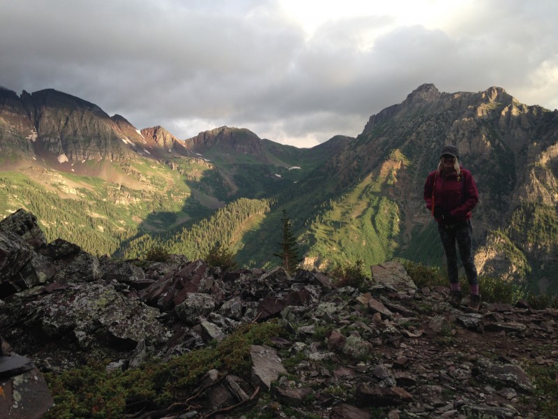
This is why we do this
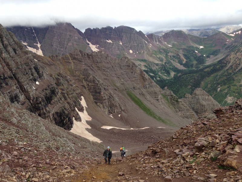
We plodded up the first big elevation gain from the Maroon Creek basin up to Pyramid's "amphitheater." We had pretty good light by the time we crested the incline and got our first look at Pyramid. The day dawned hazy, with intermittent light mist, chilly but not bitterly cold. We had wanted to be well into the amphitheater by this time, but we were moving slowly.
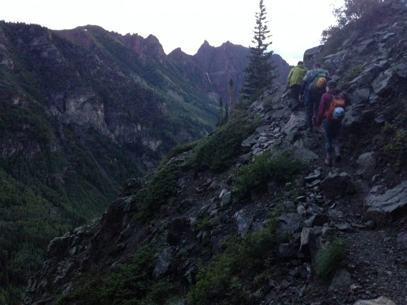
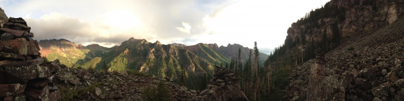
Climbing the great CFI trail Click on the panos to get the full effect.
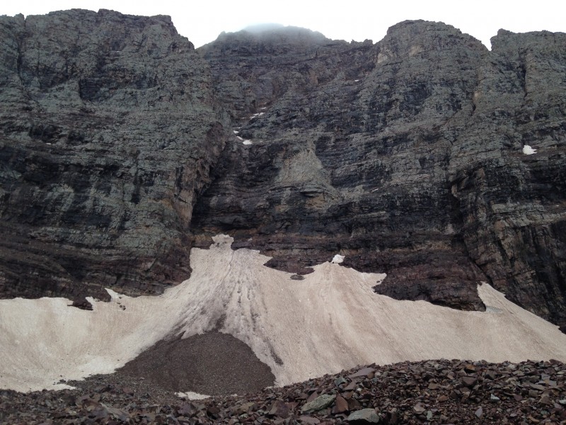
The upper basin stretched out before us, a huge rubble pile with a swath of snow more or less down the middle. And Pyramid's north face towered above that, looking far more menacing in person than any photo can capture.
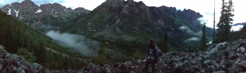
First look at the monster In the amphitheater. Sporadic breaks in the overcast sky made for some great lighting.
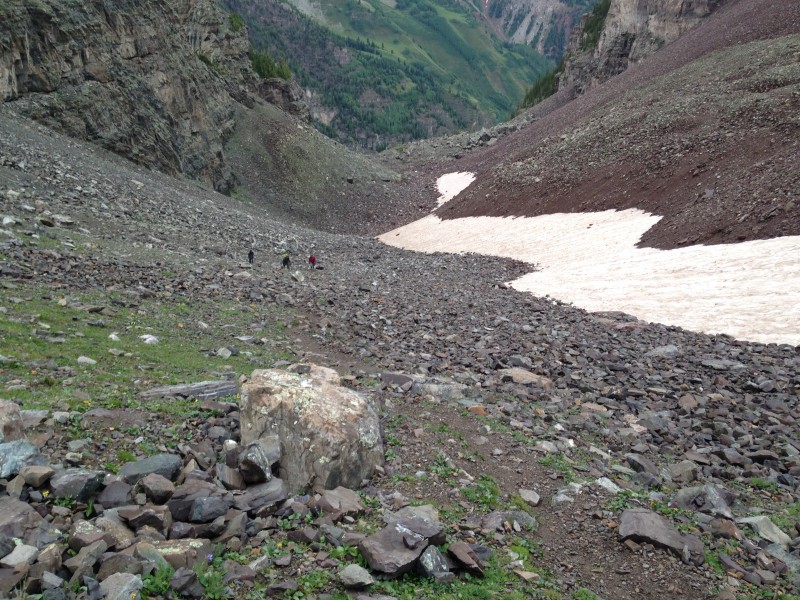
I think the size and elevation gain of the amphitheater caught some of our group a bit off-guard. A casual look at the route might leave the impression it's a bit of a reprieve between two fairly steep slopes. But the fact is that it's a pretty long stretch of talus, much of it without a trail, and with almost 1,000 feet of elevation gain from the time you first see it until you reach the steep gully at the southeast end.
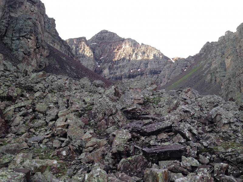
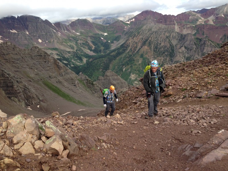
Taken on the return trip, this pic gives an idea of the terrain when you first enter the amphitheater.
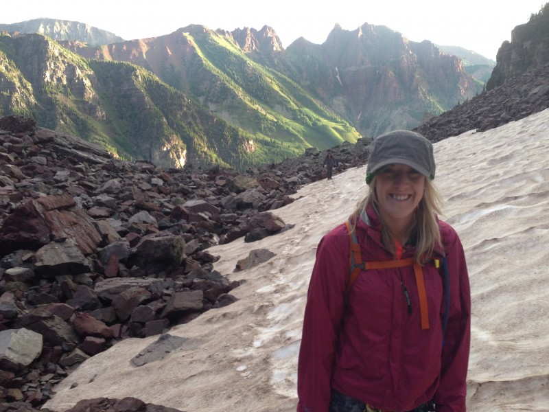
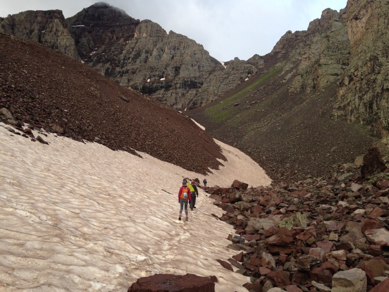
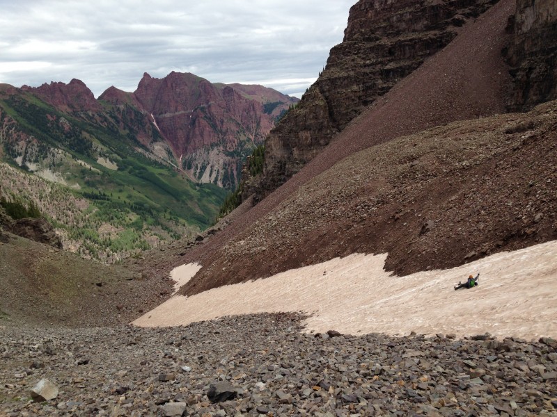
As we started up the amphitheater I took to the snow at first. At the north end the slope is pretty minimal, and the snow seemed to offer an easier surface than the surrounding talus. But before too long the angle of the snow increased to the point that it was more effort to walk on it than on the rock. A quick survey of the talus revealed a trail off to the right winding through the rubble.
Beginning to trek the snow in the upper basin. When we reached the higher-incline snow, we took to a trail through the talus to the right. A look down from about halfway up the amphiteater. This is a big basin with perhaps more elevation gain than you may expect.
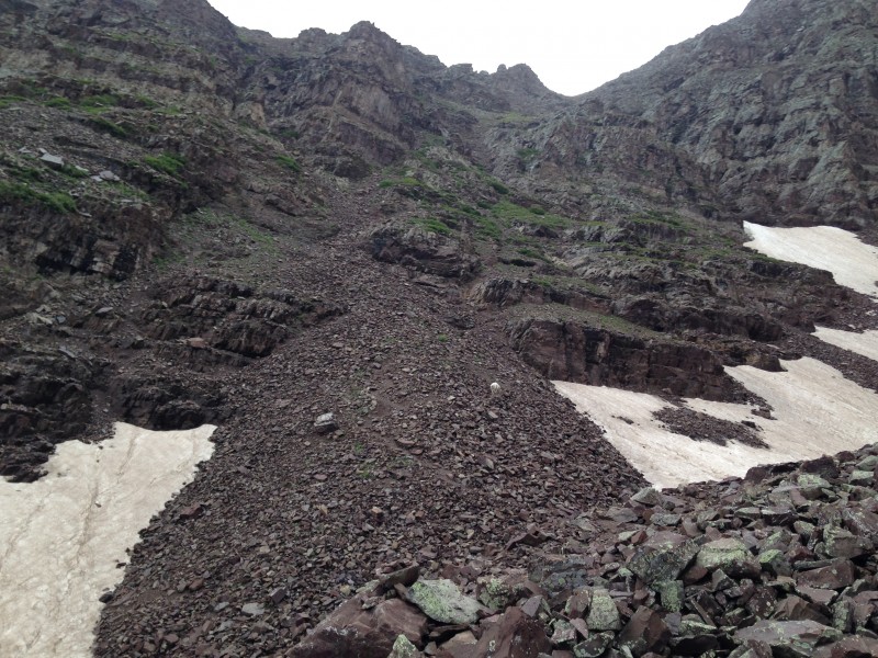
The trail parallels the snow field through the middle of the amphitheater, then abruptly ends near the south end of the basin. It was obviously time to cross the snow, start talus-hopping over larger boulders, and then ascend sloping talus at the bottom of the next gully.
Talus slope leading into the gully climb.
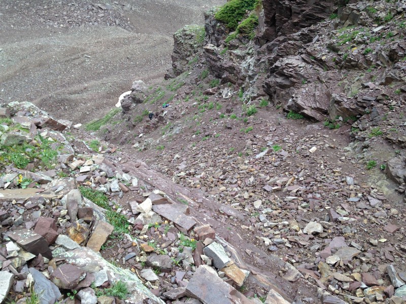
Some routefinding choices are required in the bottom third or so of this gully, as multiple paths diverge and converge as you ascend. We made note of our choices on the way up to help avoid getting off-route on the descent.
Looking down the lower part of the gully.
In the upper half of this gully I found out first hand about the infamous "rubble-strewn ledges" of Pyramid. We've found some success in the past with leaving loose steep gully trails in favor of rocky, more solid terrain on the sides of gullies. (Portions of Crestone Peak's red gully, Lindsey's north face, Challenger, and the west face of Snowmass all had areas where this approach seemed to pay off.) I kept veering left off of the trail here on Pyramid to try what appeared from below to be solid, ledgy rock up the side of the gully a bit. But every time I tried that, when I reached that rock that had looked good from below, I would discover it to be so littered with debris that it was of no climbing value. Back to the trail I would go, only to get baited into trying another similar looking series of ledges shortly later, with the same frustrating result. I also tried veering right once, on moderately-sloping talus that looked like it would be consolidated enough to make for good climbing. That also was a mistake. As far as I could tell, bottom line in that gully is, even though the trail isn't great, it beats the alternative.
View up from maybe about halfway up the gully. Near the top of the gully, with Bells as backdrop.
It was a slow slog for us. We didn't keep a good log of times on this peak, but I believe it was after 8 a.m. by the time we took a break at the 13,000 foot saddle. Worse, we were feeling pretty fatigued. It was here that I decided we needed to stop kidding ourselves into thinking we're acclimated enough on a Tuesday, after flying into Denver Friday night, to take on tough peaks. Maryjane had expressed concerns about our readiness for a grueling climb this early in the week, and I had blown her off on that point. As we sat sucking thin air on that saddle, trying to restore strength to our uncooperative bodies, I realized her concerns had been well-founded.
FINALLY reaching the saddle
The weather was also discouraging. We had hoped the early morning haze/mist would burn off, but if anything it was thicker at this time and altitude. We sat at the saddle looking up at the fearsome beauty of Pyramid's upper reaches. The summit would alternately appear and disappear behind clouds.
The foursome that had passed us near Crater Lake was visible far above us in the mist. As they worked along narrow ledges with precipitous drops below them, they had the appearance of flies crawling across vertical walls. We knew full well that walking a comfortably wide, safe ledge can look like a death-defying feat from a distance. (Narrows on Longs Peak; Sawtooth traverse.) But sitting on that gully, with the clouds casting a surreal haze over everything, and a body that was aching and refusing to bounce back the way I thought it should, I felt old, creaky, slow and definitely not up to the challenge ahead. For only the second time in 20+ climbs, I looked at a 14er summit and thought, you would have to be nuts to go up there.
Turning back at that point was openly discussed, briefly, and rejected. Just start moving ahead again and see what happens, we reasoned. I recalled the first time a 14er summit looked ridiculously out-of-reach: sitting on the saddle on Mt. Lindsey, two days after flying into Denver, with a fierce wind buffeting us and Maryjane (then a Michigan resident) green with altitude sickness. While the three guys in that day's group sat there and debated turning back, Maryjane had simply stood up and started walking up the trail toward the summit. Mark and I followed, and we ended up with a joyous and successful climb. We hoped for a similar turn of fortune here. In the back of my mind was also the knowledge that Mark, who had struggled to get this far, always morphs into a scrambling fool when he reaches the class 3 stuff - which was plentiful above us.
Starting up from the saddle
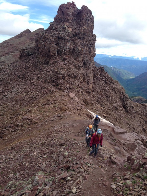
So we headed out from the saddle. A short walk traverse along the north side of the ridge took us to the "second" saddle, and from there continued to skirt the side of the ridge.
Parade of points that comprises Pyramid's northeast ridge as seen from the "second" saddle.
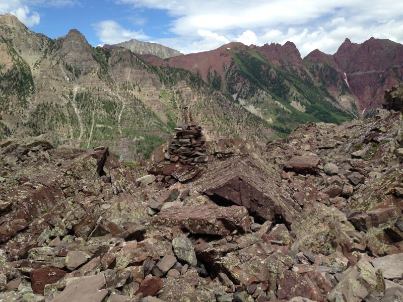
Soon we reached a point where the trail appeared to peter out into a rubble slope. To our left, cairns invited us to cross over to the south side of the ridge. The spot looked a lot like photo 17 of the 14ers.com route description - a crevasse splitting two rock formations, with a walkable route around to the left of the leftmost rock tower. I pulled out the printed route description and briefly looked at that photo. It looked pretty similar - not exactly, but that could be due to being differing vantage points, I reasoned. There were several cairns, and even a piece of surveyor's tape somewhere along there.
Mark went through the crevasse, while Maryjane and I took the walk-around to the left, with Dennis close behind us. We almost immediately came upon a nasty, loose-looking slope of debris with a steep dropoff to the left. A few flat stones appeared to offer potential ledge walk above the runout. Was this the ledge traverse already?
It didn't take long to conclude it clearly was not. The "path" was not the oft-photographed ledge traverse, and it led nowhere. But just above it appeared to be a faint trail through the debris, with more cairns. We worked along that, while Mark was exploring a higher line. Soon our lines more or less converged, but whatever semblance of trail we had been following dissolved into a step rubble slope with no visible way forward.
We were coming to the unmistakable conclusion that we were off-route. The huge piles of fractured boulders before us, stacked at a ridiculously steep angle, reminded me of being off-route on the El Diente-Mt. Wilson traverse six year previously. That was an experience I never want to revisit.
We were barely over 13,000 feet at this point, leaving 800-plus feet of mountain stretching above into the mist. The time was something like 9:30 or a bit later. If we could get back on route, we thought we'd be looking at summiting around 1 p.m. or later. The weather was not getting any better; if anything the clouds were thickening. If we did get to the upper reaches of Pyramid, we thought, what would we encounter there? There seemed to be little threat of thunderstorms in this steady cool mist, but rain, or snow or ice, all seemed possible, even likely. And enough fog to make routefinding even harder.
This was a factor in our decision to turn back.
On top of those considerations, the lateness of the hour was due in no small part to the fatigue we couldn't shake. The decision was unanimous. It was time to turn around before something really bad happened. We took a last look at the cloud-shrouded summit and headed back.
On our return trip I took a good hard look at the place where we crossed over the ridge and realized, of course, that no, this wasn't the formation shown in the route description. A mountain like Pyramid is going to have quite a few rock towers split by a fracture. The one we passed by lacked several distinctive features seen in the photo, and their absence was not due to just looking at it from a different angle. If I had taken a more critical view when we crossed over I would have seen that.
I examined what we would have faced had we continued traversing the side of the ridge instead of crossing over. Directly ahead on the traverse, the path dove into a steep sloping debris field that looked unstable at first blush. Beyond that there was no clearly visible trail. But closer inspection of the debris slope showed that a short upclimb led to a spot where the field was narrow (three or four steps) and appeared relatively stable. Just beyond that, a short flat section led around a huge boulder that blocked view of whatever lay beyond. Mark had seen the same thing returning a little before me, and saw beyond and above that boulder, a cairn.
As usual, even after seven years and 30 summits, the mountain was still bigger than you'd think. We had crossed over the ridge way too soon.
Had the clock read earlier, the weather been better, or our bodies felt stronger, we might have returned to the trail to press ahead. But it was far too late, too cloudy, too wet, too tired to consider that.
What can you say?
We resolved to appreciate the day despite not summiting. We had climbed to above 13,000 feet, learned (or re-learned) some important lessons about routefinding, and gotten a good taste of what this memorable mountain would throw at you when you try to climb it. More importantly, we had been willing to turn around when we reached a point where it was called for. All in all, it was still a great day in the mountains.
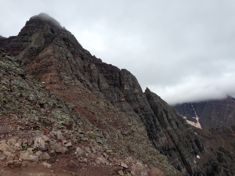
The return trip offered some nice additional experiences. Coming down the gully to the amphitheater provides great extended viewing of Pyramid's north face. Filthy permanent ice slopes at the bottom are topped by an almost vertical wall of that miserably rotten rock stretching up to the summit. It seems to glare at you, spitting rockfall intermittently as if to warn you against coming too close. Boulders seemed to decide to leap off the face for no discernible reason, hurtling down the slope with a series of thwocks until they recruited some more rocks to join the ride, together crashing all the way down until they reached a final resting place in the amphitheater along with millions of other stones that had taken the same journey. Even though I cannot imagine a human being ever climbing that face, I decided it needed a route name anyway: the "suicide route."
North face of the monster. Suicide route. Haven't seen a TR on this route yet. Don't think I ever will.
As we made our way down the amphitheater, Dennis decided to try glissading. He had limited success on snow that was too soft at an angle that was too shallow. But at least it was safe for a guy with no means of self-arrest other than digging into his heels.
Dennis glissades, sort of, in the amphitheater.
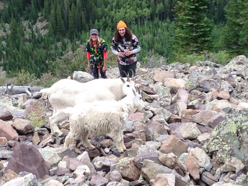
And of course, we were shocked - shocked - to find goats on the mountain.
I was a bit concerned about how close these two got to goat mother and kid, but it turned out fine.
The weather cleared some as we reached the lower end of the amphitheater and started down the final steep slope to the Maroon Creek basin. That caused some pangs of regret at turning around, but a re11ality check of the time and our creaking bodies took care of any regret. And, when we looked back up at the summit, it was still shrouded in clouds.
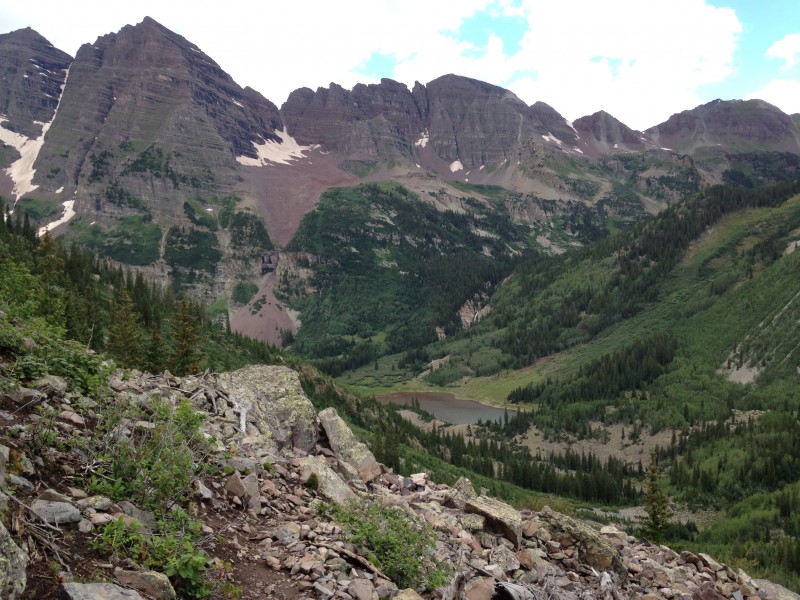
Crater Lake, Bells, Sleeping Sexton Great views of the Bells along much of the descent.
Back at the Maroon Lake parking lot, we lingered a while. Eventually the group of four that had climbed far above us earlier in the day returned to a vehicle not far from ours. They had reached the summit, and encountered some snow, along with some routefinding challenges on the downclimb in the mist. We were happy for them, but found some reassurance from their account that we had done the right thing in turning back.
Finally, we shared our mistakes, and our printed route description, with a couple who were planning to attempt the route the next day. We had no difficulty deciding against trying this mountain again on this trip. In fact, I was pretty sure I would never attempt Pyramid again. Mark was also very serious about retiring from climbing 14ers altogether. He has talked about retiring almost every trip for years now, so much it has become a running joke among us. But this year he sounded like he really meant it. Now, six months later, looking back on memorable experiences and digging into a refurbished conditioning regime, our ambition to climb 14ers has returned. And a return to Pyramid Peak is front and center in our plans for 2015.
Requisite shot of the "Deadly Bells" sign, nicely framed with the subject matter as background.
Thumbnails for uploaded photos (click to open slideshow):
I never get tired of the repeating theme on 14ers of returning to failed attempts and finding success. Glad you decided to return this summer-
Looking forward to reading your follow up trip report with summit pictures!
How can you be disappointed when you experienced that first shot of yours!? Wow! Just gives you another reason to return and try it again! This is why I always say it’s even better the 2nd (or 3rd!) time around! You know what to expect, you’re more familiar with the place with less chance of getting off route, and you can enjoy it even more. I gotta get into that area this summer! :D
PS. Does MJ mind that your called her out as a dizzy blond? :roll:
There is a trail in the upper part to your right when facing P’s north face, and where it ends, you cut straight across to the other side. Have some photos of that in my TR if it helps. There are also cairns across the linking the slope to the trail. I kept finding them, which was a reassuring since it was in the dark (6pm summit). Like other peaks, the hard part is spotting cairns on the way near the summit, always easier to spot on way down because you can see them from above. Ascending the slope to the ridge was the hardest part oxygen–wise, but just means go slower. Good luck on your next attempt. :D
I can see why you’d say whether or not you’d have the sense to turn around when you’ve had so many previous successes on 14ers. That I think, was the Million Dollar question of the day.
Weather is just one of things that will make/break a trip. But if you ask me, you learn more and acquire more wisdom BY turning around than always throwing caution to the wind and going for it, hoping for the best.
We were also pushed back due to weather, ice and snow last summer. 700’ from the summit we decided to call it a shift. The mountains will always be there....one bad mistake up there and you wont be. Smart call. No matter what, that mountain is impressive and commands respect. Not everyone can say they have seen her up close and personal. I might see you on here next year. I have been climbing the 14ers since 1986 and have only 5 to go. The Elks will see us next year! Great job, stay smart.
Coming down the gully to the amphitheater provides great extended viewing of Pyramid's north face. Filthy permanent ice slopes at the bottom are topped by an almost vertical wall of that miserably rotten rock stretching up to the summit. It seems to glare at you, spitting rockfall intermittently as if to warn you against coming too close. Boulders seemed to decide to leap off the face for no discernible reason, hurtling down the slope with a series of thwocks until they recruited some more rocks to join the ride, together crashing all the way down until they reached a final resting place in the amphitheater along with millions of other stones that had taken the same journey. Even though I cannot imagine a human being ever climbing that face, I decided it needed a route name anyway: the "suicide route."
Very cool how you anthropomorphize the north face!
Caution: The information contained in this report may not be accurate and should not be the only resource used in preparation for your climb. Failure to have the necessary experience, physical conditioning, supplies or equipment can result in injury or death. 14ers.com and the author(s) of this report provide no warranties, either express or implied, that the information provided is accurate or reliable. By using the information provided, you agree to indemnify and hold harmless 14ers.com and the report author(s) with respect to any claims and demands against them, including any attorney fees and expenses. Please read the 14ers.com Safety and Disclaimer pages for more information.
Please respect private property: 14ers.com supports the rights of private landowners to determine how and by whom their land will be used. In Colorado, it is your responsibility to determine if land is private and to obtain the appropriate permission before entering the property.


")
")
")