| Report Type | Full |
| Peak(s) |
Huron Peak - 14,006 feet Browns Peak - 13,526 feet Unnamed 13471 - 13,471 feet |
| Date Posted | 01/24/2015 |
| Modified | 02/01/2015 |
| Date Climbed | 08/03/2014 |
| Author | DeTour |
| Additional Members | CharmingCatastrophe, Lucky, SikYou |
| Tour d'Huron - Lulu Gulch approach |
|---|
 Huron Peak served as our introduction to the Sawatch Range in August of 2014. A much-appreciated route description by 14er.com member "geojed" enticed us into taking a "Tour d'Huron" route - up the Lulu Gulch approach, a run of the north ridge to Huron's summit, and down the standard route. My brother Mark (Lucky) and I always pick an "easier" 14er as our acclimation peak for our annual week-long Colorado visit. We find Diamox to be effective in warding off the illness symptoms from altitude; but we've also learned that the only way to gain strength at elevation is spending a few days in the mountains. Even after we engaged in some pretty diligent training, we know traveling to 14,000 feet two days after flying in from Illinois is sure to bring some pretty strong fatigue, lethargy, and even some disorientation. So we try to keep the first 14er pretty short - leaving not many options in the Sawatch. The Lulu Gulch loop we selected ran a bit counter to that strategy, adding some miles and elevation gain over the standard route. But it's still short by Sawatch standards, and the variety and promise of stirring views of Huron's impressive east face won out. The day delivered all that we had hoped for. Our group included my daughter Maryjane (CharmingCatastrophe), boyfriend Dennis, and Mark's son Brian (SikYou). From a nice cabin overlooking Twin Lakes, we headed out early Sunday morning, Aug. 3, and drove to the Rockdale trailhead. We started hiking from the 2wd trailhead at 5:40 a.m. We were all wearing bright Hawaiian shirts, following a new "tradition" started earlier this summer by Maryjane and Dennis and their friends. Mark had played the grumpy old man role about it for a while, but when crunch time arrived he was properly attired just like everyone else. A very short way up the 4wd road, we turned left up the Lulu Gulch mining road, following geojed's route description. I normally don't care for walking up a road that can be driven, but this road was so narrow and steep it didn't seem driveable. Hiking up in the dark with the anticipation of another year in the mountains was a joyful experience. The trees and weather conspired to keep natural light to a minimum, although I did spot a few stars to our left, out over Lulu Gulch, at a few points as we ascended. Eventually the road swung right, to the other side of the ridge it follows, and took us to a wide corner at around 11,400 feet, where the dawn began to show. It took us just under an hour to reach that point. 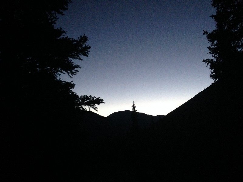 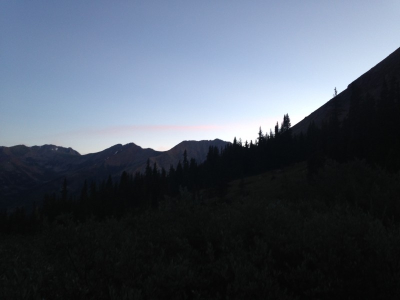 From there, a short loop back to the left toward the gulch took us clear of the trees by around 7 a.m., with enough light to appreciate that we were overlooking a beautiful basin. We dropped down a bit to an easy cross of the inevitable stream, and ascended a gentle slope into a pretty stand of pine trees. Emerging from the trees, we started switchbacking up toward point 12622. At some places along those switchbacks, what had once been a road had by now devolved to a single-file trail, presumably due to rubble eroding off the mountain, or at least that was the best theory I could come up with. Up higher, a distinct road re-emerged from the debris. 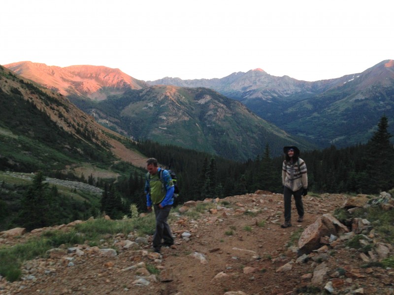 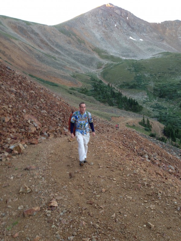 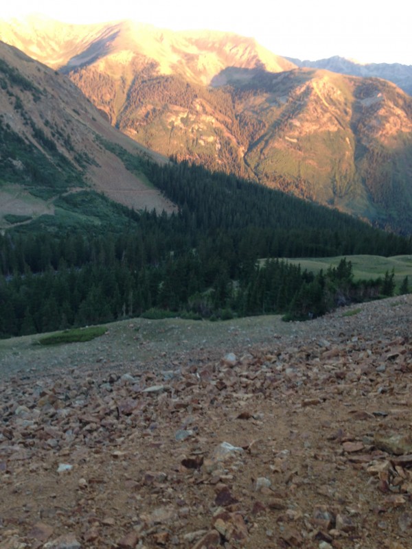 Eventually the road ended on a shallow saddle between point 12622 and Middle Mountain (13,060'). It was 8 a.m. and a perfect time and place for a break. Mark and Dennis scooted the short distance up to the top of 12622 and found a U.S. Flag proudly flying there. Much as I appreciate LNT principles, I could not take offense at Old Glory gracing this otherwise obscure point. I know, if it was some other flag I would feel differently, but it wasn't, and that's that. 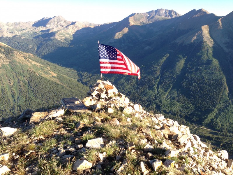 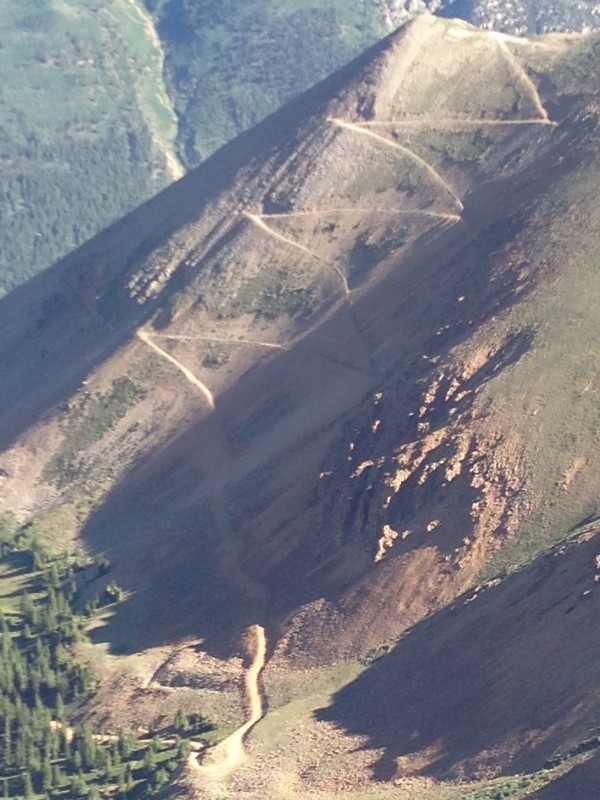 We headed southeast on the long, easy ridge which eventually reaches Huron's summit. At least some of us intended to go up and over Middle Mountain, but the trail led us around the side and by the time we realized it wasn't going to take us the summit, we decided it was not worth backtracking for. Two more higher sub-peaks awaited between there and Huron's summit, offering ample views. The first was Point 13462, which Dennis and I walked to the top of while the others bypassed to the west. Talking about it after we re-united on the next saddle, it seemed that going up and over this easy point may have been the path of least resistance despite the longer distance and modest elevation gain/loss. The bypass along a loose talus slope was not easy going, while the ridge as usual offered solid footing, not to mention a trail much of the way.  Nice views of Huron's rugged east face were readily available from numerous vantage points along the ridge, starting with Point 13462. Sawatch views were plentiful, including LaPlata to the north; Missouri, Belford and Oxford to the east; and the Three Apostles peaks to the south. Other Collegiate peaks were probably visible to the south and east, but not being that familiar with the Sawatch range, I did not specifically identify any of them. 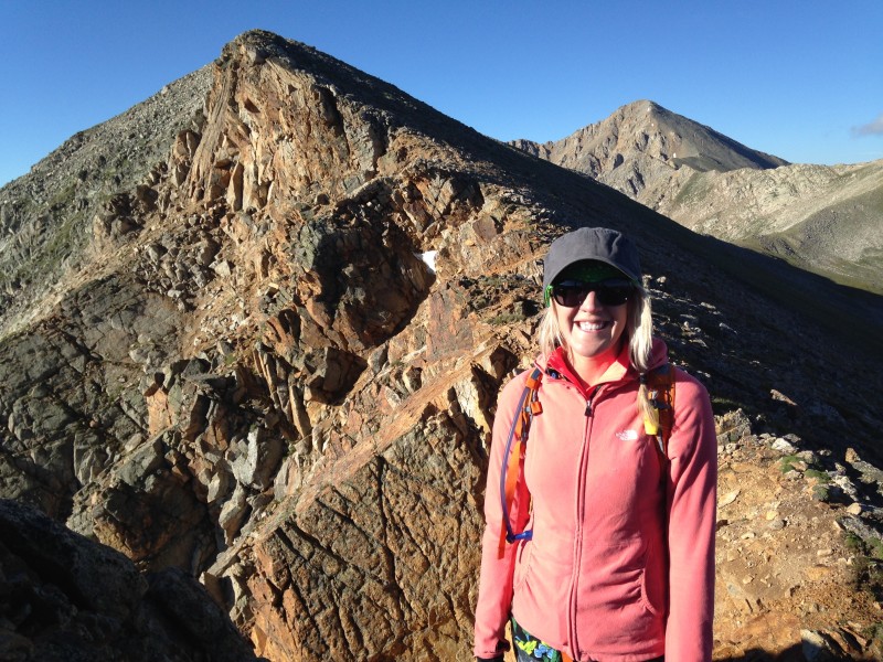 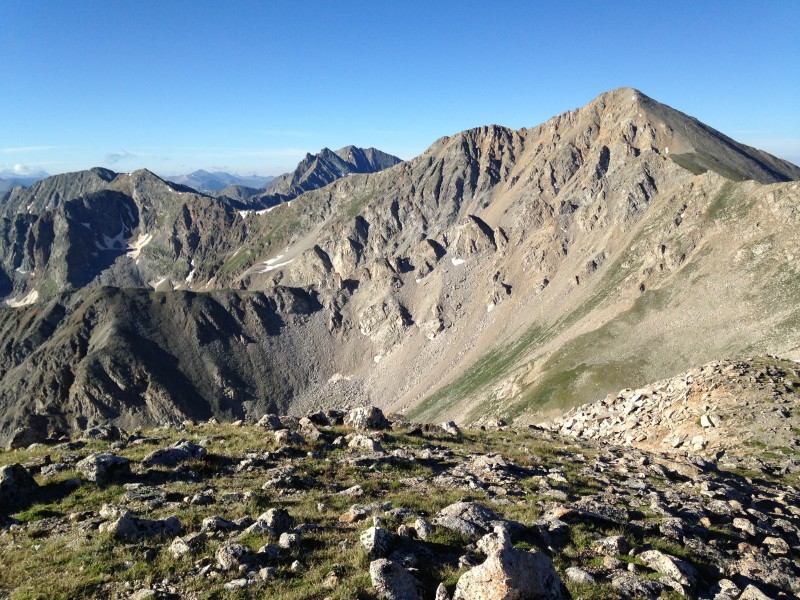 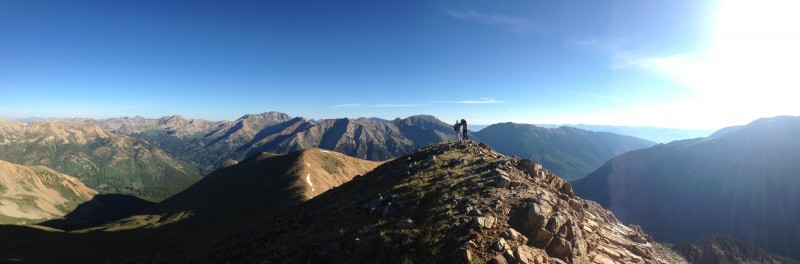 The next sub-summit was Brown's Peak, a slightly higher (13,523') and larger point. We ascended an easy, mostly grassy slope to reach that marker at 10 a.m. From here, Huron stood close and the heavily-trafficked standard approach trail was clearly visible. 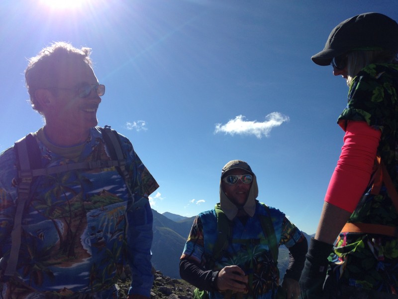 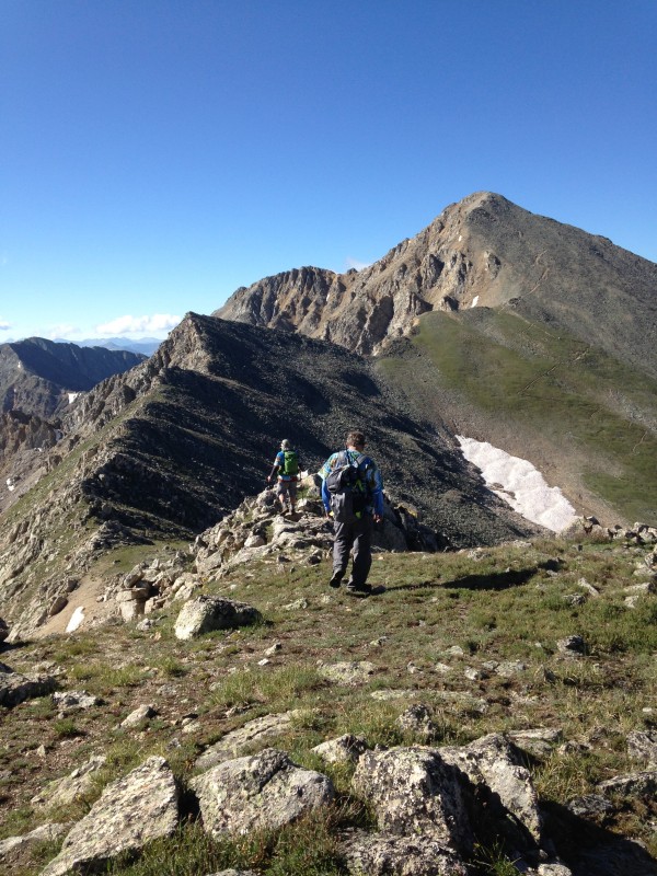 Between Brown's and Huron, however, lay another point on the ridge, this one topping out at 13,518. This point actually offered a much sportier ridge section, with large boulders and some exposure on both sides. Some of us enjoyed the opportunity to scramble a bit and catch a little air. However, we were also feeling the fatigue of our first summit climb of the year, and Huron's summit towered another 600 feet above the connecting saddle in front of us. So, we peeled off the ridge crest short of the peak of 13,518 and headed straight for that saddle. If you're the type who enjoys "sporting alternatives," and maybe have been putting off Huron as being a bit tame, you might consider spicing it up by taking the Lulu Gulch approach direct to Brown's Peak (covered in Geojed's route description) and then follow the ridge of 13,518 all the way to the saddle with Huron. 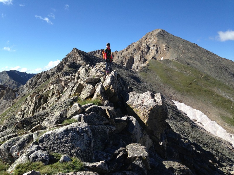 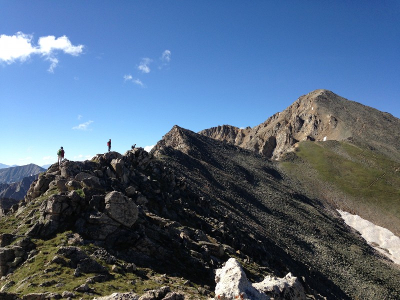  For us, a couple of short trail options connected the saddle with the main trail. We had not seen another human being outside of our group up to this point. Now we joined the hordes of Sunday climbers with their dogs, cause t-shirts, odd hats and various idiosyncrasies. We ground up the trail to the summit and joined the party at around 11:30 a.m. Of course we fit right in that crowd with our Hawaiian shirts, which did indeed draw more than a few admiring comments. 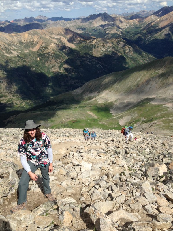 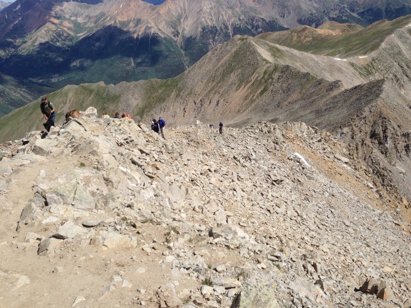 One part of that party which we didn't appreciate was a group of guys driving golf balls off the summit in the general direction of the Clohesy Lake drainage to the east. I suppose their drives generally landed on the steep, loose east slopes of Huron, where the chances of finding a human being are minuscule. But if one of those balls ever did find a person, or animal, it would be a killer. They also hooked a few toward the south, and Maryjane thought the wind from the east could have carried them back to the ridge - where we had been not that long ago. I thought the chance of that was also very remote, but all in all, we judged it to be a douchebag action.  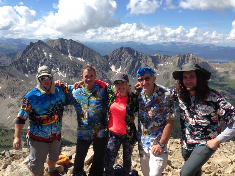 After a leisurely summit stay we started down the scenic west basin around noon. The Sunday hikers were still streaming up the trail on this bluebird day. As always, the younger members of our group descended much faster than Mark and I. Dennis and Brian strode down ahead while we gimped along. Maryjane hung be back with us for a while before striding out ahead of us to try (unsuccessfully) to catch up with Dennis and Brian. As we worked our way down scenic switchbacks through the forest, a chatty schoolteacher gal decided Mark was the ideal partner for a one-way conversation. I maintained an optimum distance ahead of them: far enough that I didn't have to participate, but within earshot for amusement, knowing well my brother's lack of tolerance for such blathering. 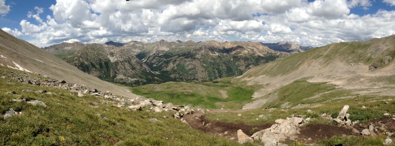 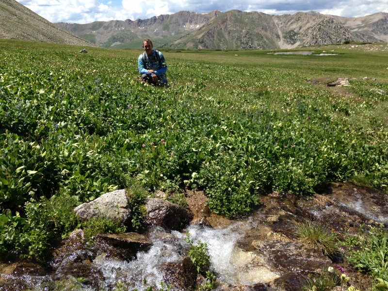 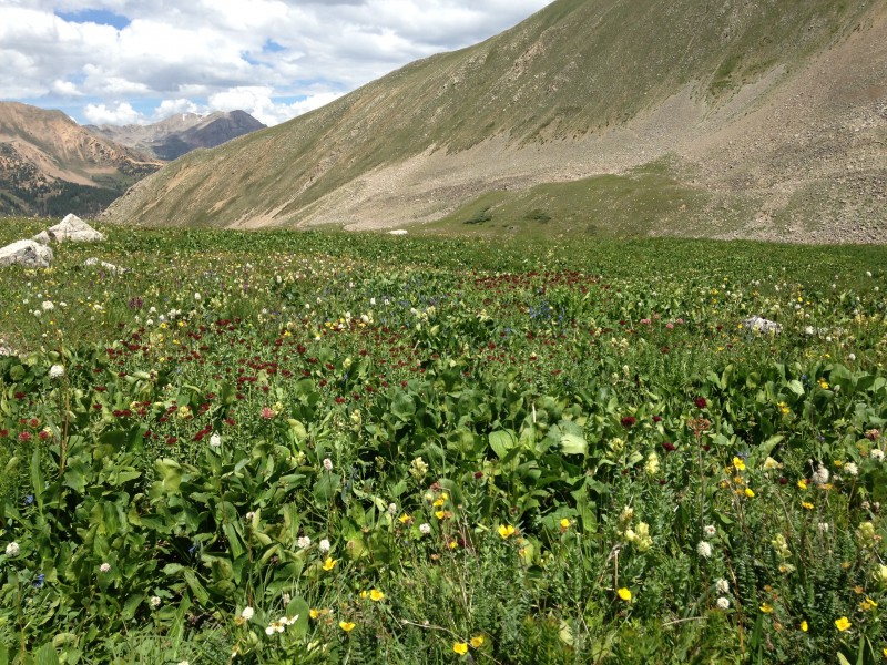 Knowing the difference in our descent speeds, we had planned for the youngsters to hike back to our vehicle at the base of the Lulu Gulch trail, and drive it back up the road to the upper South Winfield trailhead. That plan worked out nicely, at least for Mark and me. After a rest break at the main trailhead, we had just started hiking down the road from there when our vehicle showed up with the other three members of our group. We gladly rode out from there. Brian's GPS clocked the round trip at 10.36 miles for the full loop, in about 8.5 hours. It was a great day in the mountains, people we love doing what we love, with great views, great weather and a relatively easy (by 14er standards) hike. 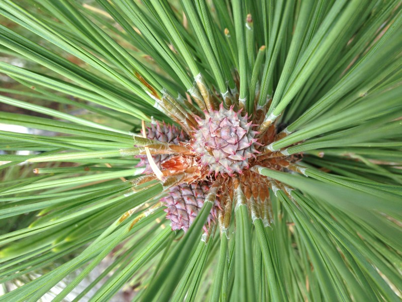  It turned out that getting a decent meal in Leadville would be about the hardest thing we attempted this day. We were ready to celebrate, and looking forward to experiencing this famous mountain town. When we had driven through on our way to Twin Lakes, streets had been blocked off for some kind of festival, which we thought would add to the celebratory mood. It was not to be the case. Our first attempt was at a bar on a side street, at the south end of the immediate downtown area. At the front door Maryjane asked if we could see a menu. She got a one-word reply from a hostess: "No." After a long and awkward silence, Maryjane broke down and asked what seems like the obvious question: "Why not?" We didn't think we looked or smelled that bad. The reply: "The kitchen is closed." It was 6:15 p.m. After a car-tour of the town revealed precious few alternatives, we tried a place on Main Street, another bar. The waitress told us the menu was limited, but we were fine with that. A few cold beers and hot burgers was all it would take to make us happy. We sat down and ordered. After about a half-hour of nursing our first round, the waitress returned with a classic good news-bad news announcement. The good news was that the round was free. The bad news was that the cook had left without telling anyone, so there would be no food. We passed on the offer for another (paid) round and headed to a place across the street that had a sign in the window about $7 sandwiches. It didn't sound the best but we were getting pretty hungry. When Maryjane asked about them, she was informed they were prepackaged sandwiches - sounded like something you would buy at a convenience store - and guess what, they were out. I have to acknowledge that we passed on a Mexican place downtown, due to some horrendous Yelp reviews. I've since read that Leadville is supposed to have great Mexican food, so maybe we outsmarted ourselves there. But when people post reviews about getting sick after eating at a Mexican joint, it's not too appealing. On the other hand, an on-line review doesn't give you a chance to ask the obvious follow-up question: was Tequila involved? Anyway, the place was packed out and we weren't in a gambling mood. We ended up getting sandwiches from a guy in a mobile BBQ wagon parked downtown. They were fine, but the overall experience wasn't quite the celebration we had in mind. A few days later, returning from a trip over Independence Pass to attempt Pyramid, we tried the Twin Lakes Inn, just a couple miles from where we were staying. It was an authentically rustic lodge that reminded me of places on Michigan's Drummond Island, in the St. Mary's River near where Mark and I grew up. The service and food were great and the prices reasonable. We all agreed: next time we eat in Leadville, it won't be in Leadville - it will be at the Twin Lakes Inn.  Thumbnails for uploaded photos (click to open slideshow):
 The GPX track in an image format")
|
| Comments or Questions | |||||||||||||||
|---|---|---|---|---|---|---|---|---|---|---|---|---|---|---|---|
|
Caution: The information contained in this report may not be accurate and should not be the only resource used in preparation for your climb. Failure to have the necessary experience, physical conditioning, supplies or equipment can result in injury or death. 14ers.com and the author(s) of this report provide no warranties, either express or implied, that the information provided is accurate or reliable. By using the information provided, you agree to indemnify and hold harmless 14ers.com and the report author(s) with respect to any claims and demands against them, including any attorney fees and expenses. Please read the 14ers.com Safety and Disclaimer pages for more information.
Please respect private property: 14ers.com supports the rights of private landowners to determine how and by whom their land will be used. In Colorado, it is your responsibility to determine if land is private and to obtain the appropriate permission before entering the property.