Download Agreement, Release, and Acknowledgement of Risk:
You (the person requesting this file download) fully understand mountain climbing ("Activity") involves risks and dangers of serious bodily injury, including permanent disability, paralysis, and death ("Risks") and you fully accept and assume all such risks and all responsibility for losses, costs, and damages you incur as a result of your participation in this Activity.
You acknowledge that information in the file you have chosen to download may not be accurate and may contain errors. You agree to assume all risks when using this information and agree to release and discharge 14ers.com, 14ers Inc. and the author(s) of such information (collectively, the "Released Parties").
You hereby discharge the Released Parties from all damages, actions, claims and liabilities of any nature, specifically including, but not limited to, damages, actions, claims and liabilities arising from or related to the negligence of the Released Parties. You further agree to indemnify, hold harmless and defend 14ers.com, 14ers Inc. and each of the other Released Parties from and against any loss, damage, liability and expense, including costs and attorney fees, incurred by 14ers.com, 14ers Inc. or any of the other Released Parties as a result of you using information provided on the 14ers.com or 14ers Inc. websites.
You have read this agreement, fully understand its terms and intend it to be a complete and unconditional release of all liability to the greatest extent allowed by law and agree that if any portion of this agreement is held to be invalid the balance, notwithstanding, shall continue in full force and effect.
By clicking "OK" you agree to these terms. If you DO NOT agree, click "Cancel"...
Partners: Matt Anderies
Elevation Gain ~ 3500ft
RT ~ 10-11mi
Time - 8 hrs
beta used: killingcokes TR on 13ers/makingturns.com
With the spring time temperatures and the stabilizing snowpack I was excited to ski some peaks. After some research and a quick glance at my list of to-do peaks, we settled on an attempt of Whale Peak. Given the time of the year, there was some uncertainty on how far we would be able to drive up the Hall Valley Rd before we were blocked by snowdrifts. Luckily, we were able to make it slightly over 4 miles up the road which left us about 2 miles from the Gibson Lake trailhead.
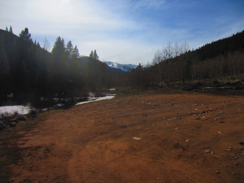
Whale Peak from the car. It is the small bump in the center of the photo.
After a relatively easy stroll up the road, I ditched the trail runners for my AT boots once we reached the trailhead. Not wanting to carry my shoes all day, I hung them on a tree for retrieval on the way out. This would prove to be a foolish decision. Anyway, we left our skis on our packs and were able to hike in our boots for the next hour as we wound our way through the woods. I'm not sure if we stayed on the trail or not. For the most part we followed some snowshoe tracks that carried us up into the basin. Once again, this was rather uneventful which at times can be desired when traveling in the mountains.
A quick side note on a new pack I had just purchased. I have the Black Diamond Anarchist Avalung and this was my 3rd or 4th time out with it. A few thoughts on the pack: I love the amount of space and the ability to compress the bag when not loading it with gear/food. The gear pocket fits my avy gear just fine although I imagine a bigger shovel might not fit too well in the front pocket. The swivel hip design is nice when skinning but by no means necessary. I do not like the swivel hip feature when I'm boot packing in windy conditions. It tends to shift the pack and put the majority of the weight on one side of my body. Compared with my Osprey Kode 30 pack, I feel like I carry much more weight on my shoulders instead of the bag sitting on my hips. Okay, back to the story.
We were able to hike for quite some time due to a solid freeze the night before. Slightly below tree line we transitioned to skinning which was a nice relief to get that weight off my shoulders. We were making pretty poor time and some clouds combined with wind helped with the concern of potential wet slides.
Anderies leading the way with our objective in the background
In hindsight, I think we took an inefficient route to the top of Whale Peak (better for mitigating avalanche concerns on the ascent in the middle of the winter, but that was not our objective or concern). It felt like quite a slog and Anderies summited a good 30 minutes before me. Fortunately, he is a pretty patient guy and was happy to soak in the views while I trudged on across the ridge towards the summit. We skinned up the north side of the basin and followed a gentle slope that would connect us to the ridge that led to the summit. My advise to others attempting a ski of this peak is to stay low in the basin, close to the creek and take the most direct line toward the wide gully that is skier's right of the Whale Peak (then bootpack up the gully). I imagine that would shave off a good amount of distance and leave one with more energy for the descent.
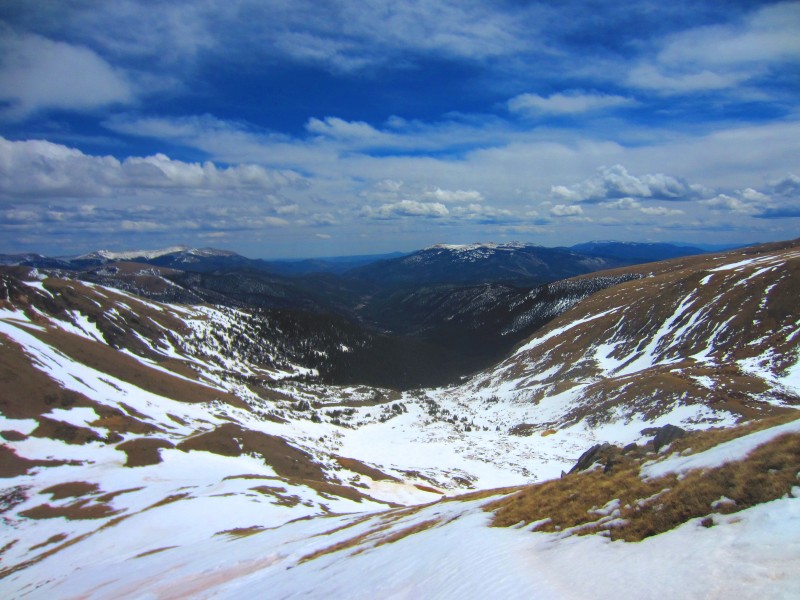
A look back into the basin where we came from
The last portion of the ascent felt like an eternity. I was physically spent and was just trying to put one foot in front of the other. The final ridge contained a few bumps along the way that seemed to be mocking me and my lack of fitness. In due time I reached the summit and feasted on whatever snacks I had left in my pack. It was a very satisfying summit and my energy was restored with the anticipation of getting to ski the descent (oh and the Take 5s, chips, and fruit).
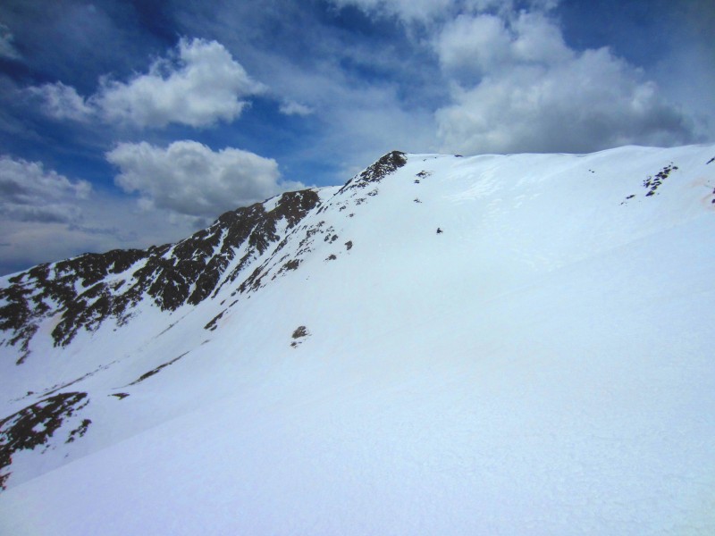
The ridge to Whale Peak, sooo close yet so far away
Summit shot, preparing for the descent
The descent was fun and while it may be more exhausting to carry up skis, it is so worth it when it comes to getting back to the car. The descent went according to plan with one exception. If you remember, my shoes were still hanging on a tree branch at the trailhead. We skied down the gully into the basin and through the trees but ended up about a ½ mile down the road from where my shoes were. Needless to say I was exhausted and was pretty focused on the IPAs hiding in the snow by the car. I said to hell with the shoes, claimed that I would come back for them, and we arrived at the car soon after.
Generally, I like the taste of beer, especially a good IPA. But after a nice day in the mountains, the beer always taste that much better and this was no exception. We had a few Modus Hoperandi at the car before heading back to Denver.
So, what ever happened to those shoes? Did I leave them for a sasquatch to run the 4wd roads in the area? I returned on the 4th of July and was able to find them about 20 yards from where I originally stashed them. Critters had shredded the outside but the integrity of the shoes were fine. I proudly put them on (much to my wife's dismay) and wore them to the Firecracker 50 where we were heading to cheer on a friend.
Our ascent route
Thumbnails for uploaded photos (click to open slideshow):
I tried to find that guide you mentioned in your Mt Blanc TR with no success. I’ll be in the Netherlands for the next two winters and was hoping to give that an attempt this spring. That TR is what originally built the excitement over making an attempt, thanks.
Bergsteigen,
It really is, makes it appealing for days when you want to sleep in (till 6am).
Caution: The information contained in this report may not be accurate and should not be the only resource used in preparation for your climb. Failure to have the necessary experience, physical conditioning, supplies or equipment can result in injury or death. 14ers.com and the author(s) of this report provide no warranties, either express or implied, that the information provided is accurate or reliable. By using the information provided, you agree to indemnify and hold harmless 14ers.com and the report author(s) with respect to any claims and demands against them, including any attorney fees and expenses. Please read the 14ers.com Safety and Disclaimer pages for more information.
Please respect private property: 14ers.com supports the rights of private landowners to determine how and by whom their land will be used. In Colorado, it is your responsibility to determine if land is private and to obtain the appropriate permission before entering the property.
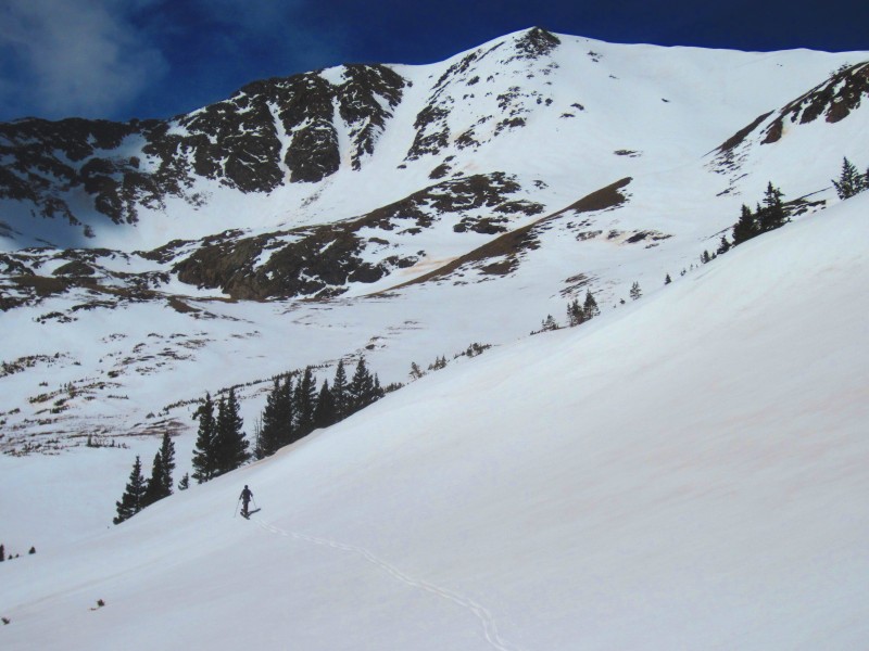
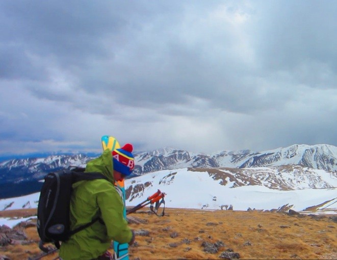

 Anderies leading the way with our objective in the background")
 A look back into the basin where we came from")
 The ridge to Whale Peak, sooo close yet so far away")
 Summit shot, preparing for the descent")
 Whale Peak from the car. It is the small bump in the center of the photo.")
 Our ascent route")


