| Report Type | Full |
| Peak(s) |
Mt. of the Holy Cross - 14,007 feet Notch Mountain - 13,243 feet |
| Date Posted | 10/14/2014 |
| Modified | 02/19/2016 |
| Date Climbed | 09/11/2014 |
| Author | MtnHub |
| Notch Mt / Halo Ridge / Mt Holy Cross |
|---|
Notch Mt / Halo Ridge / Mt Holy Cross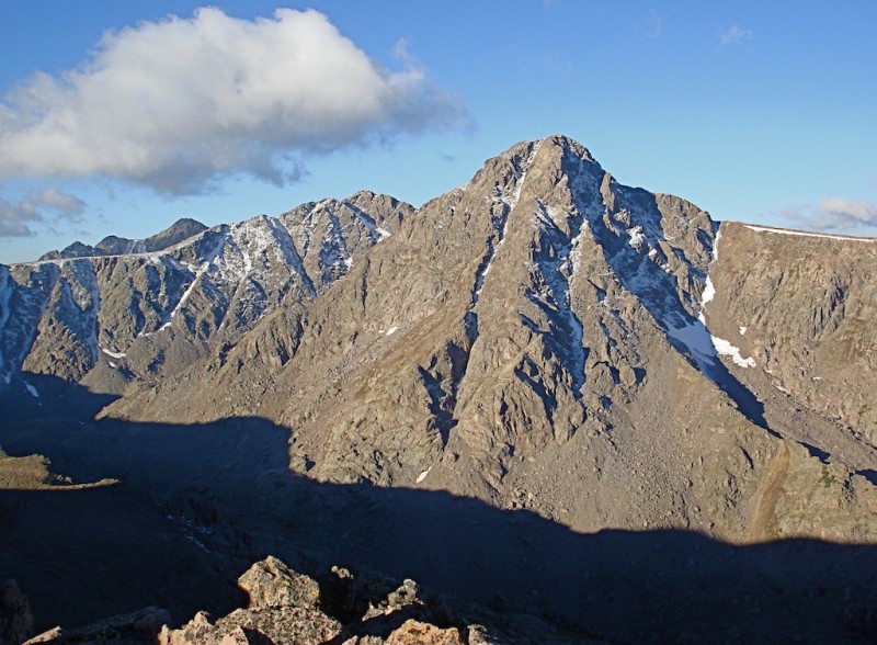 September 11, 2014 Mount of the Holy Cross (14,005') Notch Mountain (13,237') Trailhead: Half Moon (Tigiwon) Distance: 15 miles Elevation Gain: 5400' Climber: MtnHub Introduction: Mount of the Holy Cross has held a special place in my heart for a long time. I climbed my first 14er (Longs Peak) in 1992, but that was really only on a whim. I've always done a lot of hiking, mostly in National Parks. But it wasn't until I discovered 14ers.com in 2005 that my focus turned more to climbing up summits versus just trail hiking. My wife has a cousin living in Leadville, so when we started coming out regularly to visit her, it was only natural that I noticed all the 14ers nearby. I began to bag a few on each trip, and Mount of the Holy Cross was no exception. I studied the standard route to its summit but the one that really caught my eye was described in a report by SarahT: a loop going over Notch Mountain first and then across the Halo Ridge. I love loop hikes and long ridge climbs, so this one naturally intrigued me. At that time I wasn't very familiar with climbing much of anything above class 2. I started making inquiries among several other members asking how difficult the climb would be through the Notch. Since I didn't have any regular partners to hike with, I wanted to make sure I wasn't getting into anything over my head. But with all my inquiries, I also started getting better acquainted with many of the regular 14ers.com users. The following summer in 2006 I made the trip up Tigiwon Road with another friend of mine. He planned to do the entire loop with me but when we got to the trailhead, he decided he wasn't really up for it. Knowing that I was a much faster, stronger hiker, he suggested that I go up the standard Halfmoon Pass Trail alone so he wouldn't slow me down. He would start the Fall Creek Trail and go up to Notch Mountain, and we would either meet near the shelter or just come back to the car if it got too late. I made it to the Holy Cross summit OK, but by then clouds were becoming more of an issue. On my ascent I had seen a little light rain off and on. I didn't notice any real thunderheads, but I wasn't very experienced in evaluating the skies back then either. I started around the long Halo Ridge skirting around most of the high points along the way. My logic was that I wouldn't be so exposed to lightening this way. But it took me literally hours to traverse and I think it was actually much more difficult than simply going up and down along the ridge crest. Much of the scree and talus I came upon was quite loose and unstable, and it made progress very slow and tedious. By the time I was skirting around the last high peak on the ridge (Point 13,248'), a large, dark cloud developed directly overhead and I heard several deafening BOOMS! By actual comparison, a human is so miniscule standing on one of these giant mountains, but I never felt so large and exposed in all my life! I couldn't crouch low enough. After waiting it out for a little while in a semi-protected place among the rocks, I finally made a bee-line down and across the last steep section of the eastern slope and eventually caught the Notch Mountain Trail. I never made it to the shelter so I vowed to return sometime and do it right. The Holy Cross Wilderness is such an amazingly beautiful area! The following year (2007) I did return and I attempted the loop in the reverse direction. I wanted to see Holy Cross at daybreak which was supposed to be spectacular. I arrived at the shelter at dawn and went just beyond Point 13,248' but once again the skies were not looking friendly. Because of my previous experience, I was gun-shy of being so exposed, so I just returned to the Fall Creek Trail. As a consolation, I hiked through the cover of the forest and went up to Lake Constantine and then the Lower Tuhare Lake. They were fabulous and I didn't regret my decision at all. But I still had hopes of returning one day and completing the loop around the Halo Ridge. In 2008 I found a partner (Wish I Lived In CO) who also wanted to do this hike. He didn't want to attempt Notch however, so we just did the normal loop going around clockwise first to the shelter, and then returning down the standard route. This time we had a perfect day and it remains one of my best-loved climbs. When I was finally able to write a trip report on it (over a year late since I didn't have the capabilities to do it then) I included a poem I composed of the experience: A Poetic Climb: Mt. Holy Cross via Halo Ridge/North Ridge Loop Over the next few years I focused mainly on other new peaks, but I enjoyed this loop so much I always thought that if the right opportunity arose, I'd go back and repeat it one more time. And I still wanted to hit Notch Mountain too if I could. But I told myself for safety's sake, I would only attempt this long, grueling climb if I found someone to accompany me. With my retirement this past July, I planned to take a more extended vacation this year. Since I wouldn't be limited to job restraints, I wanted to enjoy the benefits of staying out in CO longer after becoming well-acclimated. I set aside five weeks for the trip which I thought would be ample time to get in the half dozen peaks I really wanted to hit. The Notch/Holy Cross loop was one of these primary goals. I didn't have a firm partner lined up for it but I had a few people who were seriously interested in joining me. But poor weather and other conflicts made most of these plans fall through. Getting down to my last week in CO, I still hadn't had a good opportunity to make an attempt up any of the peaks on my short list. I was staying with my wife's cousin in Leadville and was actively seeking out partners for this climb, but without success. The immediate forecast was one of the most promising ones I'd seen all week and I didn't want to let it pass by without taking advantage of it. In my mind I debated whether to attempt something solo close by that was "safer" or go against my promise not to try Notch with Holy Cross by myself. Late the evening before, I made the commitment to try it anyway with the understanding that if I found anything while scaling the Notch that made me uncomfortable, I would turn around and be content with just making it to the Notch summit. This was something I truly wanted to attempt and I didn't want to miss the opportunity at hand. The Climb: As I prepare to leave the house in Leadville, I see heavy frost covering the car in the driveway. Since it is a rental car without an ice scraper present in the glove compartment, I have to wait several minutes for the vents to heat up and melt the ice away before it is clear enough to see. The temperatures the last several nights have been dipping into the high 20's. Driving down the winding Highway 24 and then up the last slow 8.5 miles of Tigiwon Road, it takes me close to two hours to reach the trailhead at Half Moon. All six vehicles I find in the lot have frost on them too, which means they are all overnight campers. But I don't expect to see anyone else on the trail until I reach Holy Cross; nobody would likely be planning to do Notch Mountain first. I start up the trail to Half Moon Pass around 0545, later than I had hoped as I know it will be a long day. The trail initially climbs steeply through the thick, dark forest and I use my headlamp to guide me. But I don't need it for very long. When the trail levels off a bit at the Pass I search for the branch trail leading to Notch Mountain. Having been here twice before, I know what to look for. The branch comes at the top of the rise, just before the main trail levels off a little and begins to descend slightly. It is marked with several rocks on either side but it is fairly faint and not terribly obvious. When I come to it I'm almost glad I didn't get here much earlier when it was still dark. It is much fainter than I remembered and without full light it might be easy to miss. 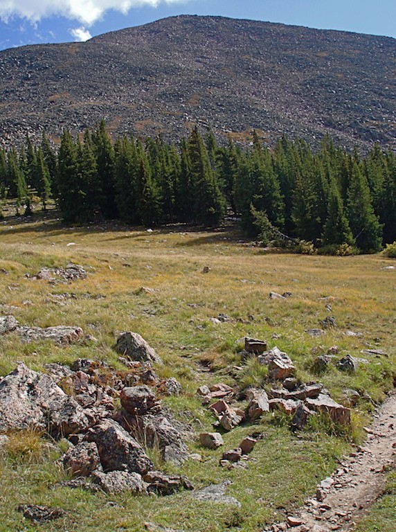 I follow this new trail into the trees, and again I'm glad I now have augmenting daylight. The path is quite overgrown and sometimes it is barely a thin matted groove in the grass, hardly even a game trail. I continue through the trees for a brief stint and then come up to a boulder field. Here I lose the trail entirely. Either I got off route or it just simply stops. I don't see any cairns marking a definite way up the east slope that other reports described, so I just start to boulder-hop up to the ridge. I know where I need to go -- get to the top of the ridge and follow it to the summit. As I climb, the sun finally breaks over the eastern horizon and casts brilliant light on the peaks to the west. I also see the waning moon setting. It's a glorious day! 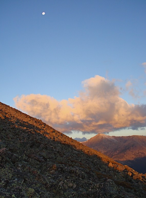 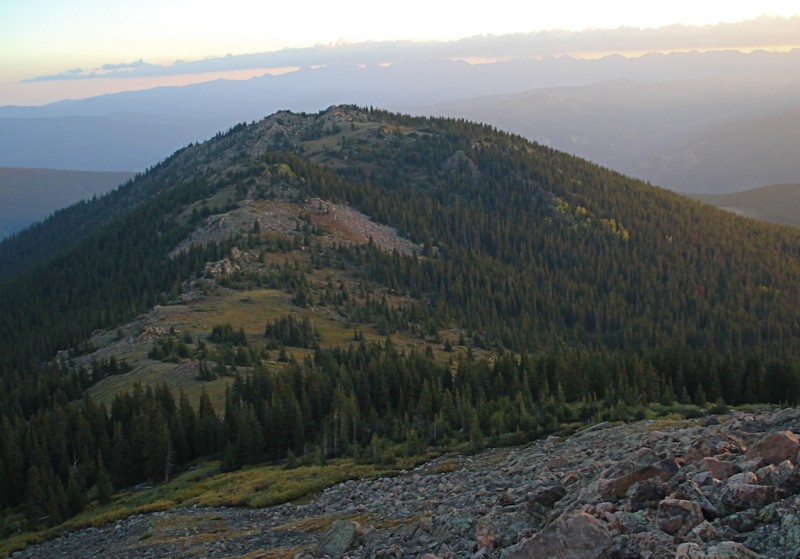 When I make it to the ridge, I get my first glimpse of Holy Cross. It is about this time that I suddenly realize what the date is. It is September 11th, a very moving day for many people. I say a short prayer for the victims and families that were involved in the tragedy. Whenever I'm in the mountains, I frequently discover myself in a contemplative mood. My climbs often turn into spiritual journeys. Sometimes I become overwhelmed with the peace and beauty the mountains bring, and Holy Cross Wilderness is one of my favorite places. I find it easy to meditate and pray here. 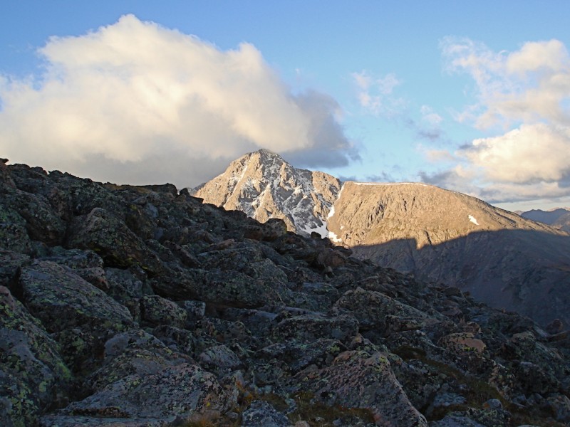 Notch Mountain is a very long ridge mountain with several false summits to climb over before reaching the actual summit. I know and expect this, but it still takes me a long time before I can even see the top. 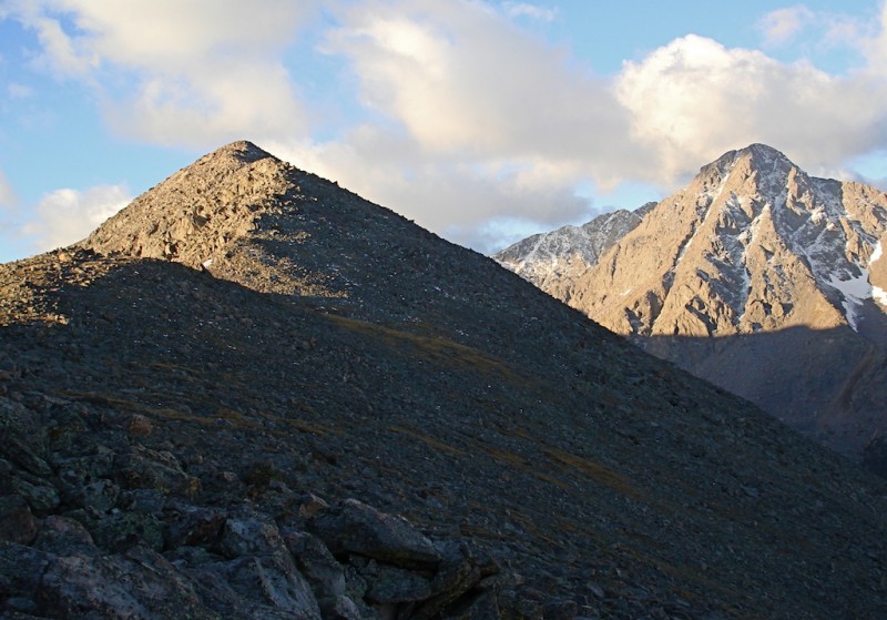 I reach the summit much later than I planned. But it is well worth it! This is the legendary view the pioneer photographer William H. Jackson first saw and photographed back in 1873. There is snow in the long vertical couloir but just traces of snow in the horizontal cracks that form the famous white cross in the mountain face. Looking ahead to the south I can see the stone shelter on the ridge. I hope to make another quick stop there very soon.  But first I need to cross the "Notch." Over the past few years, I've done a lot of research on this spot and have talked with several people about it as well. Nearly all have said it isn't that hard. I've also gained a lot more experience on difficult mountains since I first considered doing this and I now feel quite comfortable on class 3 climbing. But I'm still a little wary about trying this alone. Now, adding a little ice and snow to the mix, it concerns me even more. If I had a partner with me I would not hesitate at all. But since this is a remote, low-trafficked location, I don't want to find myself in a sticky situation and get into trouble. Across the notch the sheer cliff face stands tall before me. The route is supposed to follow a line starting at the right edge of this face and then angling over to the left towards the top. However, when I get to the bottom of the notch and see it up close, it does not look safe at all. There are too many places where I see ice on the main steps and ledges and the exposure off them looks frightening. 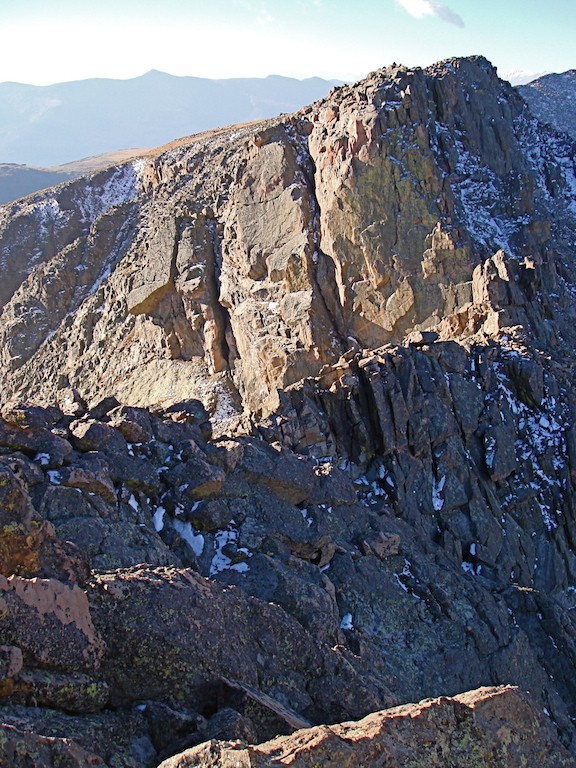 I go around to the right and get to the base of the first loose gully I find. There is quite a bit of snow remaining in the cracks and crevasses between the rocks but at least it's a more gradual slope. From where I stand I cannot conclude whether it will offer me an exit to the ridge top. Hopefully I will be able to better determine this when I climb a little higher. I carefully climb up through the rocky debris. It's not too bad until I reach some larger boulders about 30 feet below the crest and then I find I'm unable to continue. I look over a cliffy fin to the next gully. It looks about the same and again I can't quite determine whether it will allow passage to the top, but I feel I have no other choice than to try it or else return now the way I came. I have to drop down quite a ways to get around the rock fin. When I start up the next gully I find I can climb a little higher than the first one, but once again I reach some difficult boulders to get through. If it were clear of snow I think it would be a reasonably good way. But the snow hides many of the available hand and foot holds so that I have to dig them out first and test them before I feel safe to climb any higher. I do make it to the top but I have to say this last section of climbing added a little more spice than I was really comfortable with. Someday I'd like to return once again in dry, normal summer conditions with a partner and give it a better evaluation. 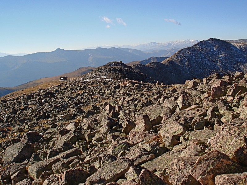 I finally reach the shelter after another hour. It's getting much later than I was planning but at least the day looks clear. The door is locked as it was the last time I was here so I just take cover from the brisk wind behind the back (east) wall to grab a bite of sustenance and hydrate. I also try to text my wife to let her know the worst part is over and I should be fine the rest of the day, but even on the high, open ridge my message doesn't appear to transmit successfully. 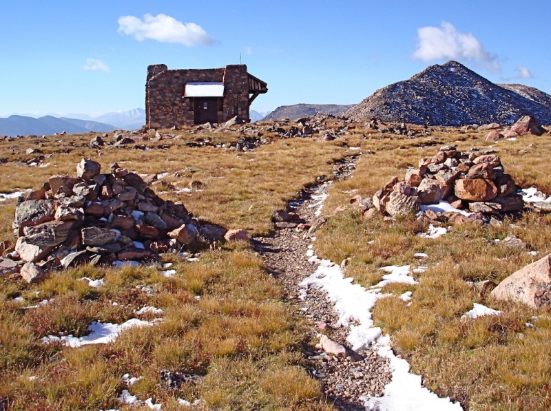 I'm now on the Halo Ridge once again! It is a long and grueling hike winding over three different 13er high points. The unrelenting rocks and boulders can become very tiring and even monotonous at times, but it is simply fantastic! I LOVE it! The views to either side are phenomenal! 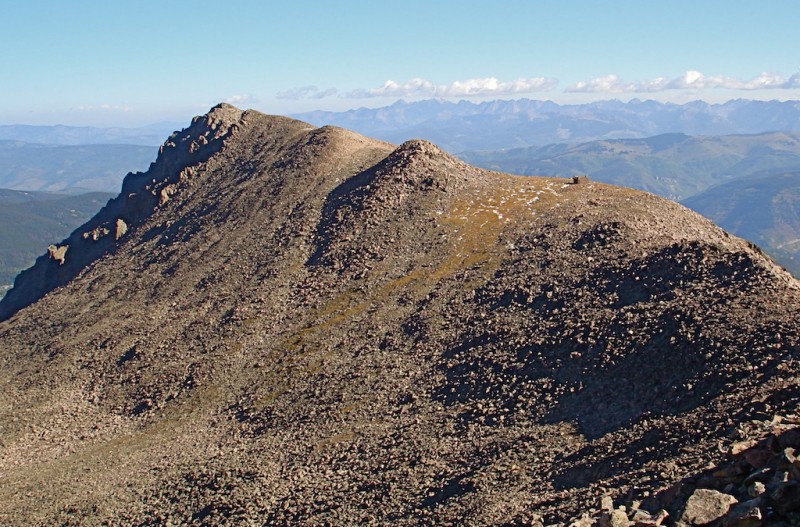 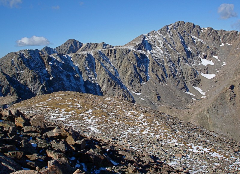 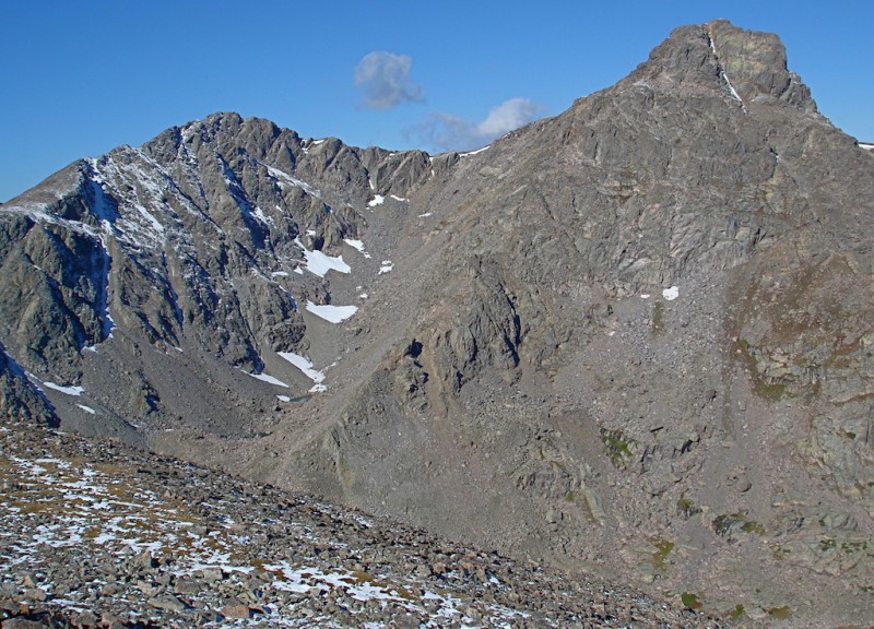 It is not really difficult climbing, but it is very exhausting. A little more careful attention is required this time, however because of lingering snow and ice patches in protected spots between and on top of the rocks.  The beauty of this area simply amazes me! It is stunning! Lake Constantine comes to view on the left. 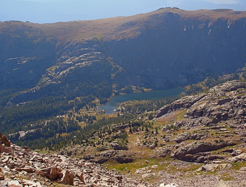 The Bowl of Tears lies in the basin between Notch and Holy Cross on the right.  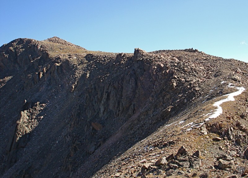 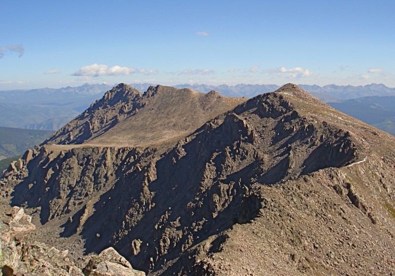 And a little farther along the ridge I finally spot the twin Tuhare Lakes directly to the south. That is a magical place! Although photographs can't truly capture it, the color of the water is such a unique shade of greenish-blue! 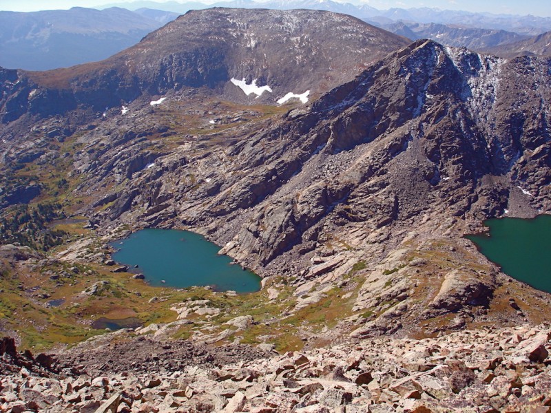 The Ridge finally offers a brief respite at its southernmost tip. It levels off to a wide shelf (except for a 3-foot wide connecting catwalk) and still holds a little snow. 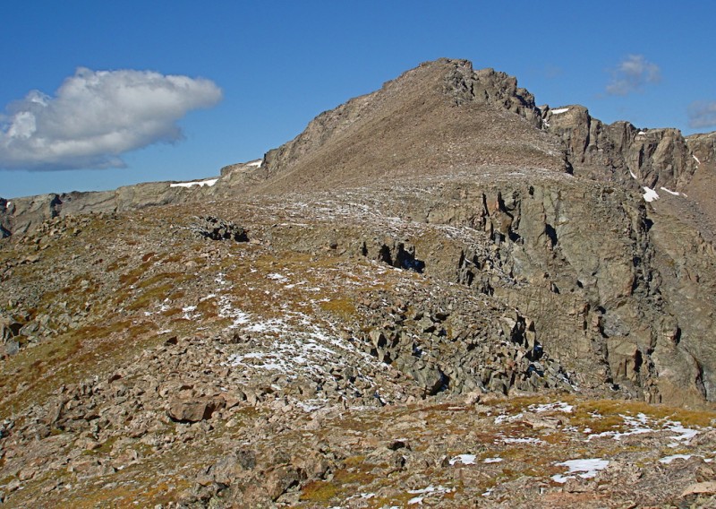 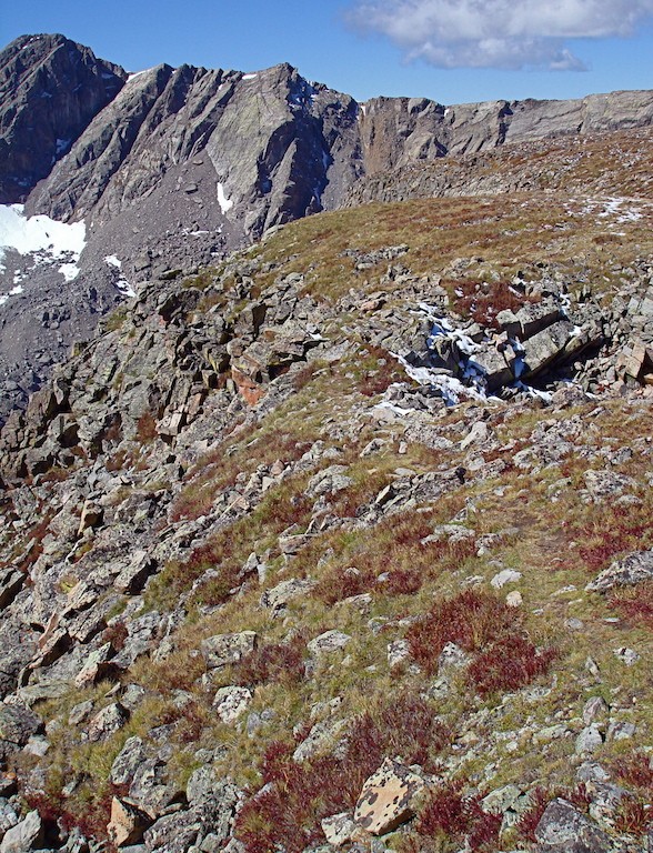 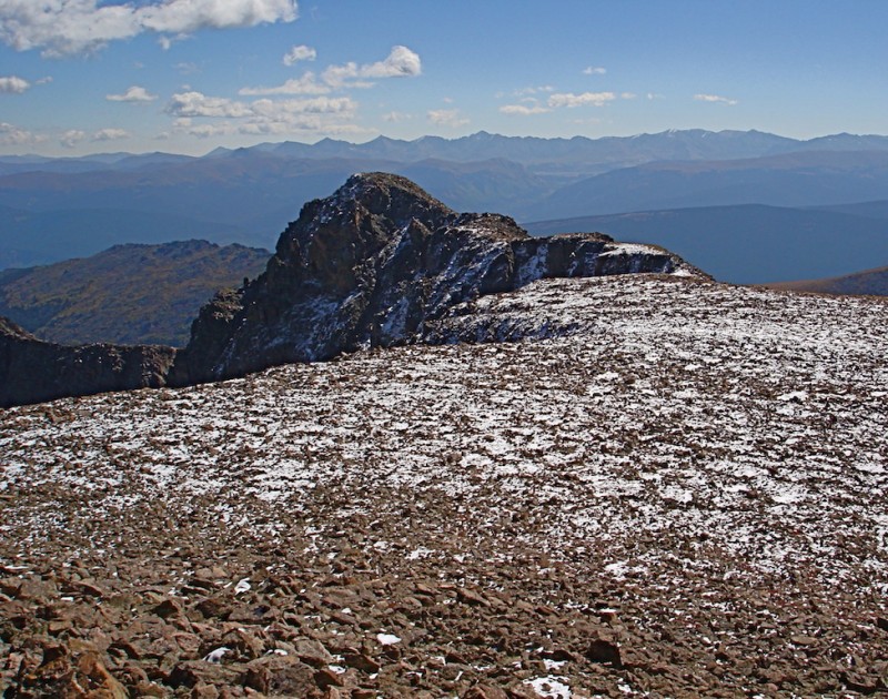 But there remains one last 13er to climb over: Point 13,831' -- the highest of the three along the ridge. It has several false summits to climb before you reach it's true top and it nearly drains my energy. I take a quick break here to grab a power bar to eat before I head down to the saddle and finally climb up the backside of Mt. Holy Cross. There are a lot of boulders to maneuver around, and again, the snow complicates this slightly. But I can also hear and see a few other climbers going up the standard route a little father to the north, so I know I won't be alone on the summit. I take a longer rest at the summit, chatting with the other climbers and ask one to take my picture. This is a special place for me and I revel in the day's success. 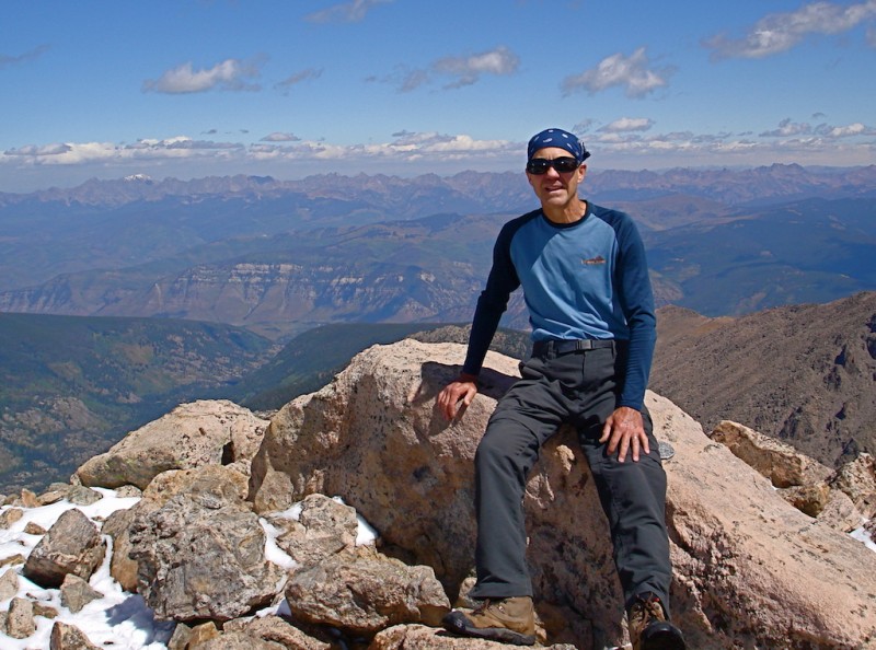 Looking across Lake Patricia in the basin below I scan the long ridge of Notch Mountain where I came up early this morning. The "Notch" looks pretty rugged from this side. 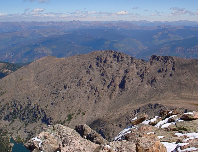 When I finally descend, I find going down the boulders and rocks even more tricky than going up. I try to stay on bare rock as much as possible to keep my soles dry, but it sometimes becomes impossible. Wet boots make for slippery footing. There is now a large cairn at the base of the peak where the route joins up with the long northern shoulder. Because of several incidents of people heading down too early from the slope and becoming lost, there has been a lot of trail maintenance done along here to prevent hikers from getting off route. Now a whole series of cairns follows the entire slope like streetlamps along a roadway. These are all new since I've been here last. 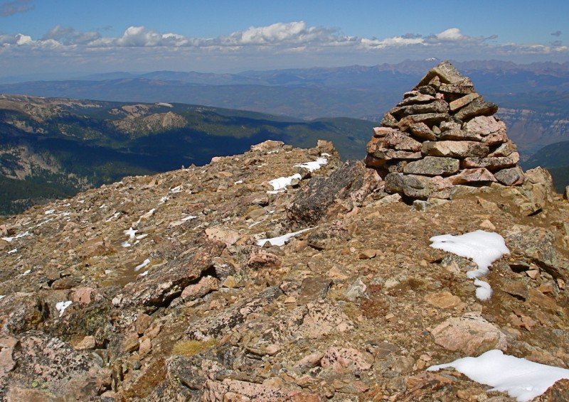 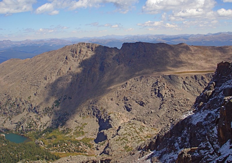 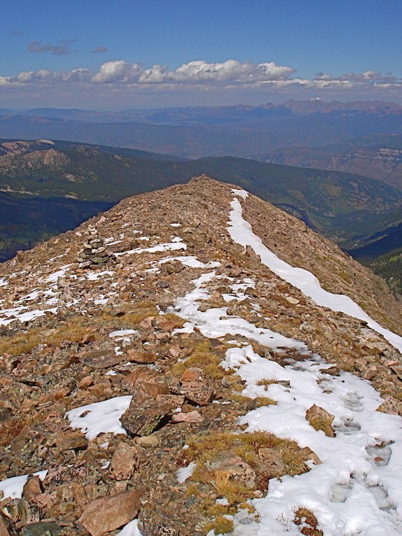 With all the large and regularly-spaced cairns, it would be difficult to get lost anymore unless you were extremely careless and inattentive. 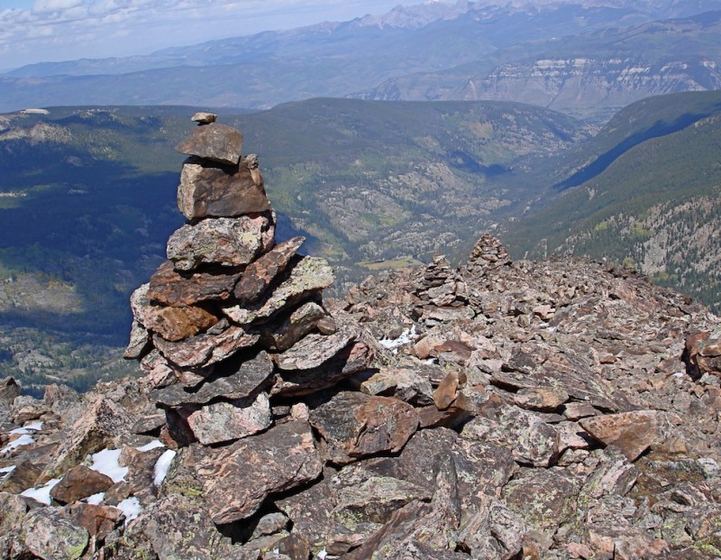 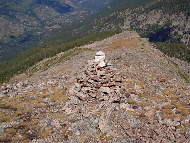 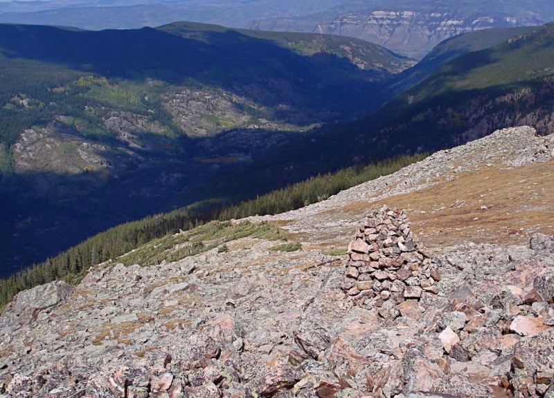 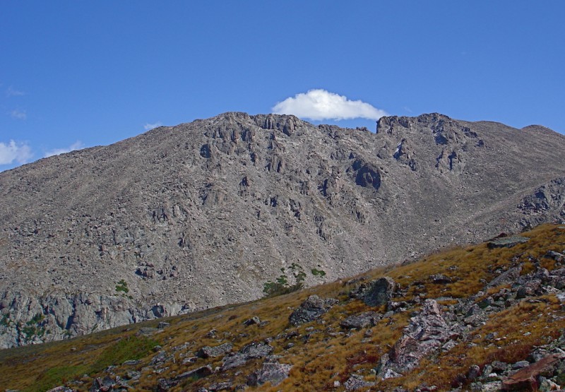 Fall is definitely in the air. I see increasing evidence of this in the brush on the side as well as aspens turning in some of the surrounding slopes across the way.  I take one last glimpse of this beloved mountain before I climb up the last part of the trail to Half Moon Pass. This loop has never failed to deliver in its glory, and it was one of the highlights of my 2014 trip!  Thumbnails for uploaded photos (click to open slideshow):
|
| Comments or Questions | ||||||||||||||||||
|---|---|---|---|---|---|---|---|---|---|---|---|---|---|---|---|---|---|---|
|
Caution: The information contained in this report may not be accurate and should not be the only resource used in preparation for your climb. Failure to have the necessary experience, physical conditioning, supplies or equipment can result in injury or death. 14ers.com and the author(s) of this report provide no warranties, either express or implied, that the information provided is accurate or reliable. By using the information provided, you agree to indemnify and hold harmless 14ers.com and the report author(s) with respect to any claims and demands against them, including any attorney fees and expenses. Please read the 14ers.com Safety and Disclaimer pages for more information.
Please respect private property: 14ers.com supports the rights of private landowners to determine how and by whom their land will be used. In Colorado, it is your responsibility to determine if land is private and to obtain the appropriate permission before entering the property.