Download Agreement, Release, and Acknowledgement of Risk:
You (the person requesting this file download) fully understand mountain climbing ("Activity") involves risks and dangers of serious bodily injury, including permanent disability, paralysis, and death ("Risks") and you fully accept and assume all such risks and all responsibility for losses, costs, and damages you incur as a result of your participation in this Activity.
You acknowledge that information in the file you have chosen to download may not be accurate and may contain errors. You agree to assume all risks when using this information and agree to release and discharge 14ers.com, 14ers Inc. and the author(s) of such information (collectively, the "Released Parties").
You hereby discharge the Released Parties from all damages, actions, claims and liabilities of any nature, specifically including, but not limited to, damages, actions, claims and liabilities arising from or related to the negligence of the Released Parties. You further agree to indemnify, hold harmless and defend 14ers.com, 14ers Inc. and each of the other Released Parties from and against any loss, damage, liability and expense, including costs and attorney fees, incurred by 14ers.com, 14ers Inc. or any of the other Released Parties as a result of you using information provided on the 14ers.com or 14ers Inc. websites.
You have read this agreement, fully understand its terms and intend it to be a complete and unconditional release of all liability to the greatest extent allowed by law and agree that if any portion of this agreement is held to be invalid the balance, notwithstanding, shall continue in full force and effect.
By clicking "OK" you agree to these terms. If you DO NOT agree, click "Cancel"...
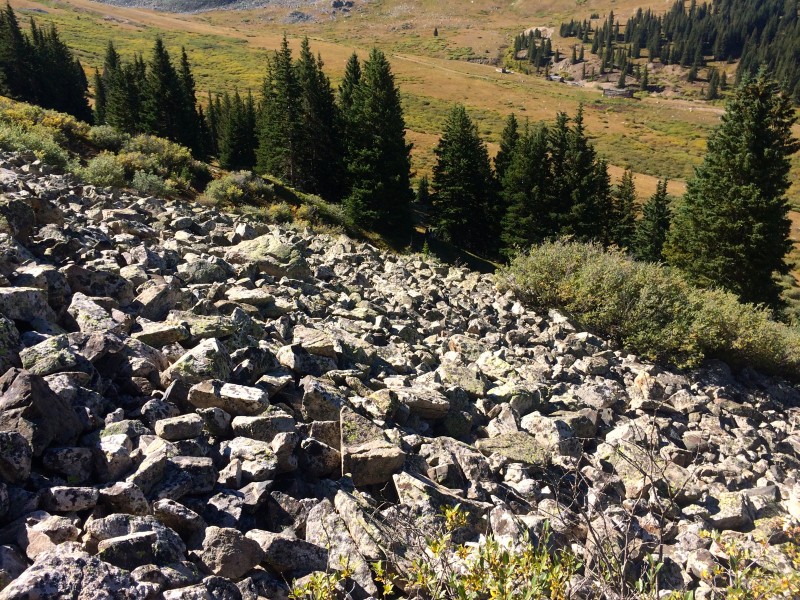
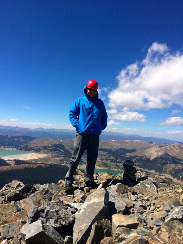
9/10/14 Peak 9 13195' East Ridge from the Ski Area 5 miles 1800' from the top of the chair lift
SNOW! I was on the verge of smashing a kitchen with a sledgehammer, trying to fix a sink, when I decided I needed to take a team building morale boosting corporate outing, IE go outside for a couple hours. I decided to drive up Peak 9 since its so close and short. Not much to say really other than SNOW! Hiking through a couple inches of snow put a huge smile on my face. After getting back down, I went back and fixed the sink in 10 minutes. Who says mountains aren't therapeutic?
nice little drift below the summit
9/11/14
Pacific Peak 13950' + Atlantic Peak 13841'
Pacific via West Ridge --> Atlantic
Not sure of mileage, but ill guess 6 miles and 3000ish'
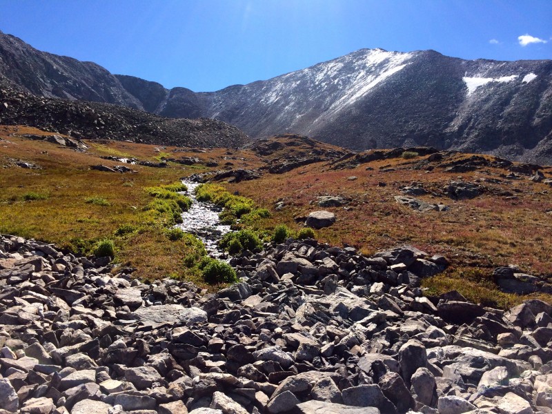
I love september...great weather and lots of daylight combine to allow for some really lazy starts. I woke up at 730 to the sound of my dog Rocco going crazy...I had slept through my alarm and Chase was already here. Whoops. I wasted more time paying a couple bills and making coffee. We left around 9, but had to make a quick detour in Frisco to the Butterhorn for a nutritious breakfast wrap. We made it to the trailhead around 10. The 4wd road was pretty easy...there was one spot with some deep ruts from the rain, but it was fine in a tacoma. I'd imagine any 4wd vehicle could make it no problem.
The weather was perfect as we began bushwhacking through head high willows. Thankfully the willows were only about 50 yards or so and soon we were heading up through the trees towards Mayflower Hill. There seemed to be a faint trail, but it didn't really matter as it was pretty obvious where we were trying to go. Hiking into the basin, the views really opened up. The West ridge on Pacific came into view and it looks impressive with its many rock towers. There is still a ton of water flowing through the basin, and we ended crossing several creeks and puddles. Its wild to see how green everything still is...Quite a contrast from the snow frosted peaks above.
love those willows first glance at west ridge
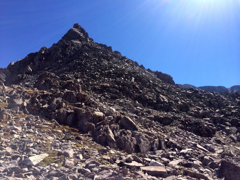
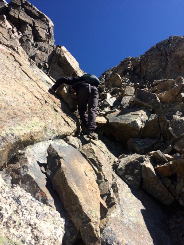
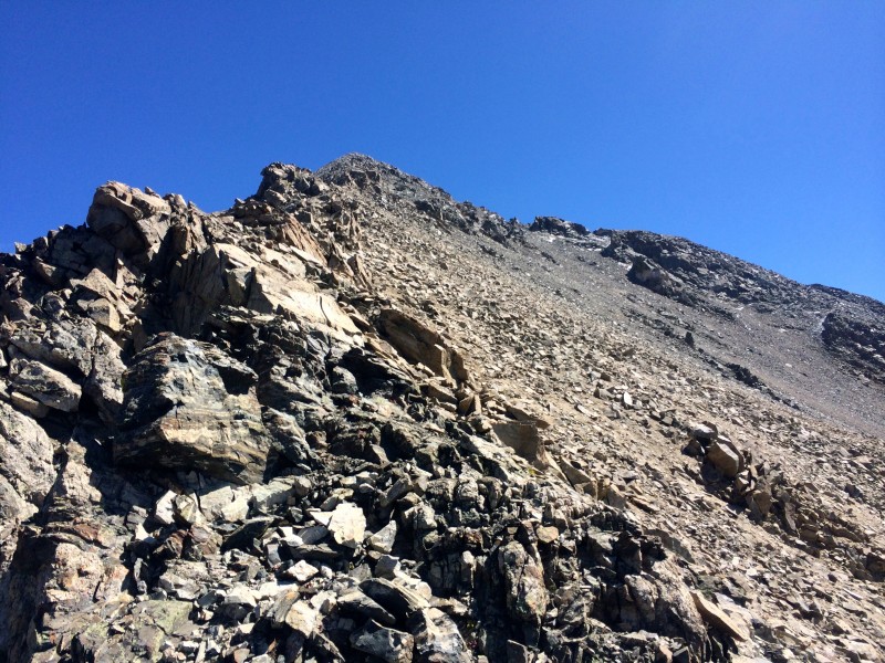
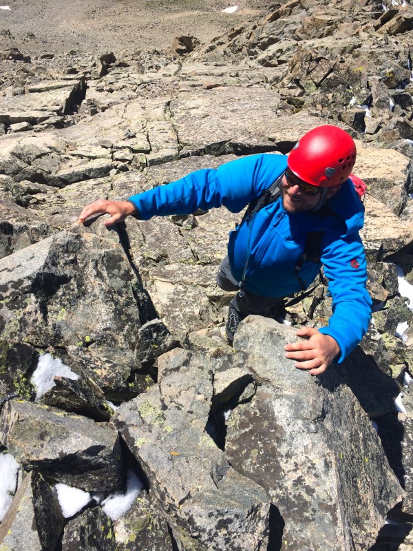
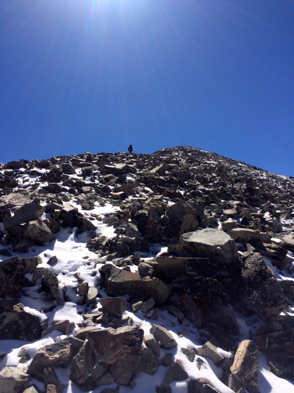
We got to the base of the ridge and stopped to put on helmets and some sunscreen. I was a little nervous that upper portion of the ridge would be icy, but I hoped that the sun would melt it by the time we got up there. The initial part of the ridge below the first rock tower is steep talus for a few hundred feet. Its class 2 hiking with maybe the odd 2+ move. As we came up on the rock tower, we skirted around to the right. The tower itself looked awesome and totally climbable with gear...another day I want to go back with a rope and stay on the crest the whole way. We scrambled around the tower and made our way back to the ridge crest.
Initial talus slope Looking back First point, which we passed on the right
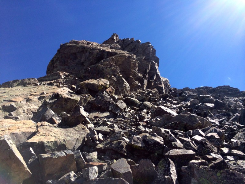
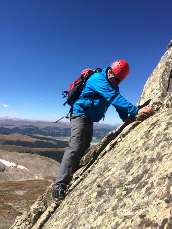
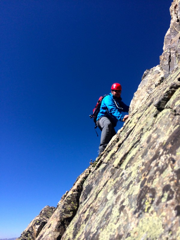
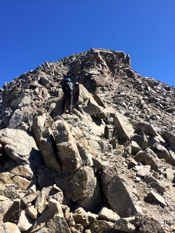
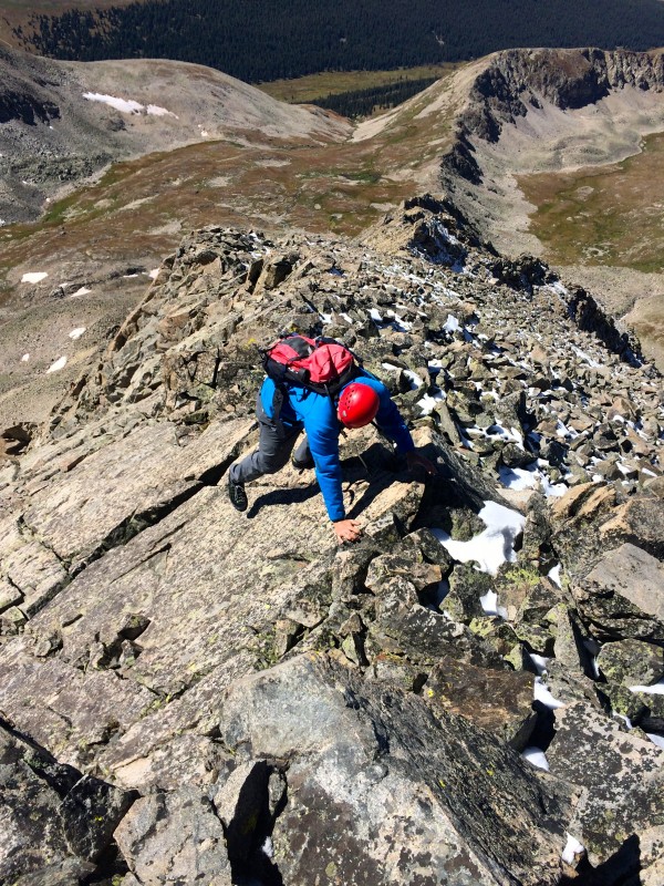
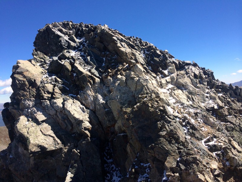
This ridge was much more solid than I had anticipated...after last weeks adventure on the Drift-Fletcher ridge, I was expecting it to be pretty loose but for the most part that wasn't the case. I think we maybe bypassed a few of the looser sections by staying closer to the ridge, opting for the slightly harder scrambling. There was one move in particular that was really awesome...you have to step around a block, and it forces you to stare directly down a sheer drop off to the left side of the ridge. Beyond that, the route was a mix of hiking and scrambling. The ridge looks complex and difficult, but it isn't too bad. There were a few icy/snowy spots towards the top but they weren't a problem and I'd imagine will be dry in a couple of days. This ridge was really fun and engaging.
headed back to the ridge crest fun scrambling more fun even more fun looking back mini knife edge upper ridge looking back Notch
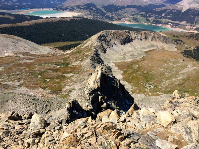
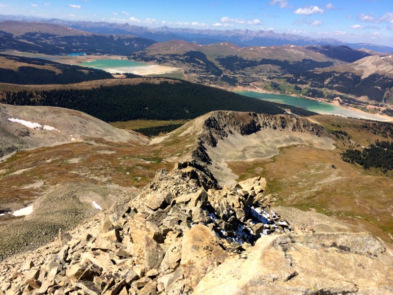
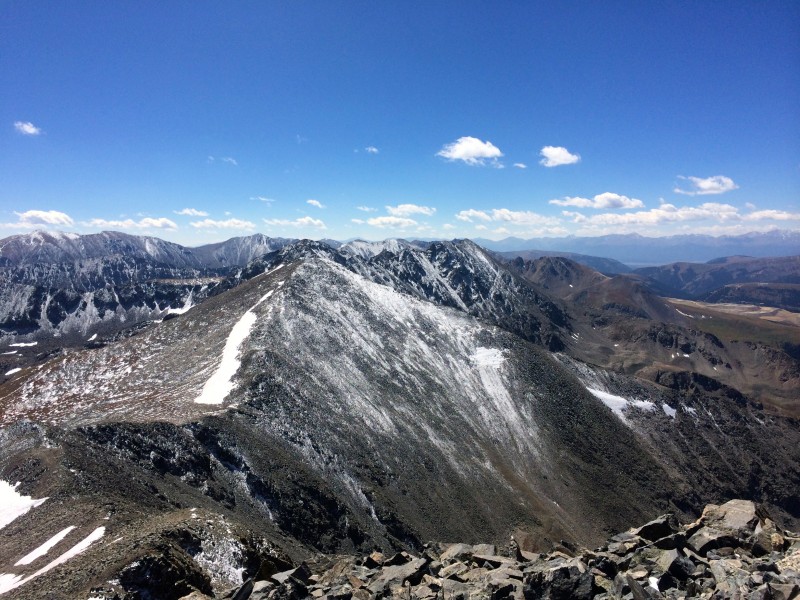
We made our way to the summit of Pacific and enjoyed the views from the summit. There was a frosting of snow on the surrounding peaks above 13000', which made for some really spectacular scenery. There was still some snow from the winter lingering around the tarn below the peak. The wind was blowing pretty hard, so we didn't linger too long.
Pacific tarn and Quandary Looking to atlantic
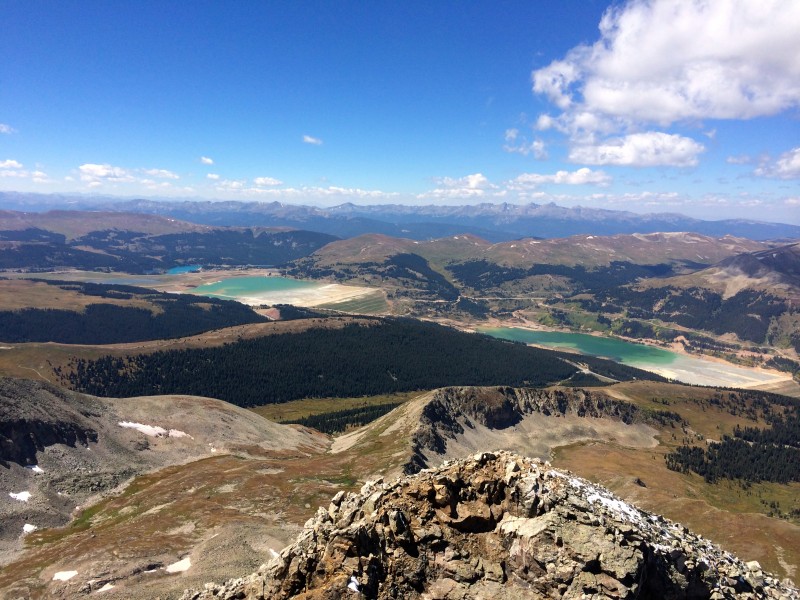
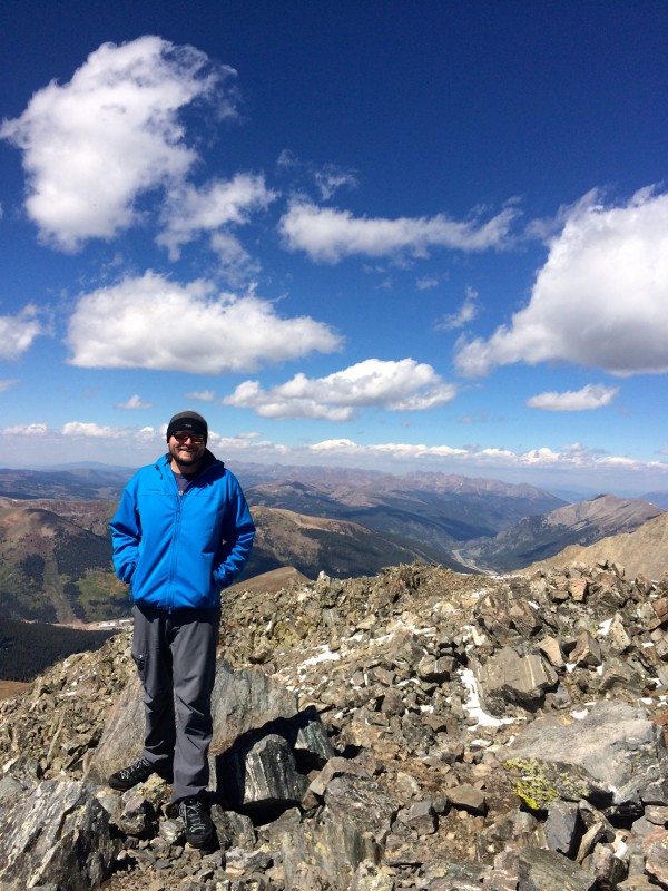
The hike over to Atlantic was short and snowy, and we topped out on Atlantic about a half hour later. Its an easy hike up mostly stable talus. The views were great once again, and the wind somehow wasn't blowing on the summit, so we relaxed for a while and enjoyed the day.
We headed down the west ridge of Atlantic for the descent. The wind rejoined us and it was surprisingly cold. About halfway down, we made a huge, huge mistake. There looked to be a trail headed down a gully on the left. It didn't seem all that steep, and looked like it would spit us out right at the mining road, sparing us the willow bash. We both knew better. I even remembered seeing all the gullies on Atlantic ending in cliffs near the bottom, but for some reason I still can't figure out, we decided to go down the gully.
The first couple hundred feet went easily enough, boot skiing down wet dirt, but soon the terrain steepened and became all scree. This was really an idiotic move on our part. We tried to stay close together to avoid kicking rocks on each other....at one point we heard a bunch of rockfall coming off one of the gullies near the summit of Atlantic, which didn't help. As we made our way lower in the gully, I began to wonder if we were going to get cliffed out. We couldn't see the bottom of our gully, which was a bad sign. We zig zagged around, trying to stay on grass and solid rock while looking for a doable exit...Somehow, we found the only exit that didn't end in cliffs. Stepping back onto the road I breathed a huge sigh of relief. Looking back on it, I don't know how we made it down that thing. Definitely got away with one there. So, in short, STAY ON THE RIDGE.
we came down the gully in the center. DONT DO IT!!!!
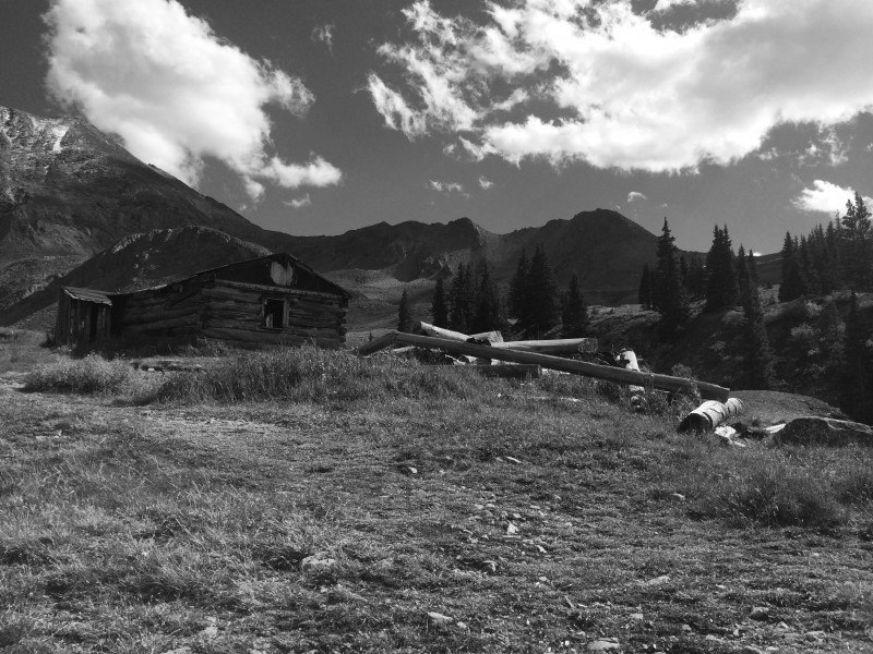
Relieved to still be in one piece, we headed down the road, back to the truck. It was cool seeing all the mining ruins on the way out.
ruins
All in all, this is a great route. Short and sweet, with great views all around. I'm starting to enjoy the 13ers more than the 14ers...the solitude and the sense of adventure is really addictive. Really looking forward to repeating some of these routes as snow climbs this winter.
Cheers!
Thumbnails for uploaded photos (click to open slideshow):
I made the same mistake yesterday and dropped down that South gully but went too far to the west and came out above the cliffs which was pretty scary. I up climbed and came down on the Talus. Definitely a lesson learned.
Caution: The information contained in this report may not be accurate and should not be the only resource used in preparation for your climb. Failure to have the necessary experience, physical conditioning, supplies or equipment can result in injury or death. 14ers.com and the author(s) of this report provide no warranties, either express or implied, that the information provided is accurate or reliable. By using the information provided, you agree to indemnify and hold harmless 14ers.com and the report author(s) with respect to any claims and demands against them, including any attorney fees and expenses. Please read the 14ers.com Safety and Disclaimer pages for more information.
Please respect private property: 14ers.com supports the rights of private landowners to determine how and by whom their land will be used. In Colorado, it is your responsibility to determine if land is private and to obtain the appropriate permission before entering the property.


")
")
 nice little drift below the summit")
")
")
")
 love those willows")
")
")
")
 first glance at west ridge")
")
")
")
 Initial talus slope")
 Looking back")
 First point, which we passed on the right")
 headed back to the ridge crest")
 fun scrambling")
 more fun")
 even more fun")
 looking back")
")
 mini knife edge")
 upper ridge")
")
 looking back")
")
")
")
 Notch")
 Pacific tarn and Quandary")
 Looking to atlantic")
")
")
")
")
")
 we came down the gully in the center. DONT DO IT!!!!")
 ruins")