| Report Type | Full |
| Peak(s) |
Kilimanjaro - 19341 |
| Date Posted | 09/01/2014 |
| Date Climbed | 08/10/2014 |
| Author | JimR |
| Geezer on Kili: Pole-Pole |
|---|
|
Geezer on Kili: Pole-pole Date Climbed: 5 to 11 August, 2014; summit 10 August Route: 7-Day Machame Route Beginning Elevation: about 6000' Peak Elevation: 19,341' Distance: about 39 miles Total Elevation Gain: about 16,700' Executive Summary: Great trip: good weather, good group, good guide, and I summited. Details follow. Pre-Trip A climb of Kilimanjaro involves a fair amount of planning and preparation, so I have started with several paragraphs devoted to the pre-trip. If you have no interest in that, just skip down to where you start seeing pictures. (This report is pretty verbose; if you want more photos and almost no words, the photos can be viewed at https://picasaweb.google.com/JimRanda/Kilimanjaro_814?authkey=Gv1sRgCK_D8rOfxIf0Fw.) I have been considering attempting to climb Kilimanjaro for several years now, and I finally accepted the fact that my chances of success are probably decreasing with each passing year. Besides, I had heard the "pole-pole" mantra, and I figured that with the way I hike these days, that should be right in my wheelhouse. So late in 2013 I started researching dates, routes, and options for a guided trip. The two most popular times to climb Kilimanjaro are around December - February and July - September. I chose the July - August time frame, in order to give myself time to hike my way into shape during the early summer. Also, I had heard that July - August was generally less rainy. Initially I decided to try to go with the CMC trip (6-day Machame route in mid-July), but it was already full by the time I tried to sign up, and I didn't want to take my chances on a waitlist, so I looked at commercial options. There are any number of companies to choose from, with a wide range of options and prices, and virtually all of them seem to be highly recommended. My principle consideration was to maximize my chances of summiting. This was likely to be my only chance at Kilimanjaro, and I would not be happy just with a week of good hiking"I can stay in Colorado and do that. After a fair amount of reading and dithering, I decided to go with the 7-day Machame route (with a 3 ½ day safari afterwards) of Alpine Ascents International (AAI), which is one of the more expensive commercial companies. I liked what I read about them in Emcee Smith's very helpful trip report on this site, and it seemed that they would give me as good a summit chance as anyone, and that I might even learn something along the way (and in fact I did). The 7-day (rather than 6-day) option for the Machame route seems to have a significantly higher success rate (along with a somewhat higher cost), so I went with 7 days. The trip started on Aug. 2, which gave me enough summer hiking time to get myself into some kind of shape. A little bonus was that we would summit on the night of a full moon. Initially I was a bit apprehensive about my age, since I have finally faced the fact that I am no longer as strong or fast as back in the day, but AAI (and other companies) assured me that they had taken people in their 70's to the summit. (I assume that they survived; I didn't really press that point.) AAI sent an extensive equipment list (and recommended meds), which I took fairly seriously. They offered the option of renting most of the bigger items, but I already had much of it, and I bought the rest. Once I decided that I would be going, I began trying to improve my fitness. I worked out fairly regularly, particularly during January - March, but mostly I concentrated on hiking as much as I could, especially at higher elevations. This wasn't helped by the lingering snow up high in June, but by the time of the trip I had over 80,000' of elevation gain for the year, including seven 14ers, and I thought that I was ready. (Actually, I was a little worried that I may have worn myself out by too much training.) The Trip I took what seems to be the standard route to Tanzania, flying Delta/KLM Denver-Minneapolis-Amsterdam-Kilimanjaro. AAI had a bus waiting for us at the airport & took us to our hotel (New Arusha Hotel) in downtown Arusha, arriving at about 10 PM on Sunday, 3 August, just under 30 hours door to door. Monday morning we had a general meeting, briefing, and gear check with our western guide, John. AAI emphasizes hygiene, and John discussed some of the health measures (double treating drinking water, washing hands before entering food tent, no direct contact with community food dishes, ...). Some of it might have seemed excessive, but no one in our group got sick. He also talked (not for the last time) about how we would be hiking together as a group, single file (to leave room for porters to pass), at a slow enough pace that no one would be short of breath (pole-pole). And he gave the first good explanation of the "rest step" that I have heard. After lunch, we had a walking tour of the downtown Arusha area. Although Arusha's population is on the order of 1.3 million, the downtown looks more like the center of a small (poor) village. 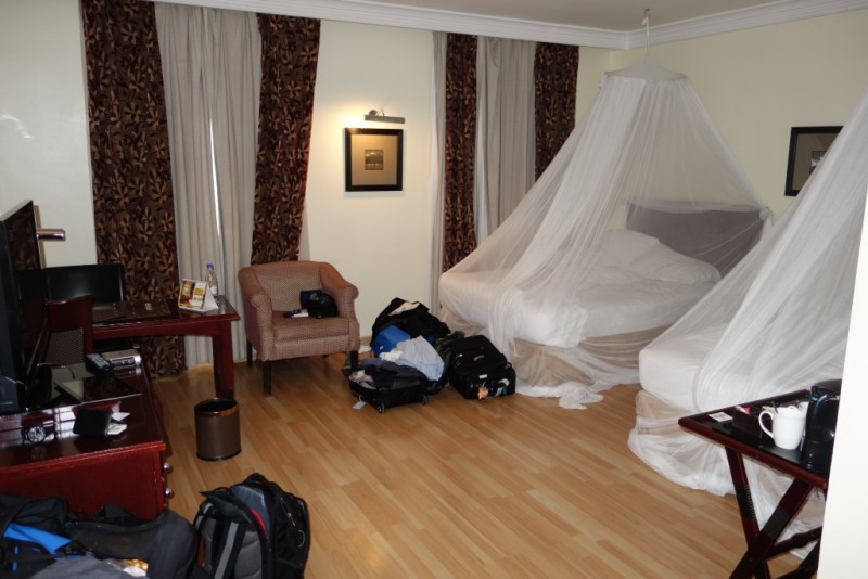  We had a big group of 16 hikers, but it was a very good group. Everyone seemed easy to get along with, everyone was usually ready on time, and no one really lagged behind while hiking (granted, it was a pretty slow pace). It was a younger group than I had expected: we had 3 guys in our 60's, one woman in her 50's, two guys in early-mid 40's, three guys & a woman in the 37 - 40 range, and 6 "kids" (3 guys, 3 women) in their mid 20's. There was a pair of brothers, a father-daughter pair, and a mother-son-daughter-uncle family; no significant-other couples. Most people had signed up with a friend or relative. There were four of us (two men, two women) who had come alone, so we were paired up in two tents. DAY 1: Machame Gate (about 6000') to Machame Camp (about 9900'), about 6 miles & 3900' elevation gain Tuesday (Aug. 5) morning we drove about 1 or 1 ½ hours to the Machame gate, at about 6000'. After some time getting organized and signed in, we started the actual climb at between 10 and 11. The first day took us through dense forest, hiking through mist or cloud on a wide, smooth trail. I was surprised by the lack of wildlife; all we saw were a few birds, not even any monkeys until the last day. 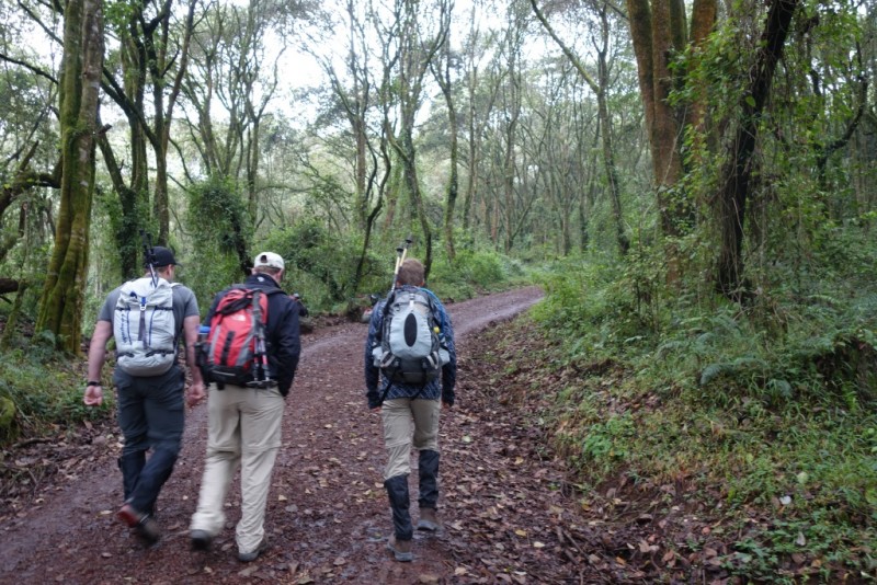  As would be the case every day, we were given a morning "snack" to carry, which was a bit bigger than what I usually carry for lunch. A hot lunch was served in a tent set up next to the trail, with tables, chairs, table cloths, flowers (plastic"you have to make some concessions), cutlery; kind of decadent, but no one complained. After lunch, back on the trail. 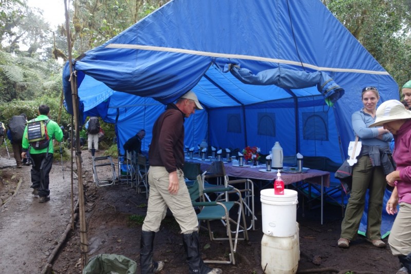 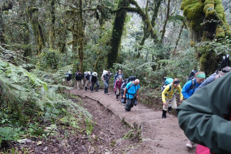 We got to Machame hut/camp at about 5 PM. We signed in at the hut and headed for our camp, where we were greeted by a welcome song from a chorus of porters. This lasted about 5 minutes and was actually pretty cool. We then picked up the boundary bags with the gear that we hadn't carried ourselves (sleeping bags, thermarests, extra clothes, etc.), picked out a tent, and settled in. Dinner was at about 6:30, in the big dinner tent. As would be the case every day, it started with a (very good) hot soup, followed by several vegetable dishes, a meat dish (Salisbury steak the first night), and one or more starches, like rice, potatoes, or a type of bread. Finally, some fruit and some sort of dessert. DAY 2: Machame Camp (9900') to Shira Camp (about 12,500'), about 5 miles & 2600'. Wednesday we settled into the usual morning routine. Wake-up at 6:00, coffee/tea/cocoa offered in tent or at tent if we were already up and around, pack our unneeded gear into boundary bags and pack our day packs, breakfast at 7:00, start hiking at 8:00. (After the first morning, with shorter hikes, the schedule was set back a half hour.) We started day 2 above the clouds, and we would stay above them for most of the rest of the climb. The trail was still clear, but no longer so wide and smooth as at the start. We were now on a drier part of the mountain, and the vegetation had thinned considerably. We had good views of Mt. Meru in the distance, and we got our first view of Kibo, the largest and tallest of the old Kilimanjaro volcanoes, though Uhuru Peak, its high point, was still hidden. 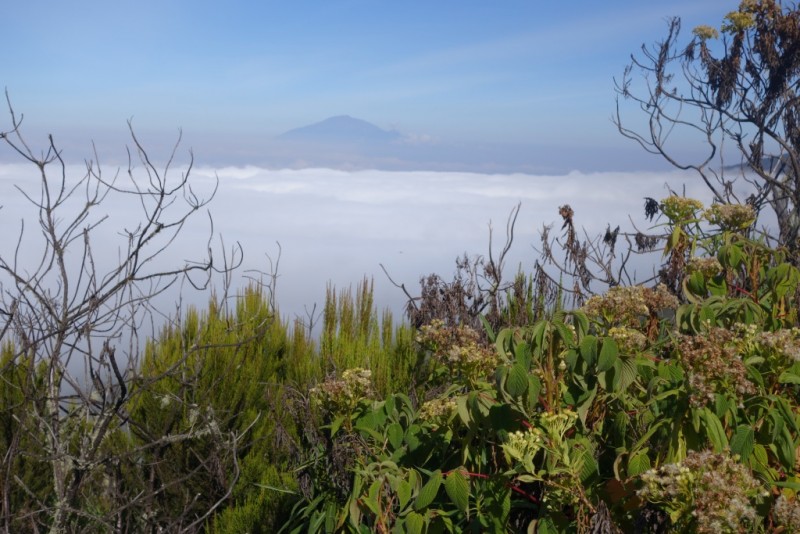  We got to Shira Camp in mid-afternoon, signed in, and were again greeted by a welcome song from the porters. We were later treated to a pretty spectacular sunset.  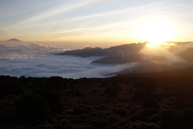 DAY 3: Shira Camp (12,500') to Barranco Camp (12,900'), with Lava Tower (15,213'), about 6 miles & 2700' The first two days were spent going mostly north up to Shira Camp, which sits on the western slope of Kibo. The next three days were spent traversing around the southeastern and southern slopes of Kibo, acclimatizing as we stayed above 12,500'. On day 3 (Thursday) we hiked up to a ridge at the top of which sat the Lava Tower, an impressive mound that rises a few hundred feet above the trail below. While the others waited, most of us took the optional detour up the Lava Tower, which proved to be a fun scramble.  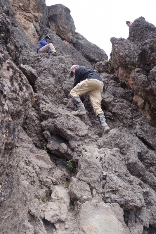 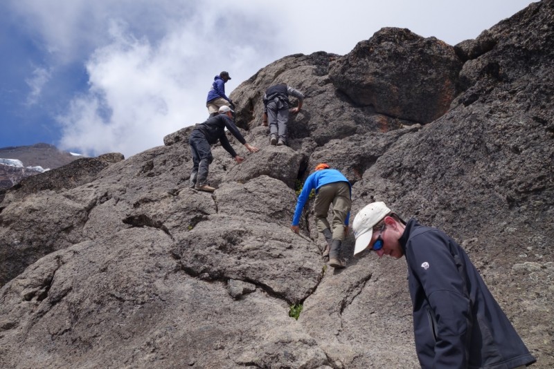  It also marked a new personal high point for all but one of us. After the Tower, as we descended south from the ridge, we were met by a cloud rolling up the valley, and we spent the afternoon hiking in mist. 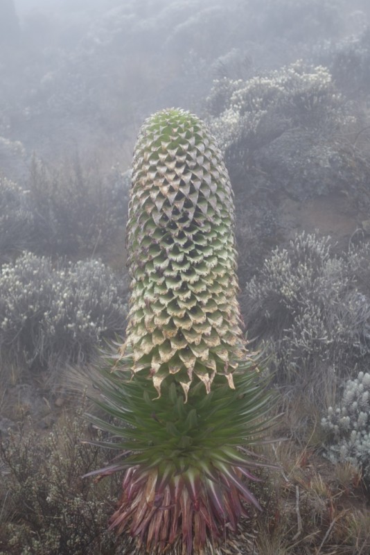 By the time we had reached Barranco Camp, however, the mist had lifted (or we had left it behind), and we had a clear view of the imposing Great Barranco, or Barranco Wall. This appears to be a sheer vertical wall rising about 1200' above Barranco Camp. 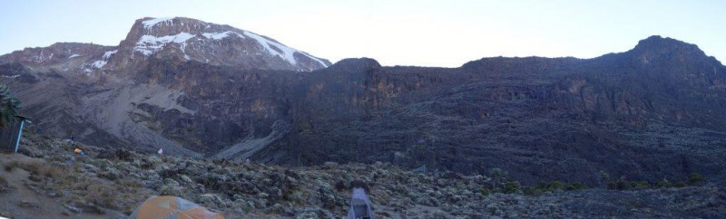 Of course, there is a trail that winds its way up the wall, and several hundred people climb it each day, but at first sight it looks pretty daunting, particularly to some of the less experienced members of the group. DAY 4: Barranco Camp (12,900') to Karanga Camp (13,300') about 3 miles, 1300' After breakfast, we headed for the Barranco Wall, sometimes called the "Breakfast Wall" because you work off your breakfast ascending it. The trail up the wall is narrow, single file in most places, and because there is a lot of traffic there is considerable congestion at the places that require a little scrambling. 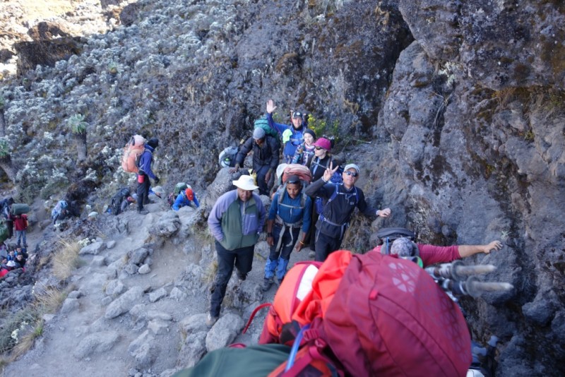 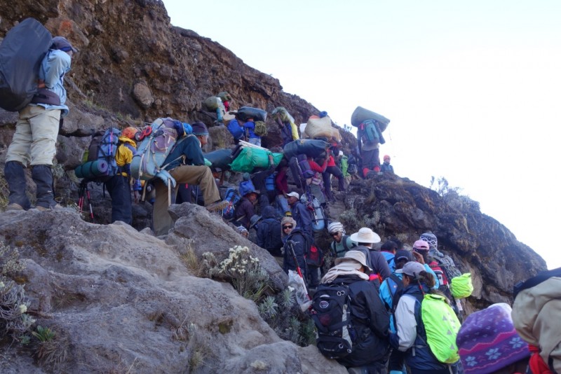 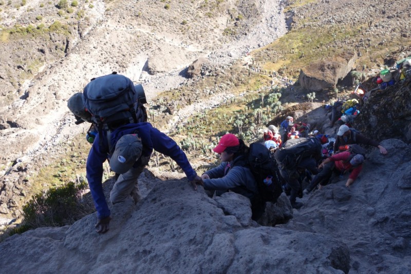 Eventually we all made it up, and stopped for a break on top. It was a beautiful day and relatively broad flat area with great views, and we did not have much distance to travel that day, so we spent quite a while up there, relaxing and taking pictures. 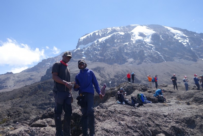 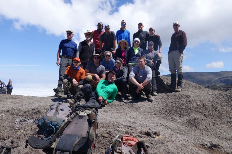 Eventually John noted that we were "burning daylight," and we got moving again, arriving at Karanga Camp in mid-afternoon. Karanga also marked a decision point for me regarding Diamox. I had brought it with me, and my original plan (assuming I did not need it earlier) was to take it before going to sleep on days 4 and 5. However, I was feeling so good up through high camp that I let myself be convinced that I didn't need it, so in the end I didn't use any. DAY 5: Karanga Camp (13,300') to Kosovo Camp (about 15,600'), about 3 miles, 2500' On day 5 (Saturday), we descended a bit and then climbed up to our high camp, at about 15,600'. 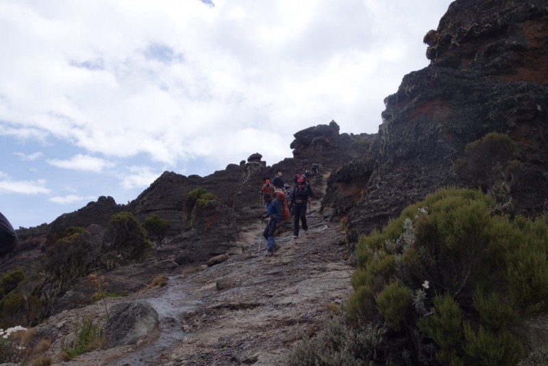 Most groups use the Barafu Camp, at about 15,300', for their high camp, but Alpine Ascents goes a little higher, up to Kosovo Camp at about 15,600'. This is one of the little bonuses of AAI. Three hundred feet doesn't sound like much, but when I got to the summit, I would NOT have wanted to go up another 300'. 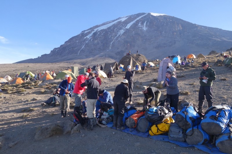 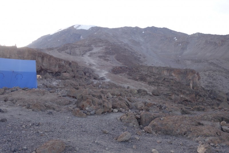 Anyway, we had an early dinner, and went to "sleep" at about 8 PM. Surprisingly, I think I actually got a little sleep. We were awakened at 11 PM, had breakfast at 11:15, and were on the trail at midnight. DAY 6: High Camp (15,600') to Uhuru Peak (19341') to High Camp to Mweka Camp (10,200'), about 4 miles+3741' up, and 8 miles+9100' down. The Machame Route reaches the rim of Kibo at Stella Point (18,862'). From Kosovo Camp to Stella Point the trail climbs 3260' up moderately steep scree"in the dark and cold, and without too much oxygen. Actually, we were pretty lucky with the temperature; I would guess it was in the 10 - 20 ºF range; at least it didn't feel too cold. We took a couple brief breaks to make sure we all had some water, but mostly we just plodded slowly along, up an infinite (I counted them) number of switchbacks, not seeing much except the backpack in front of you. I felt good as long as I didn't get short of breath, but about half or 2/3 of the way up the guy behind me noticed that I had a bloody nose. (Apparently I was leaving a trail behind me.) I stepped off the trail and stopped it, but that meant that I fell behind our main group. In catching up with our group, I got out of breath, and after that I struggled a bit. We reached Stella Point a little before sunrise and took a short break for some tea. Then we headed along the rim to the summit, about ¾ mile and about 500' elevation gain away, reaching there between 6:30 and 6:45 (I think). We took the summit photo(s), marveled at the view, and let the local guides congratulate us on our amazing feat. (They of course climb the peak several times per month, but never mind.) 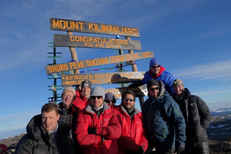 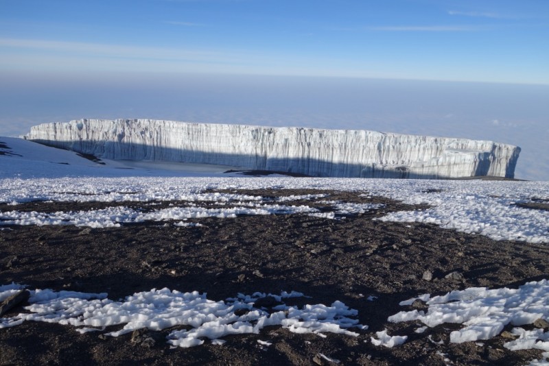  The summit was a bit of a mob scene, with numerous different groups, all suffering from oxygen deprivation to some extent, and with everyone trying to get their picture taken with the sign, and trying to stay at the sign long enough for multiple photos with multiple friends, etc. The local guides manage to maintain some semblance of order, but I won't be surprised in a couple years to read about a fight breaking out. Anyway, eventually we headed back to Stella Point. From Stella Point, you descend a different path than the one that you came up, one-way traffic up and down on the two trails between Stella Point and the High Camp. Like the ascent trail, the descent was also a long scree slope, and a few of us and a guide made great time plunge-stepping/sliding down. The scree wasn't quite ideal for it, but it was good enough, and it was a good three miles long. We were already running on adrenaline, and the scree slope just added to it. We got back to Kosovo Camp about 9:30 or maybe 10:00 (that's a guess). By noon, everyone was back in camp. Of the 16 hikers in our group, 15 made the summit. We had lunch at about noon, and then headed down for Mweka Camp, another 4 miles and 5400' lower. The hike down to the lower camp wasn't as bad as I expected it to be, probably due to residual adrenaline and the increasing oxygen as we descended. Mostly it was just boring and anti-climactic. We got into camp just before dark, had dinner, and collapsed into our sleeping bags. DAY 7: Mweka Camp (10,200') to Mweka Gate (5580'), about 4 miles+4600' descent The following morning (Monday) was the only day that my tent-mate and I were actually still in our tent when the porters came around with the morning coffee.  After breakfast we started a relaxed trek down toward the Mweka gate. When we got there, we were once again greeted by a welcome/congratulatory song & dance by the porters, joined by a ranger, and including some of our own dance-like moves.  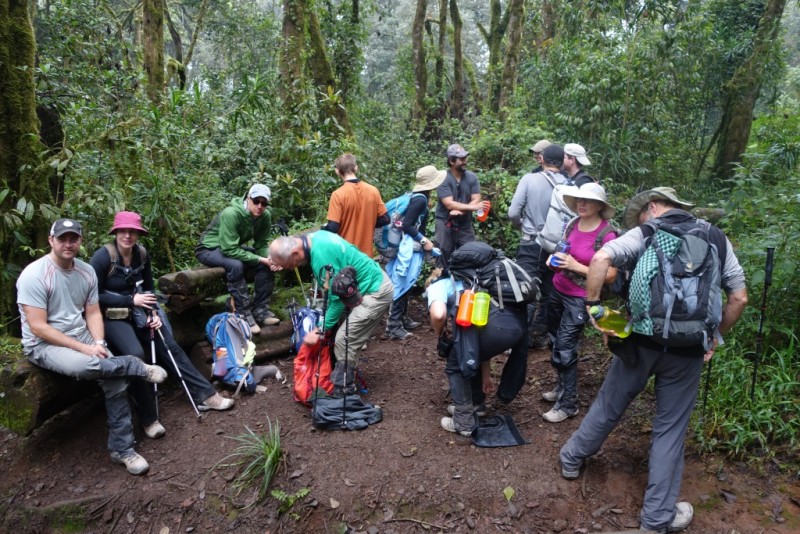  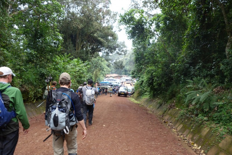 A lunch buffet, with adult beverages, was waiting at the sign-out hut, followed by the bus ride into town, and much-needed showers. A celebration dinner that evening at a restaurant in Arusha capped a great climb. Most of us started a 4-day safari the next day, but that's another story, and this story is already too long. More photos and some video of the welcome songs can be found at https://picasaweb.google.com/JimRanda/Kilimanjaro_814?authkey=Gv1sRgCK_D8rOfxIf0Fw Thumbnails for uploaded photos (click to open slideshow):
|
| Comments or Questions | |||||||||||||||
|---|---|---|---|---|---|---|---|---|---|---|---|---|---|---|---|
|
Caution: The information contained in this report may not be accurate and should not be the only resource used in preparation for your climb. Failure to have the necessary experience, physical conditioning, supplies or equipment can result in injury or death. 14ers.com and the author(s) of this report provide no warranties, either express or implied, that the information provided is accurate or reliable. By using the information provided, you agree to indemnify and hold harmless 14ers.com and the report author(s) with respect to any claims and demands against them, including any attorney fees and expenses. Please read the 14ers.com Safety and Disclaimer pages for more information.
Please respect private property: 14ers.com supports the rights of private landowners to determine how and by whom their land will be used. In Colorado, it is your responsibility to determine if land is private and to obtain the appropriate permission before entering the property.