Beyond the Constriction
The hourglass has been used for centuries as a way of measuring the passage of time......
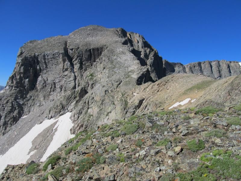
Hourglass Ridge, Mt. Alice
It is somewhat fitting that I climbed Mt. Alice in Rocky Mountain National Park earlier this week. I have been wanting to get up into this part of Wild Basin for many years now. I can be hiking here less than an hour in from my doorstep - why haven't I been to this place before? Too many things to do, too many projects to be completed, too many other places to see. I want to turn to attractions closer to home. I convinced my 21-year old son that the Hourglass Ridge on Alice was a good idea, and off we went.
Alice does not get too many ascents relative to other nearby peaks, and so not that many trip reports either. On top of that my report offers little in the way of additional detail over Zambo's excellent report from a couple weeks ago, and so may seem redundant, but I wanted to post it anyway, for the perspective of someone who does not have as many hamsters in the cage as he does. At five-and-a-half hours to the top, without throwing in Chiefshead, our times were a little more pedestrian than his.
Not the highest of peaks at 13,310', Alice often gets overlooked in part due to its proximity to Longs and Meeker, and in part due to the lengthy approach. At about 8 miles from the trailhead and 4,800' vertical, it's not exactly a walk in the park. Oh wait; yes it is a walk in the Park. Either way, you have to want it.
The great thing about the main trail in Wild Basin as it heads west toward Thunder Lake is that is well suited to moving quickly, as the grades are reasonable - so the first 5-6 miles to the Lion Lake trail go by quickly. This year the Park Service is directing people headed deep into the basin up the 'backcountry site shortcut trail' since the Ouzel Falls bridge is still out due to last September's floods. As Aubrey mentioned in his trip report from a few years ago, the sign for first backcountry site is immediately preceding the campsite trail itself - so go past the entrance to the first campsite to find the trail intersection, which is well-signed.
The wild flowers are spectacular this year. I recognize a few of the more common ones: Chiming Bells, Dusky Penstemon, American Bistort, Indian Paintbrush, Elephant Head, Purple Fringe, Columbine, Alpine Phlox, to name a few.
WARNING: The pictures below display just a few of my truly horrible photographic skills. I think a class might be in order.
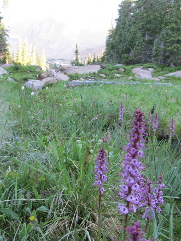
Elephant Head
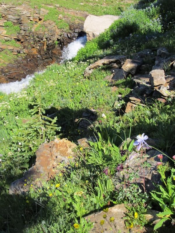
Dusky Penstemon (purple) and Columbine
Here are several I am hoping someone can educate me on - let me know if you recognize these:
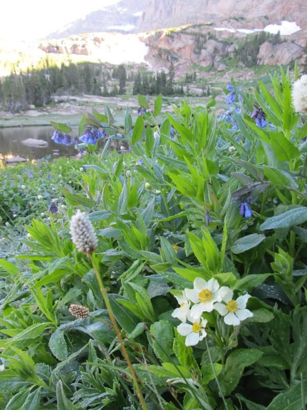
American Bistort (white, left) and Chiming Bells (blue, background) but what are the white ones in front right?
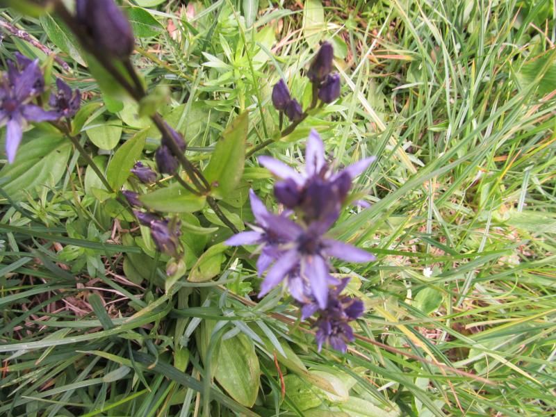
I have seen these quite a bit but have no clue what they are......
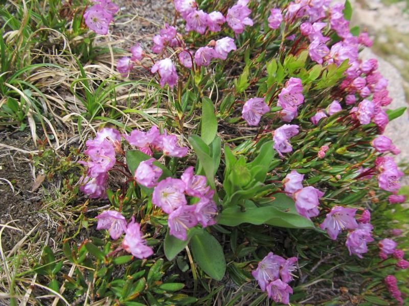
No clue what these are either......
Taking a right onto the Lion Lakes trail, the grade increases - but these lakes are well worth the hike even if you go no further. You need to go there. Trust me. Lakes, waterfalls and wildflowers everywhere. The trail from Lion Lake 1 to Lion Lake 2 is less used and a small amount of work may be needed to locate the trail beyond Lake 1, but there are cairns here and there plus a little bit of a trail tread. Normally the trail ascends through a cliffy area where the stream cascades down. This was a heavy snow year and the gully was still full of snow; we found a tricky little end-around between the rock face and the snow which requires a little minor scrambling.
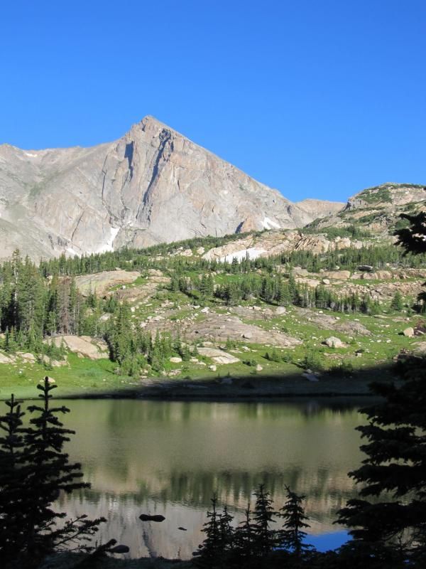
Mt. Alice and Lion Lake
We see a little frost this morning - a sign of things to come. Once at Snowbank Lake you can choose to take the valley floor as far as possible and then hike steeply up to the plateau between Chiefshead and Alice, or you can shoot west a bit to a low ridge, which offers a more linear rate of ascent. We divert to the ridge, the best of both worlds in my opinion, allowing views of the small valley immediately below Alice's east face, in addition to the entire Lion Lakes valley.
Once at the broad plateau, the best view is to be had in - well, any direction you choose to look. We see a small group of climbers near the summit of Chiefshead to the east and 1,100 feet higher. Based on their position high on the northwest shoulder of the peak, we guessed that they may have come from Glacier Gorge - we had seen no people so far, and no fresh human tracks either, as the previous afternoon's downpour had completely freshened the trail tread. Following around to the north we see the Stoneman, McHenrys Peak, McHenrys Notch, Taylor Peak, on and on they go. Spinning around to the south, the rest of Wild Basin spreads out, and the Indian Peaks area beyond that.
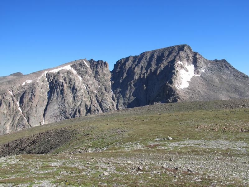
McHenrys Peak
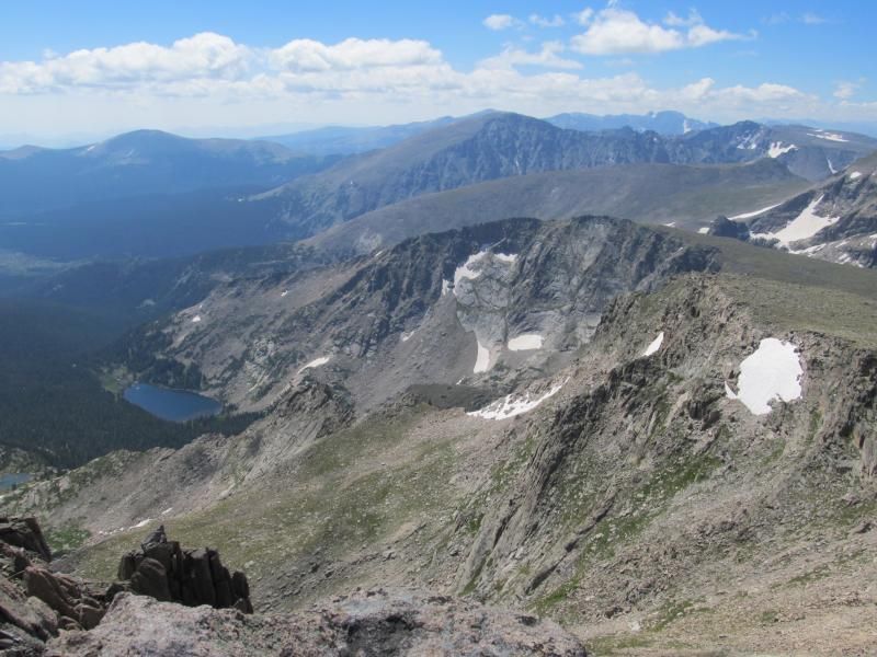
Thunder Lake and Wild Basin
Turning now to see our immediate future - the Hourglass Ridge on Mt. Alice - really more of a face than a ridge - I find the faint beginnings of the heebie-jeebies in my stomach - but sixty-some other peaks have told me that more than likely it will not be as bad as it looks. One would have to really be not paying attention to get in trouble here - just keep it between the lines. Rated at Class 2+, we know this simply means hard work, with no difficult decision making. Some people have called this a Class 3 route, and there is one move right at the very beginning of the route that might get to that level, where the ridge narrows down to just a foot or two wide, before the face itself rises up. But beyond that, you have to try if you want anything more difficult. There is no trail here, and any route will work, just put your head down and go......
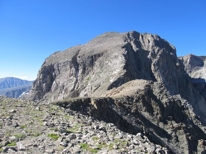
Ben headed to the Hourglass Ridge.
The face itself is shaped like an hourglass, wide at the bottom and top, with a necked-down area in the middle. The narrow part is not really that narrow - maybe 100 feet or so - but it is obvious from a distance and gives the route its name. Looking at the face from the saddle, I had assumed we would know when were passing through the narrowest point. Not so much. Once we reached a break in the slope, I figured we were there, and had a few hundred more vertical to go. But instead the summit appears - we had passed through the constriction, unnoticed.
Lounging in perfect weather on the summit, I think back to how I was a little worried about this hike. Having passed the half-century mark almost two years ago, I was not sure how a 17-mile, 4800-vert hike would go. I have been on a few longer hikes before, in the 12-14 mile range, but those were many years ago now. Sure, I have been running regularly and have started riding a bit, and generally just trying to take reasonable care of myself. But still......
Having three sons now out of the house, and having 'completed' the 14ers a while back, I have been looking to the future, pondering what is next. Several things have been on my mind - more hikes with my wife, more time with friends who want to get out into the mountains but maybe don't have as much experience and want to go with someone has been there, more 'fun' hikes and less 'hard work' hikes, more lakes and fewer peaks, more long hikes such as this one. At the same time, realistically, I also see an end-point coming, or at least I am more aware that it exists - that time where my choices may be more limited. I will not call it in, but I will accept it as it comes. Not really sure where that is or when it will happen, but I know it is coming. I see that what was more than half full is now almost certainly more than half empty. The hourglass of my life has now been turned.
I realize that constriction point has been passed. I always assumed I would see it coming......
For now though, this summit - both the literal and the figurative - is exactly where I want to be, and life is good. We sit on the summit for 45 minutes, in t-shirt and shorts weather, shooting the breeze with the local marmot. But soon, we realize that we have a long walk ahead and need to get moving. We meet the first person of the day as we descend to the Boulder-Grand Pass. She is heading up Alice while her husband, son, and daughter-in-law go for Tanima, on the south side of the pass. At the Pass, we decide that Tanima is still within reach on this day, so we go for it. We quickly knock out the 400 feet to the top, adding another mile round trip and 400 feet to the hike, where we meet the rest of the family. They are from Flagstaff, and they politely suggest "in the best possible way" that "we suck" since we are essentially locals to this most-beautiful place. And beautiful it is.
I enjoy ridge scrambles, and a descent of the east ridge of Tanima looks inviting, but as opposed to Zambo, I wanted to see the section of trail from Boulder-Grand Pass down to Thunder Lake more than I want another ridge.
Another thing about this day was the wildlife - perhaps we just got lucky or maybe this is the norm for a wild basin like Wild Basin, but we saw lots of wildlife, up close and personal. Ptarmigan galore - more Ptarmigan than I have ever seen - we probably saw 10 or 12, in small groups, some at very close range. Ever heard a Ptarmigan bark? This is the second time I have heard it and it's pretty cool. They make several noises it seems. Even these camouflaged creatures speak to me of this transition time I find myself in. Colored mostly still in the browns and grays of summer and blending in with their rocky surroundings, upon closer inspection, I see large patches of white feathers on their legs and bellies - signifying the impending turn of their lives as well, as fall and then winter set in. Perhaps their bellies stay white year-round, but today they remind me of changes to come.
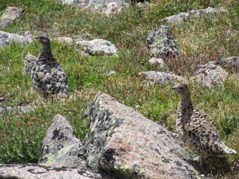
Ptarmigan
Those white feathers tell me that the height of summer has passed, but it is not yet Fall either - more sand through the hourglass, and the hourglass has been turned. I too am no longer in the summer of my youth. Not yet in advanced age either, my fall is at the door knocking. I find myself beyond the farthest edges of youth, just beyond the restriction of the hourglass. I had thought I would recognize it when I passed by. But no - the restriction has been gone by unknowingly, and the middle point of my life has passed with it.
Once to Thunder Lake, the descent goes quickly. We saw a Snowshoe Hare who was as curious about us as we were about him (or her?). We scared him at first and he ran off, but quickly circled back and approached us to about 3-4 feet, his nose going crazy sniffing to find out what we were all about. Then, a mule deer buck in velvet walking right up the trail, jumping off a few yards when we scare each other as we round a bend in the trail. On the flats above the pass we had seen several Bighorn Sheep at a distance who either didn't see us or were not concerned. Assorted squirrels and chipmunks. Lots of birds - even a Pine Grosbeak - my first time seeing one of these.
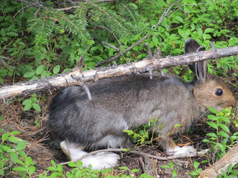
Snowshoe Hare
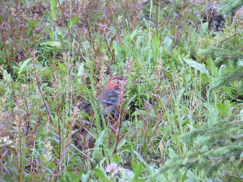
Pine Grosbeak
We take our time on the trail and do not arrive back at the car until 4:30, just over eleven hours after we sat out. 5-1/2 hours to the top of Alice, and almost 6 hours down - we were in no hurry. As I remove my boots, I contemplate what's next in my life. What does the future hold? Can I do this? Do I still have what it takes? For now, yes - thanks to God - and I will take advantage of it while I can, while there is still time in the hourglass.
Thumbnails for uploaded photos (click to open slideshow):

|
