Download Agreement, Release, and Acknowledgement of Risk:
You (the person requesting this file download) fully understand mountain climbing ("Activity") involves risks and dangers of serious bodily injury, including permanent disability, paralysis, and death ("Risks") and you fully accept and assume all such risks and all responsibility for losses, costs, and damages you incur as a result of your participation in this Activity.
You acknowledge that information in the file you have chosen to download may not be accurate and may contain errors. You agree to assume all risks when using this information and agree to release and discharge 14ers.com, 14ers Inc. and the author(s) of such information (collectively, the "Released Parties").
You hereby discharge the Released Parties from all damages, actions, claims and liabilities of any nature, specifically including, but not limited to, damages, actions, claims and liabilities arising from or related to the negligence of the Released Parties. You further agree to indemnify, hold harmless and defend 14ers.com, 14ers Inc. and each of the other Released Parties from and against any loss, damage, liability and expense, including costs and attorney fees, incurred by 14ers.com, 14ers Inc. or any of the other Released Parties as a result of you using information provided on the 14ers.com or 14ers Inc. websites.
You have read this agreement, fully understand its terms and intend it to be a complete and unconditional release of all liability to the greatest extent allowed by law and agree that if any portion of this agreement is held to be invalid the balance, notwithstanding, shall continue in full force and effect.
By clicking "OK" you agree to these terms. If you DO NOT agree, click "Cancel"...
This is my first trip report, so please excuse any abnormalities.
On Saturday, August 2, I had climbed the Needle with one of my friends, and then camped again that night. The site was just off the Humboldt trail, about a half mile south of the Lower South Colony Lake. (elevation 11,600 ft) The friend I had hiked the Needle with had altitude sickness that day, and wanted to do an easier one, Humboldt on Sunday. Since I had already done Humboldt and wanted to do the Peak, I decided to go solo, giving her the route I would take and the expected time I would be back.
On Sunday, August 3, I left camp at 4:40 in the morning. For the 0.4 miles til the turnoff toward the lower South Colony Lake, the Humboldt trail was about the same as it had been the day before.. dry in places, muddy in other places, and quite literally a stream in other places. Fortunately, I was able to avoid getting my feet soaked. Crossing the stream south of the lower South Colony Lake wasn't as bad as the day before.. most of the water runoff from the rain had dissipated, so I was able to go over the rocks with no problem.
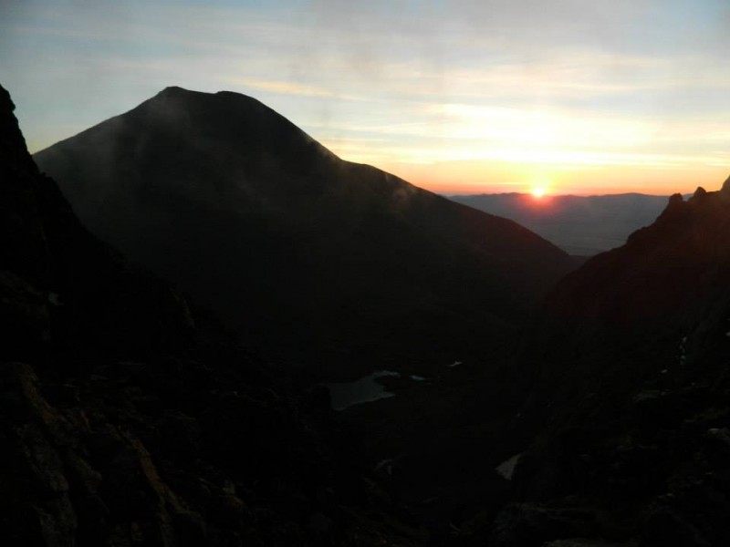
Next obstacle: Broken Hand Pass. Going up toward the pass was a lot more difficult in the dark. For most of it, there is a rock/dirt trail with big cairns that isn't too hard to follow in the day, but in the night it's a bit trickier. Taking time to stop and see where I was going, I was able to follow the trail most of the time, only getting offtrack once. Up toward the top of the pass is a little class 3 climbing, but it wasn't too bad. I reached the top of the pass right as the sun was rising.. beautiful. (about 6:00 am, 1:20 travel time, 1.4 mi)
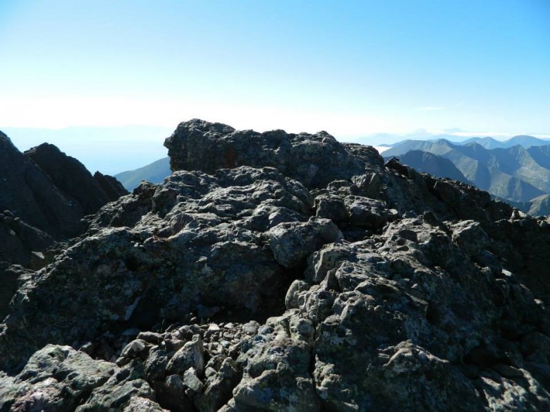
Humboldt Peak at Sunrise from BHP
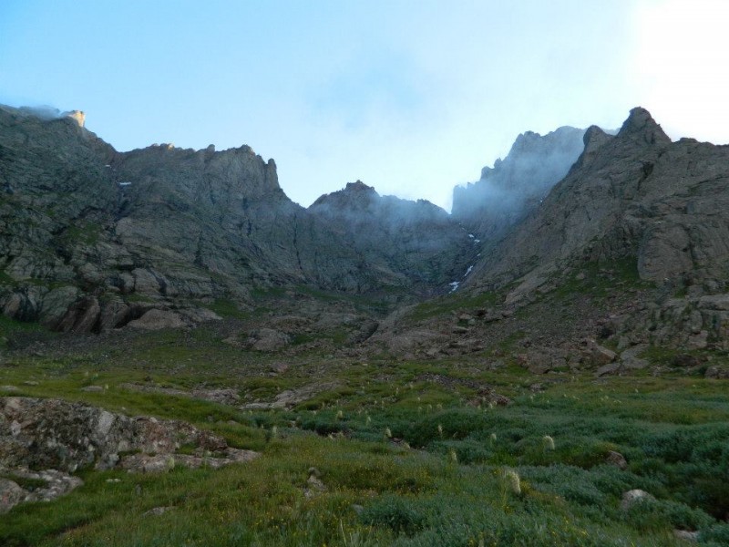
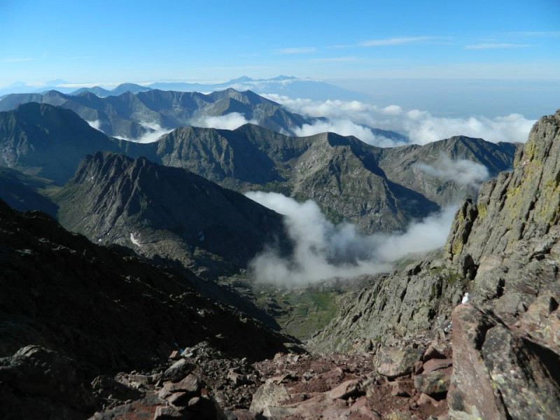
The other side of the pass was foggy, much like the day before. The top of the pass is at 12,950 ft, and you drop about 600 or 650 feet before it gets flatter near Cottonwood Lake, which is at 12,330 ft. Going down the other side of the pass, there's a nice dirt trail for most of it, with a lot of rock stairs. Once it got flatter in the grass, the trail turned into a stream again. There were rocks every few feet to step on, so it wasn't too bad. Cottonwood Lake, and the mountains to the right looked spectacular in the fog. I wanted to reach the Peak at a decent time while the weather was still good, so I jogged a little, maybe 1/4 total where the trail was dry. As I went around the bottom of the Needle, I saw the fog was beginning to dissipate some, so my hopes began to grow of reaching the summit with good views. With that motivation, I trucked onward.
Cottonwood Lake Cottonwood Lake The Peak on far left, Needle on right in fog. The Red Gully is on the left, slightly to the right of the sunlit peak.
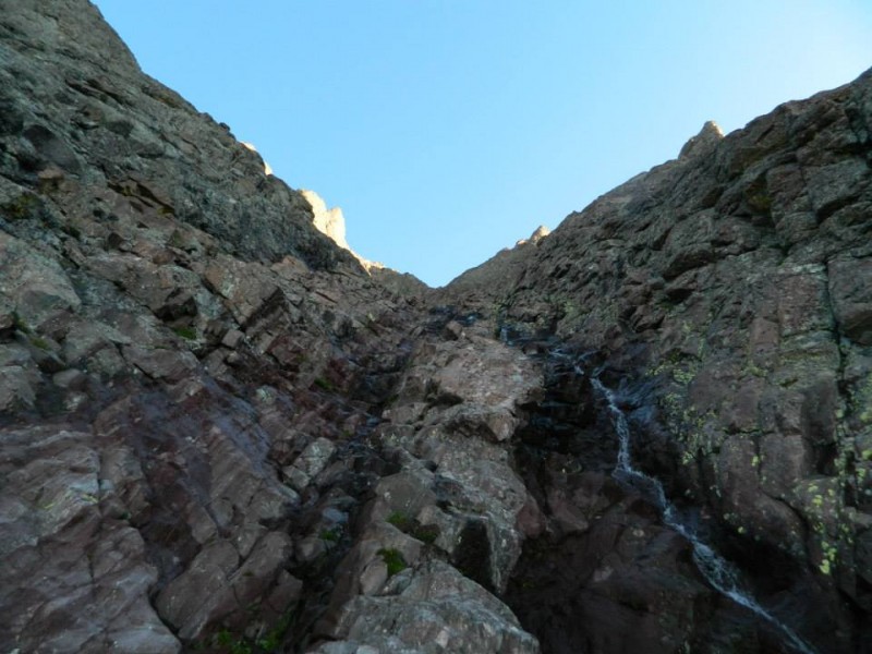
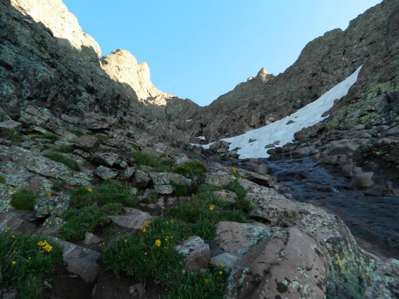
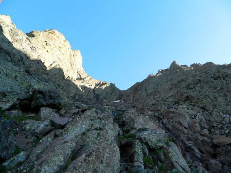
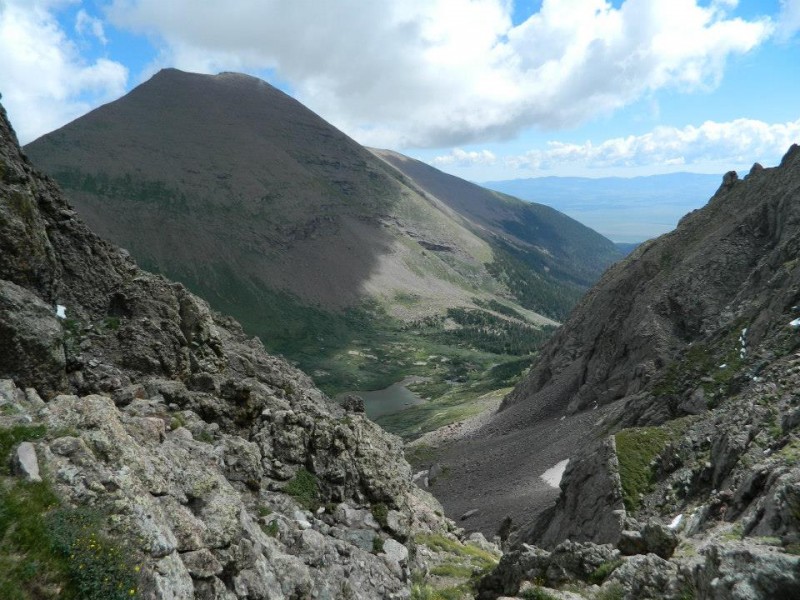
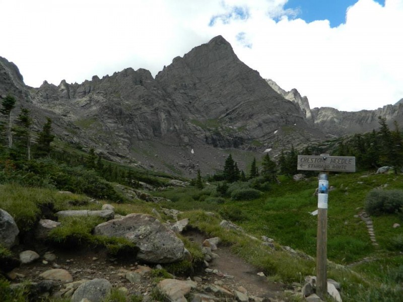
At 6:55, (2:15 travel time) I reached the point where the trail starts to head straight up the Red Gully, at 12,800 ft, 2.7 miles from camp. It was beautiful, stretching upward with Crestone Peak on the left, and East Crestone on the right. Going up the gully was similar, yet different from the gullies on the Needle. Those were basically rock climbing walls, tilted at a 45ish degree angle. (sometimes steeper). Lots of very solid conglomerate rock, lots of hand holds. The Red Gully was less steep, wider, and had a lot more loose rock sitting in it. There was a stream of water flowing down the middle of the gully, but it wasn't hard to avoid, or to cross over as I pleased. In some parts of the gully, there's a dirt trail. In others, you have to climb over decently steep polished rock, or even steeper class 3 rock. Since there's only one main way up, you can choose your own route up the Red Gully.. whatever you are comfortable with. The upper portion of the gully has a long stretch of steeper, class 3 rock. There were a few snow patches in the gully, but I was able to easily avoid them by climbing around them over rock. Many times I chose to go over class 3 rock as opposed to sketch, slippery class 2.
Red Gully Red Gully Red Gully
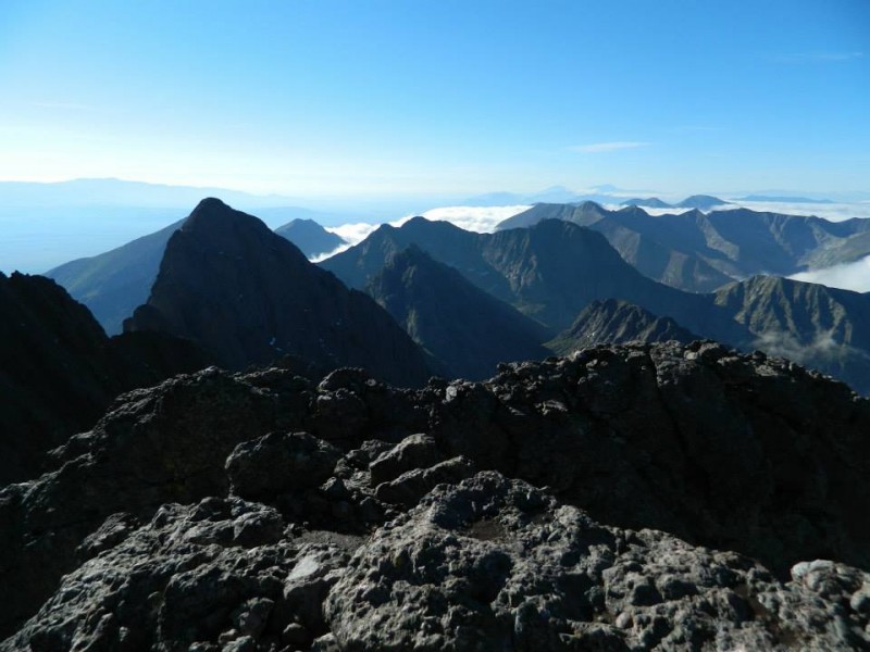
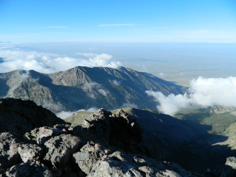
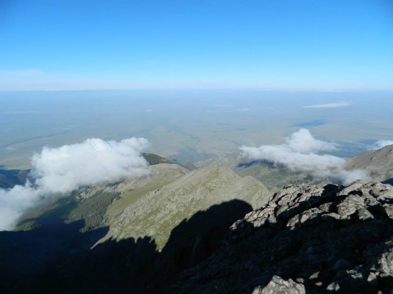
At 7:50, (3:10 travel time, 3.2 mi, ~14,150 ft), I reached the notch between East Crestone and Crestone Peak. An excellent view of Columbia Pt and Kit Carson Mtn met my eyes. And it was still clear! Behind me, I could see Mt Lindsey and the Blanca Massif looming in the distance above the clouds. The summit was to the left, 150 or so feet up. I traversed the left side of the ridge.. some exposure, it was pretty exciting. Once I reached the top, the summit was just north of me, about 30 feet away. Such beautiful views!!! I had made it to the top in 3:22, gone about 3.3 miles, and gained about 3640 feet. It was 8:02.
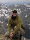
Lindsey, Blanca, Little Bear Summit View Summit View Summit View Summit View Summit View Summit View Victorious! You can see the Sand Dunes The summit
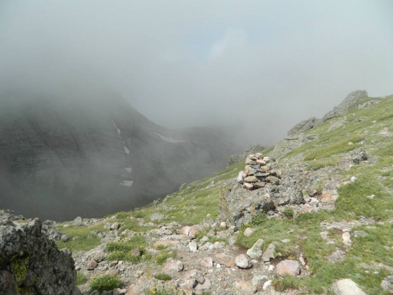
After spending about 50 minutes on the summit taking pictures and getting a snack, I headed back down, seeing some clouds forming way below. at about 9 am, I was back at the notch. Climbing down the Red Gully, I passed about 7 people coming up. I was back at the bottom of the gully at about 10 or 10:10. Passed two other people going through the valley at 10:30 or so.. I felt they were going up the Peak a little late. Trucking back up the Broken Hand Pass, I got to the top in a little less than 15 minutes from the bottom. (11:00, ~4.75 mi, ~4450 ft total gain) Again, the east side of the pass was relatively clear with some clouds overhead, but the west side was super foggy. From the top of the pass, I made it back down to camp again at about 12:15. (~6.6 mi, 4560 ft gain total)
Looking down the Red Gully Looking down the Red Gully A Columbine on the side of the trail Cottonwood Lake East side of BHP West side of BHP The trail to the Needle and the Peak
Crestone Peak is my new favorite 14er. It is an adventurous hike, going up and over BHP, around Cottonwood Lake.. Going up the Red Gully was beautiful. I felt very accomplished to climb this high, steep, small-summited mountain with spectacular views at the top.
Thumbnails for uploaded photos (click to open slideshow):
Pretty good for your first report, especially the specific elapsed time at each segment. Going to do this same climb in a few weeks, so the pics are helpful too.
Thanks! Roald, if you have any questions, feel free to PM me.
Davisrice4, both are great hikes. I'd suggest camping near the Lower South Colony Lake for doing either. Which 14ers have you done already so far? How fit would you say you are, and what level of climber are you?
The Needle is easier physically, but harder technically. It's basically a rock climbing wall, tilted at 45 degreesish. Lots of solid hand and foot holds in the conglomerate rock. I personally really enjoyed Crestone Peak, partly because it was a solo hike, the views were great, and it was just awesome. Most people, probably yourself included, might like the Needle better. (hopefully you'll get views other than fog on the top..) For the Needle, you climb up Broken Hand Pass, and STAY on the ridge and continue to the Needle. For the Peak, you go up and OVER the pass, down, around Cottonwood Lake and the Needle, and up to the Peak. Then coming back you have to go over the pass again. So it's a more physically exerting hike. It's less steep on the Peak than on the Needle. Still a lot of scrambling, though the gully is wider and there is a dirt trail in parts of it.
You'd want a helmet for both, and the route description AND pictures with you along the way for both, esp the Needle.
Davisrice4, I looked at your profile, and didn't see any 14ers listed. As you might know, the Peak and the Needle are two of the more difficult 14ers.
If your body handles high altitude well, if you are adventurous and physically fit, if you're comfortable with class 3 scrambling (going up fairly steep rocks, finding hand and foot holds, being okay with going down the same thing which is harder), if you are comfortable with some exposure (not a ton ton, but still very steep and you wouldn't want to fall in a lot of places), and if you have someone else going with you, (preferably someone who's experienced with 14ers), then I'd say go for it if these are your first two 14ers. I would not recommend these two as starter 14ers to most people, though. (I'm not sure of your experience, etc)
Make sure that you do a ton of route research for both, esp for the Needle. That thing is very rough if you go up it the first time without route pictures and the route description with you. I thought I could do it from memory, but that didn't work out. Fortunately, there were a few other climbers on the mountain who showed my friend and I where to go. Otherwise things probably could have ended badly, if not very frustratingly.
Make sure that the weather is good for either one. You would not want to be climbing up the rock on either when it is slick and wet, OR with thunderstorms.
Thanks for the advice, while I haven't done a 14er, i rock climb and can comfortably climb about 5.9. I've done lots of shorter class 4 pushing 5 scrambles with exposure. Im good with altitude I'm going in a group with others, same situation as me. I'm thinking I'd be good for either, and still debating between both. I'm leaning towards the peak though.
Thanks for the advice, I'm stoked on giving it a shot. I'm camping at south colony lakes friday and were going to climb it saturday.
This looked so cool the whole way up, only question is how bad is the exposed part after the gully? I just did Kit Carson and Challenger last week and want to get an idea of how much more scary for lack of a better word this route is.
Thanks so much, and way to go!
I actually haven't yet done Kit Carson and Challenger, so I probably won't have good beta on the comparison. Looking at the exposure rating for both, both are a 3 out of 6. So it's probably similar. After reaching the notch/top of the gully, you go west up the ridge to the top of the peak. For me, it was a little exhilarating (wow, big drops on either side!) But I didn't feel scared or jittery, because I was on pretty solid rock, with good holds, and not SUPER close to the edge. It was kinda exciting, being on a super tall, airy summit. Since the exposure rating's the same for Kit Carson (via Challenger) and for Crestone Peak, I think you'll be fine. :) It was basically steep class 3, but not quite class 4. I'm usually the one asking people to describe exposure, so it's a bit different when I'm the one trying to explain it haha.
Thanks so much man, seems like a good challenge, I think I will go for it and definitely use this trip report to help out.
Good luck on your future climbs man, and keep making great TRs!
I hope it goes well! Let me know if you have any questions. Make sure to check the conditions, or find out from someone who's been near/hiked up recently what the conditions are like. There's been a lot of snow in the mtns recently. (last Saturday people talked about snow and ice in that area).
It's not too bad.. just a lot of scrambling. Not as technical as the Needle (finding good holds, etc). Pretty long and decently steep up the Red Gully.
Caution: The information contained in this report may not be accurate and should not be the only resource used in preparation for your climb. Failure to have the necessary experience, physical conditioning, supplies or equipment can result in injury or death. 14ers.com and the author(s) of this report provide no warranties, either express or implied, that the information provided is accurate or reliable. By using the information provided, you agree to indemnify and hold harmless 14ers.com and the report author(s) with respect to any claims and demands against them, including any attorney fees and expenses. Please read the 14ers.com Safety and Disclaimer pages for more information.
Please respect private property: 14ers.com supports the rights of private landowners to determine how and by whom their land will be used. In Colorado, it is your responsibility to determine if land is private and to obtain the appropriate permission before entering the property.