Download Agreement, Release, and Acknowledgement of Risk:
You (the person requesting this file download) fully understand mountain climbing ("Activity") involves risks and dangers of serious bodily injury, including permanent disability, paralysis, and death ("Risks") and you fully accept and assume all such risks and all responsibility for losses, costs, and damages you incur as a result of your participation in this Activity.
You acknowledge that information in the file you have chosen to download may not be accurate and may contain errors. You agree to assume all risks when using this information and agree to release and discharge 14ers.com, 14ers Inc. and the author(s) of such information (collectively, the "Released Parties").
You hereby discharge the Released Parties from all damages, actions, claims and liabilities of any nature, specifically including, but not limited to, damages, actions, claims and liabilities arising from or related to the negligence of the Released Parties. You further agree to indemnify, hold harmless and defend 14ers.com, 14ers Inc. and each of the other Released Parties from and against any loss, damage, liability and expense, including costs and attorney fees, incurred by 14ers.com, 14ers Inc. or any of the other Released Parties as a result of you using information provided on the 14ers.com or 14ers Inc. websites.
You have read this agreement, fully understand its terms and intend it to be a complete and unconditional release of all liability to the greatest extent allowed by law and agree that if any portion of this agreement is held to be invalid the balance, notwithstanding, shall continue in full force and effect.
By clicking "OK" you agree to these terms. If you DO NOT agree, click "Cancel"...
Big Daddy Blanca + Ellingwood Pt. via Lake Como Road
I hiked Blanca and Ellingwood Point yesterday and here's the report.
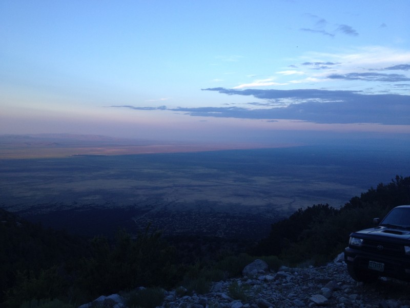
My day started at the wonderful time of 1:15am when I left my house in Aurora and headed south towards the Lake Como Trailhead. I hit Mt. Blanca Road (aka Lake Como road, but I'm calling it Blanca road to distinguish it from the rocky, terrible portion that I'll call Lake Como). I drive a Jeep Wrangler on 33's and a body lift. Driving in was insanely bumpy; it was the worst road I've ever driven on. Without a spotter, I didn't want to get myself into trouble higher up on the road so I parked at 8,800 feet and hit the road at 5:40am. The trek into Lake Como wasn't as bad as I expected, and there were some sights along the way...
First off, a shoutout to the Texas and Oklahoma cars that made it up to about 9,200 feet in a stock chevy and a stock nissan frontier. That's some driving right there. But you lose all of those points for completely ineffective food storage I wish I had a picture of it... They had the right idea of stringing a bear bag between two trees. The key is that those 2 trees are more than 6 feet high so that your bag isn't reachable from the ground needless to say, their bag was all torn up. That was a good laugh in the morning, but an uneasy laugh at that...
Next shoutout goes to the guy in the Tacoma at 10,100feet. Nice work.
Heading up to the Lake 10,100feet A little stream crossing
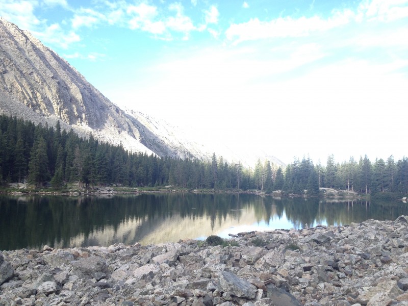
I made the 4 miles into Lake Como in 1 hour and 42 minutes. I stopped for some food and water, but was chased away by a swarm of mosquitoes. If you plan to camp, definitely invest in bug spray.
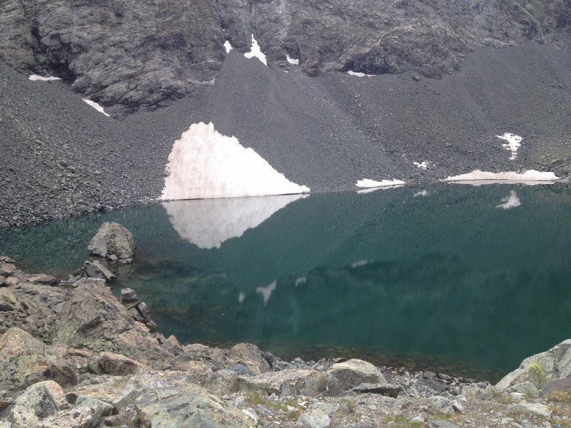
Lake Como
I chose Blanca first because I wanted to get the higher peak early if the weather looked threatening. The ascent is nice, mostly class 2 scrambling. The initial trail is well marked and easy to distinguish. However at 13,000feet it becomes slightly harder to discern. There are these "dummy trails" as you get closer to Blanca that go straight to one side rather than switchbacking. The switchback is the trail, but it looks like there's another trail that goes without turning. I passed several people, and eventually a large summer camp group (20 people). I blew past a switchback and ended up having to repass those people on the way to the summit. When in doubt, slow down and look for cairns, or the trail above you to aid in routefinding.
I also met an interesting guy on the way up Blanca who worked for the USGS. He was taking magnetic readings because apparently Blanca has a strong magnetic field around it. Maybe that is part of why it is one of the 4 sacred Navajo peaks... It sounded like pretty cool work. I would see him later on Ellingwood Pt.
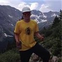
I pushed to the summit of Blanca to beat the Summer Camp group and had the summit to myself, that's a first. The summit was nice. It was almost too warm up there, I had been in a t shirt and shorts the entire hike, and did not have to put on another layer. I was on the summit after about 4 hours and 25 minutes of hiking, and roughly 7.3 miles in. While up there, I heard someone playing 'Amazing Grace' on bagpipes from Ellingwood Point. It was a beautiful experience. After a food and water break, I began the descent towards the Ridge.
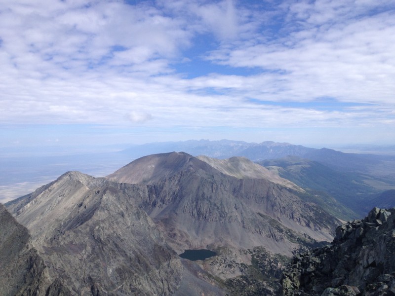
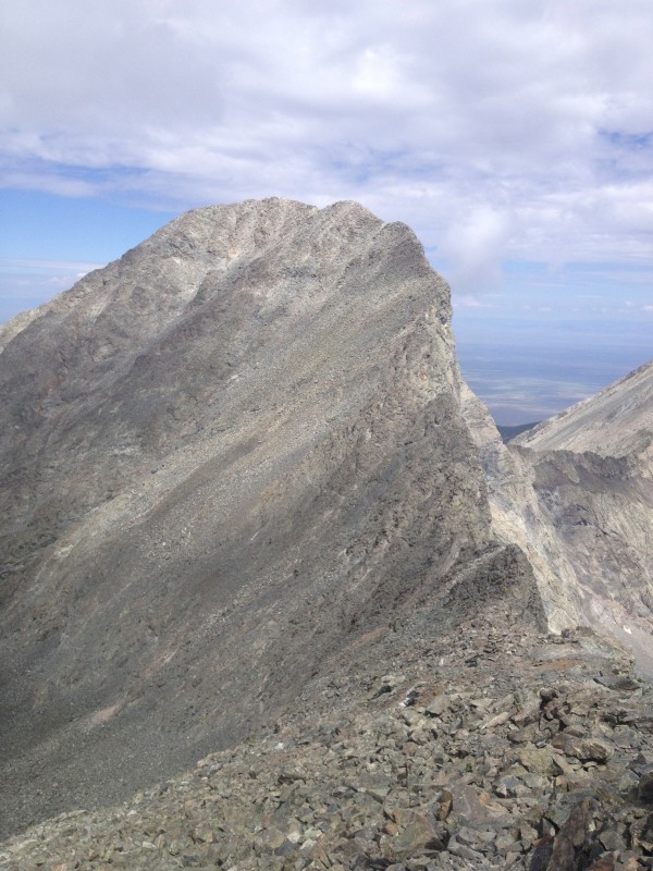
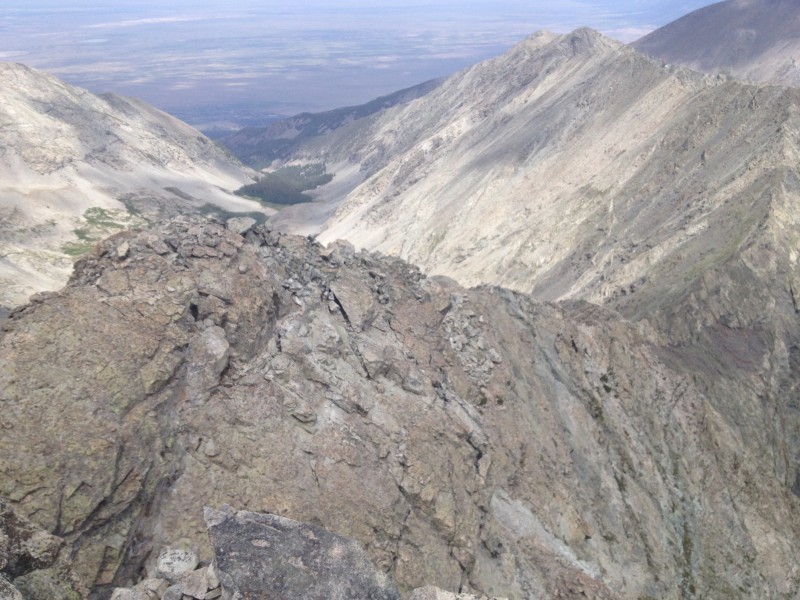
Summit of Blanca Looking at Little Bear Looking towards Ellingwood Pt.
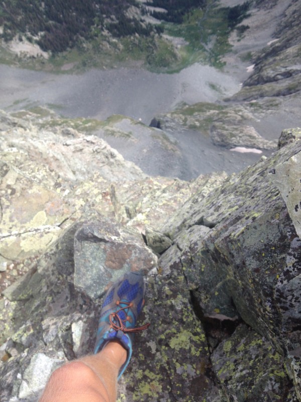
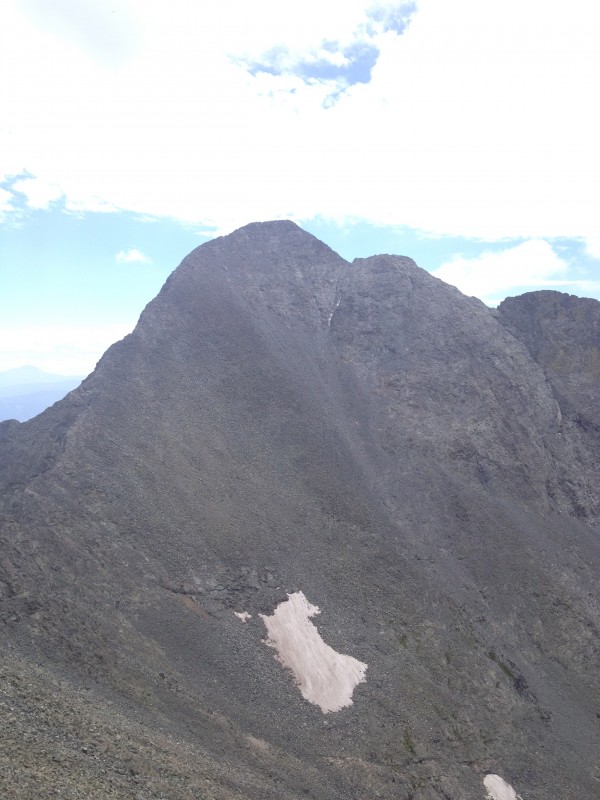
I chose to stay close to the ridge proper to make it a Class 3 traverse. The exposure off to the East is palpable. Definitely not something to mess around with. If you don't like exposure, stay lower on the ridge. The traverse was really fun, a nice class 3 ledge scramble. Some of the moves on the ledges have exposure to the west, but nothing too scary. I hate heights, and the exposure to the west didn't bother me. Being on the ridge and looking to the east was enough to keep you on your toes.
Just a little bit of exposure... A closer look at the Point
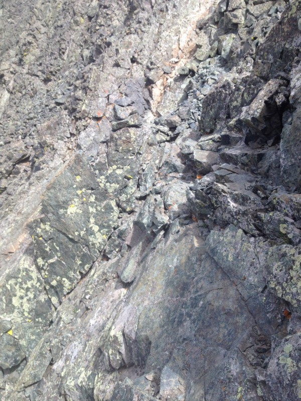
This was the most difficult ledge scramble on the way over.
Ledge Scramble Looking back down the valley
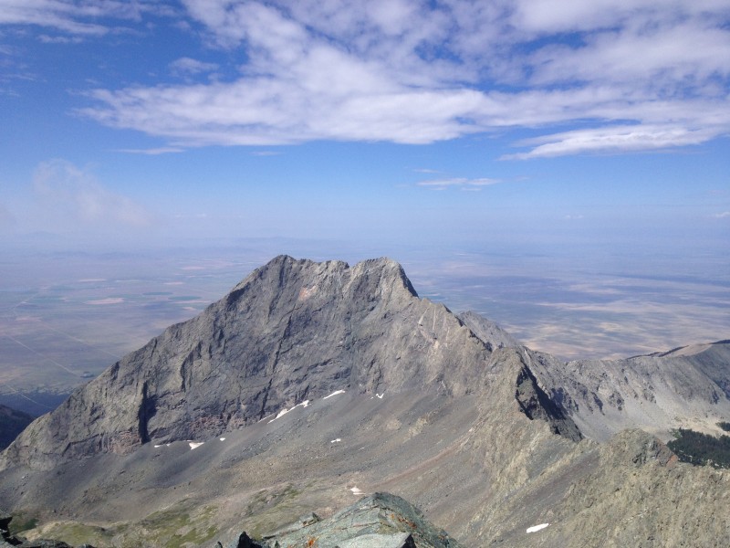
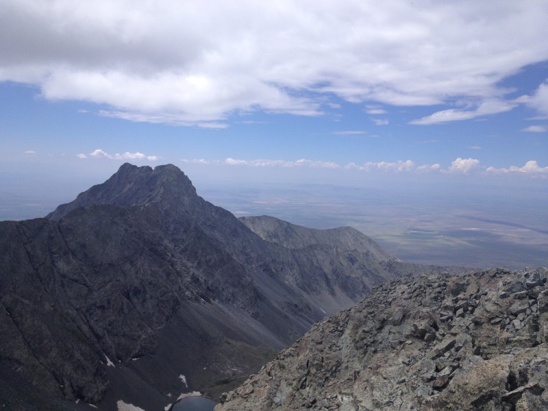
I made the summit of Ellingwood point in 5 hours and 30 minutes and about 8 miles in. The traverse was less than a mile. Mr. USGS was up there taking more readings and we chatted about 14ers and about the surrounding area. One of the neat things about Blanca is that it has about 6500feet of prominence out of the valley near Alamosa. This was my first experience in the Southern mountains, and there is a noticeable difference between the Sangre De Cristo range and the Front/Ten Mile/Mosquito ranges. I spied the Crestones... Maybe those will be my next adventure. After we chatted for a bit, we noticed that clouds were starting to form. That was my cue to start the march out.
Little Bear from Ellingwood North Ridge of Ellingwood The view of Blanca
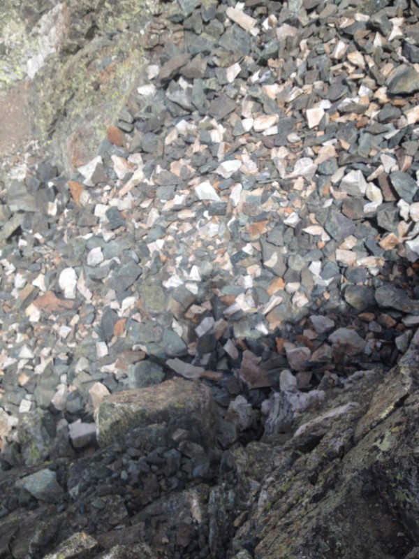
I took a more direct route to the main trail than just descending the ridge and heading down. I'm assuming that this was closer to the standard Class 2 route for Ellingwood Pt. Route finding is a little sketchy in places, but it doesn't really matter as the rock is solid and not all that angled. Be on the lookout for a ridge that connects from the Ellingwood Pt. trail, towards the main Blanca trail. It has some multicolored scree on it. The route back down to Lake Como was the same as the way up, minus the missed turns on the way up. It gets warmer as you descend, so be prepared to take off layers and put on sunscreen.
Crater Lake Look for this on the way Down
This is usually the point in B/E via Lake Como Road trip reports that everyone says they hate their life. The 4 miles down Lake Como Road back to my car weren't all that fun, but I was prepared for it which made it a lot easier. I drank all my water and gatorade to lighten my pack and set off down the road. It was probably 80 degrees and still sunny, so I worked up a sweat quickly. I made it to my car after 8 hours and 50 minutes and 15 miles of trekking.
The drive home sucked. I was on the road proper by about 3pm. I didn't get home until 8pm due to accidents all over I25.
Overall: Blanca is my new favorite 14er. Yes, the route up and down from Lake Como isn't all that fun. But the peak itself is beautiful, and the ascent from Lake Como wouldn't be too bad. If you're looking for mileage and vertical, this would be a good route for you as well. The Ridge is a nice introduction to Class 3 moves, especially because you have the option of staying lower and sticking to Class 2 if you aren't feeling the Class 3.
What to bring: Sunscreen is a must, due to the amount of time you'll be outside. Bug Spray if you're staying at Lake Como. I brought 110oz of liquid in and that was a good amount for me.
Thumbnails for uploaded photos (click to open slideshow):
I highly recommend a trip down there, it's an awesome change of pace from the mountains near Denver! If you camp at the Lake, it's a relatively short an easy day as well!
I was feeling good yesterday, plus I was a little hyped up on the sugar from Gatorade. The weather was beautiful in the morning which motivated me on the way up. And it began to look menacing on the way down which motivated me even more :lol:
"Maybe that is part of why it is one of the 4 scared Navajo peaks..." Scared, or sacred? In any case, nice work. It doesn't look like you were scared of the exposure at all!
In your opinion is the road to Como Lake Ok for a stock jeep wrangler? I am researching other web sites to determine if I should attempt the road or not. I want to camp at Como Lake but want to be able to take in more gear than I can carry. I suppose the road conditions change throughout the spring and summer and if it's ok in June it may not be ok in August...
If you are experienced and patient, you could make it to where that Tacoma was at 10,100'. However, it will be very slow/bumpy going. Even at 10,100' you're 3 miles from Lake Como. There are a series of rock bands that cover the road beginning at ~10,500'. These will be impossible without a 4+” lift and 35s along with a list of other mods. TrailDamage rates Lake Como Road as an 8 aka extreme. It is one of the most difficult 4wd roads in Colorado.
Caution: The information contained in this report may not be accurate and should not be the only resource used in preparation for your climb. Failure to have the necessary experience, physical conditioning, supplies or equipment can result in injury or death. 14ers.com and the author(s) of this report provide no warranties, either express or implied, that the information provided is accurate or reliable. By using the information provided, you agree to indemnify and hold harmless 14ers.com and the report author(s) with respect to any claims and demands against them, including any attorney fees and expenses. Please read the 14ers.com Safety and Disclaimer pages for more information.
Please respect private property: 14ers.com supports the rights of private landowners to determine how and by whom their land will be used. In Colorado, it is your responsibility to determine if land is private and to obtain the appropriate permission before entering the property.