Download Agreement, Release, and Acknowledgement of Risk:
You (the person requesting this file download) fully understand mountain climbing ("Activity") involves risks and dangers of serious bodily injury, including permanent disability, paralysis, and death ("Risks") and you fully accept and assume all such risks and all responsibility for losses, costs, and damages you incur as a result of your participation in this Activity.
You acknowledge that information in the file you have chosen to download may not be accurate and may contain errors. You agree to assume all risks when using this information and agree to release and discharge 14ers.com, 14ers Inc. and the author(s) of such information (collectively, the "Released Parties").
You hereby discharge the Released Parties from all damages, actions, claims and liabilities of any nature, specifically including, but not limited to, damages, actions, claims and liabilities arising from or related to the negligence of the Released Parties. You further agree to indemnify, hold harmless and defend 14ers.com, 14ers Inc. and each of the other Released Parties from and against any loss, damage, liability and expense, including costs and attorney fees, incurred by 14ers.com, 14ers Inc. or any of the other Released Parties as a result of you using information provided on the 14ers.com or 14ers Inc. websites.
You have read this agreement, fully understand its terms and intend it to be a complete and unconditional release of all liability to the greatest extent allowed by law and agree that if any portion of this agreement is held to be invalid the balance, notwithstanding, shall continue in full force and effect.
By clicking "OK" you agree to these terms. If you DO NOT agree, click "Cancel"...
On Friday, July 18, 2014, my dad, brother, and I set out for Wetterhorn. If you read my previous trip report on Snowmass, you know that we climbed it the day before. We are all mid-western flatlanders and have limited time in Colorado. So, we have to pack in what we can while we are in the mountains. After making the long trek out of Snowmass and back to our vehicle, we drove to Montrose, CO and arrived at the Econo Lodge around midnight for a quick night's sleep. The next morning we were up at 7:00AM and drove the hour and a half to the trailhead for Wetterhorn, arriving around 8:30 AM. This is completely abnormal for us to start a 14er so late in the morning but we were exhausted from the previous day and still wanted to accomplish Wetterhorn. By the grace of God, the weather was absolutely perfect the entire day! When we arrived at the trailhead, there was a large group of younger folks getting ready to set out on the trail. We managed to get our gear together and were off shortly thereafter.
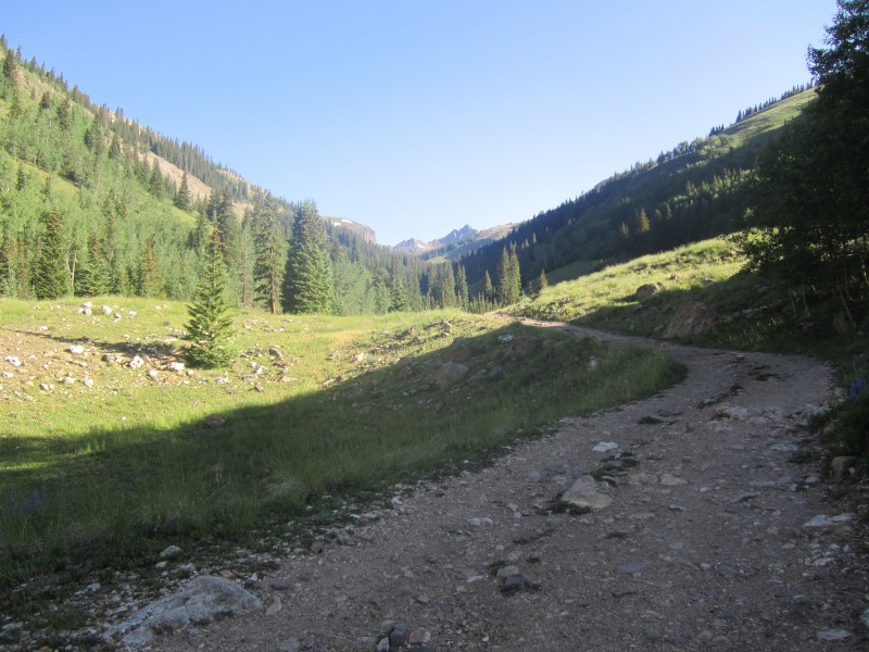
We parked at the lower trailhead as we didn't have a four wheel drive vehicle to make it up the extra .6 miles to the upper trailhead. This is no big deal as the scenery is beautiful and the road works well for hiking. It's a leisurely stroll up the four wheel drive road.
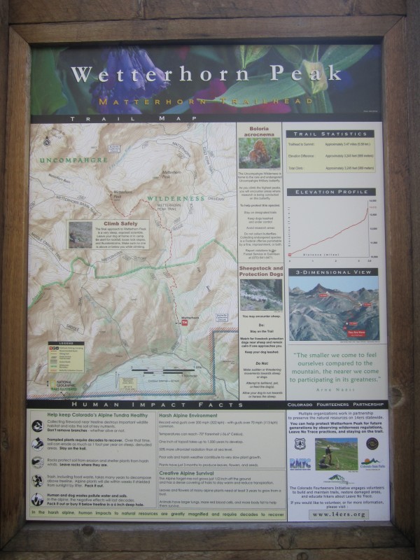
Once you make the upper trailhead, you will find this sign:
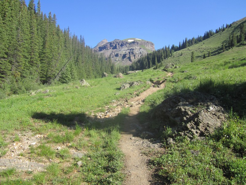
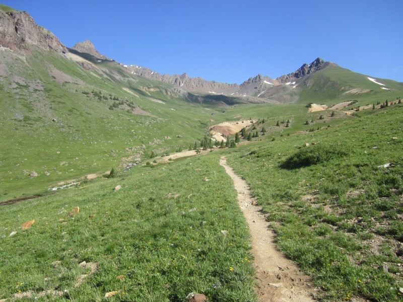
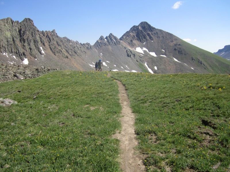
The hike into the drainage is one of the most beautiful hikes I've done with green grass, wildflowers, and a magnificent trail. I must say that the trail up Wetterhorn is one of the best trails you will ever find on a class 3 14er in Colorado. This is a picture taken coming out of the forest. You will head to the right of the peak ahead, which is blocking your view of Wetterhorn at this point.
The trail continues around to the right of that knobby peak
and then heads into the bowl where Wetterhorn becomes visible on the left side.
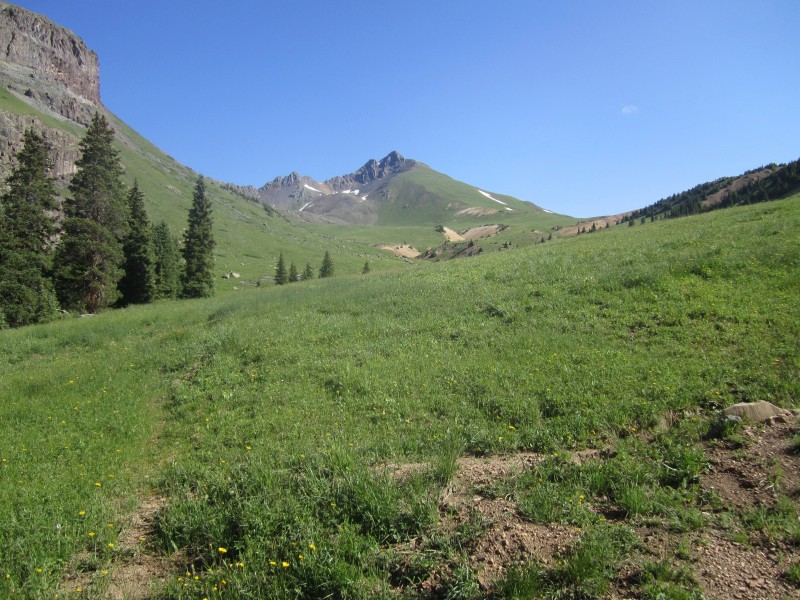
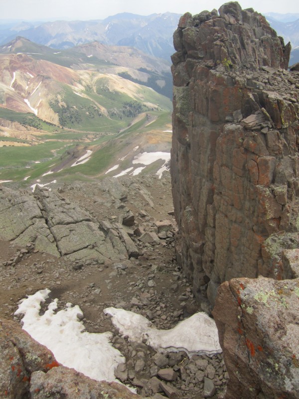
The further up you go in the bowl, the better view you will get of Wetterhorn:
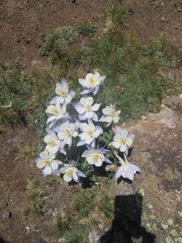
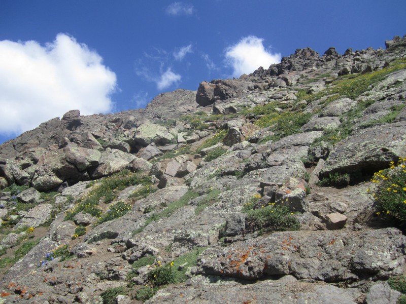
You remain on the green grassy trail for a while until you hit what I would call a grassy boulder field. The boulders are all perfectly spaced out to allow green grass to grow. The trail winds its way up through this and it's a pleasant hike with columbine flowers all around. There are a few snow patches in here but nothing that you have to cross.
Columbine on the way up:
This is more of the great trail that winds its way up through the grassy boulder field:
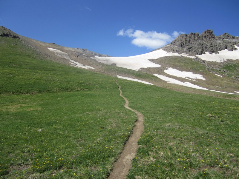
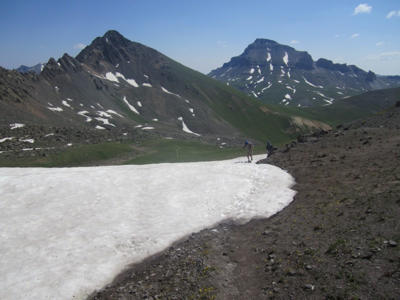
Once you reach the top of the grassy boulder field, the trail mellows out again and heads through a beautiful grassy area as you begin to gain the ridge:
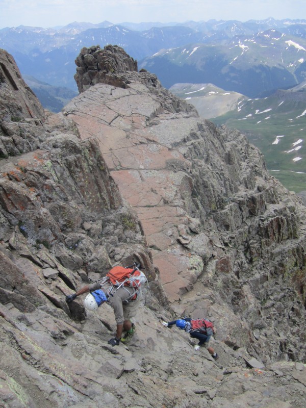
This is a picture looking back on the trail as my dad and brother make their way up from the grassy boulder field to the grassy area just below the trail heading up to the ridge:
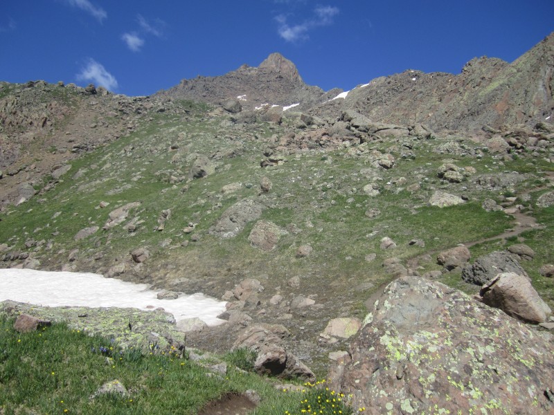
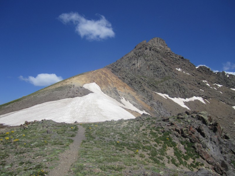
On July 18, there was still one patch of snow on the way up to the ridge that you have to cross. It was very easy and we just walk right across it with no microspikes, crampons, or ice axe being used:
Once you reach the saddle on the ridge, this is your view. You can see the second snow patch you must cross without any real good way of going around. This one happens to be steeper and right on top of the trail. Still, we did not pull out any equipment but just walked straight up. We had people in front of us that had dug out some steps which made it pretty easy.
Above the snow on the ridge, you run into a steep dirt/scree slope that had me taking one step up and sliding two steps back.
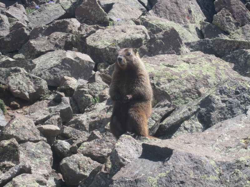
Just above this location, a marmot watched us as we hiked by and enjoyed all the attention from the climbers:
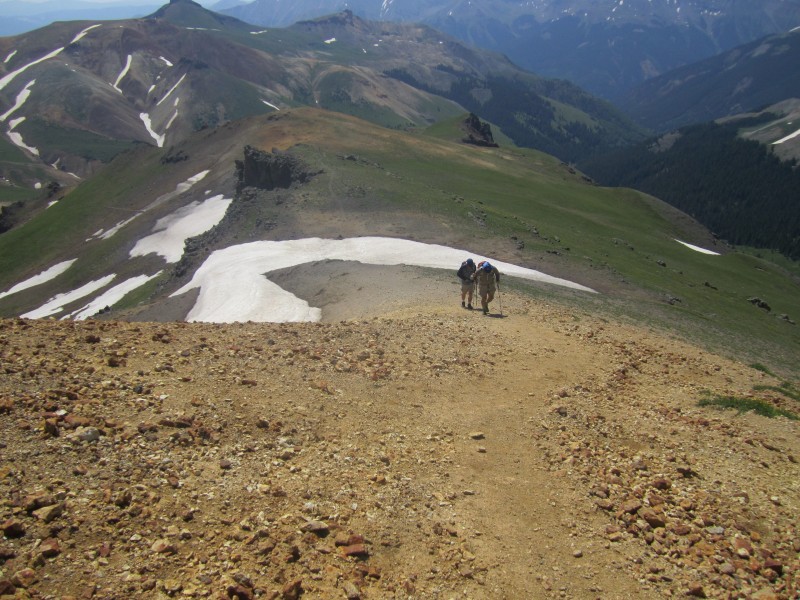
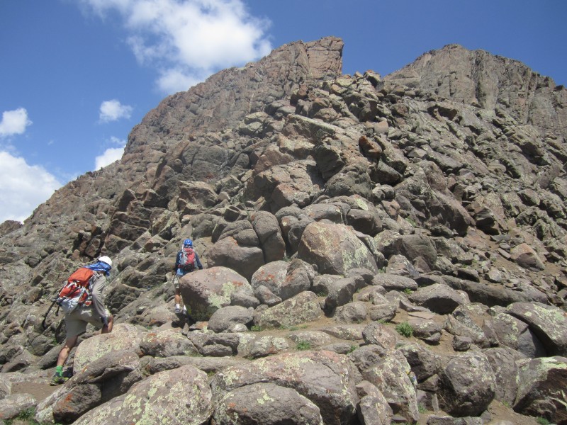
There is still trail to follow as you head up the back side of the ridge to the summit:
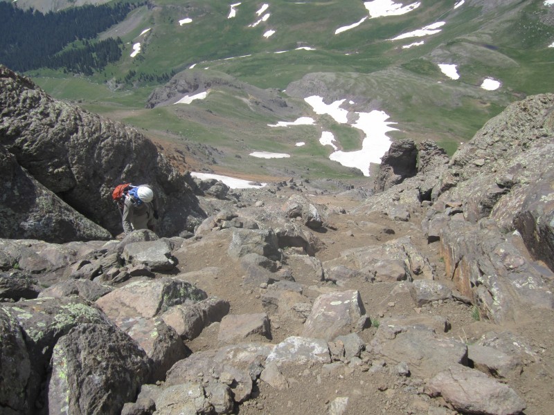
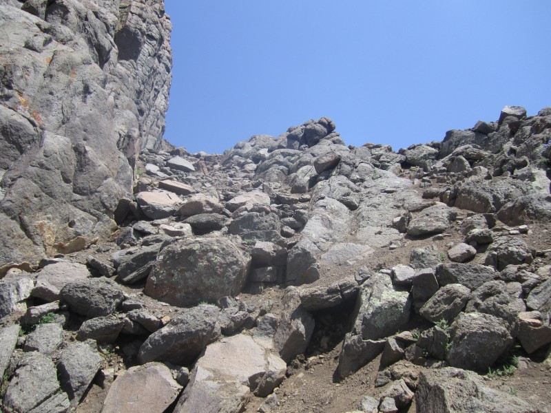
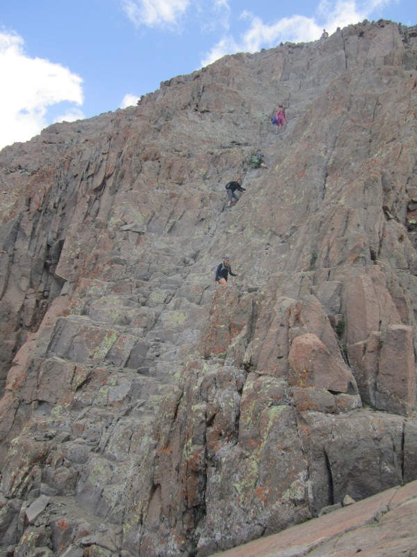
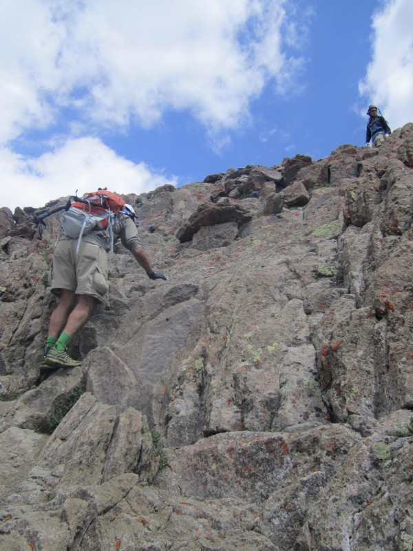
Your first major obstacle on your way to the summit is a steep gully that takes you up to what is called the "V Notch" The gully has loose dirt and rock:
The gully ends with a narrow chute that takes you up to the "V Notch" This is a neat part of the mountain as you have big rocks surrounding you on all sides and you must climb through the "V Notch" to get out.
When you get to the top of the gully, you turn left and you see the "V Notch." This is my brother checking out the view of the next obstacle before heading through the "V Notch."
Here is some video showing our scramble through the "V Notch"
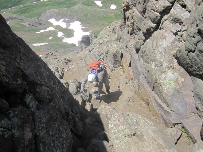
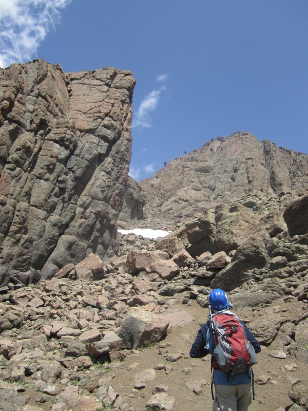
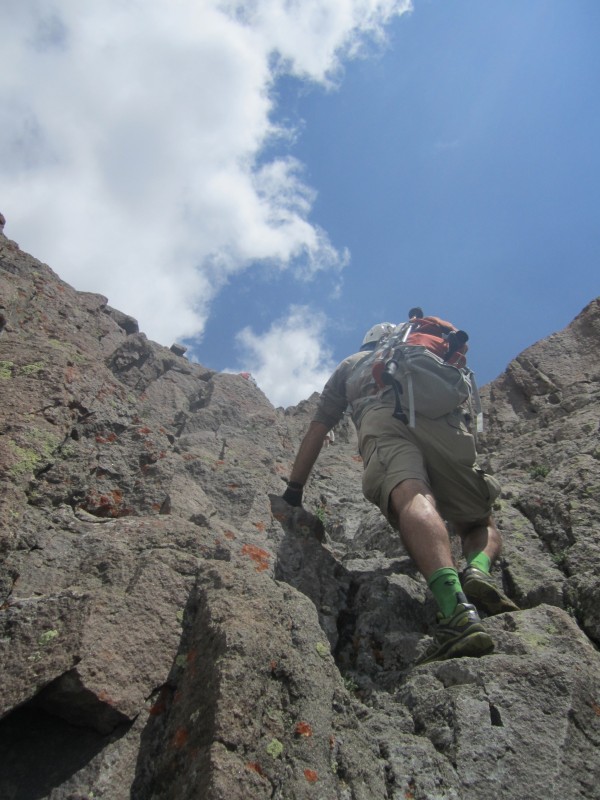
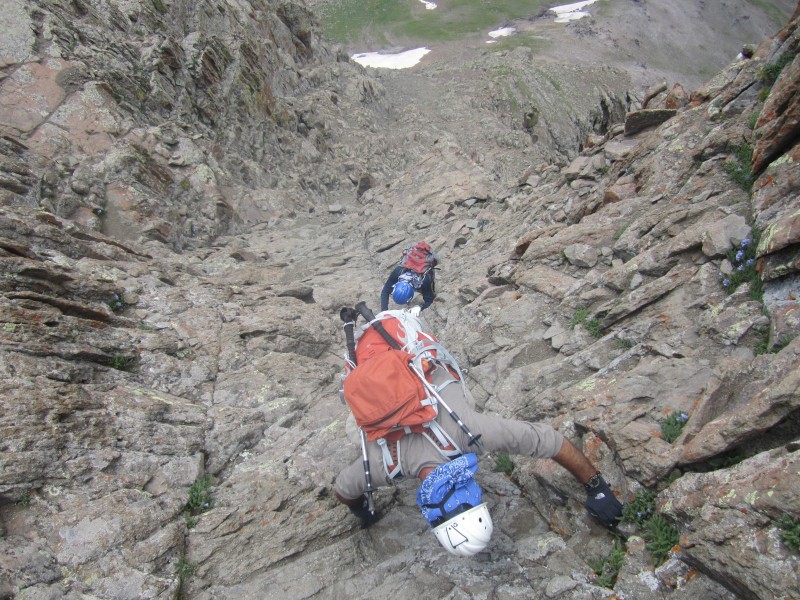
After the "V Notch," you will scramble around the rocky knob pictured and head for another gully:
Here is the next gully. For the most part, the rock is good and the climb is fun.
This is a picture looking back from up in the gully. The views are magnificent if you take the time to turn around and enjoy them!
This is a picture at the top of the gully looking at the "Prow" on your left. You will go around it to the right and into a very interesting open and fairly flat area, high up on the mountain.
Once you are in the open area with the prow towering over you, it's time to make a fun class 3 pitch up and out of this area into the final summit pitch staging area.
This is a picture looking back from the top of the pitch shown in the previous picture to the area just below the "Prow."
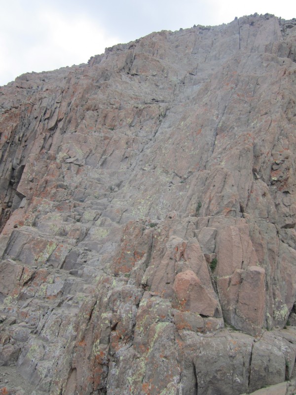
Once you reach this point, you are standing just below the final summit pitch. Everything up to this point has been fairly easy, fun, and smooth going. The final summit pitch is what makes Wetterhorn an exciting mountain to climb. This pitch makes the mountain worthy of being "class 3" with exposure. When you stand at the bottom and watch the folks coming down, your heart skips a beat and your stomach hits the ground. It is intimidating and looks very dangerous. There is a nice slanting rock that is smooth for you to sit on and watch anyone else maneuvering the final pitch. This is the view you have from that slanting rock of the final pitch:
Here are some folks watching others come down the final summit pitch:
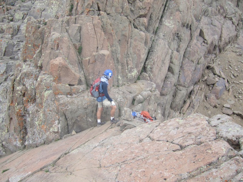
To begin the final pitch, hike down a little bit to a shelf at the bottom of the pitch. Begin climbing there. Here is a picture of that shelf at the bottom:
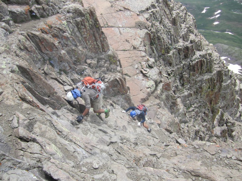
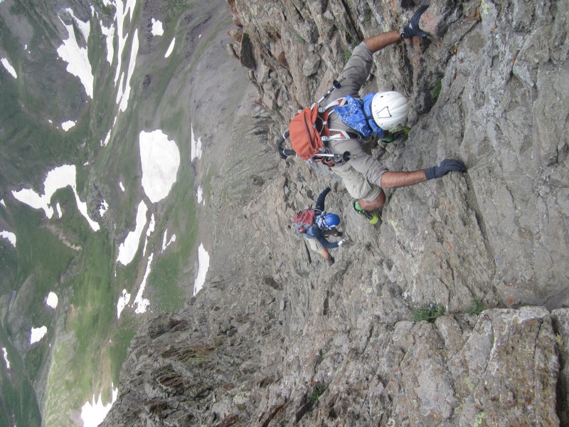
Here is a picture of my dad starting up the final summit pitch:
Here is another shot of my dad and brother coming up:
About 3/4 of the way up there is a shelf that you can stand on. This shelf leads you to the left across a rib on the cliff and over to some easier rock to make the absolute last 30 foot pitch to the summit. Here is a picture of the last 25-30 feet up to the summit where my brother is standing.
This is some video taken above the shelf 3/4 of the way up, making the final summit approach:
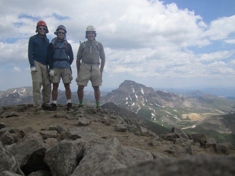
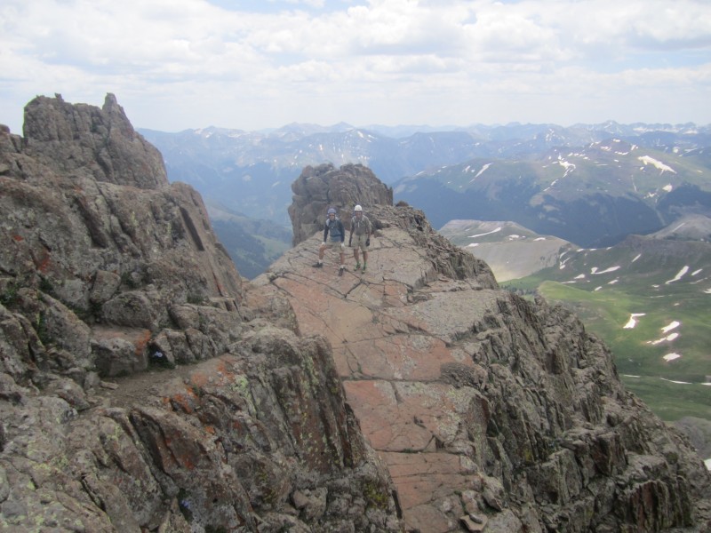
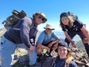
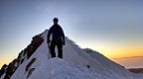
You are now on top!
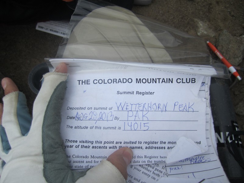
Here is the log book to prove it!
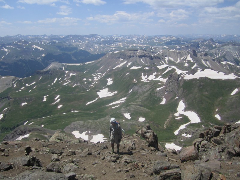
Summit Panorama
Here is a shot I took on the way down with the camera extended out over the climbers (Ok, so the steepness is exaggerated a little
And it's really exaggerated on this one:
Ok, this is more to reality:
Here is the video of the climb down the final summit pitch right off the summit:
Here is a video showing their climb down for the rest of the summit pitch:
Here is a shot I took of my dad and brother who are both down the summit pitch while I'm still up on the shelf (I took a lot of video and pictures and so I was a little behind)
Once all three of us were back down to the bottom of the final summit pitch, you must go back down that 10 foot pitch to get back into the area where you are under the "Prow" and out of the final summit area.
One final look of the final summit pitch with nobody on it:
As I stated in the beginning, Wetterhorn now probably ranks as my favorite 14er thus far. She is #51 on our list! The entire climb was beautiful with pretty good rock, several fun portions of class 3 climbing, and the final summit pitch to top it off. The exposure is there at the end but I never felt unsafe or that I couldn't make it to the top. We had a fabulous day with great weather. I can't say enough about how good the trail is almost all the way to the first gully on the ridge. You just can't do better than that on a class 3 14er!
My GPS Tracks on Google Maps (made from a .GPX file upload):
Nice trip report, and from a fellow flatlander well done!
I was with a group that went up the following day and we shared a similar experience. The exposure was never a factor until the descent, which we all down climbed with our back to the mountain and the airy exposure staring us right in the face. It seemed a little more real at that point :shock:, but still was never really an issue. Definitely ranks towards the top of my list, but I'm not even close to 51!
I really appreciate this trip report brother, I am planning on going up this peak next summer and your pics and videos are, and will be a big help! Thanks again and congrats on 51!!!
Thanks for sharing. I was up there two weeks ago, and kind of wish that I wasn't so overly focused on the Class 3 stuff, to the point where I barely touched my camera between the ”yellow dirt” and the summit. I love your pictures of the final pitch. I'm not surprised that someone with 51 fourteener summits ranks Wetterhorn as #1. It became my instant favorite, and I don't see it being displaced anytime soon. Nice job.
I have enjoyed your all your reports written over the past few years. They bring back memories of this flatlanders trips back in the seventies. Keep climbing and posting and praising GOD. Thank you again.
I know what you mean about not touching the camera. I used to not to but now I feel compelled to give people a good idea about the class 3 and 4 sections so they know what to expect. Next year we are doing Capitol and I plan on documenting that trip.
Next week I am heading to Telluride flying from Washington DC to Montrose. I am using your excellent trip report from last year for Wilson Peak and will use this one for Wetterhorn. Your detailed descriptions of every critical juncture is very informative and most helpful to mentally climb a mountain before actually stepping a foot on the trail. I must say that having your dad accompanying you and your brother is very warming and touching!
I try my best to help people get a good idea of what is to come. Next year we are doing Capitol and I plan on detailing more about that mountain than anyone ever has in the past. Enjoy Wilson Peak and Wetterhorn!
My dad is the one who got us started when I was 8 years old. That was 23 years ago. We have been knocking off 1-3 14ers per year since then. Have fun!
Awesome! I enjoyed this as well as your Wilson TR. I'll be using that for my trip to the Wilson group in a few weeks. Capitol is gonna be on of your favorite soon, let me know if you need any beta!
Caution: The information contained in this report may not be accurate and should not be the only resource used in preparation for your climb. Failure to have the necessary experience, physical conditioning, supplies or equipment can result in injury or death. 14ers.com and the author(s) of this report provide no warranties, either express or implied, that the information provided is accurate or reliable. By using the information provided, you agree to indemnify and hold harmless 14ers.com and the report author(s) with respect to any claims and demands against them, including any attorney fees and expenses. Please read the 14ers.com Safety and Disclaimer pages for more information.
Please respect private property: 14ers.com supports the rights of private landowners to determine how and by whom their land will be used. In Colorado, it is your responsibility to determine if land is private and to obtain the appropriate permission before entering the property.