| Report Type | Full |
| Peak(s) |
Humboldt Peak - 14,068 feet |
| Date Posted | 07/24/2014 |
| Date Climbed | 07/04/2014 |
| Author | Lville |
| Gonna see the 'Stones |
|---|
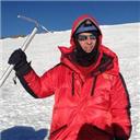
Intro... well, not the Rolling Stones, but every bit as cool as Keith Richards with a cig dangling from his blue lips. And the actual hike was on Humboldt, not the Crestones. So exit now if there was any confusion. Or stick around and enjoy my hike with me! I was on a roll with my 14ers so far this summer as I hit Yale, CaLiBron, and Humboldt on consecutive weekends bringing my number to a more respectable 15. But this one was easily the most exciting of the season to this point as I had never been into the Sangre de Cristos, and the Crestones were like Rock Stars that I was finally going to see in person. I would have a front row seat from atop of Humboldt Peak. StatsTrailhead: 5:25 AM. South Colony Lakes, West Ridge standard approach from upper 4wd TH at 9950. Top: 9:47 AM Depart 10:23 AM Trailhead: 2:00 PM (lots of conversations, pics, and meandering around side trails near the lake and stream) Weather: comfortable temps, no rain, perfect blue skies in AM, some gathering clouds late AM. Some wind in parts but nonexistent at top! Elevation: 9950 to 14064. 4200 elev gain Distance: 11 miles RT PrepIt's kind of fun debating with myself about which mountain(s) to do next and I definitely needed another fix for the July 4 weekend. I have most of the Front Range done, not quite ready for the Elks, and wanted to wait for full melt for a trek to the San Juans. The Sawatch is OK and my list is quite sparse there, but when I heard that Humboldt was completely melted out, it became a no-brainer to head down to Westcliffe. Humboldt Peak itself was fine, but I was most excited about traveling on some unexplored roads on my way to Westcliffe, a visit to a new mountain range, and a good look at Crestone Needle and Peak which I hope to summit perhaps later this summer. I also considered backpacking in to the South Colony Lakes to test myself with 40 lbs on my back in preparation for the Crestones later, but I arrived too late in the day at the trailhead. I checked out the weather report obsessively which I guess is good - hey, I wonder if the impossible-to-predict weather three days hence has changed in the last five minutes, better check it. The report was fairly typical for July. I wanted ideally to drive Thursday, hike Friday and return home to Louisville by Friday evening. I was kind of bummed when the report said "60% chance of rain mainly before 10 AM" (instead of the usual "noon"), but by Thursday, "10 AM" had been replaced by "noon", and I was good to go. It never did rain on me and I felt like I could relax at the top at 10 AM and not hurry down. But I guess there was one cloud over the 4wd parking lot that let loose with some hail while I was gone. 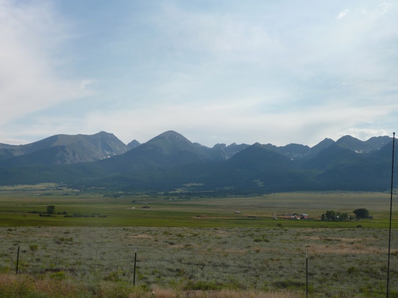 The Drive - Thurs 7/3/14The scenic drive to the Custer county seat of Westcliffe was everything I expected. The sister city of Silver Cliff just to the east, despite having the two words split and missing the silent "e", really feels like the same town. I didn't think it wise to take the spelling issue up with any of the good residents of either town as it didn't seem like the kind of place that would take kindly to outsiders pointing out inconsistencies in the spelling of their 100+ year-old town names. I just waited until I returned home to partially satisfy my curiosity on Wikipedia, so you can go there for more details. The towns were marked by a smattering of a few downhome motels and restaurants and the general absence of fast food - not that that's a bad thing. I heard there was a Subway but I didn't see it. There was a well-stocked grocery store, and I don't know exactly how many folks reside in the two towns, but half of them seemed to be in line in front of me at the checkout register. In any case, the twin cities surrounded by farmland seemed like a nice place and was rather picturesque. The drive in my F150 up the final few miles to the TH wasn't too awfully bad, though I can see why a number of two-wheel drives and some fours would choose to park below, adding 5+ miles RT to the hike. I actually drove most of it in two-wheel, but I eventually went to four, and there were a couple of spots where I stopped and had to consider carefully the best line. Much of the drive up was marked "private property", so I'm not sure if there were many good spots to pull over and park if the going gets too tough. There seemed to be ample places to pass (I passed no one on the way up and two very considerate drivers on the way down). For some strange reason, I took no pictures of the road. This massive representative conglomerate boulder served as the welcoming center well before the going got rough. Standing alone, it was more likely shoved into place by an alpine glacier than the townfolk. 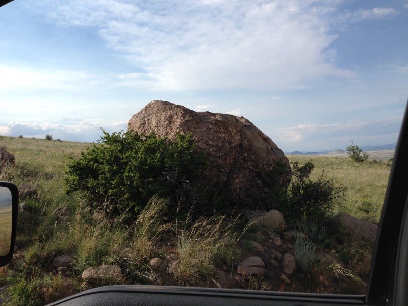 CampingParking spaces were plentiful on a Thursday July 3 evening - half of the maybe 25 or so spaces were taken, with a few dispersed camping sites nearby. As I knew there wouldn't be too much more traffic that night, I chose to pitch my small tent in the parking lot next to my truck to maximize my chances of a quick getaway in the morning, or perhaps a hasty escape to my truck in the event of foul weather or ill-humored wildlife. I was looking forward to testing out my new Jetboil with a package of yummy dehydrated something or other when my plans were changed by a very welcoming three-generation family who had already set up camp nearby. Elizabeth - a grandmother from Georgia, her son John from CO, and his very bright four year-old daughter Ansley offered me what was left of their evening meal which proved to be both substantial and tasty! I sure enjoyed the southern hospitality and I was happy to save my dehydrated meal for another time. Ansley may not appear to be a happy camper in the picture, but that's just because I had to borrower her grandmother (who you'll agree looks more like John's sister than his mother) for the shot. I had to chuckle when she whispered quite audibly into her father's ear that I was "shy", which didn't make a lot of sense to the adults as I was up there eating their food and yakking away, but it was very cute. Part of the fun of these hikes is meeting friendly people. 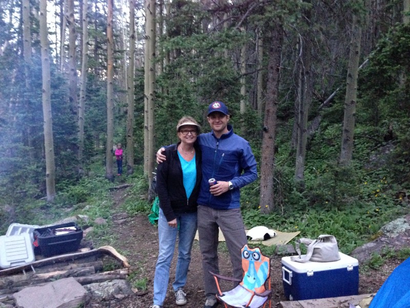 My head hit the pillow at 10 and I slept as well as could be expected in the wild, two feet from my truck. Save for the car or two that arrived in the wee hours, the night was as silent as the "D" in Humboldt. I love my tent. I bought it with the intent to backpack which I haven't yet done, but I justify the expense by the money saved on motels, and I can hit the trail quickly. Though not that quickly as it still took an hour to get going after my alarm went off at 4:20 AM. There were two other groups preparing to leave and I hoped to follow along - if not formally join up - but I just couldn't get ready in time. Maybe it's a subconscious need to wait until the sky is light to start my hike. The Hike - Fri 7/4/14Banana-nut muffin ingested, I hit the trail at 5:25 AM with just enough light that I would have a several second warning in the event of predator attack. The walk was enjoyable, even if the first 2.5 miles to the old 4WD TH is road-like, and I couldn't wait to get a shot of the 'stones that I knew awaited me. As a bonus, I finally figured out how to wear my backpack properly. My shoulders ached more than usual and I kept fidgeting trying to take some weight off my right shoulder. I finally yanked on the darn belly strap hard until I couldn't breathe. That did it! Lots of weight miraculously transferred from shoulders to hips or back or butt or belly or something. After catching my breath, I realized that it just needs to be tight down there and you just need to breathe higher up in your chest which is where I think your lungs are anyway. 30 minutes into the hike, I finally caught a glimpse of the Needle. 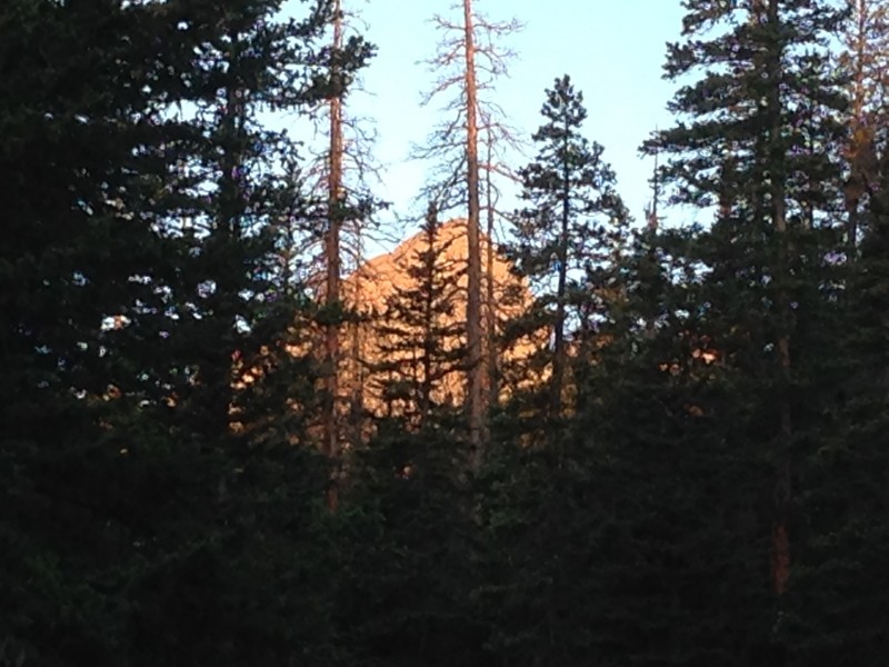 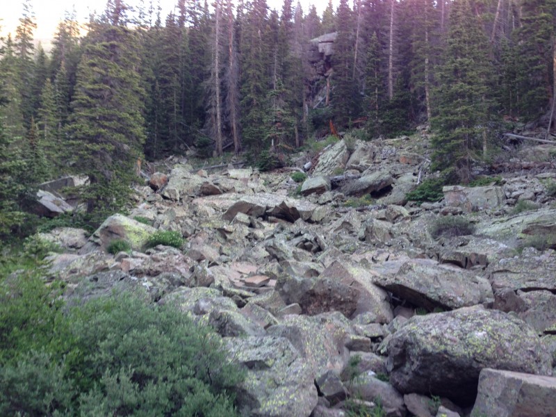 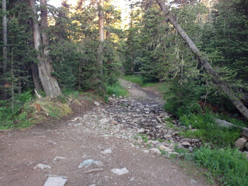 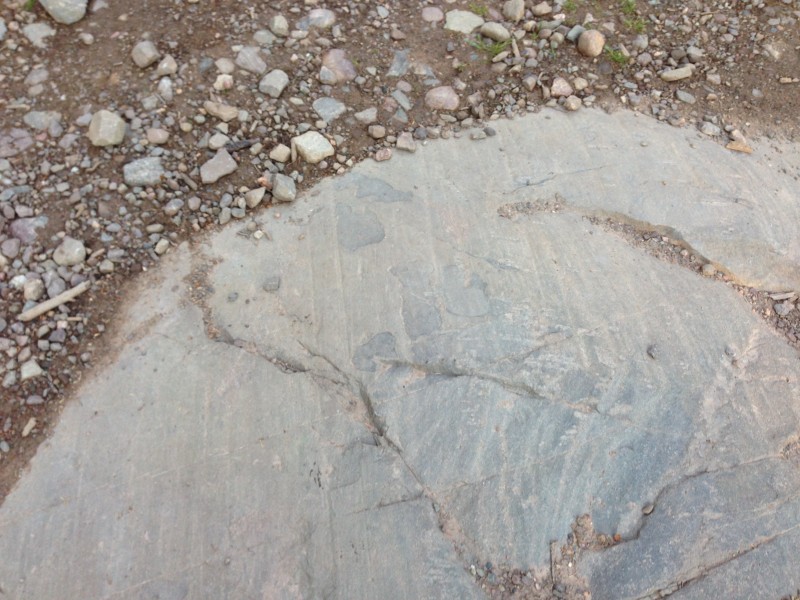 With a few level areas which allowed me to catch my breath, I made good time to the old TH at maybe 11K, arriving at 6:35, where I found three informative signs including one about hiking/climbing pioneer Eleanor Davis. 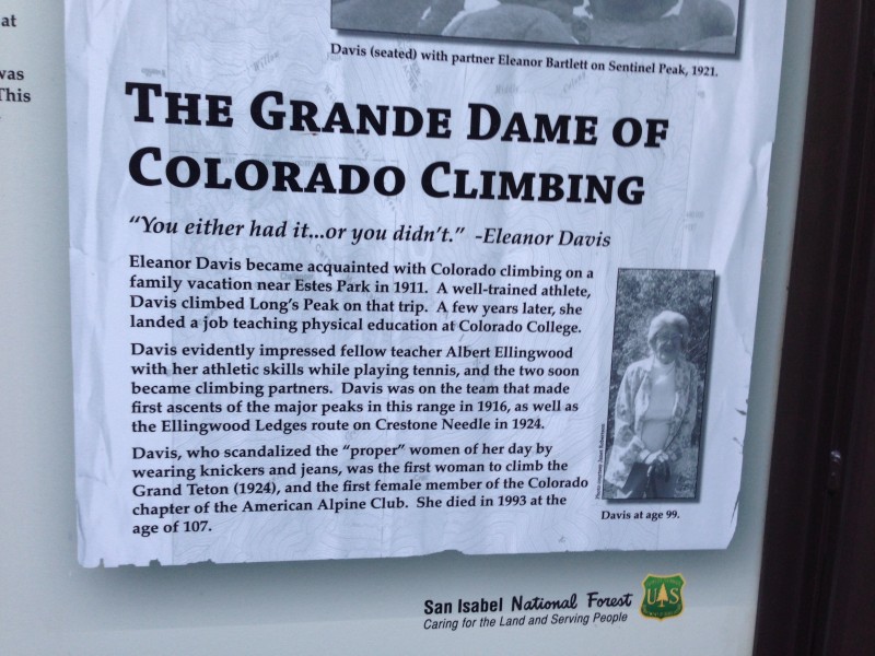 And one more sign a few steps later showing the way. BTW, the layout of the "direction" sign perplexed me What does this sign mean? Does the "Humboldt Peak" belong w/ the right arrow or the left one? Am I maybe already *on* Humboldt Peak? Should I turn around now and head back? Geezus. I now have empirical evidence that the "right" arrow applies to the first three items and the "left" arrow to the final two. And of course the sad sign about the missing hiker from last year. At this point, the "old" 4WD trail turns into a regular path, and Humboldt could be seen clearly to the right. Thank goodness for that. Energized, I moved on up the trail.  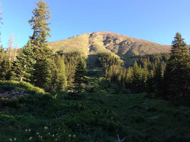 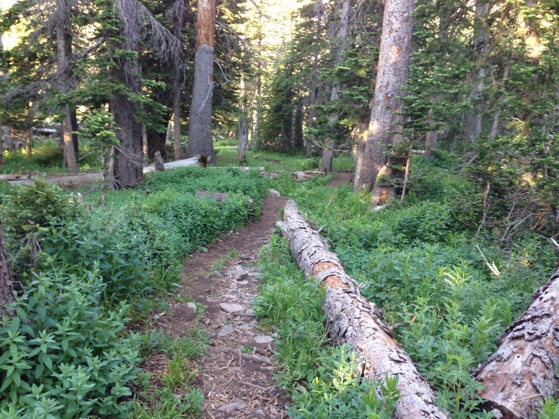 As the trees continued to thin, the views of the Crestones became unobstructed, and I stood in awe and snapped some shots as they were framed against a perfectly baby blue sky. And I observed Broken Hand Peak and Pass, about which I had read so much in other trip reports. The trail to the pass appeared to be much steeper than I had expected from photographs. Also a fair amount of snow still in it. I caught up with the couple who had left just before me by the name of TJ and Denise from Golden and their dog Blue and I enjoyed their company for the rest of the trip up to Humboldt. Between the four of us, I think we figured out why it's called "Broken Hand". 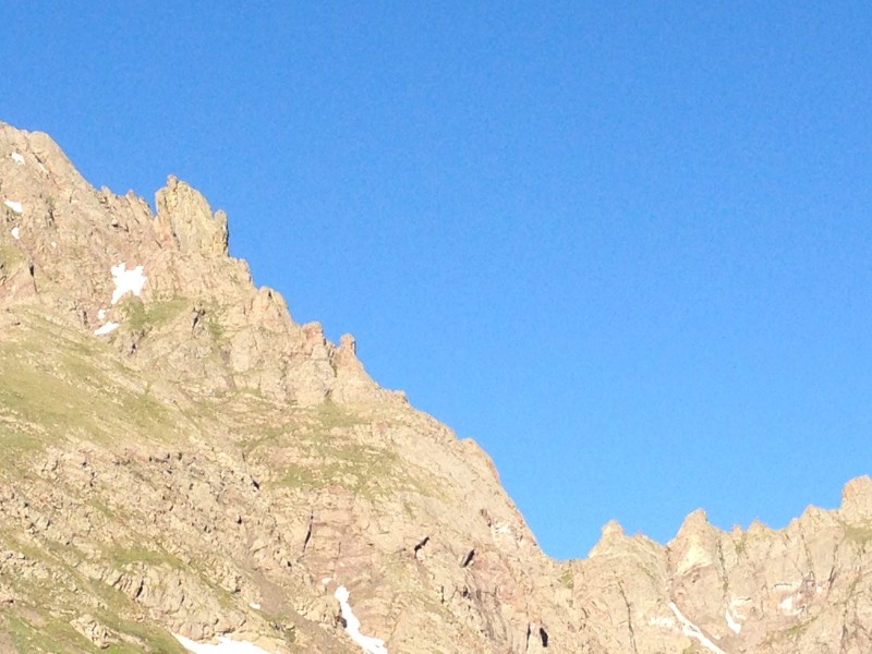 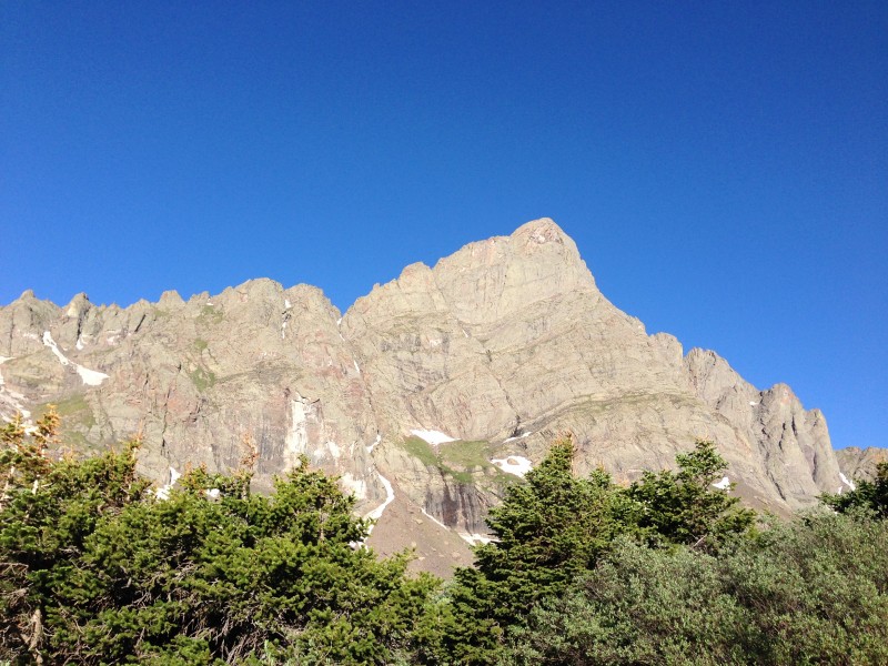 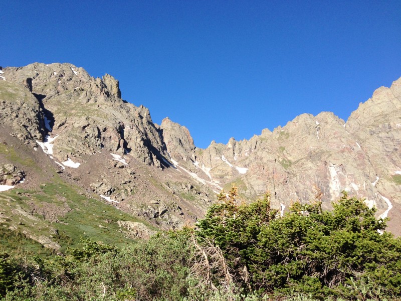  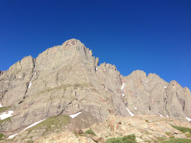 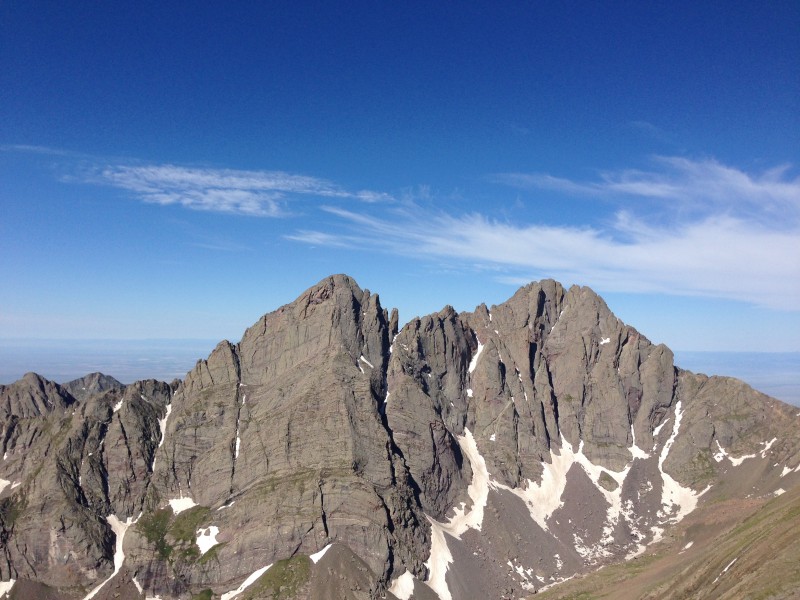 Together, we headed north up the switchbacks from 12K to 13K to the saddle, and then cut back east along the ridge for the final push. This portion of the trip was more fun than most because of the views of the Crestones, the lakes, and the other peaks that I could start to identify as we gained elevation. 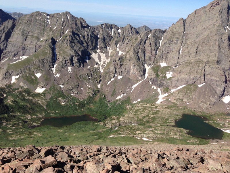 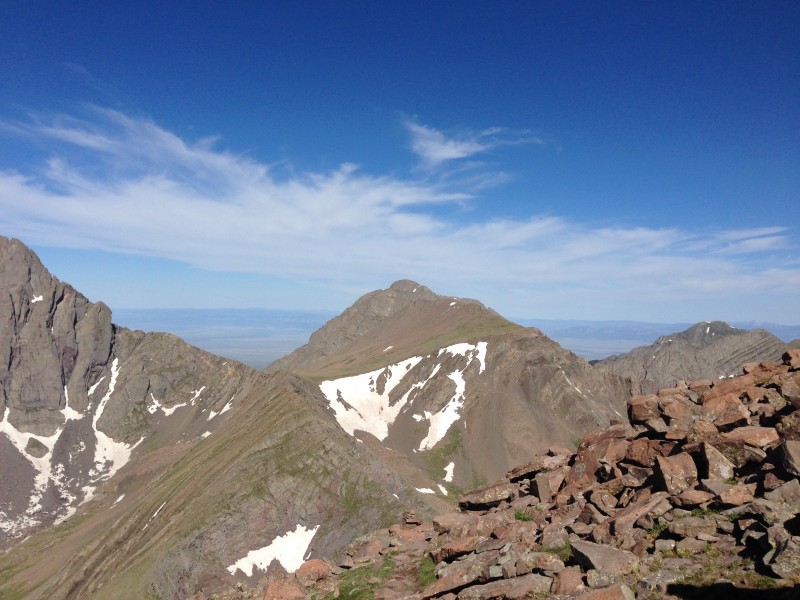 The trail became hard to follow at one point as there was a fair amount of scrambling near the top, but nothing too difficult. Just go up. There was a false summit, but the actual summit was quite close. We arrived around 9:45a and were maybe the second group up that day - at least from the more popular west side. Might have passed another 10-15 people on the way down who were headed up. 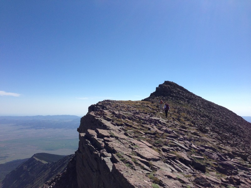 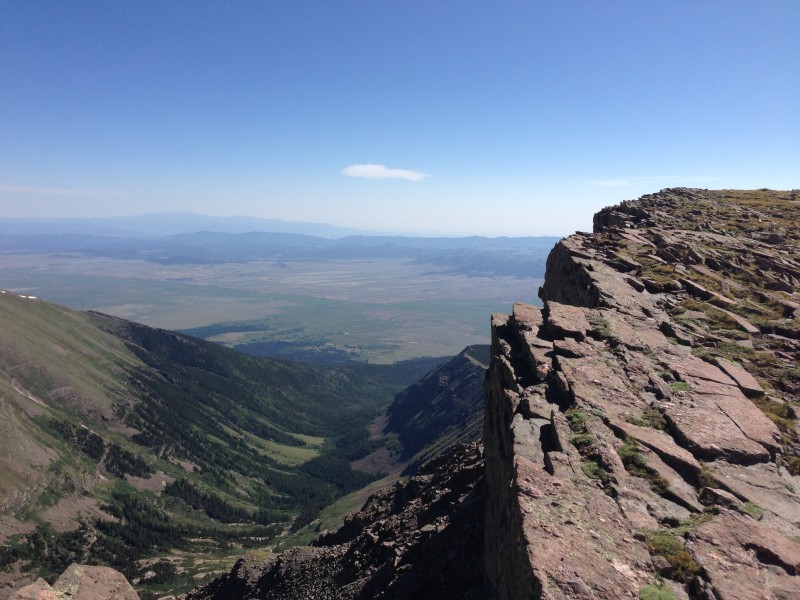 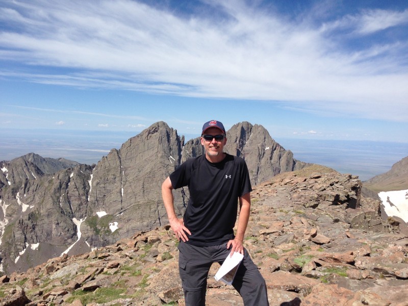 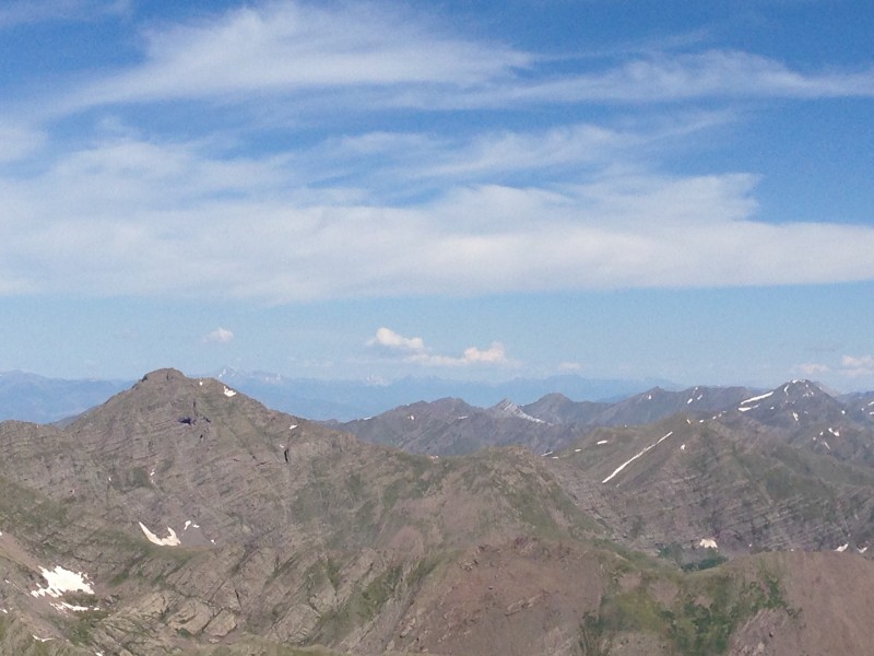 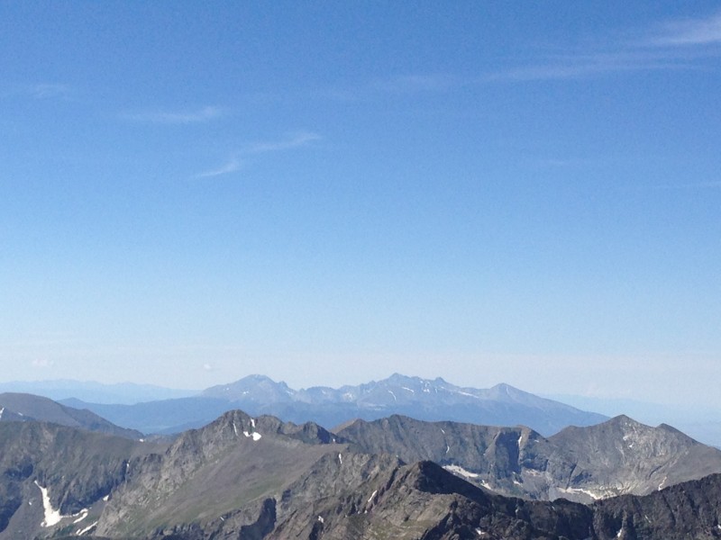 It was time to head down as the clouds began to thicken a bit after 10 AM, though not yet an immediate threat. As I look at the next picture, I'm reminded that there was quite a bit of rock-hopping the last few hundred feet. Maybe even the last 1000 feet. 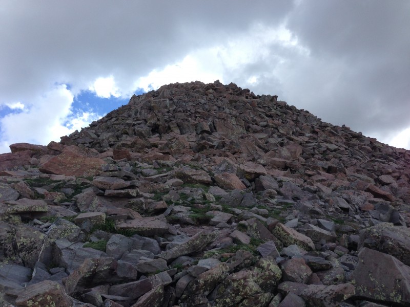  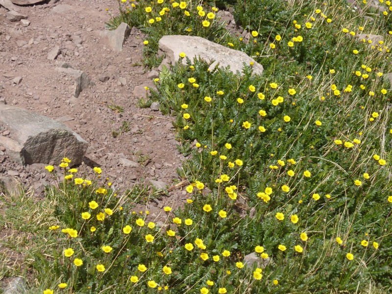 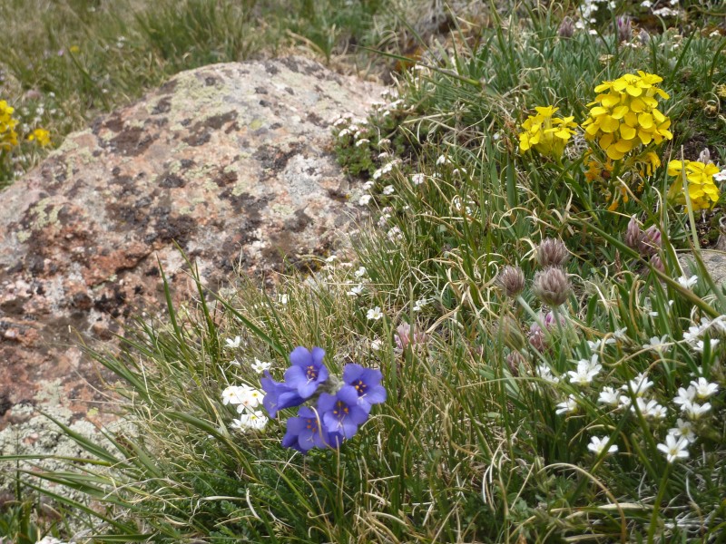 I can't get enough of the Needle and Peak as I let my new friends move on while I just sat and enjoyed the sights. I recently took up rock climbing, so I gazed at the Ellingwood Arete route going up this side of the Needle. Funny how one's view of the "climbability" of a rock face changes after learning some technical basics and doing a little climbing. Before this year, I would have simply viewed the Arete as an unclimbable vertical face and given it no further thought. Now I'm focusing in closer, seeing a wonderful, grippy structure that really isn't vertical at all and has places to rest. Lots of pitches and a long day, but at 5.4 to 5.6 according to the website, it's theoretically accessible to me with someone else setting the pro. Oh, just stop already. I'm much too big of a fraidy cat to ever attempt such a thing. I'll be lucky to do the Class 3 and 4 on the other side. But it's fun to think about.  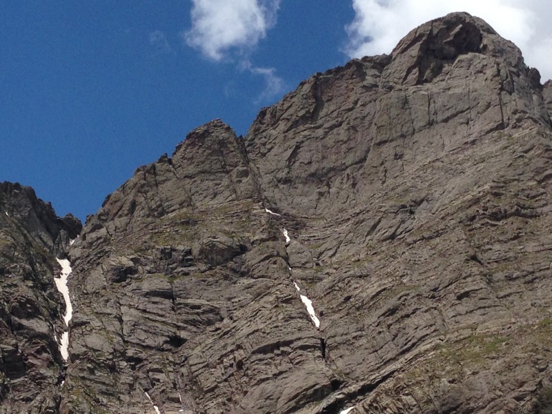 Then I figured I'd get some good, close shots of Broken Hand Pass. 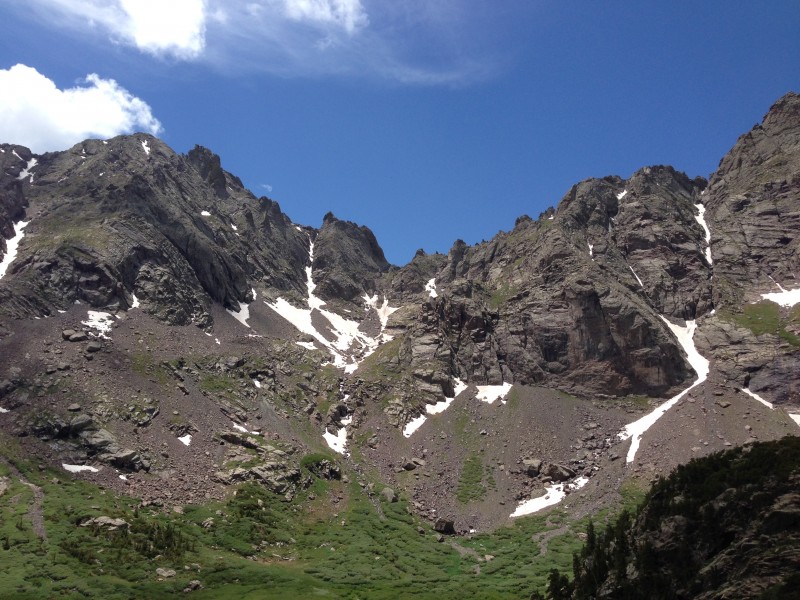 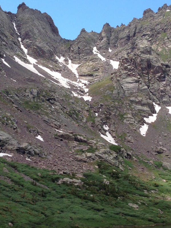 This next one is a beautiful conglomerate rock that is representative of the Crestones. Think high energy stream, probably some storms mixed in, transporting this mish-mash of rocks from an uplift - now gone - into a sedimentary basin - now uplifted - that is the Crestones. Then this piece rolled off and landed near the trail. This chance meeting seemed so unlikely that I decided to go ahead and have lunch here. The rock didn't talk much, the strong silent type I guess, but oh the stories it could tell. I figure it had seen a lot more than I had with some of its component parts predating one billion years, and it was probably much more interesting. I'm comin' back. 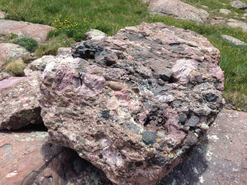 Finally back to the 4WD lot. Lots of cars now at 2 PM on July 4 but still a few places I think. 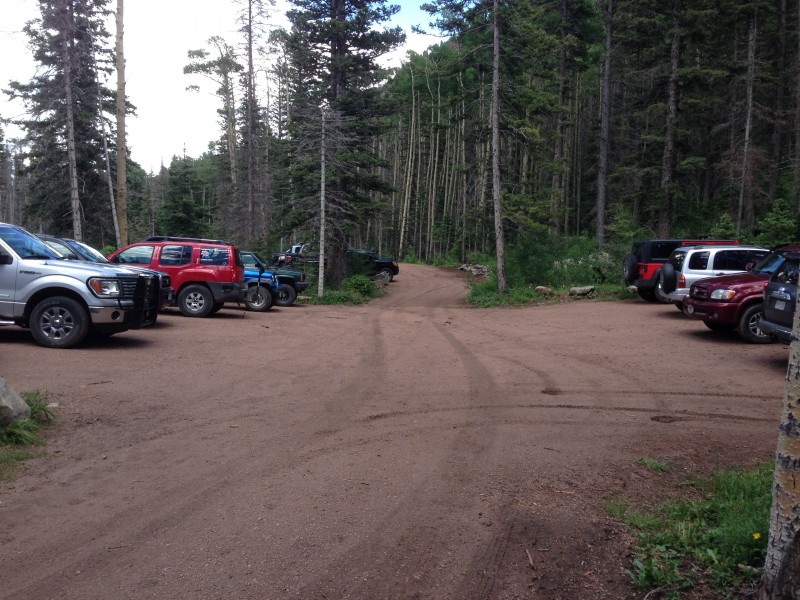 This was such a great hike, and hopefully a warm-up for bigger things. Next time I come to see the 'Stones, I hope to snag a backstage pass. 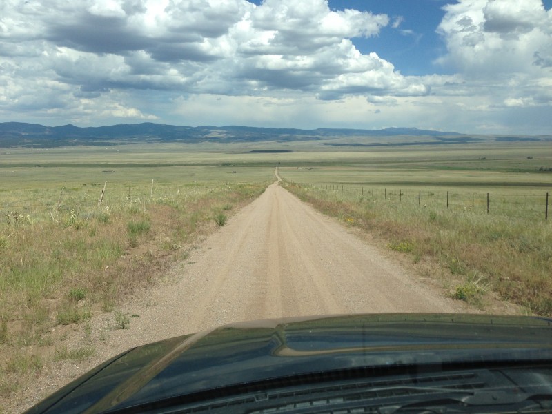  Thumbnails for uploaded photos (click to open slideshow):
|
| Comments or Questions | ||||||||||||||||||
|---|---|---|---|---|---|---|---|---|---|---|---|---|---|---|---|---|---|---|
|
Caution: The information contained in this report may not be accurate and should not be the only resource used in preparation for your climb. Failure to have the necessary experience, physical conditioning, supplies or equipment can result in injury or death. 14ers.com and the author(s) of this report provide no warranties, either express or implied, that the information provided is accurate or reliable. By using the information provided, you agree to indemnify and hold harmless 14ers.com and the report author(s) with respect to any claims and demands against them, including any attorney fees and expenses. Please read the 14ers.com Safety and Disclaimer pages for more information.
Please respect private property: 14ers.com supports the rights of private landowners to determine how and by whom their land will be used. In Colorado, it is your responsibility to determine if land is private and to obtain the appropriate permission before entering the property.