Download Agreement, Release, and Acknowledgement of Risk:
You (the person requesting this file download) fully understand mountain climbing ("Activity") involves risks and dangers of serious bodily injury, including permanent disability, paralysis, and death ("Risks") and you fully accept and assume all such risks and all responsibility for losses, costs, and damages you incur as a result of your participation in this Activity.
You acknowledge that information in the file you have chosen to download may not be accurate and may contain errors. You agree to assume all risks when using this information and agree to release and discharge 14ers.com, 14ers Inc. and the author(s) of such information (collectively, the "Released Parties").
You hereby discharge the Released Parties from all damages, actions, claims and liabilities of any nature, specifically including, but not limited to, damages, actions, claims and liabilities arising from or related to the negligence of the Released Parties. You further agree to indemnify, hold harmless and defend 14ers.com, 14ers Inc. and each of the other Released Parties from and against any loss, damage, liability and expense, including costs and attorney fees, incurred by 14ers.com, 14ers Inc. or any of the other Released Parties as a result of you using information provided on the 14ers.com or 14ers Inc. websites.
You have read this agreement, fully understand its terms and intend it to be a complete and unconditional release of all liability to the greatest extent allowed by law and agree that if any portion of this agreement is held to be invalid the balance, notwithstanding, shall continue in full force and effect.
By clicking "OK" you agree to these terms. If you DO NOT agree, click "Cancel"...
| Missouri Gulch Threesome |
Basic Information
- Peaks: Mt. Belford, Mt. Oxford, & Missouri Mountain
Distance: 15.2 miles
Ascent: 7,206 feet
Time: 11.5 hours
Missouri Gulch Map

Missouri Gulch Elevation Map

Note: The first bump is Mt. Belford, the 2nd bumb is Mt. Oxford, the third bump is Mt. Belford again, and the final bump is Missouri Mountain.
Trip Report
My goal this year has been to climb fourteen 14ers for 2014 and I figured hiking up the 14,196 foot Mt. Belford and the 14,155 foot Mt. Oxford would be an easy way to get me two more peaks this year. So I made the early morning drive from Colorado Springs up to the Missouri Gulch Trailhead via Buena Vista. I left my house at 1:15 AM to do this roughly 3 hour drive. Yes I know that is crazy early, but some how I was able to get my young kids to go to bed early which meant I was able to go to sleep at 7:30 PM and actually got five hours of sleep. Due to the sleep I actually felt pretty good as I started down the trail at 4:20 AM. The trail immediately gains altitude with some long switch backs before leveling out as it follows a creek. This is where I made a mistake and continued to follow a trail along the creek instead of crossing it. It was dark out so I did not see the creek crossing. I did not realize mistake until the trail began to narrow and fade away. I loaded the 14ers.com app on my iPhone and saw the mistake I made. By the way that is one awesome app for those that haven't downloaded it yet. Great job by everyone involved with putting that together. Anyway I retraced my route and found the creek crossing. From there it was an easy walk up to treeline where I could see Mt. Belford in the early morning light up ahead:

I stopped and ate my breakfast of Lucky Charms and Cinnamon Toast Crunch bars with milk. It was nice watching the sunrise on nearby Missouri Mountain as I ate breakfast:
It was surprisingly chilly out that morning so by the time I finished eating I was happy to get moving again to raise my body temperature. The hike up Mt. Belford wasn't very hard considering it is a class one hike the entire way. I had seen no one on Mt. Belford yet that morning, but below me I could see a large group of people that must have left the trailhead not too long after I did:

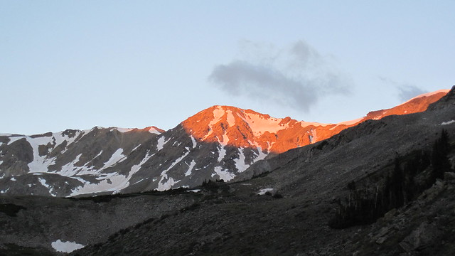
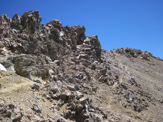
I ended up being the first person reaching the summit that morning at 7:55 AM. The summit is a large reddish-orange rock outcropping which is responsible for giving the mountain its name. Here is the view from this rock outcropping looking towards the next peak I planned to hike up Mt. Oxford:
According to the book "A Climbing Guide to Colorado's Fourteeners: Twentieth Anniversary Edition" Mt. Belford was named after Colorado's first Congressman James B. Belford. His red hair and fiery speeches earned him the nickname of the "Red-Headed Rooster of the Rockies". Belford was a big advocate for the free coinage of silver which made him popular with miners. Due to his popularity with miners and the fact Mt. Belford has a red rock outcropping on its summit this is likely the reason why some unknown miners decided to start calling this mountain Mt. Belford which became the name that has stuck to this day.

James Belford
The wind was blowing which caused it to be freezing cold on the summit. I was wearing a balaclava and heavy winter gloves to keep warm. I only spent about 5 minutes on the summit before beginning the traverse over to Mt. Oxford. The traverse from Belford is initially pretty steep and then from the saddle it is an easy walk up to the summit of Mt. Oxford:

It took me about an hour to do the traverse and on the top of Oxford the wind was still blowing pretty hard which kept the temperatures quite cold despite it now being 9:00 AM. According to the book "A Climbing Guide to Colorado's Fourteeners: Twentieth Anniversary Edition"; Mt. Oxford, Mt. Belford, and Missouri Mountain were first officially sighted as 14ers by the famed early Colorado climber Albert Ellingwood and his friend Stephen Hart in 1925. Belford already had a name given to it by miners, but Oxford did not. This is probably because there is nothing auspicious about the mountain. It is just a large mound of rock much like Mt. Belford. However, Mt. Belford had the red rock outcropping on top that made it stand out to the miners unlike Mt. Oxford thus inspiring them to name it after the red headed first Congressman of Colorado. So it wasn't until 1931 that John Hart, the brother of Stephen Hart, named it Mt. Oxford after the university Albert Ellingwood and Stephen Hart attended back in England. Additionally the naming of the mountain after a prestigious university kept with the naming tradition of the Collegiate Peaks Wilderness that encompassed the area.
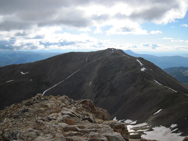
Anyway the summit of Mt. Oxford is not very exciting since it is just a big large rock pile sitting on top of a large flat rock plain:

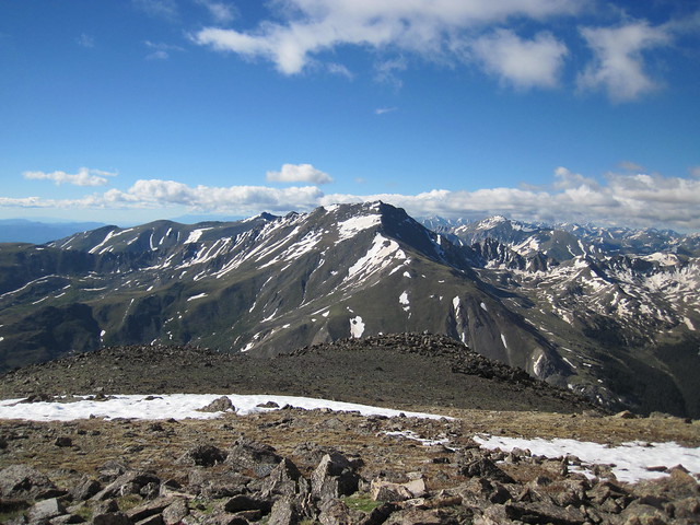
The summit may be boring, but the views are not. The view looking south towards Mt. Harvard is particularly impressive:
Rising in the distance behind Mt. Harvard I could see the fellow Collegiate Peak, the 14,196 foot Mt. Yale:

I spent about 15 minutes on the summit before beginning the traverse back over to Belford. Going back takes a little bit more energy since the climb back up to Belford is steeper with some section of loose rock:

I also saw a lot more people coming down the trail now with many of them quite cold since they were wearing shorts and t-shirts. By the time I reached the top of Belford again the wind had actually died down a bit and it wasn't so cold out any more. Most of the clouds had also burned off and it was turning out to be quite a beautiful day. I had only planned to hike up these two peaks, but as I stood there on Belford looking across Missouri Gulch over to Missouri Mountain, I decided I still had enough energy to hike up it as well. So from Belford I took the Elkhead Pass Trail over to the Missouri Mountain Trailhead. The views from the top of Elkhead Pass looking into the basin overwatched by the 13er Emerald Peak are amazing:

I could also see the route I would have to take to reach the summit of Missouri Mountain:

Gerry Roach calls Missouri Mountain "strange" in his book because it is basically not a mountain, but rather just a long ridgeline that just happens to rise above 14-thousand feet. Also due to its steepness and the fact it is shaded by Mt. Belford, Missouri holds a lot of snow until late in the year. Here is a picture that contrasts the snow on Missouri with the almost snowless Belford:

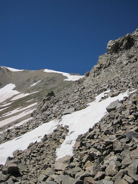
Once I reached the trailhead for Missouri Mountain I could see that I was going to have to hike across a number of snowfields. I asked a group of hikers coming down what the conditions were like and they told me no microspikes were needed since the snowfields all had packed routes through them. So I sat down and just put on my gaiters before heading up Missouri Mountain. I did have to cross a section with some loose rock going up the trail, but nothing too bad:
The snowfields were as advertised not difficult to cross and I soon found myself on the ridgeline. The hike along the ridgeline was a scenic one as I was surrounded by incredible views. After crossing a couple of sections of packed snow I found myself at the final summit pitch where with some care I was able to pass through a section of very loose rock:
After this section I did the short scramble up to the summit were it was now 12:30 PM. Like Mt. Belford, Missouri Mountain has its name thanks to the early miners that worked its slopes. It is believed that miners from Missouri named the mountain not only for their home state, but also because of the fact that James Belford traveled to Colorado from Missouri before he became a Congressman.
Anyway just like the prior two mountains I had the summit all to myself. The weather was still perfect out and the views were much better than Belford and Oxford. The view looking west at the 14,003 foot Huron Peak were stunning:

To the north I could see the 14,336 foot La Plata Peak:

To the Northeast I could see the big fat mass of the 14,433 foot Mt. Elbert:

I could even see the 14,309 foot Uncompahgre Peak way out in the distance:

Here is a panorama looking down into Missouri Gulch with Mt. Belford on the right and the Missouri Mountain ridgeline on the left:

I spent 30 minutes on the summit before deciding to head on down. It had been a long day and I was ready to go home. The hike down Missouri Mountain was uneventful and I soon found myself back along the creek running through Missouri Gulch enjoying the views of Missouri Mountain:

And Mt. Belford:

The walk back to the trailhead was also uneventful. I arrived back at the trailhead at 3:45 PM which meant it took me about 11 hours and 30 minutes to summit all three peaks. According to my Garmin Fenix the distance was 15.2 miles with 7,206 feet of ascent. This definitely makes for a long day, but it was worth it to knock out three 14ers at once. If you have the fitness level and good weather conditions I highly recommend trying to do this threesome. This meant I have not only done a 14er threesome, but also a foursome (the DeCaLiBron), and a twosome (Grays & Torreys) in the Colorado Rockies. For anyone looking for a 14er threesome Missouri Gulch is the place to go!
|
Caution: The information contained in this report may not be accurate and should not be the only resource used in preparation for your climb. Failure to have the necessary experience, physical conditioning, supplies or equipment can result in injury or death. 14ers.com and the author(s) of this report provide no warranties, either express or implied, that the information provided is accurate or reliable. By using the information provided, you agree to indemnify and hold harmless 14ers.com and the report author(s) with respect to any claims and demands against them, including any attorney fees and expenses. Please read the 14ers.com Safety and Disclaimer pages for more information.
Please respect private property: 14ers.com supports the rights of private landowners to determine how and by whom their land will be used. In Colorado, it is your responsibility to determine if land is private and to obtain the appropriate permission before entering the property.


