Download Agreement, Release, and Acknowledgement of Risk:
You (the person requesting this file download) fully understand mountain climbing ("Activity") involves risks and dangers of serious bodily injury, including permanent disability, paralysis, and death ("Risks") and you fully accept and assume all such risks and all responsibility for losses, costs, and damages you incur as a result of your participation in this Activity.
You acknowledge that information in the file you have chosen to download may not be accurate and may contain errors. You agree to assume all risks when using this information and agree to release and discharge 14ers.com, 14ers Inc. and the author(s) of such information (collectively, the "Released Parties").
You hereby discharge the Released Parties from all damages, actions, claims and liabilities of any nature, specifically including, but not limited to, damages, actions, claims and liabilities arising from or related to the negligence of the Released Parties. You further agree to indemnify, hold harmless and defend 14ers.com, 14ers Inc. and each of the other Released Parties from and against any loss, damage, liability and expense, including costs and attorney fees, incurred by 14ers.com, 14ers Inc. or any of the other Released Parties as a result of you using information provided on the 14ers.com or 14ers Inc. websites.
You have read this agreement, fully understand its terms and intend it to be a complete and unconditional release of all liability to the greatest extent allowed by law and agree that if any portion of this agreement is held to be invalid the balance, notwithstanding, shall continue in full force and effect.
By clicking "OK" you agree to these terms. If you DO NOT agree, click "Cancel"...
My original plan for the day was to take the West Ridge of Quandary and then drive to Guanella Pass for the Bierstadt/Sawtooth/Evans loop. I thought that the Quandary Route was only 4 miles round trip, but some routefinding errors on my part made the trip much longer. Oops. The weather wouldn't have allowed the Bierstadt loop anyway. It was still one of the best days of hiking I've ever had. Here's the report:
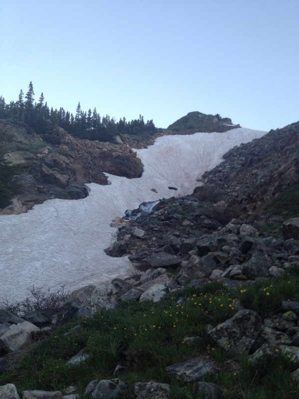
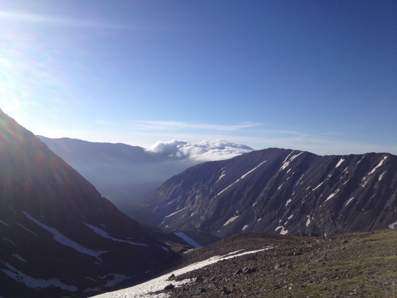
I left my house in Aurora at 2:57am and made it to the Blue Lake Trailhead at about 5:15am. I was on the trail by 5:30am, with the light coming in nicely. I recently finished reading a lot of John Steinbeck and he discusses the special time of morning where the light is slowly filling in. Steinbeck calls this time, "the pearl," and I now understand why. I was on CO9 when the light started coming over the divide and it was glorious indeed. The temperature at the trailhead was warm, probably 50 degrees. I started out in shorts and t shirt right away. I had difficulty locating and staying on the trail to begin with. I knew the general direction of where I wanted to go, but locating the actual trail gave me trouble. Normally I would be frustrated by this, but the scenery was so beautiful I actually enjoyed taking the long route. I stayed low in the valley and continued west for about 2 miles. With a little bushwhacking and some careful stream crossings, I reached the west end of the valley. At this point, I began to ascend the ridge towards Fletcher and Quandary. The valley was a bit water logged from the runoff; there is still plenty of snow on northern aspects of the valley. I was having fun picking my own path and just making it up as I went.
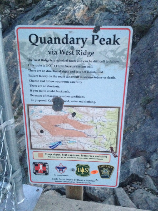
Morning Trailhead The sign Still snow This was the first snow patch Small amounts of snow Another View of the TH Out of the Basin
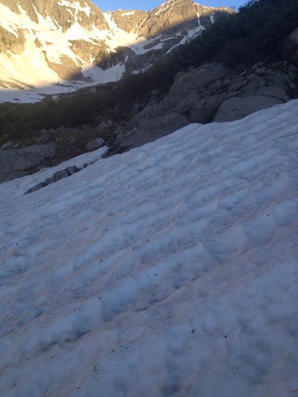
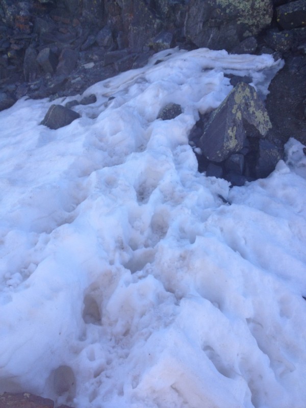
I hit the real trail after about an hour and a half of my own pathfinding. This was at about 13,300' after climbing out of the basin. There is still snow in the basin, and you would probably need snow gear to make it out of the basin through the standard route. However, it is melting out quickly, and is easily avoided with some alternate routefinding. Also, the patches of snow I crossed were softened and I postholed frequently. Moral of the story, avoid the snow by traveling west. This is where the real fun began for me.
Gaining the Ridge A careful traverse to gain it
The West Ridge was my first attempt at any Class 3 hiking. I brought a helmet just in case. I have messed around on the flatirons before, but those were just short scrambles. I was not sure what to expect from this route; reading it online seemed to make it sound relatively easy, but the pictures contradicted that. I came in prepared for anything, and I was definitely willing to turn around if I wasn't comfortable. I am not a huge fan of heights, in fact I hate heights. But there's something about being on a mountain that provides confidence for me. I will never be comfortable with heights, especially with climbing, but my goal is to have confidence when approaching them.
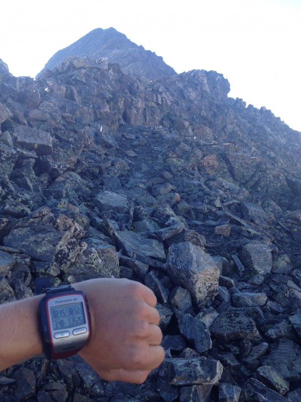
The climbing begins at about 13,600'. I once again found myself off the beaten trail (I believe).
Transition to climbing Some exposure A ledge
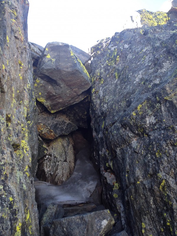
The route online says that the climbing is almost all class 2 at this point. However, I believe my route was higher on the ridge, providing more rugged, jagged rock that proved challenging to climb. It was good practice for me, and a solid warmup for the cracked walls and the crux. I regained the trail at about 13,900' and followed it into the class 3 sections. These also provided a fun challenge. There was minimal snow along the route, only a few steps here and there. I found 2 cracked walls along the route. I stared in wonder at both of them for awhile until I picked my holds and climbed up them. One of the walls has a boulder stuck in the top, so I exited the crack and went around. Then came the scary part.
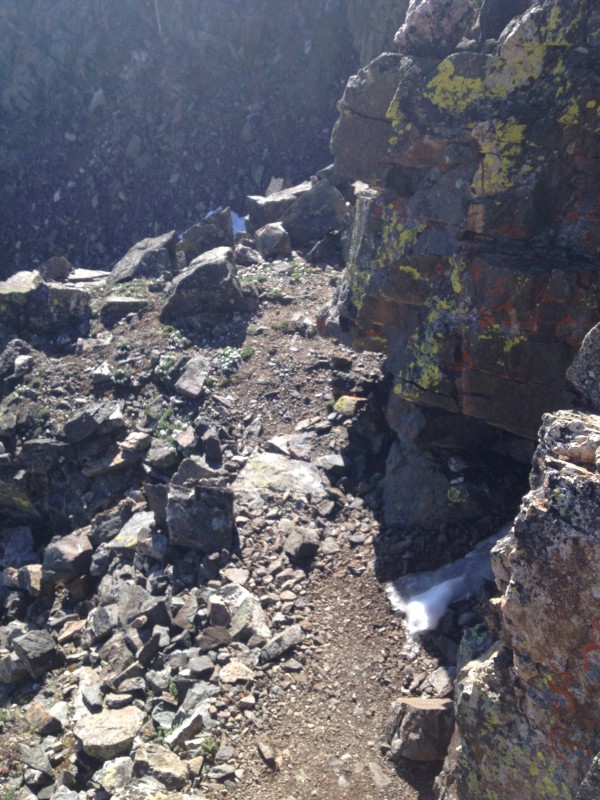
Steep Gully
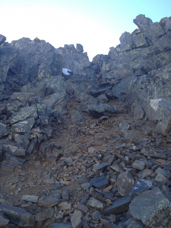
There is a very exposed walk across the ridge before you drop in to the crux. The ridge has sheer drops on both sides. I'm not sure if it is the official route, but it's the way I took, and it was definitely one of the most nerve wracking moments for me. I did a steep descent into the notch below the crux. There is some snow on this path down, but it is not bad at all. The crux did not give me too much trouble, although there is plenty of loose rock around. I tested every hold and foot plant before I applied weight. A few times rocks gave way, and they fall a very long way before stopping... Once I got over the crux it was smooth sailing. I reached the summit after 4.33 miles and 3 hours and 30 minutes. All in all I think I made the approach and the climb more difficult than necessary, but it was an awesome ascent with great conditions. Minimal snow and perfect weather!
A cracked wall Another wall Base of the crux The Crux Above the crux
Once I reached the summit I ate and talked with a few groups up there. The east ridge was packed with people, so the summit didn't have much solitude. After an hour of socializing and eating, I began to plan out the rest of the day. I knew that I couldn't do the bierstadt loop because of time, but I wanted a few extra miles in to work my legs. My goal is to do Long's Peak, and I need to have endurance for that. There were some clouds building over on Northstar as well, which made me nervous. That mountain seems to provide great lift for clouds, and I was worried that a small shift in the wind would put anyone in the valley right in harms way. The last thing I wanted was to be in that valley with more water pouring in. After some deliberating, I decided to go down the east route and just hike back to the Blue Lake TH from the Quandary Trailhead. I descended to the Quandary TH in an hour and 10 minutes, and then began the hike back to Blue Lake. This took another hour and brought the whole trip to 10.1mi in 6 hours and 33 minutes. It was an absolutely beautiful day on the mountain.
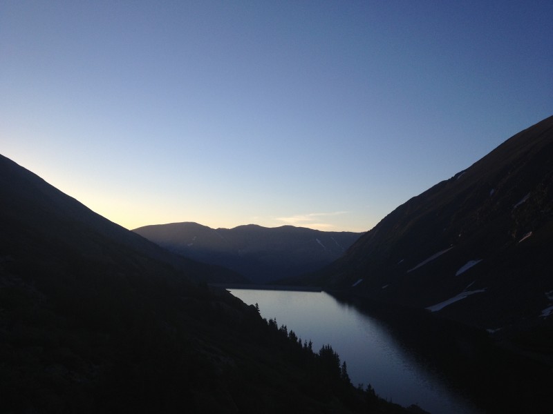
Looking back On the way out
Review:
As my first Class 3 hike, it was a steep learning curve. I apologize for the terrible pun. But seriously, I did find this route a serious jump in difficulty from Class 2 hikes. However, part of this may be due to my own creative aka not incredibly attentive routefinding. The summit was beautiful because it was above the clouds. The standard route has some snow on the way down, but it was easily traversed. All in all, it was one of the most rewarding days of hiking I've had. If you are attempting the standard route listed here, you may want to bring snow gear and temperance to deal with postholing. However, you can avoid this pretty easily with a more roundabout way. The ridge is mostly snow free except for a few traverses.
I'd adding more pictures tonight after I adjust them a bit!
Thumbnails for uploaded photos (click to open slideshow):
The double hinged on the weather and the actual length of quandary.I estimated I could do the 4 mile version in about 3 hours. That would put me back at my car at 8:30, at guanella pass by 11. 6 hours on Bierstadt and Evans, back by 5. That was my original plan. The weather forecast originally looked pretty solid, with the least chance for storms out of the last week, and people said the weather on Bierstadt had been holding out until later in the day. None of the hikes I've done in the past have physically exhausted me, so I was looking to make yesterday a bit more challenging. It was, but in a different way than I initially planned. As for the in shape part, I would classify myself as in good shape. I haven't ran in awhile, so my endurance is down a bit.
I was looking for a report on the West Ridge. Yours was the bottom of the third page. Like you I'm so-so with exposure so building up to this. I hope you got to do Longs, it was my first. Just completed Kelso Ridge on Torreys. Nothing to challenging. The Knife Edge is exposed, but I straddled it and inched my way across.
Caution: The information contained in this report may not be accurate and should not be the only resource used in preparation for your climb. Failure to have the necessary experience, physical conditioning, supplies or equipment can result in injury or death. 14ers.com and the author(s) of this report provide no warranties, either express or implied, that the information provided is accurate or reliable. By using the information provided, you agree to indemnify and hold harmless 14ers.com and the report author(s) with respect to any claims and demands against them, including any attorney fees and expenses. Please read the 14ers.com Safety and Disclaimer pages for more information.
Please respect private property: 14ers.com supports the rights of private landowners to determine how and by whom their land will be used. In Colorado, it is your responsibility to determine if land is private and to obtain the appropriate permission before entering the property.