Download Agreement, Release, and Acknowledgement of Risk:
You (the person requesting this file download) fully understand mountain climbing ("Activity") involves risks and dangers of serious bodily injury, including permanent disability, paralysis, and death ("Risks") and you fully accept and assume all such risks and all responsibility for losses, costs, and damages you incur as a result of your participation in this Activity.
You acknowledge that information in the file you have chosen to download may not be accurate and may contain errors. You agree to assume all risks when using this information and agree to release and discharge 14ers.com, 14ers Inc. and the author(s) of such information (collectively, the "Released Parties").
You hereby discharge the Released Parties from all damages, actions, claims and liabilities of any nature, specifically including, but not limited to, damages, actions, claims and liabilities arising from or related to the negligence of the Released Parties. You further agree to indemnify, hold harmless and defend 14ers.com, 14ers Inc. and each of the other Released Parties from and against any loss, damage, liability and expense, including costs and attorney fees, incurred by 14ers.com, 14ers Inc. or any of the other Released Parties as a result of you using information provided on the 14ers.com or 14ers Inc. websites.
You have read this agreement, fully understand its terms and intend it to be a complete and unconditional release of all liability to the greatest extent allowed by law and agree that if any portion of this agreement is held to be invalid the balance, notwithstanding, shall continue in full force and effect.
By clicking "OK" you agree to these terms. If you DO NOT agree, click "Cancel"...
I usually do not write trip reports but figured that some folks may appreciate the beta and conditions for this route. After researching it myself over the last few years, good beta can be hard to come by for this basin since most folks are "14er-centric" and focused on the standard routes only. This basin does provide access to Harvard, Oxford, Belford and Missouri...with much less traffic.
Been itching to get back to work on the list of the top 100 in 2014. Took a shot at Emerald and Iowa a few years back but the long approach coupled with crappy weather and not enough time in the weekend thwarted our attempt. My memories of the beautiful Pine Creek remained and I have been looking for an opportunity to return.
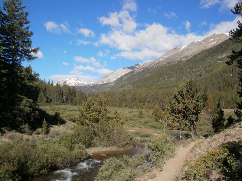
Planned a smarter attempt this time, and the weather looked like it was going to cooperate. We left a car at Missouri Gulch TH @ 7pm Friday night and shuttled back to Pine Creek TH, parked at the 4WD TH, paid $1 each and took off hiking a few minutes before 8pm. Beautiful night. If you need to layup because you don't like to hike in the dark or because of weather, there are some good shelves below the trail and above Pine Creek between mile 2 and 2.5 (2.34 mile rings a bell). Hit the wilderness boundary @ 3.62 miles from the gate and the creek crossing at the bridge at 4 miles. This is where the Colorado Trail crosses and the beautiful meadows begin. We hiked on to about mile 4.5 and found a good spot to camp up in the trees to the north of the creek. Plenty of dispersed camping all along the meadows after the bridge with easy access to water. Think we laid down camp a bit before 11pm.
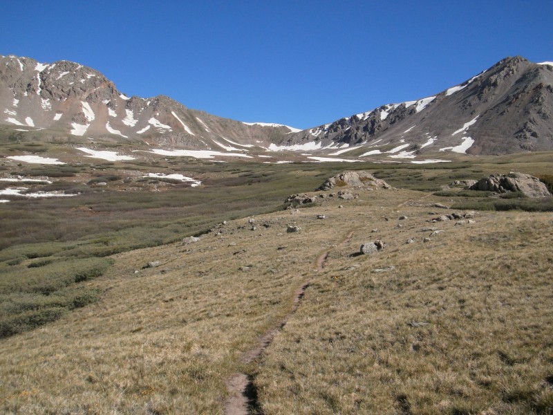
In the AM we hit the trail around 8am and hiked to the Elkhead Pass trail junction. Pine Creek Pine Creek
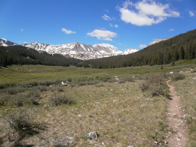
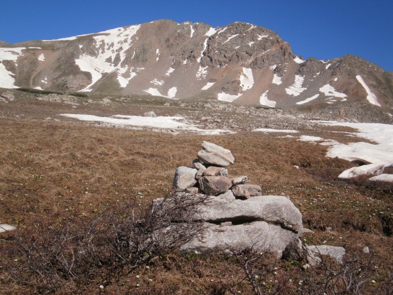
We headed toward Elkhead Pass and laid down camp at 12,000' at the edge of tree line. This was about .5 to .75 mile from the junction. If you wander down to the southwest from the trail around 12,000', there are lots of flat protected spots with access to water on the other side of the trail. We setup camp at 12pm and then ate, repacked and headed toward Emerald at 1:30pm. Bluebird skies all around. About .2 up the trail from camp we left the trail and headed directly toward Emerald. No more trail. Emerald Peak 13,904"
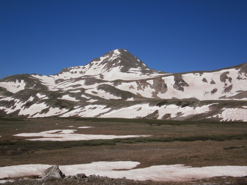
We picked our way up the ledges and were able to avoid most of the snow with the exception of a few short crossings. We traversed and ascended right until we hit the saddle. We did come across a small climbers trail to the saddle between Iowa and Emerald.
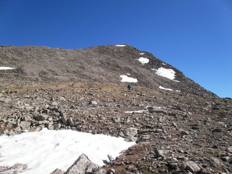
From the saddle, bank a left (south-west?) and when you get closer you will see some defined scree trails heading up to the ridge. From the Emerald/Iowa saddle From the Emerald/Iowa saddle
The last 500-600' from the saddle went real quick. Beautiful views all around from the summit. Huron, Missouri, Harvard, Ice and the Apostles. Topped out around 4pm. Hung out on top for 1/2 an hour and reversed our route back to camp. We opted to not do the .4 up to Iowa. We arrived at camp around 6:30pm.
We took off from camp @ 9am the next morning and hiked the mellow 2 miles from 12,000' to Elkhead Pass at 13,200'. Snow could mostly be avoided. Heading toward Elkhead Pass and Missouri Gulch View of Missouri from Pine Creek Basin
We dropped into Missouri Gulch and descended 3.1 miles to the cabin at 11,400', took a break and then did the last 1.4 miles to the TH, arriving around 12:45pm. Cold beers all around.
Great Sawatch thru hike that I highly recommend. #76 of 100 in the bag for me.
I am sure if you cannot coordinate a car drop at Missouri Gulch, based on the amount of people/cars over there, you could easily bum a ride to US285 and have them drop you off at CR388 (Pine Creek) on their way to Buena Vista. The trailhead is only about .7 off of US285.
Thumbnails for uploaded photos (click to open slideshow):
I probably should have mentioned that trailhead-to-trailhead the mileage was 21.3 per my Garmin, including a trip to Emerald summit and maybe .1 or .2 wandering around at 12,000' looking for a camp spot. The out-and-back from camp at 12,000' to Emerald summit was 4.2 miles roundtrip.
Glad you had a pleasant trip. I spent many weeks in the 70s up Pine creek and enjoyed every trip there climbing and camping. Your report reminded me of those days. Thank you for your report
Caution: The information contained in this report may not be accurate and should not be the only resource used in preparation for your climb. Failure to have the necessary experience, physical conditioning, supplies or equipment can result in injury or death. 14ers.com and the author(s) of this report provide no warranties, either express or implied, that the information provided is accurate or reliable. By using the information provided, you agree to indemnify and hold harmless 14ers.com and the report author(s) with respect to any claims and demands against them, including any attorney fees and expenses. Please read the 14ers.com Safety and Disclaimer pages for more information.
Please respect private property: 14ers.com supports the rights of private landowners to determine how and by whom their land will be used. In Colorado, it is your responsibility to determine if land is private and to obtain the appropriate permission before entering the property.