| Report Type | Full |
| Peak(s) |
Pt. 12214 |
| Date Posted | 06/12/2014 |
| Modified | 09/17/2016 |
| Date Climbed | 06/05/2014 |
| Author | huffy13 |
| You have to start somewhere...Adventure for Ohio newbies! |
|---|
|
This report may seem pretty boring for most of the folks on this site. Heck, after hiking Mt. Sheridan just a couple of days before, this hike was kind of an easy one...even for me. But for my wife's cousin, her kids and my son's girlfriend this was an introduction to hiking, Colorado style, and it meant a lot to them to get some kind of summit during their first ever visit to Colorado. Plus, I want to do a trip report that they can look back on and reminisce about. My original plan was to take the entire crew on Thursday to Fairplay to the Beaver Creek trailhead for a hike to the summit of Mt. Silverheels...it looked pretty doable according to a few reports here that described it...a little longer than I had desired, but most of the hikes in the Breck area that we were staying were too snowy for newbies and for us folks that are ill-equipped for snowy ascents. The south ridge of Silverheels looked pretty clear but a couple of folks in Breck on Tuesday and Wednesday mentioned that the creeks and rivers were all running very high. I know from seeing it myself that Blue River was flowing higher and faster than I have ever seen it and the South Platte stuff around Fairplay and Alma was really flowing high too...I started to think that Beaver Creek would also be running really high due to the quick melting snow and decided that maybe the standard trail or even the West ridge route might have to be looked at as an alternative.   I ended up deciding that the West ridge route would be worth a shot due to being a shorter hike....bad idea. The trail was hard to follow, a lot of it was just finding your way up a pretty steep slope to avoid a private road. This did not bother me, my brother or my son and daughter too terribly much, but I knew this was going to be too hard for several first-timers. We decided to turn back after about an hour into the hike from the pull off on Highway 9, about 2 miles South of Hoosier Pass...it was about 8 AM or so by the time we got back to the car. We decided that we would try a hike that I had seen on the Summit County Explorers website, and that hike was the Hoosier Pass Loop. It was described SCE's site that it was a good hike for beginners and didn't have any exposure but still had a rewarding view of the surroundings. I have to say that the SCE site is quite a good tool if you want to find an easy hike for younger ones or newbies. My wife and I also took my niece and one of my nephews on the Lily Pad Lakes hike near Silverthorne...one of the easy hikes described on the site. Anyways, we took off from Hoosier Pass up the "trail" at about 8ish. The trail is really an old 4WD road that slowly ascends toward Northstar Mountain. There was quite a bit of snow as soon as we started but it was never so bad that we felt the need to turn around and where there wasn't snow it tended to be pretty muddy. 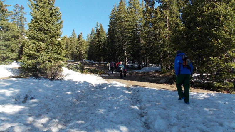 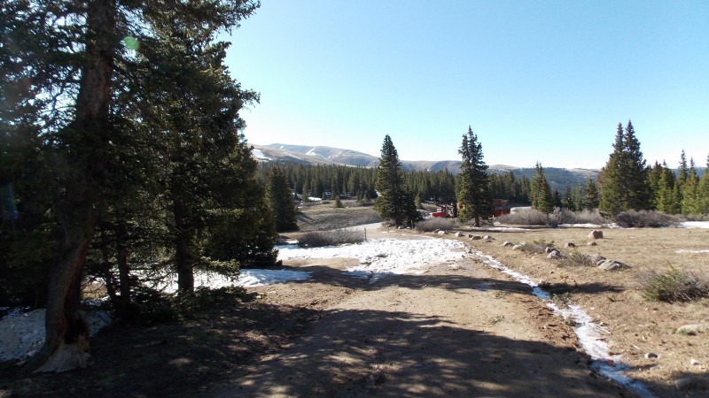 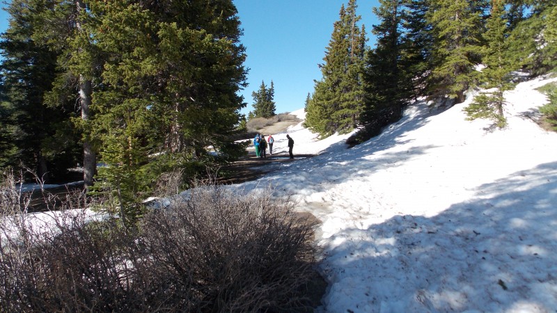   Since it was early enough, and because the snow near the road was packed pretty well we never really had to posthole on the ascent. 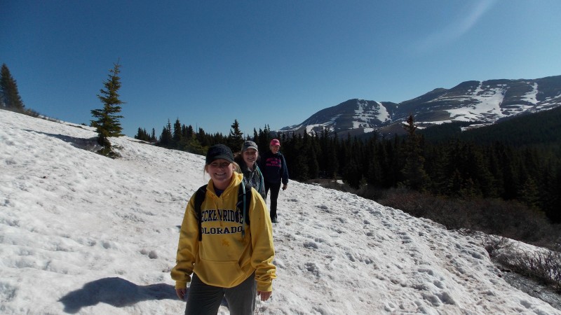 Since it was only about 400-500 ft elevation gain from the pass until treeline the views started to really get impressive early in the hike. 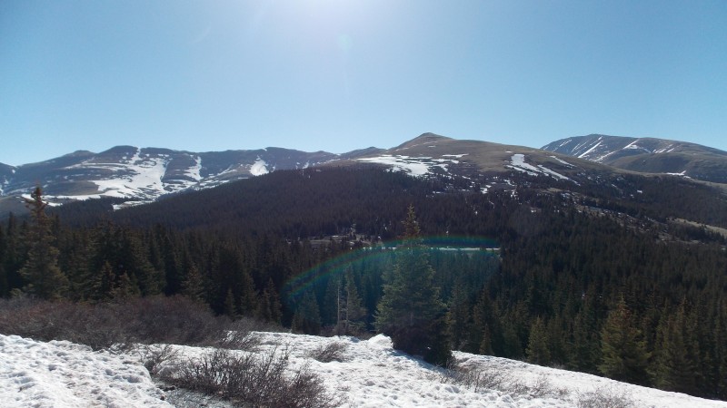 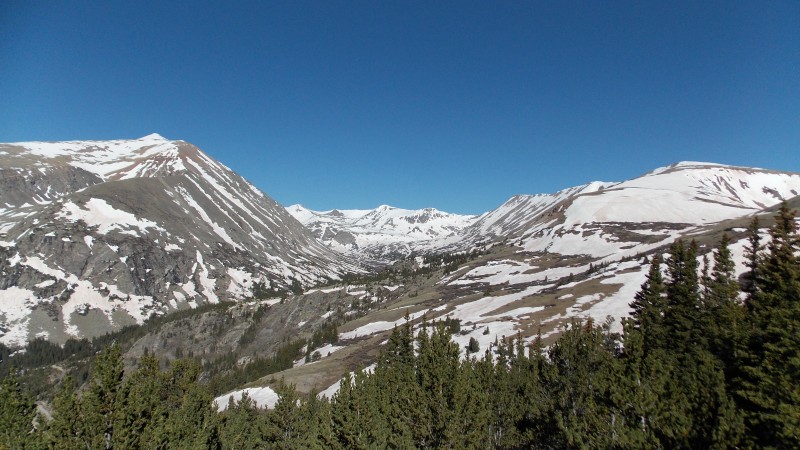 We even had a winged supporter follow us for a while until we hit treeline...if anyone can identify this particular bird I would like to know what it is....... 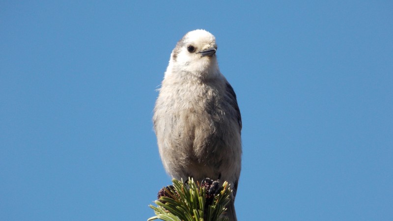 We continued up the road until we can to a spot on the road that had a large snowfield that completely blocked the road. The road was starting to turn SW from Pt. 12214 and hug the SE side of the slope up to the east end of Northstar. My brother went and scouted it out and let me know that the snow was very solid and without crampons or microspikes it would be risky to cross it without one of the members of our group slipping and ending up with an uncontrolled glissade down into the gulch....we opted to start up the grassy south slope of Pt. 12214 and find a more direct line to the summit.  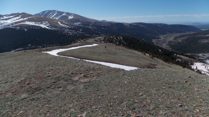 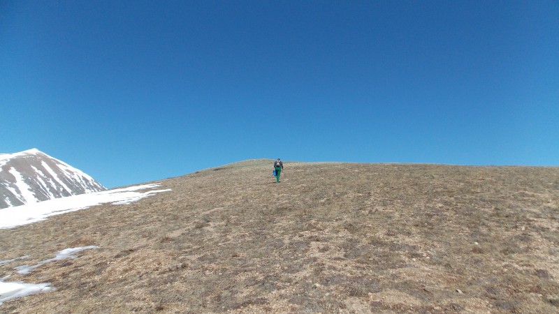 Once I was on the summit I realized that our cabin should have been visible! 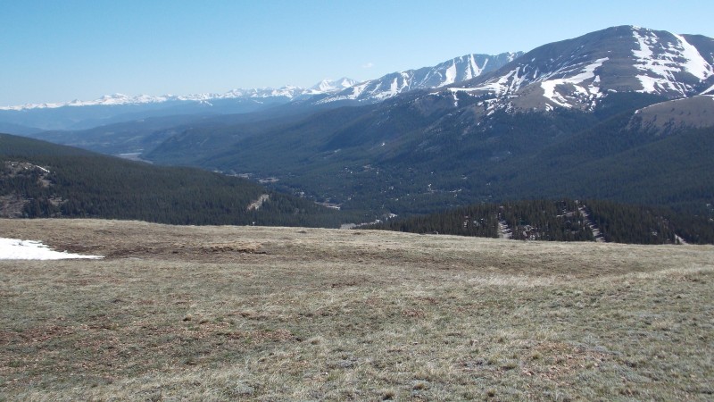 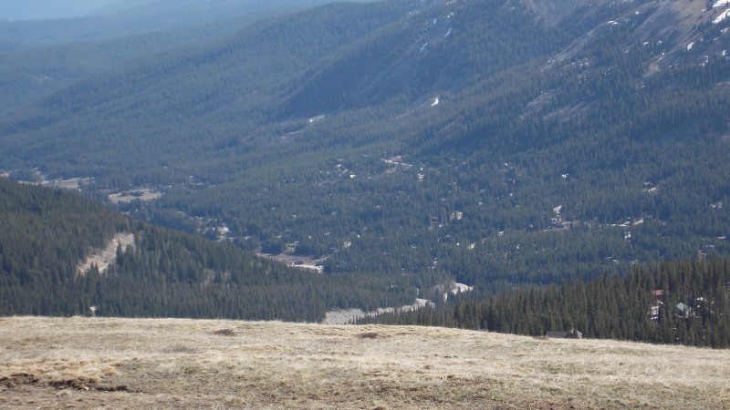 The summit had really good views and after just a few minutes over an hour and a half, our entire crew was safely on the summit of PT 12214!!!! Very proud of our crew, especially our crew from Ohio (who had never even been to Colorado before this trip) and my son's girlfriend, Bryn, who was also new to hiking at this elevation.   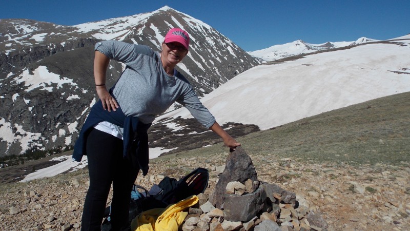 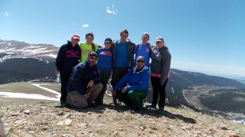 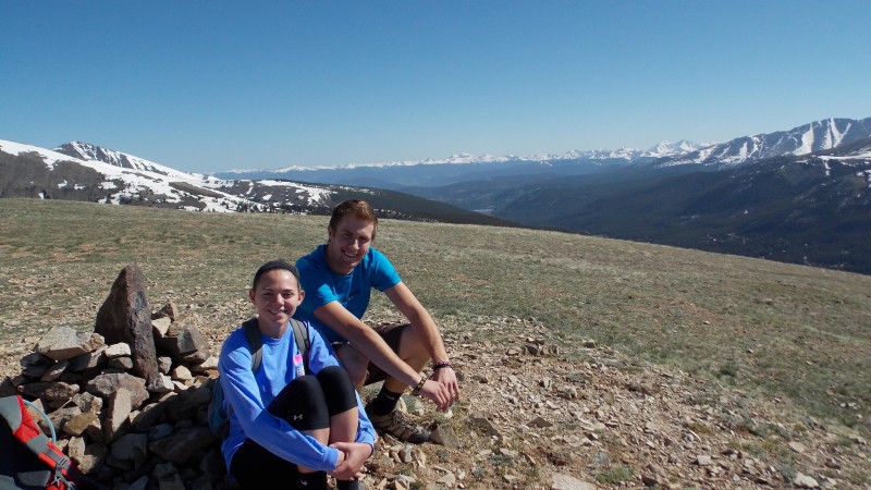 Several of our crew decided this was a great place to catch a nap.... 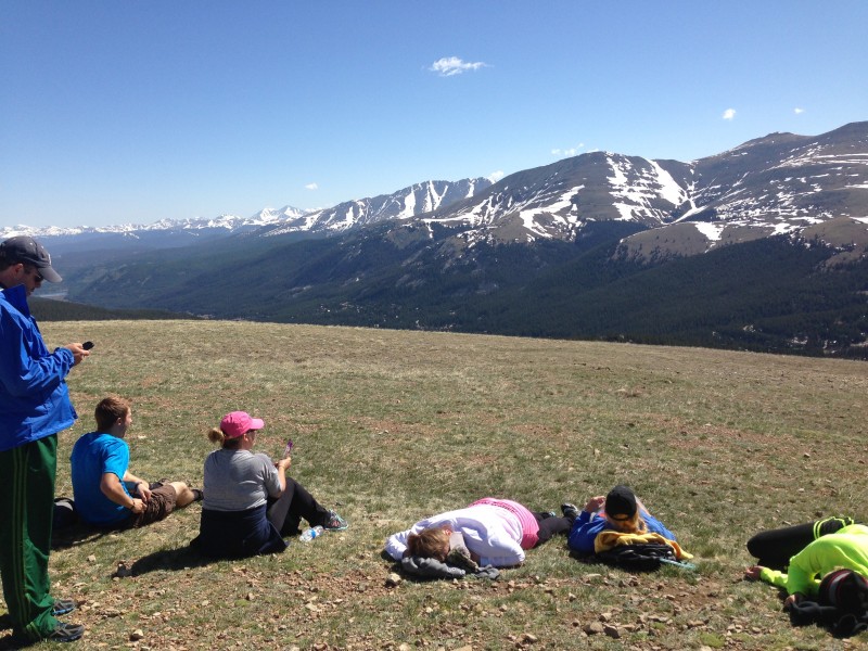 I got my summit selfie and was able to spot a couple that had passed us just before the big snowfield on their way up Northstar to ski down the Butterknife (at least I think that is what they said it was). 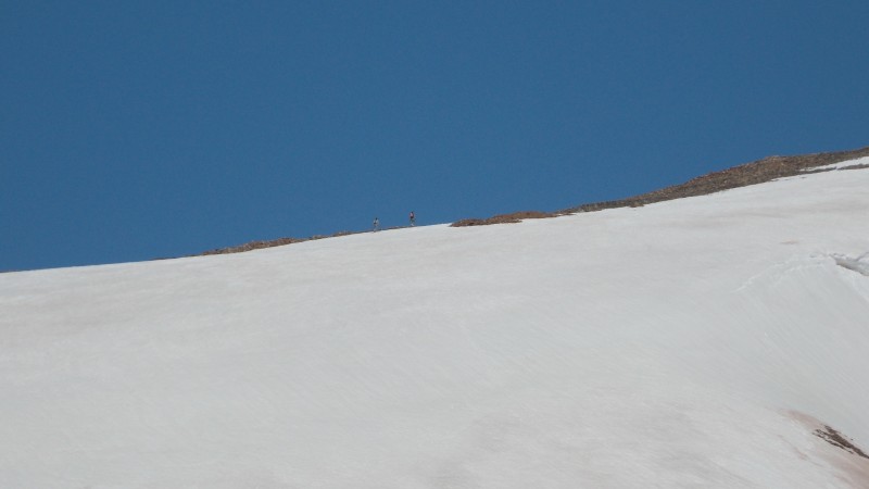 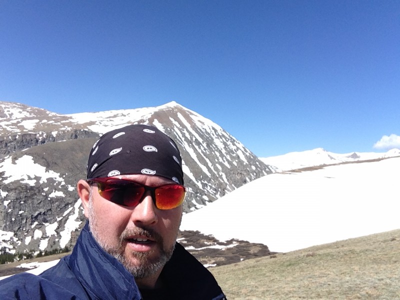 Here are some pics of the views from the summit. 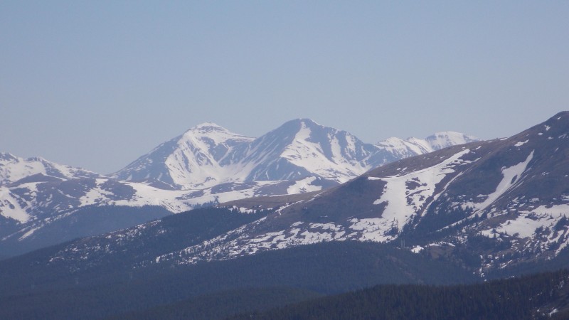  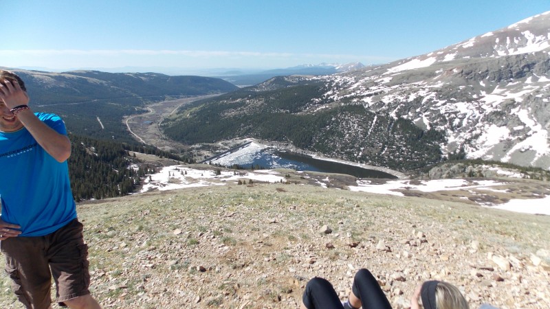 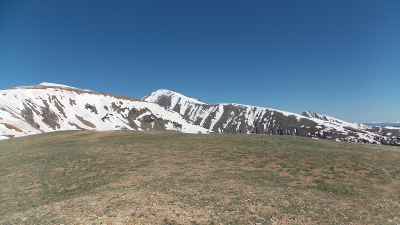 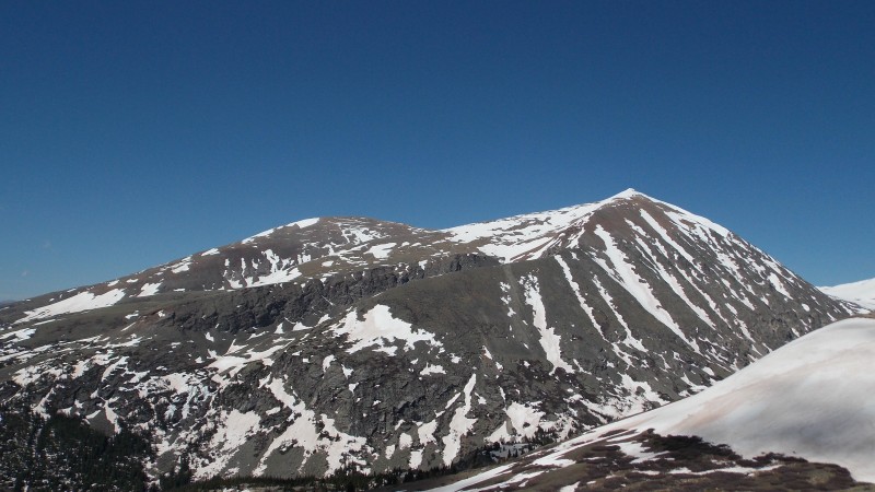 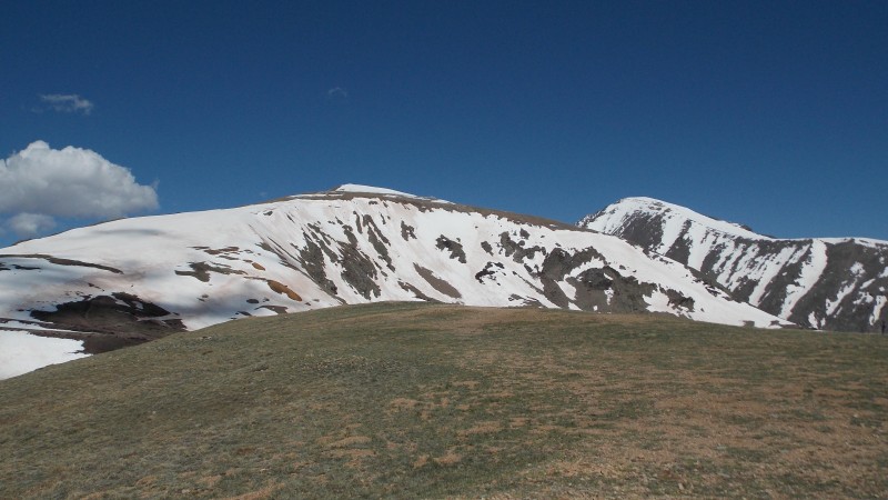 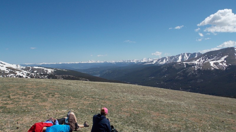 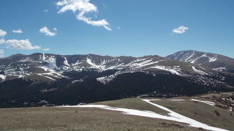 We spent about an hour on the summit and decided to descend on an obvious trail that ran along the ridge towards the pass...I assume that this path is what makes this the "loop" that is described on the SCE website. The descent was uneventful except that we did end up postholing a lot once we got to about 12,000 ft all the way back and it took a lot of path alterations to avoid much of the snow.   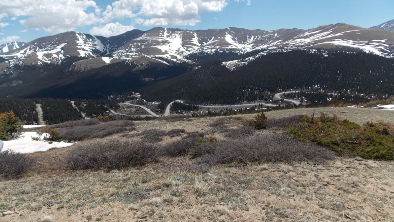 We got a good shot of the group at the pass marker.... 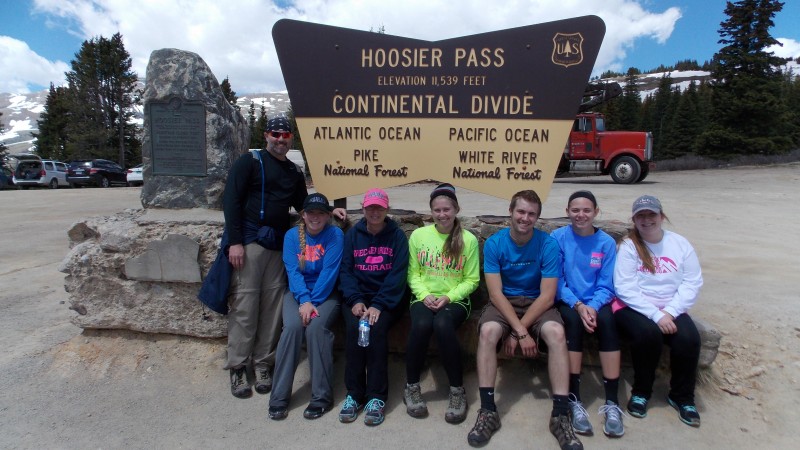 And a parting shot of Quandary from the Blue Lakes Road turnoff on our way back to the cabin.  Now....my thoughts on this hike: First off, without the snow, this is a hike I would have taken my 7 year old niece and my 10 year old and 6 year old nephews on. It is a wide, 4WD road almost the entire time....early June just surprised me with a lot of snow, but it worked out great as an introduction for our newbies. The views are great and if you are still feeling froggy after bagging 12214 you can always continue on to Northstar Mountain. This is a great hike for little ones later in the Summer...it gives them great views and lets them experience summitting a mountain. I did enjoy it also, but any day in the mountains...whether it be on a summit of a 14er or looking at the mountains from a cool mountain town....is a good day. Like I said at the start of the report, look into the Summit County Explorers website. It has really good suggestions for hikes other than summit hikes. Thumbnails for uploaded photos (click to open slideshow):
|
| Comments or Questions | ||||||
|---|---|---|---|---|---|---|
|
Caution: The information contained in this report may not be accurate and should not be the only resource used in preparation for your climb. Failure to have the necessary experience, physical conditioning, supplies or equipment can result in injury or death. 14ers.com and the author(s) of this report provide no warranties, either express or implied, that the information provided is accurate or reliable. By using the information provided, you agree to indemnify and hold harmless 14ers.com and the report author(s) with respect to any claims and demands against them, including any attorney fees and expenses. Please read the 14ers.com Safety and Disclaimer pages for more information.
Please respect private property: 14ers.com supports the rights of private landowners to determine how and by whom their land will be used. In Colorado, it is your responsibility to determine if land is private and to obtain the appropriate permission before entering the property.


