| Report Type | Full |
| Peak(s) |
Mt. Sheridan - 13,757 feet |
| Date Posted | 06/09/2014 |
| Modified | 09/17/2016 |
| Date Climbed | 06/03/2014 |
| Author | huffy13 |
| No mosquitoes on this Mosquito 13er!!!! |
|---|
|
My family and I decided last Summer that we wanted to spend a week in the mountains following my son's high school graduation to relax and wind down after a hectic year of cross country, baseball, tennis and many other activities. One of my wife's cousins also decided last Summer that her and her family wanted to come down from Ohio for the graduation and join us for a week in Colorado (they had never been to CO before). I was able to find us a cabin in Blue River that had enough beds and bathrooms for our group and once that was taken care of I immediately started to look at our many hiking options in that area and narrowing down what I wanted to try while we stayed for the week. I knew early on that snow could still be present but I had no idea what to expect back in August when I first started putting plans together. My brother wanted to do at least two hikes, one just for him and I and then another when we took my wife's family on their first ever hike in the real mountains. I immediately thought that a multiple peak hike would be fun and I planned on my brother and I would try the Horseshoe/Peerless combo and maybe more and then looked at Mt. Silverheels for the hike I would take my wife's family on. The next 10 months flew by and next thing I knew my son was a high school graduate and it was time for all of us to head to the high country. We arrived at our cabin on the evening of May 31st and enjoyed an evening of relaxation and some food from Extreme Pizza from Breck. 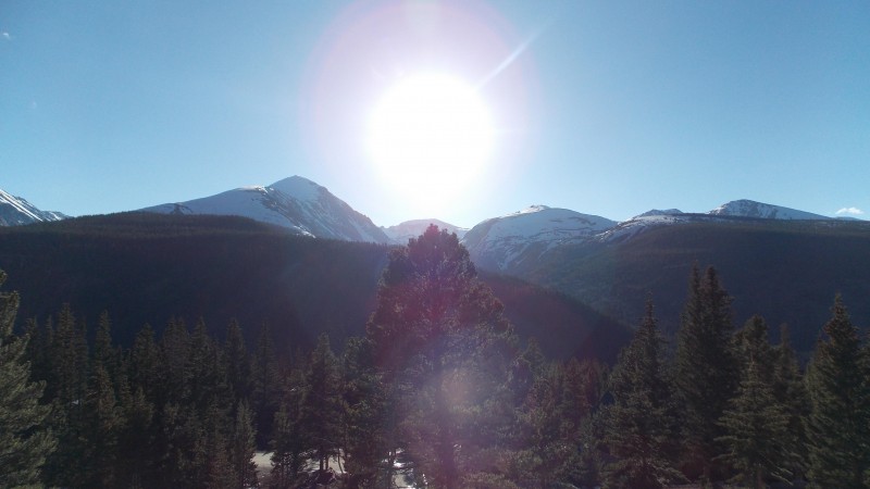 We spent the next couple of days just enjoying Breckenridge and the cabin while we acclimated. My brother and I decided that Tuesday would be a good day for our hike since we both knew what to expect. We left the cabin at about 5:15 AM on Tuesday, June 3rd to head down to the Fourmile Creek TH. We got to the Leavick Mine site right at 6 AM, said hello to a few elk that were watching us intently and hit the trail about 5 minutes later. From the start we knew that we would have to deal with some snow. We assumed that the road that splits off to the south and west of the main road was the one that led straight to Horseshoe, but it had a huge, deep drift across it, so we decided to ascend towards Sheridan and wait to see what the best route would be. 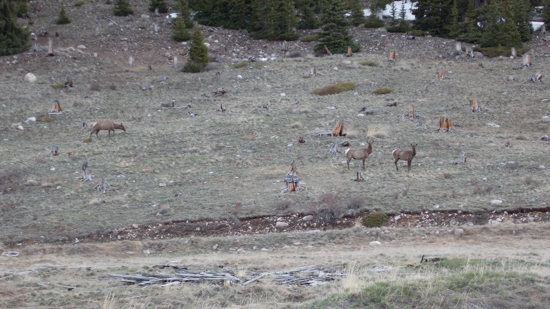 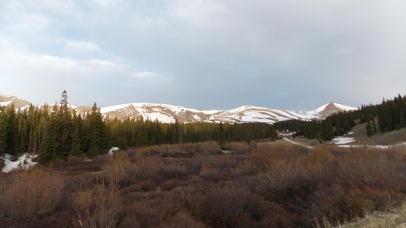 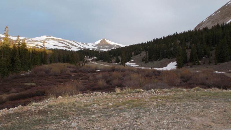 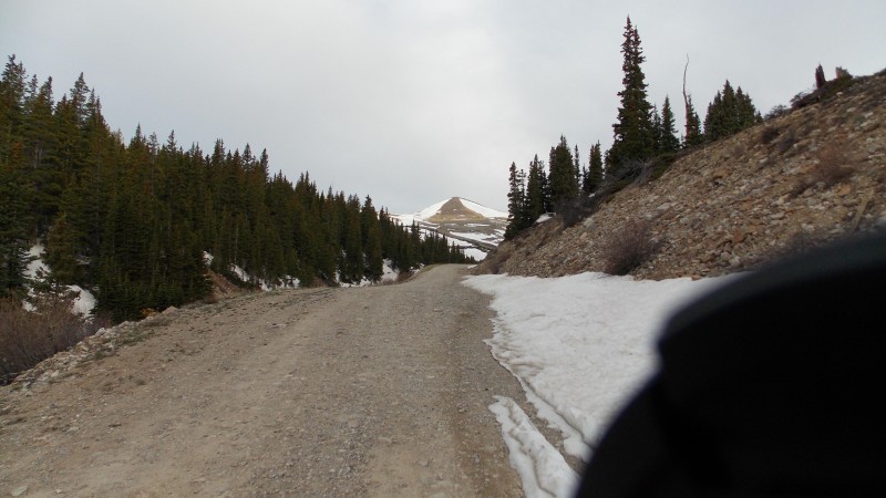 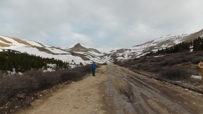 The road up had quite a bit of snow on it but most of it could be avoided with some slight alterations. There were a few places where we had to traverse snow fields and we did end up postholing a few times along the way, but it was never something that bothered us too much. 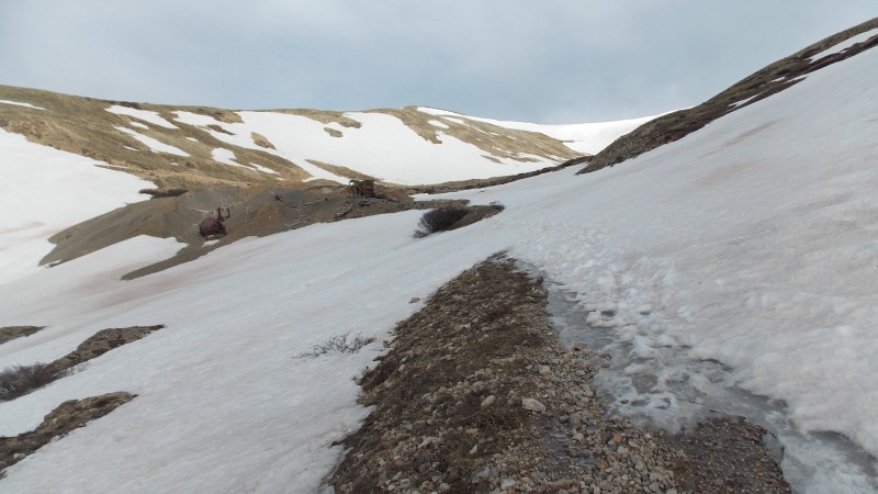 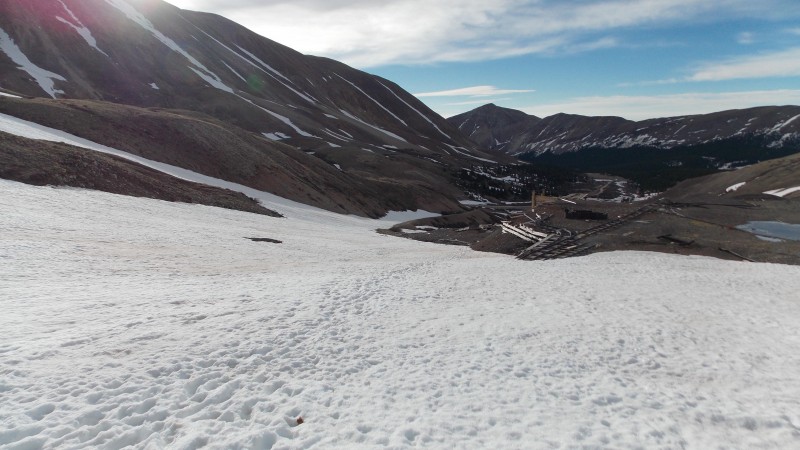 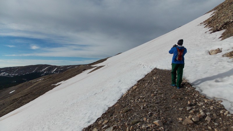 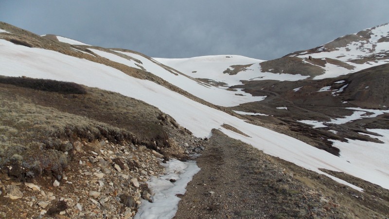 After about an hour we had already gained quite a bit of elevation and our TH was starting to look tiny. 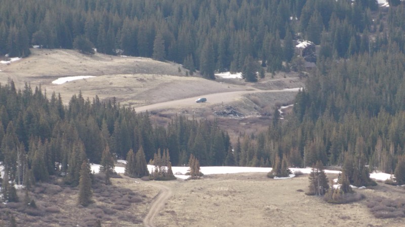 There was an impressive cornice hanging to the east off the ridge/saddle connecting Sheridan and Sherman. 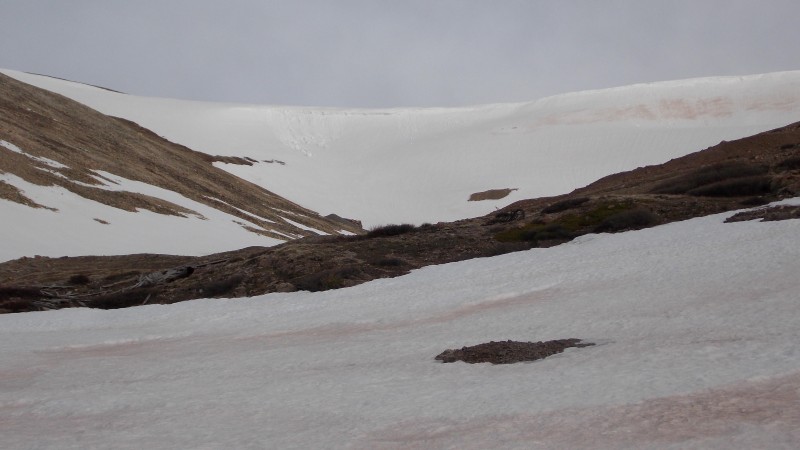 An hour and a half into the hike we got to the mine ruins, we both felt like taking a break, so we took a little time checking out this bit of early Colorado history. 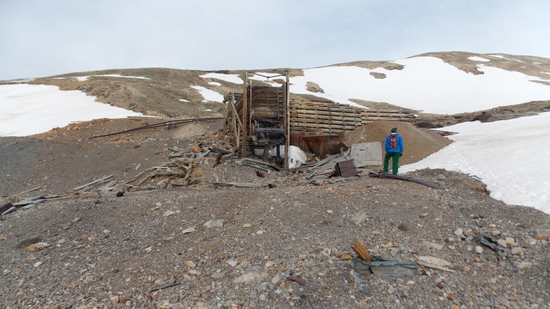 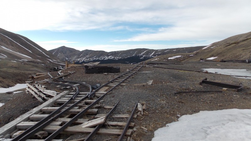 After the break we started making a push up to the gentle slopes above the ruins but before the steeper and rockier East face of Mt. Sheridan. We almost stepped on a ptarmigan here, got a few pics of it and then started to look at our options. 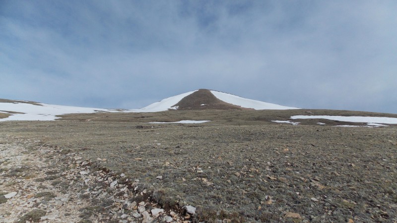 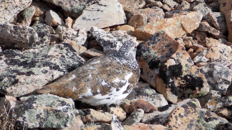 Once we saw what Horseshoe and Peerless looked like and that the East face of Sheridan had a pretty clear route to the top, we decided that we would get Mt. Sheridan for sure and then see what the ridge to Sherman looked like and also what the ridge south towards Peerless had to offer. Anyways, we started heading up the steep, rocky East face of Mt. Sheridan. This was slow going since the trail kind of faded in and out on the way up....we ended up under the large cornice for a while, which I did not like....so we slowly made our way up and further south to get out from under the large overhanging snow drift. 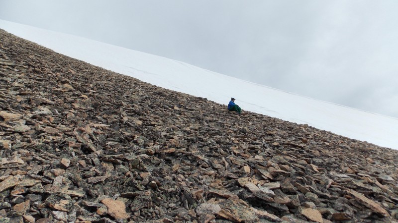 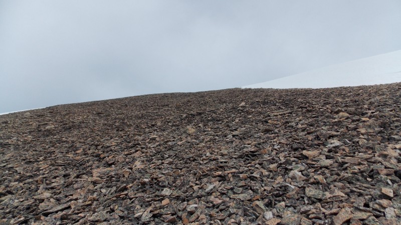 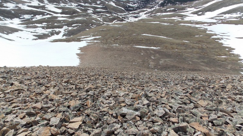 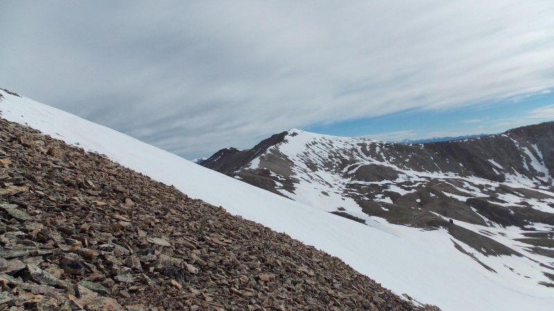 After about 45 mins. on the steep face we finally made Mt. Sheridan's summit, 13,748 ft!!! Hitting the summit at about 8:30 am or so. 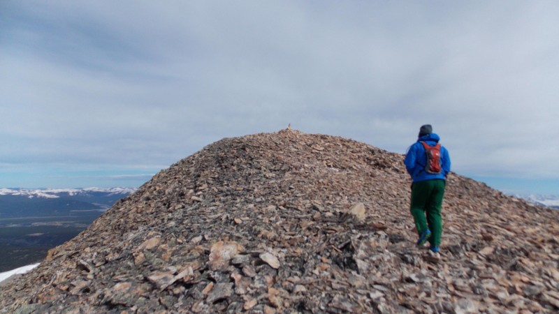 The views are surprisingly awesome for such an underrated range and peak. 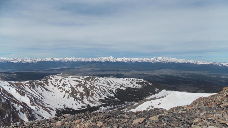 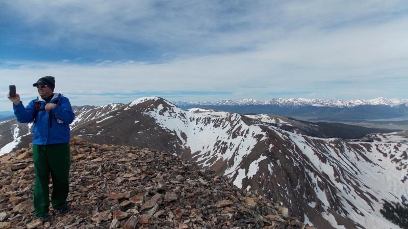 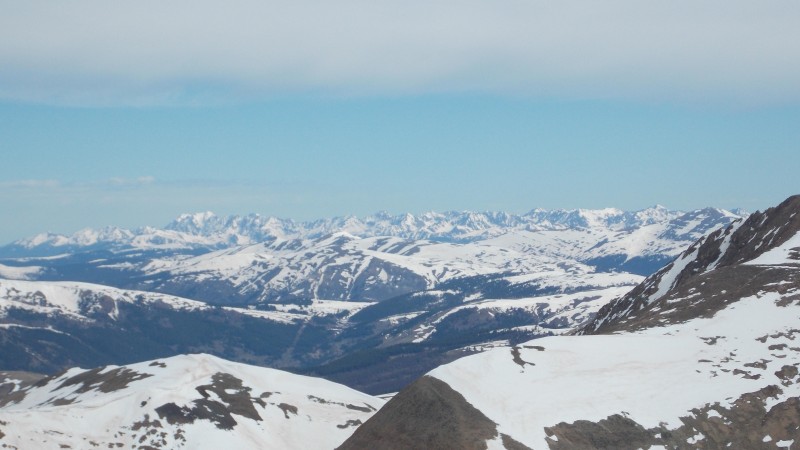 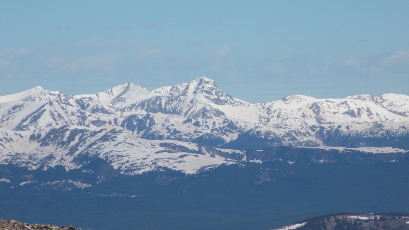 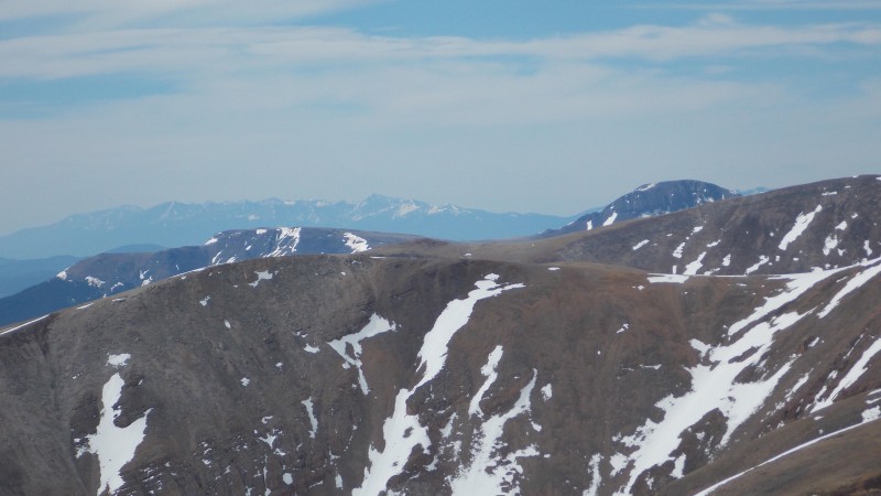 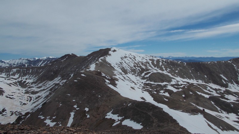 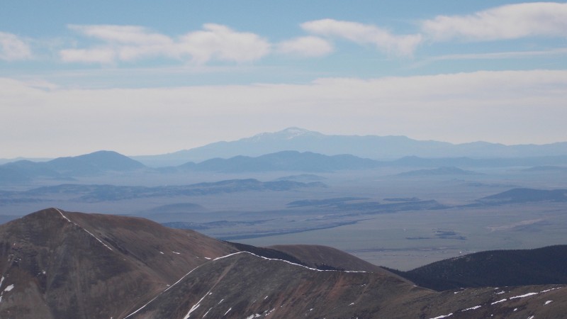 We spent about 30 mins on the summit. It was getting windier and colder, so we got our summit pics and started down.   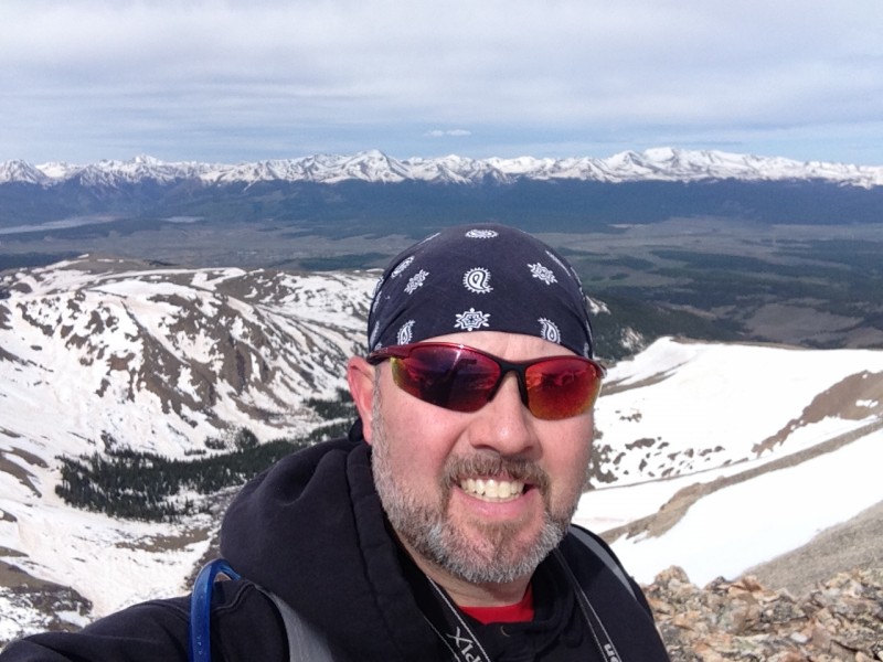 The trip back to the car was uneventful, we found a path that allowed us to avoid the larger snow fields that blocked the road and the snow we did cross got pretty soupy and the road back was a lot wetter than it was that morning. We checked out the Leavick Mine structure from a safe distance and got a few parting shots from the county road on the way out towards Fairplay. 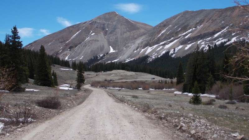 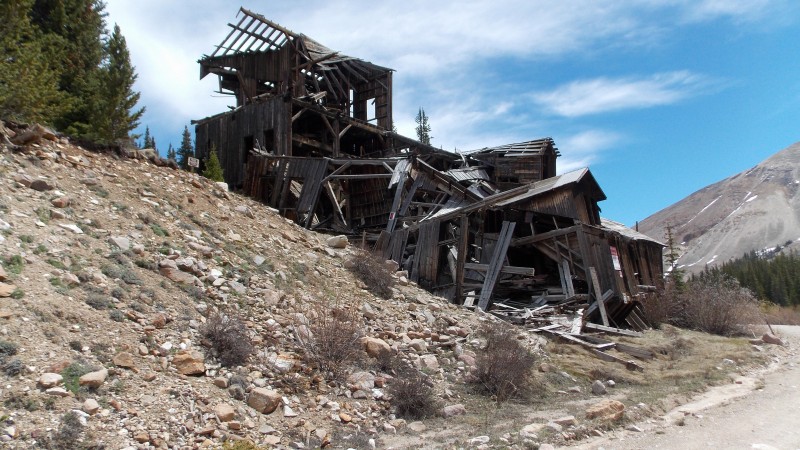 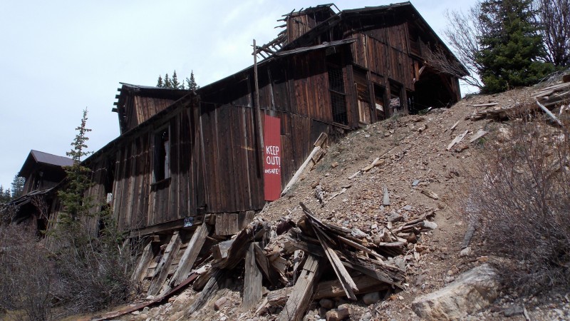 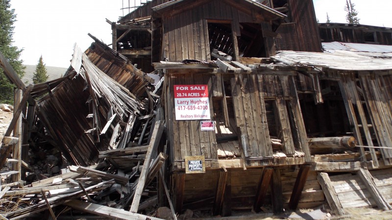 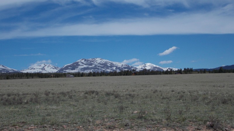  Now, as usual, I will give my insights, thoughts and suggestions about this hike....remember, these thoughts come from a flatlander, so take them with a grain of salt. First off, unless you are prepared for snow, you might try hitting up Fourmile Creek a little later in the season. From what I have been told, there has been a lot of snow later in the season than usual and you can definitely tell once you get to the Leavick site and beyond. It is not a terribly bad hike at any point unless you are going to ascend Mt. Sheridan's East face. The East face is pretty steep and has a lot of loose rock. We could see a faint path as we hiked up, but we both lost sight of it as we got on the slope. I do think the standard route up on the north ridge is probably a lot easier and more solid, but this route was completely covered with the corniced drift and we did not have microspikes or crampons or ice axes, so we didn't feel comfortable trying that route on this particular day. The area is pretty cool and without the snow I really think this would be one of the better hikes to introduce newbies to 13ers or 14ers. The ridges going both ways from Mt. Sheridan were holding a lot of snow, as was Sherman's summit and it's south ridge up it's standard route. I hope this report helps give someone a little info as to what is to be expected and helps anyone that may be looking into this area for a hike in early June. Thanks for reading! Thumbnails for uploaded photos (click to open slideshow):
|
| Comments or Questions | |||||||||
|---|---|---|---|---|---|---|---|---|---|
|
Caution: The information contained in this report may not be accurate and should not be the only resource used in preparation for your climb. Failure to have the necessary experience, physical conditioning, supplies or equipment can result in injury or death. 14ers.com and the author(s) of this report provide no warranties, either express or implied, that the information provided is accurate or reliable. By using the information provided, you agree to indemnify and hold harmless 14ers.com and the report author(s) with respect to any claims and demands against them, including any attorney fees and expenses. Please read the 14ers.com Safety and Disclaimer pages for more information.
Please respect private property: 14ers.com supports the rights of private landowners to determine how and by whom their land will be used. In Colorado, it is your responsibility to determine if land is private and to obtain the appropriate permission before entering the property.


