| Report Type | Full |
| Peak(s) |
Kalalau Trail - 3200 |
| Date Posted | 07/29/2014 |
| Modified | 09/25/2017 |
| Date Climbed | 05/01/2014 |
| Author | Kitten |
| Additional Members | Mountain Mike |
| Hiking the Kalalau Trail in Kauai |
|---|
Kalalau Trail, KauaiLength of trip (one way): 11 miles (+1 mile from car) Total elevation (one way): 3,200 feet Hours (one way): 8 h Cost for permit: $20 per night per person Did I ever say one of my passions is backpacking? Well, now we had the opportunity to combine it with my favorite beach weather and also do one of the most famous trails in the world: the Kalalau Trail. We got enough miles to fly for free to Kauai (the northern of the Hawaiian islands) and one of our goals was to hike the Kalalau Trail which runs through the Na Pali Coast. End of April or beginning of May is one of the recommended times to visit the island, when the rain subsides (or at least it is supposed to do so...). But what we did not know is that reservations must be made in advanced, something like a year in advance! So, here I go on the webpage two weeks before our trip and I was only able to find 2 spots for one night. This means we would have to go the entirety of the trail in one day, camp, and then back again. I think the longest hike we've done with a heavy pack was something like 10 miles, so we were not sure if we would achieve it or not. No big issue. There is a camp spot halfway, so at least that was the goal we had in mind when we started. The night before we camped at the Haena State Park, just a mile away from the start of the Trail. It rained all night (pretty common in Kauai). We got up, unpack the tent, pack everything and started walking to the beginning of the trail. There is parking right at the trailhead, but many cars are broken during the night and the ranger recommended us to leave the car at the State Park, which we did, and this is why this added one more mile to the long trip. We started around 8.15am in the morning. Map of the Kalalau Trail 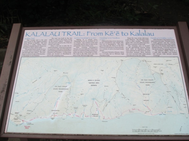 Introduction is over. This is the most spectacular trail I have ever hiked. For me the most difficult part has been to select pictures that could somehow describe the beauty of this place, which is not easy. And since pictures are worth a thousand (or in this case more than a few thousands) I will leave you with the views, just describing each pic along the way. Beginning of the Trail 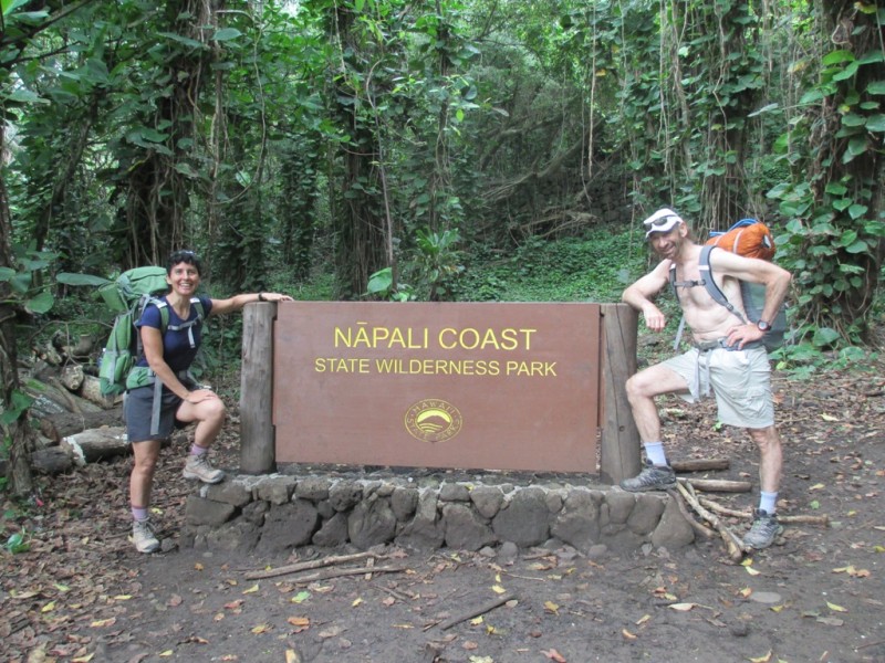 The first part of the Trail is jungle like, no wonder things are green here! 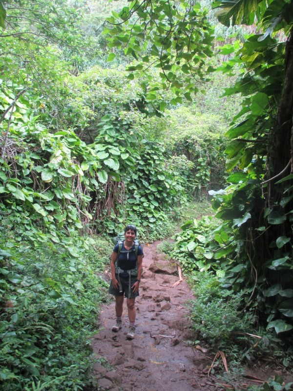 Along the coast, the trail is easy to follow...  Having rained the night before this was the status of the trail. Boots are a must! 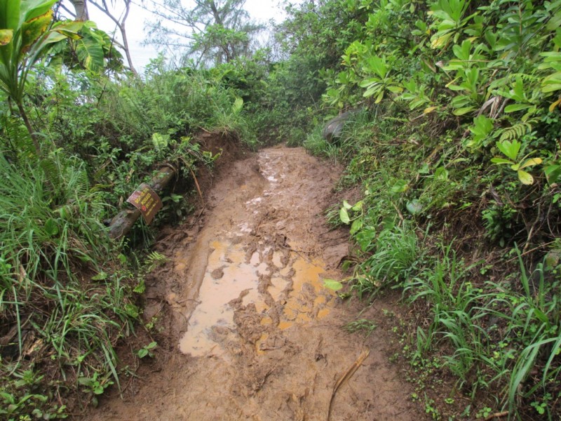 After 2 miles there is a river crossing (we took our boots out and put our sandals on to cross). Sometimes and depending on how much rain there is, it is not possible to cross this creek without being swept away and rangers close it. 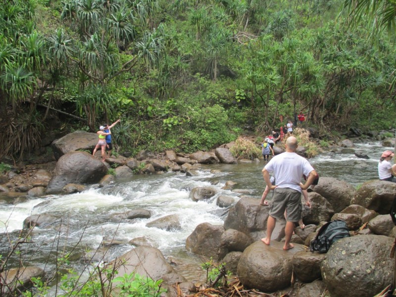 Rain gear is a must! 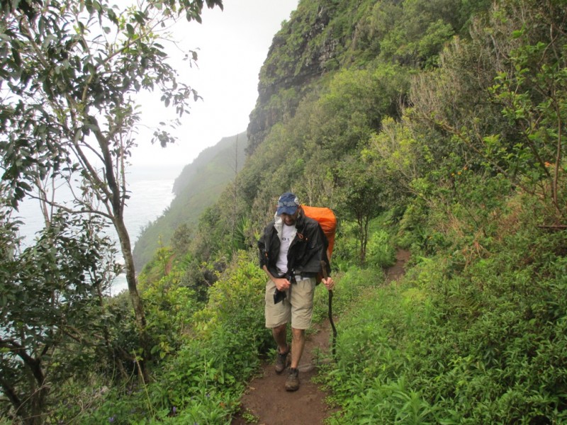 Highest point of the Trail (830 feet) 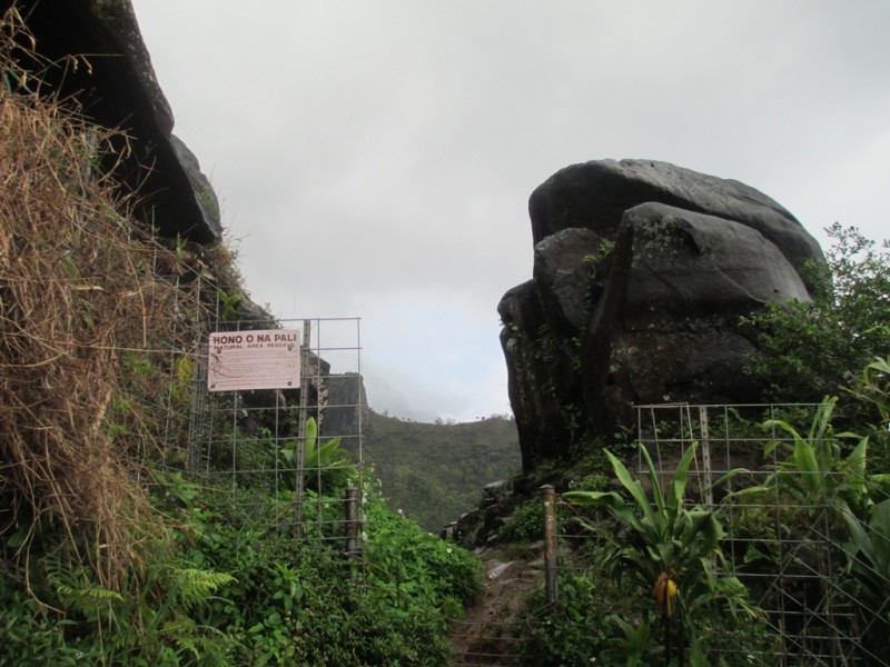 Along the moody Trail 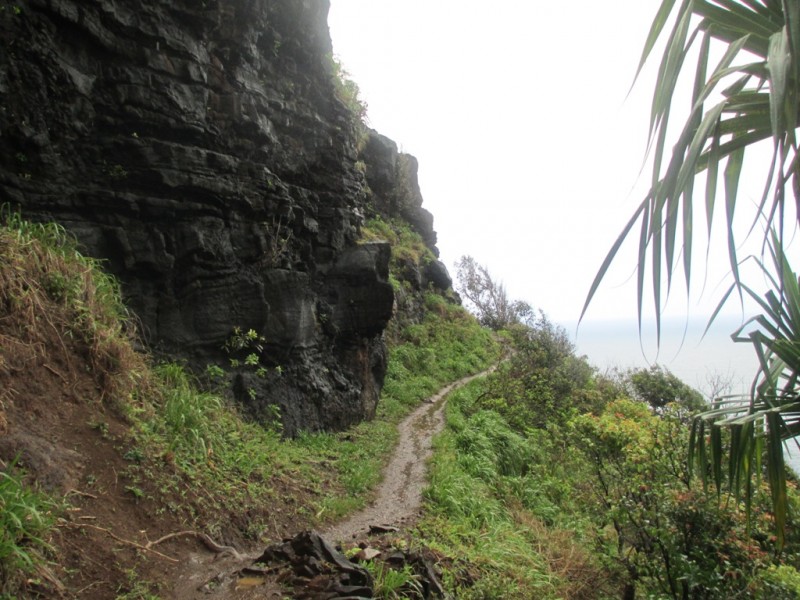 Looking back. Weather was really nasty and bad during the first part of the hike 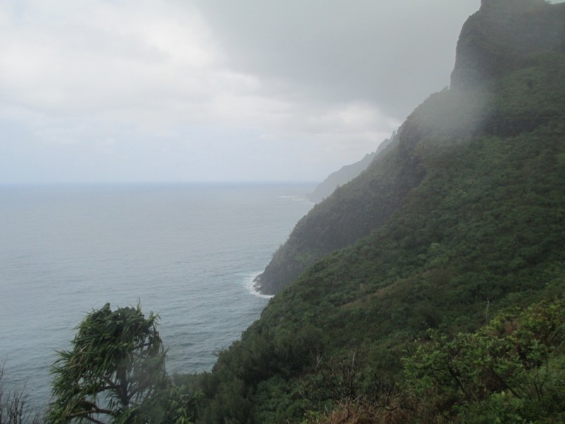 More wet trail... my boots did pretty good and my feet never got wet 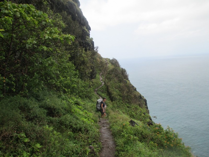 One of the waterfalls, they are spectacular 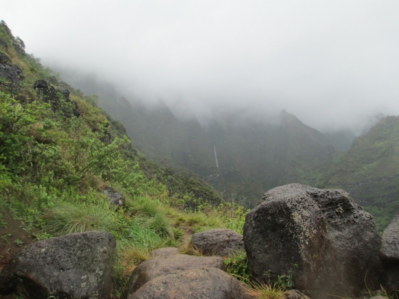 This was at Hanakoa Valley (half way or 6 miles in). This was our first goal, we could camp here and just go back the next day. But, wait, how are we going to put up the tent in this mess? We better keep going, it is just 5 more miles to the end. 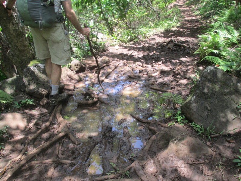 Is the sun coming out? 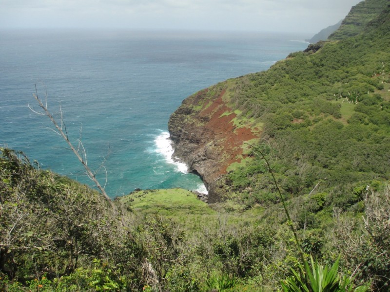 Some of the locals 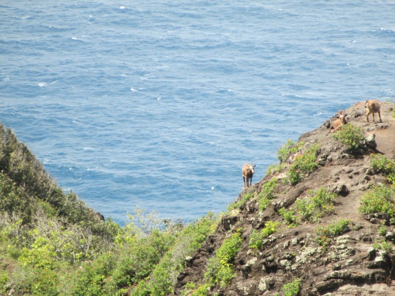 Trail gets tricky here... 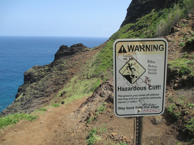 One of the downhills, you can see how the Trail winds from here 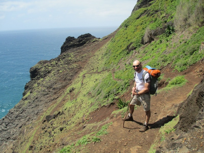 Pretty steep... 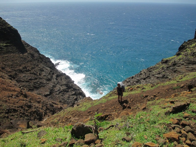 The wind picked up here and made it a little airy... 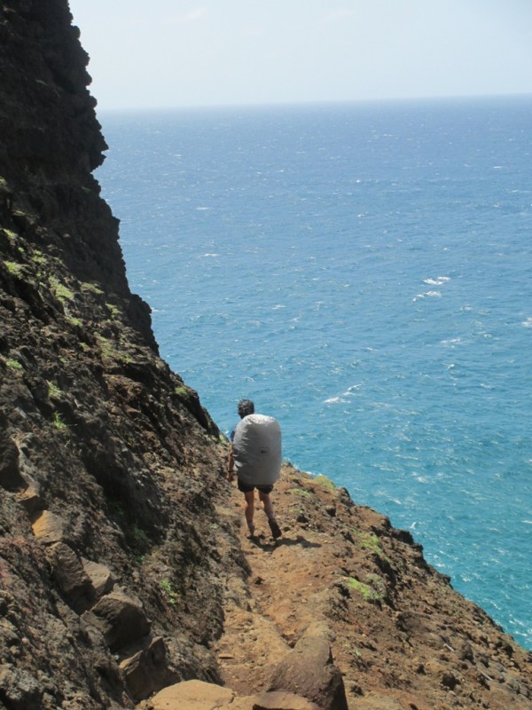 This is what you see when you look down 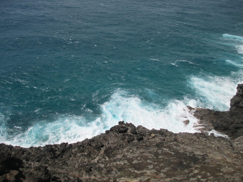 Another view of the Trail looking back, you can see two hikers 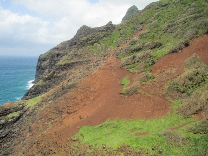 The end of the trail is somewhere there... 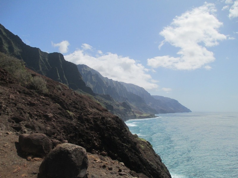 Contrast of red, green and blue 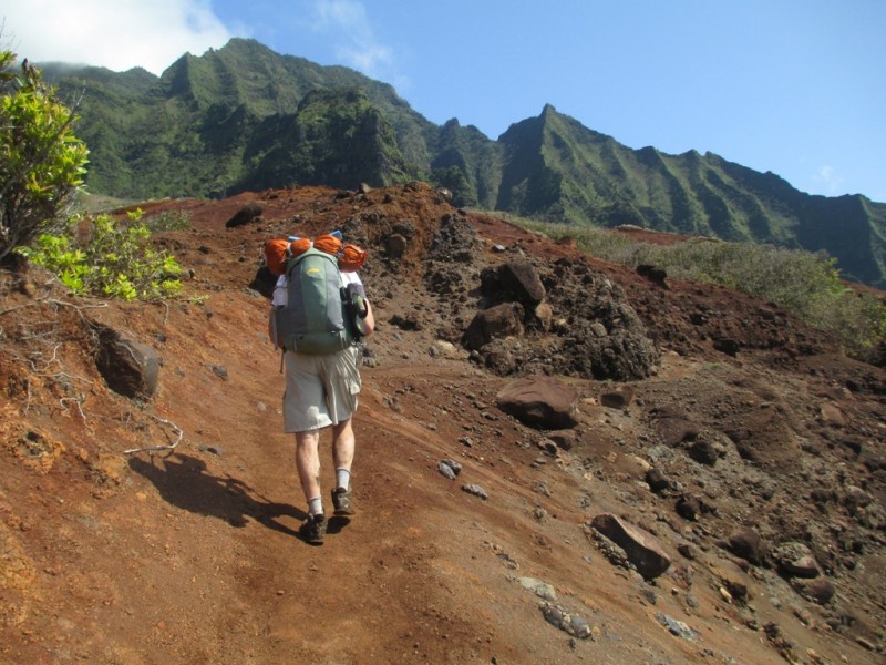 Check out the wave undertoe 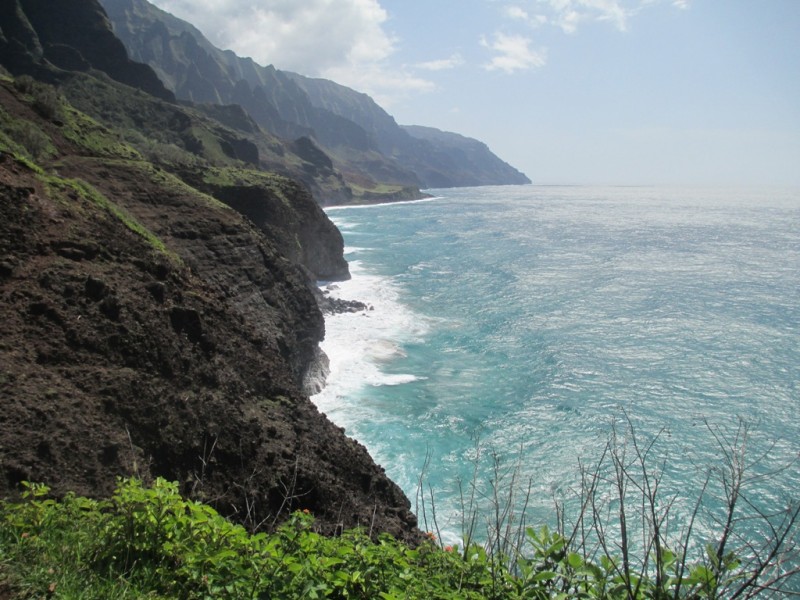 The Trail (on left is visible) is washed out in many places here, you really have to pay attention 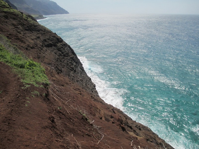 Another view looking back 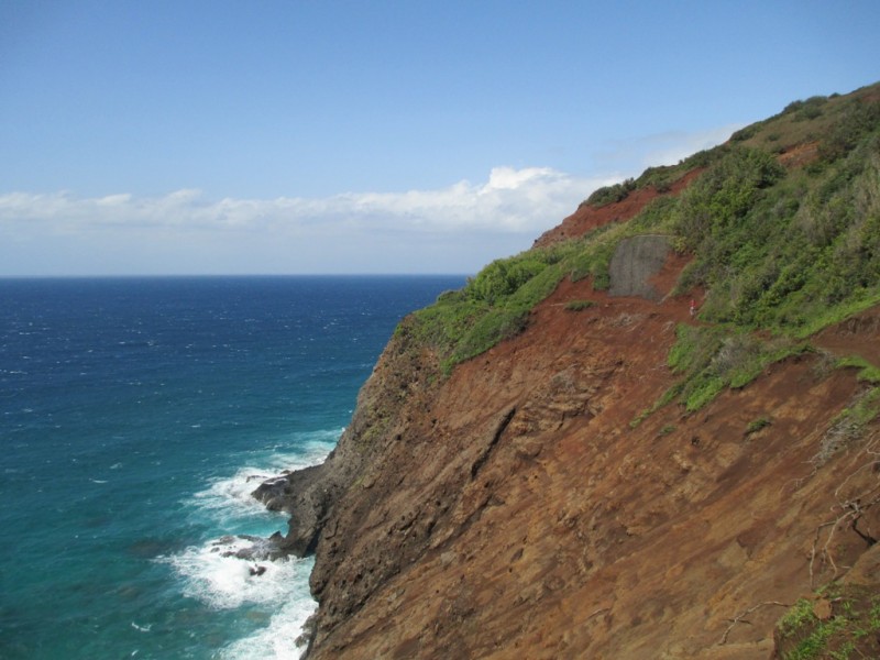 Arches in the ocean 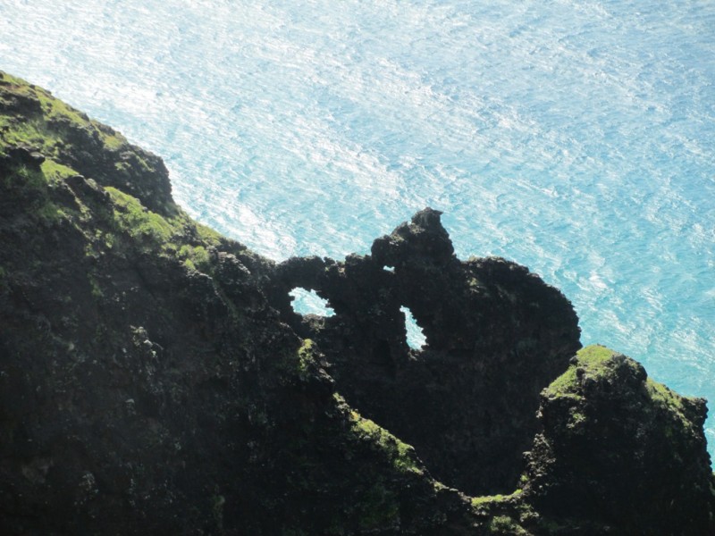 View looking back to the trail 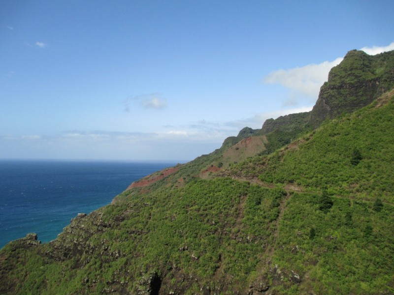 Finally, the sign for Kalalau! 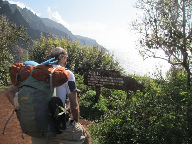 There's the sandy beach! 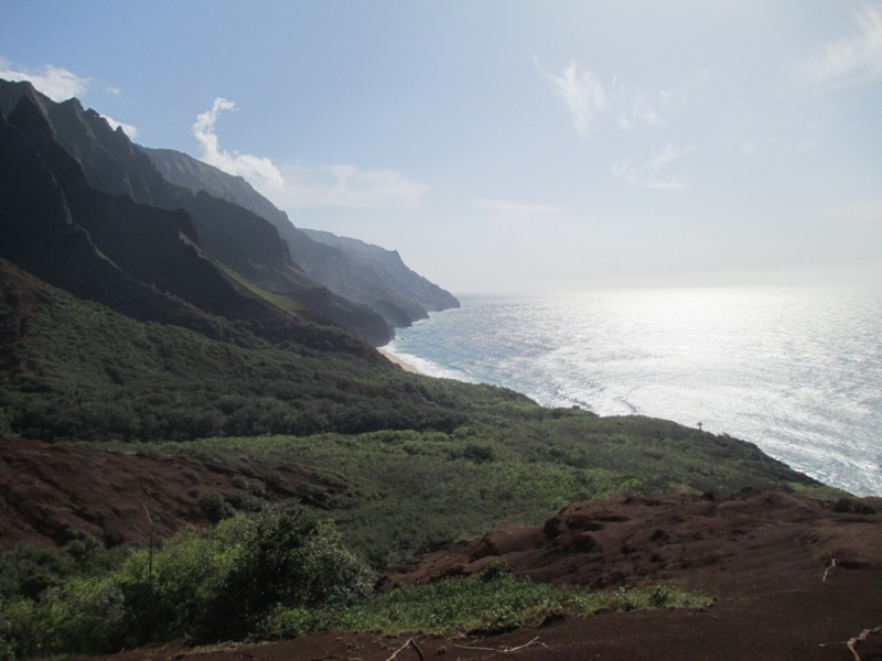 Green mountains 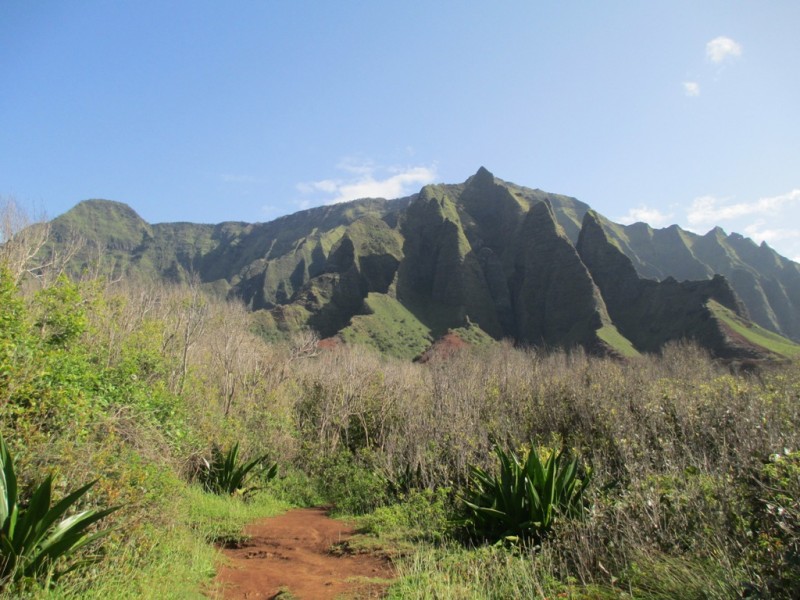 Kalalau Beach 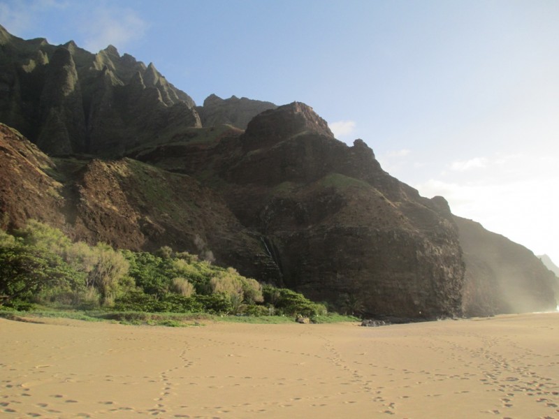 Happy to be wearing sandals. The ocean was to rough to jump in 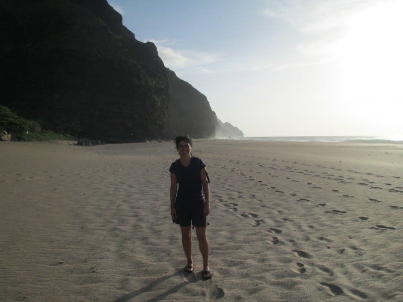 Pretty sunset 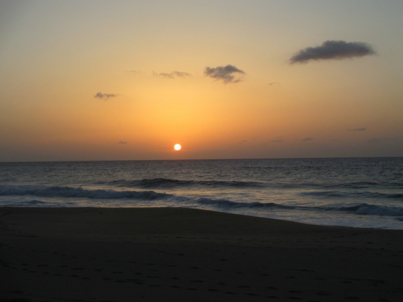 Next morning at the beach. It gets daylight before 5am  Antoher morning view  Starting the trip back to Kee Beach 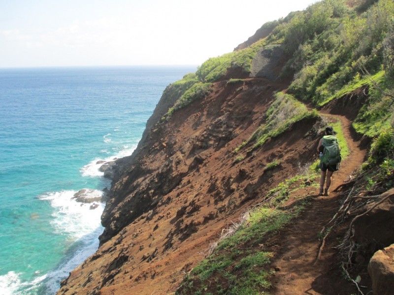 Looking back to Kalalau  Another local. 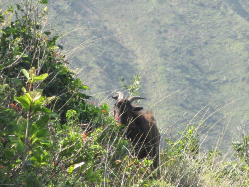 Through the narrow section. You can see a kayak on the right side of the ocean. Next time! 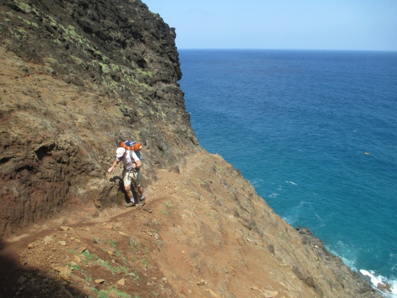 Makena Mountain 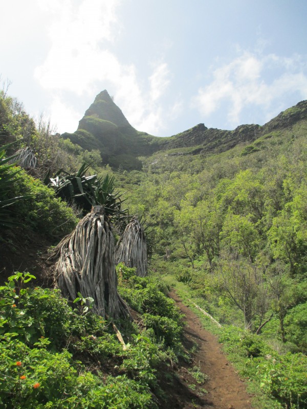 On the way back, we took a detour onto the Hanakoa waterfall, which is 500-foot high 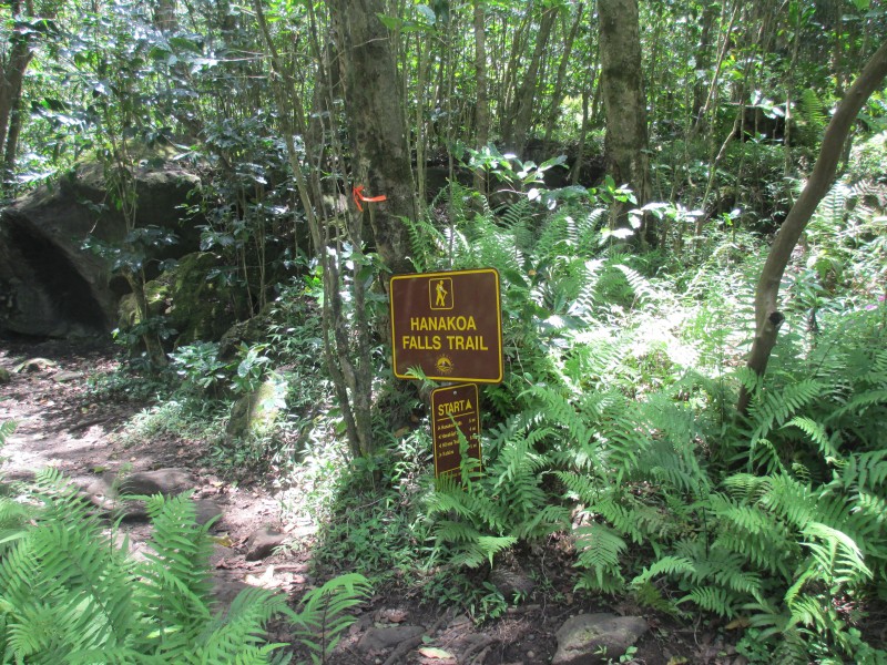 Hanakoa Waterfall, impossible to get it all inside the picture 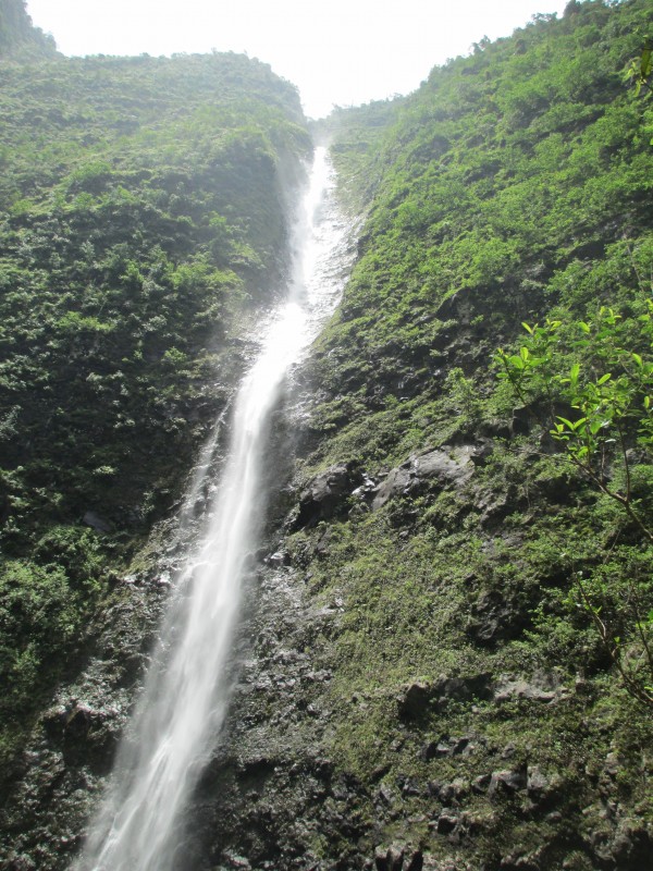 The Trail still drops out on the ocean. I am glad to have overcome the fear of heights during the CO adventures 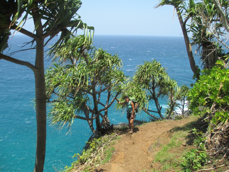 Waterfalls on the right side, you can never get tired of this place... 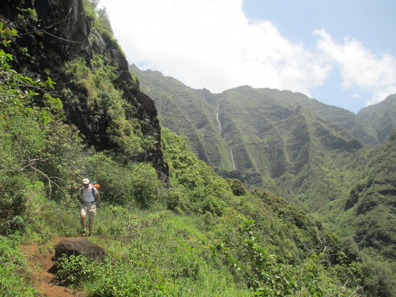 A close up to the waterfalls 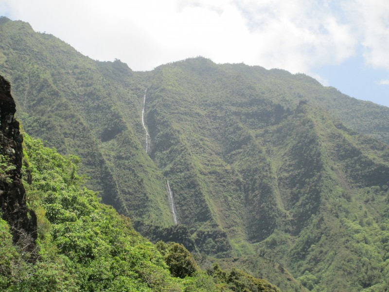 Almost back  A look again to the total distance and time. Note that Kalalau beach is listed at 6-10 hours. Even though the distance may not look that far it does take a fair amount of time to hike the entirety of this Trail. We did it in 8 hours, which would be about average, counting stopping times and a heavy-moderate load on your back. 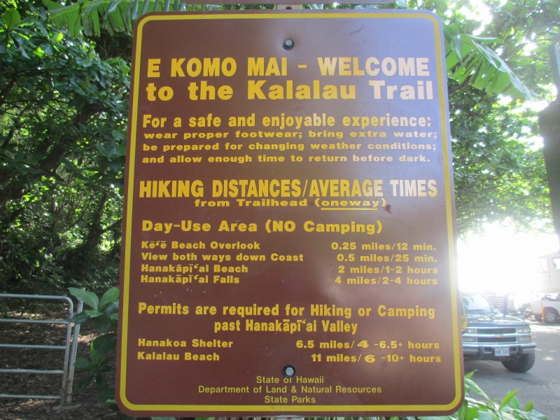 Curiosities of the trail: - Even though you need a camping permit to do this hike we discovered there is a whole Community living at the end of the Trail. They don't wear clothes (other than swimsuits), no shoes, sleep in hammocks or bivys, eat any type of nuts (macadamias mostly) or fruits they can gather from the trees...also any type of food they beg from hikers coming in... interesting life. We found out from a hiker that had done the trail the day before that a squad team (consisting of several helicopters and army groups) had repelled their way down into the valley to try to gather and catch these people. Probably unsuccessfully because they are lots of places to hide in, that place is like a jungle! Apparently they do this twice a year. Before we left we gave our tarp to one of the locals, we learned that whenever there is a piece of gear you don't want to use anymore, there is always somebody who might need it, never put it in the trash, pass it on... - An important issue regarding water safety. We always carry our Katadyn filter with us and thought we would be ok. Later on we found out that there is a bacteria call Leptospirosis that resides in waters from creeks and waterfalls in tropical climates. Common filters do not eliminate this bacteria! It is not clear if iodine does either, I have seen conflicting reports on this. The best way would be to filter the water and then add chlorine. We did not get sick (it's been already over several months). We chose to filter from very small streams and always made sure there was no usage (people) upstream. The thing is that you can get this bacteria by just swimming in the pools from the waterfalls or via direct contact with eyes, mucus, ears... - The constant buzzing of helicopter sounds (mainly from tourism operations) is quite annoying to say the least. My ears were buzzing all night the first day, after hearing the constant sound for more than 10 hours. If you have seen Apocalypse Now you know what I mean. I think they should restrict the air traffic in this beautiful part of Kauai. - There was a rescue the same day we were hiking in. Apparently somebody had fallen on their backs on the steeper section of the trail (probably due to panic) and a helicopter had to land and take them to safety. There is no cell phone reception, so if you need help you have to flag one of the tourist helis and then wait for the rescue ones to come. Every year there are rescues and even deaths on this Trail, people underestimate the difficulty of this hike and are not prepared for adverse conditions (mud, rain, river crossing, physical strength...). - If I were to do this Trail again (which probably would be by boat or kayak) I would lighten my pack. You really don't need much, other that rain gear and some food. - We calculated that the total elevation was around 3200 feet each way. The Trail goes up and down, it is demanding and you can not underestimate the length + elevation combination. - An extra night would have been nice, but we were not able to get the permit for 2 nights in a row. That would allow to rest after a long hike and explore the side canyons at the end of the Trail. By the way, the total cost for our trip was below $500 for both of us: Plane tickets: $80 for tax Car rental: $250 5 nights of camping: 6x5 = $30 Permits for Kalalau trail: $40 What else can you ask for? Thumbnails for uploaded photos (click to open slideshow):
|
| Comments or Questions | ||||||
|---|---|---|---|---|---|---|
|
Caution: The information contained in this report may not be accurate and should not be the only resource used in preparation for your climb. Failure to have the necessary experience, physical conditioning, supplies or equipment can result in injury or death. 14ers.com and the author(s) of this report provide no warranties, either express or implied, that the information provided is accurate or reliable. By using the information provided, you agree to indemnify and hold harmless 14ers.com and the report author(s) with respect to any claims and demands against them, including any attorney fees and expenses. Please read the 14ers.com Safety and Disclaimer pages for more information.
Please respect private property: 14ers.com supports the rights of private landowners to determine how and by whom their land will be used. In Colorado, it is your responsibility to determine if land is private and to obtain the appropriate permission before entering the property.


