Download Agreement, Release, and Acknowledgement of Risk:
You (the person requesting this file download) fully understand mountain climbing ("Activity") involves risks and dangers of serious bodily injury, including permanent disability, paralysis, and death ("Risks") and you fully accept and assume all such risks and all responsibility for losses, costs, and damages you incur as a result of your participation in this Activity.
You acknowledge that information in the file you have chosen to download may not be accurate and may contain errors. You agree to assume all risks when using this information and agree to release and discharge 14ers.com, 14ers Inc. and the author(s) of such information (collectively, the "Released Parties").
You hereby discharge the Released Parties from all damages, actions, claims and liabilities of any nature, specifically including, but not limited to, damages, actions, claims and liabilities arising from or related to the negligence of the Released Parties. You further agree to indemnify, hold harmless and defend 14ers.com, 14ers Inc. and each of the other Released Parties from and against any loss, damage, liability and expense, including costs and attorney fees, incurred by 14ers.com, 14ers Inc. or any of the other Released Parties as a result of you using information provided on the 14ers.com or 14ers Inc. websites.
You have read this agreement, fully understand its terms and intend it to be a complete and unconditional release of all liability to the greatest extent allowed by law and agree that if any portion of this agreement is held to be invalid the balance, notwithstanding, shall continue in full force and effect.
By clicking "OK" you agree to these terms. If you DO NOT agree, click "Cancel"...
ROUTE: East Face RT GAIN: ~5,200' RT DISTANCE: ~12 miles RT TIME: ~8 hours CLIMBERS: Jeff (SurfNTurf), Kate (binvers2)
As the first high peak I ever attempted, the final 14er of my 58 and the centerpiece of what I consider the finest view in the state, some might say I think Mt. Sneffels is kind of OK. The goal of climbing the Snake Couloir over Memorial Day formed long ago, and it served as needed fuel during months of shoulder rehab.
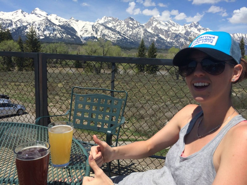
While my surgically repaired labrum held up its end of the bargain, Mt. Sneffels did not. I watched helplessly last week as the forecast drifted from decent to poor to miserable. The recent TR posted proves a few weather windows existed, but with my girlfriend Kate by my side, we wanted more sunshine and butterflies and less graupel and sufferfest.
But where to go? It's prime snow-climbing season and we'd already arranged for a dogsitter and a half-day of work Friday. Moab? Talk about a ****show over Memorial Day Weekend. New Mexico? The weather sucked there too. Anywhere else in Colorado? "LOL IT'S MARCH AGAIN NOW," Mother Nature said.
The epiphany came from a strange source. Listening to Mike & Mike while driving to work Thursday morning, one of the Mikes revealed the other Mike was vacationing in Grand Teton National Park over the long weekend. The Grand? That's only a couple hours farther than Ouray. I checked the weather on my phone and found blue skies, negligible wind and warm temperatures awaiting in western Wyoming. The decision was made. I'd be taking the first of what I hope are many pilgrimages to the Teton Range. Also, Mike doesn't talk about Cam Newton nearly enough, and I wanted to give him a piece of my mind.
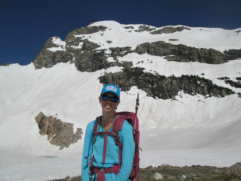
I had about 24 hours before departure and a lot of planning to do. Thank god for the American Alpine Club Library and its wealth of guidebooks. As Kate has more passions in her life than mountains (...she has a point...), even with the original plan of Mt. Sneffels, this trip was meant to be one climb squeezed in between a couple days of fun and relaxation. A plan materialized. We'd do a whirlwind tour of Yellowstone National Park on Saturday, attempt a day-climb Sunday and finish with a shorter hike Monday before heading home.
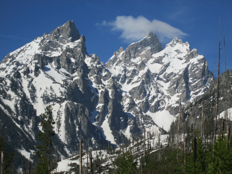
Thanks to everyone who responded to my thread asking for route recommendations. We'd settled on the East Face of Buck Mountain or the SW Couloir on the Middle Teton, and didn't decide on Buck until we laid eyes on it. Anyone who's seen it knows it's an impressive sight from the valley floor, even at a meager 11,938 feet. It fills the climber with all the emotions that make this whole summit business a worthwhile pursuit in the first place.
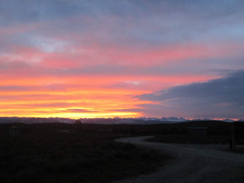
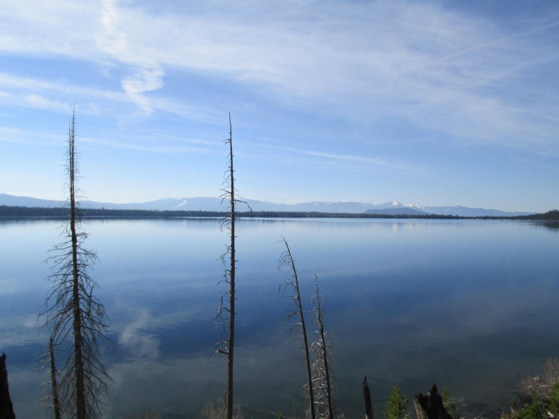
We got a late start out of Denver on Friday and didn't pass through Pinedale, Wyo., until 11 p.m. We opted to pull over and camp about 45 minutes from Jackson and were rewarded with this dramatic scene the following morning. Not bad for my first view of the Wind River Range. "The list" grew considerably.
Wind River Range sunrise.
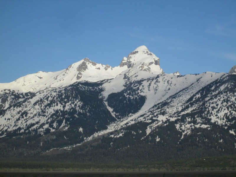
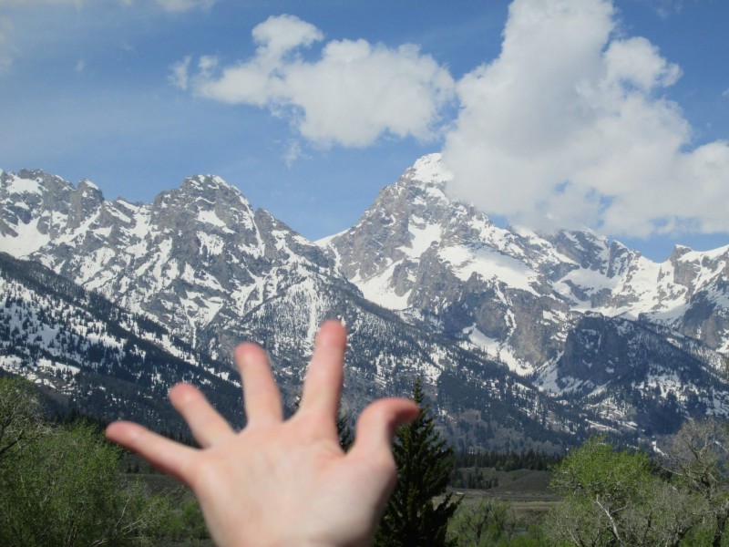
Eager to lay eyes on the Tetons, we blew through Jackson and into the valley at 7 a.m. Wow. Just wow. If you haven't visited the Tetons, cancel all your plans and go. As a climber, rounding the bend into the National Park is one of those sights you'll never forget.
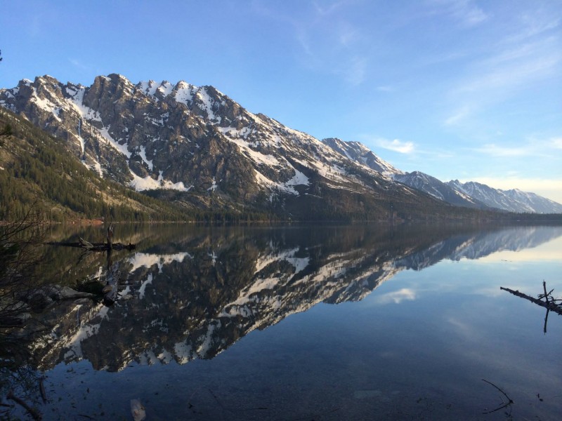
Standing proud and solitary, much lower than the Grand but still majestic, was Buck Mountain. Our decision was made immediately. But first, Yellowstone. We snagged one of the last two campsites at Jenny Lake, pitched our tent and were northbound by 8 a.m.
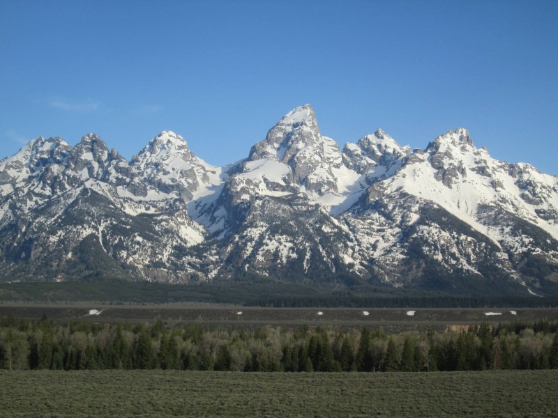
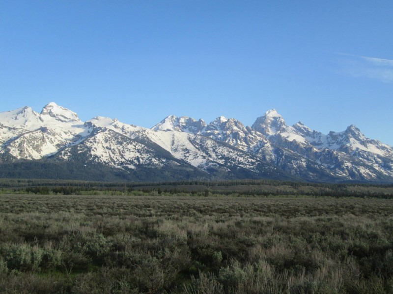
Teton Range.
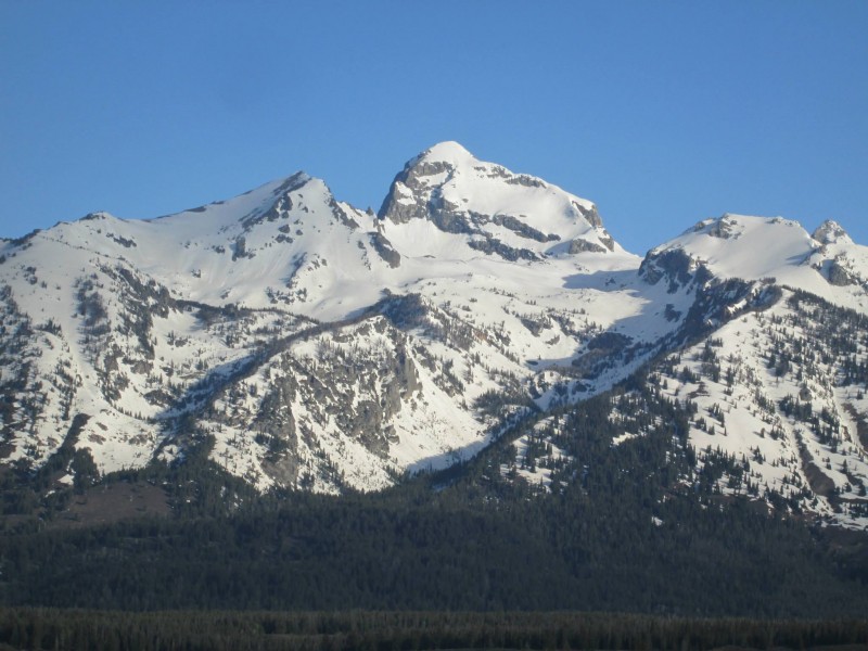
Buck Mountain.
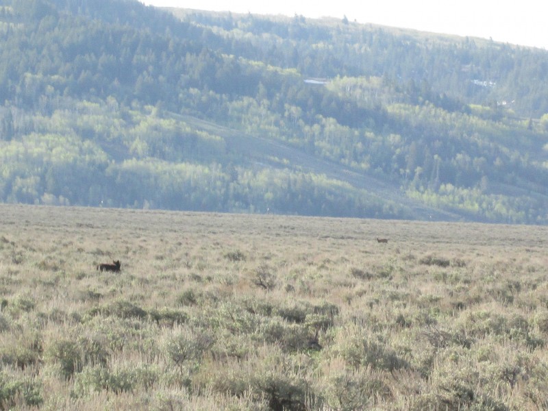
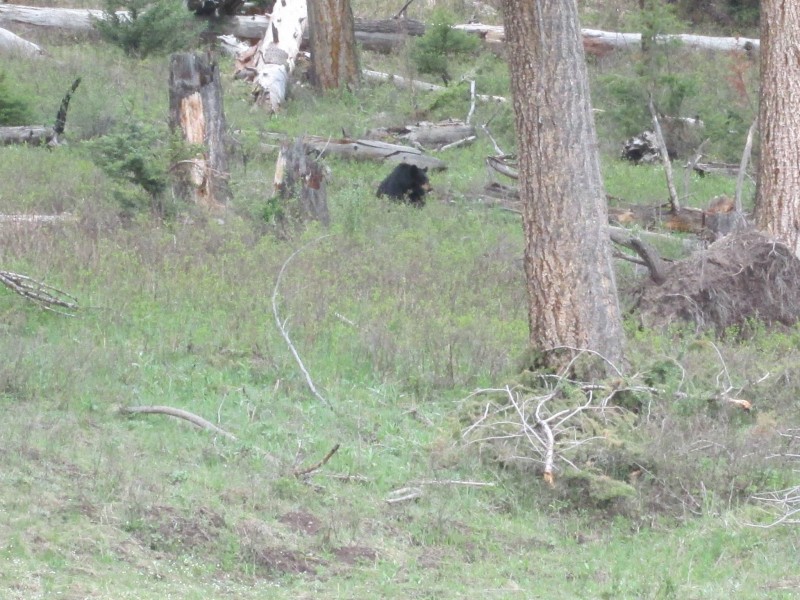
Most people take several days to experience Yellowstone. We had about eight hours. Luckily, Mother Nature decided to quit being a total ass for once this spring and blessed our entire Saturday. Before we even entered Yellowstone, we saw a grizzly bear with two cubs and a wolf. In the park, we encountered a black bear with three cubs, a moose, two bald eagles, a pack of coyotes and more bison than I could eat in a lifetime (though I'd like to try). We also managed to experience all the major attractions, including Old Faithful, Yellowstone Lake, Mammoth Hot Springs, Yellowstone Falls, the Mud Volcano and the Petrified Tree (insert Beavis and Butthead laugh here).
Wolf (...pretty sure...).
Hey Booboo...
Moose.
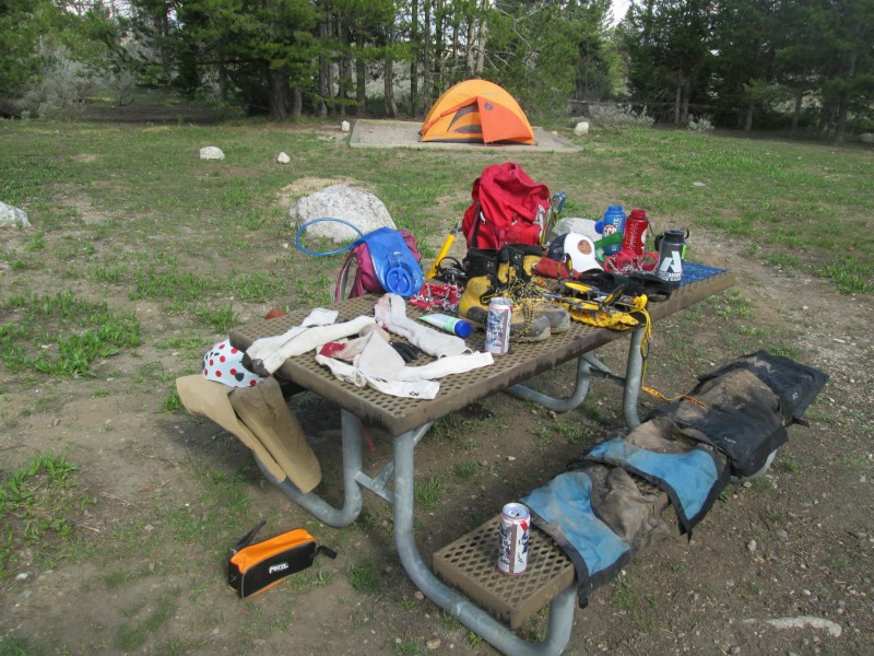
Anyway, on to the actual mountain climbing. We were back to camp at Jenny Lake by 7 p.m. with plenty of time to make dinner, pack and go to bed at a reasonable hour. There I was, calmly stuffing crampons into my pack, when I heard the sound that strikes fear into all men's hearts. The annoyed female "arghhhhhhhh!"
What had I done? Surely it coudn't be the toilet seat; that would be the least of her concerns in the campground's vault commode. Had I bought the wrong brand of macaroni and cheese? Moved her toiletry bag from the front seat to the back? Farted in her sleeping bag again? No, I was off the hook. She'd only left her mountaineering boots back in Denver.
A quick call to Teton Mountaineering in downtown Jackson revealed they had rental Trangos for $12/day. We had 40 minutes to make a 35 minute drive before they closed at 8 p.m. I channeled my inner Dillon Sarnelli and we made it with 10 minutes to spare. The shop clerks absolutely loved us, I'm sure.
Sadly, the miracle rentals didn't help us much. This is a tale of only near-success. Our fatal flaw was sleeping in too late -- and by that I mean, we woke up at 3 a.m. What are we, a couple high-schoolers, rolling around in bed until noon? Everything would have been different if we'd gotten up an hour earlier. Ugh.
Another view of Buck.
The Death Canyon Trailhead is easy enough to find. The rest of the route, in the dark at least, is not. The following photos show the major landmarks, taken on descent, as described accurately in Ortenburger and Jackson's A Climber's Guide to the Teton Range. We had boots on the ground at 4 a.m. The road to the parking area is called 4WD to deter overzealous tourists, but in Colorado we'd almost consider it paved. A low-clearance Mazda 3 handled it no problem.
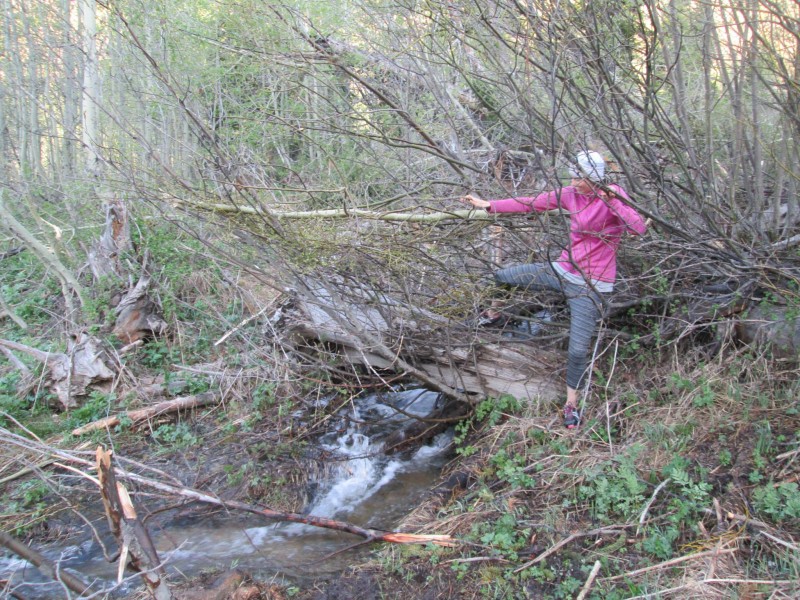
Starting on the trail to Phelps Lake, the first turn is about 10 feet before the third footbridge at the 0.5-mile mark. This is a true climber's trail, barely discernible by headlamp. Kate thought I was leading her to a grizzly den. After a few minutes of what amounts to a minor bushwack, the prospective climber emerges into a large meadow. The goal is to do an ascending traverse toward a stand of trees to hiker's right, then skirt the trees north over a series of four creek crossings. The fourth is a total bitch.
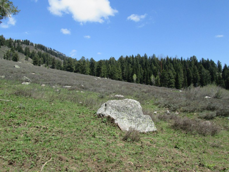
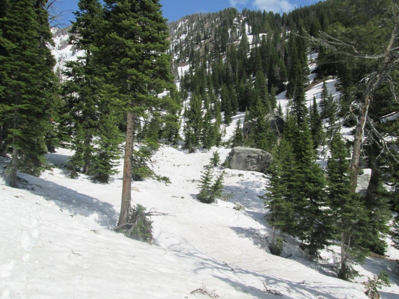
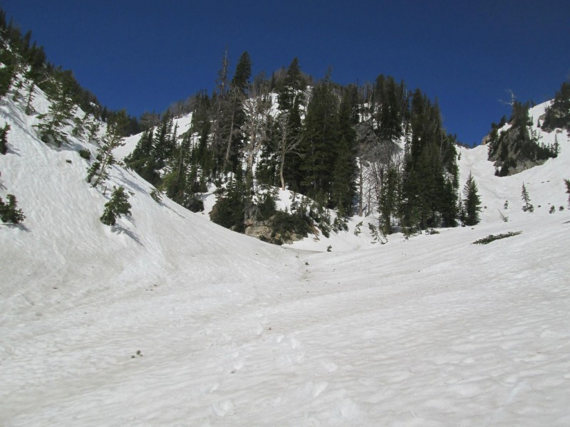
Back on a solid trail, hike over a minor ridgeline into Stewart Draw. The summer description says to cross the creek near a large boulder and ascend the northern side. Everything was still snowed over and frozen, so we skipped the sidehill nightmare and just plodded straight up the drainage. A couple hundred feet later we were presented with a choice of gullies to gain the upper cirque, and we chose the more gradual lefthand line. It made for expedient travel.
Open meadow. Head toward the right-hand trees, then follow them up to the trail.
Toughest creek crossing.
Entering Stewart Draw. You'd cross the creek near the large boulder.
We took the gully to the left. Straight up also would have worked.
There's nothing quite like a morning in the mountains.
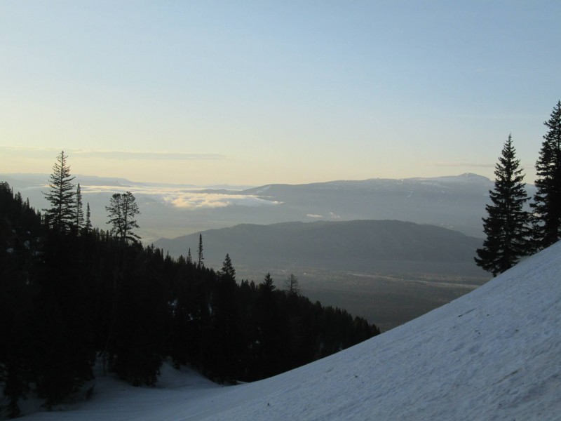
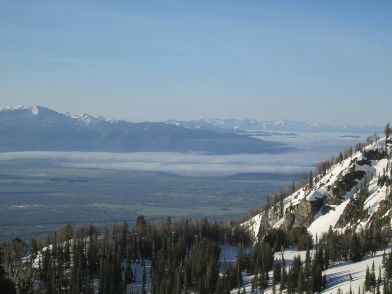
Cloud layer over Jackson.
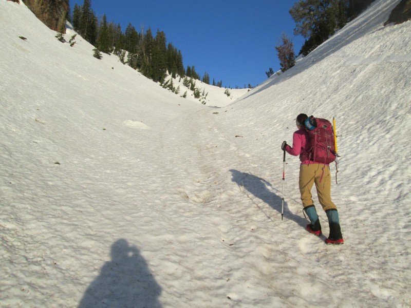
Kate heading up Stewart Draw.
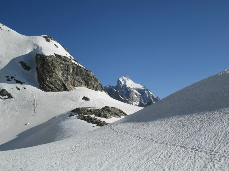
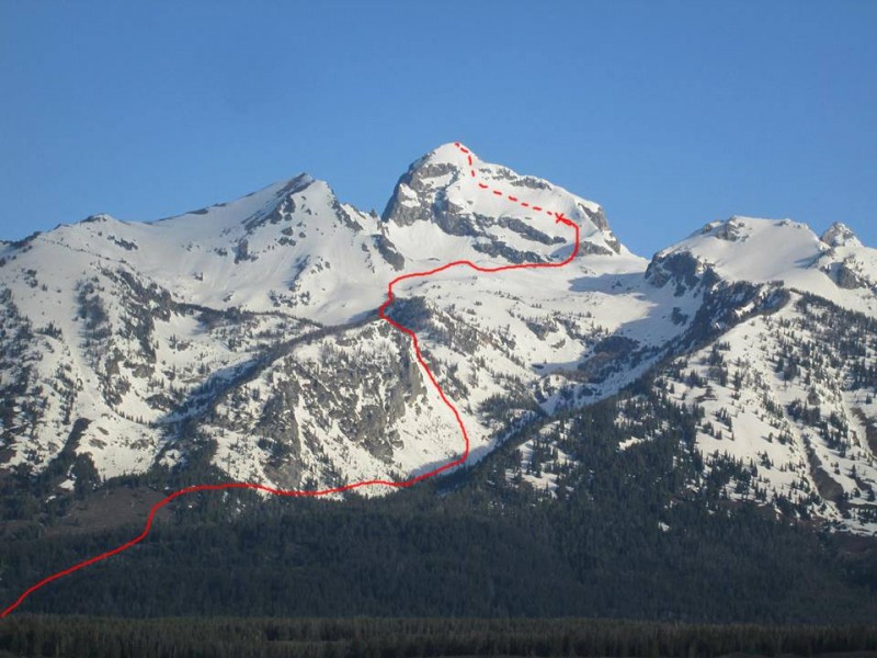
The East Face of Buck Peak, along with Albright Peak and Static Peak, finally made an appearance as treeline was abandoned. Our objective looked far away, but two climbers in the middle of the face gave perspective. We were making good time.
The guidebook says it's a six- or seven-hour ascent from the trailhead, and we were switching to crampon-helmet-ice ax mode at the base of the face by 8:30 a.m. Our pace would likely have us on the summit by 10 a.m., exactly six hours after setting out. The two climbers we'd seen summiting were now back down, and we exchanged greetings.
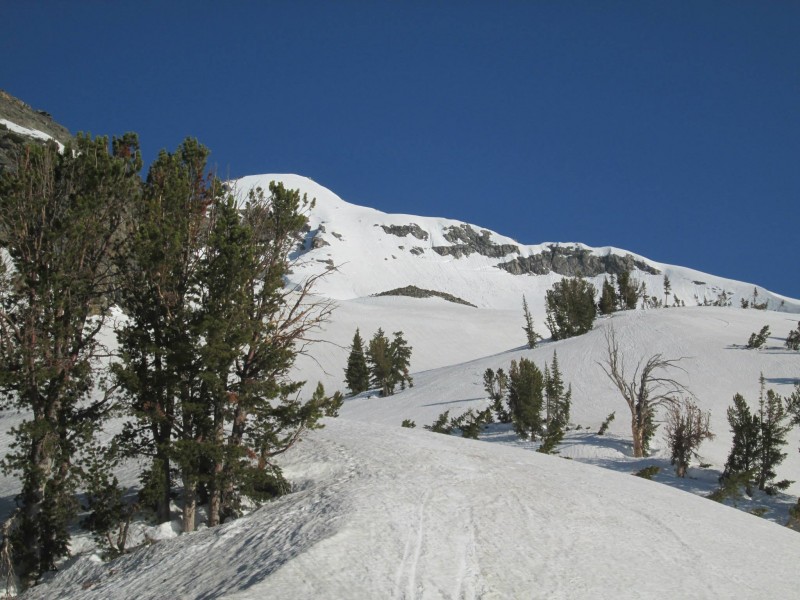
First view of the East Face. Two climbers are visible.
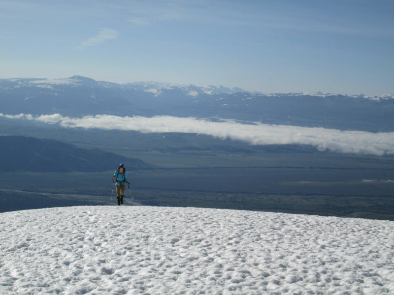
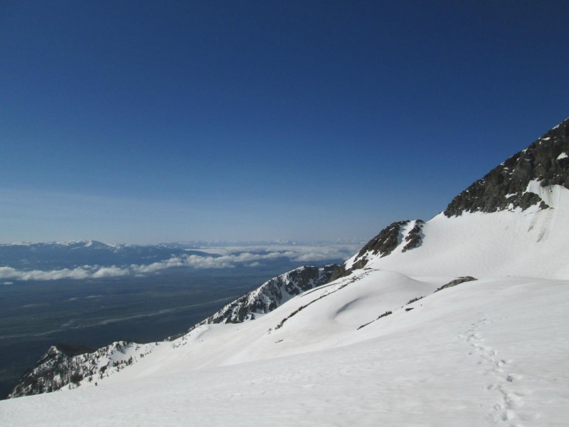
Nearing Timberline Lake.
The Grand shows its face.
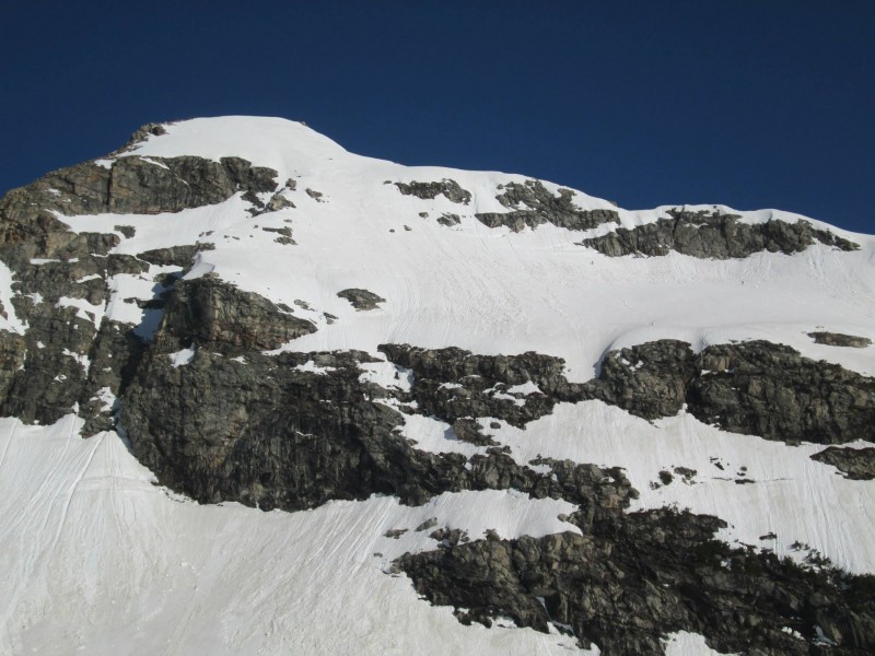
About to start up the East Face. Descending climbers visible.
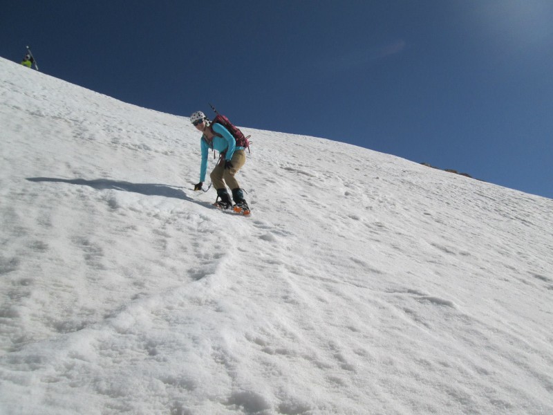
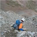
The day was heating up very, very quickly. So much so that the steps kicked by the previous pair were already melted to oblivion. We entered the face on the extreme right, climbing the only strip of snow still in the shade. At this point we were caught by a solo skier. I kicked steps out into the sunlight, where the integrity of the snow shifted to mashed potatoes. The soloist took over, bound for the more technical East Ridge. We followed him for a short distance before beginning our leftward traverse across the face.
The initial section is about 45 degrees, and the rest of the route is 40- to 45-degrees with a few short mellower areas. It was 9 a.m. and the face had already been baking in the sun for hours after a doubtful overnight freeze. Even utilizing the remnants of the previous climbers' steps, it was like trying to walk on a slope of grits.
We toughed it out for another 100 or 200 vertical feet before realizing we were getting close to putting ourselves in a bad spot. Conditions were only going to get worse. We had an hour to the summit, and likely another hour down to safety. A non-arrested slip or even a small wet avalanche would have taken us over the pair of 200-foot cliff bands. A quote from a book I'd read recently sprang to mind.
"I had learned the real rule of this beautiful, reckless, terrible game, the only rule: The mountains are beautiful but they are not worth dying for." - Greg Child
With hardly a word needing to be said, Kate and I turned around. It was a disappointing decision within an hour of the summit, but I'm sure it was the right one. The solo skier, who turned out to be an experienced Moose, Wyo., local, did summit and later told us we'd bailed at exactly the right time. He'd set off a few small wet sloughs during his descent.
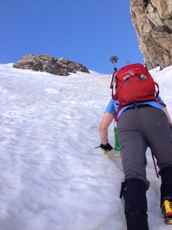
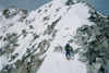
Buttshot climbing up the initial 45-degree section.
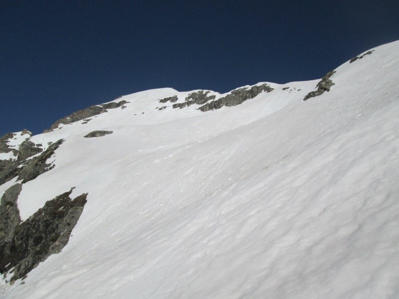
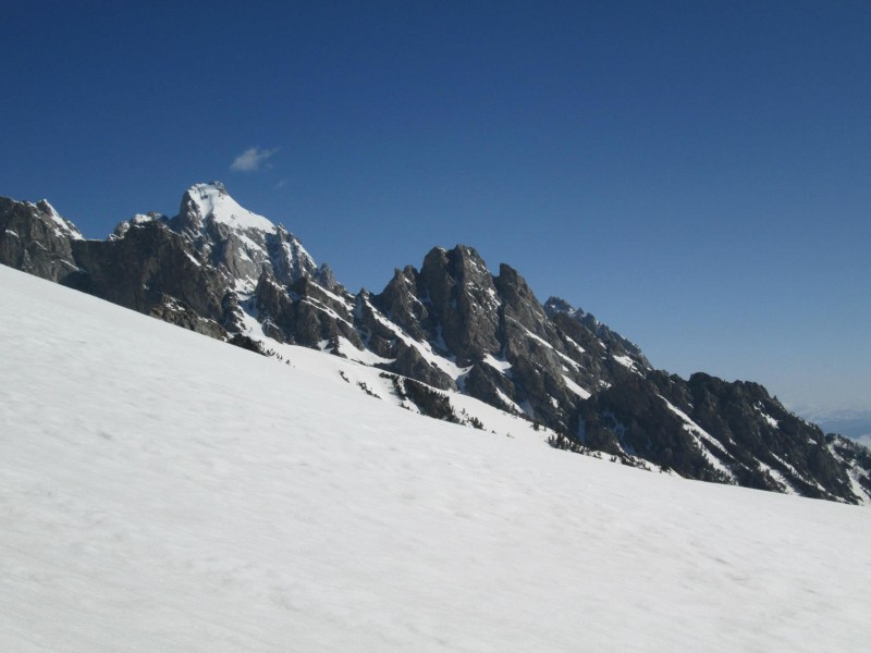
Looking across our highpoint to the summit. Sigh.
Kate descending, with the solo skier in the upper left.
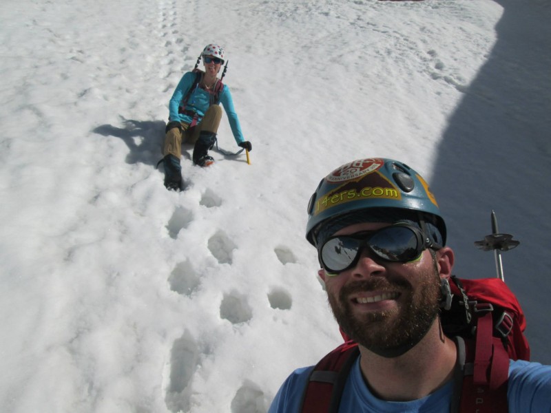
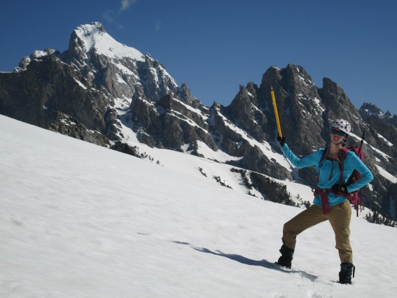
Descent selfie.
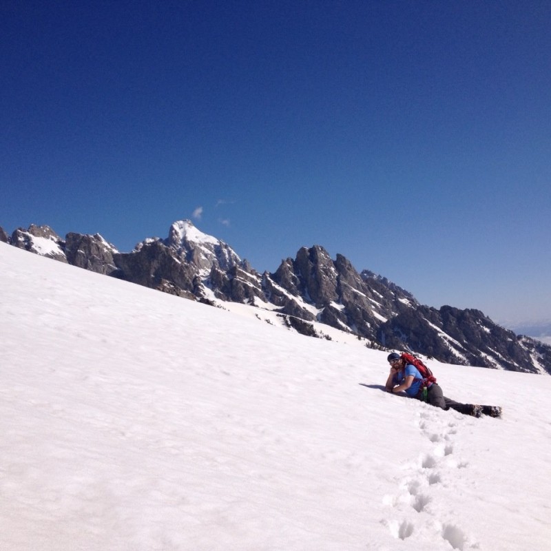
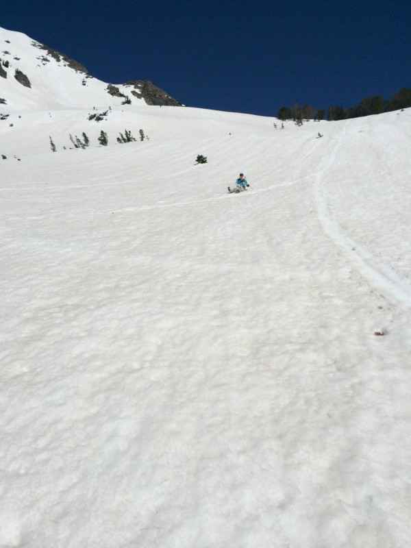
Summit or no, the views were astounding. It was only 9 a.m. and we knew our descent would be rapid, so we took our time. We sunned ourselves for a bit, admired the surrounding peaks and posed for silly pictures. The trip down was made even quicker by a series of long glissades. We'd decided last minute to leave our snowshoes in the car, which turned out to be the correct call. The few postholes we endured nowhere near justified lugging those stupid contraptions on our backs all morning.
The solo skier turned out to be an employee at Dornan's, a restaurant and bar in Moose. He told us grand tales of its rooftop patio with perfect views of the entire range. A Teton Ale, BBQ chicken pizza and a stellar panorama were a pretty awesome consolation prize. We spent the rest of the afternoon poking around Teton Mountaineering, visiting Snake River Brewing Company and drying out our gear at Jenny Lake while enjoying a campfire and some PBRs. Hey, if you're going to dirtbag the trip, you might as well go all-in.
The Grand, Nez Perce, etc.
Keeping it sexy.
She'll be back.
Kate with the East Face.
Starting down from Timberline Lake.
Skiing is overrated.
Attention: 14ers.com Facebook Group.
The day is salvaged.
Kate decided I'd taken too many mountain pics, started photobombing.
Airing dirty laundry at the Jenny Lake campsite.
Line up the East Face.
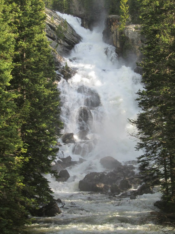
Hoping to see another moose, we woke up at 6 a.m. Monday to do a quick trip around the 7.7-mile Jenny Lake Loop with a side excursion to the Moose Ponds. We didn't find a moose, but we did find heinous deadfall and a flooded trail that stopped us in our tracks. Back on the main loop, we made good time despite long patches of snow and mud. We'd started early enough the ferries weren't running yet, and we saw nary another soul. The West Boat Dock and Hidden Falls were all ours.
Teton Range reflected on Jenny Lake.
On the well-maintained Moose Ponds trail.
Jenny Lake.
Hidden Falls.
Teewinot, the Grand and Mt. Owen.
Continuing along the west and north sides of Jenny Lake, we were greeted by grand views of the, ahem, Grand Teton (and friends). It was the perfect way to cap off the trip. Kate and I have had some fun ones, but Memorial Day 2014 takes the cake. Sorry, Sneffels. Maybe I'll finally climb your intriguing Snake Couloir over the long weekend in 2015? Then again, that Skillet Glacier on Mt. Moran looks quite tasty...
Mt. Moran.
Thumbnails for uploaded photos (click to open slideshow):
There's a new fad to take topless shots 5/28/2014 3:27pm
There is a new craze to take topless shots while on vacation or adventure. I thought this TR might be one of those...
http://www.foxnews.com/travel/2014/05/27/top-tour-movement-takes-off/?intcmp=features
I'll take one for the female team and admit I clicked on the trip report too due to the interesting title. Maybe I wanted to see what boobs actually looked like. :oops: You can never go wrong with the Tetons. My first visit had the views obstructed from wildfire smoke. HAD to return......
Mike and I were looking at Buck from the Moose visitor's center saturday, checking out the very line you guys climbed. There is another in that general vicinity called ”Buckshot”.
I was wondering where all the wildlife was that weekend. Sounds like it was all in Yellowstone. That area looks worth checking out.
The promise of boobs drew me in like a sucker... :lol:
Scintillating pics - a trip up there is excellent fodder for future planning. Nothing like seeing it in person to get the wheels turnin'.
Glad you guys put safety first - kudos!
The chick in the photo is kinda hot. But where are the boob shots?! Show 'em if ya got 'em! :D
Skied that line back in the day when I lived in the 'hole. Fun peak. Great views.
Funny small world stuff... ended up talking to the bartender at Dornan's on Monday, after a failed Woodring attempt (approach was melted out). He mentioned skiing Buck the day before- obviously your solo skier.
Wish the Tetons weren't so darn far for me. Yankee Boy is around 2 hours- Jackson is 9 with a crazy dirt road shortcut and a moderate disregard for speed limits.
Caution: The information contained in this report may not be accurate and should not be the only resource used in preparation for your climb. Failure to have the necessary experience, physical conditioning, supplies or equipment can result in injury or death. 14ers.com and the author(s) of this report provide no warranties, either express or implied, that the information provided is accurate or reliable. By using the information provided, you agree to indemnify and hold harmless 14ers.com and the report author(s) with respect to any claims and demands against them, including any attorney fees and expenses. Please read the 14ers.com Safety and Disclaimer pages for more information.
Please respect private property: 14ers.com supports the rights of private landowners to determine how and by whom their land will be used. In Colorado, it is your responsibility to determine if land is private and to obtain the appropriate permission before entering the property.