Download Agreement, Release, and Acknowledgement of Risk:
You (the person requesting this file download) fully understand mountain climbing ("Activity") involves risks and dangers of serious bodily injury, including permanent disability, paralysis, and death ("Risks") and you fully accept and assume all such risks and all responsibility for losses, costs, and damages you incur as a result of your participation in this Activity.
You acknowledge that information in the file you have chosen to download may not be accurate and may contain errors. You agree to assume all risks when using this information and agree to release and discharge 14ers.com, 14ers Inc. and the author(s) of such information (collectively, the "Released Parties").
You hereby discharge the Released Parties from all damages, actions, claims and liabilities of any nature, specifically including, but not limited to, damages, actions, claims and liabilities arising from or related to the negligence of the Released Parties. You further agree to indemnify, hold harmless and defend 14ers.com, 14ers Inc. and each of the other Released Parties from and against any loss, damage, liability and expense, including costs and attorney fees, incurred by 14ers.com, 14ers Inc. or any of the other Released Parties as a result of you using information provided on the 14ers.com or 14ers Inc. websites.
You have read this agreement, fully understand its terms and intend it to be a complete and unconditional release of all liability to the greatest extent allowed by law and agree that if any portion of this agreement is held to be invalid the balance, notwithstanding, shall continue in full force and effect.
By clicking "OK" you agree to these terms. If you DO NOT agree, click "Cancel"...
I'm backkkkkkkkkkkkkkk (you probably don't even know who I am). Where did we leave off? Mid-January, with the Crestone Needle royal boning followed by a lovely day on Elbert. Since then responsibility has tried to suck the soul right out of my body. Good thing trail running kicks so much ass. I bided my time by charging up and down the Jefferson County Mountains all winter long. I wonder if I remember how to write a trip report? Witty banter with a splash of sarcasm, lots of beautiful mountain shots, give some good advice (or at least try), and make it look like I am sort of, kind of, bad ass. The latter will be difficult as Mount Audubon is a well documented walk up BUT......I shall write this TR for two reasons:
1) It is my first time at 8,000+ feet in 4 months (please be as excited as I am)
2) I know this time of year people appreciate a good ole' condition report with pictures to assess, ponder, and contemplate snow levels. As well I think there are some people who love to ski. Maybe you will find your next line in one of my photos.
I was pretty stoked on doing something in the IPW, something easy, and something with low avalanche danger. Audubon, check, check, check. In a super last minute plan (a trail race of mine was cancelled) my friend Adam and his swagger fox of a dog Roxy the golden retriever were down to keep me company. Before I knew it alarms were screaming at 3 a.m. and I was driving down a dark winding canyon into the shadow of some big mountains. It was all hauntingly familiar.
The road up to Brainard Lake was very much closed and covered in ice and snow. Since it refuses to stop snowing this was no surprise. We had all of our winter gear and used most of it although the ice axe, 20 pounds of extra clothes, and 30 pounds of food I brought proved to be unnecessary.
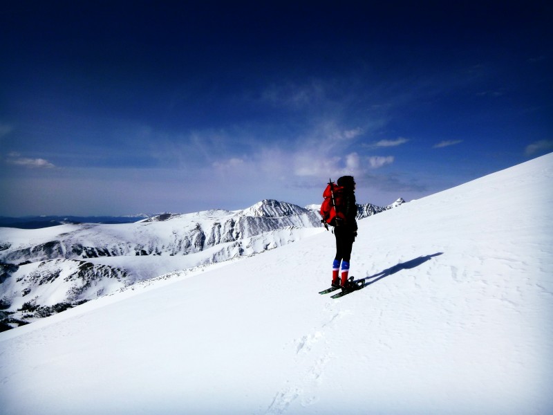
We took the standard Mount Audubon Trail from the Mitchell Lake area. There was a lightly tracked snowshoe/skin trail we followed most of the way up and down. (There is still LOTS of snow, no signs of bare ground.)
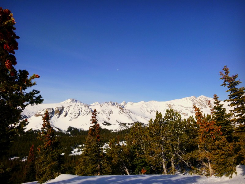
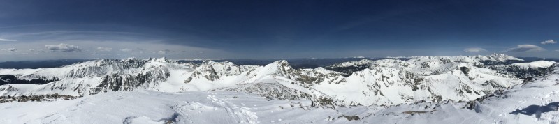
I believe... Mount Albion, Kiowa Peak, Arikaree Peak, and Navajo Peak are visible.
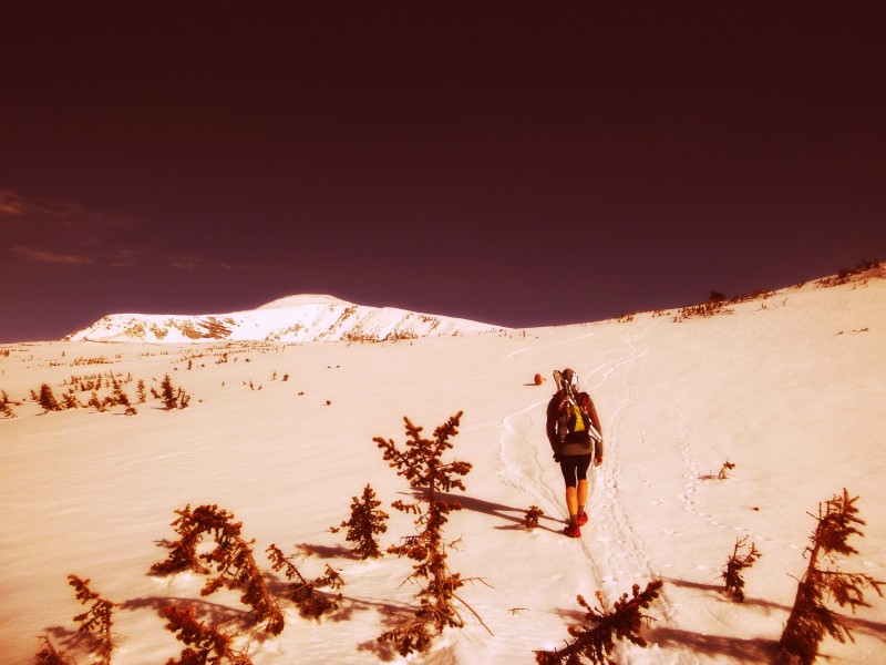
Adam (snow is still hard with only an occasional post hole)
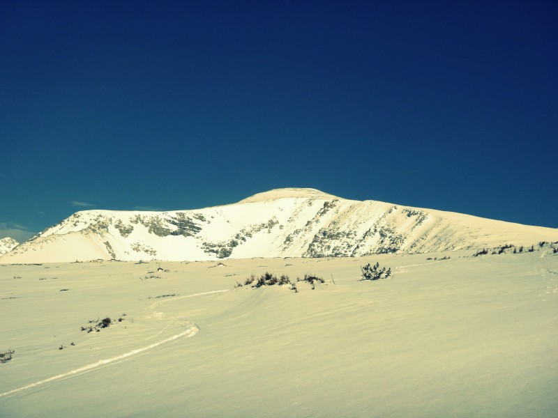
Mount Audubon
At some point we put on our snow shoes.
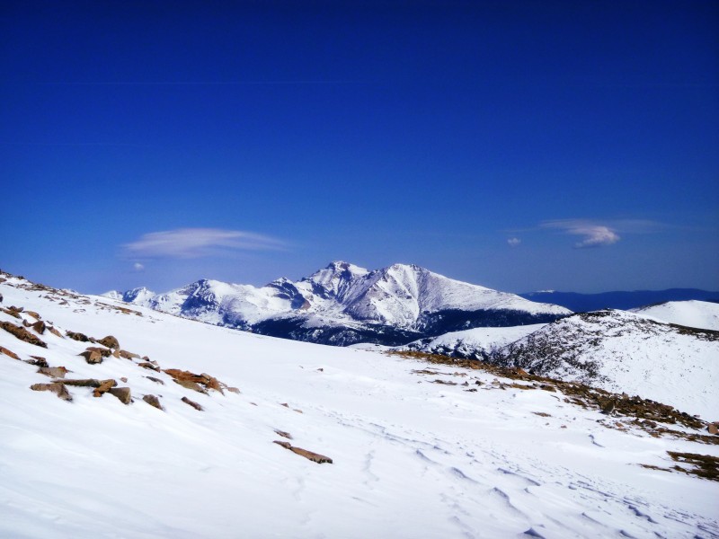
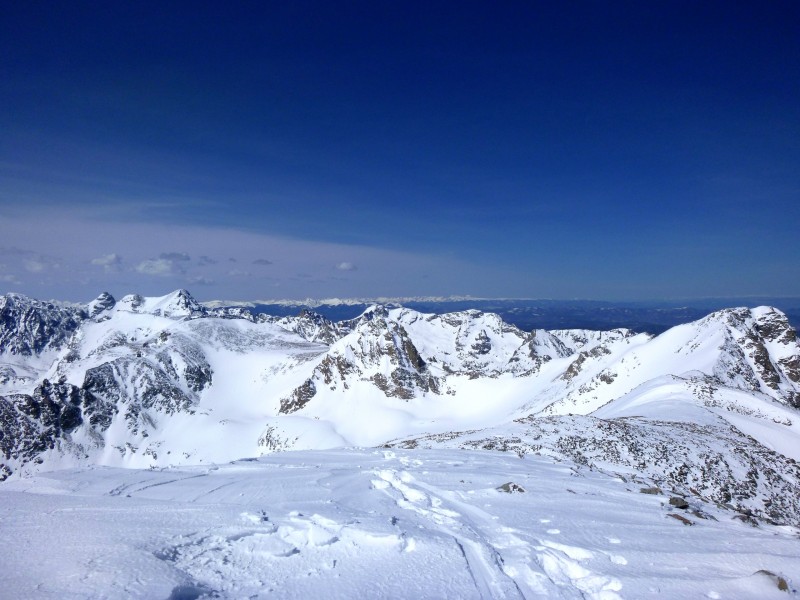
Longs Peak... our very favorite star of the Rocky Mountain National Park show
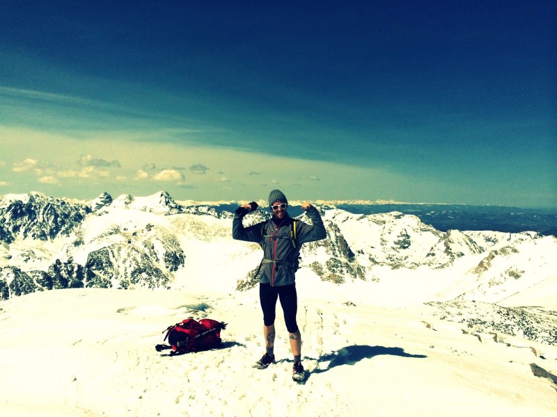
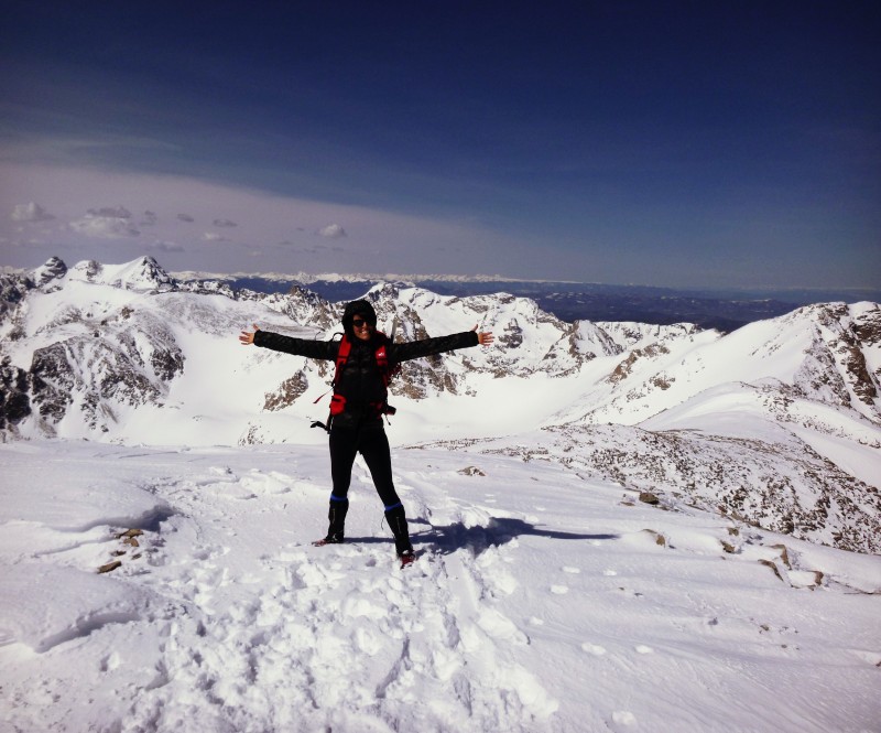
Without incident we made the summit probably around 10 ish.
Adam and a guest appearance by my pack.
So happy to be back.
PAN-OOOO
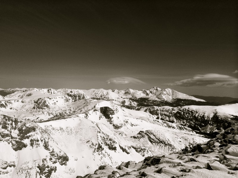
It was a little windy.
Mount Toll, Paiute Peak
Chiefs Head, Pagoda, Longs, Meeker
We hiked out and to our dismay the sun was doing its job of melting everything. My face, the snow........I ripped off most of my clothes and we slid our way out to victory. Number of face plants: 3
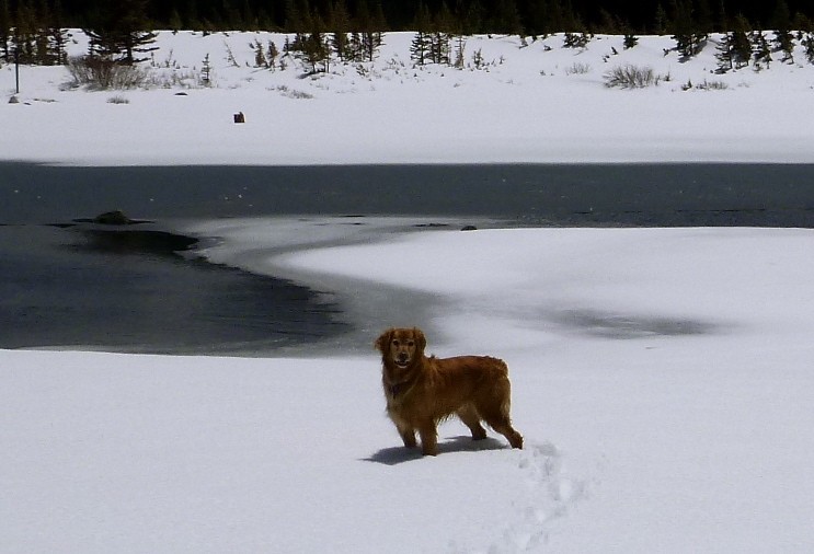
Roxy, quite possibly the happiest dog in the world.
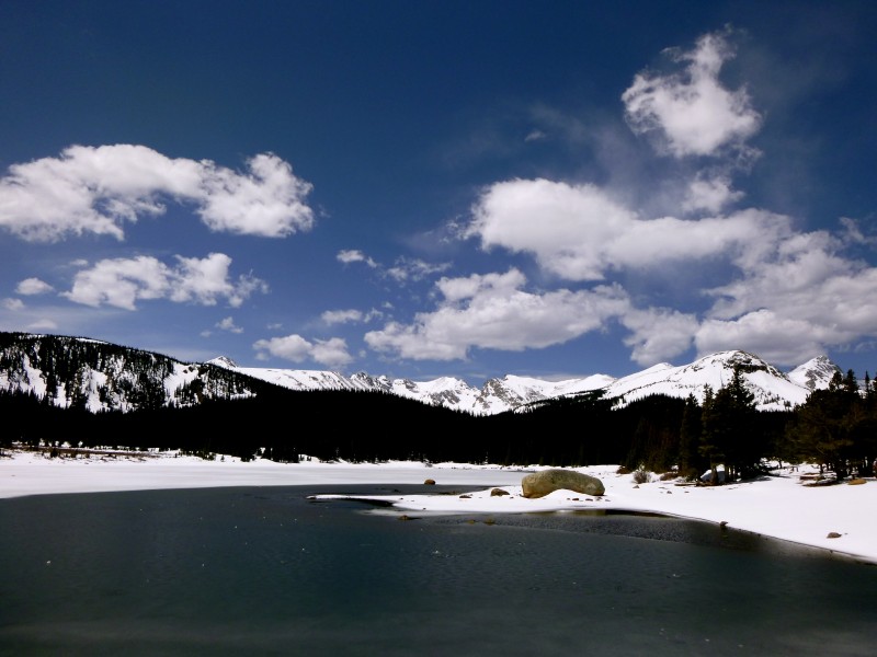
Brainard Lake
On the walk out we crossed paths with Sage Canaday and Sandi Nypaver who were heading in, most likely to snowshoe up and down Audubon in 1.5 hours round trip. I completely fan-girled out. They are the Brad Pitt and Angelina Jolie of the trail running world. I was almost too star struck to have a viable conversation with them but I managed to get out some words.
Another great day!
Life is grand. Spring has sprung. It's good to be back.
Thumbnails for uploaded photos (click to open slideshow):
We have missed your reports! Mt. Audubon was the very first Colorado mountain I ever hiked up and I'm NOT going to tell you how LOOOOONG ago that was... :)
The road was very icy in the morning 5/19/2014 2:29pm
but slush by afternoon. I don't own or ride a bike so I don't really know how they do with ice. There were 4 skiiers on bikes that started at the same time as us. We were faster on foot. I would say it is doable. Call 303-541-2500 The women I talked to was super helpful about how much snow the area had received. As well she made mention to me when they would plow the road so bikers could pass. I believe she said the 19th but call and double check :D
Jay~~~ What a beautiful area. It was nice to get out there before it gets crowded for the summer.
All of that snow is going to make for some stunning wildflowers in August!
Caution: The information contained in this report may not be accurate and should not be the only resource used in preparation for your climb. Failure to have the necessary experience, physical conditioning, supplies or equipment can result in injury or death. 14ers.com and the author(s) of this report provide no warranties, either express or implied, that the information provided is accurate or reliable. By using the information provided, you agree to indemnify and hold harmless 14ers.com and the report author(s) with respect to any claims and demands against them, including any attorney fees and expenses. Please read the 14ers.com Safety and Disclaimer pages for more information.
Please respect private property: 14ers.com supports the rights of private landowners to determine how and by whom their land will be used. In Colorado, it is your responsibility to determine if land is private and to obtain the appropriate permission before entering the property.