Download Agreement, Release, and Acknowledgement of Risk:
You (the person requesting this file download) fully understand mountain climbing ("Activity") involves risks and dangers of serious bodily injury, including permanent disability, paralysis, and death ("Risks") and you fully accept and assume all such risks and all responsibility for losses, costs, and damages you incur as a result of your participation in this Activity.
You acknowledge that information in the file you have chosen to download may not be accurate and may contain errors. You agree to assume all risks when using this information and agree to release and discharge 14ers.com, 14ers Inc. and the author(s) of such information (collectively, the "Released Parties").
You hereby discharge the Released Parties from all damages, actions, claims and liabilities of any nature, specifically including, but not limited to, damages, actions, claims and liabilities arising from or related to the negligence of the Released Parties. You further agree to indemnify, hold harmless and defend 14ers.com, 14ers Inc. and each of the other Released Parties from and against any loss, damage, liability and expense, including costs and attorney fees, incurred by 14ers.com, 14ers Inc. or any of the other Released Parties as a result of you using information provided on the 14ers.com or 14ers Inc. websites.
You have read this agreement, fully understand its terms and intend it to be a complete and unconditional release of all liability to the greatest extent allowed by law and agree that if any portion of this agreement is held to be invalid the balance, notwithstanding, shall continue in full force and effect.
By clicking "OK" you agree to these terms. If you DO NOT agree, click "Cancel"...
| Angel of Shavano |
Angel is in!
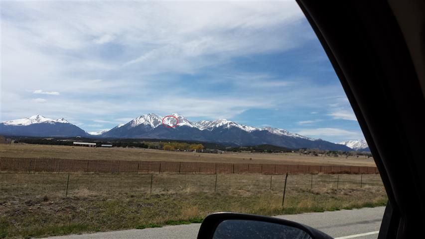
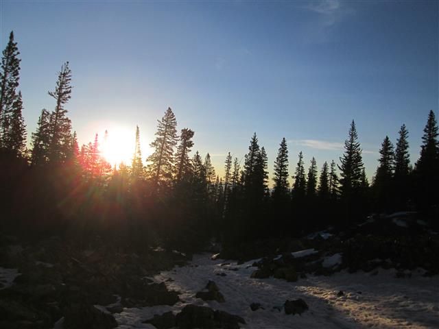
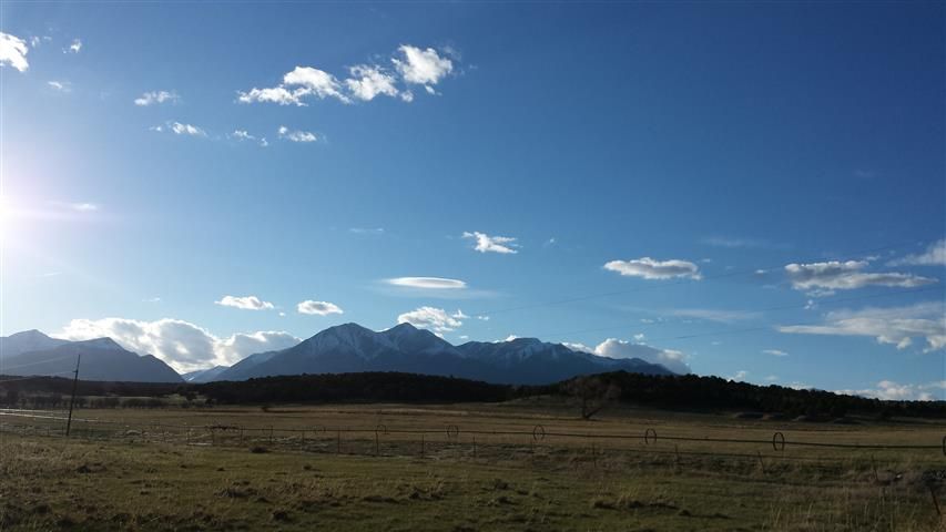
View of the Angel from 285
Chad and I met up off the turn to CR140 and we drove up and made a colossal blunder right out of the gates...we followed the directions on 14ers to turn left on 252 at the Y junction. Less than a mile after turning on this we were met with a massive snow drift blocking the road that will be there for at least the next couple of weeks. We were unaware that staying right at the Y junctions, on 250, leads to the trailhead as well. But hey, we love adding unnecessary miles onto a long day.
We car camped right before the much reviled snow drift and had plans for boots on the ground at 4AM. We were on the move at 3:56, and cursed the snow drift as we strolled past slogging out our couple miles to the trailhead. We put our snowshoes on when we encountered the first bit of snow on the trail shortly after the trailhead. The snow quickly went away and we assumed we would hit it again soon so we strolled over the dirt and even a cattle guard with our snowshoes on for a little ways until we decided we were being lazy and finally took them off. There is significant snow on the trail less than a mile from the TH, however it was nice and frozen due to our early start and we never once put our snowshoes on during our ascent. We postholed a couple of times, but nothing frustrating us enough to make us put the snowshoes back on.
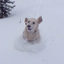
One of our few postholes...

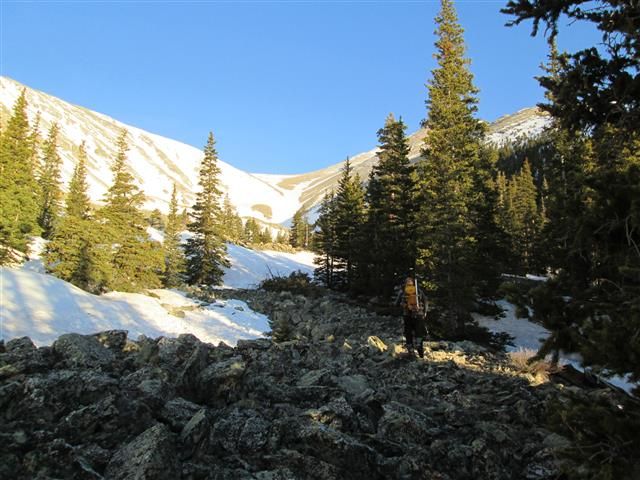
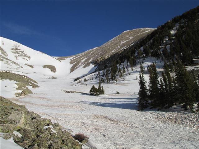
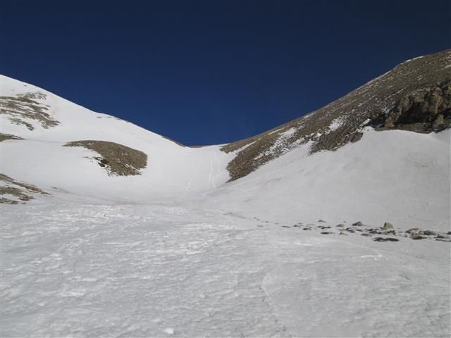
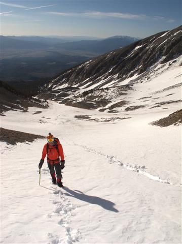
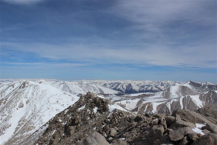
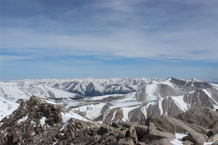
Some random approach scenery:
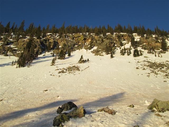
Some views of the Angel on the approach
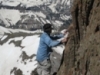
We stashed our snowshoes at the base of the Angel, and donned our crampons here. We wore crampons from this point up to the summit. We made good time up the body and decided to take the left arm of the Angel and connect to the East Ridge and ride that to the summit. Soon after moving from the body to the arm, our speed went down. The terrain becomes steeper on this section, and we had random gusts of wind that nearly knocked us over on a couple of occasions. We made slow and steady progress up the arm, to the ridge, and up to the summit of Shavano. I believe we topped out around 10am.
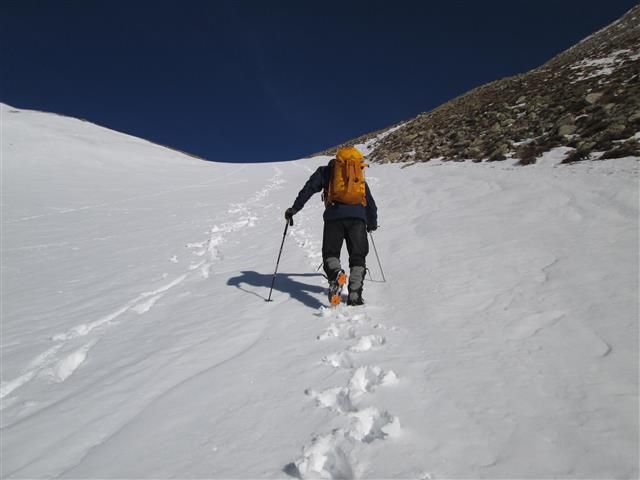
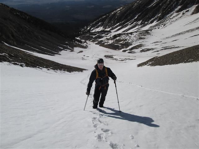
Some pics of us headed up the Angel
Summit video
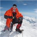
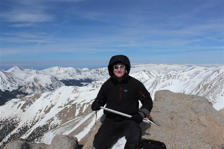
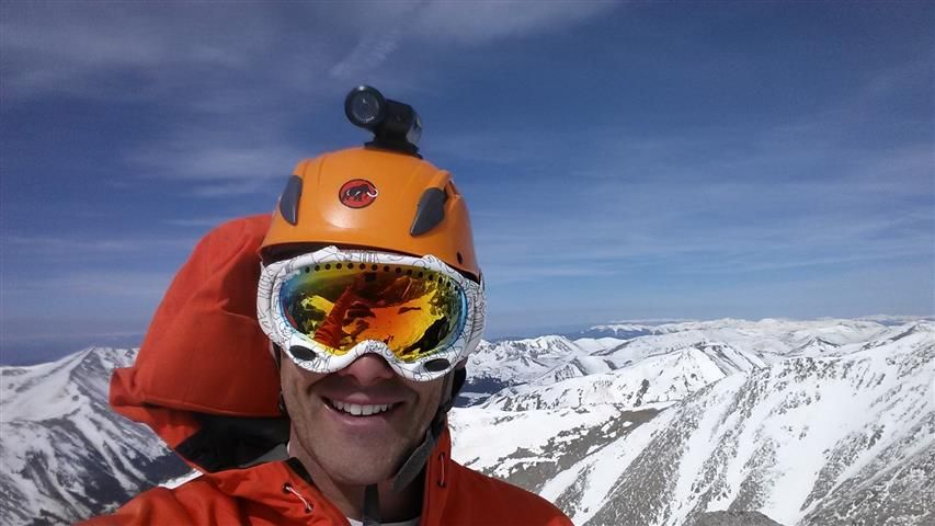
Summit shots
We got a badass here....
Everyone loves a selfie
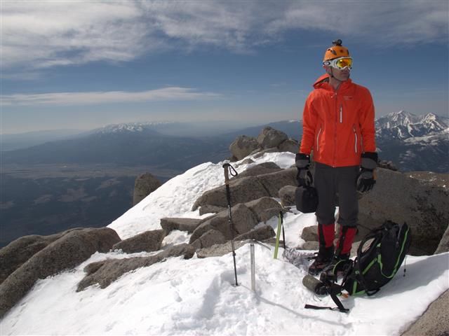
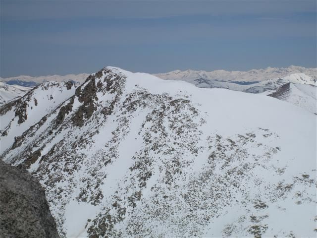
We had set out to bag both Shavano and Tab, but I became hesitant as soon as I hit the summit. You can see me staring at Tab in the last 5 seconds in the summit video...I was dropping and F bomb in my head. The ridge to the summit was holding a lot of snow and with the weather change I was unsure about crossing over it. Chad and I voiced our opinions and decided to head over about a quarter mile, past the initial cliff bands off Shavano, to get a closer look at Tab and make a decision from there.
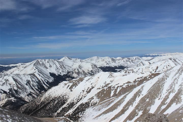
View of Tab from this vantage point:
Chad was willing to give it a go initially, I was more hesitant. I am also not nearly as experienced on snow as Chad was, so perhaps that's why I had initial pause. Once we got a closer look at it we both agreed that it did look a little iffy and it wouldn't be without risk. For better or worse, we decided to turn around at this point.
For a while descending Shavano I was upset with myself for being the primary reason for turning around. I felt like I cost Chad a Tab summit, I kind of felt like I was being a big baby about the snow. I was thinking about it out loud and Chad stopped and said "Don't worry about it, you might have saved my life." I guess that's true, and we won't ever know what would have happened. Writing this a day later I feel fine with my decision now. Making the decision to turn around really sucks at the time, however.
Now back to the fun...
We worked our way down to the left arm of the Angel and started a glissade. Little did I know...that this was going to be a glissade from the fingers to the toes. So Awesome.
The glissade ended almost exactly where we had stashed our snowshoes. We popped them on, enjoyed some Gatorade and snacks, and then started the awful descent back to the trailhead. It was very warm out, I was wearing just a T-shirt at this point and was still too warm...so you can imagine the snow conditions. Even with 30" snowshoes we were postholing and slipping and sliding our way back down to the trailhead. We made the best of it though, talking about The Summit, Touching the Void, Into Thin Air, etc. Time seemed to fly by. We reached the trailhead and to our dismay saw several vehicles. "How in the F?!?!" was our reaction. A family just finished a hike while we were resting there and went to get in their car. Chad asked how they got there and they said they just took 252. Oh well. Time to slog out an extra couple of miles...
We got back to the cars and headed to Buena Vista for some much needed bacon cheeseburgers and beer.
Overall a great day.
Thumbnails for uploaded photos (click to open slideshow):
")
|
Caution: The information contained in this report may not be accurate and should not be the only resource used in preparation for your climb. Failure to have the necessary experience, physical conditioning, supplies or equipment can result in injury or death. 14ers.com and the author(s) of this report provide no warranties, either express or implied, that the information provided is accurate or reliable. By using the information provided, you agree to indemnify and hold harmless 14ers.com and the report author(s) with respect to any claims and demands against them, including any attorney fees and expenses. Please read the 14ers.com Safety and Disclaimer pages for more information.
Please respect private property: 14ers.com supports the rights of private landowners to determine how and by whom their land will be used. In Colorado, it is your responsibility to determine if land is private and to obtain the appropriate permission before entering the property.


")