| Report Type | Full |
| Peak(s) |
Abercrombie Mountain - 7308 Snowshoe Peak - 8738 McDonald Peak - 9820 |
| Date Posted | 02/05/2014 |
| Modified | 02/18/2014 |
| Date Climbed | 07/06/2013 |
| Author | ChrisinAZ |
| Additional Members | spiderman |
| Grizz County: Ultras of the North |
|---|
|
Click here for part 1... Abercrombie Mountain--The Easy One -Elev. 7,308', Prom. 5,178' -6.4 mi. RT, 2,200' gain -class 1+ trail, high-clearance dirt road -Stevens WA County Highpoint I awoke, disoriented for a time, then remembered where I was: northeastern Washington. We were in the small clearing that was the trailhead for Abercrombie Mountain, hemmed in by an impossibly lush forest. I'd thought that here, in the rain shadow of the mighty Cascades, things might be relatively arid, but this forest was teeming with life! As we arose and packed, Arthur managed to find a small frog even before we'd left the trailhead. 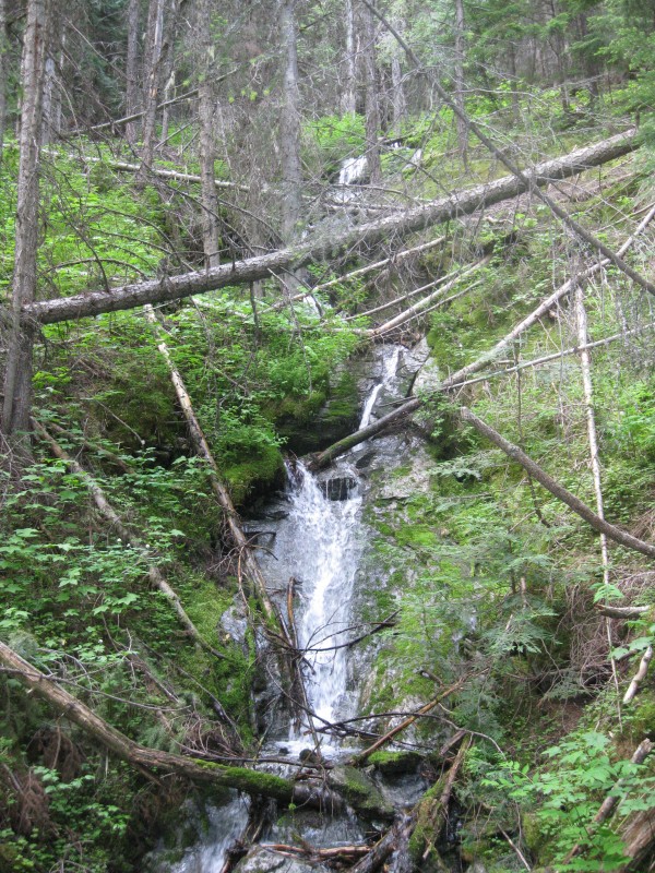 The trail was pleasant, following what must've been an old logging road (in this part of the country, they're logging roads, not mining roads!) and making a gradual gentle ascent. We passed a cascade in short order, then continued through dense forest for less than an hour to the trail split at the saddle in an area of less-dense pines. We turned left to climb the last 1.8 miles to the summit, and the trail began to make long switchbacks up the south face of Abercrombie. The views began to open up, revealing meadows of wildflowers and rolling green mountains as far as the eye could see. We topped out onto a sort of broad ridge before long, and could see most of the remaining climb. The views around us began to open up, and we could now see the border swath between the US and Canada hopping its way east toward us, only a handful of miles to the north. Skies were somewhat overcast, but the weather looked like it'd probably hold off. 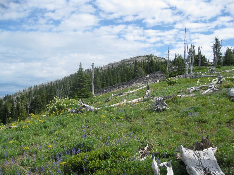 Nearing the summit, the grass and vegetation gave way to talus, and we saw the remnants of old structures as we walked the final few dozen feet to the top. There were unobstructed views in every direction, thickly-forested rolling green mountains giving way to jagged, snow-covered peaks up in the wilds of British Columbia. The Valhalla Range was particularly impressive, though partly shrouded in rain clouds. 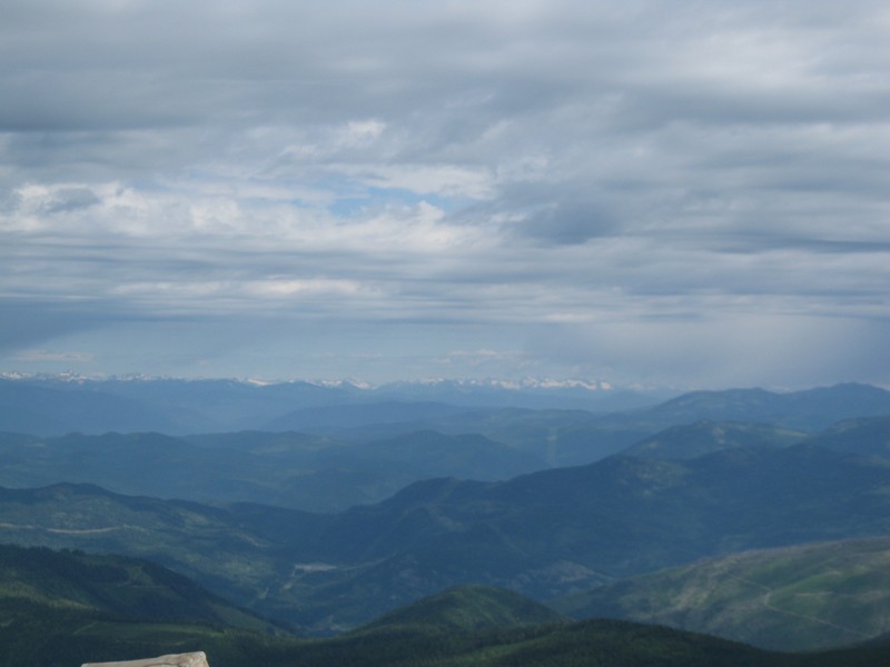 I soaked in the vista, glad to have had a chance to mentally relax on an easier peak. We soon started down, making it back to the car in an uneventful hour and a half. 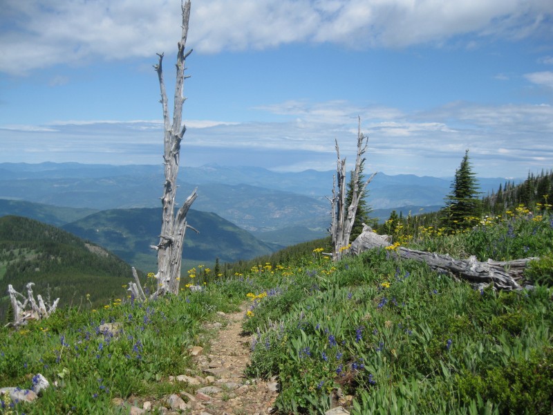  We drove the bumpy road back down to pavement, then through gorgeous lake country back to the small city of Colville, where we grabbed lunch and stocked up on supplies before turning east toward Montana. We opted for taking WA-20, which was pretty, but infuriatingly slow and tortuous as a driving route. At Newport, we crossed into Idaho again, into a part of the state virtually unrecognizable compared to where we'd been! Broad rivers, gentle forested mountains, and sparkling lakes were the rule here. After passing through the funky little town of Sandpoint and having an early dinner, we headed north to Bonners Ferry, then east down an increasingly-dramatic valley and into Montana. The mountains rose and grew steeper as we journeyed on, and the Kootenay River grew more powerful and tumultuous. Occasional glimpses of the Cabinet Range, our next objective, captivated our attention. After passing through the charming small town of Libby (and seeing the first of many tiny roadside casinos we'd encounter in Montana!) we managed to find the roads in to the trailhead for Snowshoe Peak, which loomed impossibly high far above in the afternoon sun and haze. The last mile or so was rather steep gravel, but the CR-V made it up to the small, quiet trailhead, deep in forbidding forest. As darkness fell, we slept. Snowshoe Peak--C-C-C-COMBO BREAKER! -Elev. 8,738', Prom. 5,438' -5.0 mi. RT, 3,200' gain (to turnaround point) -class 4 scrambling, high-clearance dirt road -Lincoln and Sanders MT County Highpoint We awoke at first light and quickly gathered our equipment, adding a new implement: bear spray. The Cabinet Range, as it turns out, is deep within some of the thickest grizzly bear habitat in the lower 48, and going into the area without taking precautions is highly unadvised. This mountain is not easy by any route, and there are really only two options: a long slog from the west, culminating in a moderate snow climb and 3rd class ridge, and the route we'd ultimately chosen: a short, but incredibly steep grunt up grassy slopes and a 4th class ridge from Leigh Lake. I'd contacted a ranger beforehand to inquire about conditions, and was told that the eastern route was considered "non-technical" and that, in this year, he expected the route would be virtually snow-free. Based on this, and the desire to get up and down the peak in a day, we chose the eastern route. When I return to Snowshoe someday, I'm still unsure what route I'll ultimately choose--but I'm getting ahead of myself. The trail up to Leigh Lake was short at only a mile, but steep and very overgrown. Heading up in the near-darkness, we were all decidedly "bearanoid", and had excessively loud conversation to warn bears of our impending approach. As we neared the lake, we emerged into a clearing with an impressive cascade next to the trail; here, the trail became somewhat indistinct and hard to figure out. 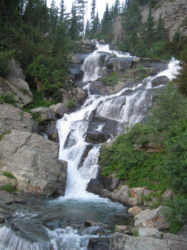 However, we finally made our way up and past the area, soon walking the still-overgrown trail along Leigh Lake's quiet shores. The scenery here was spectacular, and intimidating...sheer multilayered cliff faces lined the steep headwall around the lake, with Snowshoe Peak towering over everything. 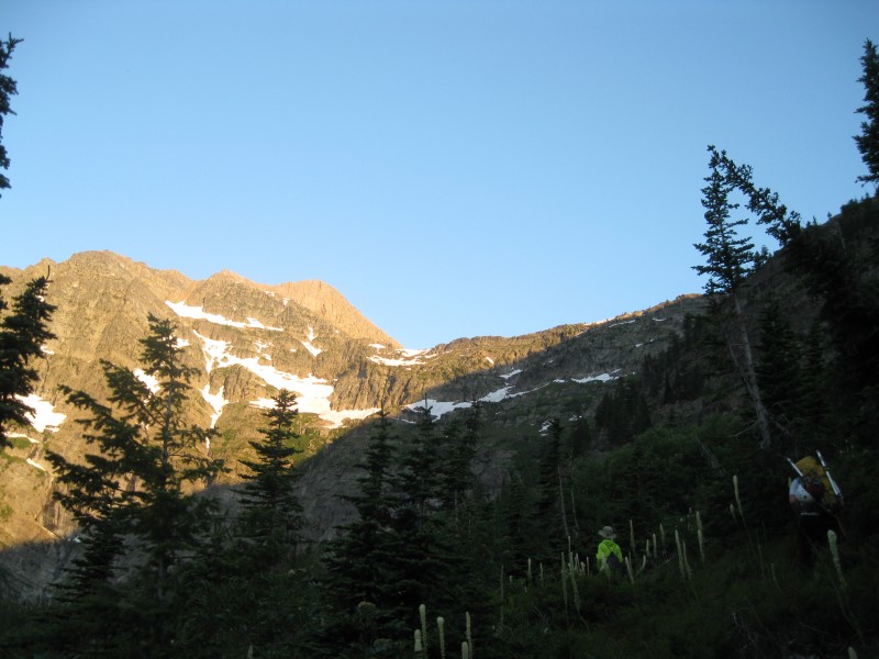 The weather was flawless, the morning cool, and only a few other people were up at the lake. We tried to find the start of the climber's route leading up the steep grassy slopes to the right, but we never found much of anything definitive--so we just began charging up the slopes. Soon, at a stream crossing, we managed to pick up faint bits of trail, though our ascent up the steep grassy slopes was mostly a way of our own choosing. With proper route finding, we were able to keep the route mostly to manageable, if steep, grass, with an occasional 3rd class move thrown in. We continued uphill, I believe farther than the route descriptions I'd read had described, but no matter--we turned left and found a very reasonable wide band of relatively mild grassy slopes, and traversed for a while. Everything was going swimmingly, until suddenly--a moderately steep snowfield in a gully blocked our path. We would have to cross, though anticipating snow, we had still brought our axes. We crossed, slowly and carefully, making our way across the hundred-foot span, when horrible luck struck--my bear spray came loose from the carrying case I'd kept around my wrist, falling to the snow and skittering down the mountainside, quickly picking up speed, already as good as lost from the moment it'd left my wrist. Fuck. There went any protection I had against grizz, and a decent chunk of change as well...I told Doug of my misfortune, but we agreed to continue on. Perhaps we should've heeded an early warning sign... Our progress was unimpeded until we came to a large, but somehow not-exposed snowfield at a good resting spot, still several hundred feet below the ridge crest. We took a break while I did a bit of exploring to scout the route out. At some point in this area, we were supposed to cut uphill and to the right to ascend a key hidden gully to reach the ridge above us. Traversing level a bit farther, I found the slopes to quickly worsen, and came to the conclusion that the gully was in fact the relatively open slight depression in the ridge I'd just passed, at the top of the snowfield. Informing Doug and Arthur, we busted out our axes again; as the snowfield was only perhaps 30 degrees and a fall would actually not be disastrous, I made short work of it and was soon back on dry ground at its upper extent. 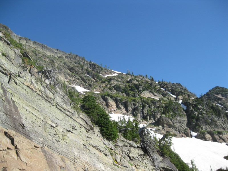 The gully, I soon realized, was more treacherous than anything we'd already ascended that day. At numerous spots, we had to rely on 3rd class scrambling on potentially-loose, wet, sketchy rock and patches of grass, with fairly daunting exposure. Had the route been dry, it would not have been that bad, but I was uneasy as we continued our ascent. Finally, the slope eased a little just before the ridge crest, and while a leftover cornice blocked the last few feet to the top, we simply detoured around it on dry ground to the sparsely-treed ridge top. The ridge almost immediately grabbed my attention. While the true scrambling still looked to be a short ways off, the ridge quickly became a sheer dropoff to the north, into a massive basin of snow, seracs, and grim rock. The immediate terrain ahead consisted of slabs of smooth, bare rock, inclined about 20 degrees toward that sheer dropoff; beyond, the ridge leapt upward in a series of cliffy, jagged rock steps before meeting the main ridgeline of the Cabinets just to the left of Snowshoe's rocky summit. Supposedly, one of the cliffy bits was hard 4th class, and most people roped up for it (hence, we'd brought a rope) but it could supposedly also be avoided where the snowfield came up to meet the ridge on the right. Taking a deep breath, we began to walk along the fairly flat ridge. It was very easy, but unnerving. 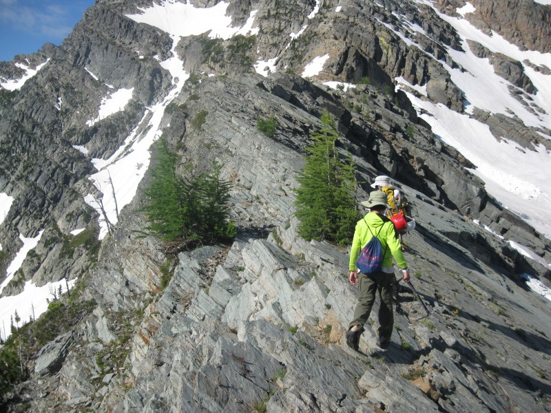 Perhaps ten minutes later, we'd reached the start of the tougher climbing. After a slight bit of uphill, we came to a tricky spot: to the right, one needed to ascend outsloping blocky rock that looked to not have many good handholds; to the left, almost-vertical rock composed of horizontal, flaky bands. I scoped out the right option, didn't like it, and then checked out the left option. The rock looked sketchy, but upon testing it out, I found the rock to be solid. Okay, let's go for that one... Inching my way along a narrow ledge, focused on not falling, I suddenly banged my bare knee on the rock, but thought nothing of it for several seconds. Then, at a safer spot, I looked down to see blood pouring down my lower leg...not good. Looking closer, I discovered the razor-sharp rock had lacerated my knee, slicing through every layer of skin, leaving a gaping wound nearly two inches across. Not life-threatening by any means, but not something I was willing to exacerbate with more climbing. I knew in that moment that my attempt on Snowshoe was finished--hell, maybe this whole trip was finished. Dammit... I called out to Doug and Arthur, and they finally reappeared; I explained what had happened, and told them they were welcome to continue toward the summit, but I was done. We conferred for a few minutes, and they finally announced they'd abandon their summit bid as well--Doug was unwilling to put himself in a position of needing to be belayed by his much-smaller son. I felt horrible, but they assured me it wasn't a big deal--they still needed to return for Mt. Cleveland someday anyway. And so it was, on a warm July late morning with nary a cloud in the sky, only 1200' below the summit, we abandoned our attempt on Snowshoe Peak. 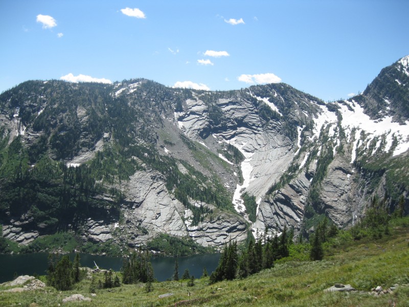 Now, to get down...I stupidly had not brought much in the way of a first aid kit, and as it turned out, the best thing I had for holding the wound together was some old, worn duct tape--it'd have to do. After the bleeding had slowed enough, I applied it, downed some water, and was as ready as I was going to be. We carefully descended, and I found my knee luckily didn't slow us up too much, though I was doing my best to not bend my right knee any more than necessary. We returned to the gully and descended it without incident, then glissaded down the snowfield at its base. We were making good progress until we reached the first snowfield again, and as Doug began to cross it, he suddenly stopped, then returned to the grassy slope we were on, announcing the snow was now much icier and more treacherous than it had been. We ended up spending a good 40 minutes belaying each other across the snowfield, Doug going first, then myself, then Arthur. I was glad to be past the snow climbing; along the gully's grassy slopes, there were not really any good places to brace oneself for belaying. From here, we made pretty short work of the remaining descent to the lake, where we stopped to chat a bit with a family fishing there. However, on resuming our journey, we promptly lost the trail, and spent a good 20 minutes thrashing around in thick, unpleasant brush--just what I needed on top of everything else! Finally, we found the trail again on the uphill side, and limped our way back to the car, luckily encountering no grizz on our return. I eased my way into the car, noticing but barely caring that the duct tape had mostly come loose. As we bumped down the mountain road back to the highway, we weighed our options for getting the wound looked at. Libby was likely too small to have anything larger than a small clinic, and it was several hours in the wrong direction to a major town or city to the west. Ahead on our route, it was two hours to Kalispell, and another two to Missoula; before 5 PM, we would only be able to make Kalispell. Since the entire state of Montana was roaming for me (thanks, Sprint!), I quickly texted a friend to see if he could find any open urgent care centers. Then, exhausted, I dozed as Doug drove onward. Nearing Kalispell, I got a text back from my friend that not only were all the urgent care centers in Kalispell closed, nothing was open in Missoula either. I guess I should've expected as much on a Sunday afternoon in Montana, but I figured at least a touristy town like Kalispell would have something open. The only remaining option was the hospital. We rolled into the small but picturesque and busy town of Kalispell late that afternoon, the sun glistening on the few nearest stunning peaks of Glacier National Park in the distance. We found the hospital in short order, and after some waiting, I had the pleasant experience of having my wound scrubbed and disinfected. I talked shop a while with the friendly ER doc as he put in four stitches, then asked him the question that had been weighing on my mind all day: will I be able to hike on this? To my immense relief, he informed me he didn't think it would be an issue, but that the stitching might be painful for a short time. Freshly bandaged, I rejoined the others and told them the good news. We remained in Kalispell long enough to grab a quick dinner and pick up a few basic medical supplies at Walgreens, then began the drive south to Missoula as planned. The drive was stunning. We were soon passing by Flathead Lake--the largest natural freshwater lake in the lower 48 west of the Mississippi--and it was enormous, and deeply blue. Every time I thought we'd reached the end of the lake, we rounded another bend, and there lay more of the lake before us! Finally reaching the end of the lake, the Mission Range began to rise dramatically on the far side of the valley to the east, its sharp peaks and cliffy faces looming a vertical mile over the valley. Driving through the broad farm country of the Flathead Reservation south of Polson, we soon drew even with our next objective: storied, yet mysterious McDonald Peak. To my joy, I saw little evidence of snow anywhere above treeline. This was a pleasant surprise in what may be one of the snowiest mountain ranges in the contiguous US outside of Washington, renowned for holding large amounts of snow well into July. McDonald was also notable for looking to be, by far, one of the least dramatic summits of the range. Steep, cliffy Mt. Calowahcan just to the north was far more typical of the range, the rest of which would not be terribly out of place in Glacier. As it would turn out, however, even mild McDonald would prove to be a significant challenge! 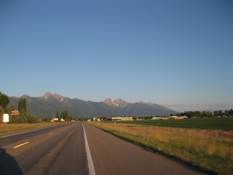 As the day came to an end, we rolled into Missoula, which was a bit of a culture shock, being the first large and modern-feeling city we'd encountered since Spokane, which already felt like a lifetime ago. A pleasant place, but it felt less like the rest of Montana and more like a typical large college town. Exhausted, we gave in and got a motel room for the first and only time of the trip, at a funky Jetsons-style Motel 6 in town. We'd rather fortuitously planned the following day as a mostly-rest day even before my injury, and checking the weather, the following morning looked stormy but the day after had a flawless weather forecast; we were gonna need that, no question. My stitches were somewhat painful now, the suture digging into my skin (even though the ER doctor hadn't made the suturing too tight); only the following day would reveal whether the pain would be too much to hike on. Exhausted, I had pretty much enough energy to take a much-needed shower and grab some dinner before sleeping like the dead. McDonald Peak--Redemption -Elev. 9,820', Prom. 5,650' -10.0 mi. RT, 5,200' gain -class 3 scrambling, moderate snow, mostly high-clearance dirt road -Lake MT County Highpoint We awoke the next morning to a thunderstorm. Not exactly encouraging, but with luck, it'd clear out later in the day. We checked out of the motel, then prepared to spend most of the day bumming around Missoula before heading back up to McDonald Peak and at least starting the climb. After hitting up IHOP (and playing some card games to pass the time), we got going with the most important order of business of the day: procuring wilderness permits from the Flathead Reservation--in which McDonald Peak is situated--and picking up a new can of bear spray. We soon picked both up at the local sportsman's store. We whittled away a few hours at the local movie theater, watching some fun, mindless action movie-ness with White House Down. The weather now clearing, we made one more stop at Target for me to pick up a new memory card, as mine was almost full. The new card had substantially more space, and I was greatly relieved to see it worked with my slightly older camera. Aww yiss, I thought, infinite pictures!! At last, though, it was time to return north... As we retraced our steps to the broad agricultural valley west of the Mission Range, my thoughts were fully occupied by the challenge ahead. For such a major summit--the second-most prominent summit in Montana--McDonald is very infrequently climbed, and may in fact be the least-climbed Ultra in the contiguous US. While the closest thing to a standard route the peak has holds no real technical challenges, this peak, by any route, is simply brutal. Years ago, I'd read a trip report of an epic and daunting group climb of the mountain, and the memories of that trip remained in my mind long after the name of the mountain had faded. Over the years, a new route had become commonplace, one which avoided the worst of the bushwhacking in the Ashley Lakes basin, and is probably the most ideal route to the summit, but which nevertheless had its own share of difficulties. Were this summit not enough of a challenge already, it also lies in grizzly habitat even more legendary than that of the Cabinet Range. In fact, the part of the range where McDonald lies is part of a grizzly bear refuge, where from July 15th to September 30th--most of the useful summer climbing season--absolutely no human is allowed to enter. This leaves climbers with the option of either rolling the dice on an early October ascent--not a sure bet by any means, in any year, this far north--or braving the highly variable snow conditions of early July. Only a few days before the summit would become off-limits, I knew the stakes were high, and resolved to do my damnedest to make the summit, one way or another. We soon reached our turnoff from US-93--on Red Horn Rd, NOT Ashley Lakes Rd!--and headed east to the end of the farm country. We didn't know much about the mountain road that headed up to the obscure trailhead, only that it was four miles long and supposedly quite rough. Much of it wasn't mapped, or even visible on satellite imagery, so I mostly didn't know what to expect. At the base of the range, the farm grid gave way to dense, lush woods, and the road became rocky and uneven and overgrown...but still passable in a CR-V, for the time being.  We made it about 1.3 miles of car abuse before Doug had had enough, and we as much made as found a pull-off on the side of the road. The following hour was spent organizing and packing our copious gear, this being the first overnight climb we'd planned to do. The damp forest around our impromptu trailhead was both eerily quiet and beautiful, and I peered into the undergrowth several times, wondering if any grizzlies might be lurking there. Finally, my pack laden and our bodies covered in DEET, we set off up the road, ready for a long uphill road walk to the trailhead. Not two minutes later, however, we turned a corner to the right and encountered a very good, flat stretch of road! Doug considered for a few moments, then decided to run back and get the car, and at least try to drive further. We contorted ourselves back into the car, huge packs across our laps, then kept driving. The decision to continue may have ultimately been the best decision of the trip--the road continued to be very passable, and we excitedly watched the tenths of a mile pass by, continuing all the way to within 0.2 miles of the end of the road! Here, at a right-bending switchback with room for maybe two cars to park, the remaining straightaway of road became steep and decidedly 4WD. No matter--we'd saved ourselves several miles and at least 1,000' of gain, and I was thrilled. And lest you think we were cheating by shaving off too much of the climb--well, reserve your judgment a short while! Now with a good hour and a half of daylight left, and already nearly at the trailhead, we agreed to see how far up the ridge we could get and find a good place to camp there. Soon reaching the end of the road and the decidedly uneven "parking area" at the end, we searched for the trail that would lead us up the ridge on the first part of our climb. To clarify a route description I'd read: there are not two trails that each separately leave the parking area, but rather one trail that splits a minute or two in. The right fork, I knew, was a trail that traversed and descended to the Ashley Lakes and their associated impenetrable brush. We stayed left. It quickly became clear that our plan to camp up the ridge had a major flaw, namely, that the ridge was an awful place to camp. Brush and deadfall, combined with no flat ground whatsover, made for a nearly impossible combination. So it was that a mere ten minutes in, upon finding a spot that looked "probably good enough", we stopped and set up our tents. I was on a decidedly downhill slope, but managed to make a fairly bare patch of ground, and being a sound sleeper figured it would suffice. After having some dinner and stashing our bear cans, we retired, right around sunset. It was a while before sleep found me. The following morning, we arose before first light, sometime around 4 AM. I knew we had a long day ahead of us, but at that early hour, I couldn't've dreamed just how long it would be! I was mostly just glad to have a much lighter pack, and worried about the possibility of running into grizz. As we continued up the trail, at first decent with relatively occasional deadfall, we held loud conversation again to warn any wildlife of our approach. "HEY, WE'RE GOING UPHILL!" "WE SURE ARE, YUP!". Soon after camp, we reached a steeper slope, lost the trail for a bit, and just bushwhacked straight up without too much effort, finding the trail again near the top. There was finally enough light to see without headlamps. My knee was only slightly achy and seemed to be holding up well. 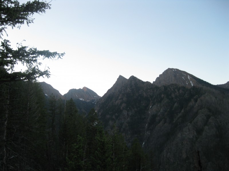 However, this relatively pleasant progress was soon to change--the deadfall grew more common, and soon we were clambering our way through a literal sea of hundreds of downed trees. While the trail was simply buried under the trees half the time, the fact of its existence was now mostly useless to us. Our life became a series of trees to hop over, walk along, or sometimes duck under, encountering a brief patch of relatively open ridgeline before having our hopes dashed yet again. This part of the route was maybe 2 miles and 2,000' of uphill gain, but it felt like much more, and every bit of progress was hard-earned and accompanied with the occasional bit of swearing, especially one or two brief downhills along the ridge crest! At last, we neared the 7100' level, where we were to break away from the increasingly-indistinct ridge and trail, and begin a large traverse of the grassy bowl far above the Ashley Lakes. It looked like the slopes were clearing ahead, and I remained hopeful that our progress might become far quicker. Yeah, right... 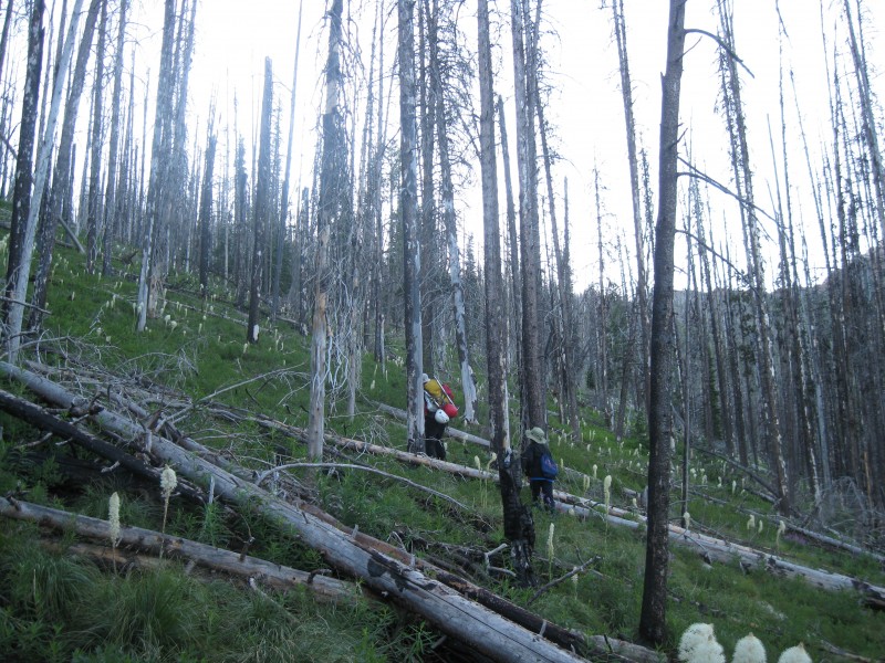 As we began to contour on mostly-open slopes with the occasional dead tree, I found myself a bit unnerved by the steep slopes that plunged, unrelenting, nearly two thousand feet down to the lakes. However, by occasionally ascending or descending as we traversed, I found a relatively safe and unexposed route across the slopes. For some, it might not be a big deal, but it had me at least a little on edge. 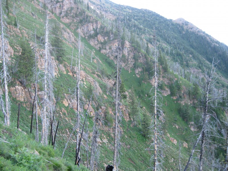 We were making good progress, but as our route began to turn southeast, that changed. Here, one must cross two steep grassy gullies, dropping about 200' to avoid some "cliffs" (really, more like rocky outcroppings), then reascend a bit. The grass slopes here turned out steeper than pretty much anywhere else on the route, even if the exposure was slightly less in places. Climbing back up along the slopes of the second gully, I became decidedly more uncomfortable with the situation--I was making my way up slopes in excess of 45 degrees, literally placing my life in trusting the tufts of dirt and grass I was holding onto. Finally topping out onto more typical slopes, interspersed with a few pines, I sincerely hoped we wouldn't be encountering any more terrain like that ahead.  Luckily from here, the route became a bit more pleasant, and almost--dare I say--fun! The slopes were manageable, and there was the occasional rock band to cross, which could involve a bit of enjoyable class 3 if one desired. We'd been slowly gaining ground on the thick forest we'd seen on the southeastern slopes of the bowl, and while I'd heard these woods could hold thick snow into summer, I wasn't seeing any, and figured the woods would mean easier progress for us. Ha. Ha. Ha. The first few dozen feet into the woods was some of the thickest, brushiest, most difficult bushwhacking of my life--and I've done a fair bit of bushwhacking. Steep slopes, combined with immature pines, made for us literally throwing ourselves uphill into the vegetation, trying to make some kind of progress. Throw in random vertical cliffs here and there, and it was almost unbearable. Luckily, the woods soon thinned out somewhat, but even then, our progress was not easy--the hillside was steep, and there were still cliffs and deadfall and unstable ground we had to navigate. As we continued, the forest began to open up in places, and we could see that we'd passed beyond the Ashley Lakes basin into a valley, its grassy floor only a few hundred feet below. We made serious consideration to the idea of just dropping down at this point, but decided to continue on at the same elevation. Soon, mercifully, the slope lessened, and my poor ankles got a bit of a reprieve for the first time in several hours. I knew we'd be reaching Duncan Lake at any moment, but as we continued, there was still no sign of it. We crossed several small grassy gullies bounded by rock bands and covered with sparse forest, at one point seeing the sole sign on the entire climb of human intrustion into this area--a small campfire ring. At last, we passed over a small rise and there was the lake--beautiful, deep blue, glistening in the morning sun. Steep, banded rock faces rose a thousand feet above its shores. We stopped at the lake's outlet to break, already beat. 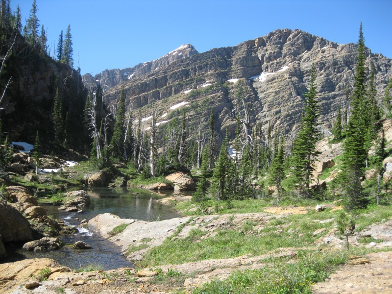 After our rest, I looked at the route ahead. Going around the north side of the lake looked unfeasible due to cliffs. However, the route others had mentioned--staying about 30' above the lakeshore on the south side--looked cliffy and snowy and impossible too. We ultimately decided just to climb the steep and loose 100' grunt up to near the crest of the small ridge along the south shore. We got through this area with relative ease, passing over a few easy snowfields, then continued up a mild incline over more snowfields and bare rock to a saddle SE of the lake, only at 7600', but already at treeline. Dropping slightly, we made our way around a corner through easy enough terrain, occasionally using our ice axes, then coming face-to-face with a large bowl of talus and boulders. Further to the right, we could see the saddle at the headwall of the creek below us--where the route had indicated we should go--but we decided to try our luck with the bowl, ultimately finding it to be a better and shorter alternative. We picked our way up to the rim on the far side, and at long last, could see our goal.  From this angle, I was heartened to see plenty of bare rock on McDonald's south face, but like everything in this range, things would prove harder than they appeared! A large snowfield rose up the right side of the face, also crossing most of the upper part of the face near the ridge crest; from here, it looked mild enough. We began to make headway up the basin, first crossing several semi-exposed bands of rock amidst grassy meadows and rushing mountain streams, higher up on bare rock and snow. However, the closer we got, the more intimidating the seemingly-mild slopes ahead became. I was now pretty certain I wanted no part of that steep snowfield, but a particularly-large rock band across most of the lower face made it clear that the alternative wouldn't be entirely straightforward either. After a brief discussion, we decided I'd try my luck at the rock, while Doug and Arthur ascended the snowfield; the weather looked perfect and we'd be pretty much in line-of-sight, so I was okay splitting up. 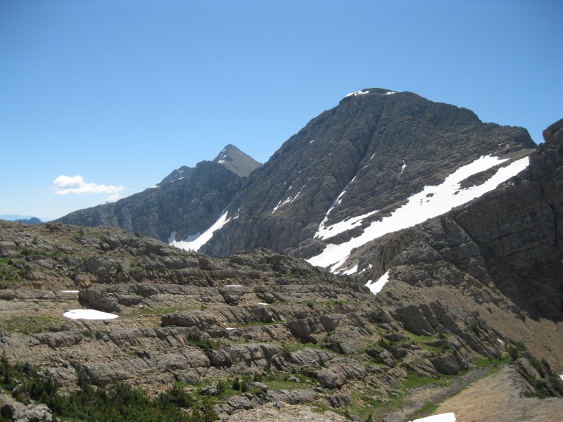 I dropped my poles and cut left, crossing up a few mild-angle snowfields until I was below the big rock band. From here, it looked potentially 4th class or harder, with a moat at the base. I kept going left, making myself good steps in the slightly-steeper snow here. I finally found a break in the cliffs, surmounted them, and found myself on bare ground--lots of dirt, loose scree, and talus, with bands of more solid rock here and there. Nothing uncomfortably steep, just tedious. Looking over to my right, I could see I'd wasted a fair bit of time, and the others had already made good progress up the snow--I picked up my speed as best I could, still favoring my knee. I kept trending right, bit by bit getting closer, trying to position myself below the summit, and wondering how I was going to surmount that last bit of snow near the top.  At last at the snow, I'd gotten myself below a few patches of rock I hoped would make things easier. The first bit was only a few dozen feet of snow, but steep enough to make me nervous; once at the top of it, it was surprisingly difficult to get back onto the rock, especially in the sun-softened snow, and I punched through a few moats trying to regain my footing. Past the rock, and with only one bit of snow left, I knew I was damn close, but McDonald had one last nasty surprise to throw at me--steep, 40-to-45-degree soft snow for another few dozen feet. Taking an eternity, I carefully made steps, self-belayed with my axe, until ten feet remained...five...and I was on bare rock again! A few more feet and I popped out onto a mild chossy slope, just west of the summit, where Doug and Arthur were already waiting. Triumphant, yet exhausted, I dropped my pack next to theirs. It had taken us ten hours from camp to reach the summit, and was already 2 PM--there was no doubt we'd be hiking down at least partly in the dark. But in that moment, I put that in the back of my mind--we'd fucking done it. The true summit was a narrow ridge of snow, which I carefully ascended and crawled over to in order to tap the highest snow.   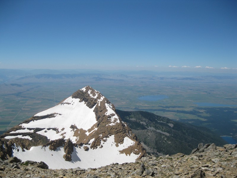 However, the views were just as good from our rocky perch. To both the north and south, the narrow Mission Range rose to a series of sharp, rugged peaks. Again, I was struck by just how much more forbidding every surrounding peak looked than McDonald, and was secretly glad our climb hadn't been any more difficult than it already was. To the west, the vast expanse of agricultural land on the reservation, 7,000' below, was a beautiful patchwork of greens, and Flathead Lake sprawled its way across the valley further north. And off to the northeast, on the distant horizon, a magnificent and tumultuous jumble of peaks and spires rising out of what had to be Glacier National Park. However, we were mindful of the late hour and knew we were really only halfway, and soon we began to gather our gear, finishing the snack food I'd been devouring to replenish my energy, and set off from the summit. Heading down, I did my best to retrace my steps, this time with Doug and Arthur in tow--to my surprise, they'd found the snow slopes fairly intimidating. We carefully made our way down the snow just below the summit, and near the bottom of the 45-degree slope, I had little choice but to glissade the last bit, managing to slow my descent enough to only kind of run into the rocks at the base. Soon we were making fast progress down the dry rocky slopes, and to my relief, we figured out our way around the cliffy impasse pretty easily. My old steps in the snow were already mostly invisible, and thus I ended up passing where I'd stashed my poles. Soon realizing my mistake, I returned and grabbed them, then continued down. After glissading a nice bit of snow, Doug realized he'd left a pole at the top of the run, and he had to return for it as well! Only Arthur escaped unscathed... 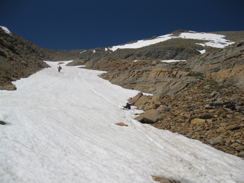 Soon, we were hopping our way down the rock bands amidst the grass and streams, then the rock bowl. 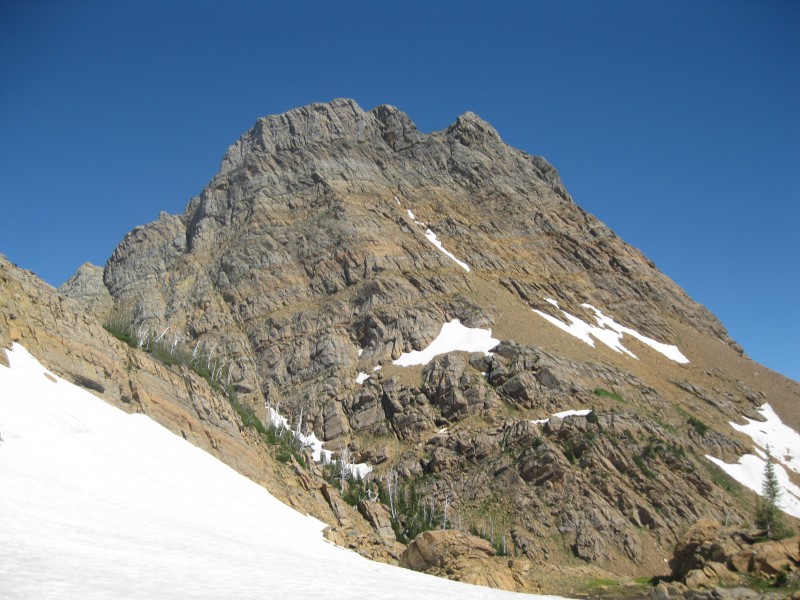 Returning to the small saddle, the snow was now softer and easier to cross, but at one point, Doug stated he saw grizzly tracks--a good reminder of the kind of country in which we were travelling. Back on the small ridge by the lake, we stayed high too long, dealing with a crappy loose descent back to the river, where we rested again and refilled on water in the late afternoon sun. 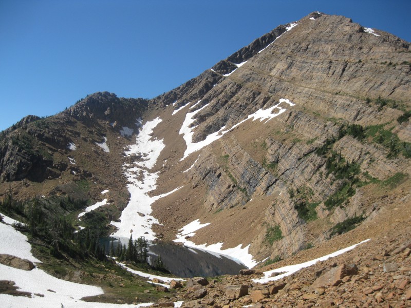 Unfortunately, the pleasant travel was over...we began our travel across the tedious grassy slopes again, making good time before hitting the forest, but then getting off our previous route a bit and staying too high in the forest, necessitating a slightly tricky descent. Once we hit the thick brush, we had gravity on our side, and were able to soon push through to the grassy slopes around the rest of the bowl. I was dreading the rest of this part, but for a good ways, we made fairly easy progress. Or maybe I was just immune to the freakishness of these slopes by then, who knows. However, our easy progress came to an end at the rocky outcroppings, and again, we found ourselves descending horrifically steep grassy slopes with only uncertain dirt and tufts of grass as handholds. On the other side of the gully, we decided to ascend a good 50' of steep grassy hillside again, which was agony--we had barely any energy left. Finally, though, we were back on manageable slopes again, and trying to make good time back to the ridge. 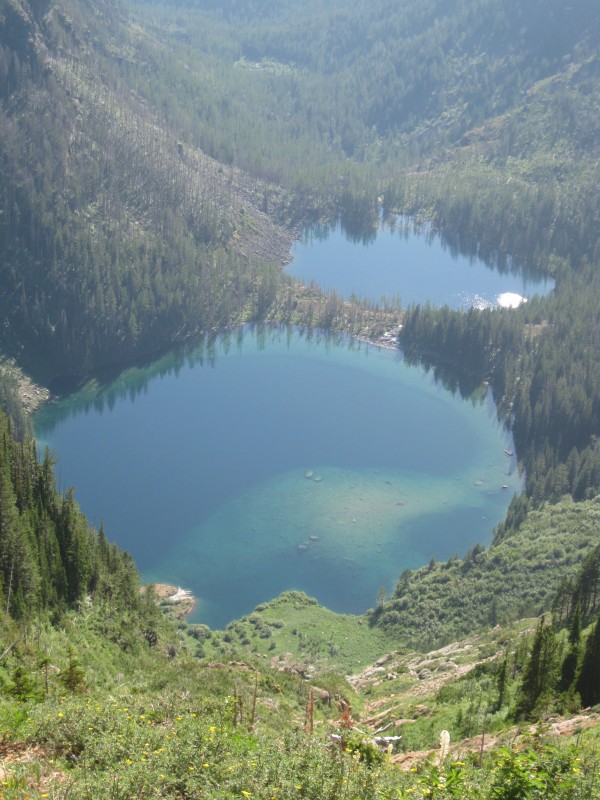 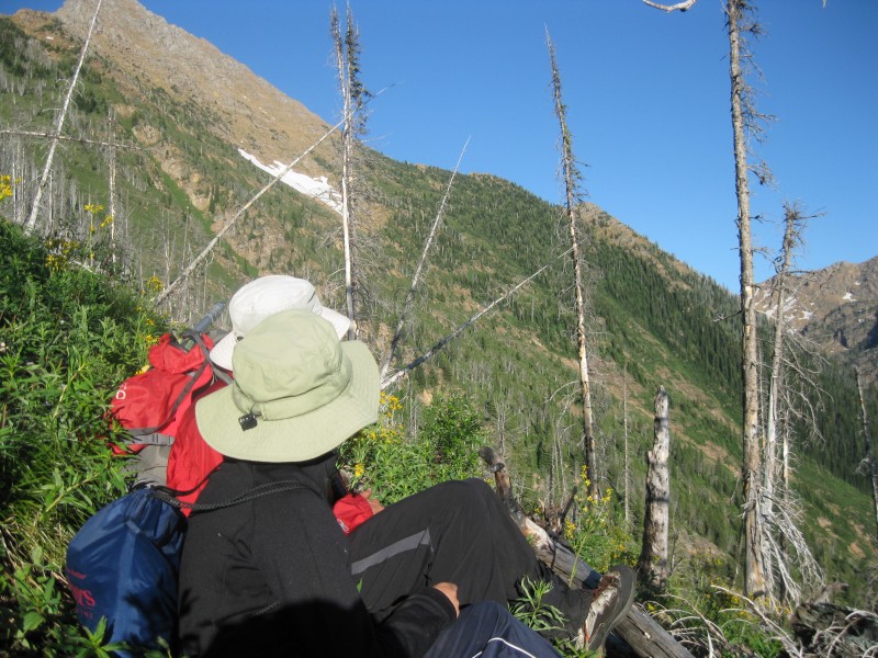 Here, I was already sick to death of sidehilling, and was considering just angling uphill to meet the ridge. Doug and Arthur seemed more opposed to the idea. I stubbornly pushed on, not entirely realizing they were slowing down, and suddenly found myself in the middle of an immature forest, dead tree stumps surrounding me, and no sign of either of them. I looked all around, trying to find them or hear them, unsure if they were ahead of me or behind me. I slowed my pace and tried dropping down a bit, and at last spotted them a short ways back. I decided to stop being stupid, and stayed close by both of them the rest of the way back. Soon, we were back on our ridge route--theoretically. We were having trouble staying on the trail, once again surrounded by endless deadfall. Oh, and you know how I'd thought the deadfall would be better than the sidehilling? Nope! In only a few tenths of a mile, I was already hating it again. Here, our progress slowed, and our frustration rose. It was still daylight out, but the sun was quickly sinking to the horizon. We resolved to cover as much ground as possible before it grew dark. 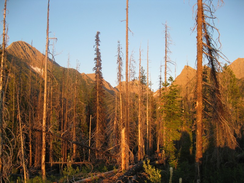 The lower we went, the less distinct the ridge became, and we'd sometimes have to check our route. It seemed like we were barely making progress, and while in my mind, I'd thought the deadfall would abate further down, reality again mostly proved otherwise. Our frustration also grew; we no longer had the energy to loudly warn off grizz, and every other word out of my mouth was some variation of a fuck-word. As bad as I had it, Doug and Arthur were worse--they were seriously low on energy, and understandably so after such a tough day. We knew we had no option, however, except to continue.  The sun departed, and the forest grew dark, and still we pressed on. After losing the trail a few more times and descending our steep slope, getting slightly off track, I saw we were only 2/10 of a mile from the tents, then a tenth of a mile...then, there they were! We turned on headlamps and began packing up camp as quickly as our low energy levels allowed, already having decided that we just wanted to get the hell out that night. We were now close, but with our newly-laden packs and the bit of deadfall and brush left to contend with, it was torture. At long, long last, 18 hours after we'd begun hiking that morning, the trail dumped us unceremoniously out at the end of the road. I'd been glued to my GPS, watching the small dot signifying our vehicle grow slowly closer, and continued to do so as we stumbled the last few tenths of a mile toward the car. Seeing the glint of our light on metal, it took me several moments to realize that somebody else was up there!! They turned out to be a couple of friendly local guys about my age, camping right near our car, preparing for a climb of McDonald Peak the following day. I dropped my pack and lay down next to the car on it as we chatted with them, giving them beta on the route. It turned out they didn't have a map, didn't have bear spray, and didn't know much about the route--and in fact had a friend showing up to meet them at 3 AM after a concert in Missoula, with a planned start time of 6! I don't know how they fared, but at least they'd done climbs in the range before, and I did give them my map, which I no longer needed. Not really giving a fuck, we just indiscriminately tossed our stuff into the CR-V, then began driving down the road. We encountered few obstacles until reaching the bottom of the road, where I was unable to open the fencing sections across the road, whether from physical or mental exhaustion I don't know. With help from Doug, we got them open, I closed them, and we were back on sweet, sweet easy dirt road. In spite of the ordeal we'd been through, I was surprisingly neither drowsy nor starving. I stayed awake as Doug drove, and we decided to try to make it to the Burger King in Missoula before they closed--but it was gonna be tight. With about five minutes to spare, we made it, and stuffed ourselves on crappy fast food. We drove a short ways east on I-90, taking an exit onto a road that led into the national forest. We found a pullout on the side of the road and slept contentedly, with the knowledge that we'd taken on possibly the toughest peak of our trip and survived. Doug, on the summit, perhaps put it best in capturing our feelings on McDonald, in spite of the stunning beauty of the range: "I'm so glad we don't have to come back for this one!" Click here for part 3... Thumbnails for uploaded photos (click to open slideshow):  Waterfall near the start of the trail")
 The summit comes into view")
 The dramatic Valhalla Range of the Selkirks, in British Columbia")
 Surreal alpine paradise...")
")
 Massive waterfall just below Leigh Lake")
 The basin above the lake, the slopes we ascended at center, Snowshoe rising above all")
 The hidden grassy back-trending")
 Following the easy, yet sketchy ridge")
 The")
 McDonald Peak at center, from the road")
 Typical stretch of the high-clearance road")
 The Mission Mountains at dawn")
 Nearing the switch to sidehilling, with a bit less than usual deadfall")
 Nearing the")
 A glimpse back at civilization from this untamed place")
 At the outlet of Duncan Lake, unnamed 8ers in the background")
 McDonald comes into view at last")
 Glacier Peaks")
 Doug and Arthur tackling the snow as I ascend dry chossy junk")
 Crawling up to the true summit on the snow ridge")
 Looking north from the summit, Mt. Calowahcan at left, the distant peaks of Glacier somewhere to the right")
 A snowy P9417 and the Flathead Valley to the west")
 Doug doing a bitchin' standing glissade")
")
 Duncan Lake and P9417 again")
 The dizzying drop to the Ashley Lakes, far below the grassy traverse")
 Doug and Arthur, contemplating what we just crossed")
 More typical bushwhacking conditions, as sun sets on the Missions...")
 ...and on the Flathead Valley")
|
| Comments or Questions | |||||||||||||||||||||
|---|---|---|---|---|---|---|---|---|---|---|---|---|---|---|---|---|---|---|---|---|---|
|
Caution: The information contained in this report may not be accurate and should not be the only resource used in preparation for your climb. Failure to have the necessary experience, physical conditioning, supplies or equipment can result in injury or death. 14ers.com and the author(s) of this report provide no warranties, either express or implied, that the information provided is accurate or reliable. By using the information provided, you agree to indemnify and hold harmless 14ers.com and the report author(s) with respect to any claims and demands against them, including any attorney fees and expenses. Please read the 14ers.com Safety and Disclaimer pages for more information.
Please respect private property: 14ers.com supports the rights of private landowners to determine how and by whom their land will be used. In Colorado, it is your responsibility to determine if land is private and to obtain the appropriate permission before entering the property.


