Download Agreement, Release, and Acknowledgement of Risk:
You (the person requesting this file download) fully understand mountain climbing ("Activity") involves risks and dangers of serious bodily injury, including permanent disability, paralysis, and death ("Risks") and you fully accept and assume all such risks and all responsibility for losses, costs, and damages you incur as a result of your participation in this Activity.
You acknowledge that information in the file you have chosen to download may not be accurate and may contain errors. You agree to assume all risks when using this information and agree to release and discharge 14ers.com, 14ers Inc. and the author(s) of such information (collectively, the "Released Parties").
You hereby discharge the Released Parties from all damages, actions, claims and liabilities of any nature, specifically including, but not limited to, damages, actions, claims and liabilities arising from or related to the negligence of the Released Parties. You further agree to indemnify, hold harmless and defend 14ers.com, 14ers Inc. and each of the other Released Parties from and against any loss, damage, liability and expense, including costs and attorney fees, incurred by 14ers.com, 14ers Inc. or any of the other Released Parties as a result of you using information provided on the 14ers.com or 14ers Inc. websites.
You have read this agreement, fully understand its terms and intend it to be a complete and unconditional release of all liability to the greatest extent allowed by law and agree that if any portion of this agreement is held to be invalid the balance, notwithstanding, shall continue in full force and effect.
By clicking "OK" you agree to these terms. If you DO NOT agree, click "Cancel"...
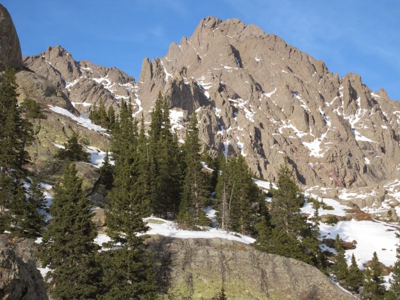
Route: Crestone Needle, traverse to Crestone Peak; Cottonwood Creek
Date: Jan 25-26, 2014
11.6 miles, 6500' vertical
Team: Natalie (nkan02), Jeff (Mickeys Grenade), Jim (Yikes)
A continuing dry winter has opened the possibility to climb some of the tougher Winter 14ers. This past weekend, Jeff suggested Pyramid and Natalie threw out the idea of the Crestones traverse. My schedule didn't allow for a 3 day weekend and I needed to drive through Salida to pick up my camping gear, so we settled upon the Crestones. We were concerned at the last minute that the Sangres would receive 5-7 inches of snow from the recent storm, but it appears the area was spared. We also knew that Abe and Kay had been up the Needle recently and were hoping the trench was still in good shape.
Jeff and I hiked to camp on Saturday. Our winter packs were loaded down with tents, sleeping bags/pads, avy gear, snowshoes, stoves, ropes, crampons, ice axes, etc. Slowed down by the extra weight, I think it took about 6 hrs to reach the nice campsite at 11,400, longer than we were expecting. The "winter" bypass goes up through a talus slope and across the slabs. It took a while to ascend the talus field, trying to follow the off and on again footprints of Abe/Kay. I was concerned that we would lose the trail as it crossed the slabs and have to trench the remaining distance, but fortunately we found the trench on the other side. Natalie showed up after dark, having trenched the "summer" route which took more time than she expected.
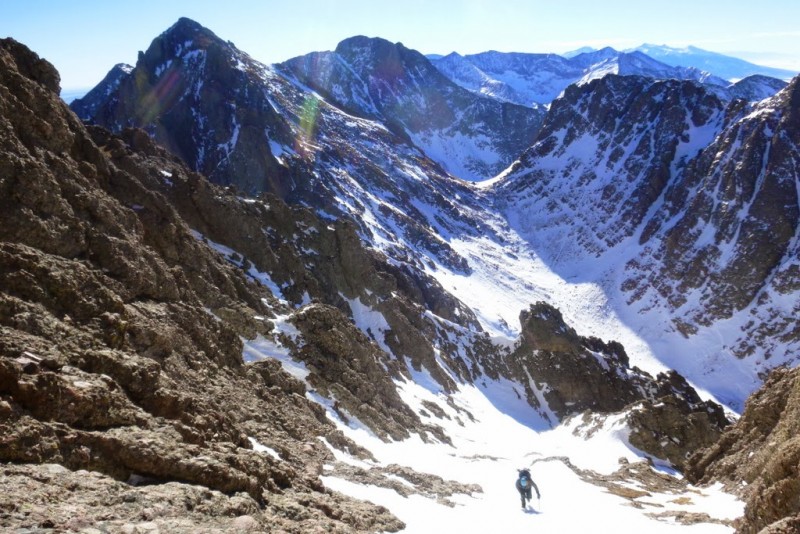
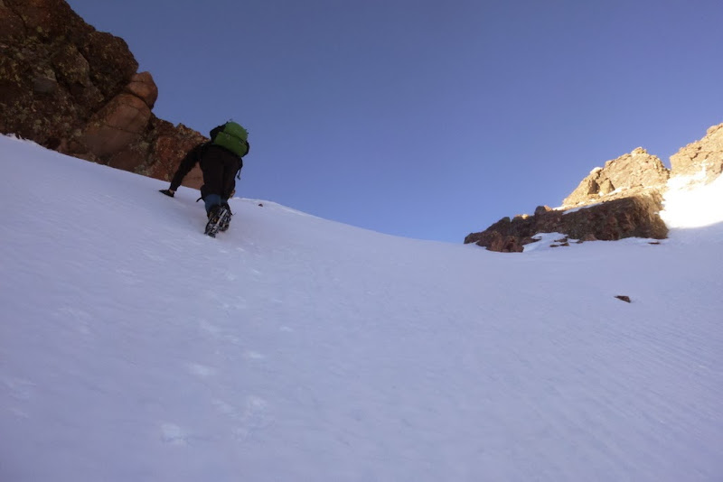
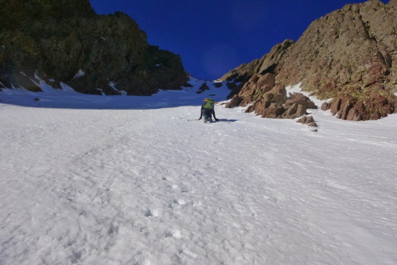
We decided upon a 5am wake up call, thinking that would leave plenty of daylight on the mountain. That ended up being overly optimistic. We followed Abe/Kay's trench up the initial steep hill, where we quickly lost it. Trenching up to the lake on the right side of the valley avoided most of the willows encountered on the summer route.
Snowy Basin
Approaching the Basin
Sunrise on Needle
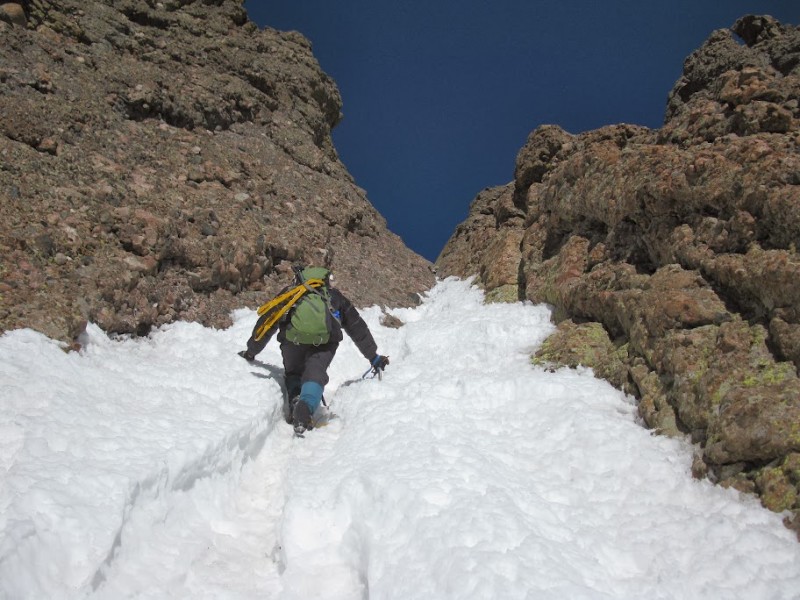
Red Gully
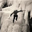
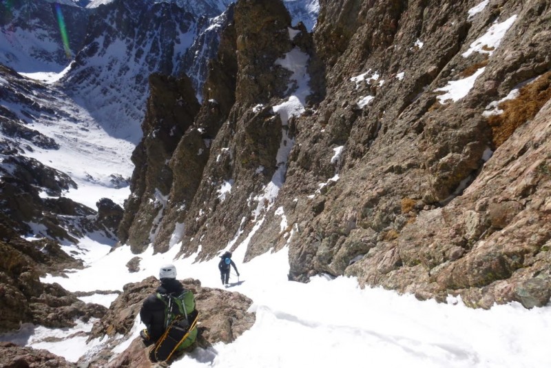
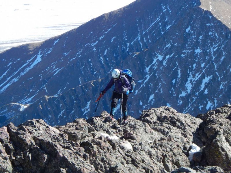
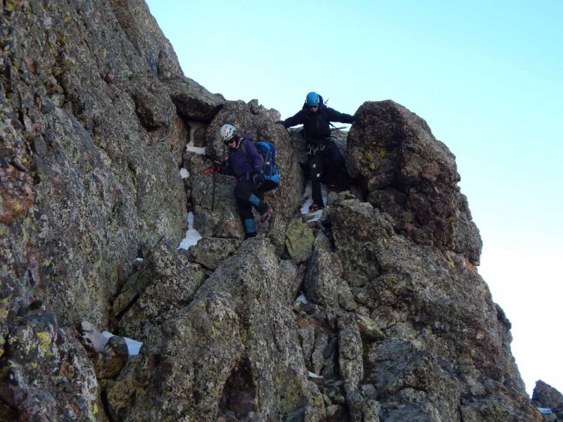
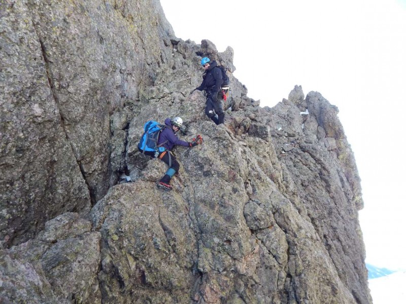
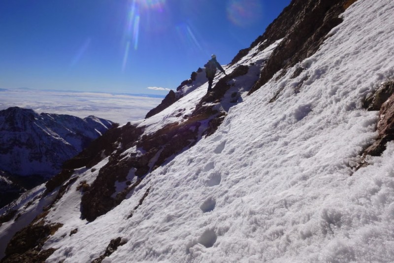
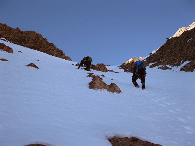
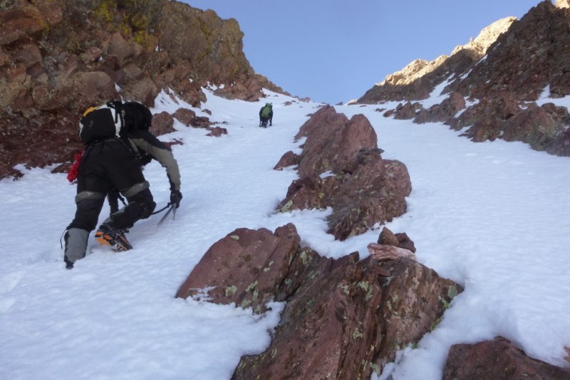
We followed Abe/Kay's advice and did not ascend the summer trail to Broken Hand Pass, but instead hiked directly up the steep slopes to gain the ridge. A quick break and we headed over to the east gully on a mostly dry trail. We climbed the east gully to the top, avoiding the crossover to the west gully. There were a few stretches of ice, but they can be bypassed by climbing the rock to the side. We summited at 11:30, which was later than we preferred.
Hiking up the slope towards Crestone Needle Start of the East Gully East Gully East Gully East Gully East Gully
Crestolita
Ice1
Ice2
Cold enough to wear the puff
Humboldt
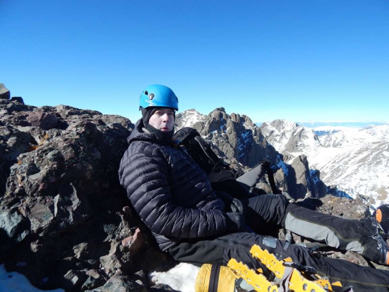
East Gully East Gully Natalie topping out Jeff resting on Crestone Needle summit The Crestone Traverse
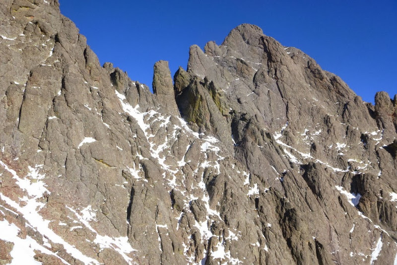
The traverse has always intimidated me. Many years ago I hiked up the Needle in a drizzle with the intention of traversing to the peak. At the time, we decided it would be unsafe to attempt the traverse in wet conditions. On a later trip, we had difficulty finding the start of the traverse from the Red Gully and saved the Needle ascent for the next day. When Natalie suggested the traverse in Winter, I felt it would be beyond our reach, but I left open the possibility. This is more of a Mad Mike than a Jim Yaich hike (nice, it all rhymes). Hating to hike all the way back up in Winter for Crestone Peak, we all decided to give the traverse a go. Natalie and Jeff had been on the traverse before, so I wasn't too worried about route finding. I was also feeling pretty strong, which doesn't happen as often as I would like when doing the 14ers.
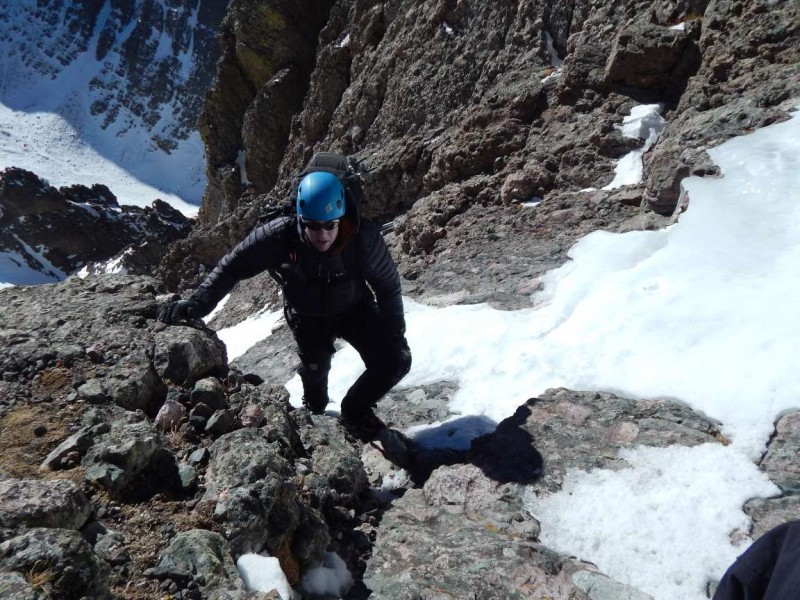
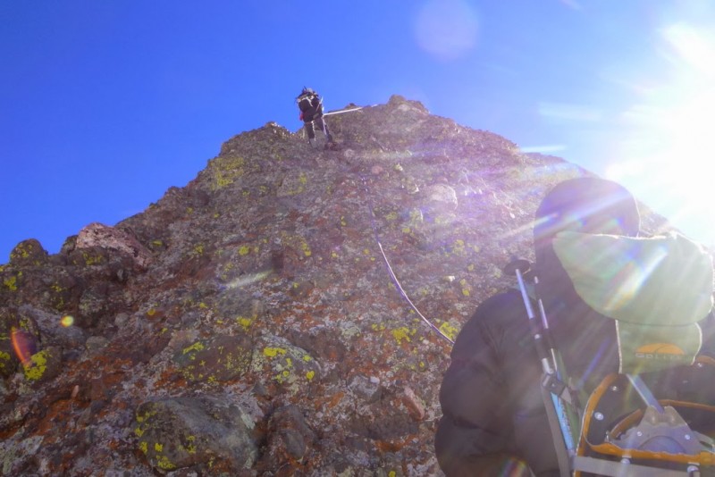
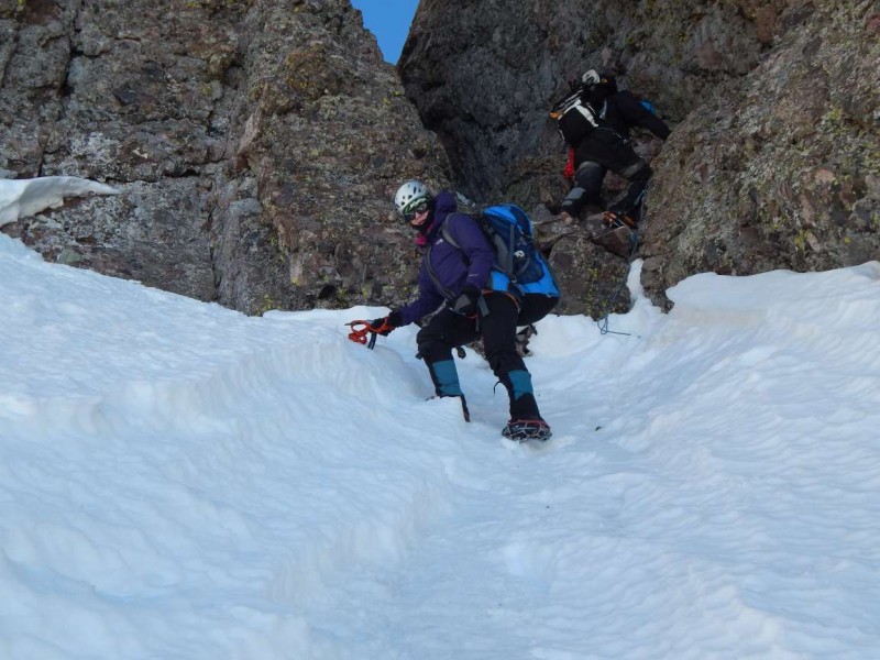
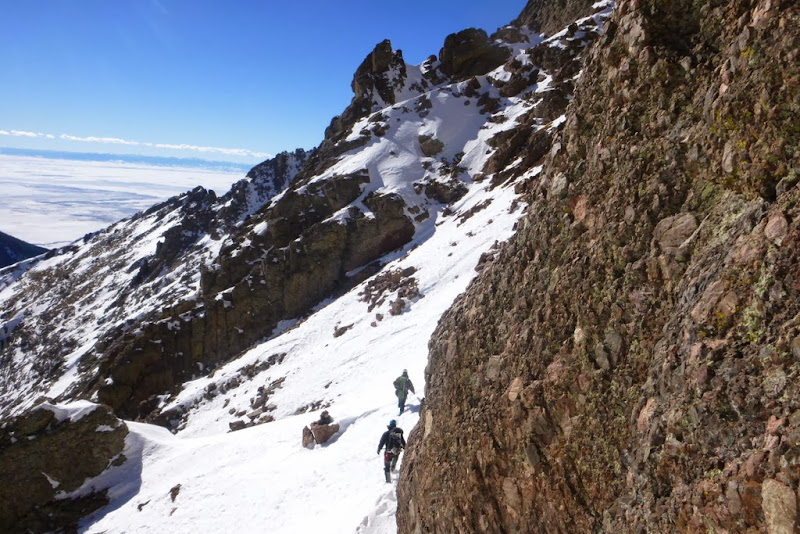
It was a little tricky getting over to the rappel station in the high wind, and the ropes knotted and wrapped around every knob as they were tossed down. There were two piece of webbing that looked somewhat decent and Jeff donated a couple of quick links to complete the anchor. We had a few misdirections in the Z traverse. The mini-knife edge was interesting, I backwards straddled since it is downward sloping. The 5.2 downclimb was absent due to the snow built up at the base (and there was a short rope to hold onto). It took us a long time to get over to the Red Gully.
Jim testing the anchor
Jim committed to the rappel
Rapping down
Traverse
Traverse Knife edge Downclimb made easier by snow
Traverse traverse traverse
Traverse
Traverse
Traverse
Traverse (overview)
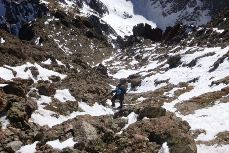
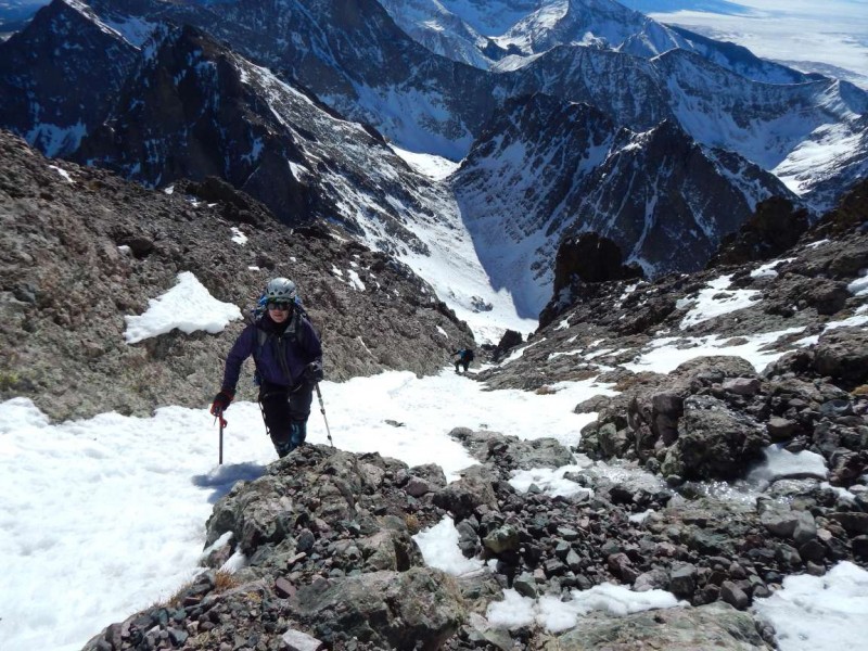
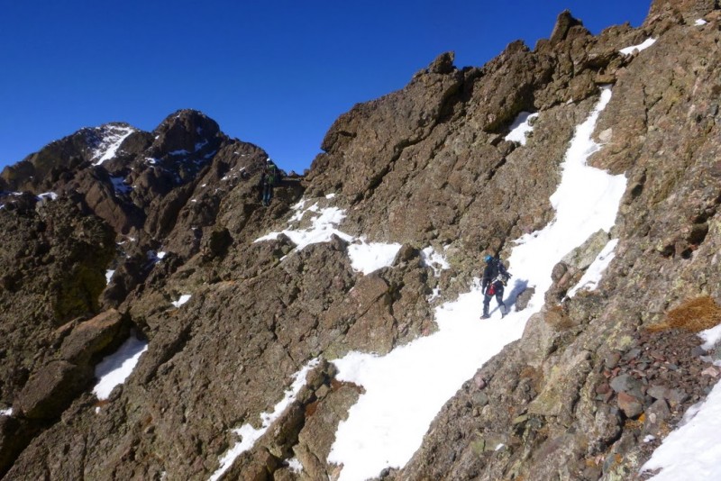
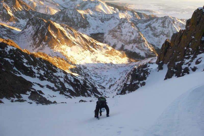
Finally reaching the gully, we dumped the excess weight of snowshoes and ropes and started up. The snow was a mixture of breakable crust and hard unbreakable. The final stretch from the pass to the summit went quickly and we topped out at a late 4:30pm.
Red Gully
Red Gully conditions (bulletproof)
Red Gully
Red Gully (Jim)
Red Gully
Kit Carson
Adams & friends
Heading up the Red Gully Heading up the Red Gully Heading up the Red Gully
Jim on summit
Going down - red Gully
Sunset
Last photo before dark; heading down the Red Gully
Now we had to get off the mountain as quick as possible. The descent down the Red Gully is tough in the dark. Half way down, I stepped on a patch of ice and went for a short uncontrolled ride, fortunately stopping myself before it became serious. In another spot, we had to downclimb some steep rocks onto bullet hard snow, requiring focus.
We were happy to reach the floor of the basin, except for Natalie who suffered some serious posthole hell getting back to her snowshoes that she cached at the lake. Jeff and I hauled our snowshoes over the traverse to deal with the eventuality. It took a little while to locate our trench from the morning; the high wind having covered in our tracks. We slowly made out way back down to the campsite.
I had to be in Denver by 8am, so packed up and started down the trench. I thought that maybe Natalie's trench on the "summer" route would be easier than navigating the talus on the "winter" bypass. However, I ended up losing the trench part way down and suffered through some deep snow in the woods before I finally stumbled back onto the trench. The mileage wasn't very far, but even walking at a good clip it felt like I would never reach the trailhead. I didn't get back to the car until 1:15am, and spent the 4 hour drive back to Denver listening to the comedy channel doing a reasonable job of staying awake. Natalie and Jeff camped out for another night, and hiked out in the morning.
Thumbnails for uploaded photos (click to open slideshow):
I am glad my TR and our trench helped some. Natalie's break down is correct. How to underestimate the Crestones in the Winter could have been our TR title too. And YES there is no way around it that approach is terrrrrrrriiiiiibbbbbbbllllllleeeeeeeeeeeeeeeeee
We ended up negotiating the whole thing in the dark of night on the way out. I am glad we day tripped so we didn't have all the extra gear but exhausting is an understatement.
Excellent job you guys! I still hope to try this come summer, but I definitely like the rock better than snow. Makes me very uneasy seeing you guys climb on that white stuff, and then to hear that you did slip! Glad to hear you're all OK! Some super shots, Jim! Thanks for sharing! :D
Thanks for posting the great TR. I still believe the traverse is the same difficulty as descending back down the needle in winter. But then if you get the Peak, you would miss out on the awesome approach again. It is not that bad. :roll:
This is my favorite TR yet!! What a gnarly couple of snowflakes you guys got! I did both peaks in a day via the standard route in summer. Not recommended! It was a lonnggggg day with far less excitement than yours! Wow. I am beyond words! Pics 7 and 8 are breathtaking.... oh, and that one of Adams and company... oh, and all the scenic shots with the sunrise and sunset on the snowy mountains! I can't pick my favorite! Absolutely incredible, guys. Well done! I'd love to try the traverse this summer. Not quite up to doing it in winter conditions yet :wink:
Thanks for the great read!!! Keep being awesome!! :D
The title of the report should be "How to underestimate Crestones in Winter" :wink: This is the climb I'll look back on and wonder what I could have done better.
1. Cottonwood creek approach sucks. There is no way around it. It is hard enough in summer, but winter takes it to a whole new level of misery. I was wondering what the *ell I was doing on ice-covered slabs with 40lb+ overnight pack in snowshoes in the dark trying to get to the high camp! Not often one gets to use an ice tool on the approach to the climb...but this is how it ended up being 5.5 hrs vs 3 hours in the summer. Same $it on the deproach - taking the "haute route", and almost getting cliffed out. At least I wasn't in the dark on that. Main motivation for the traverse? So we won't have to do that approach. ever. again.
2. Weight vs. speed trade-offs. In the ideal world, I'd love to bring my 2 lb Grivels AND carry snowshoes all day, but I knew that weight would slow me down considerably. In the end, lack of crampons and snowshoes did slow me down anyway. While Needle's East gully was in perfect spring-like shape even despite the ice patches and crampons were desirable, but microspikes were sufficient, the Red Gully was mostly bulletproof snow. At least I had an ice tool - self-arrest on that slope with just an ice ax would have been problematic.
3. Sangres are pretty dry, but all the fluffiest, softest, deepest snow is concentrated between the mouth of the Red Gully and Cottonwood lake. Really?
4. Most importantly, Jeff and I are most glad that you are ok. That slip in the dark on the icy patch was terrifying to watch. So glad we all made it out safely, and in my tired state I couldn't be more thankful for the campsite and a sleeping bag at 11.3k. Thanks for being an awesome partner and thank you for your patience.
p.s. Jim, you forgot to mention that according to the tradition you dropped your water bottle down the Needle! :lol:
Greg - just trying to follow in the footsteps of the master. I can't believe how fast you guys made it across the traverse. We were moving but at times not very fast. There were no route finding issues, it was just... work :? Fun climb nevertheless and the sunset views were quite spectacular - too bad we had to hurry down.
Caution: The information contained in this report may not be accurate and should not be the only resource used in preparation for your climb. Failure to have the necessary experience, physical conditioning, supplies or equipment can result in injury or death. 14ers.com and the author(s) of this report provide no warranties, either express or implied, that the information provided is accurate or reliable. By using the information provided, you agree to indemnify and hold harmless 14ers.com and the report author(s) with respect to any claims and demands against them, including any attorney fees and expenses. Please read the 14ers.com Safety and Disclaimer pages for more information.
Please respect private property: 14ers.com supports the rights of private landowners to determine how and by whom their land will be used. In Colorado, it is your responsibility to determine if land is private and to obtain the appropriate permission before entering the property.


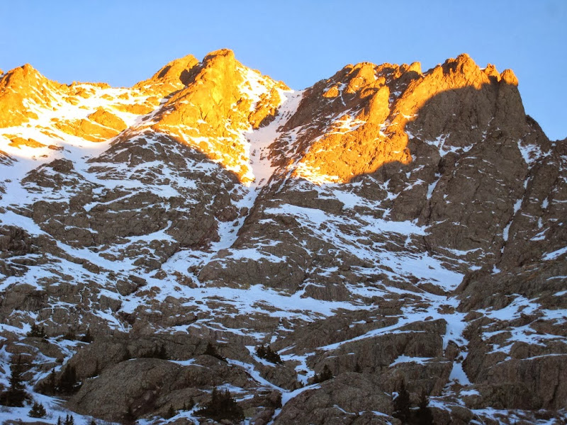


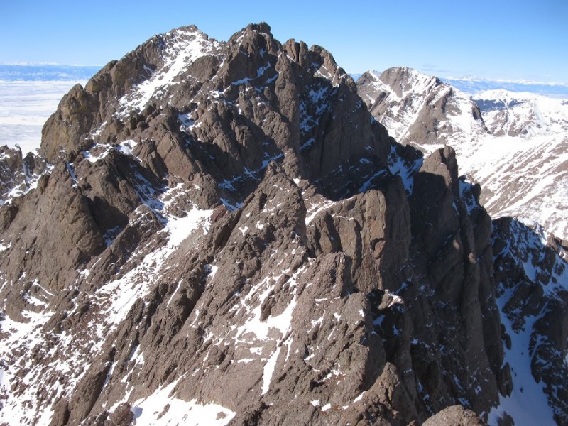


 Crestone Needle")
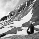
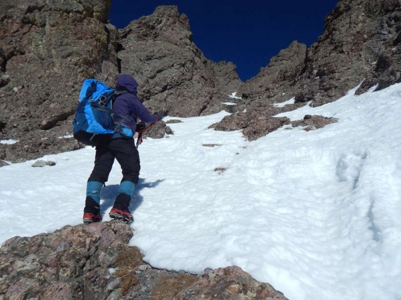
 Natalie taking a break near Broken Hand Pass")
 Looking down the rappel")
 East Gully")