| Report Type | Full |
| Peak(s) |
Rucu Pichincha - 15413 Illiniza Norte - 16818 Cotopaxi - 19347 Antisana - 18714 |
| Date Posted | 01/28/2014 |
| Date Climbed | 01/06/2014 |
| Author | Rainier_Wolfcastle |
| Additional Members | jblyth, Emily |
| New Years in Ecuador |
|---|
|
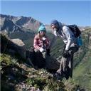
Three world travelling free spirits and one math geek went to Ecuador to climb some volcanoes. Unfortunately for you, the math geek is the one writing this story! Intro: Emily (Emily), Jason (JBlyth), and I (Shawn/Rainier_Wolfcastle) all at various times this past year had illusions of climbing Aconcagua. Our mutual friend (let's call him Bryan Crushner) often fanned these illusions with outlandish ideas of climbing for half price in November, taking the crazy Polish Direct Route, doing it in 12 days, driving there, etc....okay, I made at least one of those up. Anyways, the three of us had vacation, route, and financial concerns that made an Aconcagua attempt a bit of a reach. So Emily and Jason started putting together an Ecuador trip. I invited myself along. Then Emily mentioned the trip to Brendan, and there was no way he could pass up a trip to South America with his gal! We found out that Ryan (Monster5) was planning a trip down there as well, so we talked about teaming up, but he was only interested in multi-pitch WI6+/M11 routes...so we quickly sent him on his way to tend to his little girl hikes!!! (we actually just couldn't match up schedules) Okay, what do we climb? We are required to get guides...who/when do we hire one/two, how long should we be there? Let me tell you, planning a trip like this requiring consensus among 4 individuals through none English speaking guides/guiding companies a continent away during the few weeks preceding Christmas IS NOT EASY!!!! Picking a guide: We skipped right over the fancy companies (RMI or Alpine Ascents)...way too slow (in acclimation) and too expensive ($500-$1,000 per peak)! The next level is companies like Gulliver (a large local tourism/guiding company) and Sierra Nevada, they are also kind of slow in acclimation, they charge a bit of a premium (~$300 per peak), price is more inclusive, but our biggest problem is that they plan pretty much every day for you...even the off days! Then there are the expensive "independent" guides (I quote independent because they often contract with the guiding companies as well)...they charge around $250 per person per mountain, seem a little more experienced, often come recommended. Ryan ended up using one of these guys on Illiniza Sur and Cayambe and seemed pretty happy with him. Our group wanted to spend less money and passed on this...but in the end, we pretty much ended up with one of these guys for 2 of the peaks. All of the above typically include transportation to the mountains, lodging in a hut or tent the night leading up to the climb, and meals on the mountain. The last option is the fly by the seat of our pants independent guide that says he can do it for less...but there may be some surprises along the way..of course we went this route!!! We settled on flying down to Quito on New Year's Eve (12/31/2013), with a planned departure on 1/14/2014. Our plan was to try to be flexible with the days of the climbs, knowing that weather and acclimation would need to be accommodated. We were going to climb Rucu Pichincha (15,413) entirely on our own. Find a cheap guide locally to get us to and allow us to climb Illiniza Norte (16,818). Then hire Pablo at Andes Trek Expeditions to take us up Cotopaxi (19,347), Chimborazo (20,564), and either Antisana (18,714) or Cayambe (18,996). He agreed to be flexible with the itinerary, be our lone guide (we would have 2 of us on a separate rope without a guide), transport, secure permission to climb Antisana, if possible, and not provide any food or cover any hut fees for $540 a person. Well crap...once we are roped in, he comes back and says the Park Service requires 4 clients have 2 guides...and BAM, he raises the price to $720 per person to account for a second guide...with no frills. In the end though, it worked out...but be sure to map out what you want, what you don't want, and the price with before agreeing to anything in Ecuador...particularly guides and taxi drivers! Flights: Emily and I flew American from Denver, through Miami to Quito. Round trip tickets were ~ $1,200. Brendan flew American from New York, though Miami, to Quito. American actually has three round-trip flights between Miami and Quito each day...which surprised me. Jason flew United from Denver, through Houston, to Quito using airline miles. The whole rest of the trip cost each of us less than $1,000...all in American cash. Lodging: We booked the Traveler's Inn in Quito for the first two nights. $29 for two people with one queen bed and a shared bathroom. $17-19 for one person, one queen, and a shared bathroom. $40-45 for two people, two queens, and a private bathroom. This place was pretty nice, safe, had a decent breakfast included, had secure bag storage, and was like a decent B&B in a pretty good tourist area of Quito. We ended up spending most of the nights here, in various room combinations. We did spend a few nights in The Backpacker Inn, which was a little more hostel like, was a little cheaper $22 for two people, two beds, and shared bathroom...but it was louder, no bag storage, and the single bathroom was shared by a lot of folks! We also all spent a night at the Jose Rivas Refugio ($22 per person, $30 if you wanted food) on Cotopaxi and one night camping (free) on Antisana. One note on phone and internet, just keep your phone in airplane mode and connect to wireless internet, which is provided pretty much everywhere. The Trip: Day 1: Emily, Brendan, and I all arrived in Quito around 8 pm on New Year's Eve. After getting through Customs (pretty quick and painless), we grabbed a cab and agreed on a $25 cab ride combined for the three of us to Traveler's Inn. Cabs are cheap! The airport is pretty new and is in the middle of nowhere! And every ride in Quito involves going down, around, over, back around, etc.! On the hour long cab ride, we witnessed a lot of fires by the roadside and many, many Ecuadorian Men in drag...all wanting some spare change for their efforts! I was hoping this was just for New Years and not a daily occurrence...for the most part, that's correct. We checked in. Brendan bought a $4 box of Argentinean Wine to share. Then we wandered out to Plaza Foch...just following the noise and fires to find our way. Turns out they had a free concert in the Plaza with a large Latin Band performing. Picture by Emily: 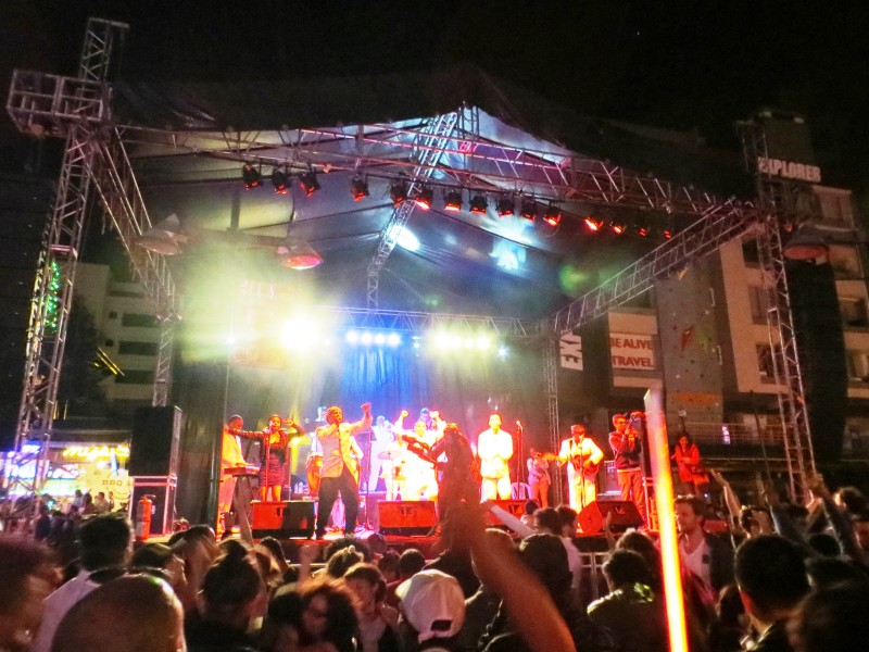 There was a serious police presence in the square, which also seemed to host quite a few tourists. The concert was cool, but this Plaza is a bit of a tourist trap as food and drink cost more than in the US. Also, you pretty much have two choices for beer in Ecuador...Pilsner (like flat Miller Lite with a poor after-taste) or Club (like Budweiser...so still pretty crappy), they are both dirt cheap. Sure, you can have some other American or Mexican Beers...for $10 a bottle. There were fireworks, dancing, and much much more burning of newspaper stuffed dummies. Picture by Emily: 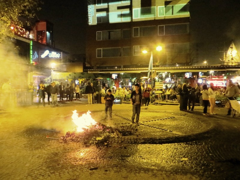 Here we ran into Ryan and Stephanie (did I get the name right?). They shared stories of Illiniza Sur while Brendan tried to start a rumble with a local bar owner over his stolen fleece. Day 2: After getting to bed around 3am, I awoke to a nasty Box Wine/Crappy Beer Hangover...but unlike somebody, I did avoid sleeping with my head on the porcelain! Jason had arrived later the previous night and he came by to say hi and recruit me for a day of sight-seeing..."sorry, but I'm not leaving this bed!" He did eventually recruit my less than enthusiastic party mates for a little trip to Old Town Quito. I missed a sweet weather day...sunny and an unseasonably warm 80 degree plus day. Picture by Emily: 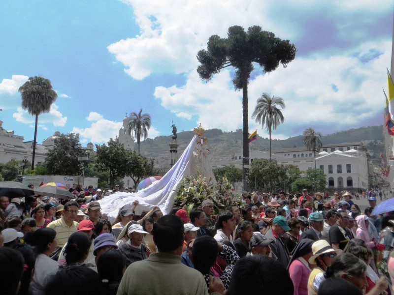 After coming back to life with a Coke and some Pringles, I started at least preparing myself for our Day 3 hike up Rucu Pichincha. I did a little research, $4 cab ride to the Teleferico, which opens at 8am and costs $8.50 per person. You could see the mountain from our courtyard, around a 15 minute cab ride. Also, I met another Traveler's Inn guest named John, he was a retired, widowed school teacher from North Carolina. He was there for an upcoming weeklong trip to the Galapagos (sounds like a pretty cool adventure). But he was interested in joining us on Rucu...an easy acclimation hike for us...but a serious undertaking for him, we agreed to let him join us. Day 3: Rucu Pichincha, 15,413 ft. Rucu is one of three summits of the stratovolcano Pichincha, which erupted as recently as 1999. The tallest summit is Guagua at 15,696. One could get both Rucu and Guagua in a day, but it would make for long day. We all pretty much wore our Colorado Summer 14er clothing with small day packs, which worked out pretty well. My estimate for the hike was around 6 miles roundtrip with ~2,500 feet of elevation gain. We were on the Teleferico (essentially a gondola) before 9am, which took us from ~ 11K to ~ 13K. We had been sleeping at around 9,500 feet in Quito...so the acclimation had already started. But the quick ascent to 13K did have me sucking a little wind early on in the hike. But heck, Brendan had come from sea level in NYC just two days prior...and he was cruising. Picture by Jason: 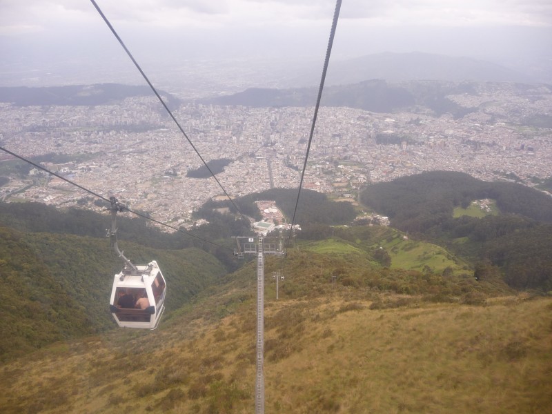 At the top of the Teleferico there are two snack shops, picnic areas, a church, and sweet views. We took some time to take pictures and marvel in the clear views. From left to right you can see Cotopaxi, Illiniza Sur & Norte, and just barely you can see Chimborazo (poking above the cloud line way in the distance).  Close-up of Cotopaxi: 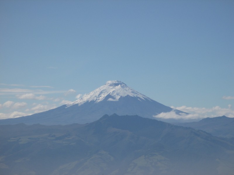 We start the hike up a dirt road, Rucu in the distance: 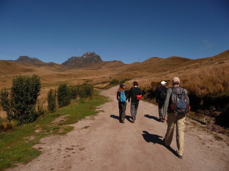 Clouds started forming pretty quickly, obscuring some views. But we did get a glimpse of Cayambe to the North: 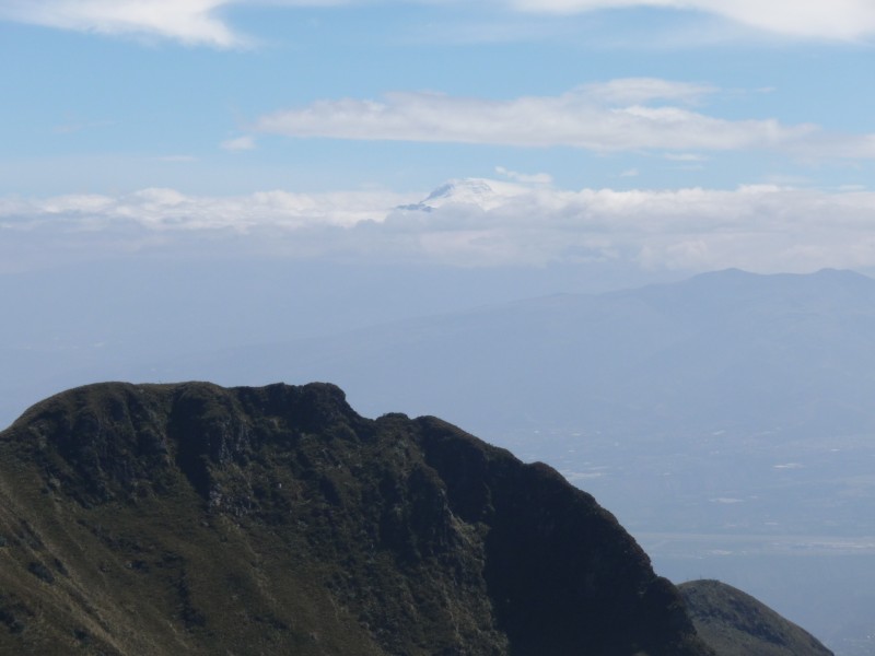 It was around this time that Jason started courting this young brunette he referred to as Consuela...he made me vow silence, but this isn't Vegas. Plus, since Consuela ditched him on the summit, no harm was done. Jason was visibly shaken, as he was out-gamed da Germans! Pictured are Brendan, Consuela, and Jason:  Soon thereafter we met a Policeman/SAR guy named Eduardo coming down. He said he also guides. Jason talked to him about possibly guiding us up Illiniza Norte tomorrow. We got his card...cool. After following the trail on the broad ridge-top for a while, you follow the trail around to the right when approaching the first tower. Looking back (Photo by Jason): 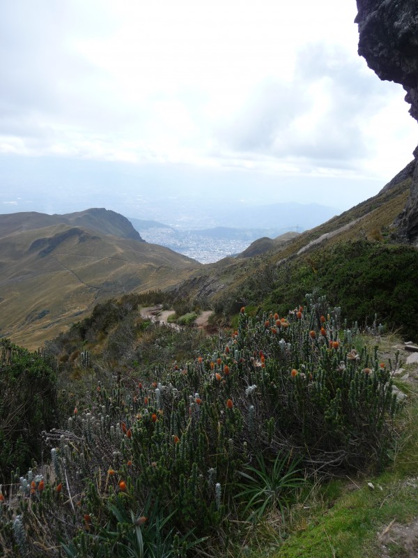 Past the first tower on the right, the trail breaks up into many social trails...a few with pretty crappy scree...I noticed Consuela chose a different route and was not following the others. I followed her, and was not disappointed, smart girl! The trail steepens and starts heading back left towards the tallest tower, which was partially hidden in the clouds. At this point there was optional class 3 scrambling on the ridge proper or class 2+ trail just to the left of the ridge. Brendan and Jason started scrambling, I again just followed Consuela up the easy trail. Photo by Jason: 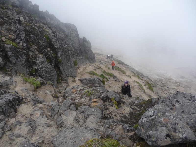 John was feeling beat and a little intimidated by the steep finish and said he was stopping. But after only 4 more minutes of climbing through the clouds I was greeted by the summit...we weren't going to let him miss the summit by so little. I dropped my pack, ran down to him, grabbed his pack and told him how it was going to be! Summit shot (John, Shawn, Emily, Brendan, Jason): 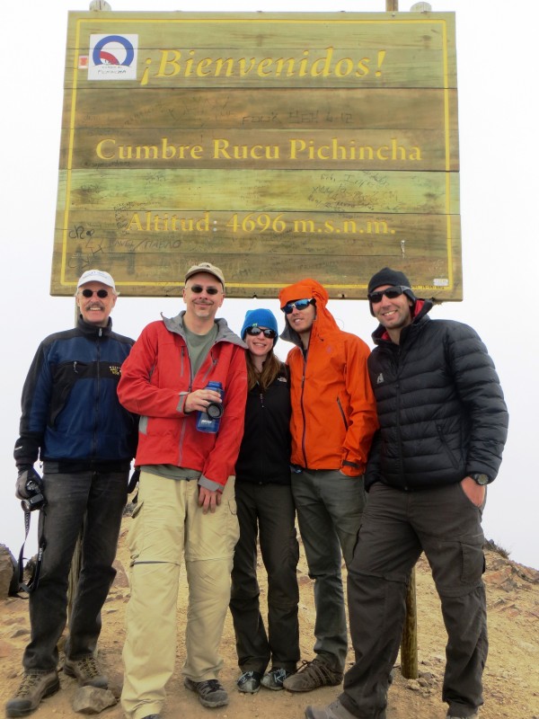 Soon at least 8 others joined us on the summit, of which we previously had to ourselves. One guy from Wyoming wearing shorts with some serious tree-trunk legs started telling us about Illiniza Norte and Chimborazo. He hitch-hiked up to the Illiniza Norte Parking Lot and climbed it without a guide on New Year's Day...interesting, we thought we had to have a guide...as it says on SummitPost.org. Then he told us of his crazy day on Chimborazo...he went with just him and his old stubborn guide...he said the last 2,000 feet was all 30-50 degree hard ice. The guide was practically dragging him. He said at one point he wanted to stop, but the guide would have none of it and actually got him to the summit. He mentioned it was pretty crazy coming down that steep ice with dead legs, knowing a fall would be bad. He also said all the other groups he saw had turned around. The crater between Rucu and Guaga was huge, but really just a lush valley with black walls: 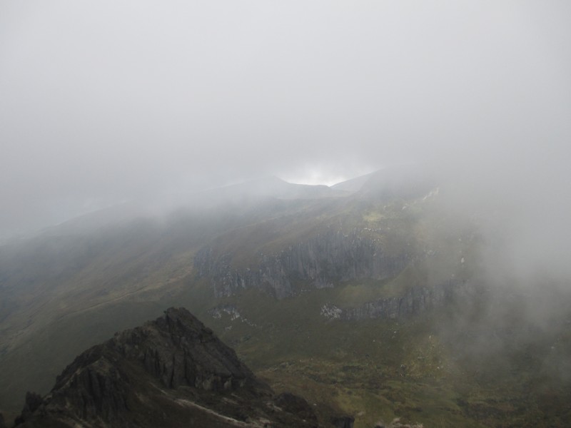 Looking the crater (photo by Jason): 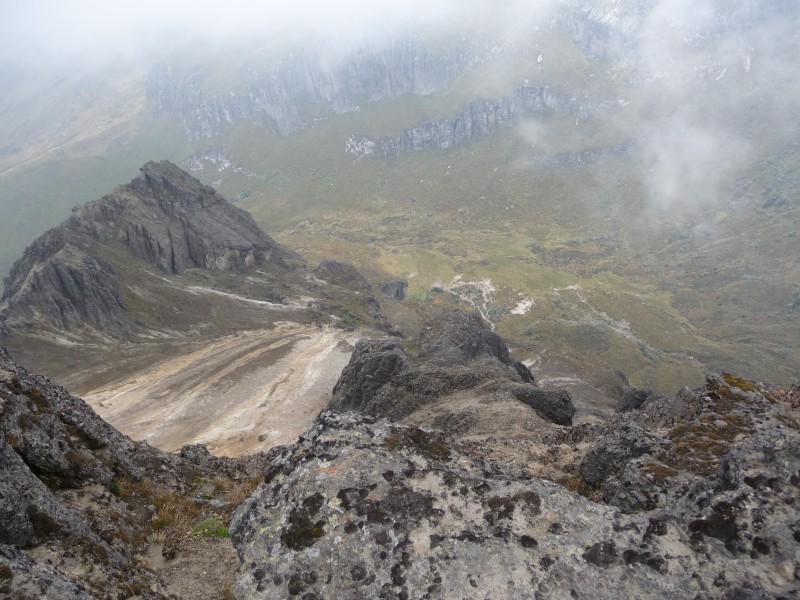 The hike out was pretty relaxing with awesome views in every direction. Photo by Jason: 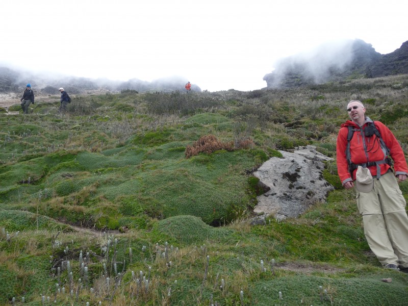 We went slow both ways and took about 5 hours round-trip. After some group discussion, we decided we would hire Eduardo to take us to and lead us up Illiniza Norte as a day trip tomorrow. His charge was $40 a person...darn near worth the cost just for the transportation. That night, Eduardo came by the Travelers' Inn to work out the details and set up a pick up time for 5 am. He mentioned he had a small car and we would each need to pay an extra $10 to pay for a 4wd ride up and down the last few miles of road to the TH. Day 4: Illiniza Norte, 16,818 ft. Iliniza Sur (17,267) and Norte (16,818) are the 6th and 8th highest peaks in Ecuador. They used to be part of the same volcanic crater, but the crater blew up and now they are two separate peaks 55 Km South of Quito. Sur is noted for requiring some steep ice climbing to summit, but Norte is generally pretty dry...but noted for loose rock on its scrambly class 3 finish. Apparently after a few fatalities by tourists in 2012, Ecuador requires non-Ecuadorians use a guide on these peaks. We all crammed into Eduardo's tiny vehicle just a hair after 5am. Eduardo hardly spoke a word of English, which made for a somewhat quiet ride...Jason, Brendan, and Emily conversed a little in Spanish...but Yo no hablo Espanol. We really enjoyed how he continually ran red lights in the early morning hours, trying to get out of Quito. I guess that is the advantage of him being a cop...but he also pointed out there were not cops out to catch him anyways. It was around 6:30 when we got to the city of El Chaupi at the base of the Illiniza National Park. But his buddy with the 4wd truck was nowhere to be found. So without saying a word, Eduardo just started driving us up ever bumpier roads. Photo by Jason:  With the 5 of us in his little hatchback, this car maybe had 3 inches of clearance. As stones ground beneath, we continually flinched and worried about poor Eduardo's car....I guess there will be no 4wd truck... Eventually he stopped and asked us to walk past the worst spots...thank you, I couldn't take any more bottoming out! Here is his little car (photo by Jason):  Further up (photo by Jason):  The last couple of miles were smoother, and we got to the TH at ~12,800 ft around 7:30. Again, weather was spectacular. BTW, no park rangers, nobody making sure we had a guide, but again..we still would have needed the transportation. 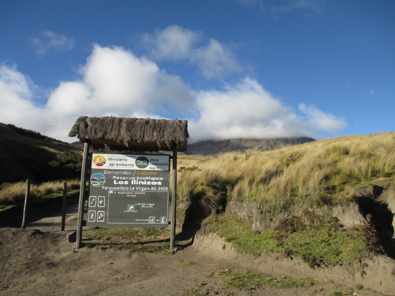 I brought a few more layers in my pack for this hike, but again was happy to be dressed in my summer 14er clothing. After getting our boots on and lathering up in sunscreen, we were off! Most people get to the TH the day before and hike up to the Refuge/Hut to spend the night...getting more acclimation and making the summit day much shorter. In retrospect, the additional acclimation would have made our upcoming night at the Cotopaxi Refuge easier...but we would have not slept as well as we did the night before this hike. Again, the views were great. Particularly the cloud phenomenon occurring on Cotopaxi: Photo by Jason: 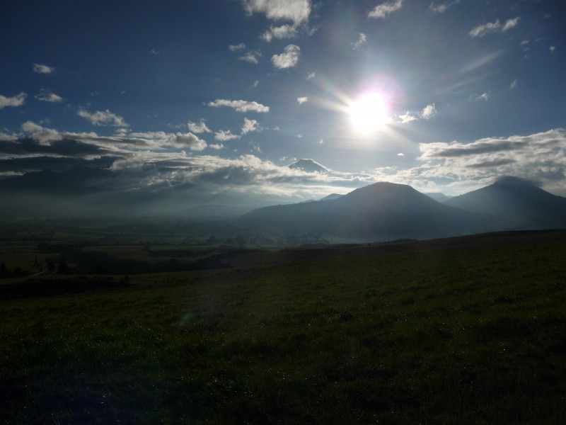 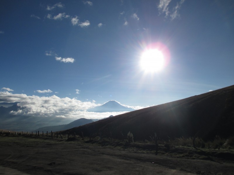 About a mile into the hike, the summit was still hiding in the clouds. The first 1.5-2 miles was very easy class 1 hiking. Photo by Jason: 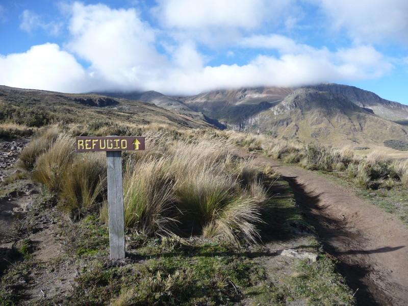 Here is a cool nearby peak: 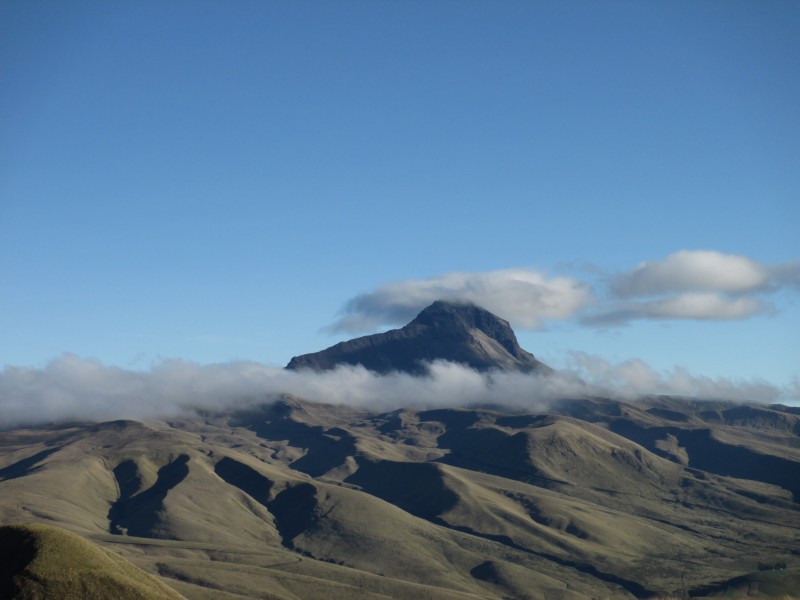 Finally, we get a glimpse of our objective: 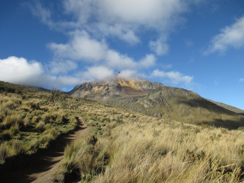 Of course, who can focus with the crazy view of Cotopaxi right behind us (both photos by Jason): 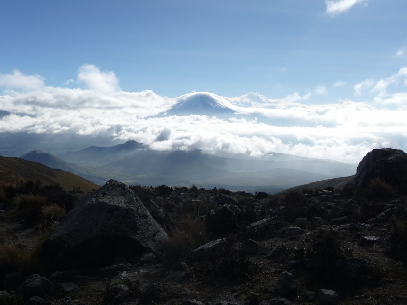 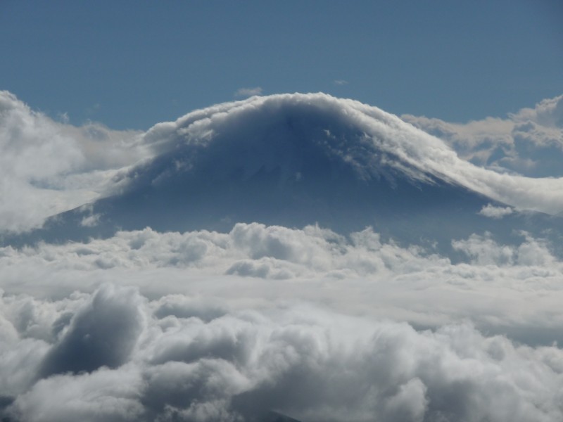 Not much further then the next photo, you need to decide if you want to: 1) take the standard route (Southeast Ridge, Grade I/F, Class 3) up to the left past the Refugio then back right to the summit ridge. This route disappears to the left around the upcoming bend in the photo. 2) take the North Face Route (same difficulty grade) off to the right. More direct, less crowded, but more scree. This route is mostly visible following the direction we are heading, disappearing well to the right of the summit in the distance. 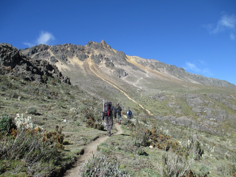 We chose the North Face Route off to the right. The trail was not as defined, particularly early on and we had to divert up steeply to our left on one section, as we noticed the cows on the trail were actually bulls...seen as black dots in the photo above. Here is a group shot past da Bulls: 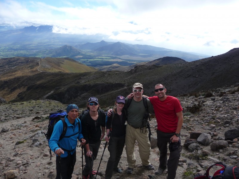 The photo was taken by a descending guided group from Utah that had spent the night in the Refuge and already summited. They were a cool bunch that we also met on Cotopaxi. Of course they wanted to know why we weren't back home passing the bong...wow, I had completely forgot about that...I'll see you guys later! Somewhere around this point we all put on our helmets...this is a good idea! Okay, here we are, fully immersed in scree goodness...I hereby rename this peak Super South Wilson (photo by Jason)! 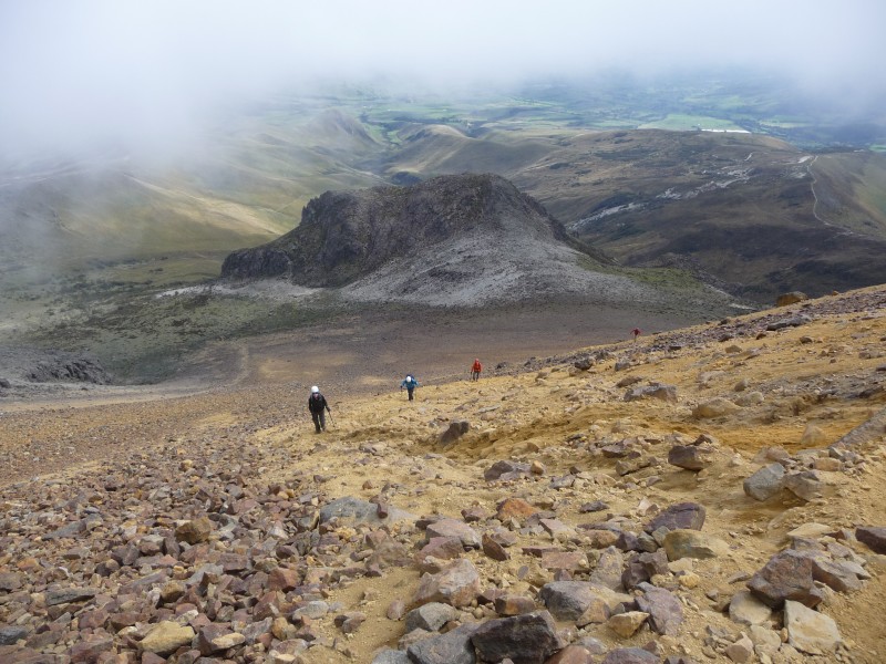 At least we aren't in the Conga Line going up the standard route (photo by Jason): 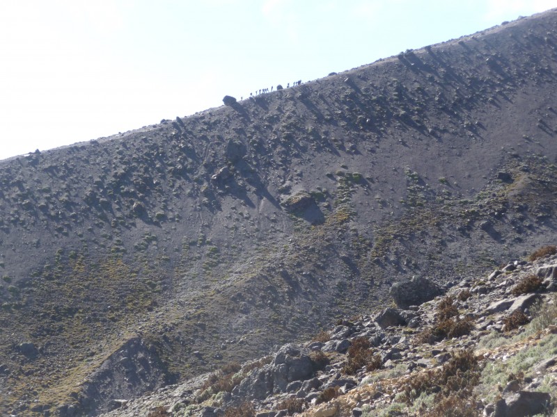 Okay, we are going to beat that group to the summit!!!!!!!! Easy for Jason (as he runs ahead yet again) and Emily (I think my pack weighs more). Of course Brendan has gone from 0 to 16K in 4 days and his lungs be burning. And me, well the rest of the group will attest to the old man noises I make pretty much every minute of every day. But we try to keep up! The first chace we got, we opted for solid class 3 over super loose crappy class 2+.  After a few hundred feet ascending the solid class 3 to our right, we come out on a ridge we take back to the left...into the clouds (photo by Jason).  Then it starts getting scrambly on loose rock just off to the left of the ridge (photo by Jason):  "ROCK!!!!" Ahhh Yes, back in Colorado...as Emily and I hide behind a giant boulder off to our right as some bowling balls pass us at light speed. Okay, note to self, get to the summit and get the ____ out of here before any other groups get up here. One last steep scramble to the summit (photo by Jason):  Victory! My second highest summit, I can't believe how great I feel! Life is good! The ascent took us a hair under 4 hours.   After a quick re-fuel, we want to get out of there before the groups we hear approaching get here. The standard route joined our route for the loose last 200-300 feet. First a group of 4 arrives just as I leave the summit, they are 3 German clients and one guide all roped together. The guide would ascend 15 feet, then pseudo anchor himself as the three other came up...how European of them Another 75 feet lower we pass a group of like 8 climbers and one guide...again Germans, again all roped together...oh well, no time to be confused...get me out of here! The descent goes very fast. I am on cloud nine! In fact, when we get back to the car I don't want to deal with the whole little non-clearance car debacle. "Can you guys throw my stuff in the car? I'm going to start jogging the road!" And I am off. Before I know it, I am knocking off sub 7 minute miles (I know, mostly downhill, but still). Ha, maybe I can beat them all the way to base...like 8 miles. Why do I feel so good? About 5 miles down...Oh crap, fork in the road...don't know which way to go. About 5 minutes later, I see them walking in front of the car...Eduardo thought they missed me...Emily and Jason were already reminiscing: "Remember the time Shawn died in Ecuador after getting lost on Illiniza?" "Jason, you call his wife!" Now where do we go eat after such big day? Eduardo takes us back to Quito and to a mall that makes Park Meadows look ghetto! We go to the food court...McDonalds, Pizza Hut, where is the Orange Julius? What do they call a Quarter Pounder with Cheese in South America...I don't know, I got a personal pan pizza at Pizza Hut...although it still came with fries. Day 5: No climbs today. We moved to the Backpacker's Inn the previous night. I freaked out when a couple of ATM's gave me some trouble...Jason came to the rescue and got me straightened out at a call center (thanks J-Rock). If you need to call the US, go to a call center, it is like 8-10 cents a minute...although a little loud. We finally got to meet the famous Pablo, our main guide. After emailing Pablo to get a price quote, Pablo actually called Emily and did some selling in real good English to get her to sign up. His father had a guiding company, now it was his brother's company. Pablo guided here part of the year, in Seattle part of the year, Denali a few times, and occasionally in Europe and other parts of South America. Okay, this two guide requirement and higher price is an issue. And what is up with the conditions on Chimborazo? Have you got permission from the National Park for us to climb Antisana? Chimbo has not been good, his brother had not got anyone up past 5,400 meters in weeks. How about we do two mountains for $480 each...Cotopaxi, then Antisana (Cayambe as the backup if permission is not granted). Then we'll see about Chimborazo! We paid him the rest of the $480X4 ($268 had already been pay-pal'd to him as our deposit). Day 6: Dropped our non-mountain gear off at Traveler's Inn for storage, then took cabs to Pablo's Brother's Hostel a few miles away. Ah yes, there was a group of Germans already there loading up in his brother's van...also heading to Cotopaxi. We loaded up in his brother's extended cab Toyota Tundra and hit the road. Pablo liked himself some hip-hop...pretty entertaining! The forecast looked a little white, but fairly warm with only mild wind. But after the two hour drive (always an hour just to get out of Quito), it was looking pretty wet! Entering the national park (photo by Emily):  Pablo had to exchange some forms with the park service (yeah, they regulate the guide rule on Cotopaxi, with a gate) and he picked up our other guide Herman...Herman jumped in the back of the Tundra. When we got to the parking lot at ~ 15K, we lucked out as we could change into rain gear and put our boots in the dry comfort of his brother's van. From here it was a 40 minute steep slog in light rain up a wet moderately steep loose dirt slope to the Jose Ribas Refuge at ~15,600 ft. Passing many tourists that just walked up to the hut or even a bit further to the glacier, I finally made the hut. As I wander through to the upstairs bunks I find out that I am on in upper bunk in the middle of the da Germans across the room from the rest of the group....SON_OF_A.... Again, the Concierge, aka Jason, steps up for me and gets Pablo to switch with me...I think that is two Deviant Dales I owe you at this point in the story! Here is the hut (photo by Emily):  Signage (photo by Jason):  Looking down towards the parking lot, people can be seen descending (photo by Jason):  People who paid for dinner waiting for their food on the main floor (photo by Jason):  And the luxurious accommodations upstairs (photo by Emily):  I would guess there were 100 people (mostly Euros) sleeping upstairs and another 20 sleeping on the floor downstairs. All with different schedules and varying views on courtesy...if you get two hours of sleep...good for you! Our guide was pretty much ignoring us at this point, so we fought of ourselves to get some water to treat (harder than you'd think) and then to get some hot water for dinner (bribing never hurts). Here is a photo looking up route to the nearby start of the glacier:  And Emily got this sweet photo of a coyote:  I drank two liters of water and threw down a Ramen for dinner. Groups would start leaving around 11am. Pablo wanted to leave around midnight, we convinced him we should not leave until 1am. Why be on the summit before daylight? We can certainly knock out ~3,800 feet in a little over 5 hours!  Day 7: Cotopaxi, 19,347 ft. Cotopaxi is another stratovolcano and is the second highest peak in Ecuador, 1,300 feet shorter than Chimborazo. It is the most popular to visit and climb of the 7 highest peaks. It is the second highest active volcano in the world and was first climbed by Wilhelm Rajss (must be another German) in 1872. The climb is graded PD/WS+ (mild difficulty PLUS). The main route up Cotopaxi used to involve a traverse below some serious seracs, along with occasionally requiring the crossing of at least one crevasse via an aluminum ladder. However, just this past year the seracs collapsed and killed at least one climber and the route was deemed not as safe. The standard route now is called "The Heartbreaker", as it ascends Heartbreak Hill. There is far less Serac danger. No serious crevasse crossings. But it is sustained 30-40 degree climbing pretty much from the first step on the glacier to the summit. Not a lot of good places to rest...that is for sure! I had gone to bed around 8:30, even with ear plugs, I slept very little. Mainly listening to others mill about and of course my heart trying to jump right of my chest...yes, this is the highest I have ever slept...by 1,600 feet. I rose at 11:30pm with a minor headache and half of my Ramen Dinner wanting to come out one way, the rest the other way...SUPER...and it is misting ice outside. I get rid of the Ramen and hope I can get down some coffee, a gu, and maybe a Nutri-Grain Bar. The rest of the crew appears to be fairing much better as they eating with the friendly Germans...and probably sharing some Hefeweizen! I had the same Ramen rejection thing happen on Capitol...that day went okay...suck it up! I succeed in drinking some coffee, hot water, eating a gu, and the bar...let's do this thing! Within minutes we are up to the glacier putting on crampons and roping up. The freezing mist is still pretty light. As we start up, it is difficult to get our pace in line...it is Pablo, Jason, then me on one rope. Herman, Emily, and Brendan on the other. Jason is getting a rude introduction to being the middle man on a rope team!!! Jason, thanks for not punching one of us in the face The weather takes a turn for the worse...so you want to be a mountain climber (photo by Emily)?  Since there are about 100 climbers in front of us, the trench is clear (sounds similar to a slightly steeper and much higher DC route on Rainier...I have only been on the Emmons side). But, that means there are 100 climbers to pass...and darn if Pablo wasn't going to try to pass them all!!!! Each time we came to another group of 6 or 9, Pablo would angle to cut them off at the pass...that meant we would be going even faster for the next 5 minutes...um, can I go back down and eat a bowl of Wheaties? So we kept passing people, the weather kept getting windier and wetter, and I kept wondering if we were every going to take a break..."10 more minutes" was uttered something like 5 times over the next hour. Eventually, my glasses had a quarter inch layer of ice on them...so I could not really see. Pablo took us off to the right of the standard route to stay out of the wind...but now we were breaking trail while side hilling on a 45 degree slope with a crevasse to our right...and instead of making slow cautious steps, Pablo was using the lets double time it to get past this method. I might have used the lord's name in vain...I know I used Pablo's! Finally we stop, Parka on, Water out, Goggles out, Energy Beans and Shot Blocks out, pack down, sit down, Pablo: " Okay let's get going!", go after Pablo with my ice axe.... I was not pleased with Pablo at this point! Did I pay for this?  At least someone is having fun!  Once we got up to around 18,500 feet, I started to feel better...but now Jason started to feel some hurt...hmmm...maybe it was the 190 lbs anchor you've been tied to for the last 500 feet??? Emily and Brendan are machines, they are right behind us and going strong! Not long after this, I started to notice some features off to our right...like the makings of a crater!!!! Then the group from Utah passed on the way down, congratulating us...we must be close! We hit the broad flat snowy summit just a hair after 6am. This is a new altitude record for all of us. The sun tried to poke through, but visibility was pretty bad, and the wind was making for a wicked wind chill. Group Summit Shot (back row: Jason, Brendan, Emily, Shawn, front row: Herman):  After about 12 minutes, we started heading back down. Aha, we beat da Germans!!!!!!  The route did not seem that crevassed, but visibility was poor so there is no telling. I recall a few short step-over's and some interesting crevasses off to the sides of the route. Despite the quarter inch of solid ice on every inch of my exterior, the temps were not terrible. Only near the summit did I need more than what I wear on spring hikes in Colorado. Capilene base layer, soft shells, gortex mittens with liners, fleece hat, winter gaiters. Although we were all glad we wore double boots...I had Baruntses and Jason wore Spantiks. I seriously think Pablo had a date that afternoon, because Jason and I were like sled dogs and Pablo had a whip! We were allowed to take one break on the way down...but the views were improving! Glimpse of the Illinizas:  What's up JB?  (Photos from Emily):  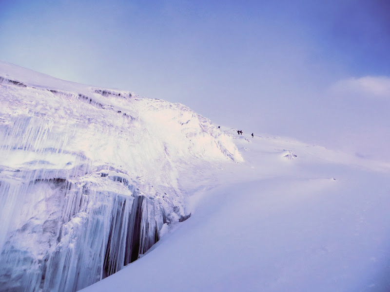  (From Jason): 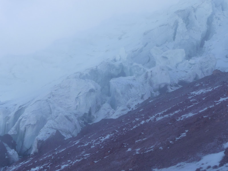 My last look back:  We were back at the hut around 8am (I would guess it was only 4-5 miles round-trip from the hut), got stuff out of our locker (bring a lock and use a locker in the Hut), packed up, hike down to car, on the road by 9:30am. No stopping for food (he must have a date!), just right back to Quito. I don't know what I eventually ate, but I was starting to miss Colorado...particularly the post hike meals! Day 8: Pablo notified us that our Antisana Permit request was approved for Wednesday/Thursday. It was Tuesday, a much deserved day of rest. I would highly recommend putting rest days like this into your itinerary, they really helped rejuvenate us and allowed us to dry and re-organize our gear. Jason and I made the 40 minute walk over to old-town Quito. Here are some pics from our walk:         Day 9: We met at the Andes Trek Hostel again around 10am. Got to the Antisana area (near Cotopaxi, but a much different approach route) around 1:30. This time we had two guarded gates to get past...you must have proof of your advance permission to pass. This whole area had a more remote and less travelled feel to it. It was again rainy, which made the 4wd portion of the drive more treacherous. Pablo asked us to walk the last few miles, while he and Herman drove up with our gear. We didn't mind, as it was a nice grassy walk and gave us chance to stretch our legs. We passed an Alpine Ascents group from Utah/Arizona/California that was starting their glacier climbing experience with a teaching/practice/acclimation day on our climbing day. Pablo did not require this based on our experience levels, but he did require us to do Cotopaxi first so he could see how steady we were on an "easier" climb. Pablo talked to one other guide that said they had summited that day...but Pablo thought he was full of crap...and the lack of tracks up high supported his opinion. We camped just below 15k in a grassy meadow near the end of the 4wd road. Pablo provided us with and set up two two-person four-season tents. He also set up a big cooking tent that Herman and Pablo also slept in. This climb felt a lot more like something you pay a guiding company for...they even made popcorn, soup, some dinner, and even some crazy drink with what tasted like moonshine as the liquor for us. In-between the bits of light rain, the vistas were incredible. Camp:  Some wild llamas passed by camp (photos by Emily and Jason):   Some vistas (third and fourth by Jason):  Cotopaxi again:    The forecast for our morning climb was questionable, but we held out hope. We retired around 8pm and planned for a midnight wake-up. Day 10: Antisana, 18,741 ft. Antisana is the fourth highest peak in Ecuador and is made up 2/3rds by an old volcano and 1/3 a newer forming volcano. It is known to be a much more difficult and less climbed peak than the other Ecuadorean Volcanoes (except maybe Altar), the climb is rated PD/AD. In 1880, 23 years after he made the famous and tragic first ascent of the Matterhorn, Edward Whymper made the first ascents of Chimborazo, Cayambe, and Antisana. Although he thought Antisana was 500 feet taller than its true height. In researching the peak, I noted that one guide had led 9 attempts to climb this peak, but only summited on two them. Midnight came and went as it was raining outside. Emily finally rallied the troops around 2am, as the rain had lightened. We had breakfast in the food tent and started the climb around 3am. It took us about 40 minutes to get to the glacier, where we clipped into our crampons, put on helmets, and roped up...with the same 3 person rope teams. At this point we were not optimistic about getting to the summit, particularly as Pablo wanted a ~8am turnaround time. His main concern was crossing the many snow bridged crevasses with the soft snow. It was strangely warm, I did not wear a hat all day, I wore a capilene base layer and my soft shell, but I mostly wished I was not wearing the soft shell. Right away you could tell by the soft snow that it was going to be tough...much like on spring Colorado climbs where the snow doesn't get a good freeze the night before. Plus we were constantly crossing crevasses, we had to build our own trench, and make up the route as we went along. Pablo bore the brunt of the hard work, but even for Jason being second it was hard work getting through the foot to two and a half feet of soft snow. The higher we got, the more broken the glacier became. Occasionally you would have a foot break through and feel the void beneath you. At one point Emily simultaneously felt the void with both feet, scary stuff! But hey, at least it had stopped raining/snowing! Because of the late start, we were all hauling butt...working much harder than on Cotopaxi...which I did not think was possible, but we were doing it. When we hit a steeper section, we suggested that we flip rope teams, to share the trail breaking burden. Herman obliged and went after the slope like a man possessed! Hey, maybe the summit might still be in the cards? Of course we still had to find a doable route, which became an issue as a huge crevasse stopped us cold. Going right did not work, left looked questionable, Pablo had us anchor him as he tried something...I remember not agreeing with what he was trying. Well that didn't work. Eventually we found a crossing a ways to our left, but the level of climbing difficulty had certainly increased a few levels. Here are some pics to help paint the picture (many of the pics courtesy of Emily and Jason):            At this point, Pablo was back in the lead. I had traded the #2 position with Jason, to give him a slight break from that tough position. Our optimism for the summit was growing, as it was around 7am and we had about 1,200 feet to go, and a big 500 foot clear slope up was right in front of us. That optimism came crashing down hard after maybe 10 steps up the right edge of this slope. Here we heard and felt a thunderous cracking/whomp like I have never heard or felt. My heart immediately moved to my throat as my head spun. It seemed like a minute, but was probably only a second before I saw the newly formed crack crossing the entire field of snow about 300 feet above us. Was this the end??? I am seriously shaking right now as I write about it. We had discussed avalanches, but Pablo always dismissed it. They apparently are not that common down here. At this point, Pablo's opinion did not matter to Jason and I...we were white as ghosts! At this point I was actually wondering why the slope of snow beneath the crack was not sliding....was it teasing us? Well, Pablo exhibited the confidence you'd like to see from a leader...whether we bought it or not. He had us retrace our steps down to the low angle base of the slope. He looked around and decided we should traverse the low angle base of it all the way to our left, then enter the maze to the left of the danger zone. I had my doubts, said my prayers, and followed. The other rope team was a bit behind, but after we crossed, we watched them cross. All the time, I was thinking "we are going to need to cross this again coming down." Huge crevasse below us, 300 hundred feet by 300 feet of heavy wet unstable snow above us. Jason and I were still quite a bit shaken. Also, my pulse had gone to about 200 a minute...which zapped some energy...but up and around we went! The next portion of the climb was some of the hardest, craziest, and exhilarating climbing I have ever done. There was some short near vertical sections, narrow passageways, jumping of crevasses, and fun ice axe work. It was a maze of seracs and crevasses, I imagined I was in the Khumbu Ice Fall. At one point Pablo suggested I move my track a bit to the right, as he points up at 20+ foot ice sickles dangling directly over my head. Some more pics (many by Emily and Jason):       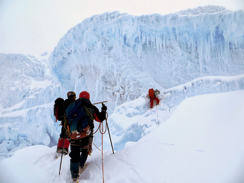     It was now about 8:30, Pablo had moved our turnaround time to 9, and we were at around 18,350 ft. We had about 400 feet to go, we could see the summit ridge, but the route was going to head sharp left, then traverse all the way across to the right, then back left up the summit ridge. As we took a break, you could feel the sun break through the clouds and share its radiant warmth. Finally the sun breaks through, but this was the last thing we wanted this high on the glacier and with the snow how it was. We all did the math regarding the current time, summit time, and off the glacier time and the ever heightening risks. We really wanted this summit, we earned this summit! But the risk was too high, and with a group vote we decided this point would be our summit, on this day! Here is a group pic on our summit:  And here is the true summit, high point in the center of the pic:  The climb back down through the maze was certainly not easy, but at least we had tracks to follow. There was some facing in, some jumping, and plenty of axes on crampon smacking...with the wet sticky snow. We ran across the traverse below the potential avy slope. We staggered back into camp around 11:30, passing the Alpine Ascents group along the way. I hadn't the strength to say anything to them, as they were heading up for some glacier schooling. But my guess is that they read our faces regarding what they had in store for them. Emily got this parting shot of Antisana from camp:  This climb was at least a level above anything I had ever done in mountaineering. It was wonderful, yet terrifying. I think I would like to experience it again, but am fearful of where an experience like this could lead me. After this climb, we all felt fulfilled, but still had Chimborazo lingering in the back of our minds. A quick check of the weekend weather forecast sealed our fate, heavy precipitation Friday and Saturday...not enough time to give Chimbo a shot, not that we were sure the route would have been in anyways. Jason and I changed our plane tickets from next Tuesday to tomorrow, Friday. Emily and Brendan decided to head to Northern Ecuador for some hiking, sightseeing, and horseback riding. Thank you Emily, Jason, and Brendan for allowing me to join in this adventure! You guys are strong climbers and great travel companions, I never could have experienced something like this without you guys! To the readers, thanks for reading this math geek's rather long-winded story! Shawn Thumbnails for uploaded photos (click to open slideshow):
|
| Comments or Questions | |||||||||||||||||||||||||||||||||
|---|---|---|---|---|---|---|---|---|---|---|---|---|---|---|---|---|---|---|---|---|---|---|---|---|---|---|---|---|---|---|---|---|---|
|
Caution: The information contained in this report may not be accurate and should not be the only resource used in preparation for your climb. Failure to have the necessary experience, physical conditioning, supplies or equipment can result in injury or death. 14ers.com and the author(s) of this report provide no warranties, either express or implied, that the information provided is accurate or reliable. By using the information provided, you agree to indemnify and hold harmless 14ers.com and the report author(s) with respect to any claims and demands against them, including any attorney fees and expenses. Please read the 14ers.com Safety and Disclaimer pages for more information.
Please respect private property: 14ers.com supports the rights of private landowners to determine how and by whom their land will be used. In Colorado, it is your responsibility to determine if land is private and to obtain the appropriate permission before entering the property.