Crew: CMC HAMS group - 12 people. Leaders: Dave Covill & Tom Chapel
Time: January 11 - January 19, 2014
Peaks climbed: Pico de Orizaba on 01.14.14, Sierra Negra (some) on 01.15.14, Matlalcueitl a.k.a La Malinche on 01.16.14, Iztaccihuatl - 01.18.14
Our group took an early Saturday flight out of Denver and after a brief layover in Dallas we found ourselves in Mexico City around 3.30pm. Being a fairly large group (12 people) we arranged for 2 vans to pick us up at the airport. It is feasible to get to Tlachichuca by bus, but I have to say that having a transfer proved to be very nice and may as well be worth the extra cost. After some time spent in horrendous Mexico City traffic, the drive through the countryside went faster (one lane highways, speed bumps and all) and were dropped off at the Cancholas some 3 hours later.
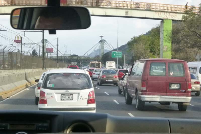
Mexico City traffic
Maribel showed us the rooms, bathroom facilities and fed us dinner. We were in bed by 8.30pm.

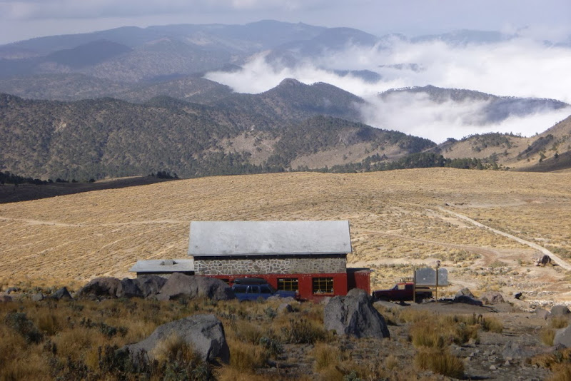
At the Cancholas

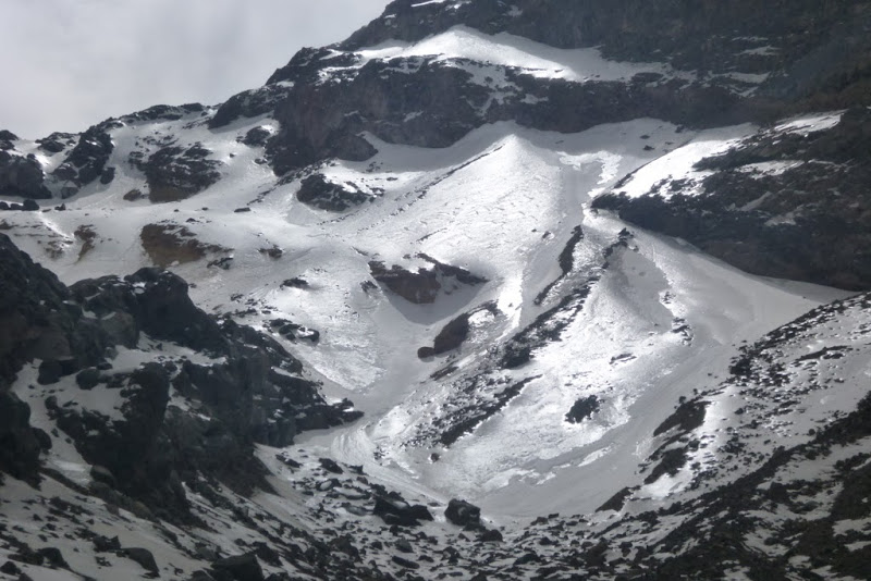
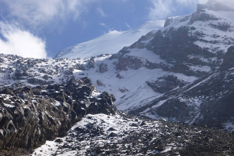
Orizaba makes its first appearance
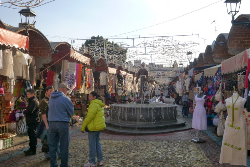
The next day being Sunday, we went to the city market with Maribel where we picked up tortillas, cheese, fruits and vegetables.

Sunday market in Tlachichuca
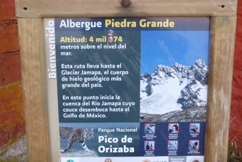
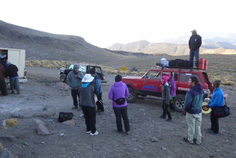
After shopping, we repacked the bags, stored some unnecessary items at the Cancholas, climbed into high-clearance jeeps and were driven to the Piedra Grande hut (~14,000 ft), which took about 2.5 hours.
Acclimation hike 1
Elevation gain: ~1,400 ft, Distance: ~1.9 miles, Time: ~2.5 hours
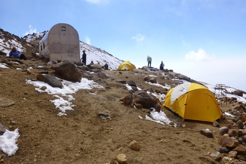
Most of us felt the effects of the altitude upon arrival at the hut and while setting up the tents. The hut was empty, so I decided to stay there, since I generally prefer huts to tents anyway. After settling in, most of us did an acclimation hike to about 15,300 ft (just about 1.3k ft of elevation gain and 2 miles RT). I don't know how else to describe it, but it felt like torture. My head felt like it was made of a cast iron and I tried to do some math problems in my head to assess if I still have any brain cells left. I moved as slowly as I possibly could while others passed me as if I was standing still. Some reported that they didn't feel any difference from a 14er, while others developed a splitting headache for the rest of the day. I had a mild but nagging headache and was borderline nauseous. I concluded that unless my condition improves (and fast), I realistically won't have a shot at the summit. After swallowing some Mountain House food mixed up with some real food bought earlier at the market (that did cause a few upset stomachs), we retired to our respective shelters with somewhat uneasy feeling. I don't think anyone slept well that night. Generally a sound sleeper I woke up about 10 times feeling very thirsty and still with a headache. A full bottle of Nalgene was gone by morning. The morning brought some bad news: one of us developed an AMS and was in and out of the tent all night. That and another AMS incidence from another party was the last straw for me for deciding to take Diamox. With another case of AMS from another group (making 3 cases in 3 days across several climbing parties, all had to descend), I am more than comfortable with my decision.
Acclimation hike 2
Elevation gain: ~2,300 ft, Distance: ~3.0 miles, Time: ~5.5 hours
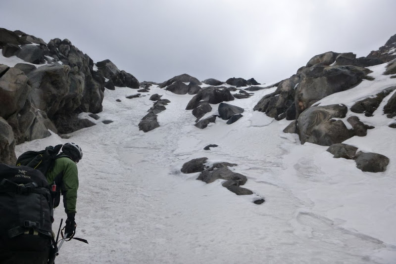
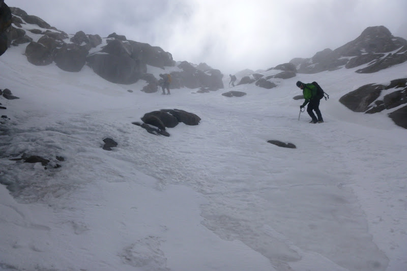
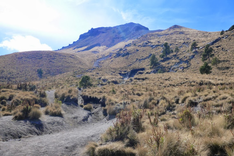
Soon after breakfast, most of us departed on the 2nd acclimation hike (2-3 people stayed with the sick climber waiting for the Cancholas' truck to arrive). With or without Diamox, and despite getting little sleep, most of us felt much stronger on the 2nd day. We packed 35+ lb packs with extra water and gear (crampons, ice axes, pickets, ropes, helmets etc) and made our way to the bottom of the Labyrinth where we made our stash. We were moving as fast with the heavy packs as with light packs the day before. The spirits soared once we entered the Labyrinth. It was in great shape. Patrick (pkelley) led the pack and found a very straightforward route through the Labyrinth.

2nd acclimation hike - the packs are heavy
The glitter of Labyrinth
I don't know about anybody else but it felt SO NICE to be walking in crampons again. The snow was sticky and supportive.
Patrick in the Labyrinth
L=>R: Tom, Jorge and Kelly in the Labyrinth
Finding a good snow line

Top of the Labyrinth
The visibility was limited, so the group stopped near 16,300 ft and I wanded the route on the way down. With the heavy gear stashed near 15.5k feet, we booked it down to the hut where a nice surpise awaited us - the Cancholas arrived and Maribel was setting up a dinner table. A homemade meal at 14k? That definitely helped our sore and tired bodies. If the weather holds tomorrow, we'd have a shot at the summit.

Maribel is getting dinner ready
Although I was already feeling stronger than the day before, I took another doze of Diamox before going to bed. The wakeup call was set at 2.30am.
Summit Day
Elevation gain: ~4,600 ft, Distance: ~6.2 miles, Time: ~12 hours (including 1.5 hours on the summit)
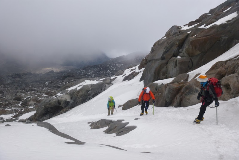
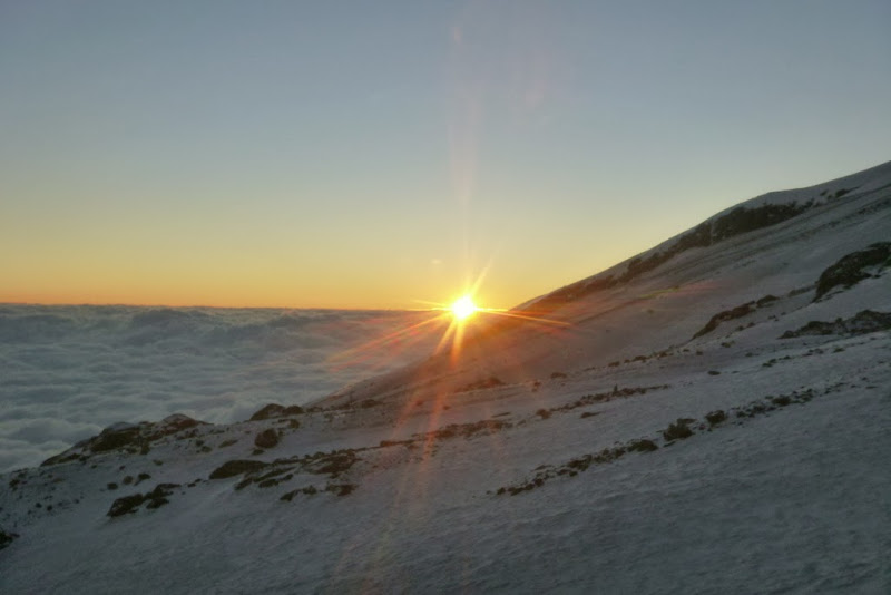
After eating hot breakfast at the hut, the group got ready and departed the camp at 3.50am, behind a couple of other parties. There was a small complication: new snow. Just an inch or two fell in the late evening, but it was enough to obscure the tracks. Still, working slowly and meticulously, we didn't have any major issues and found our gear stash at 15.5k feet intact. Patrick and I made a transition to crampons fairly quickly and were off. The Labyrinth with fresh snow and under headlamps looked a bit differently than a day before, but I could still recognize the wands I placed in the gullies we scouted. In one case the track of the earlier parties went left, but we stuck with the route we already knew, but had to re-break the trail obscured by the snow. The dawn was breaking, so I doubled the effort to reach the top of the Labyrinth to catch a sunrise. I got to the saddle near 6.30am and Patrick joined me soon thereafter. We took a long ~40-50 minutes break to take in the views and wait for the rest of the group.

Nearing the top of Labirynth at sunrise


Getting ready to go
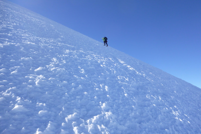
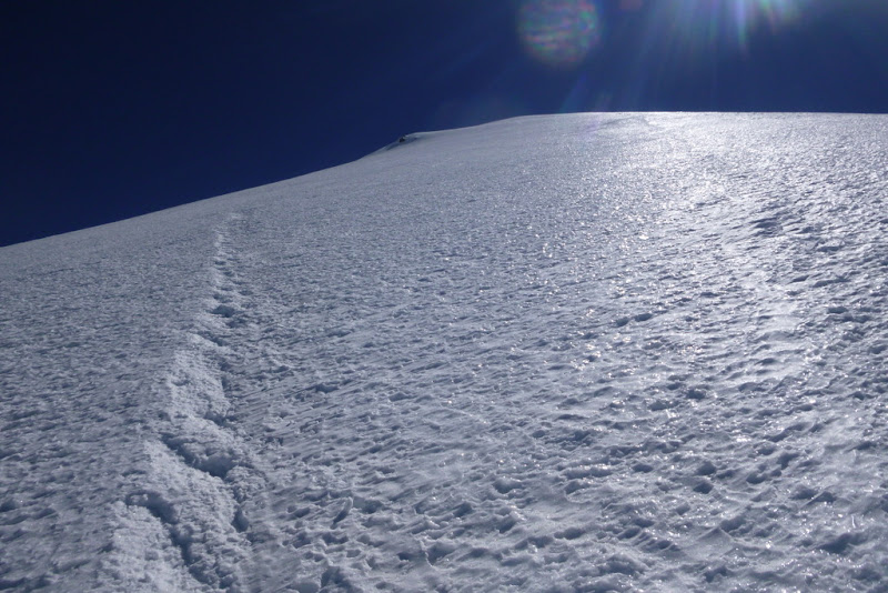
After a long refueling break, several of us starting hiking up the glacier around 7.20am. Once above the Labyrinth, we immediatedly noticed how cold and windy it was - a sustained wind of at least 25-30 mph which would accompany us all the way to the summit.

Windy

Starting on the glacier

Natalie - photo credit James

The snow was a wind-blown hardpack and probably wouldn't be fun to ski

Our group is coming up
Dustin - the angle near the top increases
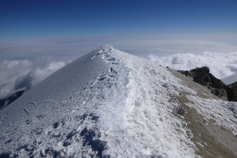
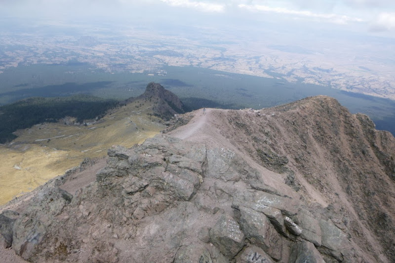
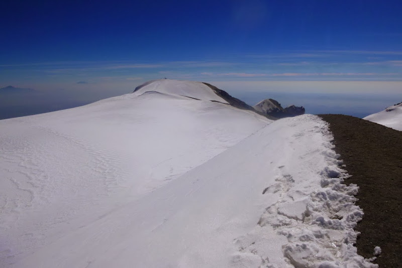
Because of the wind direction, I kept angling to the left, and topped out on the crater rim, where I was rewarded by the views.
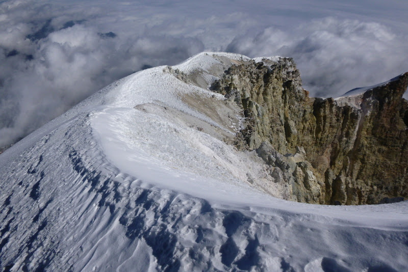
Worth a short detour

Summit ridge

Dustin on the summit
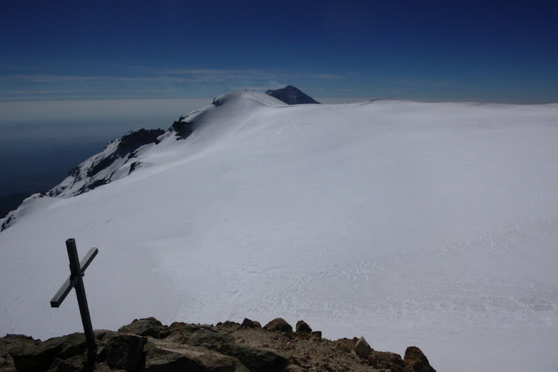
I got to the summit about 10.45am, with Dustin reaching it 10-15 minutes before me, with Tom, Keir and James joining us soon thereafter (Patrick had to turn back earlier because of cold feet). Because of the wind, I dropped just behind the summit to find an almost windless spot, where I stayed for the next 1.5 hours soaking in the views.
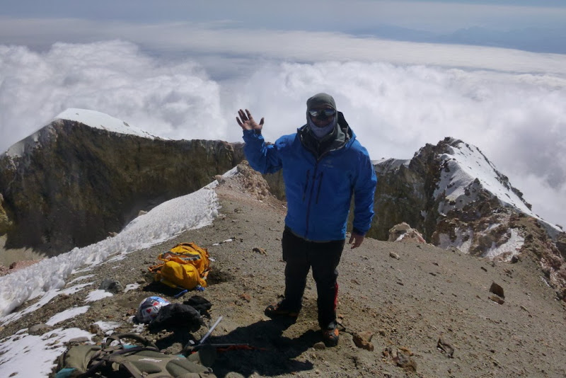
James (Fletch) is glad to be out of the wind

Natalie, Kelly, Tom and James on the summit

Our group
Around 12.15pm Kelly and I started heading down.

Kelly (moonstalker) on the descent

Descending
Glitter

Kelly and I reached the top of the Labyrinth in an hour or so to find the 4 amigos waiting.
Just some 2.5k feet left to go - L=>R: Dustin, James, Tom & Keir
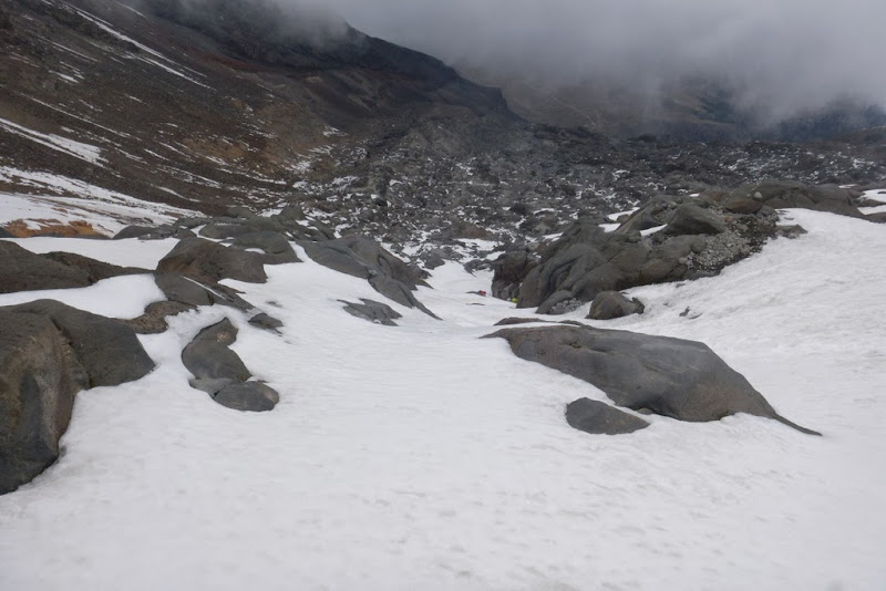
Myself and a few others were anxious to get down, so we continued. Suddenly, we were in a cloud which added some mystique to the descent.

Wanded Labyrinth

Of course, as soon as we approached our gear stash, the weather cleared - Keir, James, Dustin on the descent
Last close look at the mountain

The hut appears
The last few steps - I reached the hut around 3.30pm for a roundtrip of just under 12 hours.
We packed our stuff and headed down to the Cancholas, eagerly anticipating hot shower and dinner.
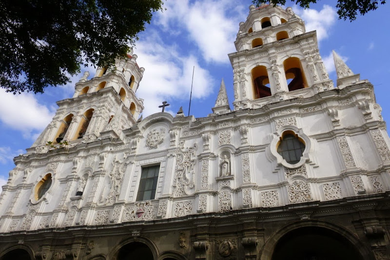
A few people hiked Sierra Negra, a 5th highest mountain in Mexico (~2k elevation gain), while several of us and Maribel headed over to Puebla for a day of sightseeing.

A day to relax - Natalie, Margaret, Laurance, Keir
Hitting the market with Maribel (Keir, Dave, Maribel)
Peak elevation: 14,636 ft (GPS 14,574 ft)
Elevation gain: ~4,400 ft
Distance: ~8.7 miles
Time: ~8 hours
After early breakfast we piled up in the Cancholas vans and departed for the La Malinche TH, which is roughly at 10,000 ft. We started hiking by 9.20am. La Malinche is a 14er, so the air felt pretty thick and we were making great time. This would be a nice acclimation hike. The hike seems to be pretty popular due to its relative proximity to the Mexico city and easy TH access. We also encountered quite a bit of trash on the way up and Dave suggested we do something about it.
La Malinche

It is also a volcano
The top of Matlalcueitl is a bit of scramble
Dave distributed some trash bags on the summit and we tried to pick up as much trash as we could on the way down - plastic bottles, candy wrappers, etc. It felt good to be able to contribute to the cleanup and give back to the mountains. Because of the cleanup we didn't get back to the TH until 4pm. The drive back to the Cancholas went quick and soon we were enjoying our last dinner in the compound.

Our Mexican guide, Vincente with the trash bag

Elevation gain: ~5,100 ft
Distance: ~9.7 miles
Time: ~11 hours
Rather silly, I wasn't expecting much from this hike, with Orizaba behind us. In the end, it turned to be another highlight of the trip. On Friday, 01.17.14 we said our goodbyes to the Cancholas, got into the vans and were driven to Amecameca. There we reserved the hotel for the following night and had a nice dinner with the expansive view of Iztaccihuatl. We could clearly see the outline of the woman's body. The Legend of Popocatepetl and Iztaccihuatl

Ixta sleeps
After dinner, we got to the La Joya TH and established the camp in the parking lot with the wake-up call set for 3.30am - given the elevation and vertical, Dave wanted us to have plenty of time to hike the peak, as none of us were feeling "fresh" towards the end of the trip. He also arranged for drivers to watch our stuff while we were gone. In addition, we had Mexican guides to accompany people who may want to go slower or turn around. Having learned from experience (I ran out of water on the summit of Orizaba) most of us and the accompanying guides were carrying extra water, so the packs were heavy again. As compared to Orizaba, which was a snow climb, most of us went light on footwear (leather boots and such), which worked out well. I didn't bring crampons, just microspikes.


Popocatepetl at sunrise, past the "Feet" of Ixta
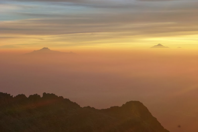
Mexico City's pollution makes for some impressive colors: La Malinche (left) & Orizaba (right)
We reached the "feet" by sunrise ~6.30am, and I stashed my extra water there making sure to mark the spot with waypoint, while the rest of the group carried their water a bit higher. Iztaccihuatl makes for a very scenic hike with Popocatepetl dominating the view. We were very fortunate to have a clear and almost windless day on this hike. There were a few class 3 sections, but most of the route is pretty straightforward. With several parties around us, Patrick and I pulled ahead and enjoyed solitude from the "Knees" to the summit.

"Feet" as seen from the "Knees" section


Some of the ups and downs on the long ridge hike to Ixta


Ixta's "Chest" ahead

When the snow finally started ~16k, we put on microspikes and started using ice axes. About 0.5 miles from the summit we encountered strong sulphur smell, which was pretty cool.

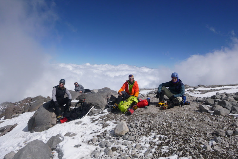
As soon as we got to the summit of Ixta (around 11am), our predicament became apparent - the summit wasn't marked and we couldn't tell if it were the "true" summit. Being consummate peakbaggers, we decided to tag all three "bumps" on the ridge.
View of the 1st summit from 2nd summit

Natalie on the 2nd "false" summit. Photo credit: pkelley

Popo looks inconsolable

Off to the 3rd summit we go
We were really glad we made the trek because we saw something unusual: the Face of Ixta

Ixta's face

Popo is still upset
View of the 1st summit from the 3rd summit

On the 3rd summit of Iztaccihuatl. Photo credit: Guatemalan team
Without lingering too long, we headed back to the 1st summit (apparently the highest and thus the true summit by just a few feet) where we were joined by the rest of our group.

HAMS group on the summit of Ixta
Patrick and I started heading down around 12.15pm.


La Malinche and Orizaba can be barely seen in the smog

I really enjoyed the views and the weather on the descent, so I took my time (and many photos).

The loose scree below the "Knees" on the descent
Approaching the hut below the "Knees"

Volcanic soil

I reached the TH around 3.30pm for a roundtrip of about 11 hours. Patrick got down an hour before me. We took a nap and waited for the rest of the crew to arrive.


Our camp in the very busy parking lot of La Joya TH
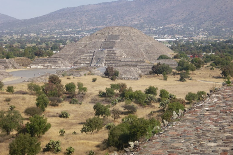
After a comfy night in Amecameca motel and a sumptuous breakfast in Mexico city, we hit the tourist attraction - Pyramids. Personally, I was glad they were not any higher  and then it was time to head over to aeropuerto. and then it was time to head over to aeropuerto.

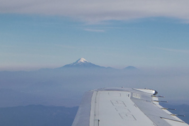
Adios, Orizaba!
All in, it was a great trip (and now I am motivated to learn some Spanish). Thanks for reading.
My GPS Tracks on Google Maps (made from a .GPX file upload):
|