| Report Type | Full |
| Peak(s) |
Vestal Peak - 13,867 feet "West Trinity" - 13,765 feet Trinity Peak - 13,816 feet "East Trinity" - 13,752 feet The Guardian - 13,624 feet Mt. Silex - 13,636 feet Storm King Peak - 13,753 feet Mt. Oso - 13,689 feet White Dome - 13,628 feet Pole Creek Mountain - 13,722 feet |
| Date Posted | 03/25/2018 |
| Date Climbed | 08/01/2013 |
| Author | Summit Lounger |
| Additional Members | doggler, Steve Climber, globreal |
| Weminuche Dreaming Part II: Binge Bagging Bicentenials |
|---|
|
When: August 1 - August 7,2013 Peaks climbed: Vestal Peak West Trinity Peak Trinity Peak East Trinity Peak The Guardian Mount Silex Storm King Peak Mount Oso White Dome Peak 1 Pole Creek Mountain Northwest Pole Stats: 57 miles 27K I don't seem to get out very often these days. Family, bikes, work seem to get in the way. I had the green light to go on a trip while my wife and daughter were still on vacation. Time for some binge climbing. I flew back, worked for 4 days, then drove to the trailhead. 2 weeks at sea level were going to take its toll. Britt, Sam, and Sean drove down the day before to hike in from Molas pass. I left Conifer at 6am, planning to drive to the other Kite lake and hike in from there. The plan was to do Wham ridge with them, then continue on my own after that. Day 1: Drive to Kite Lake. Hike to Vestal basin. 7 miles 2250 elevation gain I got to Kite lake around 1pm, and was soon on my way over the divide and down the Colorado trail to meet them in Vestal basin. I thought about a more direct line via the saddle between pk 2 and East Trinity, but was set straight by the other crew. They convinced my to hike in on the CO trail. That way once I got over the divide, I could still walk in the rain/thunder to Vestal basin without too much difficulty. If I went over the peak 2 / East Trinity saddle, I might get stuck on the east side by later thunderstorms. I made it to the beaver pond without too much trouble. I packed pretty light knowing my legs would be tired early on, and speed would be key since it was August and the monsoon season had started. I made it to the beaver pond turnoff to find 2 guys hanging out with these HUGE packs sitting on a log with there backs to me. I immediately felt sorry for the souls that would carry such behemoth packs into the backcountry. The first guy turns around, looks at me, my little pack, my trail runners and says "traveling light?" I answer "yup," not wanting to stick my foot in my mouth. Then I notice there are climbing helmets strapped to the outside of their packs. Maybe they have some redeeming qualities after all..... I ask where they are heading. The second person turns around and it is Britt!!! I have just introduced myself to Sean. Then Sam yells howdy from the beaver pond where he is pumping water. I immediately give them a hard time for the beasts they are carrying in. What in the world did you guys bring? In their defense, they carried a rope and gear to do the Wham ridge. At least I will be able to keep up with them now. When we get to camp, Sean pulls out an Ipad and solar charger, they all carried beers in, a couple of tents, fresh food, chairs. I can not help but be a little jealous. I casually ask how much their packs weighed at the trailhead. The answers range from 48# - 54#. I swallow hard sitting on my sleeping pad, not wanting to divulge my 26# pack for 7 days when the return question is asked. It was great to catch up with everyone. It started raining around 6pm, so it was off to bed early. 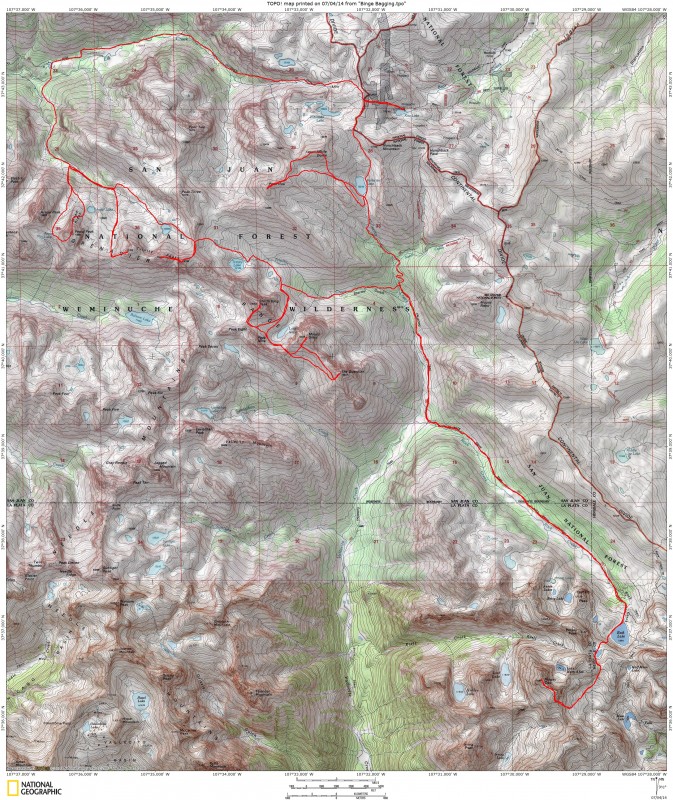 Day 2: Vestal Peak 3 miles 2580 elevation gain We got an early start. We did not want to give the rain gods any reason to dislike us today. We got to the angling grass ramp as the sun was coming up. It was beautiful, and we were excited to have a weather window. This was going to be Sam's first alpine lead. He could not have picked a better route. Britt followed and cleaned the route. Sean and I soloed. The climb went off without any problems. Sean led the crux pitch in great style. It was enjoyed by all. Once on the summit, we said hello to a friend. We did not stay on the summit too long, weather was already building. We made our way down the 3rd class descent of the south face. I still pity the soul who ascends this route....The descent from the Vestal/Arrow saddle was as exciting as always. I think Sam had the most fun on the dues collector. We made it to the lower ramp of Arrow. Time to decide if we should attempt Arrow today or not. We debated for about 2 minutes, when it started raining. Mother nature decided for us. We spent the afternoon in the tents. The weather broke up later, and we enjoyed the clouds rolling in and out of our view towards Vestal. Sean's friend Jake hiked in from Molas pass in 3 hours to climb with us tomorrow. Wow. We were forced into the tents early once again by another storm. This one was for real. Rain, hail, thunder, rain, hail, wind, etc. We found out how well our equipment performed in heavy rain/wind. My Black Diamond Highlight tent failed miserably. It is advertised as a 4 season tent. Water from the heavy rain was being pushed through the fabric on the top half of the tent. It did not matter if it was near a seam or not. When it would hail, the water was forced through the fabric, them would spray into the tent. It was going to be a long night. I strategically placed my rain jacket over my torso for some protection. At least the tent is lightweight. 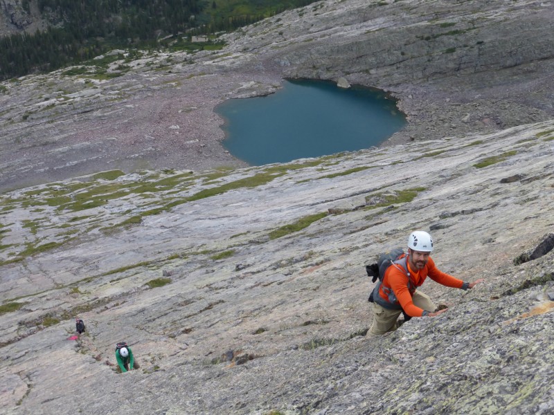 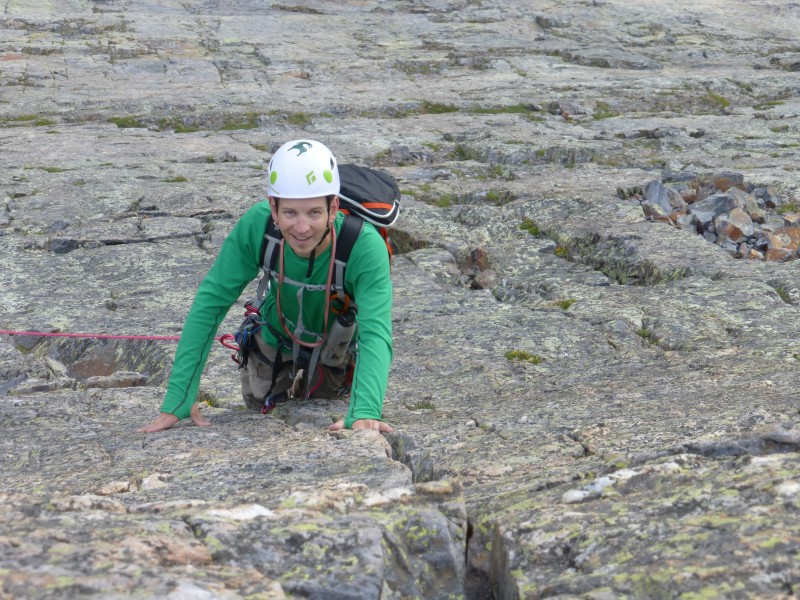  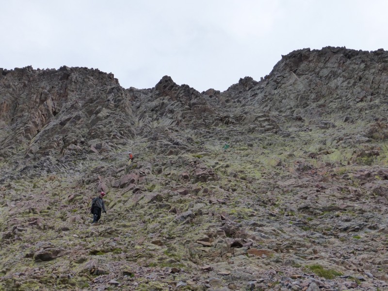 Since Sam never wrote the TR he promised, I have included a picture of him enjoying the dues collector..... 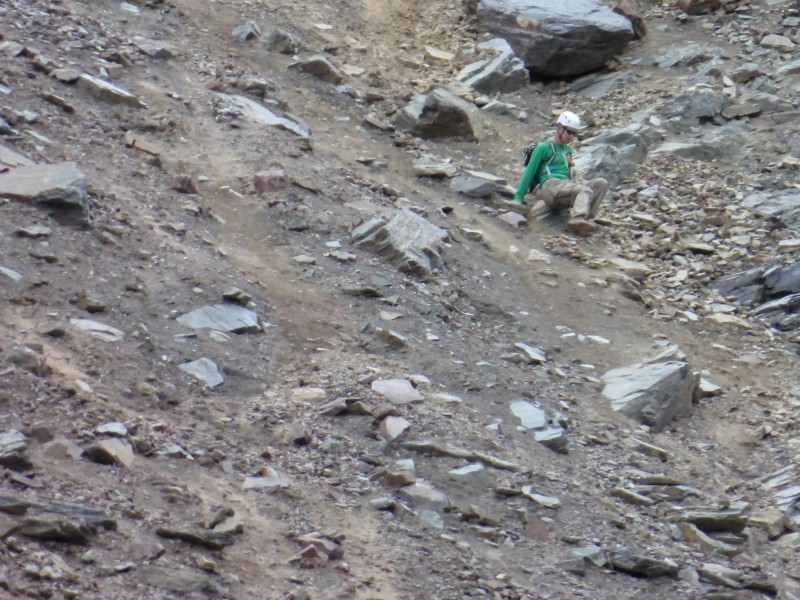 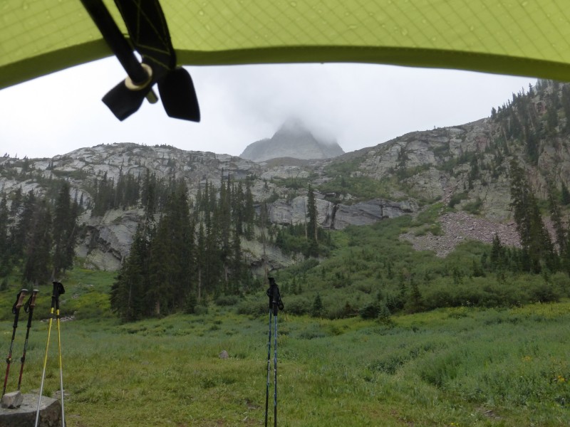 Day 3: West Trinity Peak 4 miles 2405 elevation gain In the morning, everything was soaked. Jake, who slept in a BD Spotlight bivy was soaked also. He got up early and ran a mile just to get warm. I stayed warm enough, but when I picked up my tent, I poured out at least 3 cups of water. Sleeping on a Neo Air mattress saved me from sleeping directly in the water. Britt, Sam, and Sean with their real tents did not have any issues. So now what? My sleeping bag is soaked, my tent leaks, but the sun is out. Time to go climbing. There was no way I could just sit there and watch my sleeping bag dry. We hung our sleeping bags from a tree to dry out. Britt and Sam were going to try Arrow, Sean and Jake were going to try Wham, and I was heading for the Trinities. Another beautiful climb in the basin brought me to the summit of West Trinity. Weather was moving in already. Time to decide what to do. I could start the traverse, but if it starts raining, I might have to hunker down and wait out the storm in not an ideal place. Wait, my sleeping bag is hanging to dry. If a big storm rolls through, I would return to a completely soaked bag. Not good. I was planning to rig my ground cloth as a tent fly to fix the leaking tent problem, but still need to test it out. The thing with going lightweight is that I have one pair of lightweight pants, a light synthetic jacket, rain gear, tent and sleeping bag. If things go bad, I am supposed to get in the tent with sleeping bag and be safe in my castle. The castle is only a bunch of blocks laying on the ground right now......I could try the traverse, but it may punch my ticket out of here, or at least a very miserable night. I turned around. Back in camp by 10 or so, the Wham crew bailed after the grass ramps. Wet rock and just not feeling the love after a tough night. An hour later Britt and Sam returned with a successful summit of Arrow. The bags were dry, my new roof was ready for the test. Things were looking up. Then it started to rain again..... 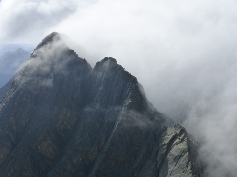 Day 4: East Trinity Peak, Trinity Peak. Hike to upper Trinity Cr. basin via Pk. 2/East Trinity Saddle. 5 miles 3850 elevation gain Using the tent groundcloth as the roof actually worked out really well. I said my goodbyes to my friends and headed for the saddle between Pk. 2 and East Trinity. I had scouted the east side of the pass from a previous trip, so I knew to go over the northern part of the saddle. I stashed the pack so the marmots would not be temped, and scrambled over the bump between the northern and southern saddles to get to East Trinity. The climb up was fun class 2/3 scrambling with great views. Down then up to Trinity Pk., then down and back up East Trinity. A quick descent back to the pack, and before I knew it, I was at Trinity Lake. The legs were actually starting to feel good, not sore after every day of climbing. I made my way down a little further to a great camp spot below Storm King Pk. 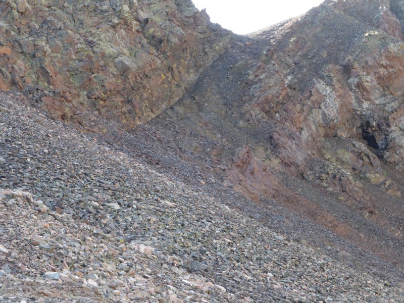 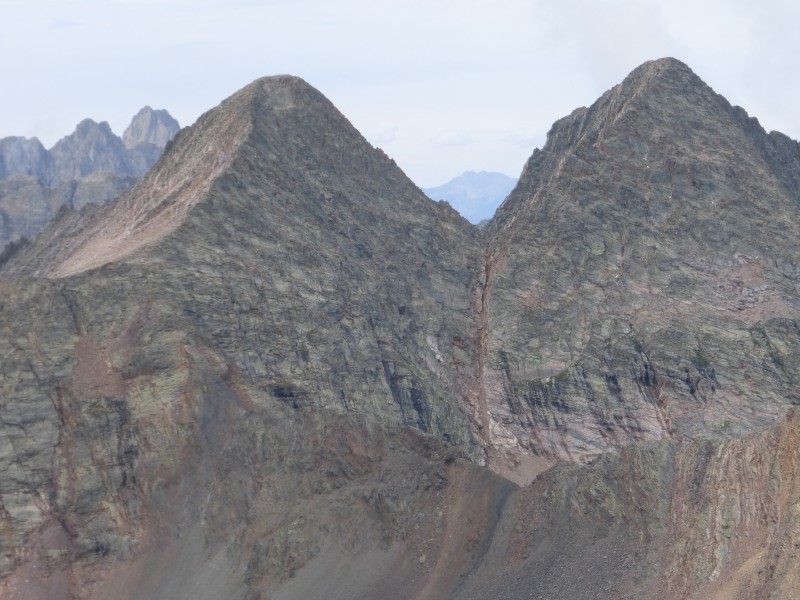 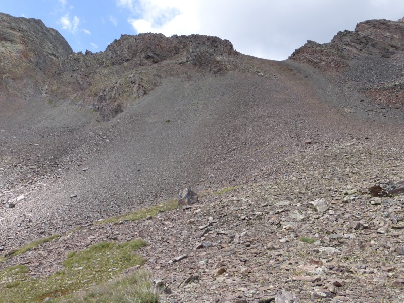 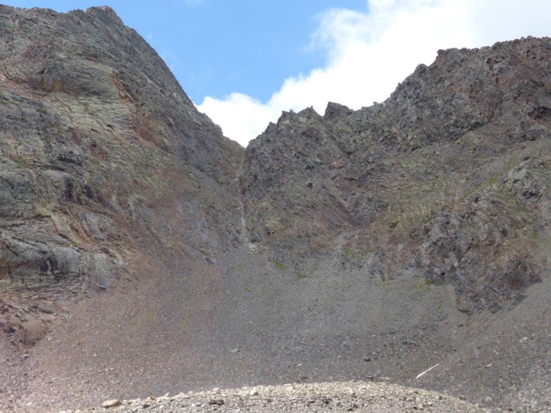 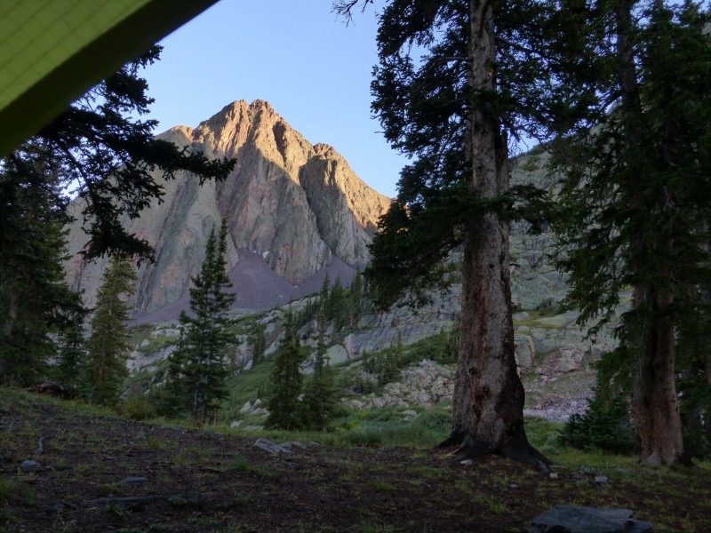 Day 5: Guardain, Mount Silex, Storm Kink Peak. Hike to upper Rock Creek basin. 13 miles 6210 elevation gain Today was going to be a bit longer, so I actually started in the dark. I had found and easy way to get to the top of the white gully from camp in about 10 minutes inbetween storms the previous afternoon. I was high above Silex lk., when the sun came up to reveal a hideous traverse to get to the Pk. 9/Silex saddle. This should be fun....When I actually got on the traverse it turned out to be relatively stable and I made good time. The summit of the Guardian was had without too much difficulty, and it was off to Mt. Silex. The views are superb from the top of the Guardian. An awesome 360 degree view of the Weminuche wilderness from a unique perspective. There is a sweet traverse that stays up high, almost like a small sidewalk, that takes you to the upper slopes of Mt. Silex. Another summit bagged. I got back to the Pk. 9/Silex saddle, time to decide. I had thoughts of going for the summit of Pk. 9, but weather was building already, and I was on a bicentennial mission. On to the Pk. 8/Storm Kind saddle by 11:30. What now? Weather was approaching. I did not relish the thought of coming back for it tomorrow. What to do? I sat down and ate some food, drank some water, looked at the clouds building......I decided to put it in high gear up to the notch and reassess there. The notch came quickly, I stopped, took a photo, and kept moving up. The old legs can still work. A quick SPOT at the summit, and down I went. Got back to the saddle before any lightning or rain. Folks around here seem to care about numbers. 33 minutes roundtrip from Storm King/ Pk. 8 saddle to summit and back. 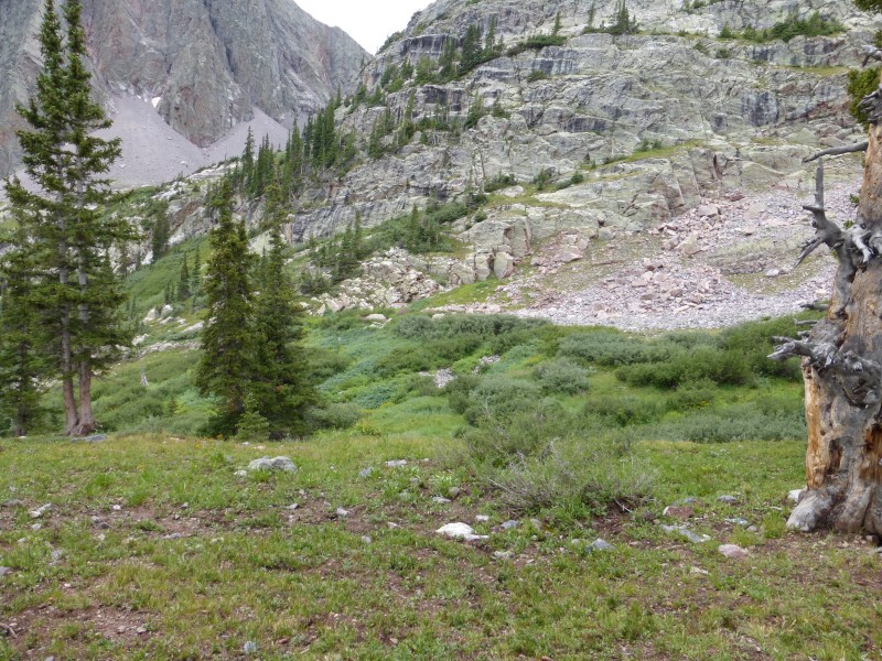 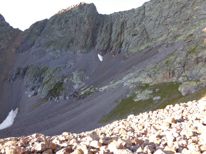 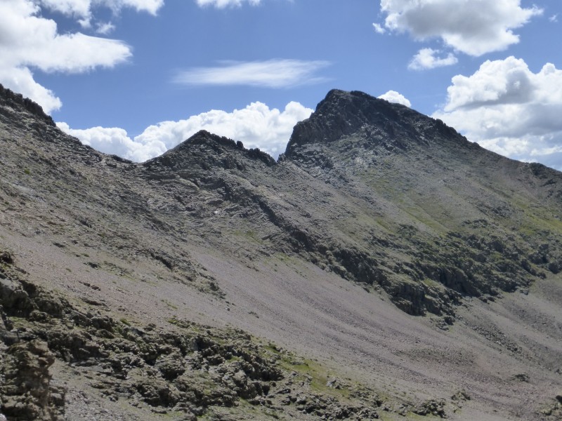 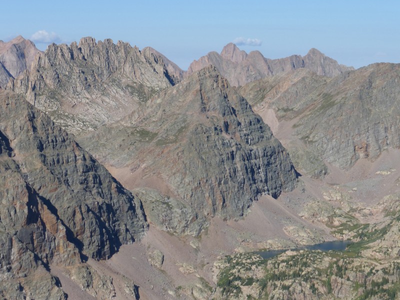 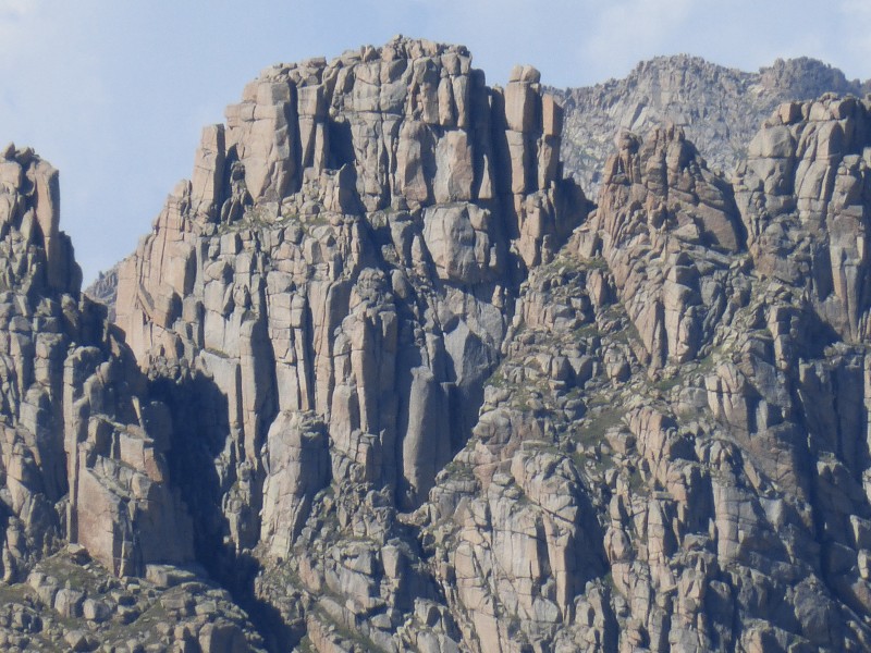 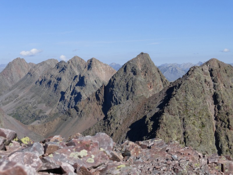 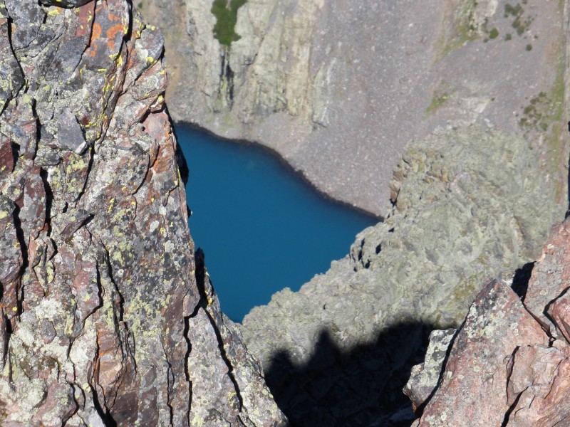 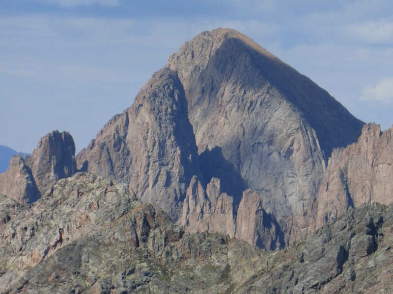 The other thing the weather messes up is getting to the right drainage, or close enough to a climb to reach the summit at a reasonable time based on the current weather. I could hang out in camp all afternoon, staying dry in the tent, but then I would not be close enough to try Mt. Oso from my current camp. A day would be wasted moving to Rock Cr. drainage the next day, but I would also get there late enough that I would not be able to attempt a summit with weather happening by 1pm if not earlier. So after the rain breaks, I packed up and headed for Rock Cr. The upper reaches of Rock Cr. are beautiful. I was treated with great thunderstorms, lightning, and rainbows. This basin is worth another trip. 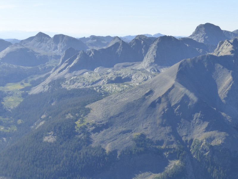 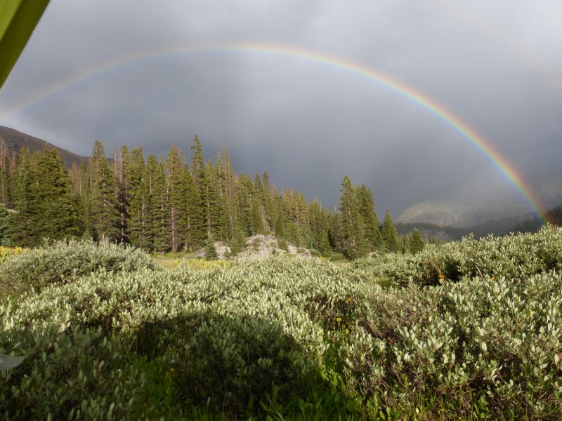 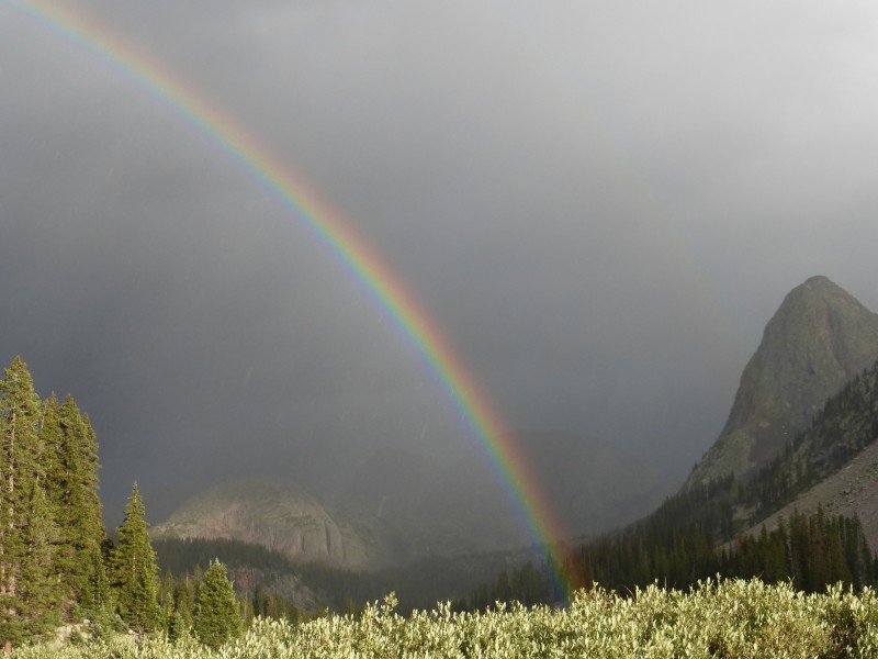 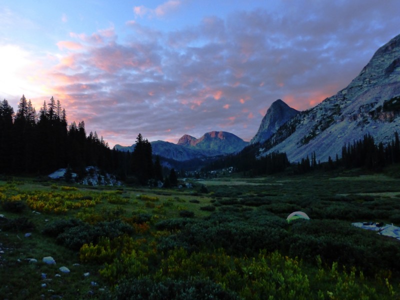 Day 6: Mount Oso. Hike to Valecitto Lake. 12 miles 5210 elevation gain I hiked the remaining mile to Rock Lake in time to see a couple of bull elk grazing on the north side of it. Now, figuring out the route to climb Mt. Oso. I purposely did not do any research on the route. I like figuring out the puzzle that route finding presents. I was cussing myself out right about now. Here I am wasting time trying to figure out where to go, weather is building already, I can't see the peak, and it is light outside, no obvious trails, and I still don't know where to go. I could hike up a sub peak to scout out the route, but I decide to go with my gut and head toward the southwest side of the peak. Most of the other harder peaks in the area have a weakness on this side...... I hike to the west end of Rock Lake and find a trail that skirts the talus on some grass up to a cliff band, then a great trail turns right and takes you up some ledges that go between 2 rock bands to a tarn. Then a trail takes you south into the basin south and east of Mt. Oso. As soon as I could see the peak, I was relieved to see a weakness that would lead to the summit. I called out Bishop to hike with me, and hoofed it to the summit. Another quick summit lounge. This weather is cramping my style. Once down in the basin south and east of the peak, the weather quit building, so I had some time to enjoy the wildflowers. Back at camp, it was looking like another afternoon of hiking with the pack cover on to get to Valecitto Lake before nightfall...The mountains sure are pretty with the clouds and storms coming and going during the hike back north. 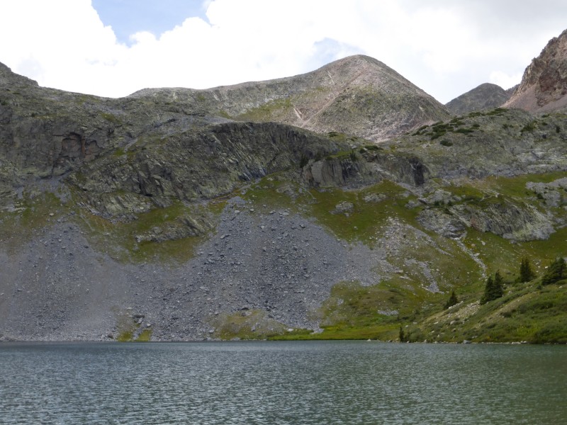  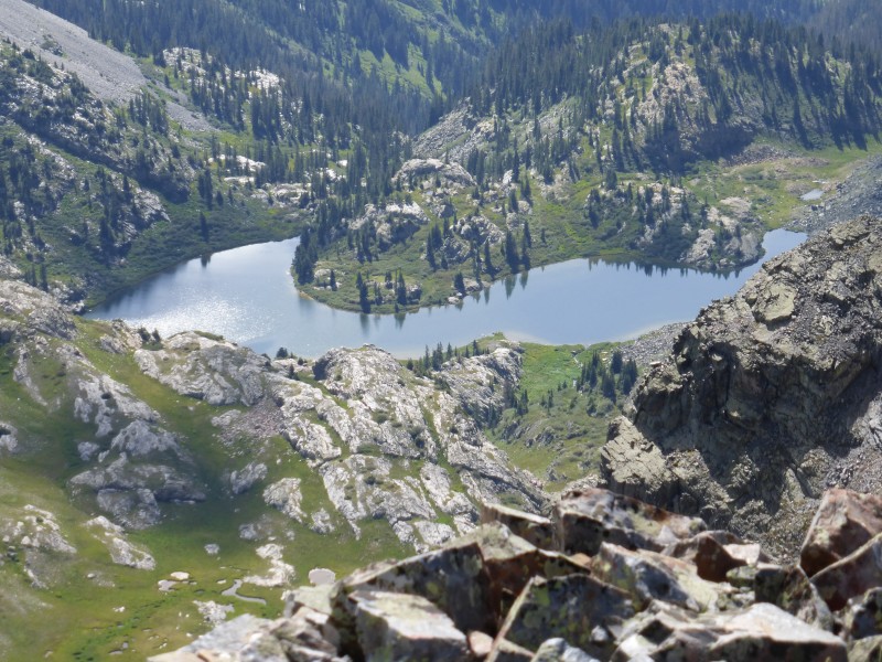 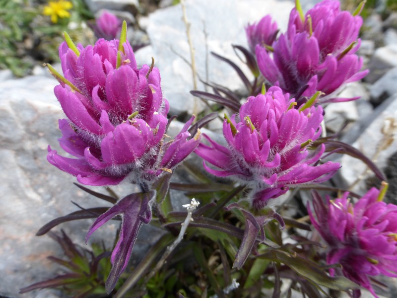 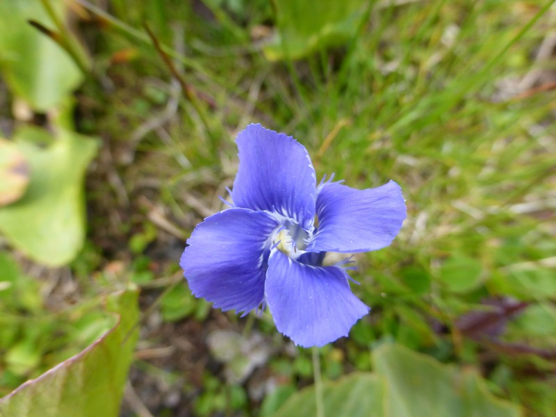 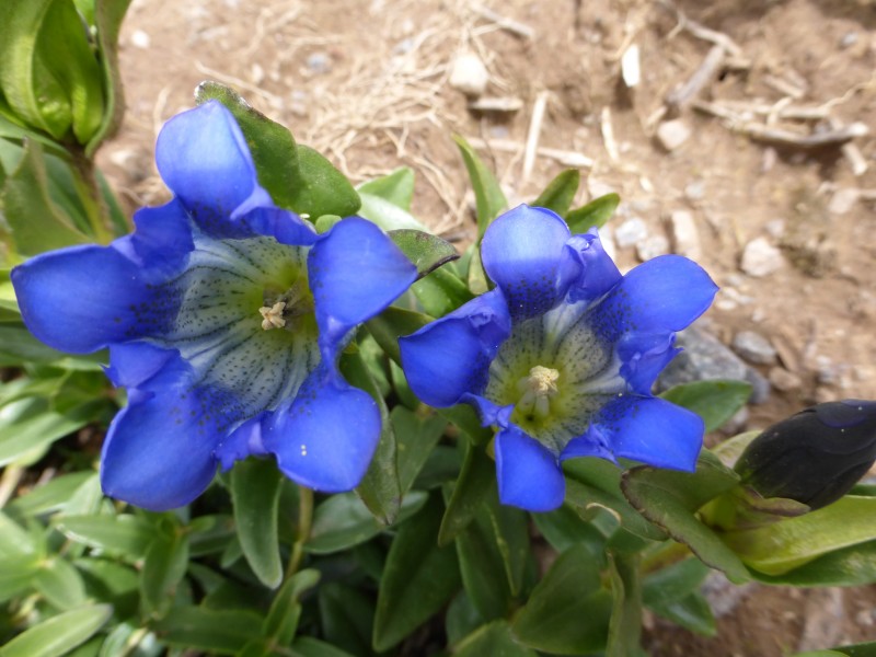 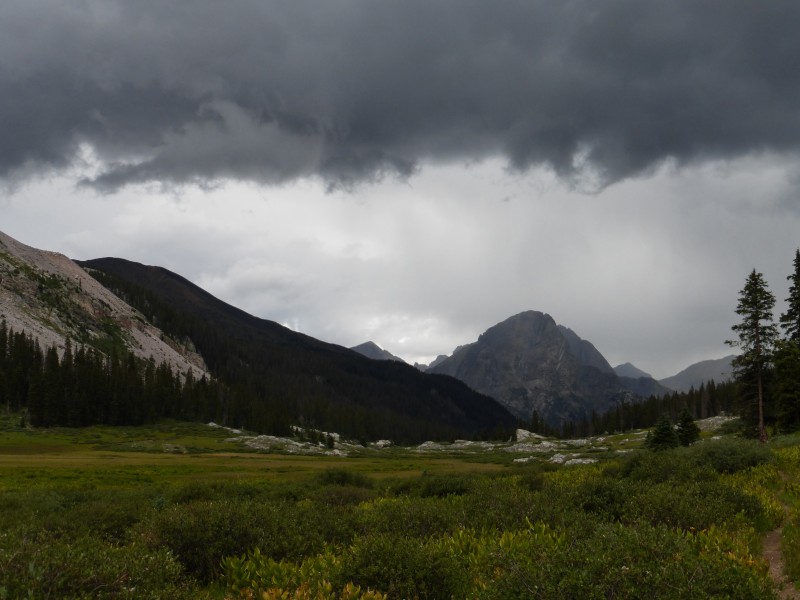 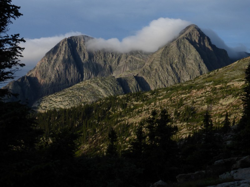 The spot to leave the CO Trail to head for Valecitto Lk. is pretty obvious. The trail peters out after 100 yds., but the best route stays on the left (west) side of the creek until you get to the boulder field. Real weather was coming in fast, so I just went up the boulder field to the right of the Cr., not wanting to mess around with routefinding up the ledges on the left side of the creek. There were cairns near the top of the ledges that I saw when I got close to the lake. It started to rain with lightning just as I reached the lake. I threw everything in the tent and set it up from the inside to avoid getting soaked. No gourmet meal out of a foil pouch tonight. Day 7: White Dome, Peak 1, Hike to Kite Lake. 6 miles 3100 elevation gain I slept pretty well considering the nights activities. Another daybreak start to cloudy skies saw easy ascents of White Dome and Peak 1. Rain by 9:30 am. At least there was not thunder and lightning yet. Packed up the tent in the rain and stared towards Kite lake. There was a break in the weather, so I picked up the pace to get over the pass. It felt good to be back at the truck..... 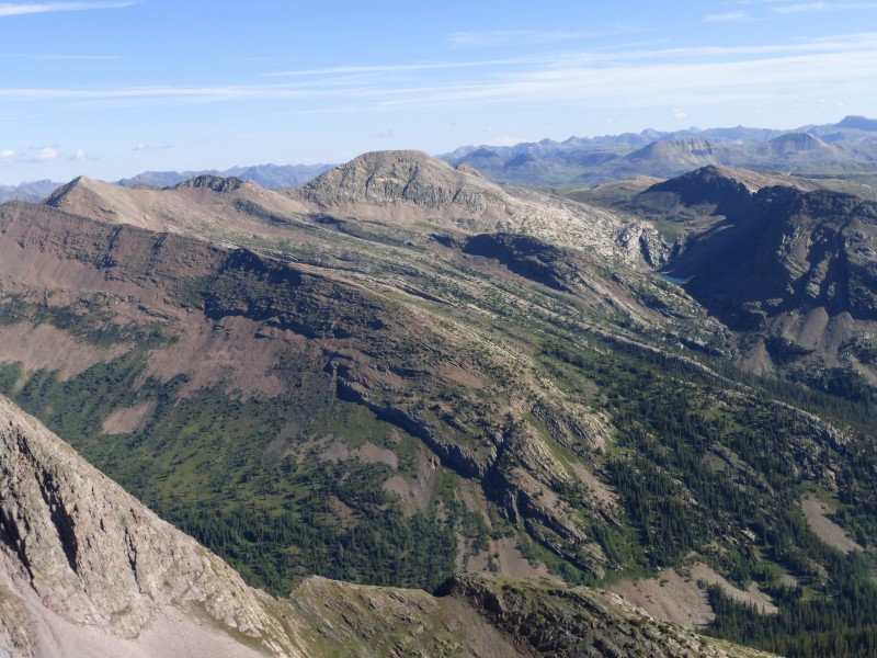 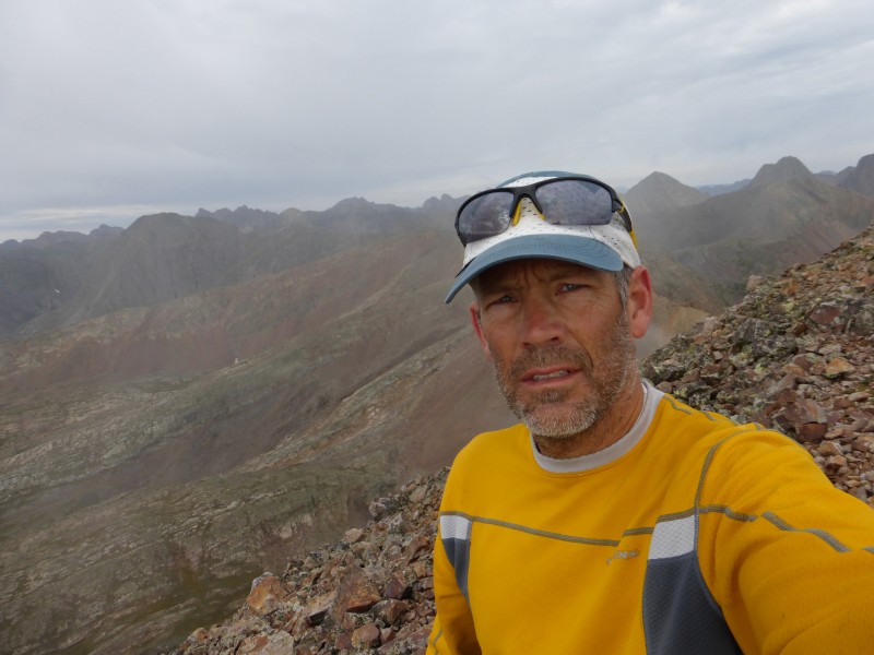 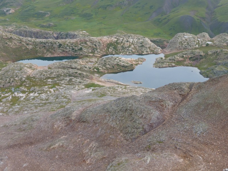 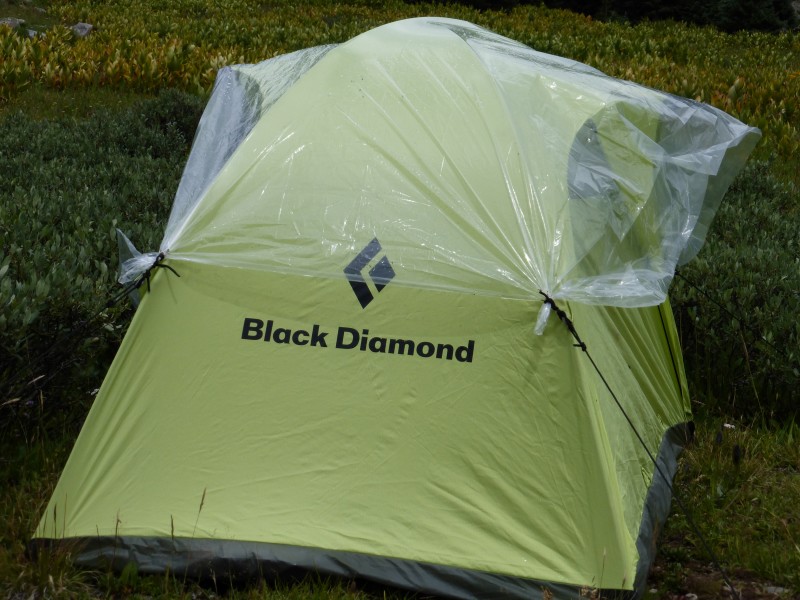 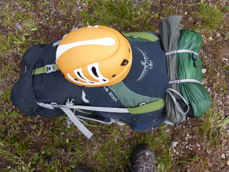 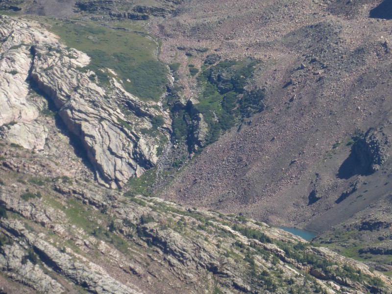 Day 8: Pole Creek Mountain, Northwest Pole. Drive home. 10 miles 4085 elevation gain Northwest Pole turns out to be one of those sleeper summits that one never hears about, but turns out to be an awesome summit. It rained a bunch during the night again, what a surprise. Sorry, no pictures. Camera battery was dead, and I forgot to bring the charger.....I walked up Pole Cr., turned up to the south ridge of NW pole and began a fun ascent up ridges and grassy slopes. Got close to the summit to find a nice cliff band that formed the summit. Class 3 ish got me to the summit that was exposed on the north side with a great cliff. I wanted to hang out for along time, but the weather was building as usual. Headed south to the great spires on Pole Cr. Mtn. across grassy slopes with great wildflowers. The ascent was uneventful, but fun. Lounged on the summit for 10 minutes before it started to rain. I was not going to wait for the first lightning to start heading down, so started trotting down the west ridge for a while. Stopped raining at about 12k, so slowed down to surprise some bull elk. When I got to Pole Cr. it started pouring in earnest. Rain gear back on and slog to the truck in the mud. Almost made it back to the truck without issue, until I ran into a herd a cows being wrangled up into the basin. Herd was being moved from upper Rio Grande to Pole Cr. basin. The Trail was at a point where it side hills back to the TH. I figured a game of chicken with 2000 lb. animals was a losing battle, so I turned around and let them pass. What was left in their wake, was a trail already slick from the rain, all of the feces and urine from said cattle, this mixture was then ground together from 400 hooves forced into a 4 foot wide track. If there was ever a time not to fall, this was it....I think I will get a burger when I get back to town. 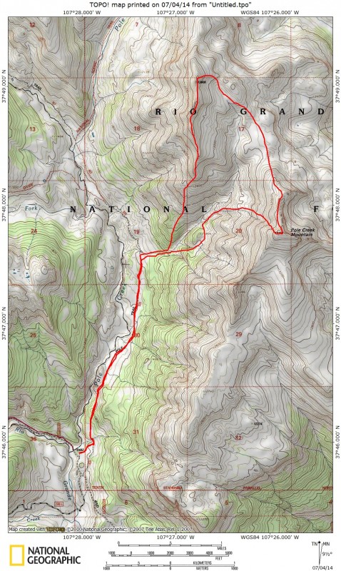 Thumbnails for uploaded photos (click to open slideshow):
|
| Comments or Questions | |||||||||||||||||||||
|---|---|---|---|---|---|---|---|---|---|---|---|---|---|---|---|---|---|---|---|---|---|
|
Caution: The information contained in this report may not be accurate and should not be the only resource used in preparation for your climb. Failure to have the necessary experience, physical conditioning, supplies or equipment can result in injury or death. 14ers.com and the author(s) of this report provide no warranties, either express or implied, that the information provided is accurate or reliable. By using the information provided, you agree to indemnify and hold harmless 14ers.com and the report author(s) with respect to any claims and demands against them, including any attorney fees and expenses. Please read the 14ers.com Safety and Disclaimer pages for more information.
Please respect private property: 14ers.com supports the rights of private landowners to determine how and by whom their land will be used. In Colorado, it is your responsibility to determine if land is private and to obtain the appropriate permission before entering the property.


