Download Agreement, Release, and Acknowledgement of Risk:
You (the person requesting this file download) fully understand mountain climbing ("Activity") involves risks and dangers of serious bodily injury, including permanent disability, paralysis, and death ("Risks") and you fully accept and assume all such risks and all responsibility for losses, costs, and damages you incur as a result of your participation in this Activity.
You acknowledge that information in the file you have chosen to download may not be accurate and may contain errors. You agree to assume all risks when using this information and agree to release and discharge 14ers.com, 14ers Inc. and the author(s) of such information (collectively, the "Released Parties").
You hereby discharge the Released Parties from all damages, actions, claims and liabilities of any nature, specifically including, but not limited to, damages, actions, claims and liabilities arising from or related to the negligence of the Released Parties. You further agree to indemnify, hold harmless and defend 14ers.com, 14ers Inc. and each of the other Released Parties from and against any loss, damage, liability and expense, including costs and attorney fees, incurred by 14ers.com, 14ers Inc. or any of the other Released Parties as a result of you using information provided on the 14ers.com or 14ers Inc. websites.
You have read this agreement, fully understand its terms and intend it to be a complete and unconditional release of all liability to the greatest extent allowed by law and agree that if any portion of this agreement is held to be invalid the balance, notwithstanding, shall continue in full force and effect.
By clicking "OK" you agree to these terms. If you DO NOT agree, click "Cancel"...
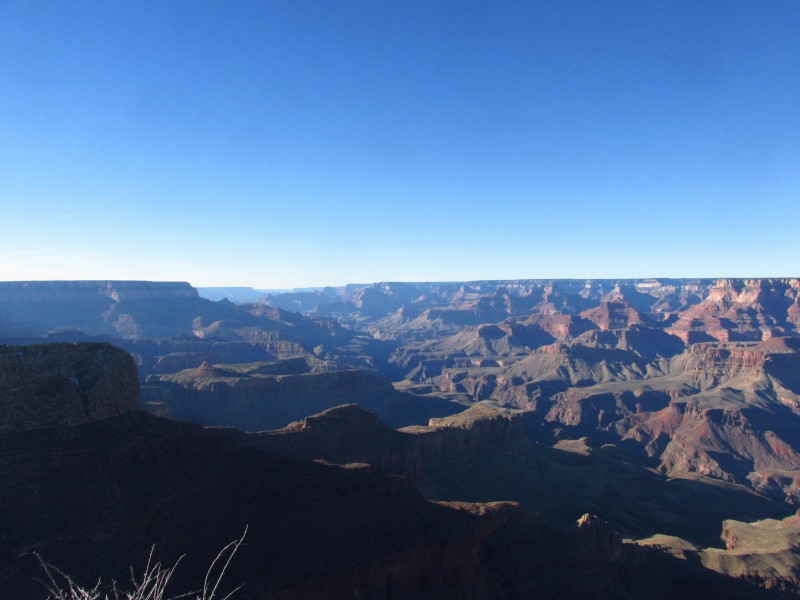
Grand Canyon National Park, The Road Less Traveled
Grand Canyon National Park
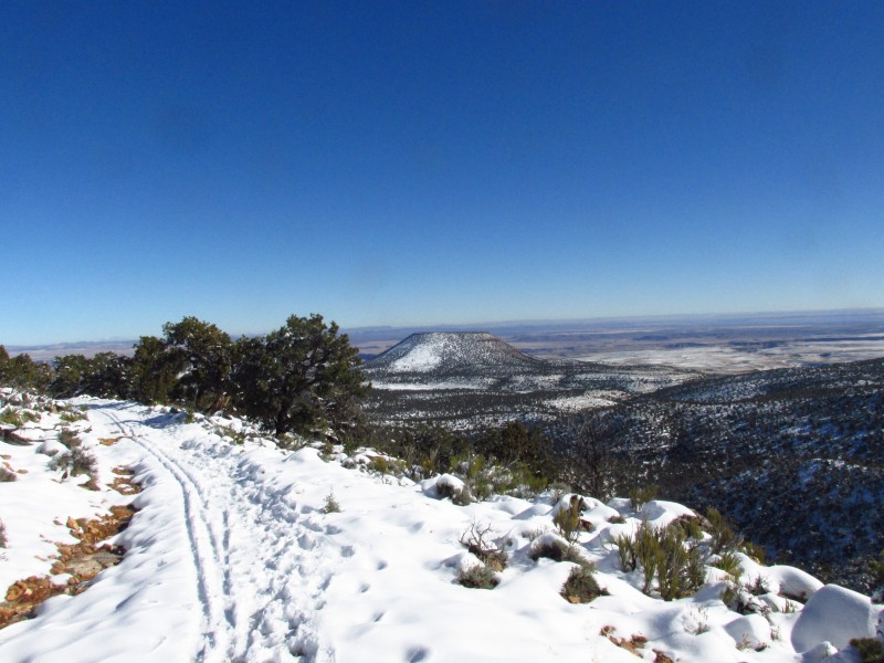
Cedar Mountain 7061
~9 miles 1400 ft class 2
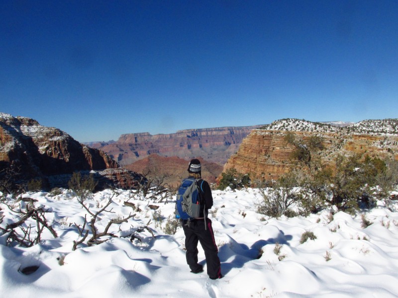
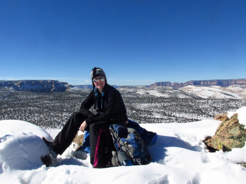
Partner: Dorothy (my sister)
This is the second Thanksgiving break I have made the trip to Arizona to visit my sister and hike in the Grand Canyon. Last year we climbed Escalante Butte, a stiff bushwhack with a class 4 summit block. Unfortunately I was in between cameras so I couldn't take pictures to post my standard trip report for Escalante. Recent snow made any trip into the canyon more treacherous than I wanted to deal with without extra traction. A quick look at surrounding summits led us to Cedar Mountain.
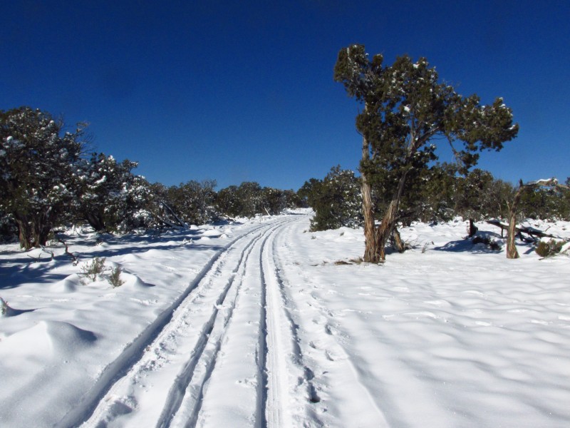
The trailhead is at the desert view visitor's center. We popped in to check on the route. The ranger told us to go through the Cedar Mountain apartments to get to the Cedar Mountain Road. It was easy enough to find the road so we started our mellow descent of the Cedar Mountain Road. For the first half mile or so we followed a ski track then we noticed a superhighway constructed by an elk herd heading down the mountain. The elk trail saved us a total of maybe 45 minutes down and back. Soon we arrived at the intersection with the trail which heads in the direction of Comanche Point. Comanche Point was what I originally wanted to summit but I didn't want to slog through 14-15 miles of slushy snow with a slight head cold.
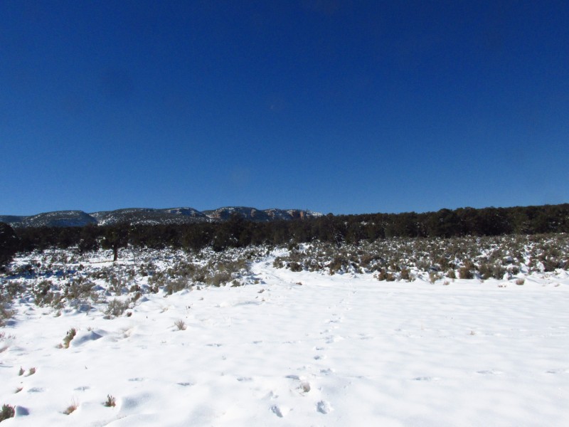
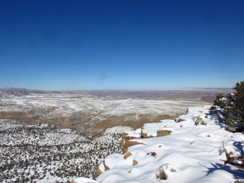
Little Colorado River canyon Cedar Mountain Road First good view of cedar First good view of the canyon Dorothy likes the views of the canyon The meadow
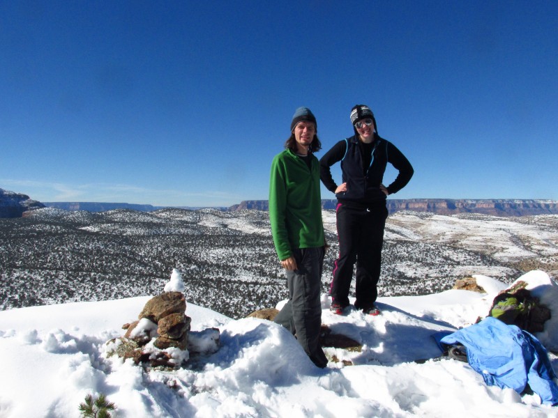
We turned right and headed down another mile of mellow road to a large meadow west of Cedar Mountain. From there the route is obvious, just go up. We aimed for a spot just to the right of a small cliff band. The cliff band would be trivial without snow. Despite the wet snow we made really good time up the final 600 feet. The next test was to find the actual summit on the flat plateau. I knew from the topo that it was on the west side so we explored the west side and soon found the cairn.
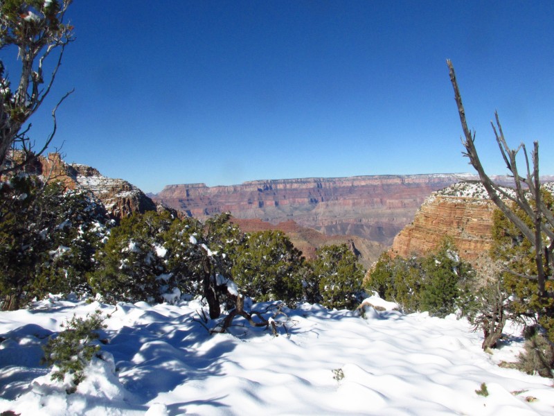
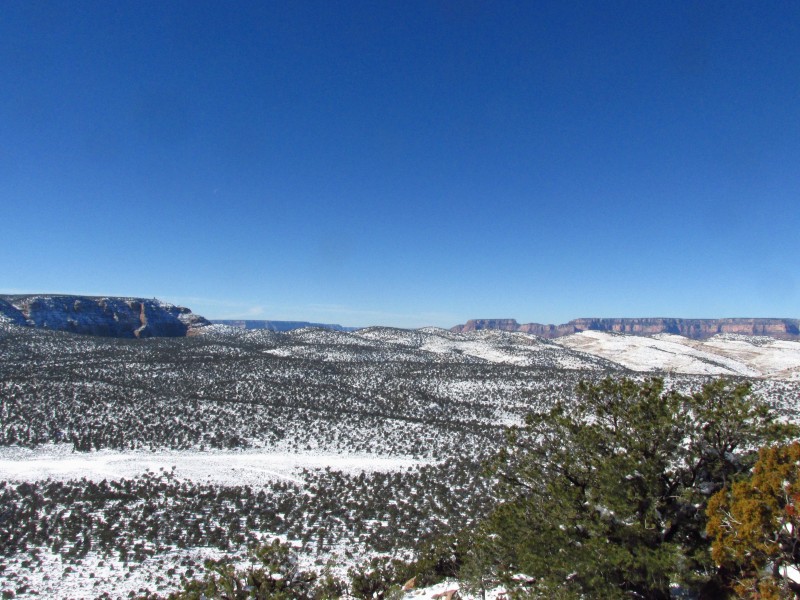
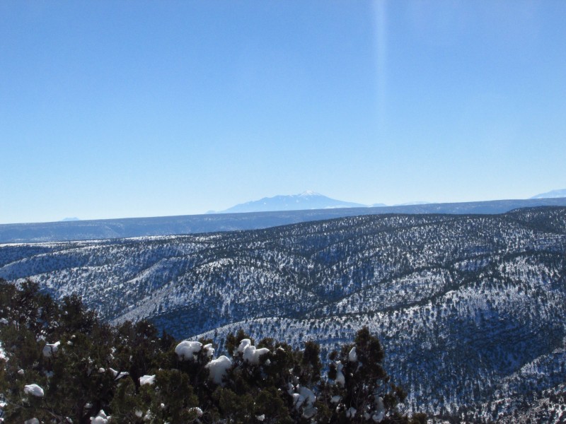
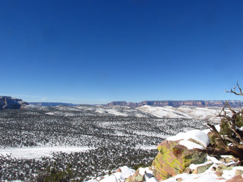
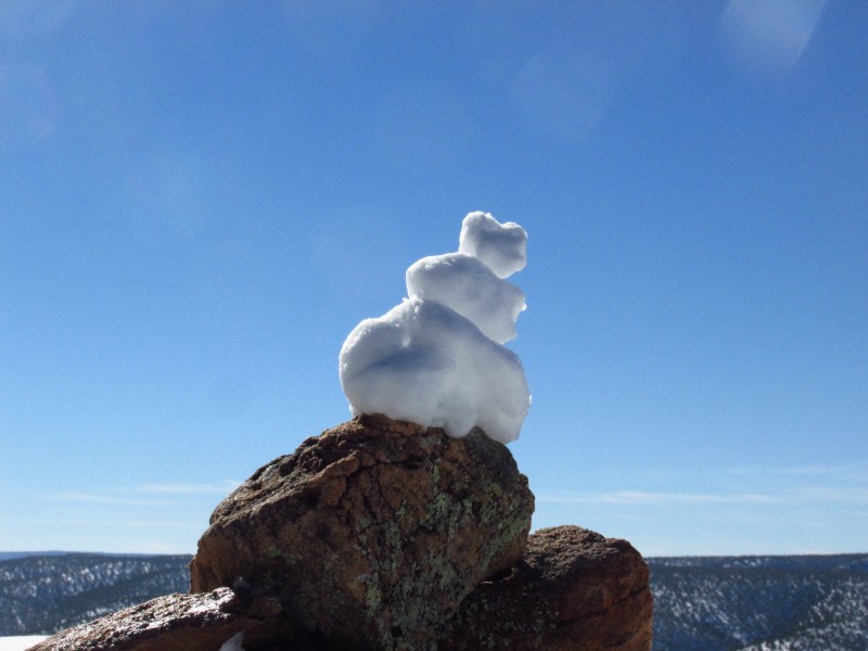
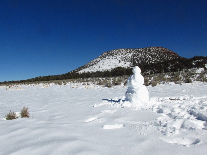
Excellent views all around Arizona's highpoint Looking towards the canyon View towards the east Snowman cairn
Did I mention that this was a bluebird day. There was no wind and we could see all the way from Humphrey's peak to Navajo Peak in Utah.
We returned via the same route, making great time up the elk track. We made a few extra stops to soak in a perfect day.
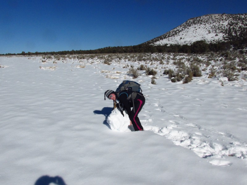
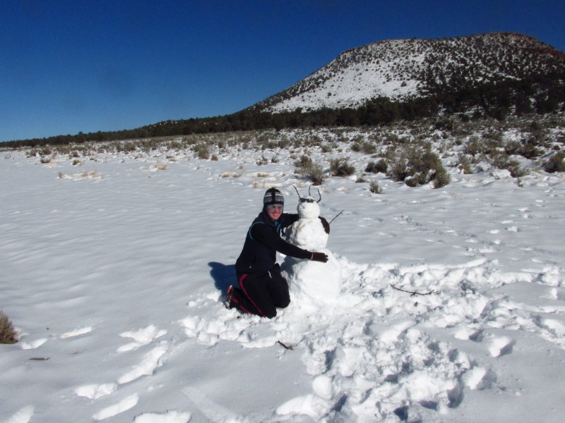
We couldn't resist The snowman shows the way We made a new friend Parting shots of the canyon
Thumbnails for uploaded photos (click to open slideshow):
The snow really adds to the beauty of the Canyon! And I love your snow cairns! Ha! True LNT and probably only good for yourself for a day or two! Thanks! :D
A nice way to see the canyon and get a peak in too! Kudos for doing it with your sister! I got my sister to climb her 1st peak this summer and now she is talking about doing another! Aren't sisters great!
Caution: The information contained in this report may not be accurate and should not be the only resource used in preparation for your climb. Failure to have the necessary experience, physical conditioning, supplies or equipment can result in injury or death. 14ers.com and the author(s) of this report provide no warranties, either express or implied, that the information provided is accurate or reliable. By using the information provided, you agree to indemnify and hold harmless 14ers.com and the report author(s) with respect to any claims and demands against them, including any attorney fees and expenses. Please read the 14ers.com Safety and Disclaimer pages for more information.
Please respect private property: 14ers.com supports the rights of private landowners to determine how and by whom their land will be used. In Colorado, it is your responsibility to determine if land is private and to obtain the appropriate permission before entering the property.