Download Agreement, Release, and Acknowledgement of Risk:
You (the person requesting this file download) fully understand mountain climbing ("Activity") involves risks and dangers of serious bodily injury, including permanent disability, paralysis, and death ("Risks") and you fully accept and assume all such risks and all responsibility for losses, costs, and damages you incur as a result of your participation in this Activity.
You acknowledge that information in the file you have chosen to download may not be accurate and may contain errors. You agree to assume all risks when using this information and agree to release and discharge 14ers.com, 14ers Inc. and the author(s) of such information (collectively, the "Released Parties").
You hereby discharge the Released Parties from all damages, actions, claims and liabilities of any nature, specifically including, but not limited to, damages, actions, claims and liabilities arising from or related to the negligence of the Released Parties. You further agree to indemnify, hold harmless and defend 14ers.com, 14ers Inc. and each of the other Released Parties from and against any loss, damage, liability and expense, including costs and attorney fees, incurred by 14ers.com, 14ers Inc. or any of the other Released Parties as a result of you using information provided on the 14ers.com or 14ers Inc. websites.
You have read this agreement, fully understand its terms and intend it to be a complete and unconditional release of all liability to the greatest extent allowed by law and agree that if any portion of this agreement is held to be invalid the balance, notwithstanding, shall continue in full force and effect.
By clicking "OK" you agree to these terms. If you DO NOT agree, click "Cancel"...
Pt. 12,210 - Slumgullion
8 Miles, 1,350 ft. elevation gain
I'm not sure of the official name for this mountain but it's labeled "Slumgullion" on topo maps and has an elevation of 12,210 ft. It's on a ridge that's north of Highway 149 as it heads up to Slumgullion Pass. This was a great winter hike with 360 degree views. View of Wetterhorn and Uncompahgre from the summit of Pt. 12,210
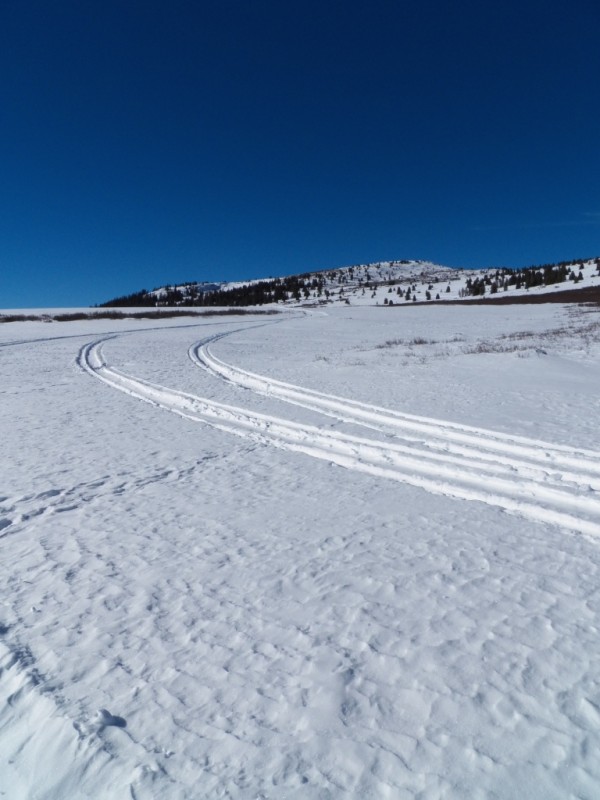
Directions to the start of this hike : Coming from Lake City, head south and then east on Highway 149 and proceed to the Slumgullion Pass summit. There's a sign announcing the Slumgullion Pass summit. From that sign, continue on Highway 149 for 2.0 miles going east and then south and then make a sharp turn back to the east. Shortly after this last turn, at 2.0 miles from sign for the Slumgullion Pass summit, there's a small parking pullout on the north side of the road. I parked here. The hike starts on a snowmobile trail 100 yards, or so, west of this parking area on the south side of the road. Look for small stop signs on either side of Highway 149. The stop signs are for the snowmobilers, not the highway traffic. Heading south from the highway, I stayed on the snowmobile trail as it made several turns until it emerged from the trees, heading northwest. As you near the ridge on the northern horizon, the trail makes a 90 degree turn and heads southwest. At this turn, you can make a short detour up to the ridge where there's a great overlook with views of Uncompahgre, Wetterhorn, the Sawatch range to the northeast and many other peaks.
I went back to the point where the trail turns southwest. After going southwest, the trail then turns again and heads south and then west as it goes around a ridge. After you make this turn and start heading west on a straight section of trail, Pt 12,210 - Slumgullion is ahead and slightly off to the left. After following this straight section of trail toward Pt. 12,210, I left the main snowmobile trail and followed a smaller trail made by a snowmobiler a short distance north. I finally had to leave the snowmobile trails which had made travel very easy up to this point. This is where things got tough. Instead of going up to the saddle east of Pt. 12,210 I headed west toward a point on Pt.12,210's south ridge.
The picture below was taken as I approached Pt. 12,210, which is the tallest mountain in the picture, slightly right of center. I went straight up to the ridge roughly at the point where the trees start to get sparser, approximately the midpoint of the ridge Approaching Pt. 12,210
Once I left the snowmobile trail I was in powder and sinking 18" with every step despite having snowshoes on. I thought about quitting several times but, wanting to see the view, I kept going. I kept recalculating the time I thought I'd make it home. With the slow progress, my guess went from 6:30 p.m. to 8:30 p.m. in less than a half hour of trying to make it up to the ridge. I ended up getting home at 9:15. It took me an hour and a half to go the final ½ mile, finally reaching the ridge and then heading north along the ridge to the summit. I remembered a trip report by Anna where she wrote about how it took her hours and hours to get up Ganley Mtn. in the snow. At the time I wondered how it could take that long. Now I know from personal experience. As I headed up to the ridge it was all I could do to take 10 steps and then I had to rest. the picture below shows my trench through the snow. It was taken on the way down after I pretty much slid down the slope.
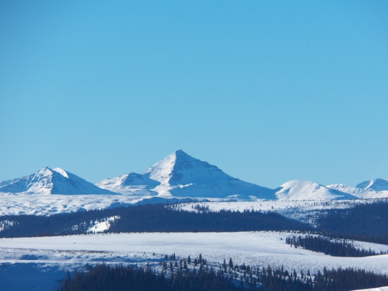
The picture below was taken from the point where I topped out on the ridge. You can see my track in the flat area below if you look carefully. Baldy Cinco is the peak in the distance. Baldy Cinco
Prior to this trip I had read the CAIC avalanche forecast for the San Juan's. They mentioned wind slabs that had developed on the leeward sides of ridges. I dug a hole or 2 as I started up the ridge. There was a slab of only an inch on top with several feet of powder below. I figured I was safe, although I'm not an expert. Near the summit it got slabbier, but the slabs were still pretty thin, and the ridge itself is at such a low angle it didn't matter.
I finally made it to the top where the views were 360 degrees and great in all directions. The Rio Grande Pyramid caught my eye throughout the day. I was also pretty impressed with Baldy Cinco and its neighbors, including Snow Mesa. The best views were of Uncompaghre and Wetterhorn. Mt. Ouray could also be seen off to the east. The Slumgullion earthslide in the foreground to the northeast was pretty interesting from this angle too.
Rio Grande Pyramid from the summit Snow Mesa Uncompahgre from the summit Wetterhorn from the summit Mt. Ouray Redcloud and Sunshine from the summit Southern Sawatch (Shav and Tab near right) Slumgullion earthslide and Highway 149
Thumbnails for uploaded photos (click to open slideshow):
Great pics and strong work - thanks for posting!
It's very slow going solo in 18 inches of powder.
Caution: The information contained in this report may not be accurate and should not be the only resource used in preparation for your climb. Failure to have the necessary experience, physical conditioning, supplies or equipment can result in injury or death. 14ers.com and the author(s) of this report provide no warranties, either express or implied, that the information provided is accurate or reliable. By using the information provided, you agree to indemnify and hold harmless 14ers.com and the report author(s) with respect to any claims and demands against them, including any attorney fees and expenses. Please read the 14ers.com Safety and Disclaimer pages for more information.
Please respect private property: 14ers.com supports the rights of private landowners to determine how and by whom their land will be used. In Colorado, it is your responsibility to determine if land is private and to obtain the appropriate permission before entering the property.


 View of Wetterhorn and Uncompahgre from the summit of Pt. 12,210")
 Approaching Pt. 12,210")
 Rio Grande Pyramid from the summit")
 Wetterhorn from the summit")
")
 Baldy Cinco")
 Snow Mesa")
 Mt. Ouray")
 Uncompahgre from the summit")
 Redcloud and Sunshine from the summit")
 Southern Sawatch (Shav and Tab near right)")
 Slumgullion earthslide and Highway 149")


