Download Agreement, Release, and Acknowledgement of Risk:
You (the person requesting this file download) fully understand mountain climbing ("Activity") involves risks and dangers of serious bodily injury, including permanent disability, paralysis, and death ("Risks") and you fully accept and assume all such risks and all responsibility for losses, costs, and damages you incur as a result of your participation in this Activity.
You acknowledge that information in the file you have chosen to download may not be accurate and may contain errors. You agree to assume all risks when using this information and agree to release and discharge 14ers.com, 14ers Inc. and the author(s) of such information (collectively, the "Released Parties").
You hereby discharge the Released Parties from all damages, actions, claims and liabilities of any nature, specifically including, but not limited to, damages, actions, claims and liabilities arising from or related to the negligence of the Released Parties. You further agree to indemnify, hold harmless and defend 14ers.com, 14ers Inc. and each of the other Released Parties from and against any loss, damage, liability and expense, including costs and attorney fees, incurred by 14ers.com, 14ers Inc. or any of the other Released Parties as a result of you using information provided on the 14ers.com or 14ers Inc. websites.
You have read this agreement, fully understand its terms and intend it to be a complete and unconditional release of all liability to the greatest extent allowed by law and agree that if any portion of this agreement is held to be invalid the balance, notwithstanding, shall continue in full force and effect.
By clicking "OK" you agree to these terms. If you DO NOT agree, click "Cancel"...
Report Type
Full
Peak(s)
Mount Mellenthin - 12645
Mount Laurel - 12271
Pre Laurel - 11700
Utah is a spectacular place, even if it is blanketed under a layer of death clouds for five straight days. I have a strong distaste for the holiday that is thanksgivingblackfridayconsumerismatitsgrossest which is exactly why I was excited when during one of our trail runs through Estes Park Abe (FireOnTheMountain) and I solidified plans to head west to Moab and avoid the whole classy American tradition. Six days of fun physical activity ensued in a place that I will never be able to do justice with words or pictures. However, I will try, so crack a beer, sit back, and enjoy the journey of two dirtbags living in a truck, running, scrambling, and hikeclimbaneering some of the wildest terrain this nation has to offer.
The Break Down:
Day 1 (11/26)
Denver--->Moab
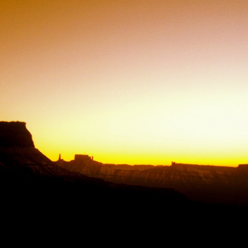
Fisher Tower sunset trail run (and the last time we would see the sun below 8,000 feet)
Day 2 (11/27)
Arches National Park~ Trail Runnin: Devils Garden Primitive Loop (we saw more arches than we could handle) & Delicate Arch
Day 3 (11/28)
Giving thanks for mountains in the snowy La Sals'
Day 4 (11/29)
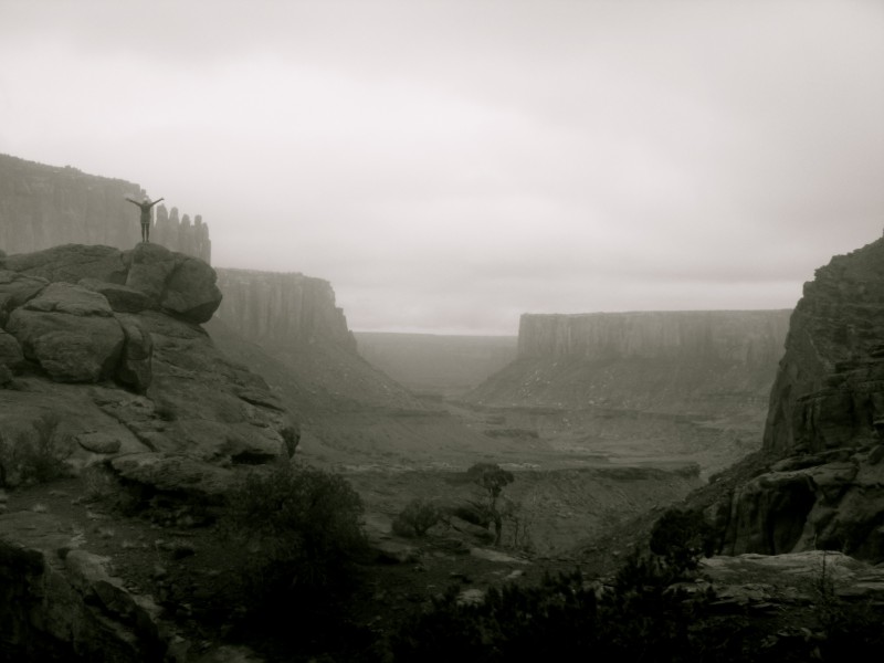
Canyonlands National Park~ Trail Runnin: Island In the Sky, Syncline Loop (potentially one of the coolest things I have ever done)
Day 5 (11/30)
Canyonlands National Park~ Trail Runnin: The Needles District, Chesler Park/Joint Trail/Devils Kitchen (with just the right amount of getting lost)
Day 6 (12/1)
Awesome breakfast, Trail run out to Morning Glory Arch and back, Moab--->Denver
The end of a fantastic trip.
Day 1:
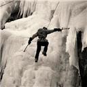
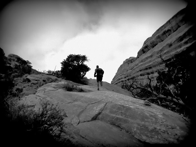
The trip began a healthy two hours behind schedule as we departed my apartment in Lakehood around 10:30 a.m. Even with Abe's senior citizen like driving skills it is not too far a drive to the Fisher Tower Trail Head off of Route 128 (road that goes into Moab, I would suggest this over 191). We were able to squeeze in a quick 4.5 mile out and back run through King Fisher and his tower friends as the sun set upon Moab for what may be the rest of eternity. It is mind bending that people climb those towers. Super super fun run that involved some ladders, scrambling, and a few "where the hell are we going?" moments, a trending theme for Utah trail running.
It was then time to hunker down for a comfortable nights sleep off of Onion Creek Road in Shea Hilton Tacoma, no membership card needed. Abe pulled a pimp my ride and we had a shelf for cooking and storage and a futon mattress for sleeping. It really solidified my hatred for tents.
Day 2:
This is not the part of the trip report where I adorn cold, wet, moist, misty, muddy, foggy confusion type weather. I love the sun and its rays of vitamin D. Simply stated: It was really hard for me to get out of my sleeping bag on Wednesday morning. Abe on the other hand likes freezing his face off. But with trail to run as motivation I emerged and we headed to Arches National Park.
I did not for one second miss the HOARDS of people summer time draws to national parks. We chose to trail run Devils Garden. If you like arches this place is the jam. We saw seven plus a bonus phallus named Dark Angel. If you have ever traveled to Utah you have made a mental 6th grade joke about the rock formations that protrude from the ground. Well I made an out loud joke and taught Abe what the word phallus means. It was time for my first taste of Utah trail running and all I have got to say is Utah don't give a.......... Whether you are a seasoned trail god or a run of the mill tourist wearing Uggs these trails are confusing, require scrambling, route finding, and demand attention as a wrong turn can lead you right off a phallus or deep into the desert where everything looks exactly the same.
Tunnel Arch
We started at the Devils Garden TH and made our way down to the Devils Garden Primitive Loop Trailhead where we chose to go right, opposite of traffic (couterclockwise). I was happy with our choice because most of the fun scrambling was up, not down. And by fun scrambling I mean smooth, rounded, vertical slick rock with some exposure and no hand holds. There were times I had to power sprint at the rock and hope momentum and leg strength was on my side. We soon came across an ice-water hole that I could not cross. After trying everything I took my shoes and socks off and waded through the freezing cold water. A German man followed my lead while Abe pulled some ninja moves over the slick rock. Our journey continued as we ran into a male/female trail running duo from Boulder who told us the rock is normally very sticky but the 6.5 inches of snow (more up high) the Moab area received right before we came really changed the landscape. We ran an out and back to Private Arch with them.
The Ice-water hole. Anything involving cold water and I crumble under the pressure.
Private Arch
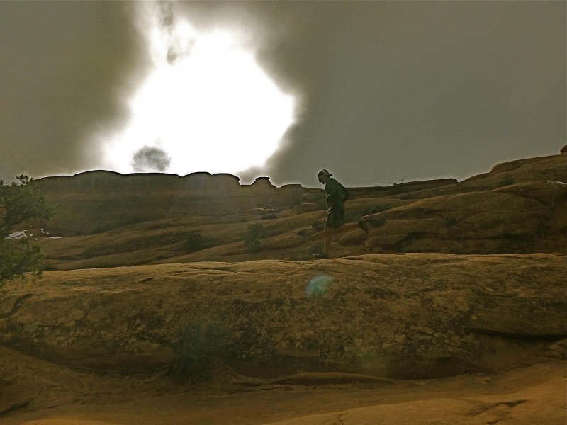
The clouds devouring the sun.
I'm really deep because I don't look at the camera.
Dark Phallus...I mean Angel
Partition Arch
We came across a rock that looked like a shark fin and I screamed out "I'm a landshark, I'm a landshark!!" I think this is the moment Abe realized the full potential of my weirdness.
Whatchoo know bout a land shark (taken on a different day)
Abe and I were giddy nerdy losers, running through mud, snow, puddles, up slick rock, down slick rock, and pointing out all the cool stuff we saw. It was an awesome run and tallied up to be around 10 miles by the time we were done goofing off. We ended up seeing Private Arch, Dark Angel, Double O Arch, Navajo Arch, Partition Arch (my favorite), Landscape Arch (Abe's favorite), Pine Arch, and Tunnel Arch.
Action Shots
Landscape Arch
But were we done for the day? Psh, of course not.
On the way out of Arches we stopped at Delicate Arch and ran the 3 mile out and back. The 1.5 miles to the arch packs a bit of gain on some fun rock. Also Delicate Arch is stunning. Also also people look at you weird when you run.
Delicate Arch
The days run short in almost winter and before we knew it our world had gone dark. We headed towards base camp a.k.a City Market downtown Moab and conferred about which of the La Sals we would climb and how we would approach them. I followed Abe around City Market eating a cilantro lime rice and bean burrito like a zombie, moaning that it was the most amazing thing I had ever tasted. Base camp was a flurry of activity on thanksgiving eve and we were ready to make moves in the snow capped La Sal range. Awkwardly we prepped our mountain gear in the parking lot and prepared our thanksgiving feast which consisted of apples, cuties, granola bars, fruit snacks, banana chips, and trail mix cookies I had baked back home.
Our plan was to attempt to grab as many of the southern peaks as we could. We had no route, no road directions, and no idea how much snow was actually up there. What we did have was a map, two brains, and a federal government website full of lies. We took 191 south out of Moab and made a left somewhere near Ken's Lake, we then made a right on to La Sal Mtn Loop Rd., and eventually another right on to Geyser Pass Rd. We weaved our way through some nasty fog until we were above the clouds that were socking in the Moab area. Following the governments directions to the winter trailhead we clocked mileage and came up four miles short. Abe made several failed attempts to barrel down a VERY snowy road in the Tacoma before we decided to sleep in a large plowed out area and snow shoe in the extra miles. It was around this time we noticed a large bulletin board that read Geyser Pass Winter Trail Head (where we needed to be). It was also around this time that Abe ran over my 3 gallon recycled plastic water container.....that was full of our water supply for the trip. I mourned its loss for a moment and we moved on to making dinner and setting alarms for 4:20 a.m.
Day 3: 8.5 miles
3,500 feet of elevation gain
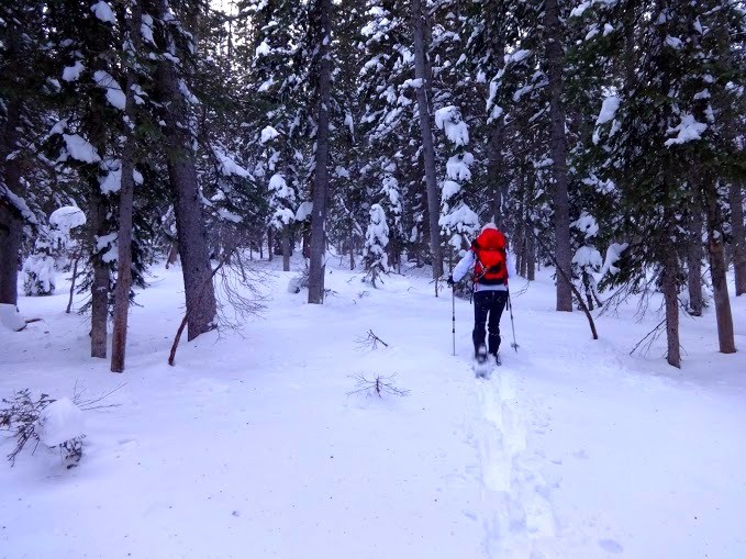
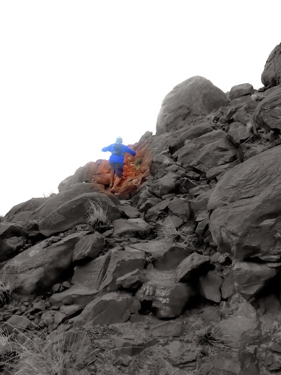
Up and at em' by 5:15 a.m. I had super annoying poles with snow baskets in my hands and snowshoes strapped to my feet for the very first time in my life, strapped on to the wrong feet, the entire way up, yes there is a right and left snowshoe, lesson learned. We followed the cold, silent, dark, snowy road into a still forest. My snowshoes made noises that resembled a small purse dog. I could not decide if I was hallucinating or if there was a chiwawa following me. We had slept around 8,990 feet and decided that we would turn right or southeast off of the road around 10,289 feet and begin to break trail up the Northwest slopes of Mount Mellenthin. And trail we broke! Another first. I made sure to break on through to the other side as much as Abe did. The newspaper had said that the La Sal Mountains had received 25-32 new inches of snow, I concur. Breaking trail is a lot of work so I am probably going to start poaching trenches throughout the winter. Abe told me that 14ers members really like that and I want to be popular so.....be ready, I will be hiding behind trees all winter long.
Bands that start with an X besides the band X...
We passed the time by playing the alphabet game with bands until we emerged from tree line around 11,200 feet. We skirted a potential avy slope and continued to the base of Mellenthin's north ridge. On the dark side of the mountain the wind whipped strong. Abe called it "normal wind", whatever the hell that means, I couldn't hear myself think.
The Route from tree line (summit not in photo)
We decided to keep our snowshoes on and use the somewhat decent snow of the wind whipped north ridge over the semi-covered talus to our right. Newbie with snowshoes on a steep snow slope, whaaaa...actually everything was going fine until this conversation took place:
Abe: "Are you scared?"
Me: "Nope, why should I be?"
Abe: "I would almost say this is ice axe territory for you."
Me: "Why?"
Abe: "Don't look behind you, it's a steep slope. Probably about 40 degrees."
I was excited to be on a steep slope man handling the hell out of some snowshoes slapped on the wrong feet in junction with awkward cheap summer poles with two dollar snow baskets tediously attached. This is what it's all about.
Eventually we reached the point where the shoes had to come off and it was time to do some minor rock scrambling. Having already vetoed Mount Tukuhnikivatz we sat down and had a heart to heart about whether or not Mount Peale was really in the cards. It wasn't a decision of whether or not we could get Peale, it was a decision between getting back to the truck around 9 p.m. vs. 4 p.m. The ridge from Mellenthin to Peale is quite long and there was a lot of snow. We considered stashing our snowshoes, heading only for the summit of Mellenthin and then retreating a way that Abe had already been eyeing up. In the end we strapped the sloshoes to our packs and headed for the summit of Mellenthin no closer to a decision.
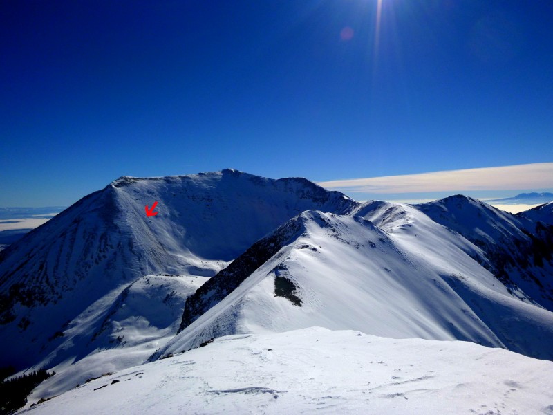
Mount Tukuhnikivatz is the prominent peak just off center to the right and Tuk NO is to its right.
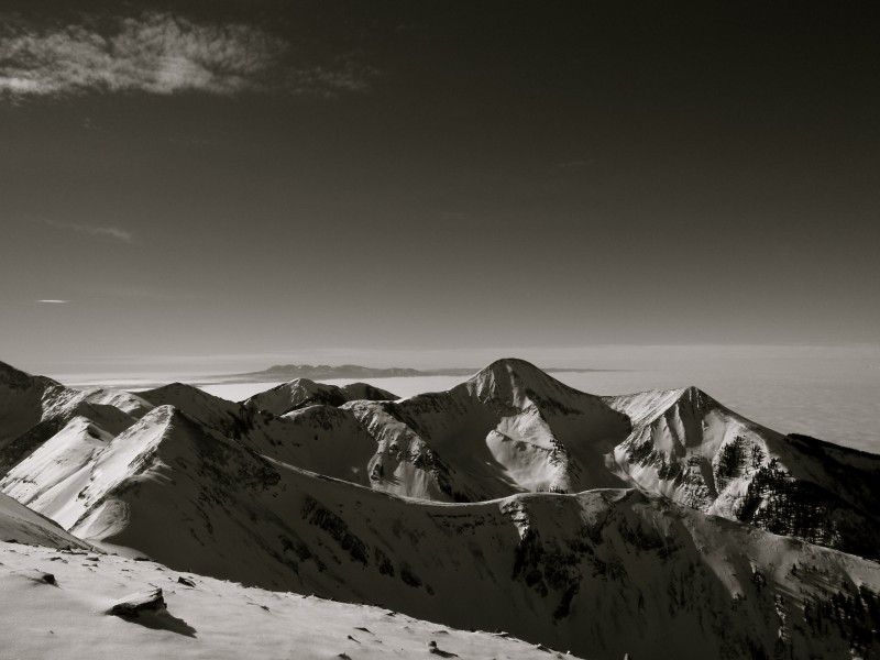
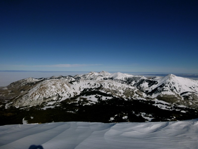
Looking towards the Northern La Sals we got Haystack Mountain, Manns Peak, and Mount Tomaski.
After a somewhat pathetic battle to overcome minor scrambling with the giant winter pack I may never get used to we were on the summit ridge. The snow makes everything more interesting and more beautiful.
Summit Mount Mellenthin, Happy Thanksgiving!
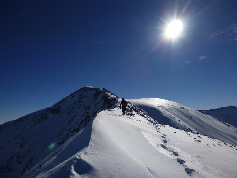
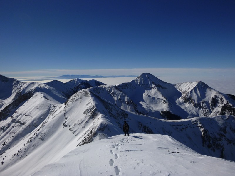
From the summit we were still indecisive about Peale so we continued off of Melenthin's south ridge towards Mount Laurel. In the summer this would be a deadly nightmare of steep talus/scree but with plenty of snow it felt like I was walking down a staircase made of marshmallows.
Mount Laurel is the peak in the foreground right of center. Mount Peale is the peak in the background left of center.
Free from snowshoes we post-holed our way to the summit of Mount Laurel. There were two short steep sections that were a little creepy without the shoes on. The "normal" wind had now been upgraded on the terror scale to "annoying" by Abe.
Summit Mount Laurel
Big Slide.
Failed attempt at goggle reflection instagram hipster shot.
The time was wuss-out thirty and we blew kisses goodbye to Mount Peale as we headed down the west ridge of Mount Laurel. There were many reasons we didn't go for it but mostly because base camp closed at 4 p.m. and I couldn't stop fantasizing about the burrito from thanksgiving eve, I had to have another. We came to the summit of Pre Laurel where a man had built a weather station. I opened its box and that is where we learned that Mount Laurel and the hump we were standing on actually had names.
Pre Laurel weather station
About 100 feet off the summit of Pre Laurel the snowshoes went back on, the correct feet this time. Turns out that didn't make a difference as I tripped, slipped, and tried to ski back down to the truck. We saw a few skiers and one even knew how to pronounce the mountain that begins with a T, showoff. We made it back to the truck by 3 p.m. and dicked around just long enough to make it to base camp 3 minutes after closing. My first time hikeclimbaneering (because I don't know what to call it without offending someone) outside the state of Colorado was pretty darn fun
Mount Tukuhnikivatz and Tuk No
Above the clouds
While I was on the phone wishing my father a happy thanksgiving Abe made the executive decision to head towards the Canyonlands Island in the Sky district. After barreling past a questionable utilities building the road abruptly turned to dirt and we were surrounded by junk yards so of course I started singing "we're on a road to no where." Abe asked me to consult the map and I confirmed that 279 does NOT go to Canyonlands and it was 313 we needed. We turned around but ended up staying over night off of 279 in an area called Long Canyon.
Day 4 11.5 miles
3,000 feet elevation gain
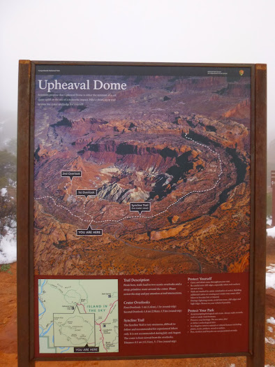
It was time to run again and this was my favorite day of the trip. If you ever find yourself in the Moab area the Syncline Loop around Upheaval Dome in the Island in the Sky district of Canyonlands is a must do. The weather was terrible and there were signs everywhere warning us we would get lost and fall off a phallus but on we ran. Supposedly this is the trail more hikers get lost on than any other trail in Canyonlands. We again went right or counterclockwise around the loop.
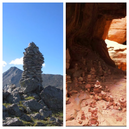
Battle of the cairns!........Colorado vs. Utah........Colorado's are bigger but Utah has a bazillion more and when you are running in a cloud on slick rock where there is no trail those little bastards are your savior. There are so many opportunities to lose your way and spotting the cairn became a game. As well, there is something called a desert crust which is hugely important in housing cyanobacteria (something awesome) and it is kind of important you keep trampling it to a minimum.
Running in the clouds.
As we descended we dropped below the cloud cover.
We came to a long section of scrambling with an expansive view.
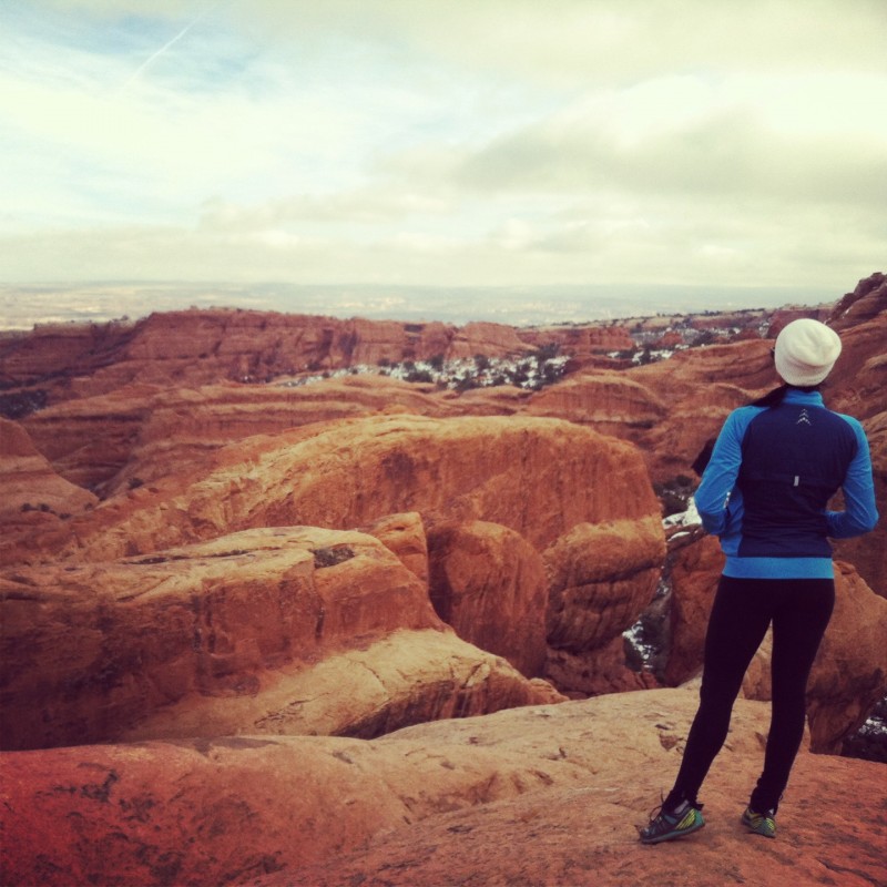
Feeling great we came to the out and back that ventured in to the massive crater we were running around. Abe took off in full sprint mode and I jogged in (not all the way) and took some pictures. I know, I know....it's shocking that Abe is a stronger runner than me
A creepy crater
The next section of trail was especially confusing but led us to Abe's favorite climb ever, of all time. He asked me to mention that. Exactly like that. There was a 1,300 foot gain in 1.55 miles. This is the moment I realized it never gets easier I just get stronger. What a good feeling. I powered through it with little to no anguish.
I am small.
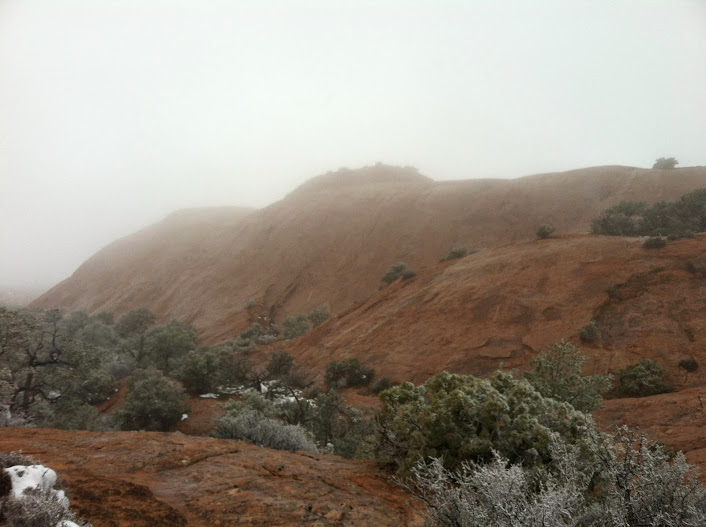
And then we were back in the cloud and it was snowing. The snow on the red rock is stunning by the way.
Abe's tree
A desert pothole
On the way out we passed whale rock. My best friend in the whole world is a crazy whale rights activist nut job and wants to burn Sea World to the ground so it was only appropriate that I ran whale rock. It was a one mile out and back and took us 10 minutes even though the sign told us to expect a 2 hour turn around. We could not see anything but that was becoming the norm.
Whale Rock yo
We were not quite through being awesome and I led a mini yoga class in the mucky parking lot before we headed back towards Moab to do something truly spectacular.....SHOWER There are many places to shower in Utah if you are dirtbagging it. We settled on the Moab Recreation & Aquatics Center on Park Ave. Ahhh 4$ shower of hot steamy goodness. I'm not a big water waster but I could have stayed in there all night long.
After I made myself look like a presentable female we went to base camp where we both ate five star burritos as we shopped for the bare necessities; kale, popcorn, and chocolate. Next on our to do list was to make the empty beer growler turn into a full beer growler and since these things don't happen on their own we battled our way through the masses at the Moab Brewery.
Having refreshed our lives in more ways than one we headed towards 211 which would drop us in The Needles district of the Canyonlands. It would have behooved us to go directly from the La Sal Mountains to The Needles but since we didn't study the roads hard enough we learned how to most efficiently approach things on our next trip. We ended up sleeping off of 191 (after traveling a ways south) down some sketch road where I felt we were being watched. Abe assured me he had a murder knife and knew how to use it.
Day 5: 14.0 miles
2,900 feet of elevation gain
My suspicions were validated when we emerged from the truck early Saturday morning and two horses were curiously investigating our rolling home. Realizing we were most likely on private property we hightailed it out of there and ended up regrouping at Newspaper Rock in the Indian Creek area. This trip report would not be complete unless I mention the ninja. I am an avid blender and begin every morning with an organic fresh fruit/veggie shake. Abe and I did very little planning for this trip but I had mentioned to him I would miss blending for the six days. When he informed me Shea Hilton Tacoma came equipped with an outlet I nearly shat my pants with excitement. My morning concoctions are my go-go juice and life without them lacks luster. We had delicious shakes every morning and this morning was no different....only it was because we blew a fuse and broke the ninja.
The Ninja
Home Sweet Home
Refusing to believe the blender was broken we moved on to The Needles visitor center where we asked the park ranger if we could try an outlet at their facility. She allowed us to use an outdoor one. Ya, the blender was really broken. So coconut water, vegan protein powder, chia seeds, 2 bananas, an apple, nearly an entire bundle of kale, some chard, broccoli stems, and lime went down the toilet. There are few things in this life that bring a tear to my eye, wasted vegetables gets me every time.
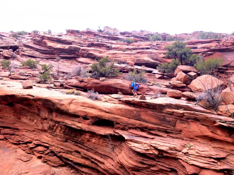
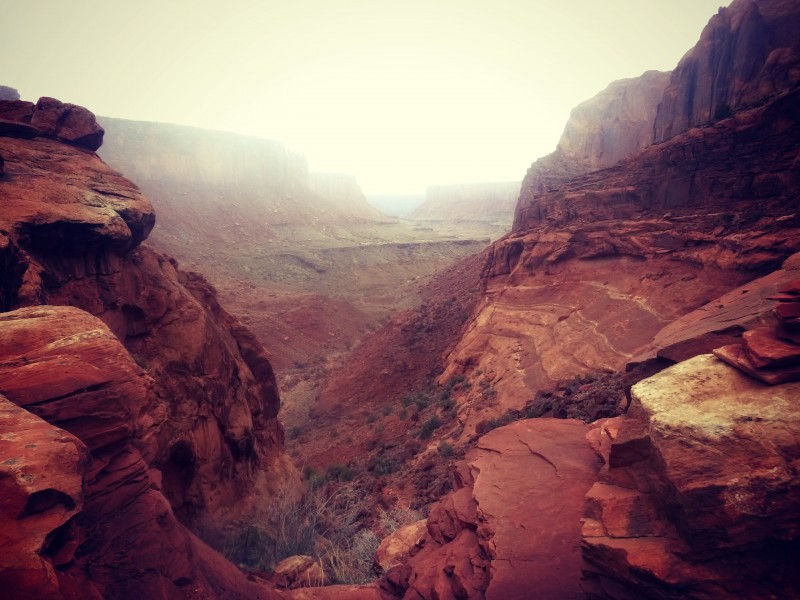
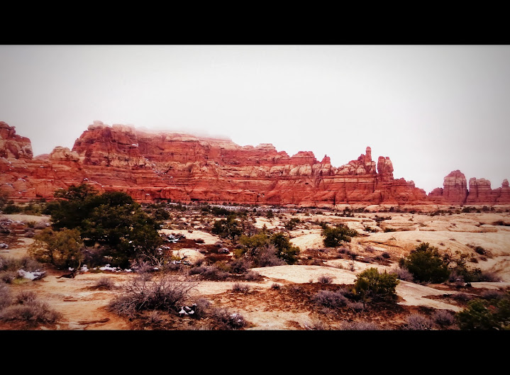
Putting the morning tragedies behind us we headed towards the Elephant Hill trail head where we counted sixteen Colorado license plates. This trailhead is down a dirt road and accesses long and isolated trails. When I return this area is first on my to do list. We chose to run the Chesler Park/Joint Trail loop to Druid Arch but a piss poor call on my part took us to Devils Kitchen instead. Either way it was a really sweet run with some optional scrambles.
The run began with a long, steep climb and led to a short scramble with a nice view.
There were narrow slots to run through.
On we ran through snow, mud, and rock past Utah trail signs of confusion to outrageous overlooks.
Next we came to Joint Trail. It is not very long but it is quite entertaining. There are ladders, narrow hallways, and at the end a cave like area with 18 billion cairns.
Joint trail dumped us into the primitive Chesler Park TH area where we continued running on Devils Lane (a 4wd jeep road) right past the turn off for Devils Garden. I am pretty terrible at running road and running flats so it was only a matter of time before I started questioning everything and we realized we had over shot. We turned around and the turn off was much easier to spot coming from the opposite direction. Back on track the fun continued.
We came to a foot wide crack in the rock and Abe stepped up all evil knievel like and jumped it. Kids don't try this at home it is pretty serious stuff.
I really wish I was not in this shot.
I'm not expecting to grow flowers in a desert but I can live and breathe and see the sun in wintertime.
And then it was over and we headed back towards Moab to shop for stickers. We found a radio station that played 5 of my favorite rock songs in a row and then a spanish christmas song. Weirdest. Station. Ever. We stayed right outside of Moab and picked an area that was a flurry of ATV activity.
Day 6:
The last day of our holiday week running fiasco had arrived. I don't like when fun things come to an end and it is time hold hands with responsibility again. I had found a breakfast place called The Love Muffin and lucky for us they were open and we sat down to breakfast around 7:30 a.m. Vegan waffles with fresh fruit, vegan muffins, hot tea, and some warm quinoa agave nectar walnut soymilk deliciousness took the place of my normal shake. With ten pounds of food sitting in our stomachs we set out to run a 4.5 mile out and back to Morning Glory Arch via the Negro Bill TH off of 128 the road out of Moab and then it was time to battle I-70 traffic.
Cactus Alley
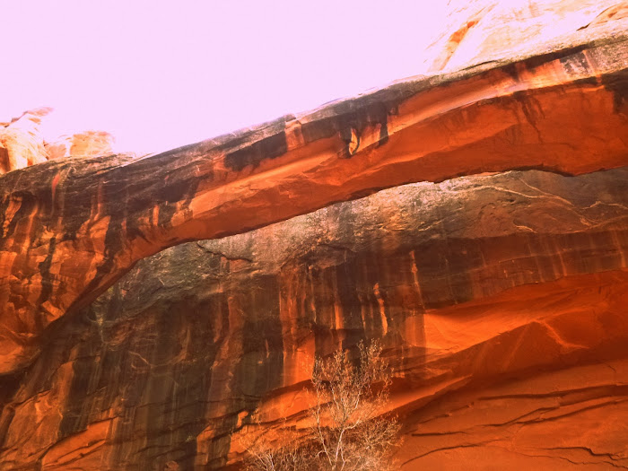
Morning Glory Arch (6th largest natural bridge span in US)
Abe and I had bickered about taking pictures of signs, with signs, signs in general for most of the trip. I like signs because they help me to organize photos and they are informative, he thinks they are pretty stupid. Good thing I made an effort not to care at all and got him to take my dream sign photo, "Welcome to Colorful Colorado" where people apparently need to crap so bad they pull over and can't even make it to a shrubish area. The green arrow is pointing to a massive dump! Gross man. I know there have been plenty of shitastic incidences in the mountains but now we have solid or not so solid proof that this phenomena extends all the way to state line.
What a great trip, great company, and we almost completely ignored thanksgiving. I LOVE Utah and would like to live in the Moab area for 2 months at some point in my life. My hopes are this TR may help those planning a trip to the Moab area or you at least enjoyed the photos and procrastinated some. Thanks for reading
"I run because long after my footprints fade away, maybe I will have inspired a few to reject the easy path, hit the trails, put one foot in front of the other, and come to the same conclusion I did: I run because it always takes me where I want to go." ~Dean Karnazes
Thumbnails for uploaded photos (click to open slideshow):
Even one corner of Utah is the kind of place you could spend a lifetime exploring...some of my fondest memories are from trips to the greater Moab area! Looks like you guys had an awesome time :D
death clouds, takin an hour to drink a liter of water and the incessant goobering... wont ever forget this one!
You captured the best moments of the trip and also the "everyday" moments that truly make the journey better than the destination. Let do it again, yo! :)
Second the notion on the trippy pics, they are sweet! Oh, and nice Morrison analogy.
Not only was I in Moab enjoying the gloomy weather at the same time as you, I was also in the Moab Brewery the same evening.....AND.....I was in the Love Muffin sitting at a table near you chowing down on my yummy breakfast. I remember walking in and seeing that awesome looking waffle and wishing it were gluten free. The Love Muffin is one of my favorite places in town. I had no idea it was you and Abe. I was the one wearing obnoxious lime green compression socks and mountain biking attire (yup, it was a cold ride)... :D
You guys worked in some fantastic loops and areas. Nice pics showin' it all too. Joint trail looks worthy of a gander at some point. Bummed you couldn't join us. A few neck deep frigid pools to flop through followed by time-consuming rappel setups.
The Love Muffin spot looks pretty good. We've been hitting the breakfast place in McStiff's Plaza; not all that great. Haven't found a good dinner spot in Moab either. The grocery store is probably the best option.
Dude, this whole TR makes me question what the hell I'm doing with my life. I AM BEYOND JEALOUS. You know what I did for Thanksgiving? NOTHING. I was sick all week then gorged myself like a disgusting American. Blah. I am in physical pain looking at the beauty of your pictures and knowing I WASN'T THERE! haha Seriously, let's plan a summer Moab trip. I am obsessed.... I must see it for myself!! Such a great report. Again, you are my hero, my love, my other mountaineering half (in a non lesbo way). I can't WAIT for snowboarding!!! You are inspiring, my lady!
There must have been some weird cloud inversion from all the snow that Utah got a few days before. It was quite a bit sunnier and drier at lower elevation where we were (UT/AZ border) but heading north/east from Escalante on your Day 6 it was mostly cloud cover. Very strange!
Caution: The information contained in this report may not be accurate and should not be the only resource used in preparation for your climb. Failure to have the necessary experience, physical conditioning, supplies or equipment can result in injury or death. 14ers.com and the author(s) of this report provide no warranties, either express or implied, that the information provided is accurate or reliable. By using the information provided, you agree to indemnify and hold harmless 14ers.com and the report author(s) with respect to any claims and demands against them, including any attorney fees and expenses. Please read the 14ers.com Safety and Disclaimer pages for more information.
Please respect private property: 14ers.com supports the rights of private landowners to determine how and by whom their land will be used. In Colorado, it is your responsibility to determine if land is private and to obtain the appropriate permission before entering the property.


")
")
 Tunnel Arch")
 The Ice-water hole. Anything involving cold water and I crumble under the pressure.")
 The clouds devouring the sun.")
 I'm really deep because I don't look at the camera.")
 Dark Phallus...I mean Angel")
")
 Landscape Arch")
")
 Delicate Arch")
 Bands that start with an X besides the band X...")
")
 The Route from tree line (summit not in photo)")
 Mount Tukuhnikivatz is the prominent peak just off center to the right and Tuk NO is to its right.")
")
 Looking towards the Northern La Sals we got Haystack Mountain, Manns Peak, and Mount Tomaski.")
 Summit Mount Mellenthin, Happy Thanksgiving!")
")
 Mount Laurel is the peak in the foreground right of center. Mount Peale is the peak in the background left of center.")
 Big Slide.")
 Failed attempt at goggle reflection instagram hipster shot.")
")
")
")
 I am small.")
")
")
")
")