| Report Type | Full |
| Peak(s) |
Unnamed 13171 - 13,171 feet Unnamed 13232 - 13,232 feet |
| Date Posted | 11/27/2013 |
| Date Climbed | 08/22/2013 |
| Author | docjohn |
| Part 1, Weminuche Wilderness West Ute Creek Walk |
|---|
|
Distance: 16.2 mi Elevation gained: 7020 ft  Summer hiking was meager because of the early wild fires, then the outrageous rains. I thought I had a window in August and tooled on over to Silverton, getting over Stormy Pass quickly to the trailhead southeast of Bear Creek. The plan was to pack over Starvation Pass, 12702 ft., and drop down and south to West Ute Lake. There I would establish a camp, spending a few days hiking the Ute Creek area, maybe even a short trip over to Rock Lake and the Oso group. This plan was no different in its outcome from my earlier hikes this summer: from the getgo modifications were in order. The pack over the pass went well, the trail well known from my previous trips to Ute Benchmark, and the two unnamed thirteens bookending the pass.   Rain to the north at 10:30 AM and suspect conditions to the south led me to make a camp a mile sooner than expected, near a small tarn at 12000, well away from the well used trail.. As usual rain interrupted me and I made camp in wet conditions. So far zero for two of my goals. A few hours later everything dried up, I ate and bedded down. Then the rabbits began to cavort about my tent. More later. I woke to the usual monsoon morning, clear and warm.  Off I went bushwacking a course over to West Ute Lake, through wet alder and soggy tundra, bashing through a few downed tress. I eventually reached the trail at the lake, using up a good half hour of light, gaining five pounds of water in my boots, by not using the established trail (I didn't want to lose then gain 600+ feet). I passed a noisy group of ten camped at the lake, glad I only had to deal with quiet frolicking rabbits at my camp.   After draining my boots I stayed on the trail up and south, then wandered west up the east ridge of 13169. 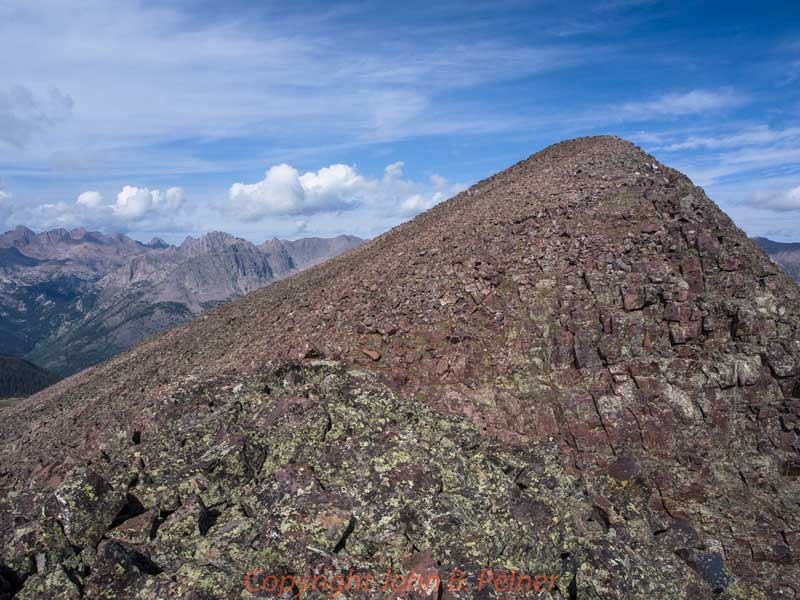 The walk to the summit was straightforward over blocky rocks, the views of the Oso, Sunlight and Jagged groups filling the horizon. Along with the views of clouds popping all around me. 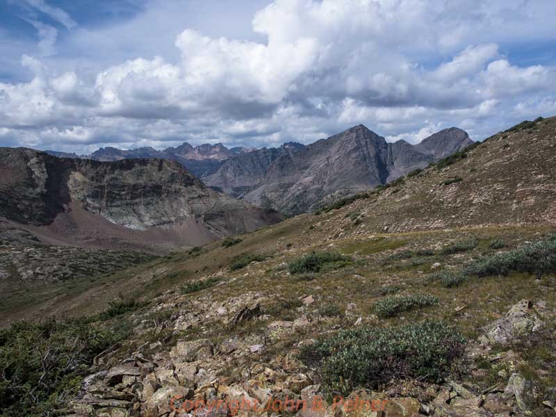 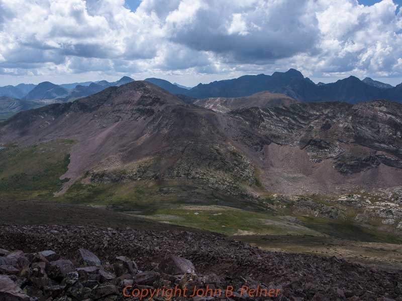 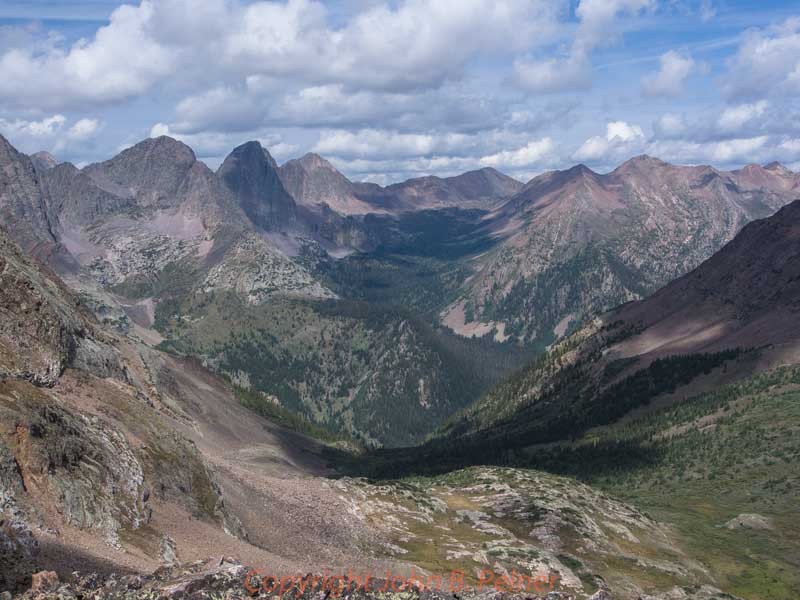 I moved along, descent to the 12180 pass west of Ute Lake going well, with some scree around a steeper band on the north. There I changed the plan for the day. I wanted to skirt over to Mt. Nebo (great name) then down and up to the 13230, over to the 13110. Ahh, but for the weather! So up the easy slopes, north then northwest to the summit of 13230. The view into Stormy Gulch was stupendous and the amazonite green of Nebo Lake below me lured me into dreams of a swim at 12400 ft. 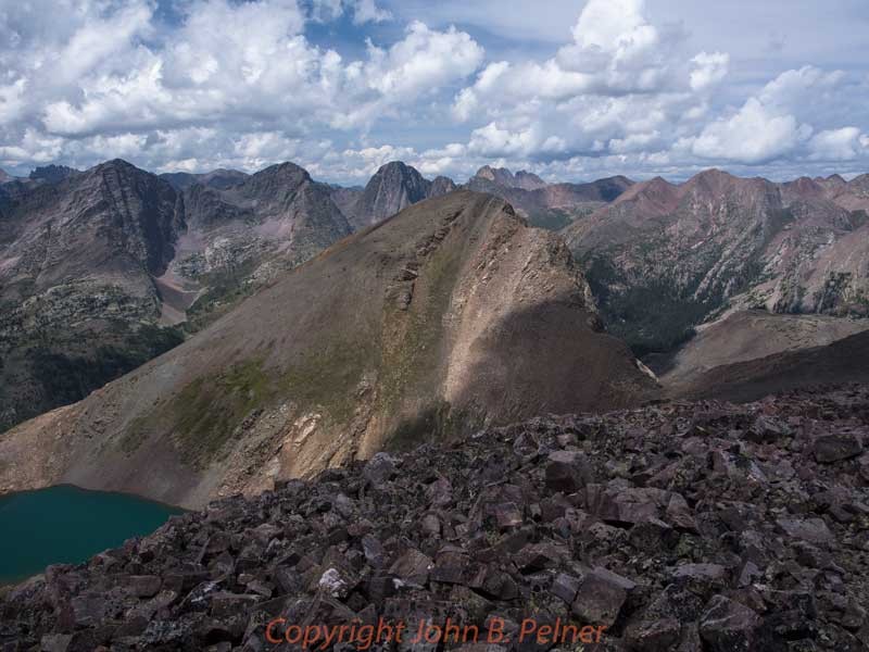 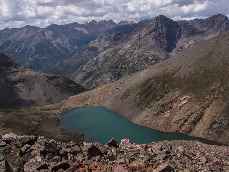  The descent off 13220 was to the northwest over a near thirteen point then down north, with some easy third class through two cliff bands. At Nebo Pass, I sat, ate and took in the island lake situated at the base of Nebo's cliffs.  The way back to camp, crossing the Continental Divide Trail, past a 12326 lake, was easy, sauntering along the elk trails. Rain began about one hour later. A typical monsoon afternoon, the rain stopped late afternoon.  I ate, took pictures of the clouds and read. My plan was to hike the 13110, cross over to Mt. Nebo and return, maybe cut loose to pack back over Starvation Pass. Plans of a foray south to the Rock Lake area aborted. 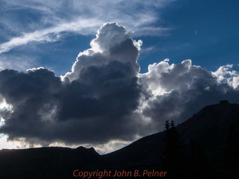 I almost fell asleep at twilight, when the rabbits started in. Two of the cute furry creatures kept trying to get into my one man tent. I don't know why: the food and trash were hanging from a distant tree limb, it was warm outside and the only thing inside smelled bad. This nonsense went on until full dark, the rabbits continuing to push against the tent walls. Finally they left and I slept, occasionally waking to the soft sounds of rain sprinkling the camp. (Continues to Part 2) Thumbnails for uploaded photos (click to open slideshow):  Rain over Pole Creek Mountain Starvation Gulch")
")
 Rio Grande Pyramid")
 West Ute Lake 13169")
 West Ute Lake 13308 13342")
 West Ute Lake 13308 13342 Ute Ridge")
 Summit Slope 13169")
 The View up Stormy Gulch")
 Sunlight Group Vallecito Mountain")
 13169 Mount Oso")
 Grenadier Range Mt Nebo from summit 13230")
 Sunlight Group Nebo Lake Vallecito Mountain")
 Descent North Slopes 13230")
 Mt. Silex Storm King Peak 12300 Lake")
 Camp Hidden in Alders")
 Evening Clouds")
|
| Comments or Questions | |||
|---|---|---|---|
|
Caution: The information contained in this report may not be accurate and should not be the only resource used in preparation for your climb. Failure to have the necessary experience, physical conditioning, supplies or equipment can result in injury or death. 14ers.com and the author(s) of this report provide no warranties, either express or implied, that the information provided is accurate or reliable. By using the information provided, you agree to indemnify and hold harmless 14ers.com and the report author(s) with respect to any claims and demands against them, including any attorney fees and expenses. Please read the 14ers.com Safety and Disclaimer pages for more information.
Please respect private property: 14ers.com supports the rights of private landowners to determine how and by whom their land will be used. In Colorado, it is your responsibility to determine if land is private and to obtain the appropriate permission before entering the property.


