Download Agreement, Release, and Acknowledgement of Risk:
You (the person requesting this file download) fully understand mountain climbing ("Activity") involves risks and dangers of serious bodily injury, including permanent disability, paralysis, and death ("Risks") and you fully accept and assume all such risks and all responsibility for losses, costs, and damages you incur as a result of your participation in this Activity.
You acknowledge that information in the file you have chosen to download may not be accurate and may contain errors. You agree to assume all risks when using this information and agree to release and discharge 14ers.com, 14ers Inc. and the author(s) of such information (collectively, the "Released Parties").
You hereby discharge the Released Parties from all damages, actions, claims and liabilities of any nature, specifically including, but not limited to, damages, actions, claims and liabilities arising from or related to the negligence of the Released Parties. You further agree to indemnify, hold harmless and defend 14ers.com, 14ers Inc. and each of the other Released Parties from and against any loss, damage, liability and expense, including costs and attorney fees, incurred by 14ers.com, 14ers Inc. or any of the other Released Parties as a result of you using information provided on the 14ers.com or 14ers Inc. websites.
You have read this agreement, fully understand its terms and intend it to be a complete and unconditional release of all liability to the greatest extent allowed by law and agree that if any portion of this agreement is held to be invalid the balance, notwithstanding, shall continue in full force and effect.
By clicking "OK" you agree to these terms. If you DO NOT agree, click "Cancel"...
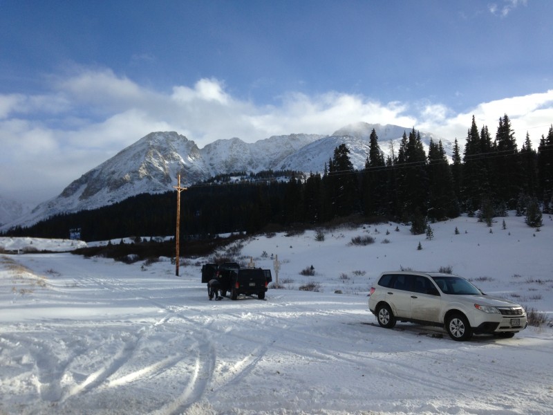
TH/Route: Turn-out near Climax Mine, North Ridge Climbers: Jed, Ryan, Jim, Caitlin, Jack-dog, Harley Distance/Elev: 5.2mi, 2750' elev gain Time: 7hrs
You Don't Know Unless You Go
With a day pass from my very pregnant wife (Baby GIRL! Due Dec. 11!) I started looking for nearby hikes of cool peaks that would allow me to get back to Denver in a hurry if I got "The Call" that my wife was going into labor. Bard/Parnassus and Mt Arkansas made the shortlist and I quickly settled on Mt Arkansas' North Ridge; a very aesthetic ridge that I've admired every time I drive over Fremont Pass. Ryan and his fiance Caitlin signed on and Jim PM'd me about joining after I posted on the forum. We decided to meet at 7AM at the turnout below the Climax Mine. It appeared that this area hadn't gotten clobbered by the recent storms as nearby Copper Mtn had only received ~6" of snow.
As I drove up I-70 in the early morning hours what started out as light flurries near Evergreen turned into fairly heavy snow above G-Town with large plow trucks clearing the road. The forecast for the day was Mostly Cloudy w/ 1-3" of snow so I began thinking that this may my first climb that starts in clouds/snow, summits in the clouds and ends in the clouds; and caused me to doubt if this climb would even be worth the trip/effort.
Competing with that idea in my head was the experience I had when I climbed La Plata Peak. That time, it was snowing hard all the way to Dillon on I-70 and then by the time we got to Leadville there wasn't a cloud in the sky! Well, as I came down I-70 into Dillon this time the snow stopped and whadaya know, clear skies over the Tenmile Range! YES!
Riding the Razorback
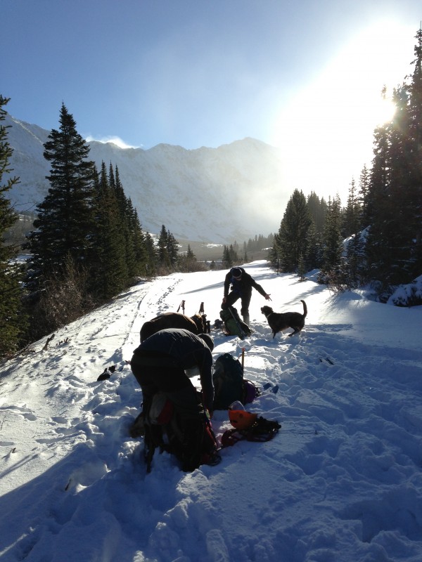
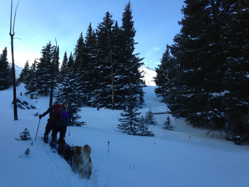
I arrived at the TH around 7:30am. Jim had already arrived and so we waited for Ryan, Caitlin and the dogz to arrive. We started up the snow covered road around 8:30am, and were able to follow some older tracks for 1/2mi or so and then stopped to put our snowshoes on.
Snowshoeing up!
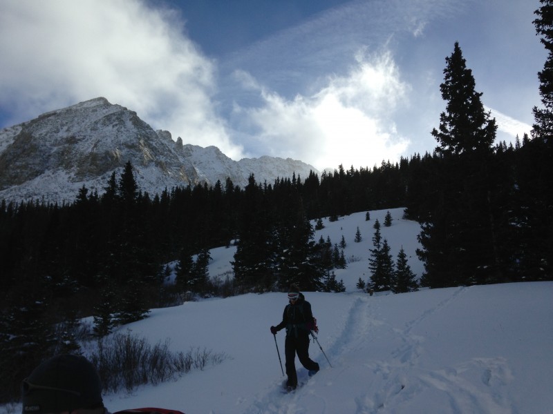
At 0.9mi we left the road and headed up through deep snow in the trees.
Breaking trail up the deep stuff w/ Arkansas' North Ridge seen through the trees
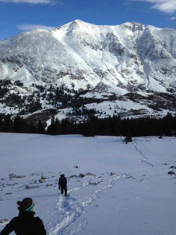
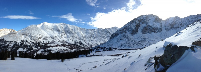
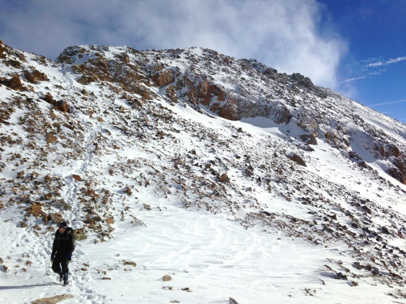
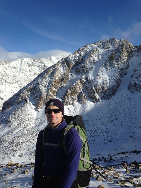
We rotated trail-breaking responsibilities and quickly gained the 500' to Arkansas' North Ridge. Here we ditched our snowshoes as the ridge was fairly windblown with rocks and tundra visible. Jim ditched his snowshoes about 50' too early and ended up postholing as he clawed his way up to where the rest of us stopped to take off our snowshoes. The views of McNamee, Traver, Democrat, and Arkansas' NE ridge were pretty spectacular from here.
Traver and McNamee towering across the valley while Jim postholes his way up to us.
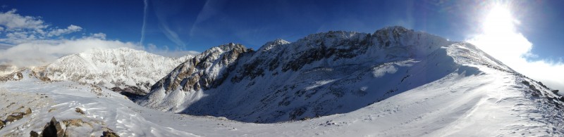
Panorama: Traver, McNamee, Democrat and Arkansas' NE Ridge
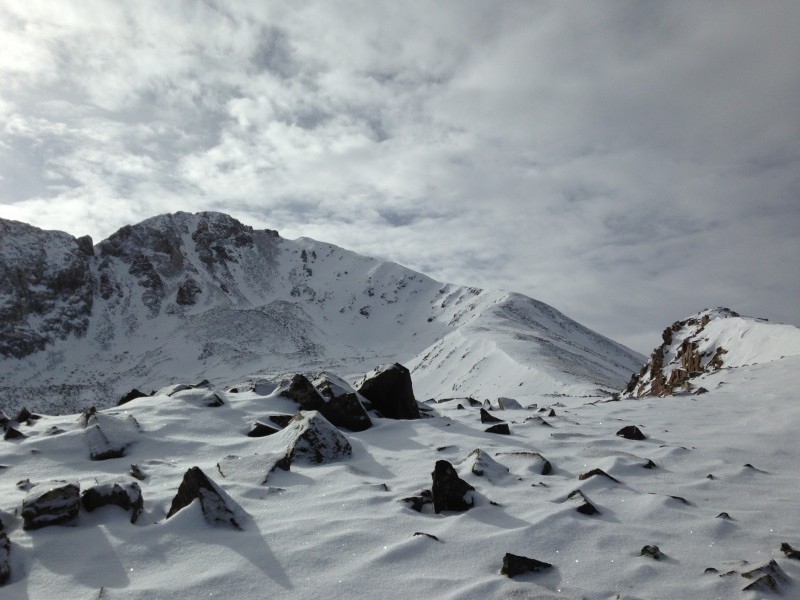
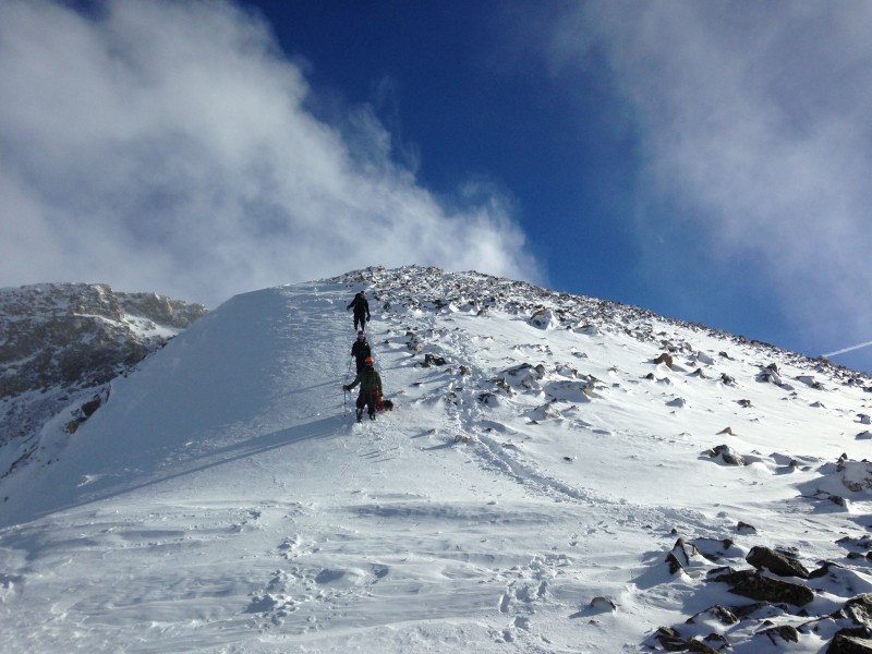
From there it was a quick and steep 500' grunt up to where the ridge leveled out and we could see most of the rest of our route on the North Ridge. The true summit is still hiding behind a couple of false summits. Also around here, the light breeze we had been enjoying quickly changed into a blustery/gusty mess. "Oh great, here begins the "fun"!" we all thought. So once we all got bundled up....the wind stopped, and the sun came back out for awhile.
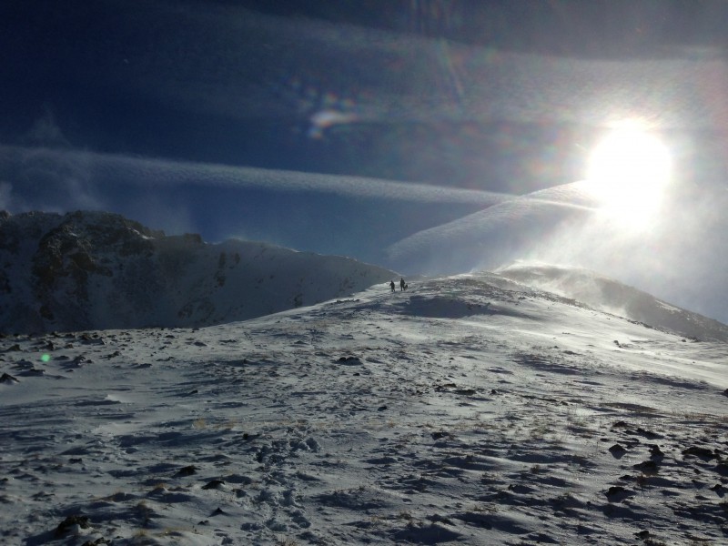
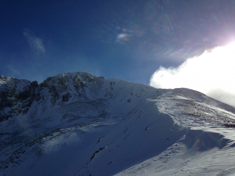
The gentle North Ridge of Arkansas. True summit is hidden
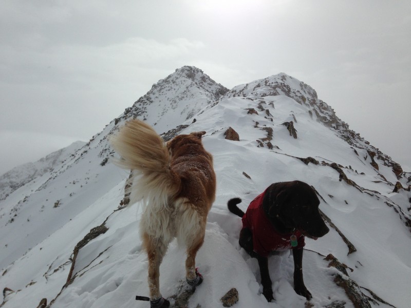
The nice easy grade on the North Ridge quickly lead us to where the ridge narrowed around 13,400' w/ the true summit still not visible.
Jack-dog, Harley on the narrow, aesthetic ridge. True summit still not visible.
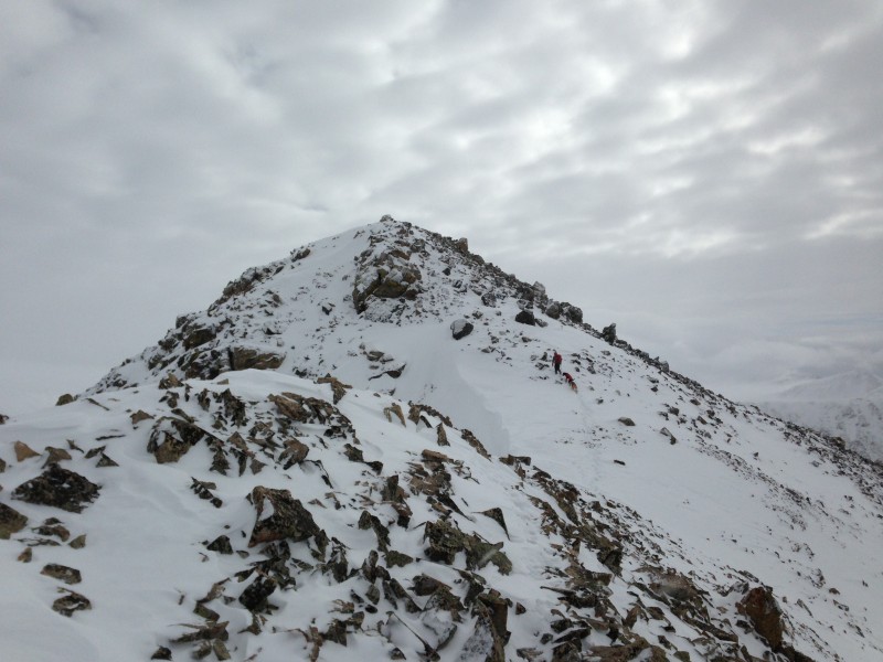
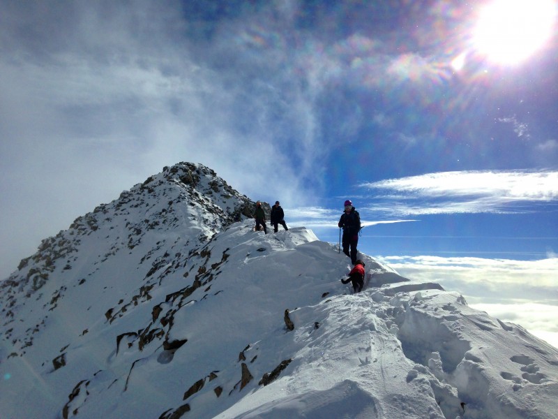
Following the narrow, snow-capped ridge we made it up to the last false summit and our first view of the true summit.
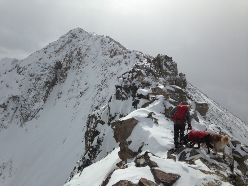
Spicy section of the North Ridge. We bypassed it on the right. True summit is visible.
Here the ridge narrowed even more and became Class 3 and a bit treacherous with the snow cover. So we descended down to the right of the ridge crest and followed a narrow series of ledges to bypass the difficulties. Jack-dog and Harley needed help and a spotter in a couple spots getting from deep snow up onto the rocks and where the ledges narrowed. The ridge finally broadened again and we climbed the final bit to the summit.
Ryan, Jack-dog, and Harley attack the final slope to the summit.
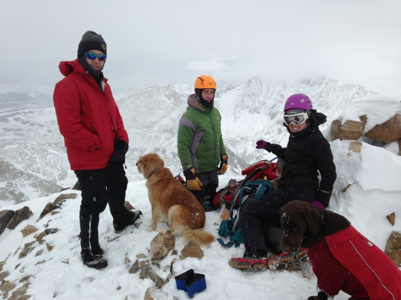
The wind was a bit chilly on the summit and the clouds covered the sun so we only stayed there for 30mins or so.
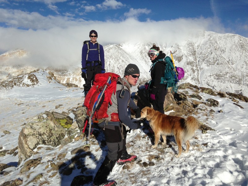
Crew on Mt Arkansas' 13,795' summit.
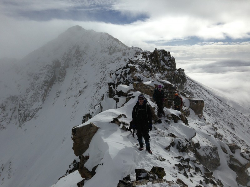
As we descended past the difficult section the sun was nice enough to reappear and the skies cleared up a bit. We were amazed all day that the surrounding mountains and valleys always seemed to have clouds draped over them but Arkansas never did. We definitely lucked out with the weather on this one.
Coming back down, just past the difficult section.
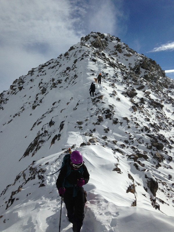
The narrow, snow-capped ridge, with steep drop-offs on both sides made it feel like we were on a lot "bigger" mountain than we were on.
Descending the ridge.
Narrow snow-capped ridge makes this peak feel extra "BIG"
Once we made it down to the broader portion of the North Ridge it was a very enjoyable stroll the rest of the way down as we took our time and soaked in the fantastic views that surrounded us.
Jim (Yikes) reaching the gentle portion of the ridge.
Looking down the North Ridge.
Group enjoying the plunge-stepping descent.
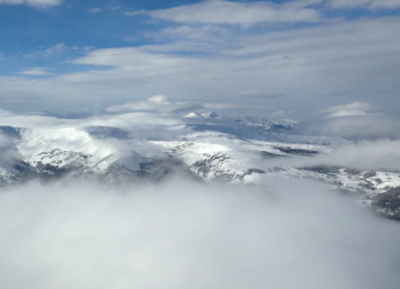
We even got some views of Mt of the Holy Cross in distance peeking through between the layers of clouds.
Mt of the Holy Cross visible in distance between layers of clouds.
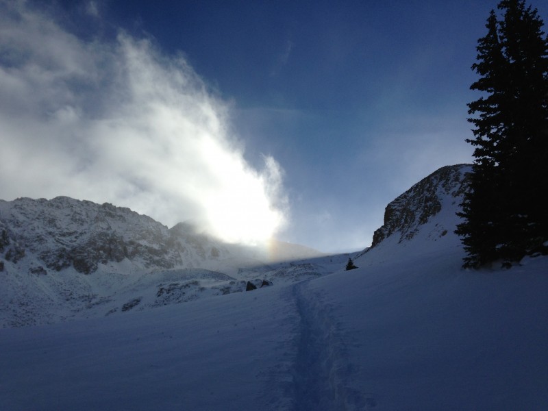
Blustery winds and streaming snow with Ryan and Caitlin
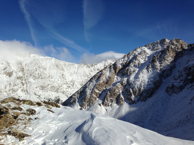
Panorama of Arkansas' incredibly rugged NE Ridge
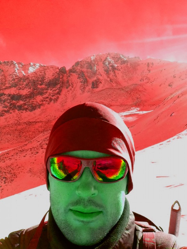
Go Razorback Red! (No, I'm not a Razorback alumni) AKA: Christmas Colors!
Ryan flexing for the camera.
Pretty views
Looking back up the ridge.
Jim (Yikes) with Democrat and the end of Arkansas' NE ridge behind
The snowshoe track was a welcome sight, and we cruised down it to the road and back to the TH.
Hello trench! Looking back up towards Arkansas. North Ridge on right.
Caitlin reaches the road with Arkansas' NE ridge behind.
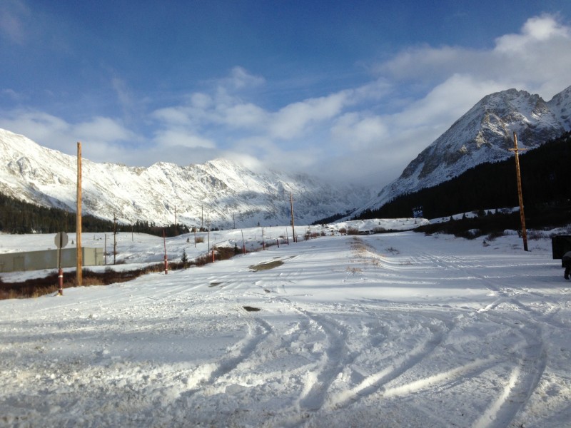
Trailhead
Looking at the headwaters of the Arkansas river
Afterwards Ryan and Caitlin introduced me to the Smiling Moose Deli in Frisco. Southwest Mo? YUM! I even got a free cookie when I answered the trivia question of the day: What was the original name of the Colorado River
Anyone know it without "Googling" the answer? Clue: A city along the Colorado River got it's name from the Colorado River's "old" name.
My GPS Tracks on Google Maps (made from a .GPX file upload):
Hey Jed,
Great TR & pix. I'm hooked. If I didn't have a turkey in the oven, I'd throw my snowshoes in the Xterra and head up I70.
I am putting Arkansas on my list for 2014.
Caution: The information contained in this report may not be accurate and should not be the only resource used in preparation for your climb. Failure to have the necessary experience, physical conditioning, supplies or equipment can result in injury or death. 14ers.com and the author(s) of this report provide no warranties, either express or implied, that the information provided is accurate or reliable. By using the information provided, you agree to indemnify and hold harmless 14ers.com and the report author(s) with respect to any claims and demands against them, including any attorney fees and expenses. Please read the 14ers.com Safety and Disclaimer pages for more information.
Please respect private property: 14ers.com supports the rights of private landowners to determine how and by whom their land will be used. In Colorado, it is your responsibility to determine if land is private and to obtain the appropriate permission before entering the property.