Download Agreement, Release, and Acknowledgement of Risk:
You (the person requesting this file download) fully understand mountain climbing ("Activity") involves risks and dangers of serious bodily injury, including permanent disability, paralysis, and death ("Risks") and you fully accept and assume all such risks and all responsibility for losses, costs, and damages you incur as a result of your participation in this Activity.
You acknowledge that information in the file you have chosen to download may not be accurate and may contain errors. You agree to assume all risks when using this information and agree to release and discharge 14ers.com, 14ers Inc. and the author(s) of such information (collectively, the "Released Parties").
You hereby discharge the Released Parties from all damages, actions, claims and liabilities of any nature, specifically including, but not limited to, damages, actions, claims and liabilities arising from or related to the negligence of the Released Parties. You further agree to indemnify, hold harmless and defend 14ers.com, 14ers Inc. and each of the other Released Parties from and against any loss, damage, liability and expense, including costs and attorney fees, incurred by 14ers.com, 14ers Inc. or any of the other Released Parties as a result of you using information provided on the 14ers.com or 14ers Inc. websites.
You have read this agreement, fully understand its terms and intend it to be a complete and unconditional release of all liability to the greatest extent allowed by law and agree that if any portion of this agreement is held to be invalid the balance, notwithstanding, shall continue in full force and effect.
By clicking "OK" you agree to these terms. If you DO NOT agree, click "Cancel"...
Selecting 14ers for our annual Colorado trip is getting harder. Not that there aren't plenty of great peaks that we haven't climbed yet - there are. But to enjoy the climbing that we love safely, within our limitations, that can be challenging. The first 14er each year has to be relatively "easy" to allow some acclimation from our 600-foot home elevation. Problem this year was, it was time to take on the Elks, and there are no "easy" Elks, even by 14er standards.
Castle Peak is the least difficult of the Elks, right? Of course, if you climb Castle, you have to do Conundrum as well - when you only get out once a year, passing on a two-fer is not an option. So whatever is left of "easy" is pretty much gone.
We thought we could get around this problem by claiming a little-known exemption to the 3,000-foot rule. It's called the "Old Flatlanders' waiver." If you (a) live at an elevation of less than 1,000 feet; and (b) are over 50 years of age; and (c) arrived in Colorado less than 48 hours prior to your summit bid, you can ignore the 3,000 foot rule. (See Roach's 4th Edition, Page 383.) We would drive up to something around 12,000 feet for a relatively short scramble while our bodies acclimated to mountain air.
We had done our best to research the Montezuma Basin Road, and it seemed like driving that high was a reasonable plan. The afternoon before our planned hike, we headed up the 4-wheel drive road to see how difficult it would be.
Stream crossing - no problem on Aug. 30
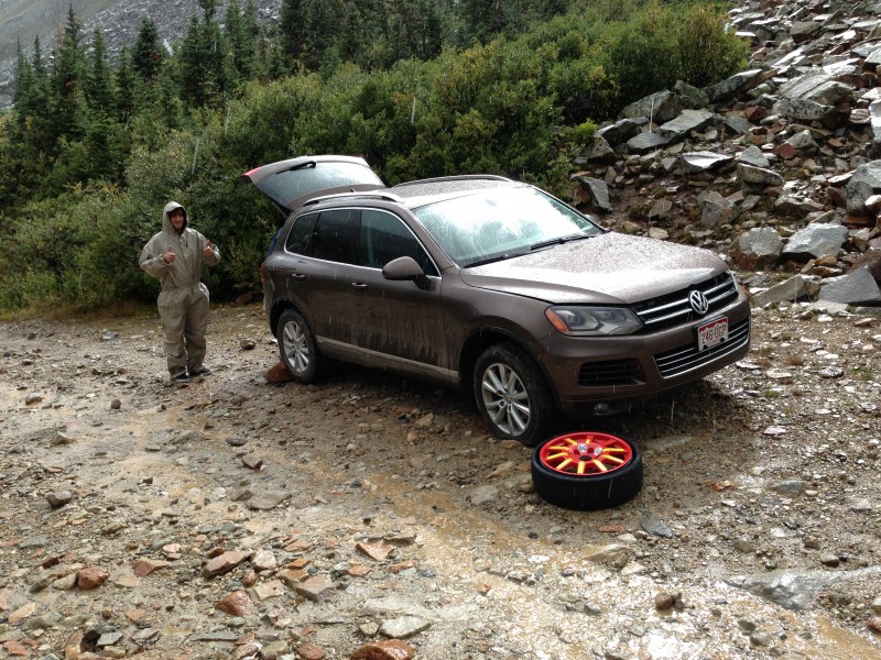
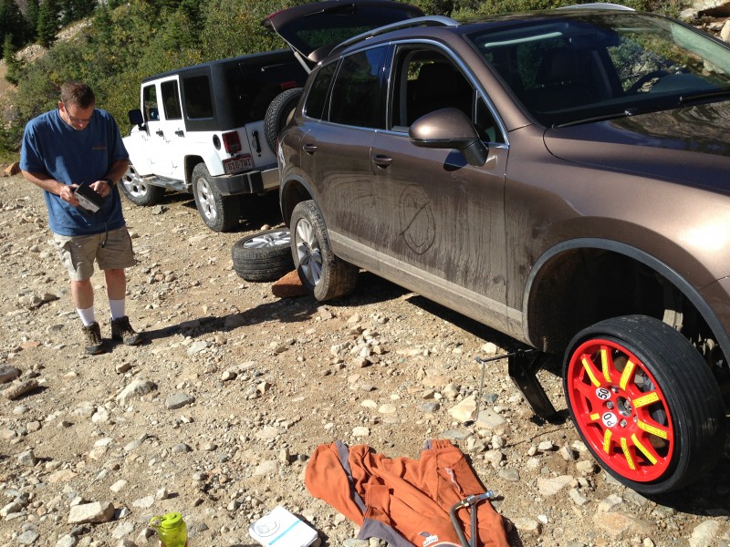
We negotiated the creek crossing fine in our rented Volkswagen Touareg and soon were passing the Pearl Pass Road junction and headed for the upper reaches of Montezuma Basin. The road gets decidedly rockier beyond that point, but nothing is that much worse than the gnarly spots down lower - it just becomes a steady diet of rough stuff, rather than the occasional patch that you encounter below the Pearl Pass Road junction. But, one of those rocks would throw us an unanticipated curve ball: a flat tire, courtesy of a 2" gash in a sidewall.
Trouble
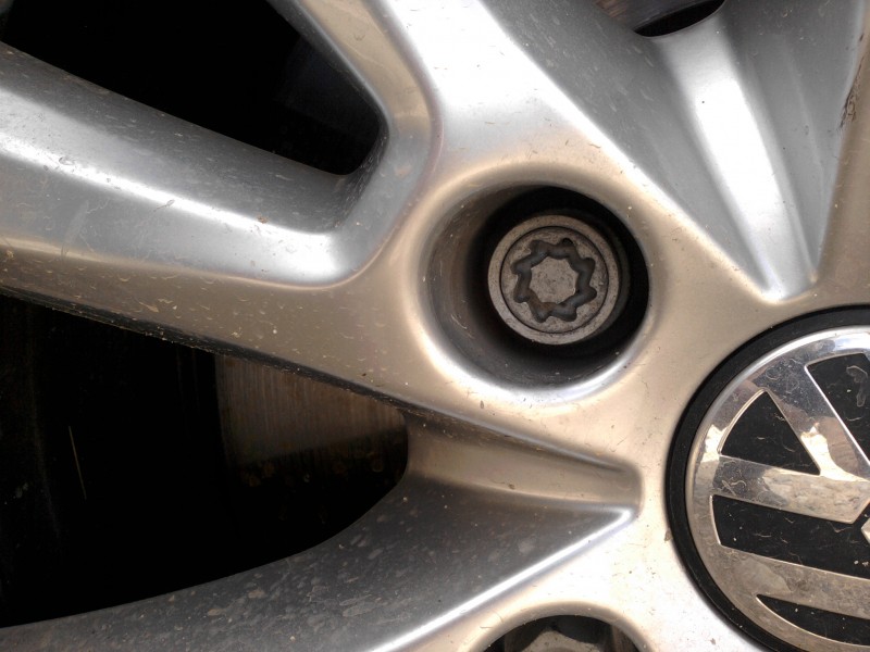
Changing a tire at 11,000 feet in a light rain seemed like a memorable but not terribly daunting experience - until we encountered VW's "anti-theft" lug nut. It requires a unique socket made only by VW - and that socket was missing from the tire-changing kit in the vehicle. We emptied the vehicle of a week's worth of luggage, camping gear, backpacks, etc. and searched it high and low. The socket was nowhere to be found.
C'mon guys, we can do this!
Um, no we can't ....
That led to a pathetically futile effort to find a way to turn that lug without the right socket. After a few minutes of that it was becoming obvious that we were going to need to leave the vehicle and get down off the mountain without it. The clock was ticking toward 5 p.m. The drizzle had let up for the time being, but we faced three-plus miles of hiking on the 4-wheel drive road just to reach the paved Castle Creek Road. Whether we could hitch a ride from there back to Aspen was anyone's guess. Cell reception was, of course, non-existent.
It rained on our parade, but the rainbow hinted of better things to come.
We got a huge break at that point in the form of a pickup with four extremely gracious young folks returning down the road from a day of playing in the upper basin. They quickly confirmed the futility of trying to get that lug off without the right socket, and offered us a ride back to Aspen. Wendell, Jeremy, Anna and Paige were Georgia natives, and their southern hospitality extended to driving us right to the Alamo desk at the Aspen airport.
The Alamo clerk, Max, had just climbed Castle and Conundrum a week or two prior, as his first two 14ers. He tried everything to get that custom socket in our hands on Labor Day weekend - without success. It was no shock to learn that towing the vehicle down from there was not an option. We also learned in the process that Alamo's road service ends 75 yards off any paved road. There was only one choice left: rent another vehicle. We would have to wait until the holiday weekend was over to try to scare up the socket and recover the VW.
So, Sunday pre-dawn found us proceeding back up the Montezuma Road (slower than before) in a more appropriate Jeep Sahara. Most of our 14er gear remained in the stranded Touareg, which we had now dubbed as "base camp." Our strategy at that point was to drive to "base camp;" gear up properly there; then drive higher in the basin and go at Castle and Conundrum just as we had originally planned.
Well, the Montezuma Basin Road had another curve to throw at us. This time it was in the form of somebody else's vehicle, stranded in the middle of the road, blocking all traffic both directions - a few hundred feet below where our VW was sitting. A lone occupant emerged from that pickup to sheepishly tell us his tale of woe: broken gas gauge, forgot to fuel up in Aspen, ran out of gas at 11,000 feet. Wait, it gets better: tried to roll backward down the 4wd road at night, and (surprise!) hung up his truck on the back axle by rolling down onto a big boulder, which he couldn't see because, you know, it was, like, dark out.
By that point three vehicles full of hikers, including us, had pulled over to the side of the road due to the obstacle. The eight or so guys from the other two vehicles were ready to start hiking from there, but we managed to talk them into trying to free up the truck, for the sake of everyone else who wanted to drive higher on the mountain that day (especially us). They graciously agreed to give it a go.
Moving the truck backward over the boulder was not an option, so we dug in to try pushing it uphill over various smaller obstacles. To the surprise of most of us, we succeeded in three or four heave-ho's to move it couple feet. A few short breaks and additional grunts got it a few feet further up the road. Mr. out-of-gas was then able to roll back down again, this time steering around the boulder, to reach a spot that didn't block the road. Success!
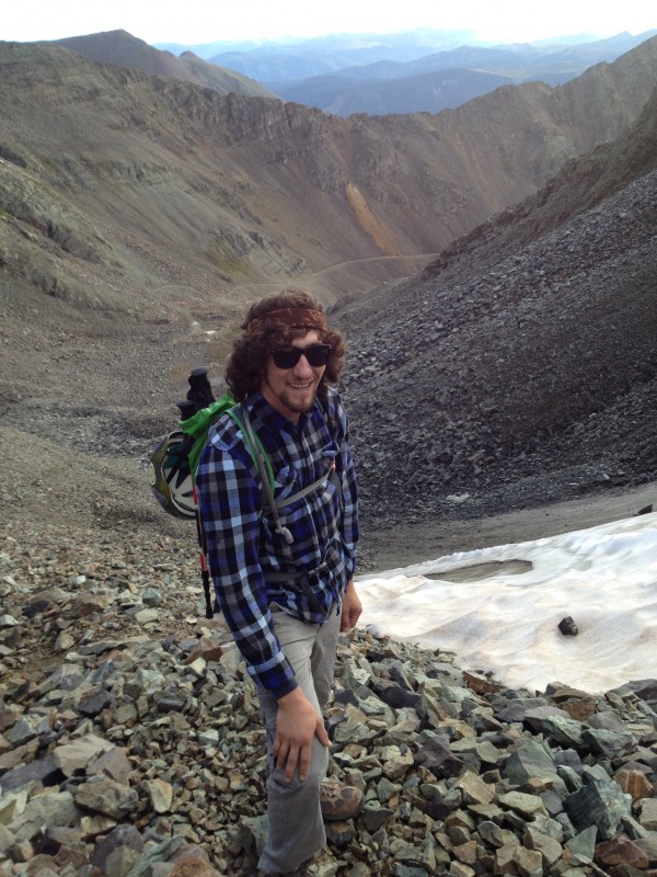
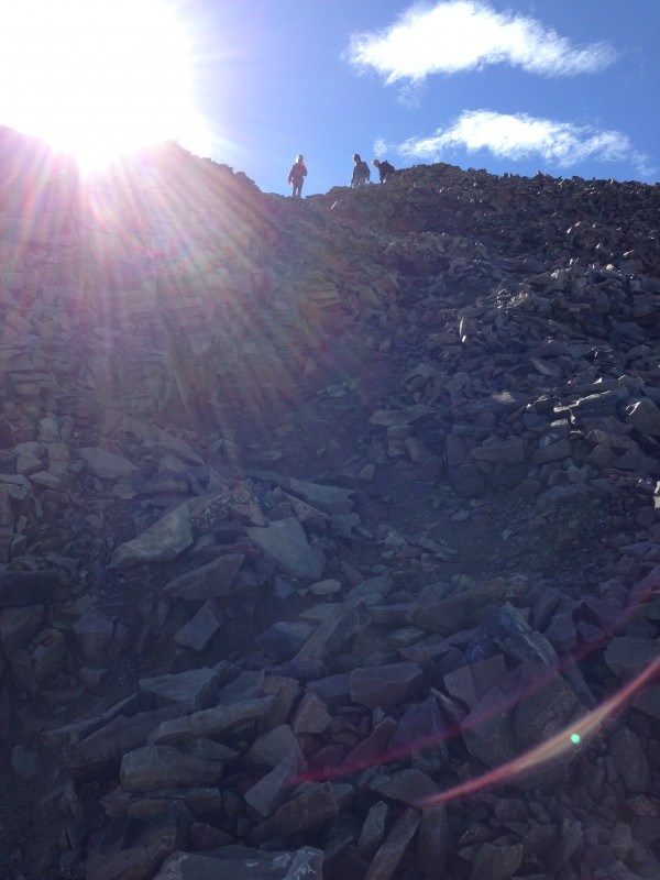
After all that vehicular excitement, it may seem like the mountains were anticlimactic, but of course they were not. We continued up to "base camp" as planned, geared up there, and drove slowly on up the road. We ended up parking the vehicle at a spot just above 12,200 feet. From there it was a mercifully short hike up the road to its termination at around 12,800 feet, where a loose, somewhat steep headwall provided the first hiker's challenge of the route.
Walking the road with Conundrum dead ahead. The scee-pile headwall to the upper basin is above Dennis.
The terrain beyond the road end began with talus-hopping on relatively large, stable boulders - something I enjoy quite a bit. As we ascended the headwall, however, it soon devolved into a loose scree trail. But at least there was a trail, which could be followed with a minimum of annoying slips and backslides.
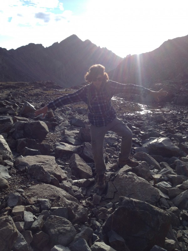
Talus-hopper extraordinaire
Scree slog
I believe Jesus is with me on every climb, but this was the first one where I saw him.
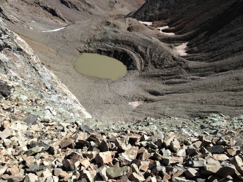
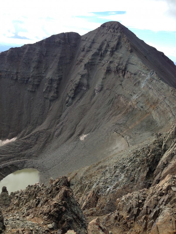
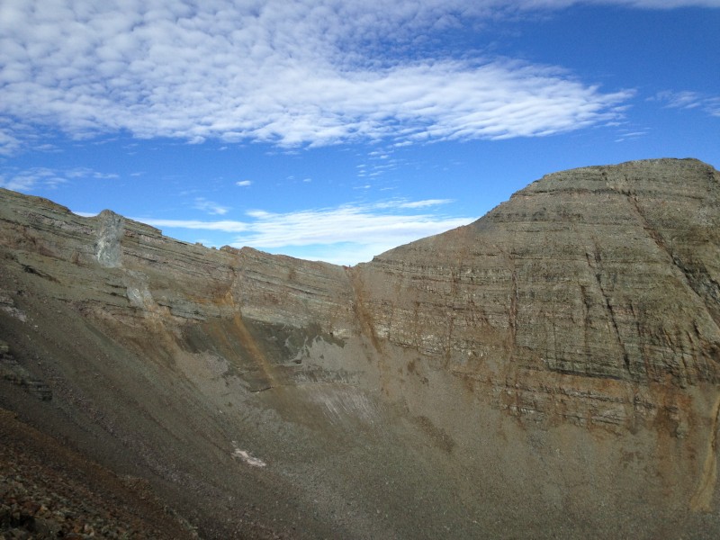
At the top of the headwall we were greeted, not surprisingly, by a stiff breeze. To our right was upper basin's iconic sinkhole lake, which for some reason apparently has never been named. I suggest it should be named Sinkhole Lake. In every photo of it that I've ever seen, it was a beautiful teal green color. This day it looked more like the world's largest mud puddle, a murky brown, presumably a result of the recent heavy rains and lack of snow and ice in the upper basin this summer.
Sinkhole Lake from closer to Castle's summit
Headed for the ridge. People are visible on Castle's summit in the upper center of the photo.
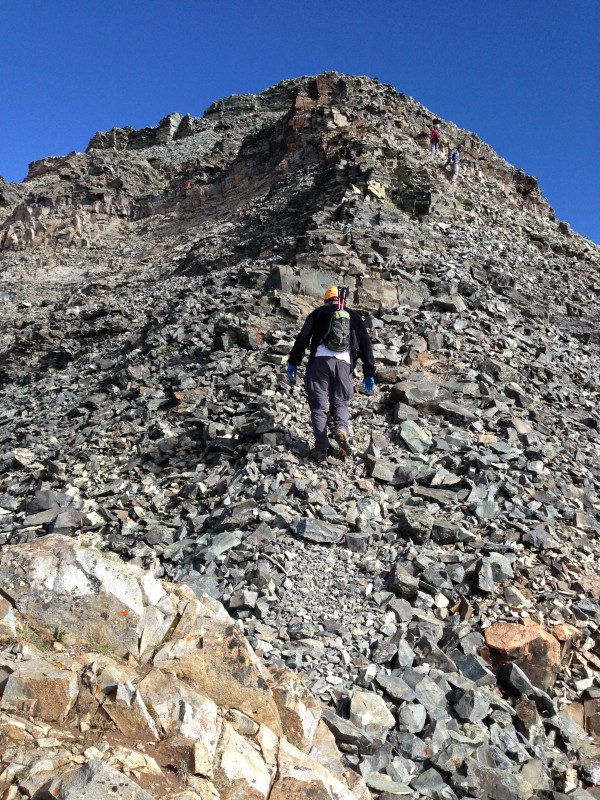
Our route went left, up the climbers' trail ascending the Northeast Ridge of Castle. It was a huffy-puffy ascent for our flatlander lungs, with some relief as we neared the ridge, where the angle relented. The trail skirted to climber's right of a few rock towers to reach the ridge at a small saddle.
View Southeast from the first saddle in the ridge.
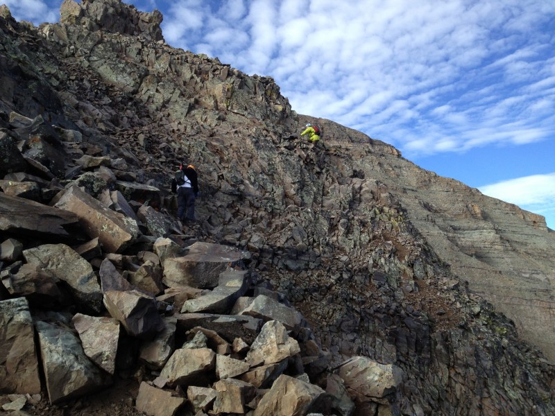
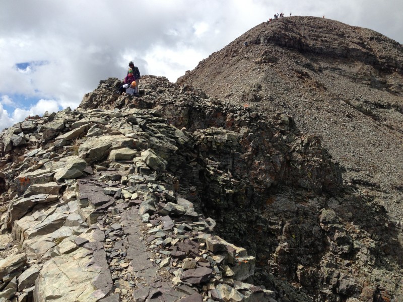
We continued to follow the trail to climber's right around several more obstacles. Here we made a routefinding error which was not catastrophic, but worth sharing in hopes of helping out some future climber. The trail comes to a second, small saddle - really more of a notch in the ridge - and continues to the right around larger towers of rock without any real elevation gain. Soon this path took us across a crumbly ledge that looked less than perfectly stable, with a nasty runout down steep rubble below. Mark, in the lead, carefully negotiated the ledge and looked around a corner to see that this course was leading nowhere.
We realized there was a weakness in the rock towers to our left, and that it was time to go up. We climbed up a short distance, maybe 30 feet or so, and followed another trail continuing around to the right. This trail continued to traverse around the west side of the ridge, as it turned out, all the way to the saddle directly below the final pitch to Castle's summit. It wasn't a bad way to go, although it had a couple sketchy spots with some serious exposure on steep, loose rubble. When we got to the final summit pitch, I realized we had missed an opportunity somewhere along the way to gain the crest of the ridge.
We followed a trail through the notch right above Mark, in lime green dead center. Shoulda kept climbing to the ridge at far
View down of the same spot in the previous photo
We eventually figure out that the missed opportunity had been where we first ascended from the horizontal trail. Instead of peeling off to the right partway up, we should have kept climbing the weakness all the way up to the ridge. Had we kept going up to the ridge, we would have had an easy ridge walk instead of a sometimes tough winding trail along the side of the ridge.
Great views of Conundrum all the way along Castle's Northeast Ridge, with Sinkhole Lake below
All good, a fun climb!
The trail we took skirting the west side of the ridge was steep, loose, but not too sketchy - still fun!
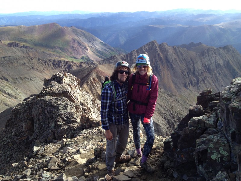
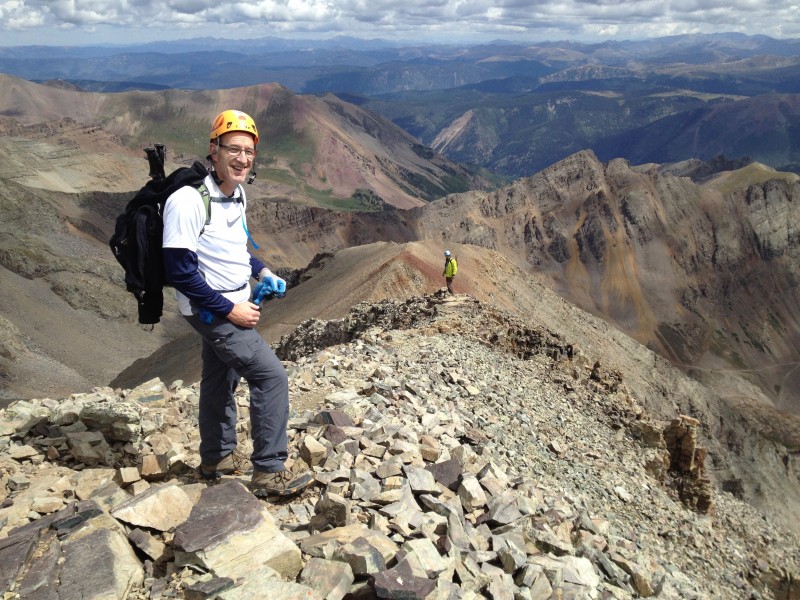
No problem, we made it to the saddle with no drama and from there it was just a matter of ascending the steep final pitch of the ridge to the summit. It was indeed "difficult class 2" as the route description labels it, with emphasis on the "difficult" part. But soon enough we were hiking up the final few steps together to the summit - #21 for brother Mark, daughter Maryjane and me. For Dennis it was #9, not bad considering he just started climbing 14ers last summer.
Castle summit
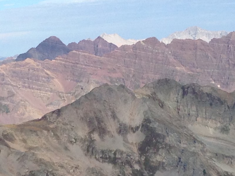
The summit brought much-needed rest and fabulous views to enjoy, especially of the other Elk 14ers, each so distinctive in its own way - the classic striated maroon lines of the Bells and Pyramid, and the stark white ridges of Capitol and Snowmass. Then it was decision time: Are we going for Conundrum or not? The weather looked good and even though we were pretty tired already, we were all for going after it.
Crown jewels of the Elks: Maroon Bells, Snowmass, Pyramid, Capitol
Descending Castle toward Conundrum
We were glad we did. The scramble down Castle to the saddle, and back up Conundrum, was pure fun, and the ridge walk on Conundrum's false summit was a blast. The view back to Castle's north aspect from Conundrum's summit is especially impressive. It took us about 45 minutes from Castle's summit to Conundrum's.
Ascending Conundrum
Conundrum summit. The clouds made us nervous but not wet.
Castle is spectacular from Conundrum
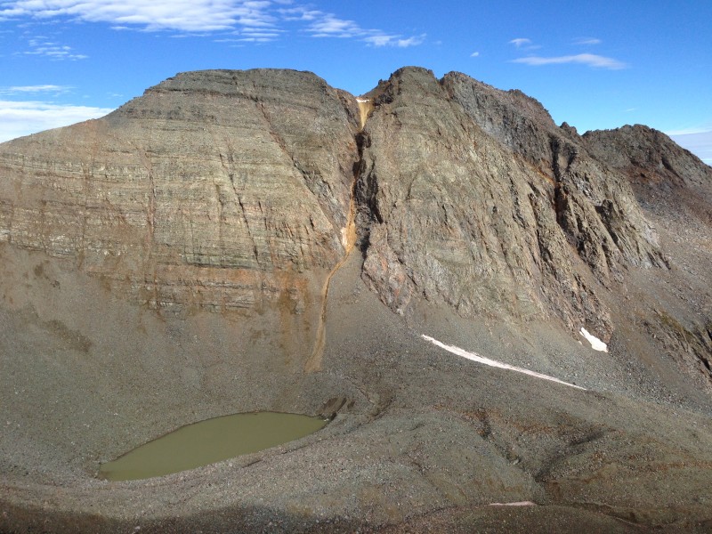
Both times we reached the Castle-Conundrum saddle, we paused to examine the gully leading down from there toward "Sinkhole Lake." We had read with quite some interest the thread on 14ers.com about this gully, and all the opinions that it was unsafe in non-snow conditions. On our ascent of Castle we had watched across the basin as one party started down the gully, then thought better of it and re-ascended to the saddle and from there back over Castle. Others, however, had gone down that gully.
View back up Conundrum as we descend. A group of climbers who passed us going up are visible cresting Conundrum's false s
Still descending Conundrum
I had made up my mind based on the 14ers.com thread. I wanted no part of that gully. Descending it seemed like the kind of decision that, by the time you regretted it, was too late to undo. We agreed to stick with our original plan and together began the ascent back up Castle.
Castle-Conundrum saddle, dead center. A lone climber stands in the saddle contemplating his future.
Mark and I were pretty concerned about our stamina to re-climb that peak and then descend again along the Northeast Ridge. Even though the overall length of the route was real short by 14er standards, we were really gassed by this point. We find Diamox to be effective in warding off altitude sickness symptoms, but it takes more than a pill to build up any real stamina for exertion at elevation. Those 550 feet back up Castle looked daunting. But we made it, slowly and wobbly much of the time, but soon enough we were back atop Castle.
Our second visit to Castle's summit was brief. The day dragging on, we had been above 13,000 feet for quite some time, and we still had the descent of Castle to negotiate. This time we took the ridge to enjoy on the descent the ridge walk that we had missed on the ascent. It was very nice and, just as important at that point, very easy.
Descending Castle's Northeast Ridge. Now that's more like it!
I tend to have the hardest time in our group on descent, especially the first one of the year, when my knees invariably turn to mush. This day was no exception. The struggle to keep moving robbed some of the enjoyment of another successful climb as I stumbled and struggled down the trail. Relief would not come to me until we got off the loose scree of the headwall, almost down to the road. As we plodded down the road while the afternoon wore on, I was very glad that we had driven as high as we did, and especially that we had moved that out-of-gas truck back down the road instead of hiking up from there!
Still, the weather once again stayed near-perfect for us. A few drops spit at us at 2:15 p.m. while we walked the road, a half-mile or so from our vehicle. It was just enough to make us appreciate how fortunate we have been with weather in our 14er climbing experience. The Elks had been getting pummeled with storms almost every day before noon, but we escaped the rain this day, as we essentially have on every one of our twenty 14er hikes.
The drive down included another stop at "base camp" to clear the rest of our stuff from the stranded vehicle. In case you were wondering, Mr. Out-Of-Gas was long gone by the time we descended the road. But our VW would sit up there almost two more days while our unwelcome vehicular drama played out. Repeated attempts to scare up that custom socket by phone or Internet on Monday, Labor Day, failed. On Tuesday morning we walked in to the service counter of the nearest VW dealer, Elk Mountain Motors in Glenwood Springs. We had no idea at that point if they could help us or if so, how long it would take.
We told an abbreviated version of our tale of woe to Duane at the service counter at the dealership. We had been told over the weekend that VW had numerous custom lug nuts/sockets, which makes sense for an anti-theft device. The way to identify the correct one was supposedly with the VIN of the Touareg. Duane informed us that was wrong: it's a trial-and-error process.
This was staggering news considering where the stranded vehicle was located. But we had one ace left: a photograph of the anti-lock lug nut. "That might work," said Duane - our first ray of hope in three days since the tire went flat. He disappeared to the back shop for a minute and re-appeared with a case of about 24 custom VW anti-theft sockets. I've never received a Christmas present in all my life that looked as beautiful as that case of sockets. In a matter of seconds, we identified the socket that matched the photo. Even better, Duane freely consented to loaning it to us with minimal collateral - along with his personal lug wrench, as the socket took a different size driver than the lug wrench in the vehicle. That guy was beyond heroic for us. He was so great, I think everyone who reads this TR should proceed immediately to Elk Mountain Motors to buy a car. Just not a VW Touareg with a dopey anti-theft lugnut.
A couple hours later we were back at 11,000 feet in Montezuma Basin and that cursed lug bolt was removed. We resisted the temptation to fling it into the sea of scree below our VW. The spare tire proved to be a new adventure, but I'll spare you those details.
USA-made Jeep rescues German-made VW. The spare tire goes on flat, and gets inflated in place with the mini-compressor in my
By day's end the VW was back in Aspen getting a new tire, Duane had gotten back the socket and lug wrench along with profuse thanks from all four of us, and we were on our way to Lead King Basin to take on Snowmass via the S ridge.
Great to get acquainted with the Elks
Thumbnails for uploaded photos (click to open slideshow):
One of my biggest fears is having vehicle damage way out on a 4 wheel drive road. Glad to see that you were able to get the car issues straightened out and complete the C+C double.
Congrats on a fine hike and getting your car situation resolved. Clever planning by Alamo to not be sure the proper tools are provided to change a flat. My initial thought would be to give them an ear full for this, but considering you were well beyond the 75 yards from a paved road, that would only risk increased penalties for disregarding their contract. Love the bright orange spare as well, they must not want anybody getting too comfortable using the spare long term.
... I'd rather hike an extra 5-6 miles vs drive up those roads! Ha! :lol: As long as I have my feet on the ground, I'm good. And that's why I go out to CO each year - to hike and climb. My greatest fear is getting stranded along the road with a vehicle like that. Conundrum lived up to its name!
Maybe Mark should change his username to something else. (or were YOU driving?) :wink:
But glad it all worked out for you guys! :D
So you're now into the Elks. Hmmm.... I'll email you later!
how bout just driving down the road with the flat until you hit pavement and then call for road-side service? ”no, i wasn't up there. just drove from aspen and noticed the flat”
Really brings out the comments :lol:
> Painless, maybe ”someone” was telling us to walk the road, but my body was definitely telling me that driving was the right idea.
> Doug, you are right, Mark (”Lucky”) definitely was not that this weekend. Not only was he driving, he was paying for the cars.
> Yikes, driving down on the flat was at the bottom of our list of options. Shudder to think what that road would do to the rim, suspension etc. without a tire, but if all else failed, we would have reached that level of desperation eventually. Thankfully we got a resolution before then.
> Brian, you are correct sir, that was a ”love/NOT” commentary by MJ in the dust. Absolutely no love for VW in our crew.
Yep that would be an anti-theft lug. I just got a flat on my vehicle for the first time literally last week and my spare has one so i had to locate the special socket for it. Mine was in my glovebox. I hope you guys glanced in the glovebox for the socket before going to all that trouble, kinda sounds like you guys may have peaced right out to get down. Would suck if that socket was just sitting there. Doesn't matter now though, hah.
I'm sorry, I had to chuckle when you got to that part of the story. Very, very glad you had an awesome hike of those peaks and got out that basin with your sanity intact! :D
Caution: The information contained in this report may not be accurate and should not be the only resource used in preparation for your climb. Failure to have the necessary experience, physical conditioning, supplies or equipment can result in injury or death. 14ers.com and the author(s) of this report provide no warranties, either express or implied, that the information provided is accurate or reliable. By using the information provided, you agree to indemnify and hold harmless 14ers.com and the report author(s) with respect to any claims and demands against them, including any attorney fees and expenses. Please read the 14ers.com Safety and Disclaimer pages for more information.
Please respect private property: 14ers.com supports the rights of private landowners to determine how and by whom their land will be used. In Colorado, it is your responsibility to determine if land is private and to obtain the appropriate permission before entering the property.