Mileage: ~9 miles
Elevation gain: ~2,500 ft
Time: ~5 hours
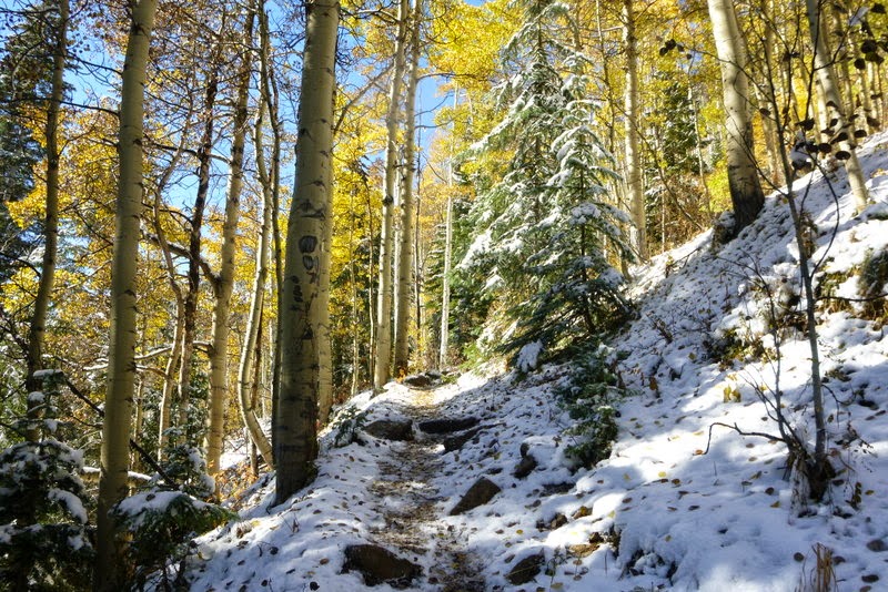
The visit to the Elk range was long overdue. So when I received an invite to make a trek to Conundrum Hot Springs in mid-October with a group of hiking friends, I got excited. While studying the map of the drainage, I noticed a number of 13ers in the basin, most notably "Castleabra", a bi-centennial (it is quite interesting, though, that Roach labels "Castleabra" as one of the centennials in his 13er book - likely a typo). It made sense for me not only to visit the hot springs, but also try to get at least one of the thirteeners while there. The group drove to the trailhead after work and camped by the trailhead. The next morning, we woke up, packed out "big packs" (mine clocked in at 40 lb) and started hiking up the trail shortly after 9am. A nice warm sunny day soon after the area received several inches of snow made for a spectacular setting. The trek is long, but somehow goes fairly quickly - there is so much to see!

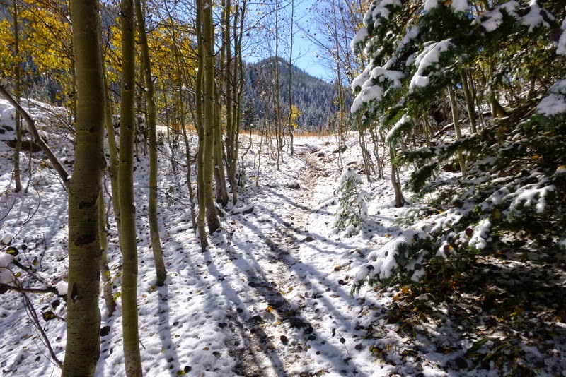
The trek begins
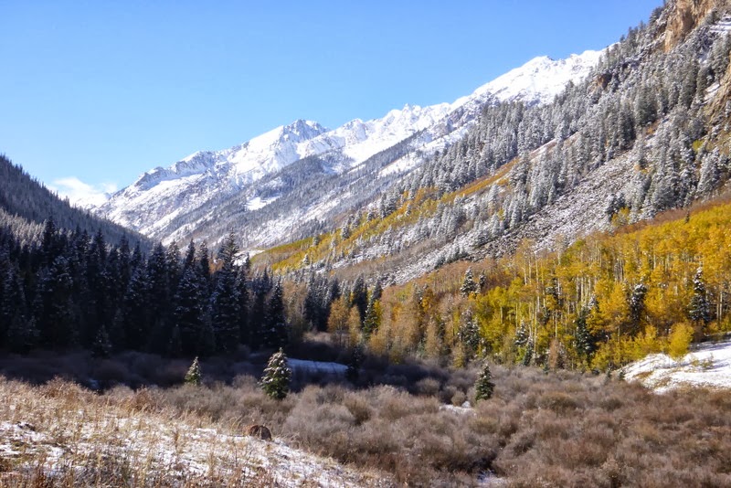
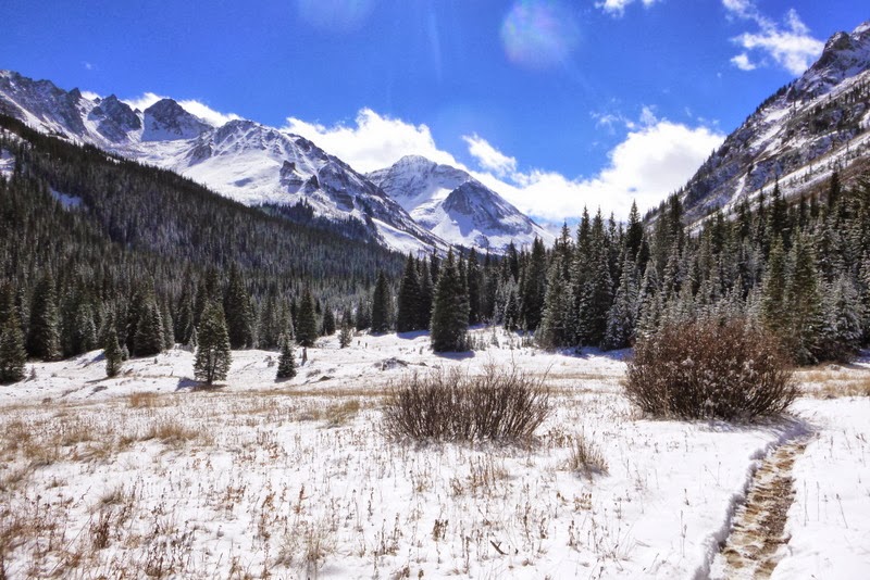
At about 4 miles in, Castleabra appears
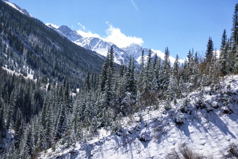
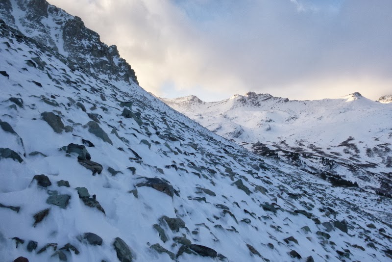
The higher you go, the more wintery landscape looks


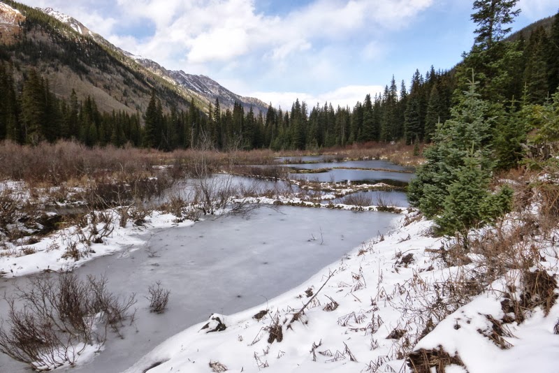
Creek crossings, that late in the season, didn't present any problems. But I can see how it can be an issue in spring.

Less defined river crossing - hiking poles might be helpful here

Even in the snowy (shady) sections, a day after the snowfall, the trail was boot packed - a reflection of how popular this trail is with backpacking crowd


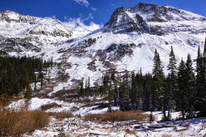
Castleabra dominates the approach in the last few miles

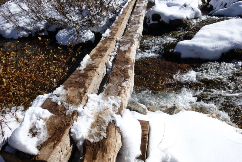
Final creek crossing
Since we had a large group with several other smaller groups arriving on the same day, everybody rushed to get a campsite. I haven't camped in the snow for over a year, since Rainier. Thankfully, once you learn the basics, it doesn't go away - it is just like riding a bicycle. Jetboil gets fired up and water melting commences. Ahh, the little luxuries of backcountry camping.

A camp with a view
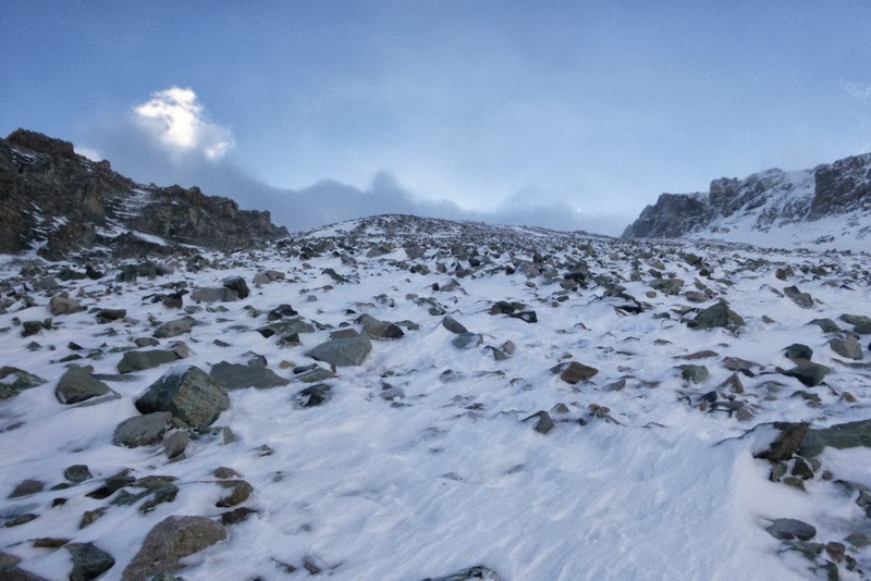
A short scouting trip to the base of tomorrow's climb revealed that this approach is doable, while other peaks in the basin would require snowshoes (which I didn't bring).

Some potential targets, which at present would require snowshoes


At the base of the climb
Content with the findings, I joined the rest of the group in the famed (or infamous?) hot spings. The pool is rather small (by the developed hot springs standards) and quite a bit muddy. Still, it was very nice to soak after a long day of backpacking. Most people wore swimsuites, but quite a few were in the nude. So, be prepared...

A look from the pool back into the valley
After about couple of hours, I extracted myself from the pool and retired to the tent. Some of our group stayed up until midnight and enjoyed the evening under the stars, but they didn't have a 13er hike the next day. I didn't think I would be sound asleep by 7.30pm, but somehow it happened.
Mileage: ~12 miles
Elevation gain: ~2,800 ft
Elevation loss: ~5,300 ft
Time: ~10 hours (5.5 hours for the summit bid + just over 4 hours for the hike out)
Initially, several people in the hiking group expressed interest in Castleabra. However, upon closer inspection, one turned out to be injured, with his arm in a cast; another didn't bring an ice ax and spikes, and quite understandably, was having second thoughts looking at snow-covered slopes; and the third didn't have enough experience for the shoulder season. Solo it is. After restfull 10 hours of sleep in the toasty warm 0 degree bag, the alarm went off at 5.30 am. I forgot, however, that it takes longer to get ready when it is cold outside, and having a hot oatmeal for breakfast was too enticing, so I didn't set out from the camp until 6.50 am. The weather showed a stark change from the day before - gray clouds were swirling on top of the mountains and the winds were howling.

Castleabra turns a cold cheek
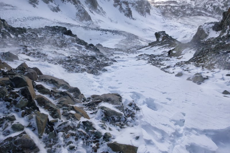
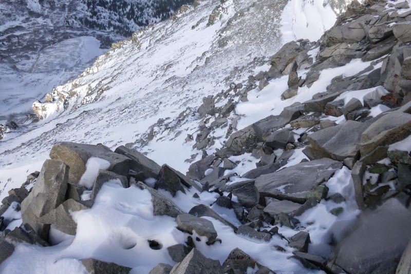
Still, I kept telling myself - it is only 2,500 ft and just 2 miles! This is so close... I made a good progress to the bottom of the climb, but soon thereafter my pace slowed. Roach hints that the early season snow may make the gully a bit more stable. If that is the case, I just can't imagine what it looks like when dry. One step forward-slide-repeat sequence ensued for 800 feet.
Slippery talus

Approaching the top of the 1st headwall ~ 12,000 ft
I decided to take a slow and measured approach, as I didn't want to get tired too quickly, which could lead to frustration, and given the subpar weather conditions, bailing too soon. At the snail's pace I pressed onward. Rather surprisingly, I felt rather comfortable. I had my face mask, warm gloves and a hat, gaitors, ice ax, microspikes, 4 layers of clothing (an extra one still in the pack) and lots and lots of GU (the latter gives you a delusion that you are feeling strong). At around 12k, the slope flattens for a bit.

Looking at upper reaches of the mountain. 2nd headwall ahead

Trying to find a surface that doesn't slide
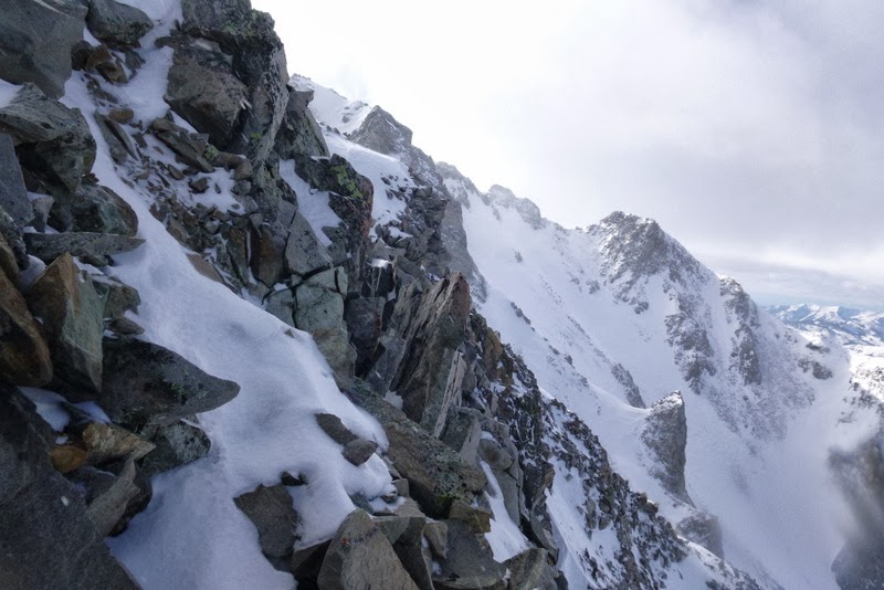
After scaling the 2nd headwall, I found myself near 13k. While the wind became quite punishing and I was horrified to watch the clouds "flying" over the ridge, meaning 50+ mph gusts up higher, I kept telling myself that the summit is "only" 700-800 ft away. The "standard" gully looked very snow covered, so my options were either postholing or more of the sliding talus. Trying to avoid either of those options, I went with the leftmost gully - although it looked a bit steeper (I guestimated it at Class 3+), I hoped it would provide some handholds to pull myself forward.

Looking for some holds to counterbalance the wind pressure
Not sure which way would have been faster, but by carefully pulling on ice and rime-covered rocks alternated with manageable postholing, I was able to propel myself to the ridge near 13,600 ft. From there, I looked for a reasonable traverse line around the cliffs surrounding the summit.

Traverse to bypass the cliffs
After a few carefully placed moves, I made the ascending traverse and was relieved to spot a snowed-in trail near the ridge.

Summit becomes visible
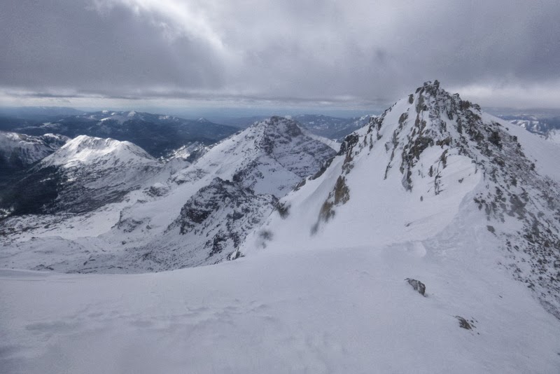
The ridge towards Pt 13,550

Full view of the ridge towards Pt 13,550
I followed the trail and then the straightforward ridge to the summit. It was cold and windy and the 2,500 ft ascent took 3.5 hours. I didn't have any aspirations to continue to another summit. "Castleabra" (my first Elk) in "wintry" conditions required my full undivided attention and the mountain got it. Somehow, reaching this snow- and rime-covered summit felt incredibly satisfying. The full views of Castle and Conundrum were obstructed by the clouds, but I could see Cathedral and the Pyramid group.

Summit cairn

The view of Castle is obscured by clouds

Cathedral

The Pyramid group
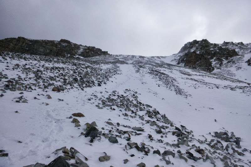
The descent went far better than expected and only took 1.5 hours. I was able to connect the snowfields and step-plunged or glissaded all the way to the base. The snow felt very stable - it was strange to realize that there were no "weak" or "rotten" layers underneath - just a knee/thigh deep October powder. If this trend continues, this could be a great year for skiing (or at least Joel Gratz says so).

The descent gully


This is not a black and white photo
Finishing the descent
I got backed into the camp just past noon to the visible relief of my camp-mates (who actually watched my descent off the mountain from the comfort of the hot springs). After a welcome hot meal, melting snow for the hike-out and packing the camp, we were on the move soon after 1pm.

Parting shot of the Hot Springs

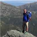
Me on the hike out

North face of Castleabra. Still cold

Teeth marks on a tree

Probably this house needed some remodeling

It was amazing to see how much snow had already melted just 24 hours later. The trail was boot-packed. The pack felt heavy, feet in mountaineeriing boots were sore, but we made great time, arriving at the trailhead by 5.30pm. What a great trip! I think Conundrum Hot Springs is something to see or experience, at least once, and getting a 13er just makes a trip that more exciting. Thank you for reading.
Trip totals: ~21 miles, ~5,300 vertical.
Combined hiking time: ~15 hours
My GPS Tracks on Google Maps (made from a .GPX file upload):
|