Download Agreement, Release, and Acknowledgement of Risk:
You (the person requesting this file download) fully understand mountain climbing ("Activity") involves risks and dangers of serious bodily injury, including permanent disability, paralysis, and death ("Risks") and you fully accept and assume all such risks and all responsibility for losses, costs, and damages you incur as a result of your participation in this Activity.
You acknowledge that information in the file you have chosen to download may not be accurate and may contain errors. You agree to assume all risks when using this information and agree to release and discharge 14ers.com, 14ers Inc. and the author(s) of such information (collectively, the "Released Parties").
You hereby discharge the Released Parties from all damages, actions, claims and liabilities of any nature, specifically including, but not limited to, damages, actions, claims and liabilities arising from or related to the negligence of the Released Parties. You further agree to indemnify, hold harmless and defend 14ers.com, 14ers Inc. and each of the other Released Parties from and against any loss, damage, liability and expense, including costs and attorney fees, incurred by 14ers.com, 14ers Inc. or any of the other Released Parties as a result of you using information provided on the 14ers.com or 14ers Inc. websites.
You have read this agreement, fully understand its terms and intend it to be a complete and unconditional release of all liability to the greatest extent allowed by law and agree that if any portion of this agreement is held to be invalid the balance, notwithstanding, shall continue in full force and effect.
By clicking "OK" you agree to these terms. If you DO NOT agree, click "Cancel"...
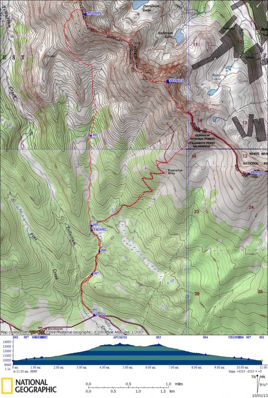
Date of Climb : 10/01/13
Peaks Climbed :
1) Anderson Pk - 13631'
2) Petroleum Pk - 13505'
Distance : 11.0 miles
Elev Gain : 4533'
Time : ~7.5 hrs, 7am - 2:30pm, Ascent to ridge 2.75hrs, Ridge & 2 Summits 2.75hrs, Descent 2 hrs
Ascent Party : John B. solo.
Fall weather finally arrived! What a perfect October day for a windless ridge walk! The views were amazing!
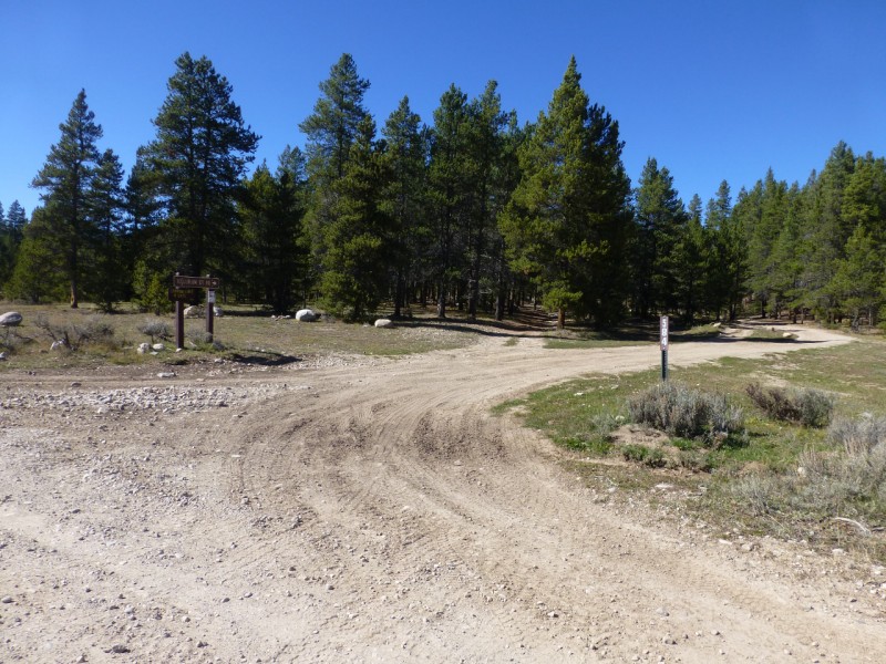
The start of this hike begins at Tellurium Creek road (584) accessed from Taylor River Rd (742). Great camping areas are available at this TH. I did not drive up the 4WD rd because the 1st mile was very rocky. The crux of the rd occurs at the river crossing where big boulders narrow the rd to super bumpy. Too bad because after that the rd seems fine. It only took 35 min to hike up to the Enterprise Mine rd.
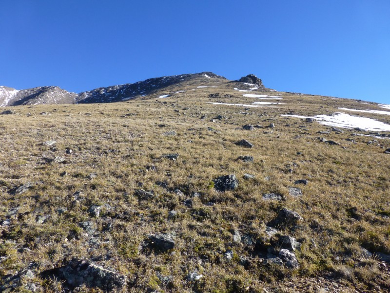
The Enterprise Mine rd is now overgrown but easy to follow. I walked it up to the mine and then one more switchback before deciding to climb the grassy ridge to the county line. If you walk the rd to the end then you end up on a ridge more direct to the summit but all on talus.
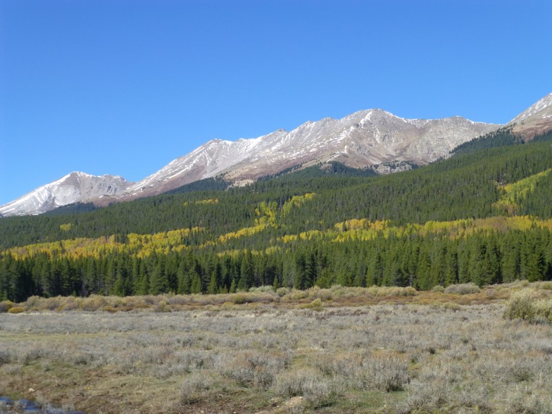
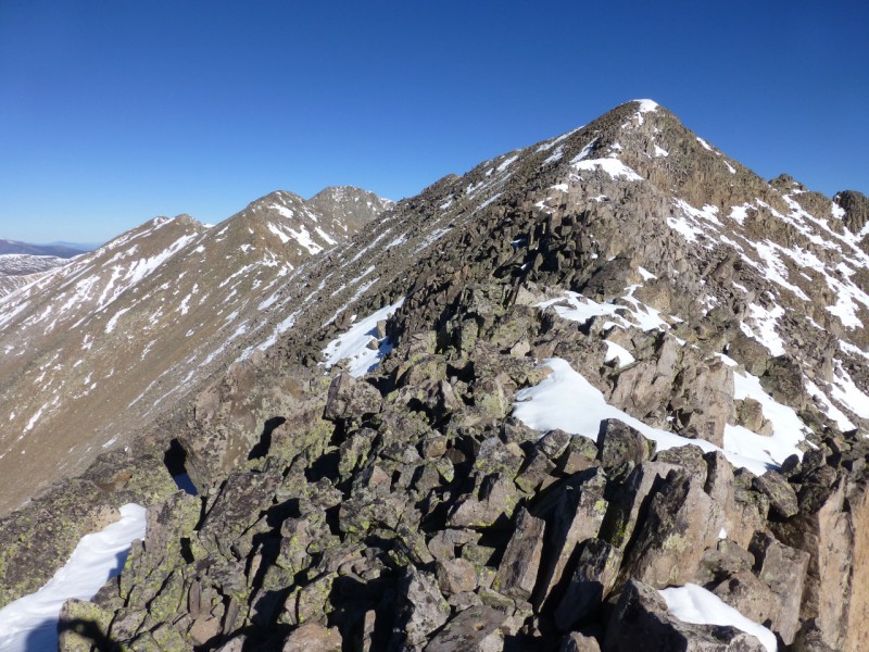
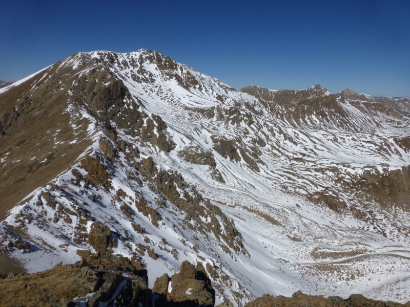
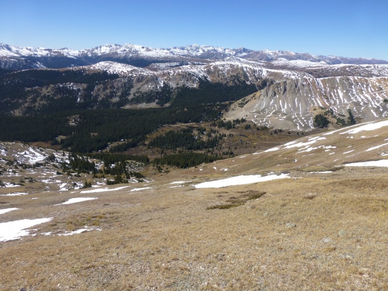
The extra ridge line proved to be very worthwhile. Just sheer blissful class 2 climbing/hiking with amazing 360 views including 14ers: Castle Pk, Snowmass Mtn, Capitol Pk, Pyramid Pk, & La Plata Pk, and Centennials: Cathedral Pk & Grizzly Pk.
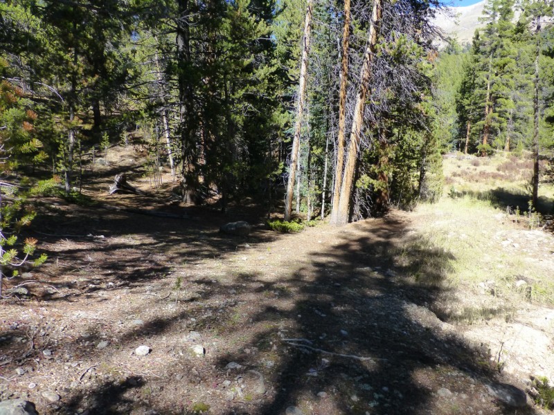
I headed North off of Petroleum Pk taking a grassy descent that eventually led to an undocumented trail. Luckily, this trail led all the way back to the start of the Enterprise Mine rd. Occasionally the trail was hard to follow, but if you follow my descent track then you end up mostly on trail and no bushwhacking. I think it could get quite swampy in places though in the Spring.
Tellurium Crk TH.
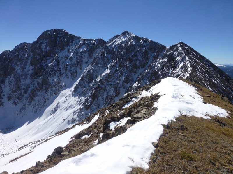
Petroleum & Anderson Pks.
Enterprise Mine grassy ridge SSW of Anderson Pk.
Fun start to ridge.
Looking back along ridge.
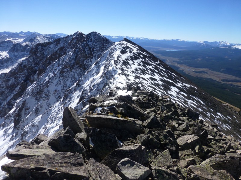
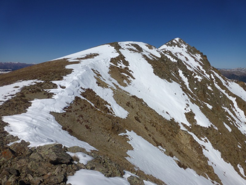
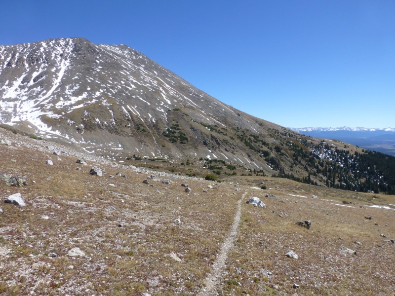
Final summit push to Anderson Pk with Petroleum Pk in view.
Anderson Pk summit with view of Grizzly, Garfield, & La Plata Pks.
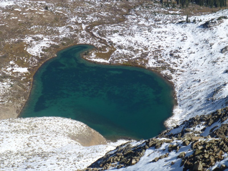
Anderson Lake.
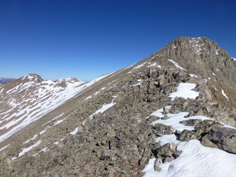
Looking back along ridge after descent from Anderson Pk.
Nice ridge walk to Petroleum Pk.
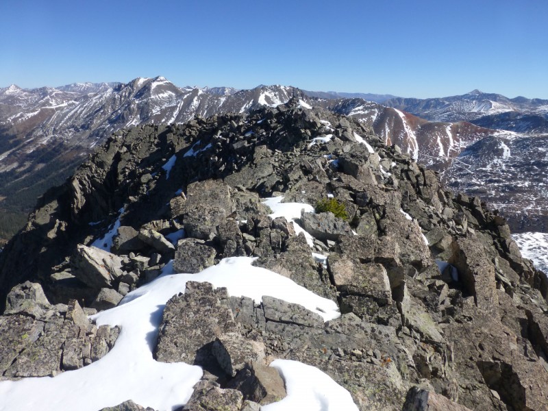
View back to Anderson Pk.
Final summit push to Petroleum Pk.
Petroleum Pk TriCentennial summit shot.
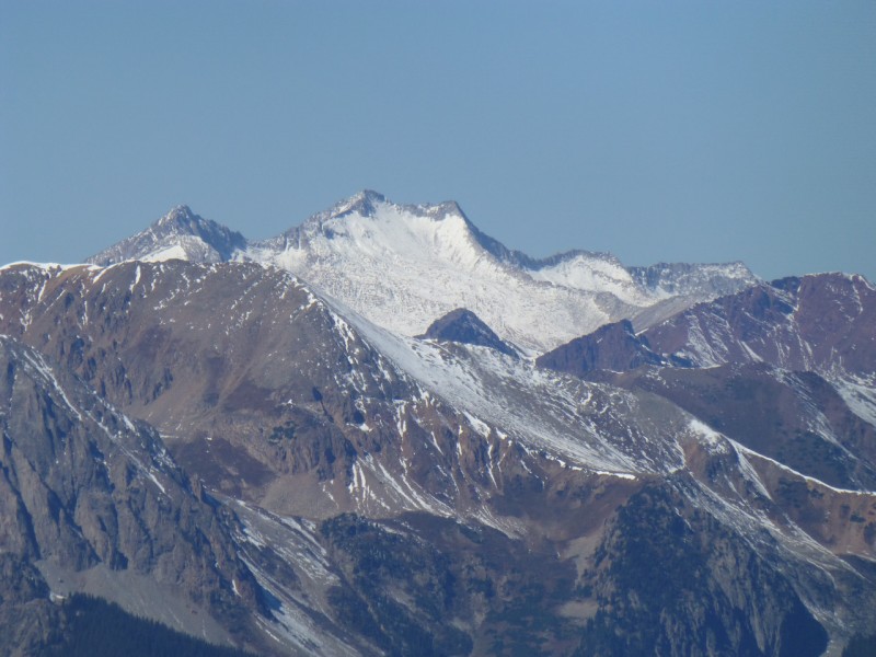
Gorgeous view of Snowmass Mtn.
View of semi-forested descent.
A real trail exists!
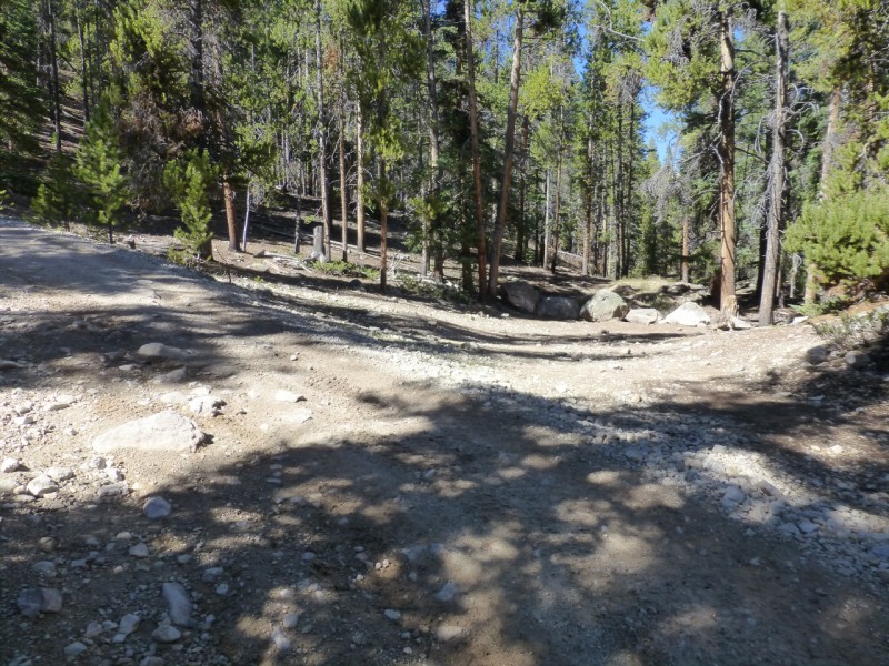
Enterprise Mine trail (L) junction with road (R).
Tellurium Crk rd (L) junction with Enterprise Mine rd (R).
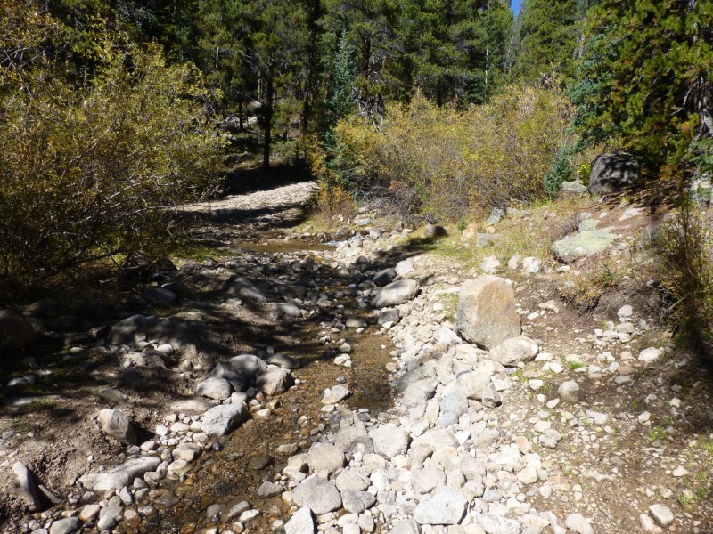
Tellurium Crk rd crux (bumpy & narrow) river crossing.
Topo Plan & Route. The ascent route is all road up to 12000', and the descent trail begins at ~12400', SW of Petroleum Pk's summit.
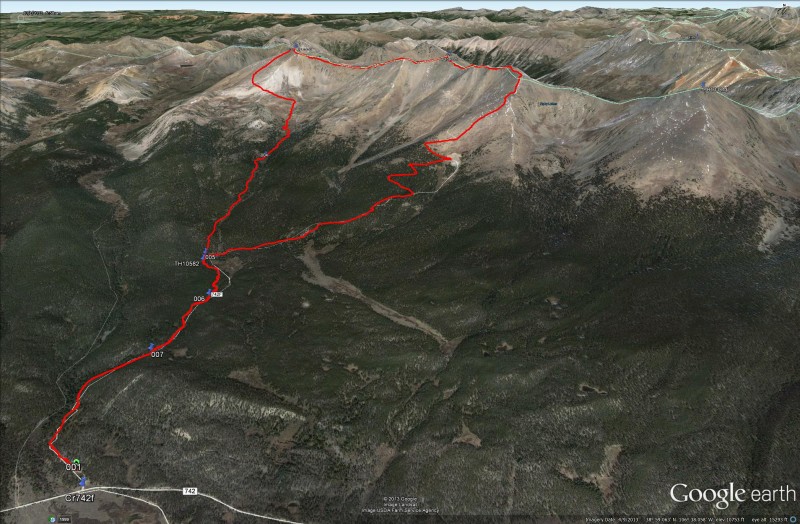
GE view. Red is my track.
Overall, a fantastic fun Fall day!
My GPS Tracks on Google Maps (made from a .GPX file upload):
Nice! I like this report a lot. And you are correct, that IS a gorgeous view of Snowmass. Guess I'm going to have to add this one to my to-do list.
Thanks for posting!
Caution: The information contained in this report may not be accurate and should not be the only resource used in preparation for your climb. Failure to have the necessary experience, physical conditioning, supplies or equipment can result in injury or death. 14ers.com and the author(s) of this report provide no warranties, either express or implied, that the information provided is accurate or reliable. By using the information provided, you agree to indemnify and hold harmless 14ers.com and the report author(s) with respect to any claims and demands against them, including any attorney fees and expenses. Please read the 14ers.com Safety and Disclaimer pages for more information.
Please respect private property: 14ers.com supports the rights of private landowners to determine how and by whom their land will be used. In Colorado, it is your responsibility to determine if land is private and to obtain the appropriate permission before entering the property.