| Report Type | Full |
| Peak(s) |
Emma Burr Mountain - 13,544 feet Mt. Kreutzer - 13,122 feet "Chalk Rock Mountain" - 13,064 feet Jones Mountain - 13,214 feet Gladstone Ridge - 13,212 feet |
| Date Posted | 09/24/2013 |
| Modified | 09/26/2013 |
| Date Climbed | 09/21/2013 |
| Author | IHikeLikeAGirl |
| Additional Members | BobbyFinn, KatieFinn |
| Getting Back on that Horse |
|---|
|
...granted, she was an older, milder, horse, but she still had a few kicks in her Total Mileage: 13.3 mi Elevation Gain: ~4800 ft Duration (including ~60 min on summits): 10 hr 35 min Overall, the Emma Burr to Gladstone Ridge, ridge run, is fairly mild, but there are a few class 2+ and 3 sections thrown in, which made this a perfect outing to try get my "mojo" back (as BobbyFinn calls it). Some Background Info: Three weeks ago, I took a fall that ended in a face plant when a (seemingly stable) refrigerator sized boulder moved (TR: http://www.14ers.com/php14ers/tripreport.php?trip=14265). Couple that experience with several other mountaineering accidents: witnessing a partner take a bad fall when a large rock broke off, getting caught on a talus slope when part of it suddenly slid a little, the deaths of some top mountaineers, and KatieFinn getting injured from moving boulders...I was starting to question my choice in hobbies. I know we all fall in this endeavor, I expect it and I certainly fall, A LOT. But to have such a large rock move so easily, has me freaked out when venturing onto anything loose or rocky. I have been constantly thinking about my 16 yr old daughter and Steve Gladbach's own words, "Rocks move, feet slip, snow slides." (RIP Steve) and well...I wondered if I should find another way to get my endorphin high or stick to manicured, tourist, trails. But then the Finns (ah...the Finns) sent me an invite to do the Emma Burr and Tincup loops this weekend, and as I've stated in a previous TR...I am weak to their peer pressure. So, I reviewed Otina's (bergsteigen) TR, bugged the heck out of MtGirl (Vicki) with numerous emails about the route, set my baggage aside, and agreed to meet them for this delightful trek. Other Random Stuff: Friday evening, I stopped by a store for some items and a cooler (all they had were Styrofoam) and headed toward Buena Vista and the Avalanche Gulch TH (off CR 306). At 9:15p Bob and Kate pulled up. They hadn't seen me since the ER visit, when my face was stitched and starting to swell. They hopped out, shone a bright light in my face, checked out the latest on "the face," agreed to a departure time, and headed off for a lovely slumber in the back of their car. I felt a little used.... We left the Avalanche parking area at 6a on Saturday and headed up CR 344 past Cottonwood Lake...WAY past Cottonwood Lake (like 7-8 miles past). All the while I had a squeaky Styrofoam cooler adding a maddening audio aspect to this trip!  Actual Hiking Stuff: At 7:40a we started hiking up the basin. Soon the trail came to a small, stable, boulder field. After we'd crossed, Bob asked, "How did that feel?" I said, "It felt like, déjà vu." I was surprised at how bothered I was. Felt like every rock was going to move or flip and very bad things would ensue...but the trek across was uneventful. I kept an eye on the ridge to Emma Burr and was leery about all the loose, steep, rock I saw. We discussed our options, option A involved following some elk up to the ridge, but with all of the hunters in the area, mingling with their objective was not something I wanted to do that morning. So, we went with option B and took a strip of tundra up to the ridge. I was pleased...tundra gives. 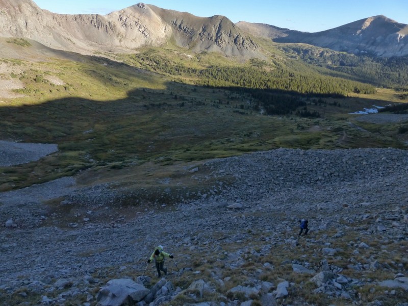 The ridge up Emma Burr is a gentle mix of grass, rock, and talus, with a class 3 (mostly solid) finish, right before the summit. When we got to the class 3 section before Emma Burr's summit (~ 1.5 hrs into the hike), I was done. I was incredibly anxious with the few rock or talus slopes I had crossed, thus far, I did not want to be there. 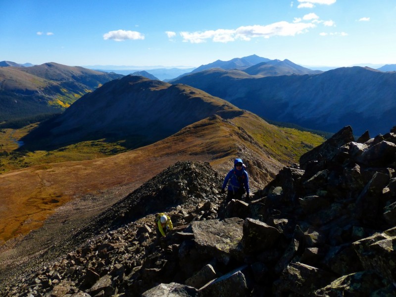 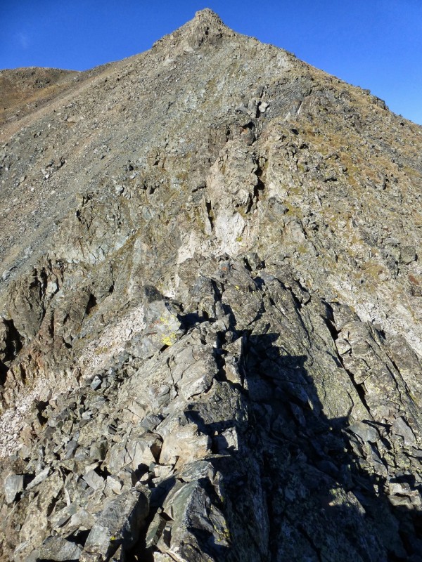 I told Kate that I was going to head down a great trail that we'd found (not on a map), move their car to the intersection with CR 349 and wait for her and Bob there, while they did the loop and brought my car down. Kate: "No." Valerie: "No really, I - " Kate: "No." I'm sorry,...what?... Kate would hear none of my protests. She assured me that we'd take it slow, she and Bob would help me with every step, and that I would not be turning back. A bewildered Valerie: "Ok...." And with that we were heading up the class 3 section to Emma Burr. Still not sure how she did that.... (A note here, as this can be interpreted in the wrong light. Kate nailed it. She knows me, understood what I was going through...as she has had similar accidents, and she knew that the terrain was nothing I couldn't handle.) Bob and Kate pointed out where to go, what rocks to not grab/step on, etc. All stuff I used to be quite comfortable doing for myself, but my connection with the mountains and the rock has changed. 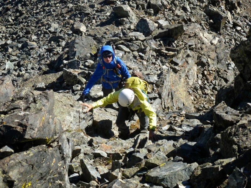 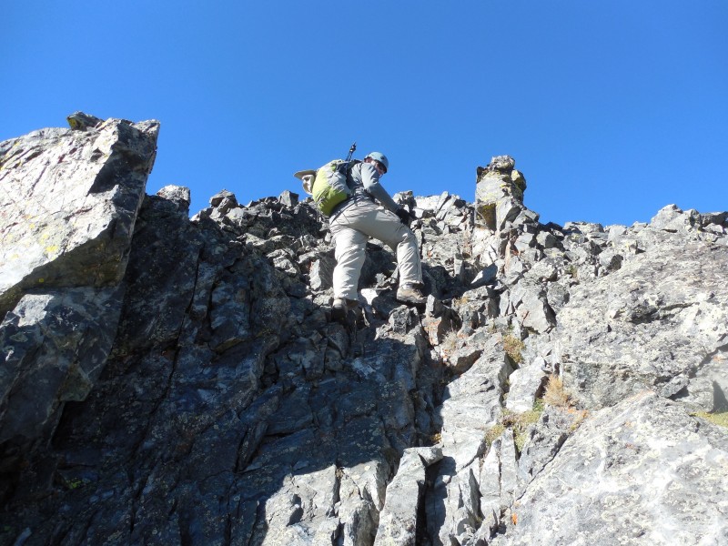 A few short class 2+/3 sections and the 3 of us were on Emma Burr's summit. 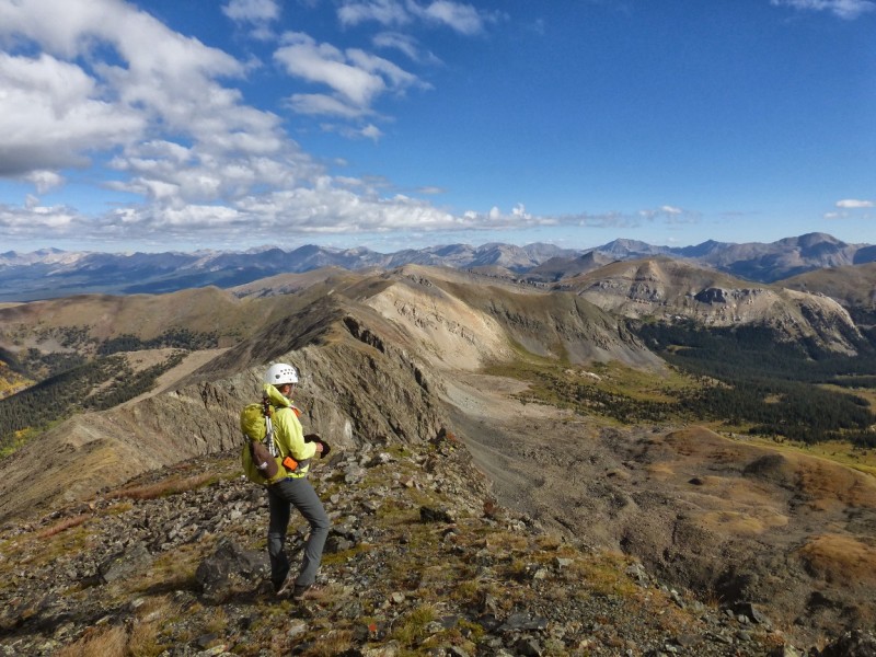 It felt great being on a mountain summit again and the views were stupendous! We stayed for ~12 min, ate, took pictures, and then headed toward Mt. Kreutzer. A cold wind had picked up, but other than that, the hike to Mt Kreutzer was rather pleasant. The ridge is gentle with a mix of rock and tundra along the way. There's a dramatic drop to the east and the views are gorgeous. Our stay on Kreutzer was not long, ~5 min, just long enough to take some pictures and enjoy the views a little.  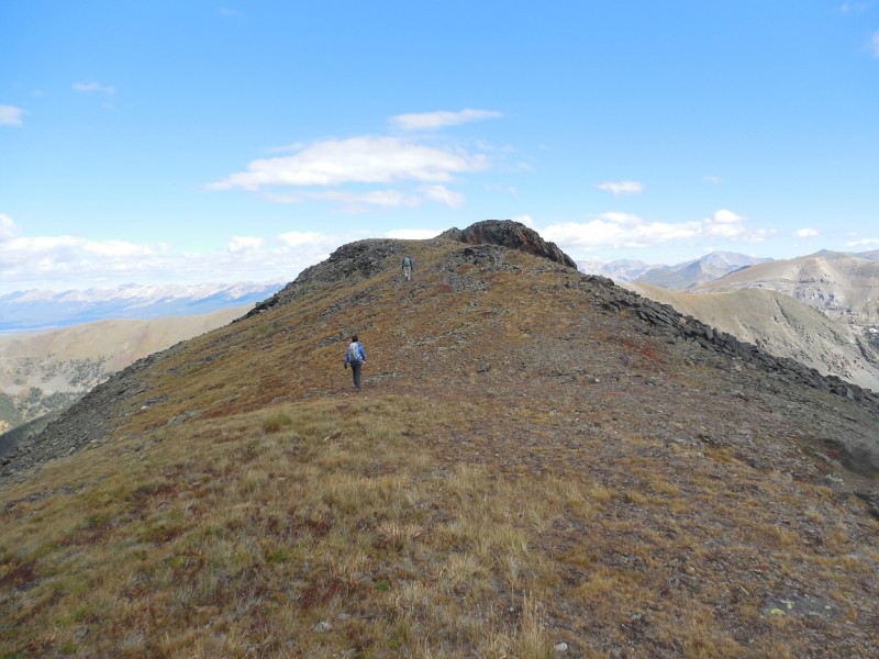 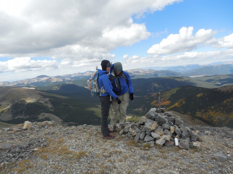 The hike over to "Chalk Rock Mountain" was very similar. Another pleasant hike on a gentle ridge, comprised mostly of grassy tundra, and more gorgeous views. We found a spot out of the cold wind on "Chalk Rock" and hung out for ~20 min enjoying our perch and the changing aspens.  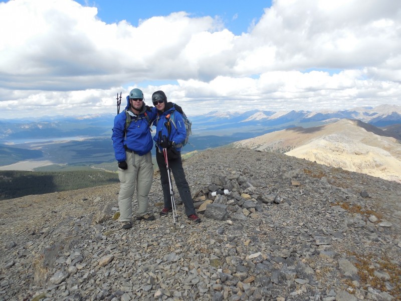 Finally, it was time to get moving again, but our "gentle ridge" runs, were over for the moment. In Otina's report, she had some great information about the ridge from "Chalk Rock" to the saddle with Jones Mtn B so, we knew what to expect. The ridge can be...basically, anything you want it to be...just pick your line. Ridge proper the whole way is class 4 and maybe higher. If one wanted to keep it strictly to class 2 or easier, one could drop off the ridge (to the south) and side hill on scree, then regain the ridge near the saddle. 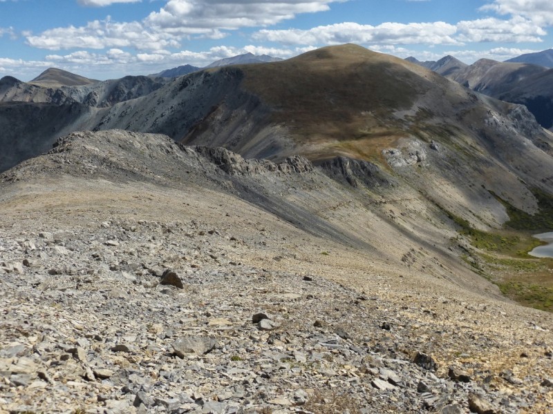 We chose to stay fairly high on the (mostly) solid ridge and it worked out well. Bob did the route finding, while Kate tended to her high maintenance hiking buddy. For the most part, I was fine on the ridge and enjoyed it. I was definitely cautious and focused, but wasn't experiencing the anxiety I was on the rock/boulder slopes...odd. 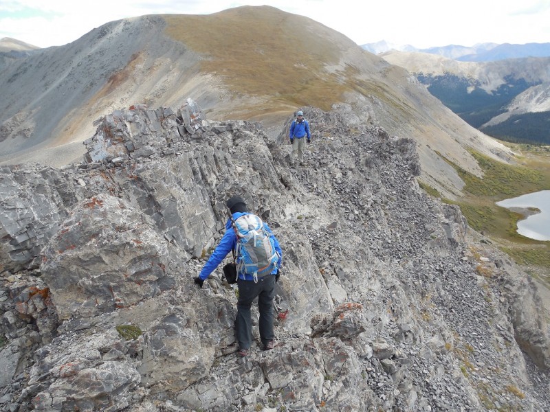  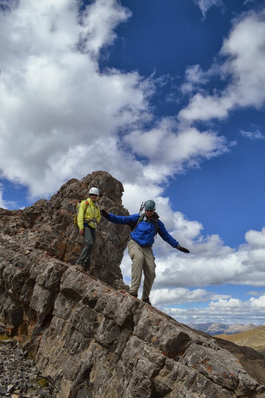 When Bob encountered a class 4 down climb, we dropped to a ledge on the south side. We were able to take the ledge for almost the whole way past the difficulties. It got quite narrow in spots, but it went. 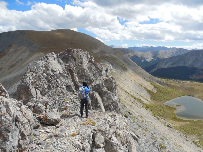 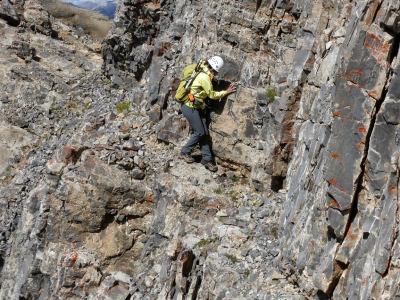 Just before the end of the difficulties, there was a short upclimb (5-7 feet with exposure and a little loose) that I was not comfortable with so, we dropped down about 8-10 feet traversed around and then got back onto the ridge. For the remainder of the trip to the saddle we were able to either stay on the ridge or just on the north side. 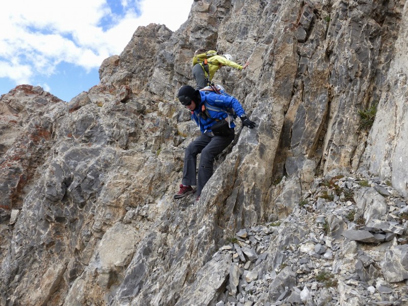  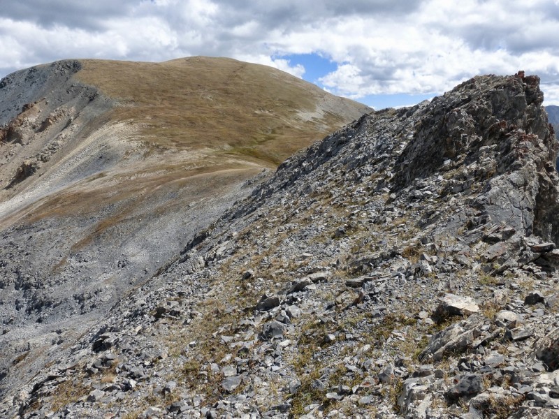 Once at the saddle, there was nothing but tundra facing us up to Jones Mtn B. We stowed our helmets and headed up.  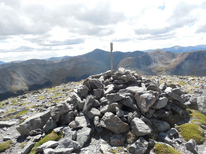 After descending Jones Mtn B, we had to make a decision, try for Gladstone Ridge or head down to my car (~ 0.5 mi away on the road beneath the saddle). The weather was not an issue, but Kate's ongoing knee issues were really flaring up, pretty much from the start. Rather than opt for a half mi walk back to the car on a nice trail and road, Kate wanted to continue on...adding ~5 mi onto our hike and over 1000 ft of elevation gain/loss. WTF Kate? 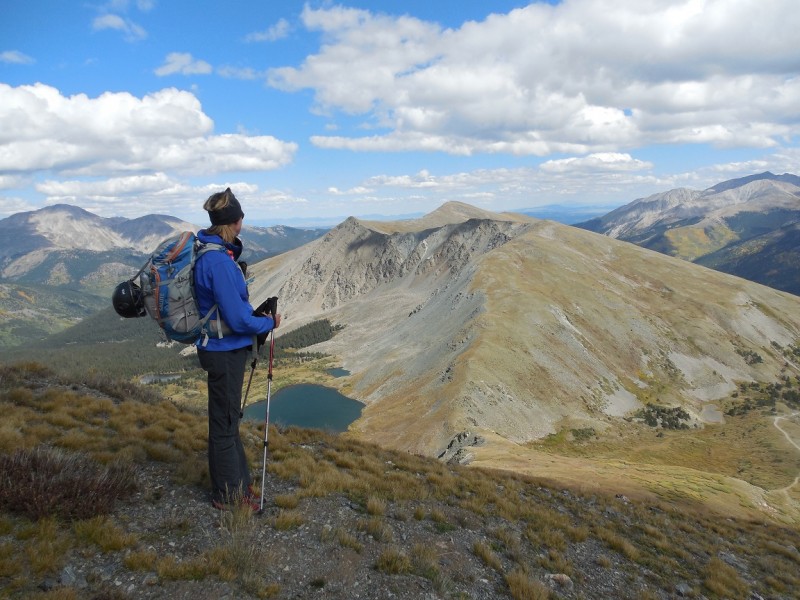 The ridge to the summit of Gladstone Ridge is ~3 mi from the summit of Jones Mtn B. It's long, but it goes fairly quickly. It took me 1:40 or 1:45 and that included me being VERY squeamish about another (short) rock field and some talus slopes that we crossed to skirt one of the bumps on the ridge. I actually went up and around a couple of them, while Bob and Kate just trapsed across. I sure hope those doomsday feelings can go away, I want to enjoy this again. We summited Gladstone Ridge at ~4:15p, hung out for 15-20 min and then headed back from whence we came. 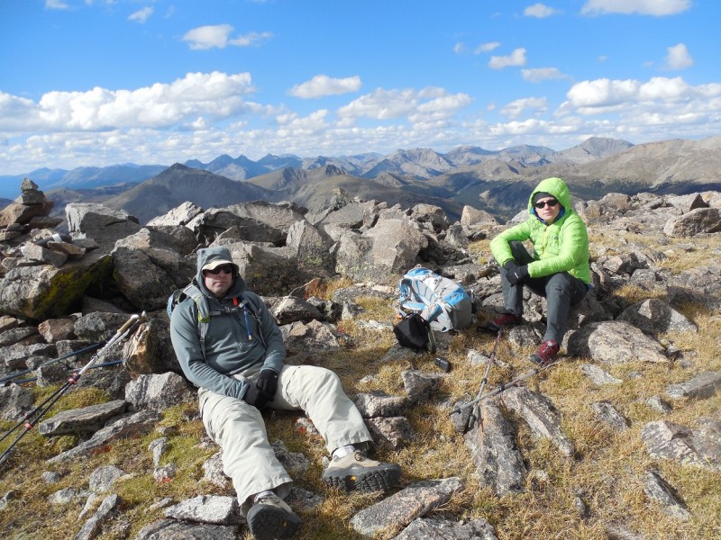 When we got to the low point, between Jones and Gladstone Ridge, we turned left, down the awesome trail through the willows and back onto CR 349. A few switchbacks later and we were back at my car at ~6:15p. Then came the drive down CR 349. 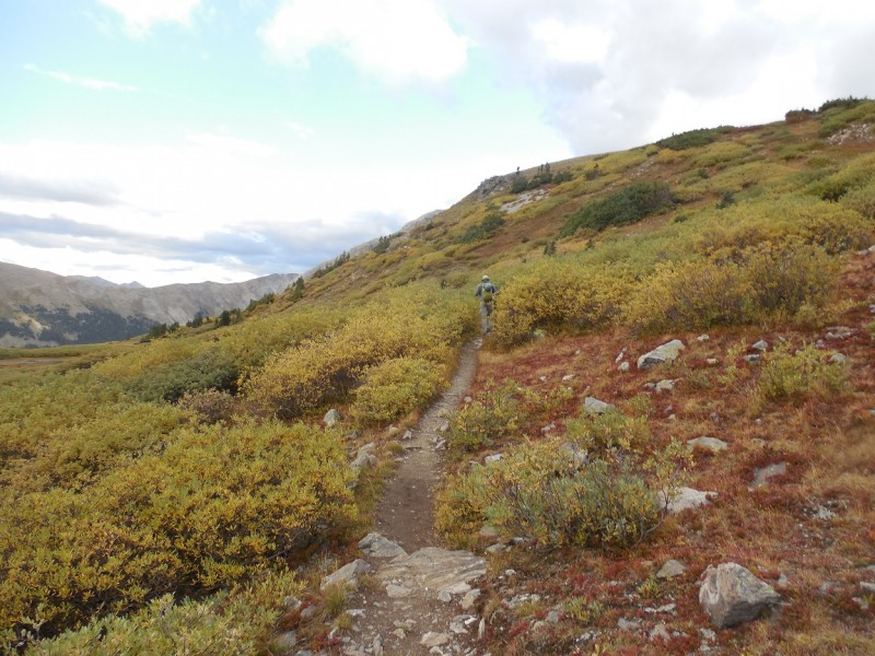 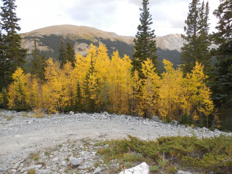 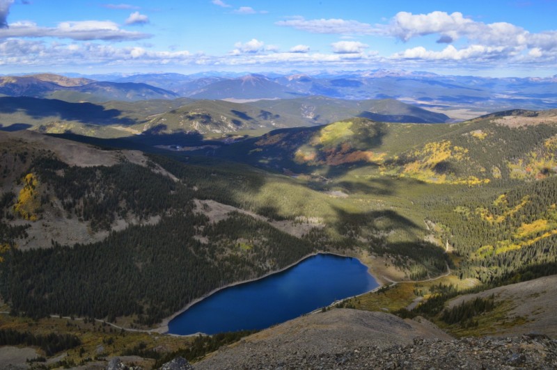 Bob drove (at my request) while Kate and I hopped out at times to move rocks, direct, or just raise the height of the vehicle. We still hit bottom a few times, it was unavoidable...and like my helmet, I am also thankful for skid plates. The car made it back to CR 344 in one piece and we headed the mile or 2 up the road to the Finnmobile. We drove out the 12 mi on CR 344 and back into Buena Vista for a fine post hike meal at Eddylines. While at dinner, Kate checked the forecast for the next day's hike near Tincup Pass and it was pretty much crappy all morning long. High probability of thunderstorms from 9a on. So, we ordered another round and just enjoyed the rest of the night at the restaurant. Then headed back to Avalanche Gulch for the night. As I drove through Buena Vista Sunday morning, I saw a thick layer of dark clouds near the area we would have been hiking. Looks like we made the right call and I'm sure Kate's knee could use the time off. I got a latte and headed home. Again, I want to thank Bob and Kate for their patience, understanding, and for getting me out on these 5 fun peaks! I had a great day and night! 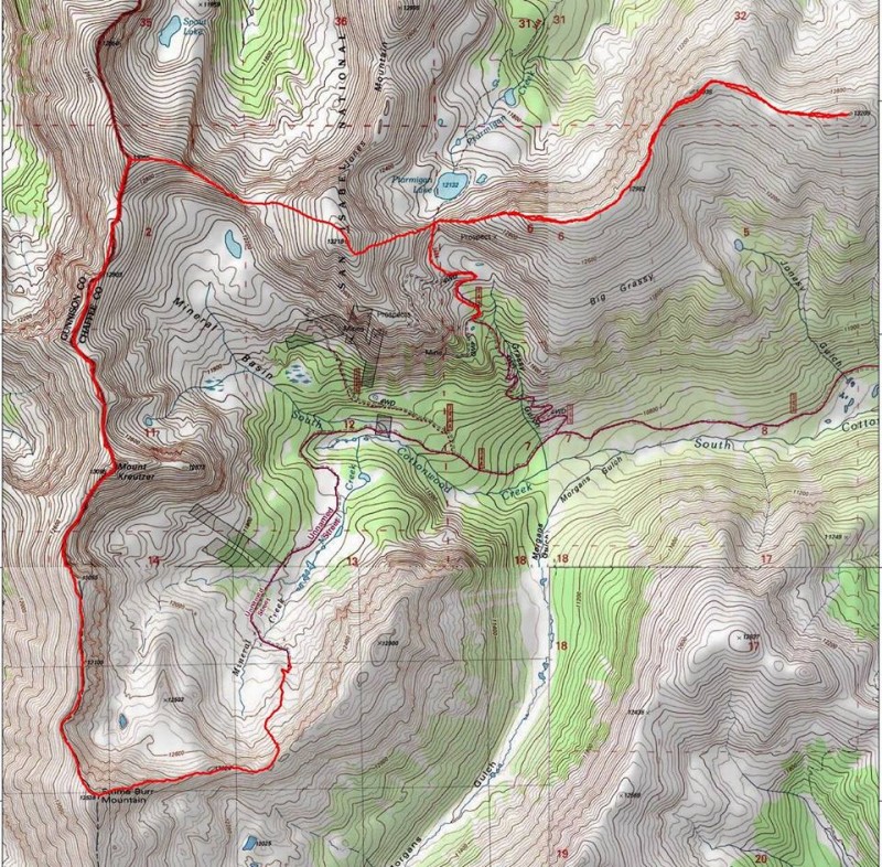 Thumbnails for uploaded photos (click to open slideshow):
")
|
| Comments or Questions | ||||||||||||
|---|---|---|---|---|---|---|---|---|---|---|---|---|
|
Caution: The information contained in this report may not be accurate and should not be the only resource used in preparation for your climb. Failure to have the necessary experience, physical conditioning, supplies or equipment can result in injury or death. 14ers.com and the author(s) of this report provide no warranties, either express or implied, that the information provided is accurate or reliable. By using the information provided, you agree to indemnify and hold harmless 14ers.com and the report author(s) with respect to any claims and demands against them, including any attorney fees and expenses. Please read the 14ers.com Safety and Disclaimer pages for more information.
Please respect private property: 14ers.com supports the rights of private landowners to determine how and by whom their land will be used. In Colorado, it is your responsibility to determine if land is private and to obtain the appropriate permission before entering the property.


