Download Agreement, Release, and Acknowledgement of Risk:
You (the person requesting this file download) fully understand mountain climbing ("Activity") involves risks and dangers of serious bodily injury, including permanent disability, paralysis, and death ("Risks") and you fully accept and assume all such risks and all responsibility for losses, costs, and damages you incur as a result of your participation in this Activity.
You acknowledge that information in the file you have chosen to download may not be accurate and may contain errors. You agree to assume all risks when using this information and agree to release and discharge 14ers.com, 14ers Inc. and the author(s) of such information (collectively, the "Released Parties").
You hereby discharge the Released Parties from all damages, actions, claims and liabilities of any nature, specifically including, but not limited to, damages, actions, claims and liabilities arising from or related to the negligence of the Released Parties. You further agree to indemnify, hold harmless and defend 14ers.com, 14ers Inc. and each of the other Released Parties from and against any loss, damage, liability and expense, including costs and attorney fees, incurred by 14ers.com, 14ers Inc. or any of the other Released Parties as a result of you using information provided on the 14ers.com or 14ers Inc. websites.
You have read this agreement, fully understand its terms and intend it to be a complete and unconditional release of all liability to the greatest extent allowed by law and agree that if any portion of this agreement is held to be invalid the balance, notwithstanding, shall continue in full force and effect.
By clicking "OK" you agree to these terms. If you DO NOT agree, click "Cancel"...
North Twin Sister Elevation: 6,570'
Route: West Ridge, Class 4
Total Elevation Gain: Approx. 5,500 feet
Round-Trip Distance: Estimated 15 miles
Bellingham-to-Trailhead Drive Time: ~45 minutes
The pointy Twin Sisters just east of Bellingham have beckoned us to climb them since moving here, but after reading about them, we kept resisting the urge. Even though the two peaks are both under 7,000 feet in elevation, they're difficult to climb and they have long and confusing approaches. Many people spend two days just to climb one.
But we finally decided to give the North Twin a go, and it turned out to be one of the toughest single-day climbs I have ever done.
The North Twin Sister (6,570') is slightly lower than the South Twin Sister (6,932'), but it's slightly more difficult to climb. We chose it for two reasons: It is a classic alpine scramble and its approach is more doable as a single-day climb (even though many people still do it as a two-day climb).
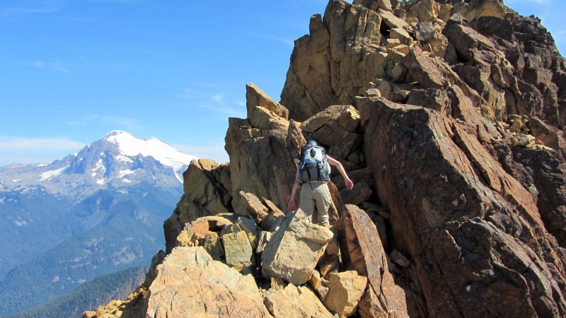
The rock on this mountain is amazing. It's super-grippy rock called Dunite, which is only found above the earth's crust in a few places in the world. The other factors, however, made things very challenging. The routefinding was difficult, the scrambling section was unbelievably long, and the exposure was severe.
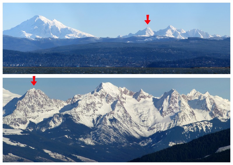
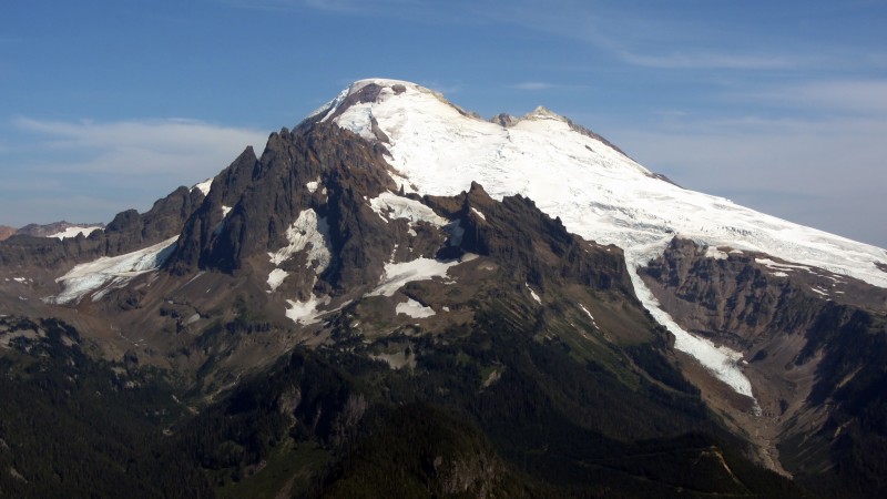
To give you an idea of where Washinton's Twin Sisters are, here are some winter/spring photos I took. The top image is of Mt. Baker and the Twin Sisters, with a red arrow pointing to North Twin and the West Ridge straight down the middle (Bellingham and Bellingham Bay are in the foreground), and the bottom image is a close-up of the Twin Sisters from the Chuckanut Mountains, with a red arrow pointing to North Twin, with the West Ridge running down the front-left, dividing shadow and sunlight:
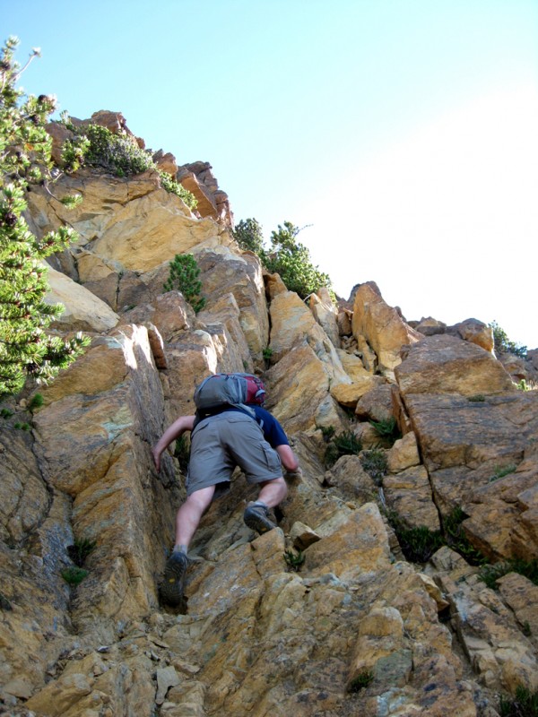
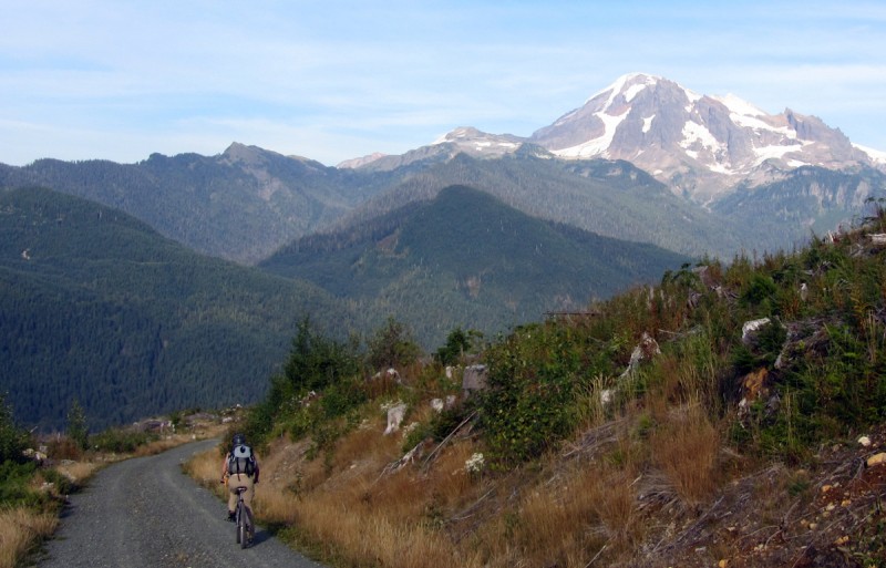
At about 7 a.m., we began pushing our bikes up the steep, long and confusing logging roads. We brought four different route descriptions and they were all vague, ambiguous or incorrect. Somehow, by cross referencing all of them, we figured out which turns to make.
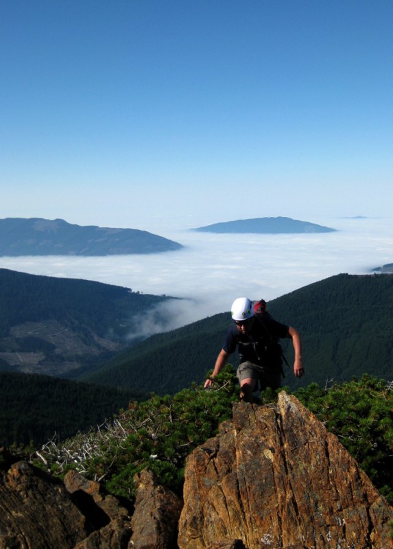
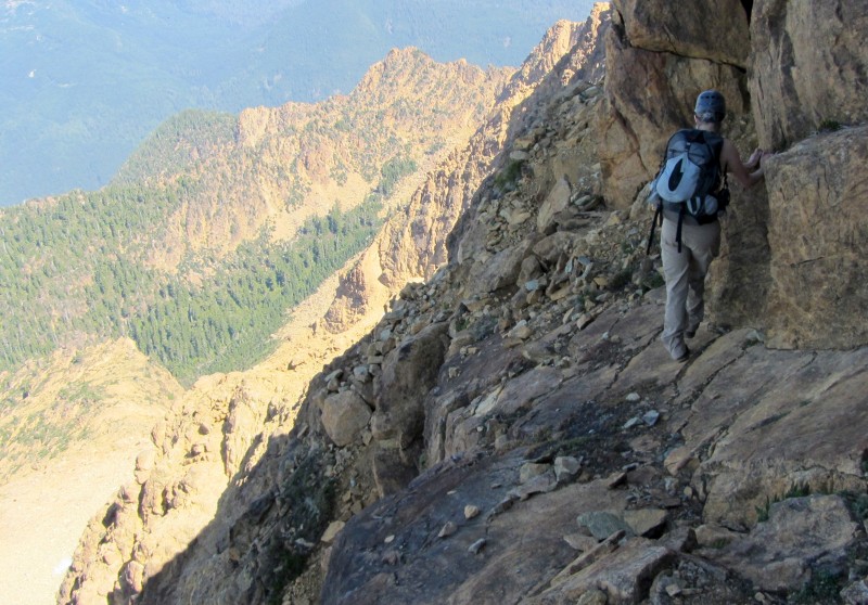
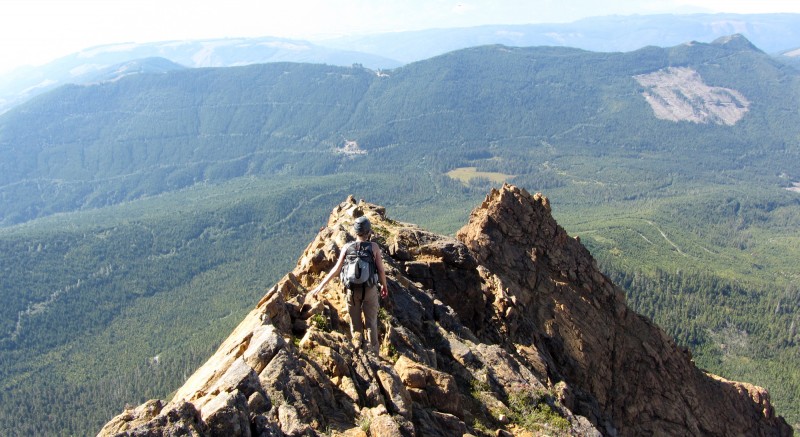
Hours later, after pushing our bikes for approximately 5 miles, we stashed them and finally started up an actual trail, albeit a seriously overgrown trail. Then, farther up the ridge, at about 10:30 a.m., the trees opened up and we began the rock scrambling section.
And by "rock scrambling section," I mean "the longest and most-sustained rock scrambling section I have ever done on a single mountain."
The higher we climbed, the more difficult the rock scrambling became. And it never let up the entire way.
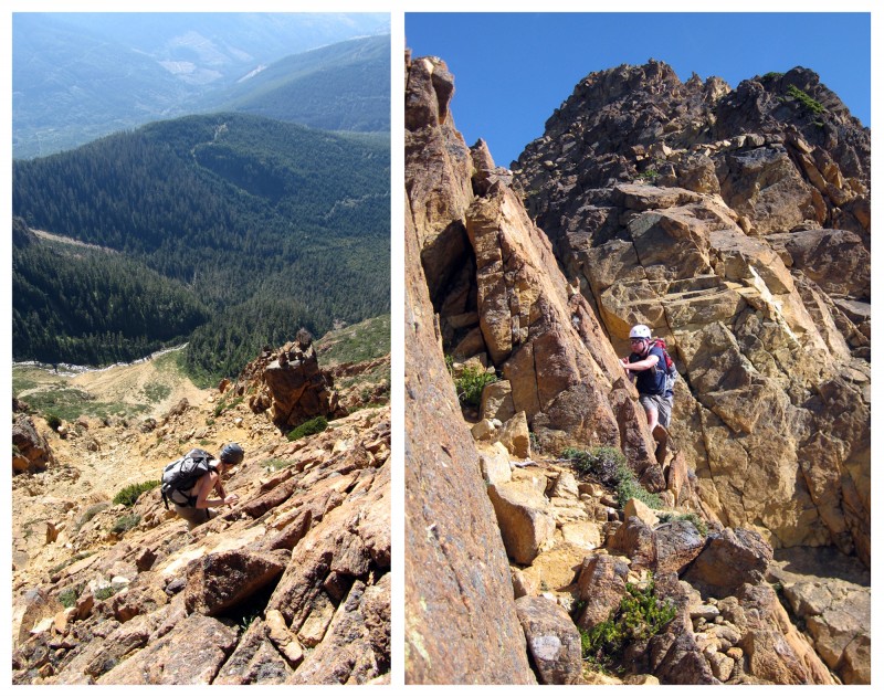
Jen rock scrambling.
Even though there were some loose rocks here and there, the Dunite rock was magnificent and the scrambling was loads of fun.
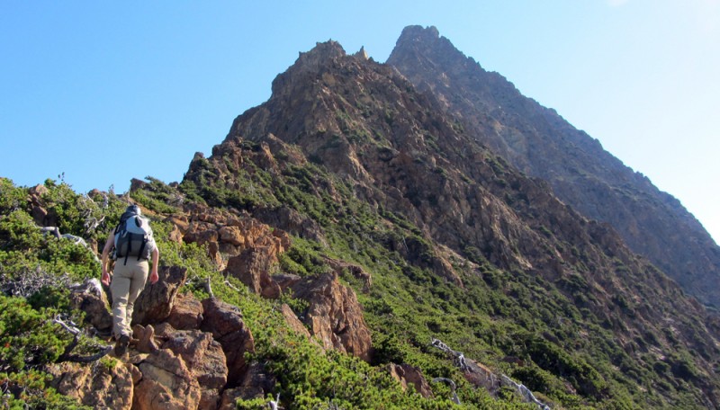
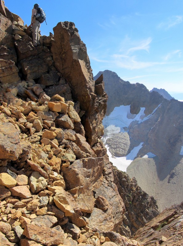
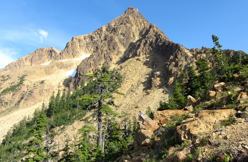
Getting close to the "obelisk," with a couple climbers just above us (they turned around soon after this section):
Some route descriptions say to pass beneath the obelisk and then regain the ridge. We made the mistake of traversing too far, lured by some rather well-built cairns.
My experiences in Colorado taught me to never completely trust cairns, but these cairns were just too alluring for some reason. Plus, the rock above us just looked too difficult to ascend.
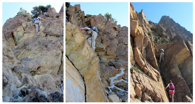
We traversed a particularly difficult gully ...
... which required some climbing ...
... and then we climbed around an airy rib of rock.
And that's when we realized we were way off route. Directly above us were some steep slabs that appeared to be unclimbable, so I worried we'd have to do some serious backtracking. Jen went up to investigate and found that they had some decent hand holds and foot holds in the cracks.
I followed her up. And while the holds were good, I'm not going to lie, it was scary.
If necessary, I felt I could have down climbed that section, but I really didn't want to, so I was really hoping we could find a route to the ridge - without hitting a headwall!
Just above the difficult slab.
Even though it was a bit stressful, we worked through the problem by shouting back and forth with hold suggestions and possible routes options. I'm fortunate to have such an awesome climbing partner.
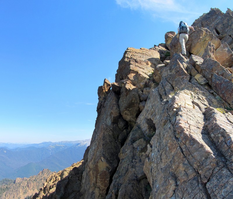
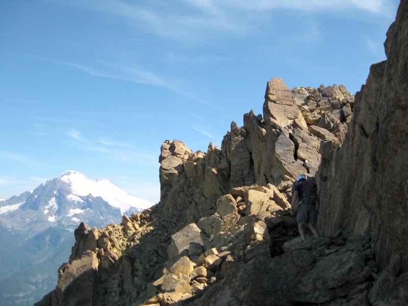
After doing lots of zigzagging, we eventually found a solution back to the ridge crest. Getting to that point wasn't easy, though, and it was among the toughest rock scrambling I have ever done. As a comparison, some of the moves I made felt more difficult than any move I made on the First Flatiron's East Face Route in Boulder.
Even though we made it to the ridge, we still had many routefinding challenges ahead of us. The first big one was to find a way to bypass a headwall. Finding the "sloping slab on the left side of the ridge" was the only part of a route description that actually helped us on this climb.
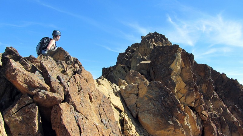
Once back on the ridge, we ran into another block, so we ended up on the right side of the ridge ...
... and then it was back to the left side of the ridge ...
... with more knife edges and narrow-ridge scrambles sprinkled in between.
At 1:20 p.m. (yes, you read that right), we finally gained the summit!
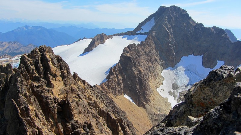
I felt an enormous sense of accomplishment, and the views were heavenly.
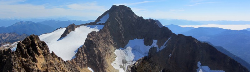
South Twin Sister viewed from North Twin Sister.
South Twin Sister viewed from North Twin Sister.
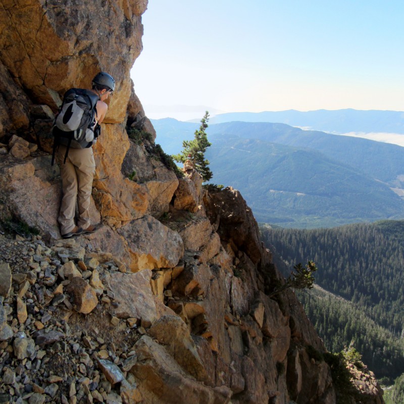
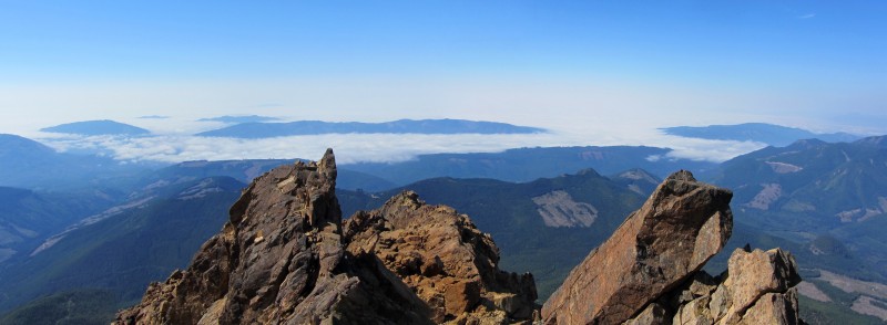
View to the west, toward Bellingham, with the Chuckanut Mountains and the San Juan Islands.
Mount Baker's southwest side.
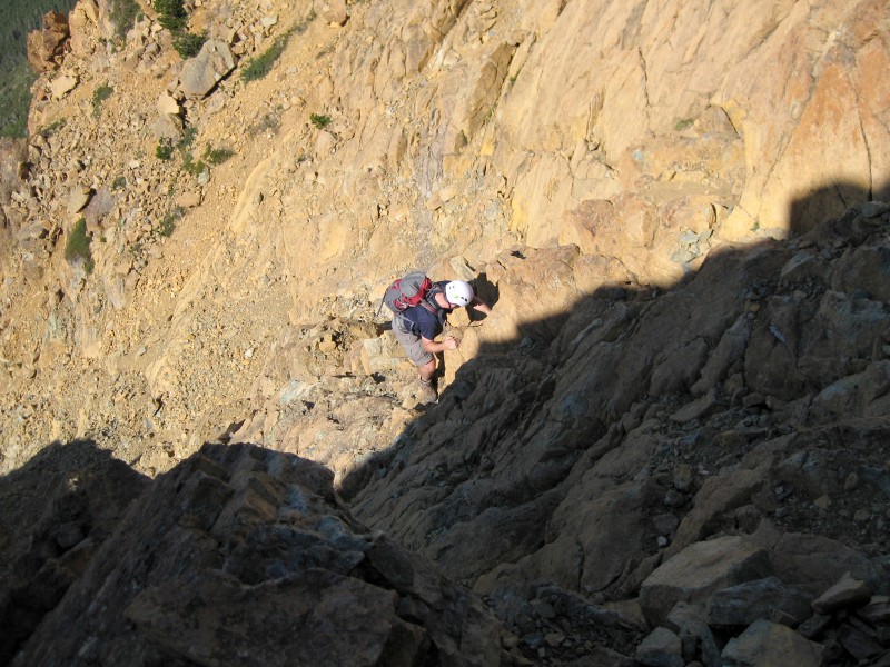
We only spent a few minutes up there because we knew we had a long way back down.
On our descent, we tried to stay on the ridge crest as much as possible.
Of course, when we cliffed out, we had to find traverses just below the ridge.
This was one particularly exposed traverse, which involved using cracks and micro ledges in the slab to get across:
Because we got off route on the way up, many sections were new to us on the way down, so we had to do some backtracking and a lot of improvising.
It was a relief to get back down below the obelisk, even though it was only the halfway point on the ridge.
Below the obelisk, climbers circled in red for scale / reference.
Hot and exhausted, we made it down to the bottom of the scrambling section at 4 p.m. Here's a shot looking up from there (the true summit is out of view):
It was warmer than expected and the climb was longer and tougher than expected, so even though we each brought more than 3 liters of water, we were almost bone dry. Heat exhaustion was becoming a real threat. I even had to sit down for a moment, for the first time that day. If it weren't for the electrolytes in the Sport Beans, I think I would have been screwed.
Fortunately, earlier that morning I decided to put some extra water and Gatorade on the bikes. So we focused intently on getting back down to the bikes as soon as possible. I GPS'd the coordinates, and I carefully watched my GPS all the way down to that oasis.
Jen is not a mountain biker, and the logging roads were steep and loose, so we went slowly on our ride back down. Ironically, the bike ride scared her more than anything on the climb.
Meanwhile, I didn't know what was going to burn out first - my old bike's brakes or my hand muscles.
Just before 6 p.m. we made it back to the truck at the locked gate.
Overall, it was an epic, 11-hour day of non-stop hiking and climbing, plus a brief period of coasting. And even as I type this, my hands are still raw and my legs and arms are still scabbed, scraped and bruised. But it's good to push yourself to your limits every once in a while, and I will not forget this mountain or this experience.
I'll leave you with one last photo of North Twin that I took from Mount Baker:
Thumbnails for uploaded photos (click to open slideshow):
Wow, that looks like an intense day. Pushing your bikes for 5 miles must have sucked. And I'm right there with Jen, the bike ride down the road would have been the toughest part for me.
You are lucky to have an awesome partner! Love seeing you guys getting out and doing all these spectacular, challenging days together. Sure seems like you've both got your scrambling skills dialed and you work together as a team, which is awesome.
Please do keep these coming. Enjoying them immensely. Congrats on a tough summit!
Wow, that was really an accomplishment, great job. What do you think the climbing was in Colorado grades? I ask because I see you listed it as Class 4, but some sections looked low 5th to me, so maybe 4th class in the PNW is low 5th in Colorado? Just curious. Really enjoyed this TR, congrats again.
-Tom
That looks like one tough outing. Relentless scrambling, improvising routes, airy slabs and cracks, exhausting heat .... and sounds like you thoroughly enjoyed it. Nice work.
Pasquel, it was a scrambler's dream, and there were endless route possibilities. If I climbed this mountain 10 more times, I'd probably never go up the exact same way twice.
TomPierce, good questions. As I alluded in my text, I think we did get into some low 5th class ... and we did many class 4 moves. Generally speaking, and IMHO, I think Washington's class 3 is closer to Colorado's class 4. I have been on some ”class 3” routes here that felt harder than any ”class 4” move I've done on any of the Colorado 14er. The term ”scrambling” seems to be used loosely here, too. It can mean anything from scampering on loose rock to very difficult climbing with major exposure. It also takes a lot of work just to get to most scrambling sections ... and many are disappointingly short.
Did you do the Table Mountain above Artist Point (near the Mt. Baker Ski Area)? It is a beautiful area. It's also a great place to visit in the winter (though getting up to Table Mountain would require some special gear).
Great post. It’s one of my favorite moutanins. Sorry to tell you that permit now required.
https://www.wyrecreationnw.com/Permits/PermitDetails.aspx
$200 motorized – family only $50 non–motorized individual. (And they close it for extreme fire danager.)
We live in Acme, WA. contact me if you want more info.
Caution: The information contained in this report may not be accurate and should not be the only resource used in preparation for your climb. Failure to have the necessary experience, physical conditioning, supplies or equipment can result in injury or death. 14ers.com and the author(s) of this report provide no warranties, either express or implied, that the information provided is accurate or reliable. By using the information provided, you agree to indemnify and hold harmless 14ers.com and the report author(s) with respect to any claims and demands against them, including any attorney fees and expenses. Please read the 14ers.com Safety and Disclaimer pages for more information.
Please respect private property: 14ers.com supports the rights of private landowners to determine how and by whom their land will be used. In Colorado, it is your responsibility to determine if land is private and to obtain the appropriate permission before entering the property.