Download Agreement, Release, and Acknowledgement of Risk:
You (the person requesting this file download) fully understand mountain climbing ("Activity") involves risks and dangers of serious bodily injury, including permanent disability, paralysis, and death ("Risks") and you fully accept and assume all such risks and all responsibility for losses, costs, and damages you incur as a result of your participation in this Activity.
You acknowledge that information in the file you have chosen to download may not be accurate and may contain errors. You agree to assume all risks when using this information and agree to release and discharge 14ers.com, 14ers Inc. and the author(s) of such information (collectively, the "Released Parties").
You hereby discharge the Released Parties from all damages, actions, claims and liabilities of any nature, specifically including, but not limited to, damages, actions, claims and liabilities arising from or related to the negligence of the Released Parties. You further agree to indemnify, hold harmless and defend 14ers.com, 14ers Inc. and each of the other Released Parties from and against any loss, damage, liability and expense, including costs and attorney fees, incurred by 14ers.com, 14ers Inc. or any of the other Released Parties as a result of you using information provided on the 14ers.com or 14ers Inc. websites.
You have read this agreement, fully understand its terms and intend it to be a complete and unconditional release of all liability to the greatest extent allowed by law and agree that if any portion of this agreement is held to be invalid the balance, notwithstanding, shall continue in full force and effect.
By clicking "OK" you agree to these terms. If you DO NOT agree, click "Cancel"...
This was my first ascent of a 14er, and I was thrilled to be able to hit two in one day (even though I feel like it barely counts as two). I took off work early, and we drove up to the trailhead the night before.
We left Thornton at around 3pm and encountered significant traffic coming through west Denver on I-70. This was no real surprise, but was a frustrating way to start a trip. Once we got past town to highway 6, it all opened up and was smooth sailing the rest of the way. We got to Bakerville around 5pm and drove up to the trailhead in my 2WD F150. The road has some areas with pretty bad washouts, but we made it with no problem. As others have reported, I saw a number of sedans at the top the next day, so it must be doable without a high-clearance vehicle. However, I wouldn't be willing to risk the damage to my car.
We set up camp in the dispersed camping area around the trailhead. At that time, there were only a few other campers, so spots were plentiful. By about 8pm, there was a pretty steady flow of traffic into the site and spots started filling up fast.
We found what seemed to be a perfect spot down by the creek. Most of the spots have fire rings, so we were mostly looking for flat ground. Unfortunately, it rained from about 8pm to 10pm and then got pretty cool outside. For anyone else picking a site up there, I would recommend choosing a spot in the trees to provide some added protection from the wind/rain and to give you something to tie a tarp off to for some shelter. Since there are no bear boxes out there, that also gives you some better options to hang your food.
I set my phone alarm to get me up at 4am on Saturday morning, but of course it died trying in vain to find a signal. I was actually up by 4:30am, fired up a cup of joe on the cat stove and had two packs of Carnation Instant Breakfast with 2% milk (total about 450 calories) and was on the trail right at 5am. For trail snacks, I brought 4 rice cakes with peanut butter (250 calories each), 2 cheese sticks, some sunflower seeds, a 2 quart bottle of gatorade and a 2 liter camel back bladder of water.
What can I say? I get thirsty.
I immediately learned that my old incandescent head lamp was insufficient. For the next one, I will buy a cheap LED lamp from Walmart ($6 up to $100). However, I made it OK until dawn with only a few stumbles. My trekking pole helped. I also learned that I brought way too many clothes. I started with a short sleeve workout shirt, a long sleeve base layer, a fleece, a hooded jacket and long gym pants over shorts. By the end of the first mile, I had the jacket and fleece strapped to the pack. The long pants stayed on until the top of Grays.
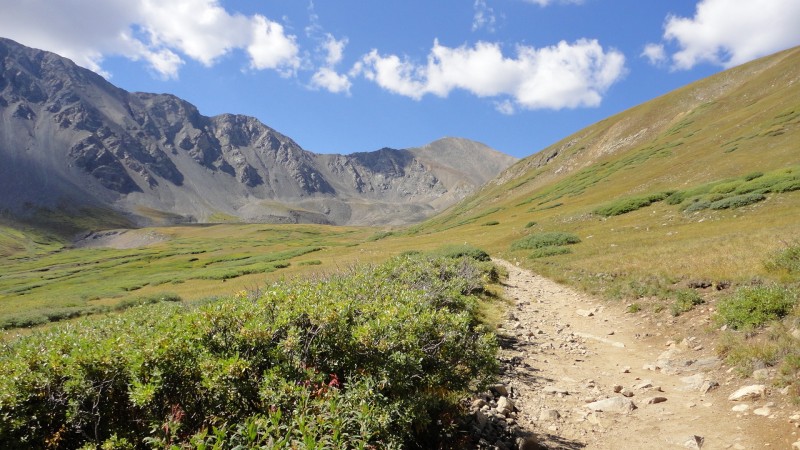
Surprisingly, there were people coming back down already, all of whom reported beautiful conditions on top. Planning my route and pre-selecting my rest stops seemed to help keep me motivated and on track for a puncutal completion. My first stop was at 6am around 12,500' near the first rock field. From there, my next stop was at about 7am for peanut butter rice cake and some gatorade about 2/3 of the way up Grays.
I summitted Grays at 8am and took a little breather there before summitting Torrreys at 9am.
Now out of food and down to my last liter of water, I started down. The descent took me about 2.5 hours, putting me back down to camp at 11:30am. I was surprised that the descent was much harder on my body than was the trip up. It's a lot of impact on the joints, so I was glad to have a trekking pole.
About this time, the clouds were starting to roll in, so I was glad to be getting off the mountain. It started raining about an hour later. Fortunately, I had already broken camp and was on the way back down to I-70.
Lessons learned from this first climb:
1) Don't make camp unless you plan to spend some time there in the afternoon. It was a pain in the butt to break it down while I was worn out from the climb. I wish I would have slept in the truck.
2) Eat a bigger breakfast so you don't get hungry in the first hour.
3) Don't drink as much we did the night before. ;)
4) My hard soled Red Wing work boots were a huge improvement on the rocks over the sneakers that I normally hike in, but they were heavy (steel toe, 8" ankle, 5+ pounds). It was also pretty hard on them. I think it's time to invest in some hiking boots.
5) Like after any strenuous exercise, stretch. I had a little lapse in judgement and skipped this step, so now I'm a little sore.
And just like that, it was over. I had a great hike, met some really cool people and had some spectacular views. #1 and #2 are in the bag. My wife and I are already planning #3 for next week.
See you on the trail.
Thumbnails for uploaded photos (click to open slideshow):
Planning to hike Greys & Torrey's this weekend. This will be our second as we did Elbert over Labor Day weekend. Legs were sore for three days so I plan to take your suggestion and o plenty of stretching afterwards.
We hiked these both the day before you! Took us an hour from Grays to Torreys and 2.5 down as well (some in the rain!). They were our first 2 and we headed over to Buena Vista and bagged Belford/Oxford the next day (awesome hike, much longer and steeper and fantastic views). A longer day but definitely double worthy!
Caution: The information contained in this report may not be accurate and should not be the only resource used in preparation for your climb. Failure to have the necessary experience, physical conditioning, supplies or equipment can result in injury or death. 14ers.com and the author(s) of this report provide no warranties, either express or implied, that the information provided is accurate or reliable. By using the information provided, you agree to indemnify and hold harmless 14ers.com and the report author(s) with respect to any claims and demands against them, including any attorney fees and expenses. Please read the 14ers.com Safety and Disclaimer pages for more information.
Please respect private property: 14ers.com supports the rights of private landowners to determine how and by whom their land will be used. In Colorado, it is your responsibility to determine if land is private and to obtain the appropriate permission before entering the property.


")
")
")
")
")
")


