Download Agreement, Release, and Acknowledgement of Risk:
You (the person requesting this file download) fully understand mountain climbing ("Activity") involves risks and dangers of serious bodily injury, including permanent disability, paralysis, and death ("Risks") and you fully accept and assume all such risks and all responsibility for losses, costs, and damages you incur as a result of your participation in this Activity.
You acknowledge that information in the file you have chosen to download may not be accurate and may contain errors. You agree to assume all risks when using this information and agree to release and discharge 14ers.com, 14ers Inc. and the author(s) of such information (collectively, the "Released Parties").
You hereby discharge the Released Parties from all damages, actions, claims and liabilities of any nature, specifically including, but not limited to, damages, actions, claims and liabilities arising from or related to the negligence of the Released Parties. You further agree to indemnify, hold harmless and defend 14ers.com, 14ers Inc. and each of the other Released Parties from and against any loss, damage, liability and expense, including costs and attorney fees, incurred by 14ers.com, 14ers Inc. or any of the other Released Parties as a result of you using information provided on the 14ers.com or 14ers Inc. websites.
You have read this agreement, fully understand its terms and intend it to be a complete and unconditional release of all liability to the greatest extent allowed by law and agree that if any portion of this agreement is held to be invalid the balance, notwithstanding, shall continue in full force and effect.
By clicking "OK" you agree to these terms. If you DO NOT agree, click "Cancel"...
It's been a while since I have posted any trip reports, so I thought I'd put up a few of our recent climbs in the North Cascades. Here's the first, and I'll post a couple more in the coming weeks.
Mt. Pugh, 7,201'
Round-Trip Distance: 11+ miles
Total Elevation Gain: 5,300 feet
Class 3 with lots of exposure
Climb Times: 4 hours up, 2 hours down
Jen and I have been wanting to climb Mt. Pugh for some time, but I'll admit, the more I read about it, the more I put it off, due to my rational fear of heights.
Earlier this summer we met some hikers on a trail, and somehow Mt. Pugh came up. They said it was the scariest hike they have ever done. That didn't ease my fears.
Exposure thresholds are very subjective and they vary greatly from one person to another, of course. But almost every route description and trip report I read about Mt. Pugh made my palms sweat. One guidebook even describes it as "extremely difficult and taxing" and "downright frightening." So I guess you could say I wasn't in a rush to do it.
But with all the stellar weather we've had since the spring, our "summer list" of mountains quickly dwindled and Pugh surfaced to the top.
Because it is such a long and difficult climb, we made sure to get a really early start. So, in the wee hours of the morning, at about 8:30 a.m., we started up the trail.
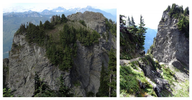
The first portion of the trail was your standard PNW lush-green forest. Beautiful, in and of itself, but once we broke out of the trees, things got a lot more interesting. The route up to Stujack Pass didn't look very far, but it was deceiving, and it took longer than expected. From below, you can't see the countless switchbacks that zigzag up the wildflower-filled talus slope.
Hikers above us, on their way to Stujack Pass.
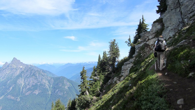
The view from Stujack Pass was fantastic, but we didn't spend much time there, as we still had 1,500' to gain on mostly exposed terrain. Even the "easy" sections of trail traversed steep grass slopes that dumped over cliffs.
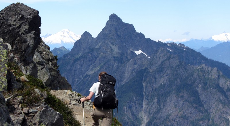
The farther up we went, the narrower the trail became.
My eyes were mostly focused on my feet, but I occasionally stopped to soak in the views.
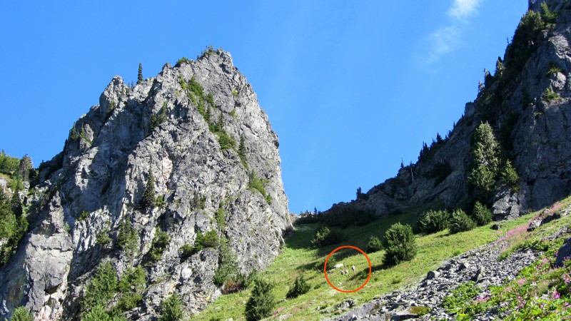
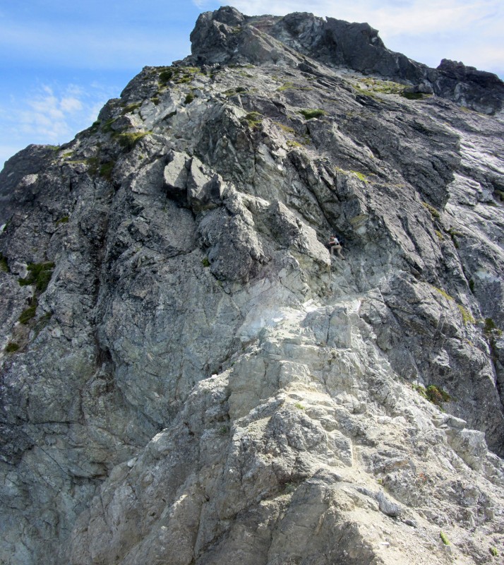
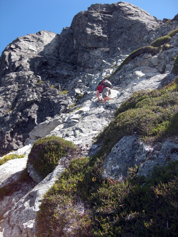
When the trail meandered over to the left side of the ridge, we finally got our first good look at the upper reaches of the mountain, and it was intimidating.
Jen on the trail in front of me, with climbers in the distance (inset in red).
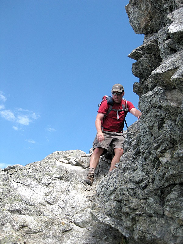
After some fairly easy - albeit exposed - hiking, we made it to the col right below the Class 3 section. A couple guys were sitting there enjoying the views, and they warned me, "This is where it gets hard."
Jen started investigating the rock while I talked to them, hoping to glean some beta on the route. "Are you guys going up?"
"No, we're turning around here." After looking up at that looming wall, I considered doing the same.
But then Jen yelled down, "Hey, the rock is pretty good! Come on up."
Unfortunately, to get to the "good rock," you have to walk across an airy col.
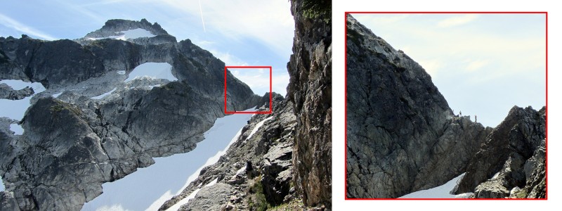
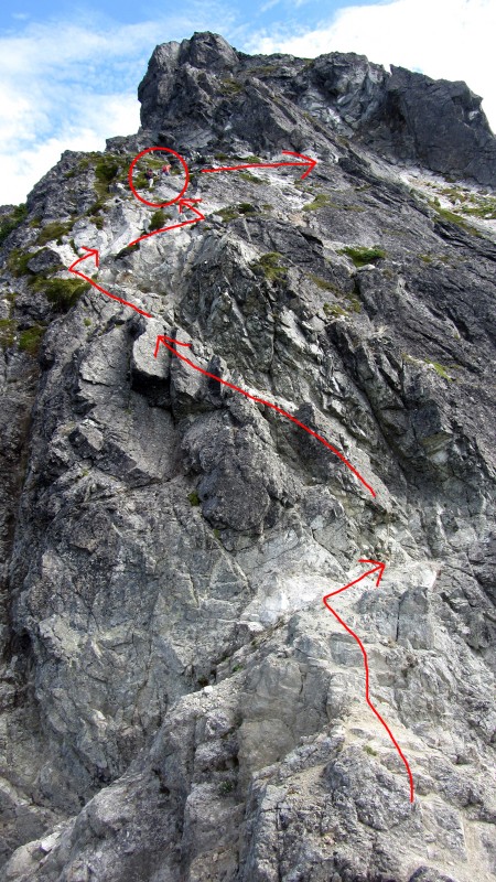
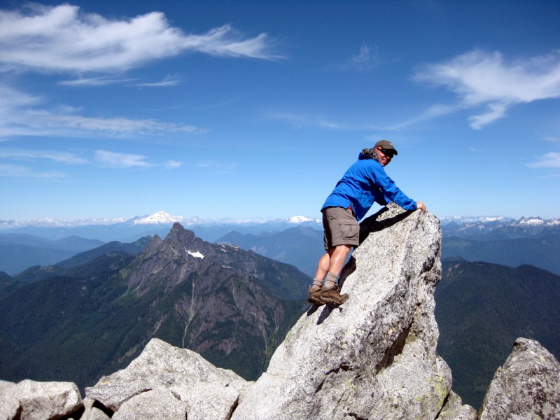
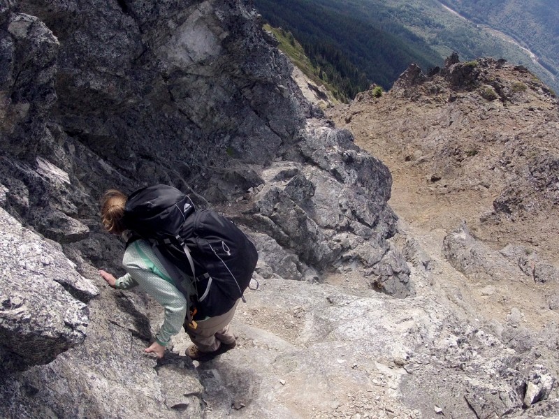
Once I started up the rock, it wasn't as bad as it looked below, and the scrambling was fairly easy Class 3. The exposure, however, was rather insane. Especially on the loose scree sections that were directly above a cliff that dropped straight down onto the top of a steep, icy glacier.
Three-photo, vertical pan with Jen in the middle of it.
Route, roughly drawn, in red, with climbers toward the top.
Loose dirt/scree section above the cliff.
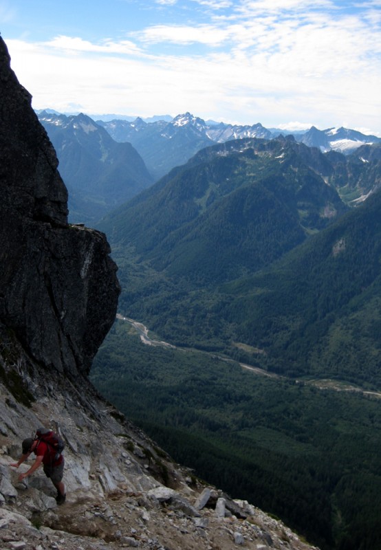
Looking back, with the Sauk River far below.
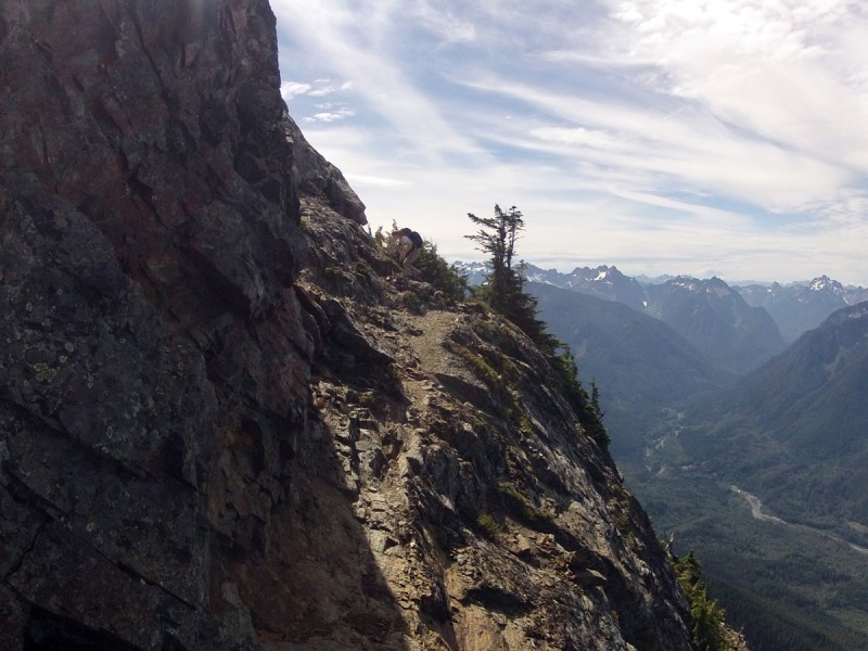
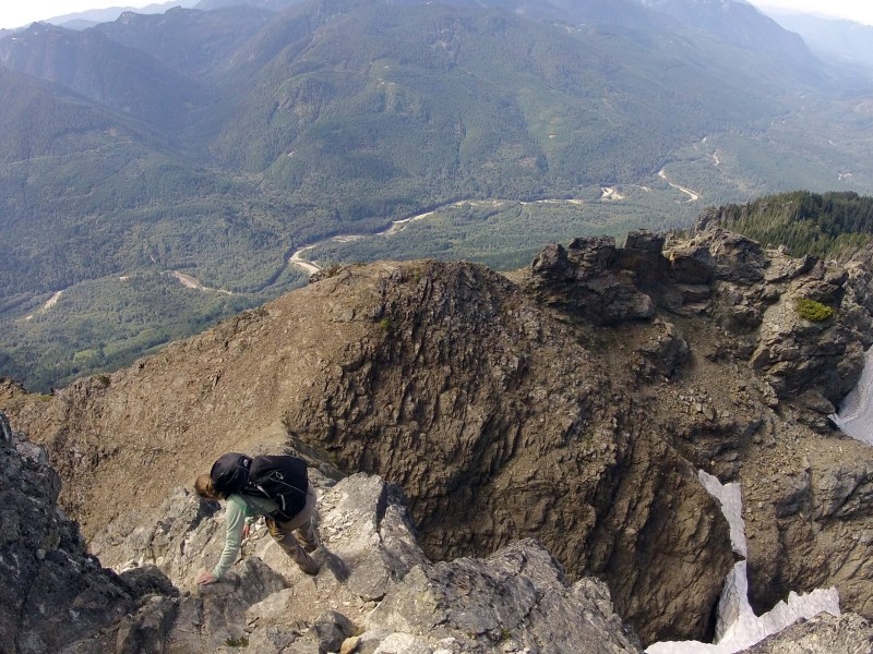
From there, the route featured more rock, lots of narrow trails on steep slopes, and one slabby section.
The one slabby section was particularly nasty, and it was also a no-fall zone. There were basically two crappy options: Go up loose scree or go up pebble-covered slabs.
Even the easy sections of trail were a bit vertigo-inducing.
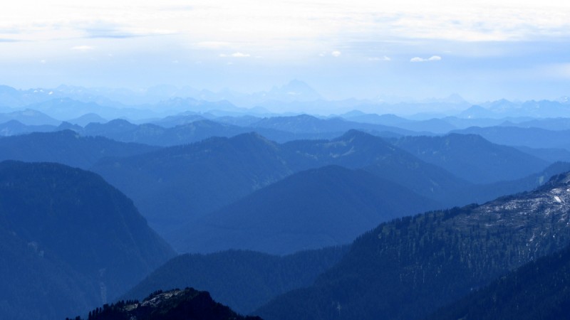
Eventually, we gained the summit just as a party of 3 was heading down. Magnificently rugged mountains extended into the horizon in every direction.
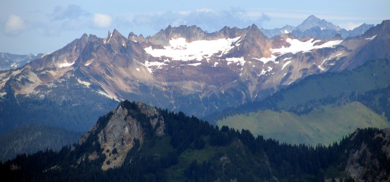
We had some awesome views of Glacier Peak to the east.
This summit boulder reminded me of the one on Snowmass.
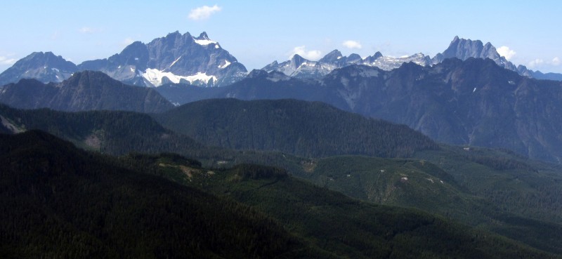
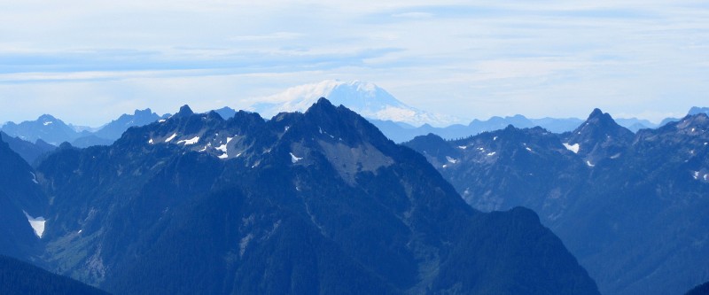
Sloan Peak to the south was particularly impressive as well, and we could even see Mount Rainier to the southwest.
Sloan Peak, with Mt. Rainier in the distance on the right.
Not 100%, but I believe that's Mt. Stuart, dead center in the distance.
Mt. Rainier off in the distance to our southwest.
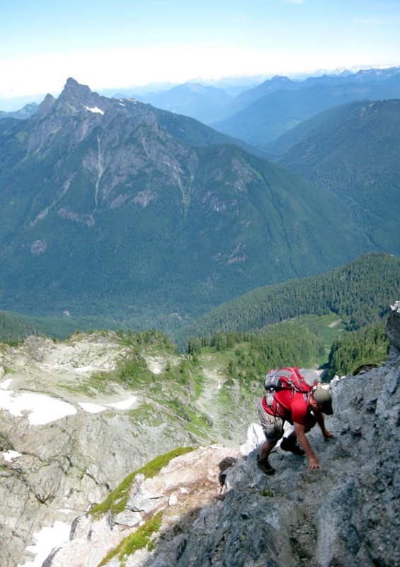
After enjoying the summit all to ourselves for about 20 minutes or so, we began our descent. New perspectives kept things interesting.
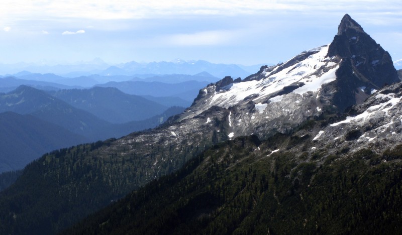
Mt. Baker, White Chuck Mtn., and Mt. Shuksan.
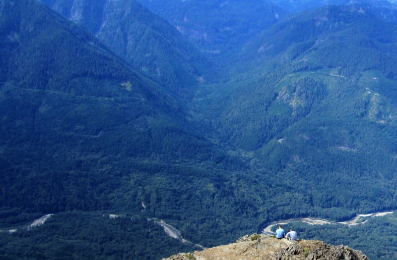
The vertical relief and prominence of the mountains in the North Cascades region always blows me away. On this mountain, for example, there's 6,100 feet of vertical difference between the river at the bottom of the valley (seen in the following photo) and the summit of Mt. Pugh, which is directly above the valley.
By the time we made it back down to Stujack Pass, my nerves were spent. 2.5 hours was a long time to spend on exposed terrain.
Getting back down to Stujack Pass.
We didn't rest, though, because we still had to hike 3,800 feet back down to the trailhead.
On our 1.5-hour drive back to Bellingham, a rainstorm rolled in out of nowhere, and we were so glad to be off the mountain. I felt like we were back in Colorado, dodging afternoon storms.
Overall, I thought Mt. Pugh was an amazing climb with amazing views, even though it rattled my nerves a bit. And as it turned out, I'm glad we did it when we did, because it broke me in a bit and it prepared me for the even more exposed mountain we climbed the following weekend (TR to come).
Side note of interest: NW Peaks Brewery in Seattle has a beer named Pugh Pale. THIS LINK has a description about it with a great shot of Mt. Pugh from White Chuck.
Thumbnails for uploaded photos (click to open slideshow):
One of the major drawbacks of reading great TR's is that it tells me how many super trails and climbs there are in this world that I will probably never get the opportunity to even attempt. But at least I can enjoy them at home. Thanks for sharing yours! :D
Since we've had an Aubrey TR. Absolutely incredible. I have to admit, you guys are making a much better case than my wife is to relocate back to the PNW. Looking forward to the next reports. You guys ever explore that waterfall I sent you a while back?
Floyd, haven't done that waterfall ... too many things closer to home keeping us busy, including lower B.C. Actually, we haven't even made it to Vancouver Island yet ... might go there toward the end of this year, though it will be mainly to hit some breweries. And hey, just think, if you move up here, you'll instantly have some climbing companions!
Caution: The information contained in this report may not be accurate and should not be the only resource used in preparation for your climb. Failure to have the necessary experience, physical conditioning, supplies or equipment can result in injury or death. 14ers.com and the author(s) of this report provide no warranties, either express or implied, that the information provided is accurate or reliable. By using the information provided, you agree to indemnify and hold harmless 14ers.com and the report author(s) with respect to any claims and demands against them, including any attorney fees and expenses. Please read the 14ers.com Safety and Disclaimer pages for more information.
Please respect private property: 14ers.com supports the rights of private landowners to determine how and by whom their land will be used. In Colorado, it is your responsibility to determine if land is private and to obtain the appropriate permission before entering the property.