Mountains: El Diente Peak, Mt. Wilson, Wilson Peak
Access: Kilpacker Basin
Mileage: 30 miles total
Difficulty: Class 3, a few Class 4 sections on El Diente-Mt. Wilson traverse
Getting into the mountains just makes me excited. With less than a dozen 14ers left, my sister and I wanted to get some more peaks in before the summer was over. Finally, we settled on the Wilson group over Labor Day weekend. So, on Friday morning our group of four headed down to the San Juan mountains. We decided on climbing from Kilpacker Basin, which turned out to be a 5 star camping experience!
A beautiful view of El Diente Peak from our campsite:

We set out at 4:00 in the morning on Saturday in the hopes of getting the El Diente-Wilson traverse in good weather. Enjoying the end of a clear, starry night, we hiked to the high basin below El Diente's south slope and started up the steep mountain. Soon it became light enough for us to see the upper mountain clearly.

Approaching the summit ridge:


The South Slopes route was straight-forward for the most part - the only tricky section, we found, was that before actually cresting the ridge, the route turns and traverses left along the ridge to avoid rock spires on the ridge known as the Organ Pipes.


Looking down the steep South Slopes route:
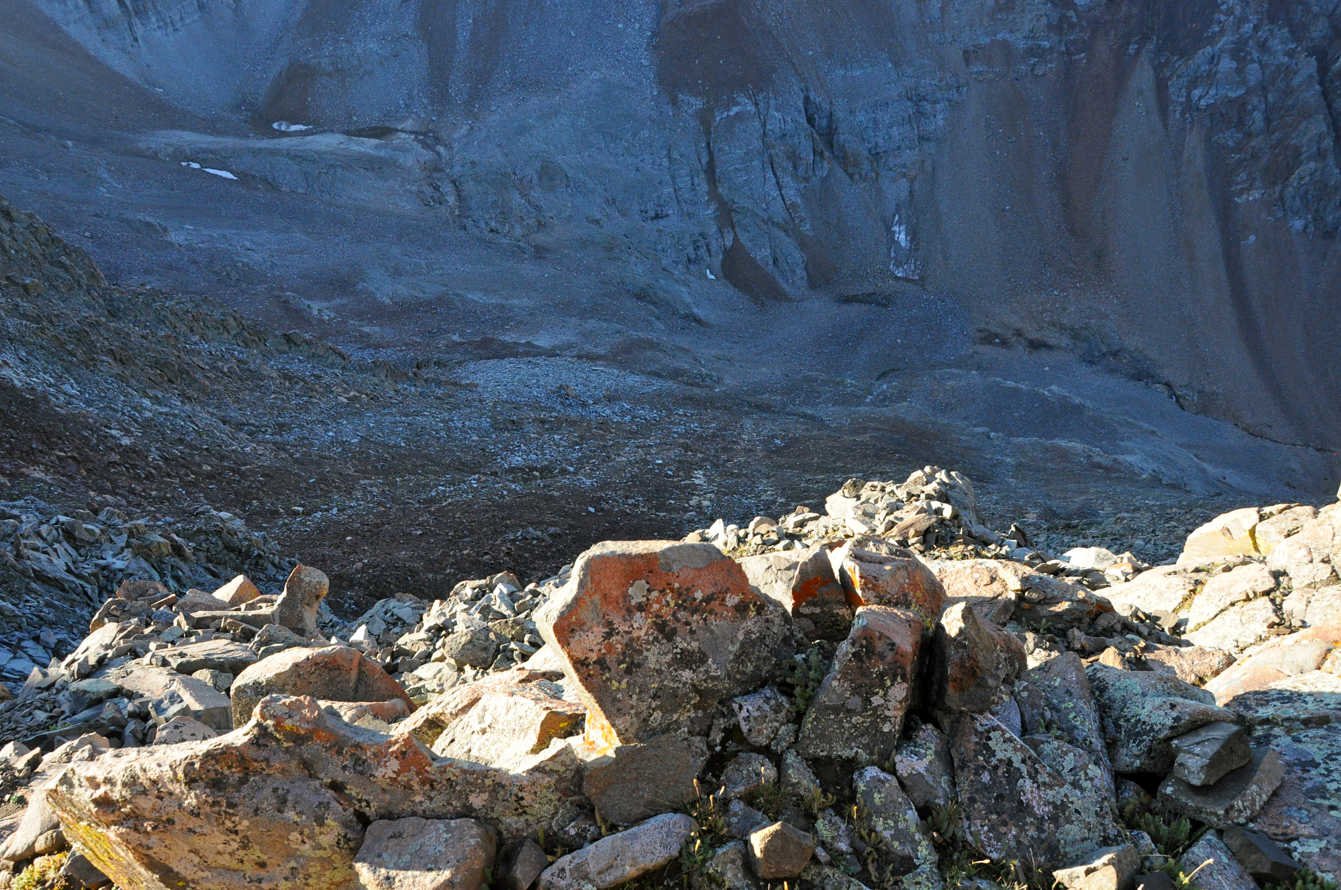
Eventually, the route climbs up a loose gully to the ridge crest and traverses to the north for the last 150' or so.
Wilson Peak from the ridge crest:

Mt. Wilson and the rugged connecting ridge in between:

The final climb to the summit:

I scramble up the final few feet:

Before we knew it, we were on the summit. What a great route up an awesome mountain!
A pika on the summit:

Looking down to the meadow where we camped:

Now, the challenge awaited us - the mile-long connecting ridge to Mt. Wilson, one of the four great 14er traverses!
At first, the traverse route stays off to the south of the ridge...


Scrambling around one of the gendarmes along the ridge:

A dark cloud gives El Diente a menacing look as we escape its shadow:

Back up to the ridge...


Wilson Peak watches our progress:

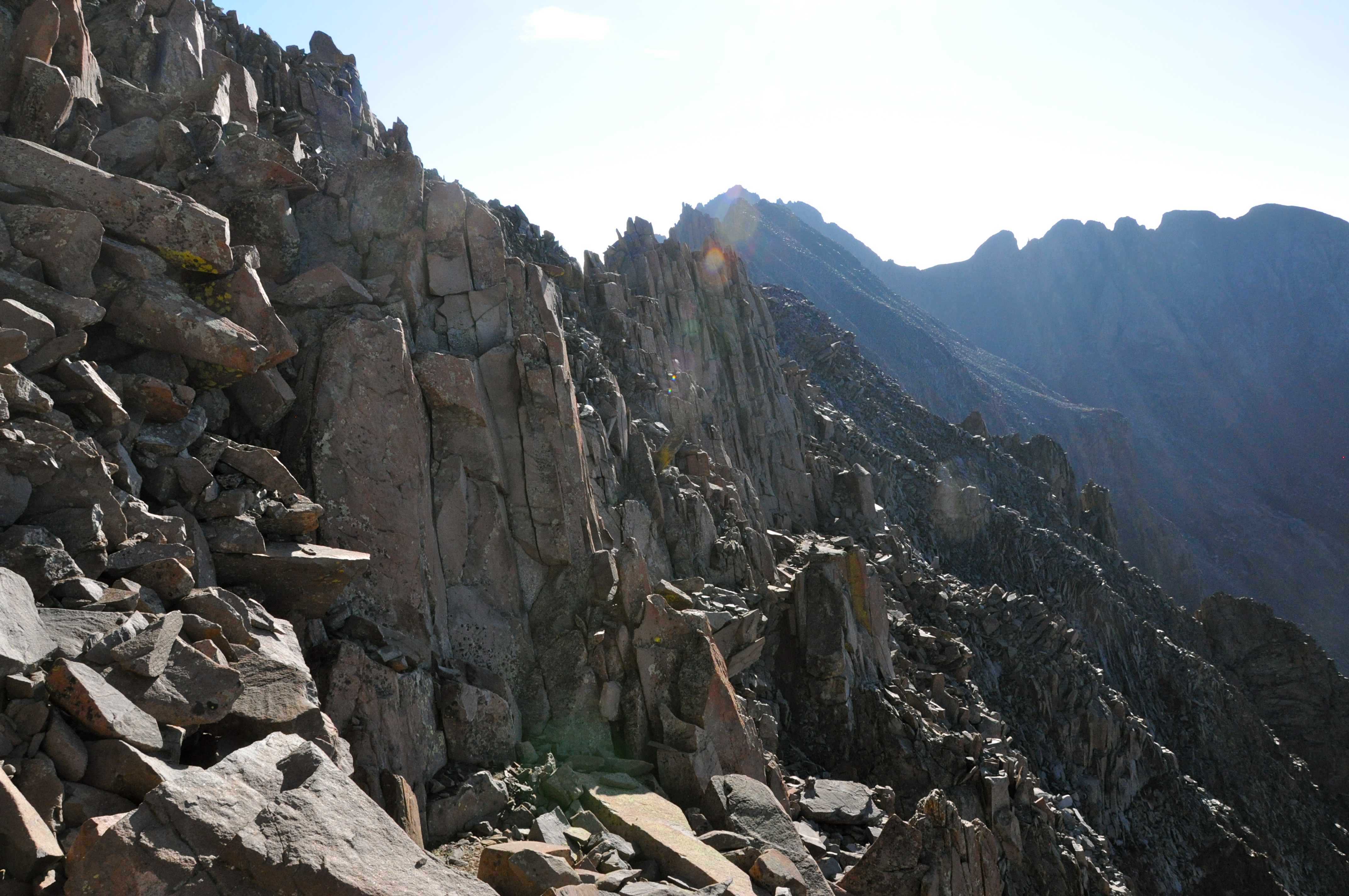
From here, the route stays on the ridge for most of the remaining route. Some excellent scrambling awaited us as we approached the main difficulties on Mt. Wilson's side...

A steep wall of rock challenges us, our first major obstacle:

Down to the saddle...

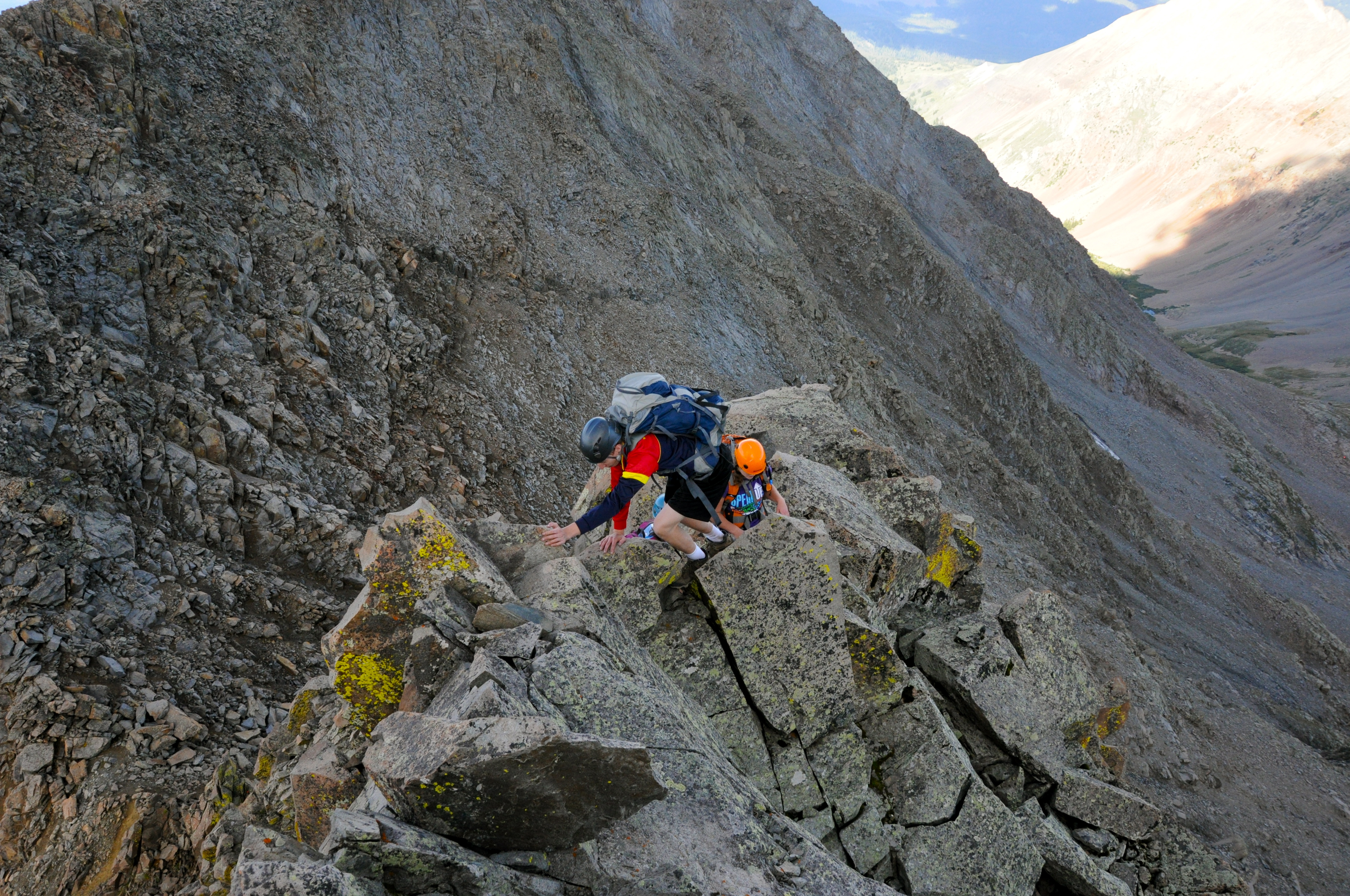
...and up the steep rock...


More exposed scrambling on the ridge:
Back on top:

Crossing the narrow ridge:

One final downclimb...

...and then, the final challenge - Mt. Wilson itself!

Climbing around one more time to gain the final ridge:


The final difficulties:

Just before the summit, the crux and climax of our climb!

Up and over...

Summit!

El Diente and one awesome ridge traverse:

Despite our excitement at finishing the traverse, the dark clouds and rumbling thunder encouraged us to get off the summit and figure out a feasible route into Kilpacker before the storms hit.
Looking down the face that we would have to descend:

As it turned out, we found a route that didn't exceed Class 3, although the rock was quite loose. We dropped off of the summit about 25 feet or so into a gully and started climbing down.

Almost immediately, the gully split into two:

We opted for the right gully and followed it until it cliffed out and we had to traverse right again, this time over a rock rib. This crossover was surprisingly easy and led to a gentler gully that we followed the rest of the way.
Crossing over:

In the final gully:

This last gully held lots of loose rock, but we were soon off the mountain. Now, we just had to descend nearly a mile of loose, broken talus, which proved a challenge in itself...

Mt. Wilson (our descent route is right of center but hard to distinguish):

Back under El Diente:

Eventually, we got back on the trail. Before long, an all-out torrent of rain and thunder let loose, and we got down fast! Soon, we were back at camp.
Sun rays from campfire smoke:

The next morning, we were back on the trail around 4:00, since Wilson Peak from Kilpacker is a long hike, about 16 miles roundtrip from our campsite. We trudged along the muddy trails in the dark, and 4.5 miles later, we reached Navajo Lake.

Navajo Lake:


My brother got this awesome shot of the lake from the other side:

Looking down Navajo Basin:


Wilson Peak from Rock of Ages saddle:


Mt. Wilson and El Diente Peak from 13,200':

My brother ran out of steam at the 13,200' saddle and opted to stay back while the rest of us climbed to the summit.
Final stretch to Wilson Peak:


Almost to the false summit:

From the top of the false summit, the final crux came into view...

This last wall looked pretty steep and loose, but it turned out to be a fun, solid scramble - definitely worth coming back to climb again!


Wilson Peak - my 50th fourteener summit!

The rain hit much earlier this time, so we ended up having to scramble down on wet rock. However, the cooler weather proved pleasant as we hiked all the way back to Kilpacker Basin.
Final shot from Navajo Lake:

It was hard to leave this beautiful area of Colorado, but we'll be back, no doubt. Thanks for reading!
|


