Download Agreement, Release, and Acknowledgement of Risk:
You (the person requesting this file download) fully understand mountain climbing ("Activity") involves risks and dangers of serious bodily injury, including permanent disability, paralysis, and death ("Risks") and you fully accept and assume all such risks and all responsibility for losses, costs, and damages you incur as a result of your participation in this Activity.
You acknowledge that information in the file you have chosen to download may not be accurate and may contain errors. You agree to assume all risks when using this information and agree to release and discharge 14ers.com, 14ers Inc. and the author(s) of such information (collectively, the "Released Parties").
You hereby discharge the Released Parties from all damages, actions, claims and liabilities of any nature, specifically including, but not limited to, damages, actions, claims and liabilities arising from or related to the negligence of the Released Parties. You further agree to indemnify, hold harmless and defend 14ers.com, 14ers Inc. and each of the other Released Parties from and against any loss, damage, liability and expense, including costs and attorney fees, incurred by 14ers.com, 14ers Inc. or any of the other Released Parties as a result of you using information provided on the 14ers.com or 14ers Inc. websites.
You have read this agreement, fully understand its terms and intend it to be a complete and unconditional release of all liability to the greatest extent allowed by law and agree that if any portion of this agreement is held to be invalid the balance, notwithstanding, shall continue in full force and effect.
By clicking "OK" you agree to these terms. If you DO NOT agree, click "Cancel"...
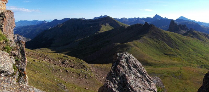
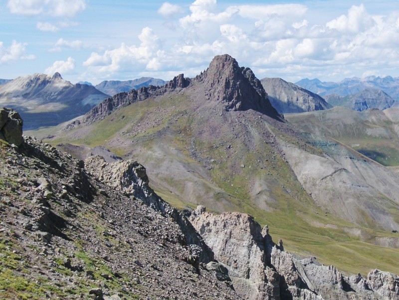
Wildhorse Peak (13,266')
Blackwall Mountain (13,073')
San Juan Range
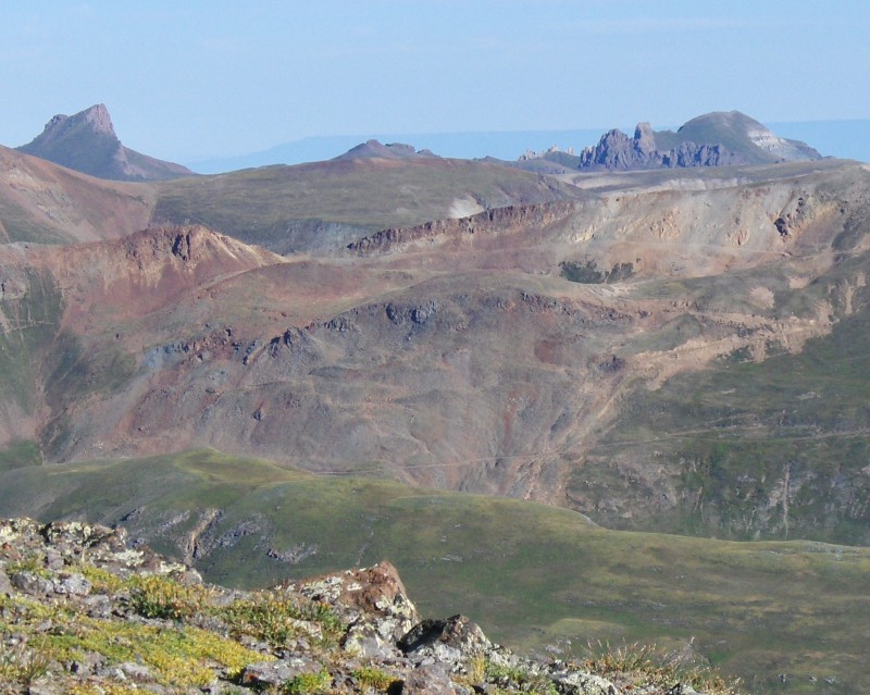
Wildhorse Peak and Blackwall Mountain (highest points l. to r.) from the N ridge of Handies Peak (picture taken the next day)
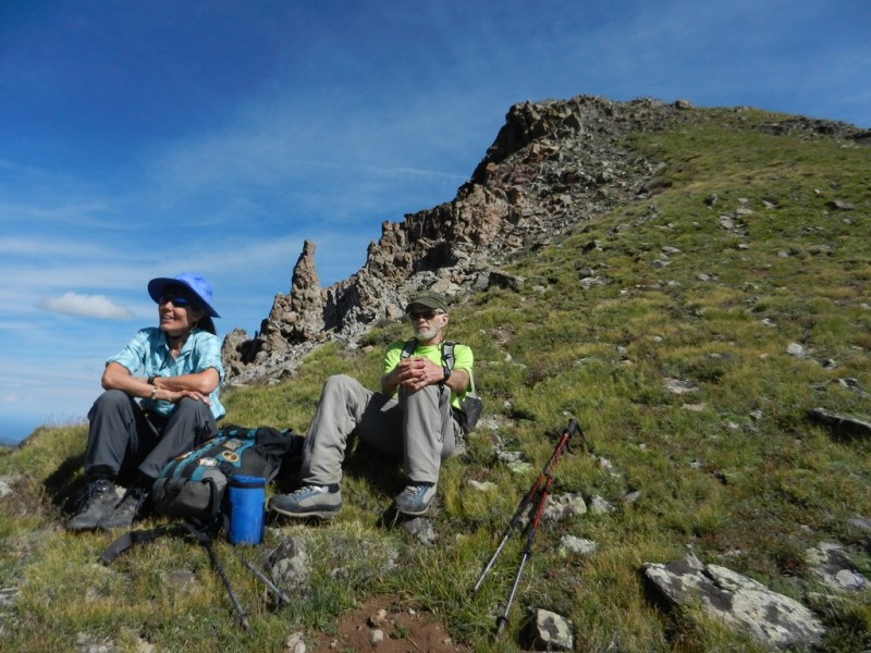
Hikers: Me and my friends
(l. to r., Terri Horvath, Darin Baker, Denise Snow, & Carson Black)
Trailhead: Horsethief Trail, No. 215 (accessed from mile marker 17 on E side of Engineer Pass) Note: We drove a Nissan Xterra to the TH, and after the drive, Carson mentioned he would have been comfortable driving his Subaru Forrester to the TH. Route: see map at the end of the report Distance: ~9.5mi's RT Elevation Gain: ~2500' (to a flatlander, this felt like 25,000' of gain!) Difficulty: Class 2 hiking without a constant trail while on a lot of tundra; easy route finding
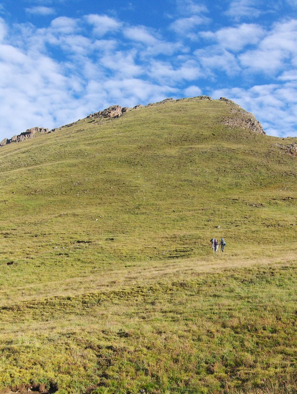
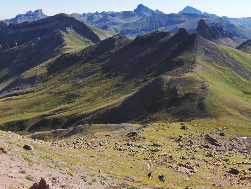
Denise and Terri crossing American Flats en route to Wildhorse Peak (prominent peak in photo)
Gear: daypacks w/Essentials Resources Used For Trip Planning: Above+Beyond's trip report from earlier this summer; TOPO!; weather forecast (NOAA); Trails Illustrated Map #141
Introduction
Pining my time in the lowlands of Louisiana while on a work project - six months strong. Still not done, but f*ck it. I'm going on vacation!
This area of the San Juan Range has been a long time favorite since the beginning of my Colorado mountain travels. These peaks caught my attention last fall while on a hike of Sunshine Mountain (13,321'). Then a report earlier this summer (noted above) sealed the deal for me: I will hike them while I'm home for vacation!
Finding a few friends to tag along was not hard. Thank you Terri, Carson, & Denise for a fine day in the hills! It's always a pleasure to share a trail and a story with plenty of laughs with each of you!
We met up the night before our hike and car-camped just past the Capitol City "for sale" sign on the Henson Creek Rd. On the Trails Illustrated map, one can see a sheep corral with a notation about a bathroom....well there's no bathroom. But there is a corral. There's also a sign suggesting to people not to recreate in the area. Our recreation was elsewhere, so we didn't have any concerns.
The morning came and we made the drive up to Engineer Pass in search of the trail head. Thanks to Above+Beyond's detailed report, our search was not hard.
Now - onto the report for which the pictures will tell most of the story. I hope you'll enjoy them. And might I suggest you take a walk in this part of our fine state, you won't regret it.
Back in the Saddle....
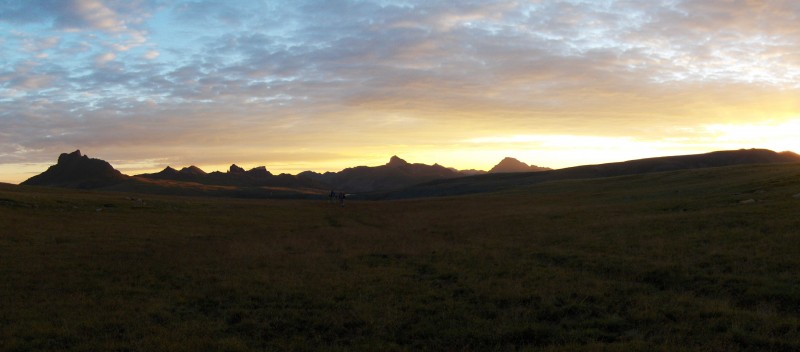
We got to the trail head sometime just before this.....
You don't see a sunrise like that in Louisiana!
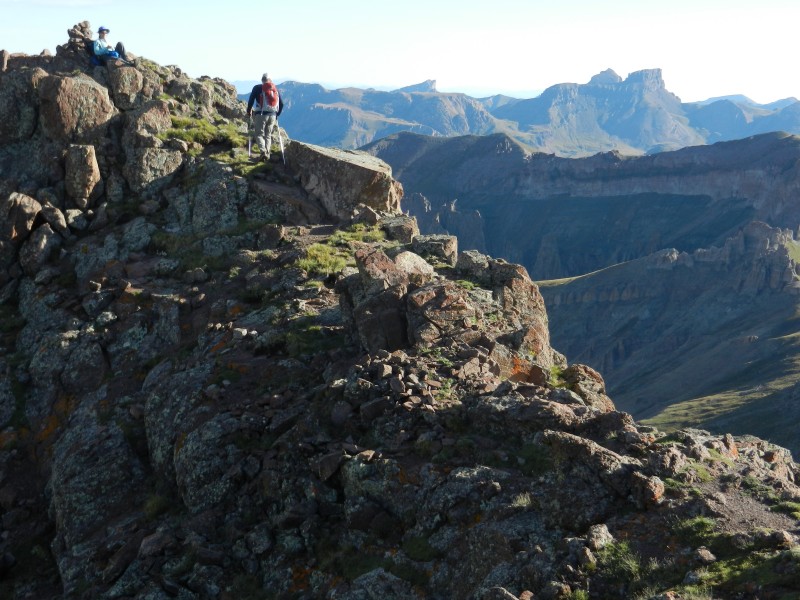
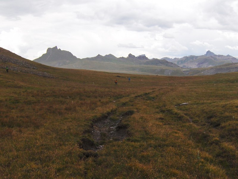
Starting from the Horsethief TH, we walked up an old stock road which eventually flattens out and the views open up to the N/NE with the sights of Coxcomb, Redcliff, Wetterhorn, and Uncompahgre dominating the expansive scenery. Of course, our first goal (Wildhorse Pk) was clearly seen right away.
Wildhorse Peak (13,266' and its S slopes)
In the above photo, we ascended the SE ridge as can be seen on the sky line on the right side.
Also in the photo you can see a cluster of white specks on the shadow line of the S slopes. That was a herd of sheep with sheep herders (i.e., dogs) in tow! Quite the scene and it made for an interesting ascent with the blats and barks of our fellow 4-legged mountain travelers.
Watch Dog with Mt Sneffels and Teakettle Mountain beyond
Looking up the S slopes
Denise and Carson near the edge of the SE ridge of Wildhorse
Darin coming up the ridge with American Lake below Photo by Terri
The view from the ridge
Denise waits on the summit while the rest of us approach Photo by Terri
On the summit of Wildhorse
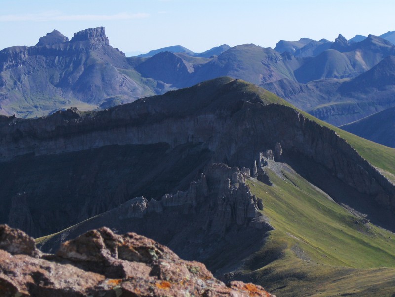
Our next goal, front and center: Blackwall Mountain
For our descent, we chose a gully option off the E side for a quick and painless way down. The gully is mostly fine scree to a mix of tundra and rock farther down.
Denise and Carson starting the descent Photo by Terri
Looking down at the base of the descent gully
Looking up at the descent gully off of Wildhorse's E side
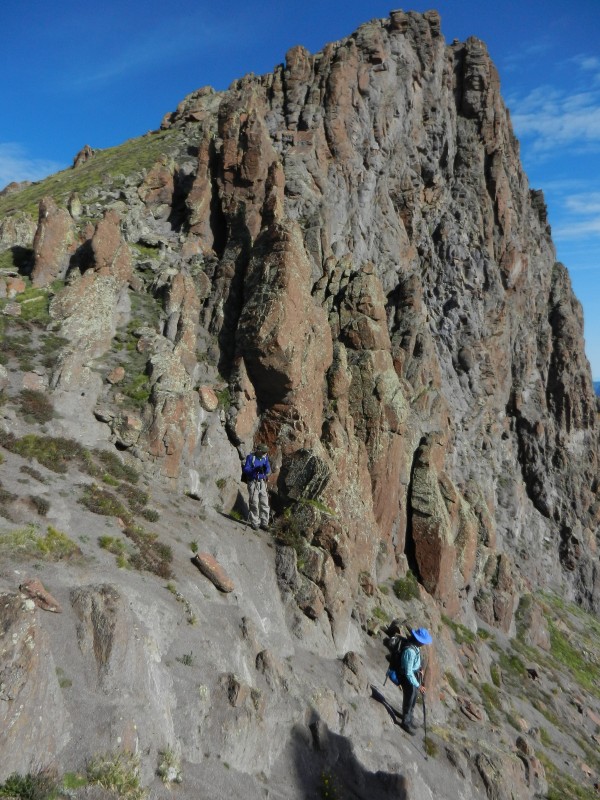
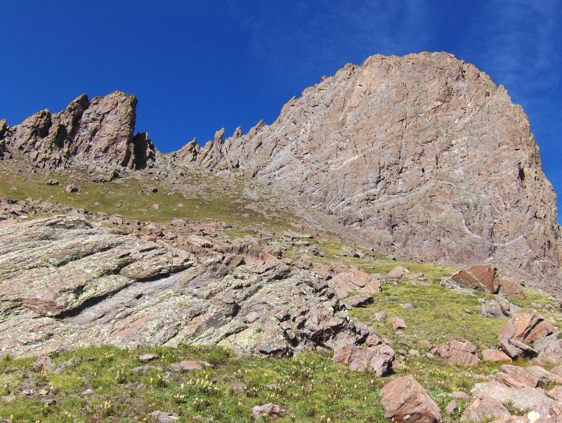
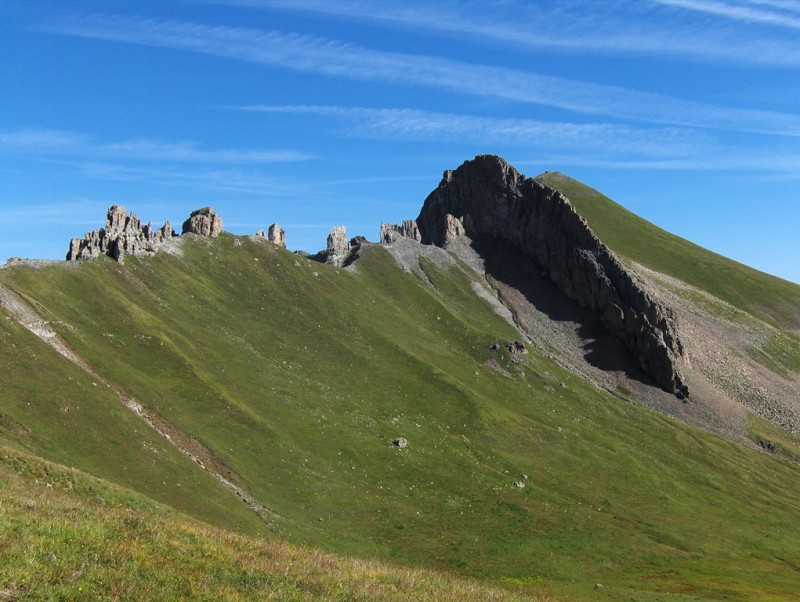
Dragons Back (12,968')
Denise to the E of 12,913' before dropping down on the approach to the base of the SE slopes of Blackwall Mtn
The approach to SE slopes of Blackwall. Our goal was to round the corner of the rock spine and cross the talus to ascend tundra slopes.
Looking back along the approach
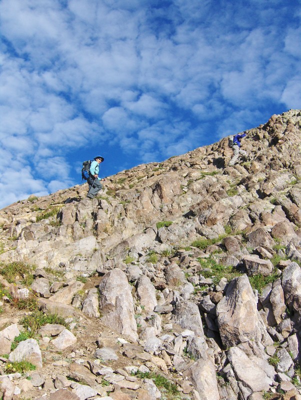
Denise and Carson patiently waiting for the flatlander to ascend the SE slopes Photo by Terri
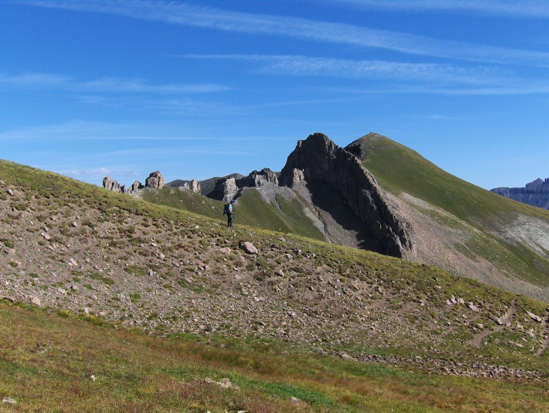
Terri crossing the last section of ridge to the summit of Blackwall Mountain (Grenadiers beyond)
Wildhorse Peak
Get the funk out
We spent some time enjoying the views but we knew the clouds forming overhead wouldn't allow us to stay too long. We descended the way we came, and made our way back to American Flats. By that time, I was slowing down and feeling the effects of being away from the high country. I wasn't sick or anything, but I did feel a little low on energy. This hike is above treeline for a long time.
However, a reminder from the clouds shot a quick boost of energy into my system and I was able to pick up the pace! That reminder was an instant flash/bang! There was thunder in the distance as we re-crossed the Flats, but this one strike nearby was enough to make all of us a bit nervous!
I didn't have hair standing on my arms nor did I hear ringing in my poles, but that was my closest encounter with such an immediate loud flash/bang. I think our friend Steve was playing games with us! We miss you Steve.
A round of hail, anyone?
This was a great day in the hills, and a great way to start my vacation!
Thanks for reading,
Darin
Approximate Route:
Thumbnails for uploaded photos (click to open slideshow):
Wait are these Cimarrons? Volcaniclastic lahars and stuff. I like them anyways. Cute Brady Bunch photo. Dragon's Back looks trip worthy. Nice pictures. You done good. You'll get outa the Bayou someday. Saw a cool sinkhole salt dome collapse video the other day.
Welcome home Darin! Those pictures are awesome....and what a secluded looking, but cool looking place. Very nice report and pictures on some peaks that not many people visit.
Hope you can make it back more often...or just relocate back to Colorado. Sure would like to climb with you again.
And yeah....I bet Steve was just poking you with his heavenly trekking pole! :lol:
Good to see you back and thanks for the pictures on these two. I had my suspicions but this TR confirmed that this needs to be added to the list of child-friendly peaks. She (They) may not be ready for Dragon's Back though. Image 8 is really cool.
It is good to see you roaming the hills here again. What did Carson eat on the summits? He had a sweet potato on Tijeras which I thought was pretty creative/tasty. Congrats on a sweet day out.
@Floyd - Did a sasquatch use you for TP? I can't believe I touched that brown spot on Saturday morning. Doc says he might be able to save my arm at the elbow though.
Thanks for the comments (and the thumbs up) everyone!
@ Bumble: I'm back in Shreveport now. So tell me a (tid-bit) story!
@ Papi: I wasn't watching Carson's food, so no clue!
@ Floyd's Best Friend: Yeah, those peaks would be good for you and your little one. The four legged one too! But keep him away from the Pyrenees dogs!
@ Woodi: I should be back for Xmas - New Years for about 15 days or so. Tell the old man to start planning something....
@ Hulk: If you haven't hiked Holy Cross yet, maybe we could hook up for that one someday. I spread some of Dale's ashes up there. Would love to hear some stories you have of my brother. Thanks for the note.
@ Sunny: Yup, you missed out on a good hike! The lightning strike wasn't that funny though.
@ Uwe: Good to see you too! As well as your partner in crime that day (SJP).
@ Monster: That's the ”Baker Bunch” not the Brady Bunch. You're too young to know about them anyway! Stupid google.
@ Matt & Fisching: I don't know. I see some Mountain Loving (w)hores in the photos. Surrounded by mountain porn too.
Cowman, you must have posted when I was writing mine. Longs?! I don't know. I failed the other day. As I told someone else, I Mounted Lady Washington instead. Saw a bride on the Diamond too. That was worth the aborted summit attempt on Longs.
Sorry we didn't get out on this trip.
Great to see you make it back for some R&R, Colorado style. Nice place, those San Juans. Doesn't look like there's a tree in sight for miles in some of those pics. Nice crew too. Happy belated birthday, Darin!
Nice report Darin. Love the pictures of the sheep and especially the one of the dog surveying his terrain. I want to go there just to see that.
Sorry I missed you. Hope your birthday was a good one.
Caution: The information contained in this report may not be accurate and should not be the only resource used in preparation for your climb. Failure to have the necessary experience, physical conditioning, supplies or equipment can result in injury or death. 14ers.com and the author(s) of this report provide no warranties, either express or implied, that the information provided is accurate or reliable. By using the information provided, you agree to indemnify and hold harmless 14ers.com and the report author(s) with respect to any claims and demands against them, including any attorney fees and expenses. Please read the 14ers.com Safety and Disclaimer pages for more information.
Please respect private property: 14ers.com supports the rights of private landowners to determine how and by whom their land will be used. In Colorado, it is your responsibility to determine if land is private and to obtain the appropriate permission before entering the property.