Download Agreement, Release, and Acknowledgement of Risk:
You (the person requesting this file download) fully understand mountain climbing ("Activity") involves risks and dangers of serious bodily injury, including permanent disability, paralysis, and death ("Risks") and you fully accept and assume all such risks and all responsibility for losses, costs, and damages you incur as a result of your participation in this Activity.
You acknowledge that information in the file you have chosen to download may not be accurate and may contain errors. You agree to assume all risks when using this information and agree to release and discharge 14ers.com, 14ers Inc. and the author(s) of such information (collectively, the "Released Parties").
You hereby discharge the Released Parties from all damages, actions, claims and liabilities of any nature, specifically including, but not limited to, damages, actions, claims and liabilities arising from or related to the negligence of the Released Parties. You further agree to indemnify, hold harmless and defend 14ers.com, 14ers Inc. and each of the other Released Parties from and against any loss, damage, liability and expense, including costs and attorney fees, incurred by 14ers.com, 14ers Inc. or any of the other Released Parties as a result of you using information provided on the 14ers.com or 14ers Inc. websites.
You have read this agreement, fully understand its terms and intend it to be a complete and unconditional release of all liability to the greatest extent allowed by law and agree that if any portion of this agreement is held to be invalid the balance, notwithstanding, shall continue in full force and effect.
By clicking "OK" you agree to these terms. If you DO NOT agree, click "Cancel"...
Summit Elevation: 3,724 ft (1135m)
Elevation Gain from Estação: 1500ft (457m)
Start Time at Estação Vila Clarice: 10:58am
Summit: 11:56am (16 minutes spent on summit)
Finish Time at Estação Vila Clarice: 1:05pm
RT Time (Estação to Estação): 2hr 7min *Look at me being all fancy with my foreign language and cool letters like "ç" and "ã" not to mention use of metric measurements. I gotta do something to keep you entertained and motivated to read this.*
Full Disclosure here before anyone runs off to Google Translate, but "Jaragua" does not translate to "jaguar" in Portuguese although the similarity of the word made me think of one of the most absurd movie scenes as an inspiration for the TR title.
And yes, I know, they rode a cheetah. Don't get technical on me and ruin the fun... Is anyone else craving White Castle now?
The good news is that the accessibility of Pico do Jaragua makes it an easy place to get to when the only mode of transportation available is public trains and buses because transportation issues will be an habitual obstacle trying to reach other destinations. The bad news? My camera's memory card malfunctioned and lost all the pictures I took from my first hike, so I returned a few days later as a "Take 2" with expert photographer, Kim, and her working memory card.
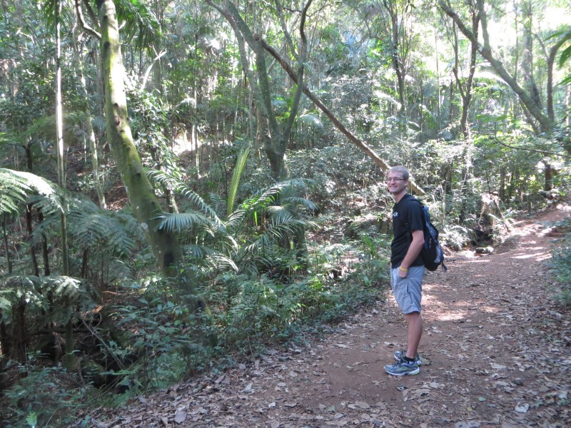
After getting off the train at Vila Clarice, I decided to honor winter rules for summiting peaks and begin from the platform rather than taking a bus to the park entrance. Integrity, yo. I checked my bag to ensure I had everything I needed to handle the day hike conditions of 25ºC temps and the tenacious gusts of 20kph. And no, canned wine was not a part of my decision making. I believe being caught with said product is grounds for automatic extradition from Brazil.
Fleece Base Layer - Is a short sleeved shirt close enough? It's polyester!
Balacava - Um, I need a haircut, so that'll suffice.
Glacier Glasses - I still have a pair I bought at the Sunglasses Hut "2 for$18" sale, so you know they're good
Insulated, full-shank, Winter Boots - Que é isso?
Snowshoes - Nos não temos recebemos neve no Brasil exceto em no Sul do país. (Rather proud of myself there. I didn't even need Google Translate!)
Suncreen - As if I don't already stick out enough being a blonde, blue eyed Aryan even before I open my mouth to speak with a strange accent that I want to rub some white, pasty cream on myself to stand out some more.
Technical Jean Shorts
**Warning: Link is not suitable to children or women who have taste**
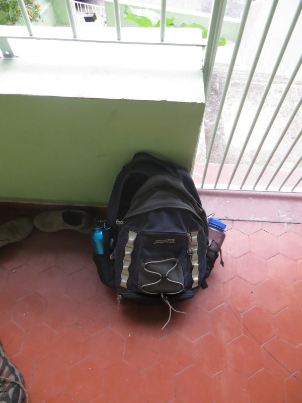
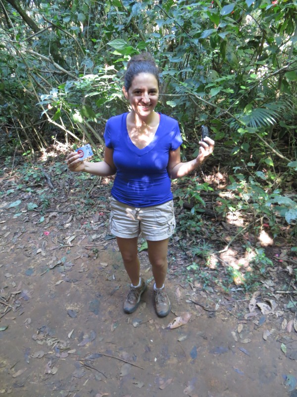
25L Bag; 5lbs. Don't ask me; apparently it's all the rage to show how BA you are by the literage of the backpackKim's showing off her Winter climbing gear consisting of a $25 cell phone and a Metro pass.
The initial part of the trail from the Winter Closure is straightforward; it's a matter of following the streets in the direction of the summit. The biggest obstacle would be avoiding the animal life and making sure not to cross paths with the vicious creatures of the street. We'll call these creatures "Brazilian Grizzly Bears". Brazilian Grizzly Bear. If startled, they will rip your face off. (See youtube video for graphic footage)
It's also recommend to watch your footing as the sidewalk traverse can become tricky when it's littered with Brazilian Grizzly Bear feces. Consider yourself warned. What can you say? Battling winter conditions is only for real mountaineers.
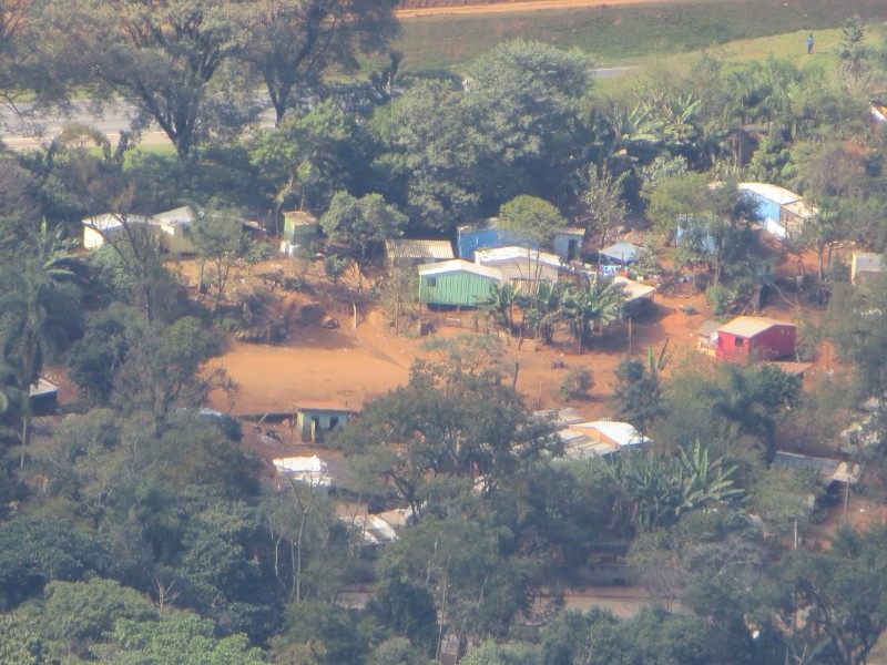
After following the road under the Bandirantes AutoBAn viaduct (we'll call this I-70), turn right at the fork in the road and continue heading in the direction of the pico and the antenna towers. This next part also crosses a stark reality in Sao Paulo's history that not many of its own citizens are aware of. On the right hand sign of the road, is a small barrio that looks rundown but isn't a favela (Portuguese word for a slum). The small barrio is called an "aldeia" which is a small indigenous village. The original inhabitants of the area of Sao Paulo (and much of Southern Brazil) have been pushed out to the periphery of the city and given a small chunk of land bordered by the interstate on the one side, a construction yard and a state run park on the others. This is only a microcosm of the larger reality of an ongoing issue in Brazil as the continued relations between the indigenous groups and the Brazilian government remained strained. At the same time, is it really any different than US history and even some current events in our society? Not saying I'm able to offer a solution - heck, don't even know if there is one - all I can do is bring recognition to both Brazil's cultural problem and its similarity to the US's own egregious faults with ingenious peoples. Aldeia. Who said this (prize for the winner)? "John Marshall had made his decision, now let's see him enforce it.&qu
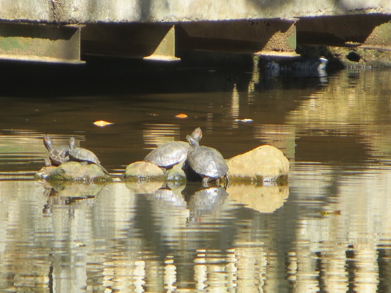
That concludes today's cultural lesson and guilt trip. You're welcome. How bout a quick distraction of some wildlife? TURTLES!!!
What were we talking about again? ...
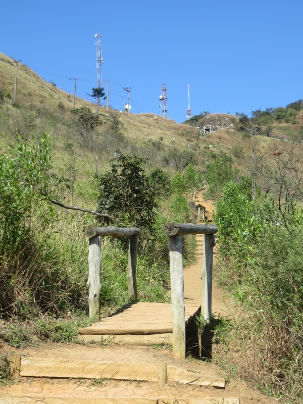
The Trilha de Pai Zé is accessed through the entrance on the park's east side followed by a quick right at the turtle pond. The trail is about as straightforward as it can gets, so pulling one of these is next to impossible: Don't forget to give the nearby turtles a handy.
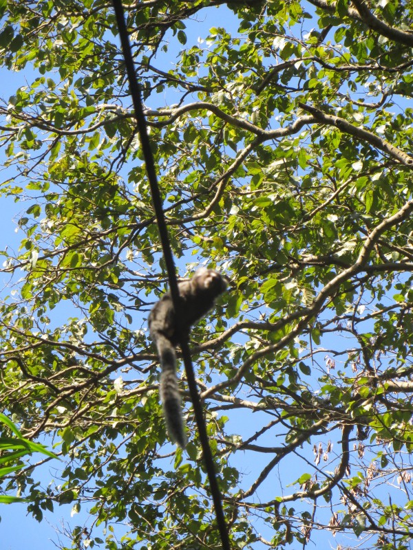
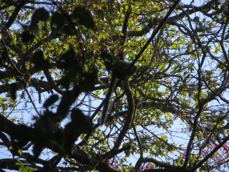
While Pico do Jaraguá may not be the most impressive or grueling endurance feat, it does offer some positives. For one, there is some wildlife that cannot be seen outside of a zoo in the US. Granted, a bunch of city slickers have tamed the monkeys by feeding them Doritos (no joke, I witnessed this), but I'll still take it. Monkey #1Monkey #2
The entire park of Jaraguá offers a glimpse into what the Atlantic Forrest once was - in the Sao Paulo metropolitan region, there is only 5% of the original forest left. Apparently 20 million people living together takes up a lot of space. Who knew? However, that glimpse contains tropical forest flora for those of us unaccustomed to it and, particular to Parque do Jaraguá, hikers get the chance to travel through 3 different ecological zones while ascending the peak. And, not to be dead a dead monkey (I think that's expression translated into Portuguese), it's VERY accessible to the city.
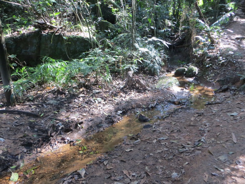
The trail is easy to follow as it's the largest (and only permissible) trail to the summit. It's easy to tell where people have gone off trail as the tropical forest ground gets easily trampled and destroyed under human feet. Oh CFI, where are you when we need you... Atlantic Forest FloraThis might be the cleanest water in the city of Sao Paulo
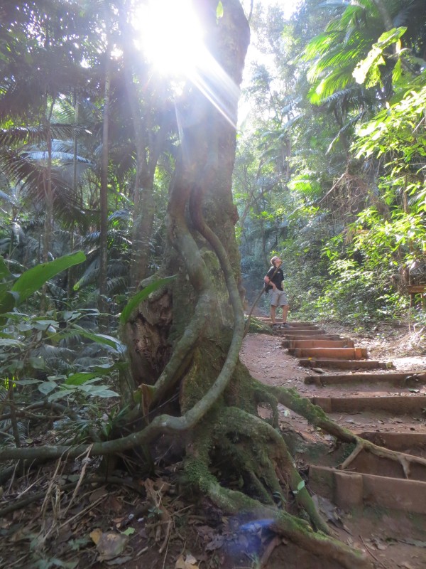
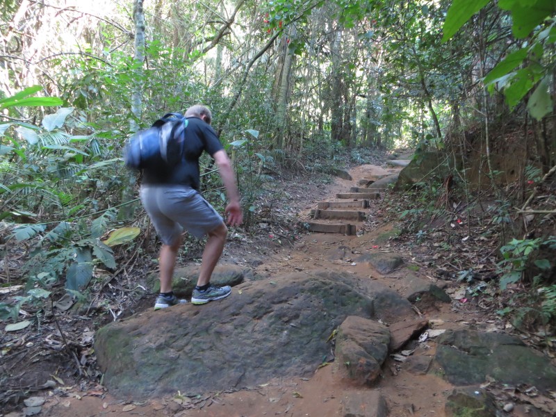
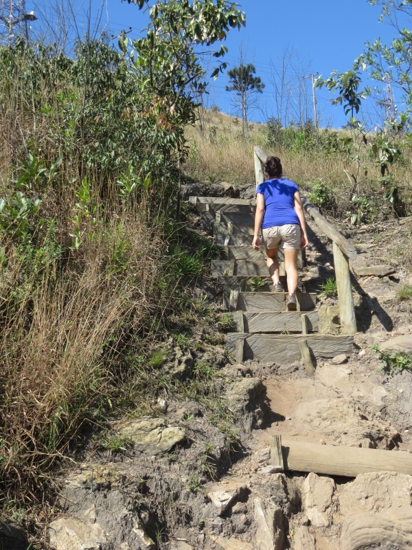
If looking for a Colorado comparison, the best description of the trail might be a blend between Mt. Morrison and the Manitou Incline with a summit-like experience of Pikes Peak. The lower portion of the trail is not as steep although above the treeline the trail does become progressively steeper until the trail meets the roadway and parking lot full of fat tourists. Not surprisingly, the weekdays are the far better days to go if looking to get away from crowds both on the summit and the trail. But, in a city of 20 million, there's only so many to escape from. Stepped TrailOh look, Class 2! Out of the trees and into the grassland
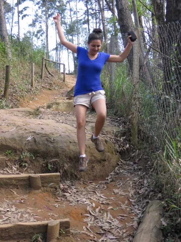
Much to Kim's ignorance, I grabbed a few photos behind my wife before she figured out I was capturing pictures of her rear. Near year-round summer temps are an amazing thing. I decided to stop before she threw a Nalgene bottle at me. I could get used to the viewI wonder how pissed she'd be if she knew I posted these photos?
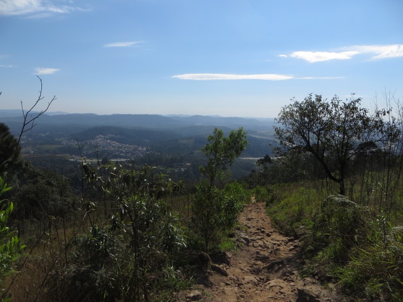
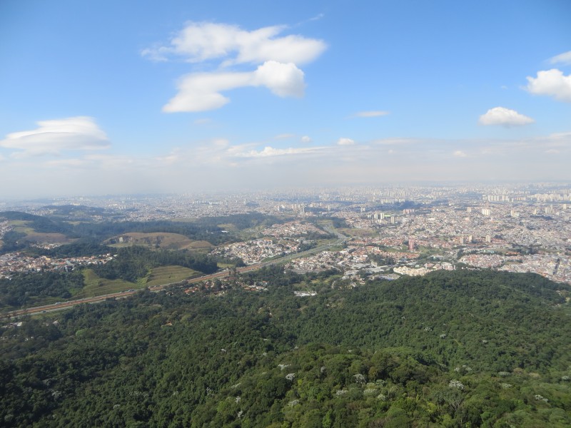
Weather is key when hiking Jaraguá since a good experience, especially for a one-time visitor, is dependent on the views. Sao Paulo is known for frequent rainfall and low cloud cover that will obscure the vistas. It's also well known, at least to me, for the Thunderdome of Smog encircling the center of the city. While hiking on that day will remove you from inhaling that (sorta), the panoramas from the summit and nearby areas will be a disappointment. A look back at the Serra da Cantareira mountain rangeA look north and in direction of the Perus region of Sao Paulo
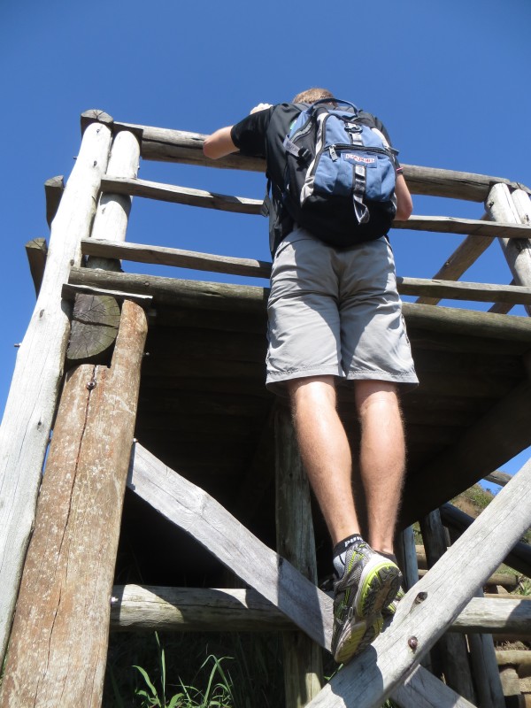
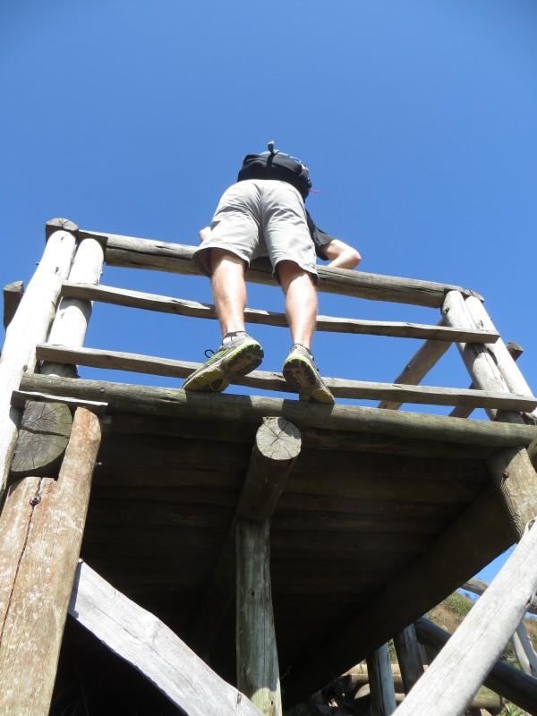
This TR became too serious, back to the absurdity. The crux of the hike: Reaching the roadway via free-soloing A Platforma da Vista (Class 5.3) Wishing I brought my Trad gearAt least that idiot isn't wearing cutoff jean shorts.
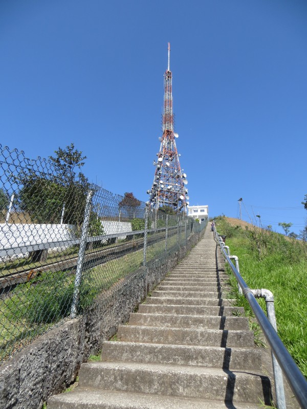
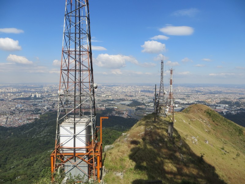
A quick walk on the roadway will lead past a Military Police outpost - why they need an outpost up here is beyond me - to the taller of Jaraguá's two summits that is also occupied by a hideous Globo TV antenna. If you're lucky the Nestle ice cream stand will be open. Yay Globalization! After a lot of steps, the antenna viewing platform offers some great panoramas of the entire metropolitan region of Sao Paulo. The Pikes Peak RoadwayThe Steps. If you look closely, you can see a technican near the top of the antenna mast.
City Vista: Looking over the northern side of Sao Paulo.Looking SE Looking SWOur house is there... somewhere
And of course, no Fisching TR isn't complete without the trend now invading South America, tomar a fotografia conhecida como "Imando." Iman'ed!!!Double Iman'ed!!!
Just know the Sao Paulo metro area, despite it's immense size, has hiking venues to explore in Jaraguá and the Serra da Cantareira. Action ShotEPIC, bro.
Thumbnails for uploaded photos (click to open slideshow):
Arc'teryx Winter Collection... coming to an overpriced gear store near you!
In all seriousness, I coached JV high school soccer at Woodland Park High School and the Varsity boys has a working relationship with Rush. He orders them for the summer soccer camp the high school players host via Rush for the younger players.
how language changes and brands become words. A photocopy becomes a "Xerox", web searching becomes "Googling", taking a self portrait makes you "Iman'ed", Liberty Ridge becomes "Wish I were as cool as Iman ridge", etc.
Capturing the right pose and facial expression for an I-Man self portrait makes it a signature brand. All naming rights and Trademark credit goes to the guy who originally perfected it for future generations to aspire to.
While the Liberty Ridge one is new, a quick entry on Urban Dictionary should correct that.
Caution: The information contained in this report may not be accurate and should not be the only resource used in preparation for your climb. Failure to have the necessary experience, physical conditioning, supplies or equipment can result in injury or death. 14ers.com and the author(s) of this report provide no warranties, either express or implied, that the information provided is accurate or reliable. By using the information provided, you agree to indemnify and hold harmless 14ers.com and the report author(s) with respect to any claims and demands against them, including any attorney fees and expenses. Please read the 14ers.com Safety and Disclaimer pages for more information.
Please respect private property: 14ers.com supports the rights of private landowners to determine how and by whom their land will be used. In Colorado, it is your responsibility to determine if land is private and to obtain the appropriate permission before entering the property.


 Pico Sign")


