| Report Type | Full |
| Peak(s) |
"Pyramid Mountain" - 13,054 feet |
| Date Posted | 08/20/2013 |
| Date Climbed | 08/18/2013 |
| Author | jdorje |
| 13054 East Ridge |
|---|
|
I had done some research into climbing 13054, reading a series of trip reports in ever-increasing order of painfulness. The best one, naturally, is by Furthermore, and describes a 2000 foot bushwhack so tedious that they took a different bushwhack down that ended up being even more tedious. And that was through aspens during winter; repeating the route in summer conditions would be far more tedious. Perhaps I exaggerate, but the end result was that I decided not to climb 13054 at all. Instead I would climb the adjacent Eureka Mountain. Note, this report gives more prose description of the route than may be considered normal. It was an elegant yet hidden route, for which I can take little credit. But I digress. Distance: 11.9 miles (per GPS) Elevation gain: 4591 feet (per GPS) The trailThe plan was to head up the north fork of North Crestone Creek, up to the col connecting over to the San Isabel basin, and then climb Eureka Mountain. The weather looked great and a alpine-ish start had me on the trail by 7:45. I did notice there were around ten cars at the trailhead, far more than I'd ever seen before, and I wondered if I'd actually run into people on this non-fourteener trail. 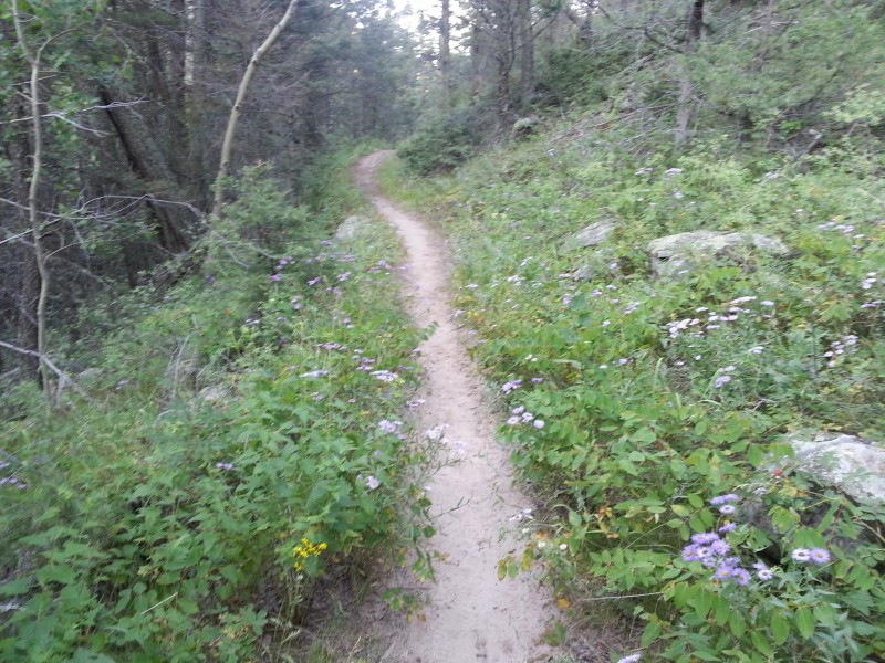 About fifteen minutes up I did indeed meet a group: a couple on their way up. These individuals seemed like rather private people, and so shall be known here as D and M. Their packs looked suspiciously large, yet with none of the markings of overnight packs. As I just about always do, I asked them where they were going. "Pyramid Mountain," M replied. Not entirely sure where this peak was, I replied with my plan of hiking up Eureka Mountain and passed them. After passing, however, I continued to talk to D rather than pulling ahead. Turns out D had finished all the 13ers several decades ago, and was now repeating them as M approached the same goal. And, indeed, "Pyramid Mountain" refers to Pt 13054, as it is inexplicably labeled on some topo maps. On a split decision I asked if they minded if I abandoned my goal of Eureka, and joined them for 13054. I wouldn't have been surprised if they showed just a bit of hesitation at a stranger following them up one of the least-traveled 13ers in the state, and I probably would have continued on my way, but both D and M welcomed me into the group. This meant a slower pace, at least at low elevations, but this seemed a small price to pay. We continued up the trail, taking the north fork at the "three forks" intersection. Three Forks is right after a significant creek crossing (of the north fork spur creek), and has been relabeled with a new and legible sign since last I was there. The north fork was prettier than I remembered (I've only descended it before, and have always bemoaned its length rather than celebrating its beauty), and we first switchbacked up across a minor cliff then paralleled the creek as it rose up into this sizable basin. There were several creek crossings, including one place where twice before I had lost the trail on the descent; the trail has been improved and I don't see how you could lose it for long now. 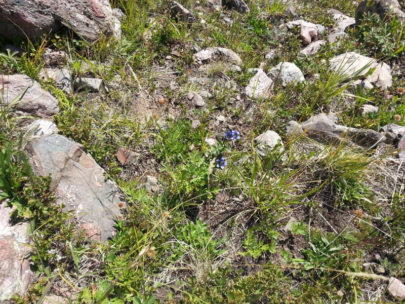 D and M were skilled map-and-compass hikers, and had a few contingency plans for getting up this shy-looking peak. These were based on less steep areas shown on the topo map, combined with D's 20-year old recollection of climbing this peak from Groundhog Basin. I had Furthermore's GPX file and trip report loaded on my phone, which we briefly looked at. However when we got to the cutoff to follow his route, it looked like about the worst bushwhack imaginable through dense aspens up a steep, cliff-riddled slope. 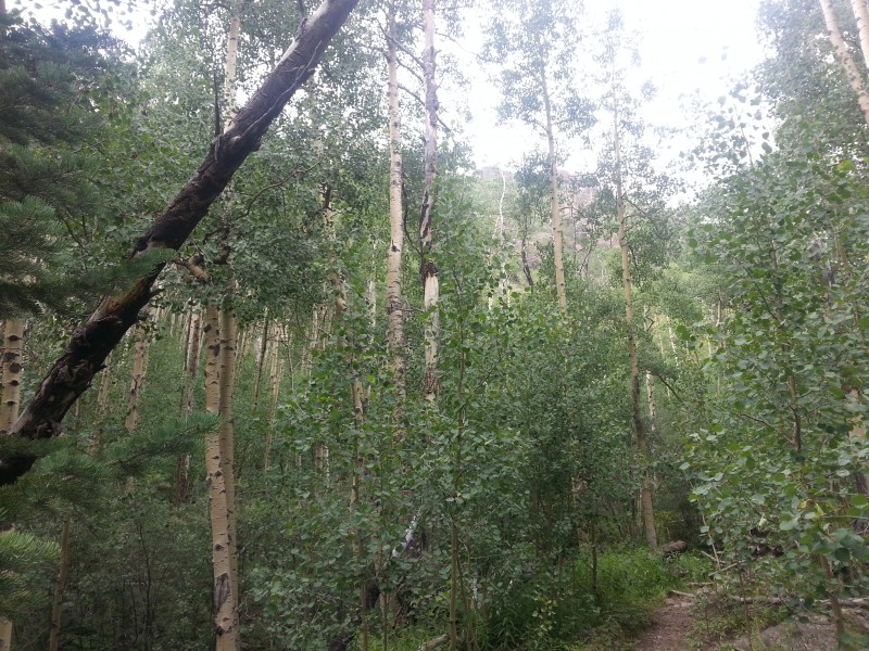 Continuing up the north fork trail, we eyed a few possible routes up. One would head straight up a ravine full of willows, a literal bush whack, but once out of the willows appeared to give a clean line to the class 2 south ridge (green on the topo map); it looked like a lot of work. Just to the right of this section, there was a more promising steep grassy slope that went at least part of the way up, but we couldn't see for sure if it connected without having to fight our way through more cliffy aspens (yellow on the topo map). After the creek crossing, we briefly considered going up this way, but decided to continue around toward the Groundhog Basin instead.   Groundhog BasinGroundhog basin was pretty, although we only saw one marmot very briefly; this basin must have the fewest groundhogs of any in this area. As we were approaching it on the trail, we saw a couple of overnighters descending to our left. We cut west here, crossing back across the groundhog creek (which we'd just crossed once) and then following a sharp uphill over and into the basin. Here began the first of many complexities of this elegant route, for which I generally lack photographs. A gentle ridge blocks the entrance to groundhog basin, and after gaining this ridge just above the creek, we took a look straight uphill. Going further into the basin did not seem like it would be helpful, as the cliffs underneath 13054 were sheer. Gaining the north ridge of 13054 looked possible but futile, as it appeared extremely rugged from this side; even if the obstacles could be bypassed on the slightly less steep north side it would still be extremely long. Heading straight up the groundhog ridge didn't give a clear access, but D and M were both confident we'd be able to gain the east ridge this way. In the end, it was necessary to bushwhack 20 yards or so through some willows. This brought us up to a higher section on the ridge, underneath a small cliff. M spotted a weakness in the cliff to the right, and working our way over we found an easily passable ledge climbing up the cliff (GPX track: the 90 degree left then right turns). This ledge was surprisingly solid, and wide enough that the exposure wasn't bothersome. The ledge, or more specifically finding it, was probably the crux of the route. It was also very interesting that this ledge appeared to have a substantial trail on it, which continued almost all the way up to the summit. We followed several animal trails, but this one was impressive, and contained regular placements of bear scat.  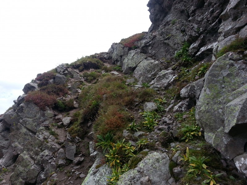 Above the ledge the route was more obvious, but there were several more steep sections as we tried to get up to the peak's east ridge. Near the top D and I climbed straight up through a dihedral-looking gap, while M went around to climber's left; though these ended up going to the same section on top of the ridge the left route - following the animal trail - turned out to be the easier one. Of all these steep sections, I don't think anything quite rose to the level of class 3, but there was a fair bit of what I'd call class 2+. It was, however quite solid all around (lots of Crestone conglomerate) and none of it was dangerously exposed. 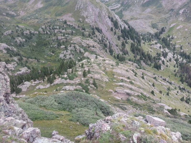 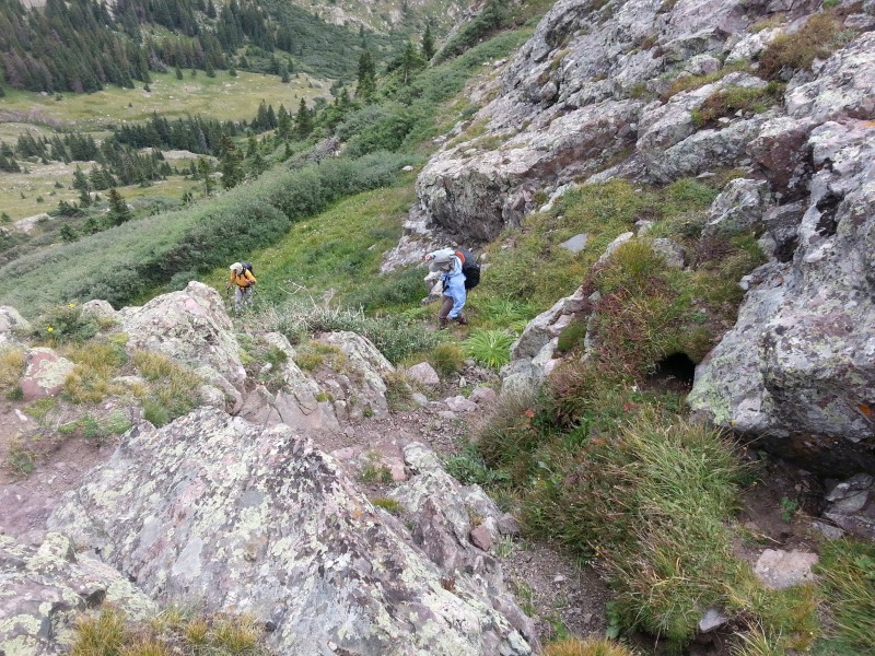  East Ridge & SummitOnce on the east ridge it was necessary to stay on the left/south side of the ridge, allowing us to easily traverse upwards (the bear trail helped) and bypass a number of towers that were directly on the ridge crest. The north side of the ridge at this point - and really all the way around Groundhog Basin - is a sheer cliff. From here the remainder of the route became obvious, though there is a cliff on the east side of the summit that must be bypassed. We went to the left (south) on the way up to follow the most obvious route around it, but took a slightly more direct (and annoyingly loose) route down from just north of the summit on the return. 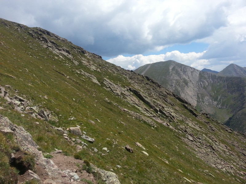 The summit, once we arrived, was covered in flying, biting, swarming ants: a scene straight out of a horror movie. We very quickly put on our long pants/sleeves, but even so could not remain for more than a few seconds. M had brought up a summit register paper, and since we could find no register in the summit cairn this paper was placed into double ziplock bags and buried under the cairn. Side note: if anyone reading this summits this peak, take a proper register container (and post a comment here to that effect). 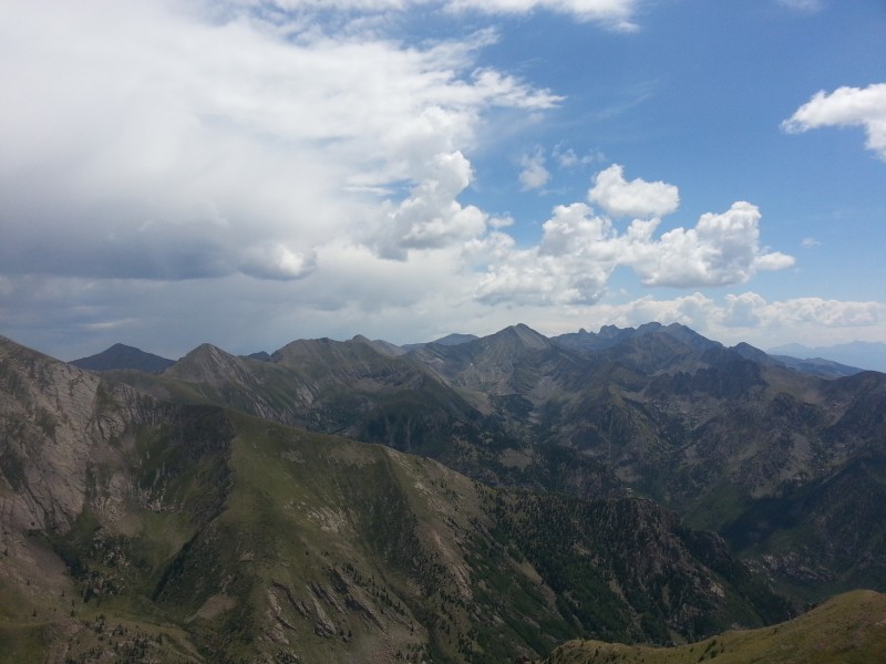 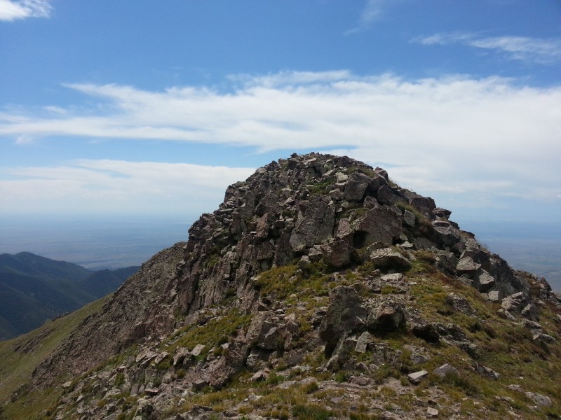 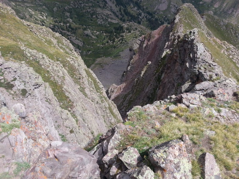 Although we moved our summit camp 30 yards north, the ants only took a few minutes to find us. This, along with the encroaching clouds, lead to a shorter summit stay than we had wanted. I did conclude that the bear trail must have been a dinner trail leading to the numerous insects on the summit. DescentThe route back down had a few differences. First, we descended the more-direct-yet-loose-and-steep direct route from just north of the summit, down to the bear trail. Secondly, we followed the bear trail around to the right (south) of one of the obstacles we'd climbed over on the way up. Third, when we reached the top of the groundhog ridge - right below the crux sections - instead of bushwhacking forward, we followed an animal (sheep) trail to the left (west). We did this to avoid the brief bushwhack on the ridge as well as to get a short walk through the scenic Groundhog Basin. The sheep trail also continued to the right/east; had we followed it in that direction it would have been a shorter route back down to the trail proper. Fourth and finally, we took a slightly more direct route back to the main trail, meeting up with it slightly further down (though had we followed the sheep trail, it would have been even more direct). There was one final alternate route we noticed on the descent, as it was only clearly visible looking downhill. Shortly north of the creek crossing, it is possible to ascend a clean grassy slope on the north side of the ridge, then cross over to the south side of the ridge to rejoin the yellow route described above and continue up. Opinions were divided over whether this route was likely to be better than the one we took, but it is very likely passable with minimal bushwhacking. The spot to leave the trail is marked via a waypoint on the GPX, and is right next to two giant dead trees; however, you can't clearly see the route unless you continue a bit further up the trail and look back. This route is marked, rather approximately, in blue on the topo map. Blood OxygenI had a lightweight blood oxygen / heart rate monitor, which I took on this hike. At 8400 feet, my blood ox level is typically around 97%. At 13000', we all tested our blood oxygen, and were all right around 88% - significantly low! My heart was racing here too, and remained over 100 for the entirety of the descent as well. As we descended, oxygen saturation increased predictably, and was back up to 92% for all of us around the trailhead - still significantly depressed. Most amazingly though, I observed that D's heart rate never rose above 80 the entire trip, even on the steep uphill (which we took at a rather sedate pace). By the next day my blood oxygen was back up to 96% and my heart rate down near its resting rate. I have no idea if this information can be used constructively. Topo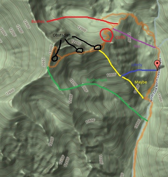 Thumbnails for uploaded photos (click to open slideshow):
|
| Comments or Questions | ||||||||||||
|---|---|---|---|---|---|---|---|---|---|---|---|---|
|
Caution: The information contained in this report may not be accurate and should not be the only resource used in preparation for your climb. Failure to have the necessary experience, physical conditioning, supplies or equipment can result in injury or death. 14ers.com and the author(s) of this report provide no warranties, either express or implied, that the information provided is accurate or reliable. By using the information provided, you agree to indemnify and hold harmless 14ers.com and the report author(s) with respect to any claims and demands against them, including any attorney fees and expenses. Please read the 14ers.com Safety and Disclaimer pages for more information.
Please respect private property: 14ers.com supports the rights of private landowners to determine how and by whom their land will be used. In Colorado, it is your responsibility to determine if land is private and to obtain the appropriate permission before entering the property.


