Download Agreement, Release, and Acknowledgement of Risk:
You (the person requesting this file download) fully understand mountain climbing ("Activity") involves risks and dangers of serious bodily injury, including permanent disability, paralysis, and death ("Risks") and you fully accept and assume all such risks and all responsibility for losses, costs, and damages you incur as a result of your participation in this Activity.
You acknowledge that information in the file you have chosen to download may not be accurate and may contain errors. You agree to assume all risks when using this information and agree to release and discharge 14ers.com, 14ers Inc. and the author(s) of such information (collectively, the "Released Parties").
You hereby discharge the Released Parties from all damages, actions, claims and liabilities of any nature, specifically including, but not limited to, damages, actions, claims and liabilities arising from or related to the negligence of the Released Parties. You further agree to indemnify, hold harmless and defend 14ers.com, 14ers Inc. and each of the other Released Parties from and against any loss, damage, liability and expense, including costs and attorney fees, incurred by 14ers.com, 14ers Inc. or any of the other Released Parties as a result of you using information provided on the 14ers.com or 14ers Inc. websites.
You have read this agreement, fully understand its terms and intend it to be a complete and unconditional release of all liability to the greatest extent allowed by law and agree that if any portion of this agreement is held to be invalid the balance, notwithstanding, shall continue in full force and effect.
By clicking "OK" you agree to these terms. If you DO NOT agree, click "Cancel"...
Uncompahgre - Nellie Creek. Great hike! (and info)
Summary
This was a great hike on a beautiful mountain! Very mild exposure on the staircase near the top. But this part was mostly just fun with some use of hands and it's over in five minutes. I carried my two trekking poles in one hand and was fine. Uncompahgre always *looked* like it must be difficult just because of its ruggedness from afar, but probably the toughest part of this mountain is the 4WD trek up the Nellie Creek road. This was my ninth 'teener and my teenage son's second, and probably my favorite next to possibly Sneffels - though Uncompahgre is *much* easier. I see no reason why this Class 2 peak wouldn't be a great first 14'er if you're OK w/ driving to Lake City, navigating the Nellie Creek road, and a small scramble.
Lots of pictures below, but first some notes in outline form.
Times:
Left Lake City lodging: 7 AM
Arrived trail head: 7:50
Start hike: 8:00 AM (start at 7 AM or earlier for Pete's sake - I just never seem to be able to get out at my target time ...)
Summit: 10:45 AM
Leave summit: 11:15
Back at trail head: 12:45 (ran part way near end in rain/hail)
Things I liked:
-Great looking mountain. And you get to see it all the way up.
-path was extremely easy most of the way - so could get down very fast w/o picking thru rocks and hurting knees/ankles.
-7.25 mile round trip was good. Started at 11,400.
-scrambling on the staircase was fun.
-view outstanding (colors, San Juans, Sneffels, etc ...)
-Lake City cool (Southern Vittles restaurant excellent for meal after hike)
-wide top
-the sheer drop-off at other side of top for great pix opportunities
-met lots of nice folks. A Boulder family assisted with pictures. Thanks!
-only 20-30 total hikers that day (Sunday)
-plenty of room to park at trail head.
Things I didn't like:
-rain/hail started at 12:15. Not totally unexpected, but 1:00 would have been better!
-3 or 4 thunder claps around 12:30 (higher up and behind us - again no surprise - though maybe what is more interesting is that this was a day where the 14er report for Uncom said 80% chance of rain w/o specifying the usual comforting "mostly after noon" - and we had great weather up until then!)
-Nellie Creek road for 4 miles. Took 45 minutes or so to cover the four miles of Nellie Creek Road, and bottomed out twice up and twice back. Do *not* take a 2WD or low clearance vehicle. I was in my 4WD F150, but cringed over each hump in the road waiting to bottom out. Big rocks generally weren't the problem. There seemed to be a lot of humps or ridges that ran perpendicular to the road. A jeep or a vehicle w/ less distance between front and back wheels would have had no problem. Exposure was moderate - but really not a big deal - lots of trees on the side of road so it felt safer. Confronted vehicles coming the other way twice (once up, once down) involving some negotiation, but it all worked out without incident or unusual risk. There had been a fair amount of rain recently so some mud but not a big obstacle. The two streams weren't bad. Maybe eight inches max or less? I've taken my truck up American Basin to Handies and now Nellie Creek. Both times I had the same thoughts: "I should have just rented a jeep (like I did for Yankee Boy basin). Yeah, but that's a hassle/expense and that's what I have a truck for, besides it's kind of fun. Yeah, but what if I get a flat tire, do some damage to the truck, suspension, alignment, etc, it will cost more than the cost of a jeep". Bottom line, if you don't mind parting w/ $150-$200, get a jeep. But otherwise you'll probably be fine.
On to the pictures (applicable text is *below* the picture) ...
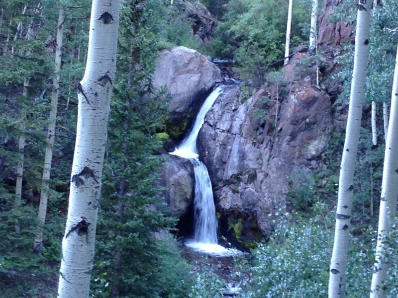
The waterfall among the aspens along the Nellie Creek road was an unexpected bonus.
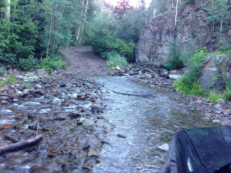
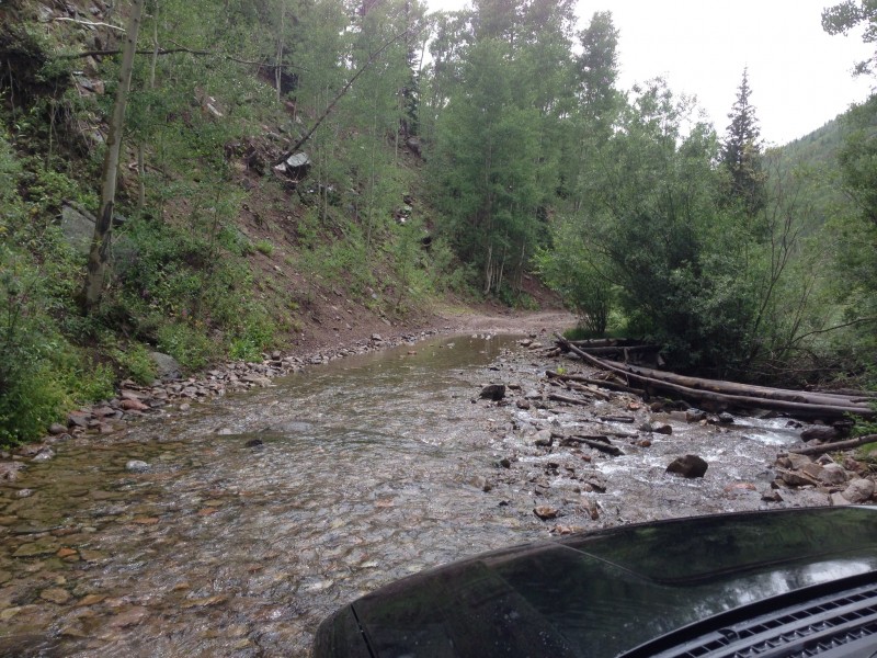
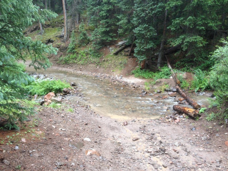
Three pictures of the two creek crossings (one of them was coming down). One of them was right before a switchback heading up for which I felt the need to give a little more gas into the turn.
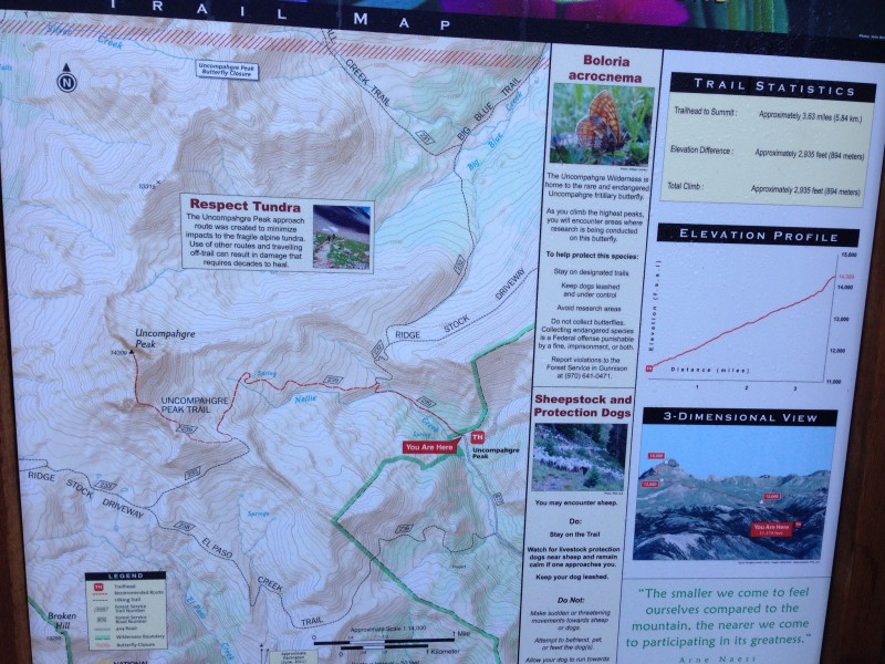
I love a good map and feel compelled to look at every single one. Here's a preview of the nicely descriptive one at the trailhead.
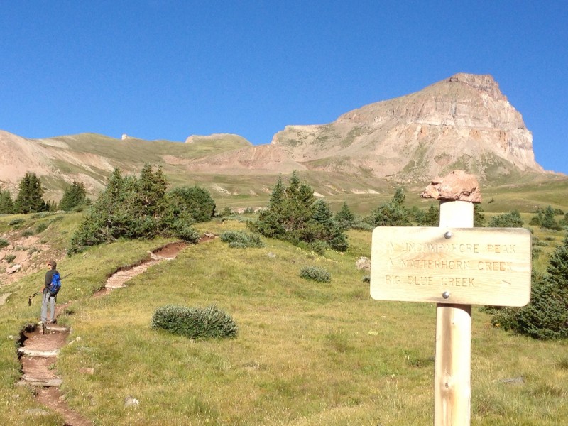
The peak comes into view very early in the hike. I didn't notice the scale model of Uncompahgre resting atop the signpost until I was writing this report. That's hilarious.
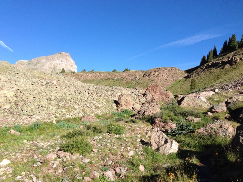
Large volcanic rocks that have tumbled down from above, taking a break on their way to the ocean.
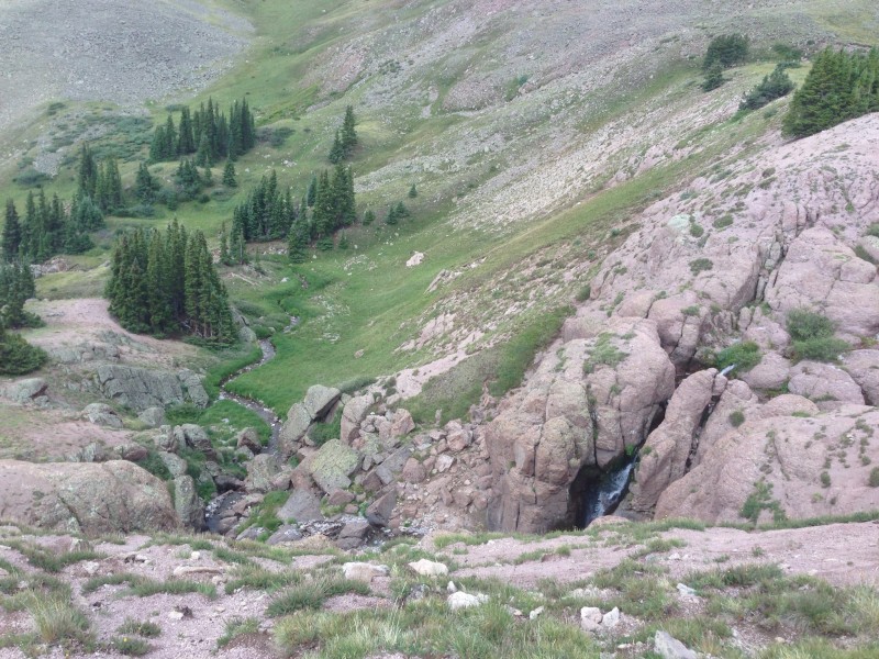
Nellie Creek meandering through the valley within first mile or so.
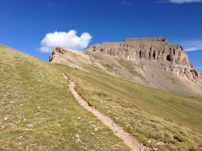
The aforementioned "staircase" scramble is around back, right about where the baby duck cloud's neck curves. His beak points the way to the top.
Just after gaining the grassy ridge to the left (south) of the trail at about 13K ft, the expansive and colorful views to the south and west open up. I think that Sneffels is the very light gray point just right of the distant shadows near the edge of the cliff.
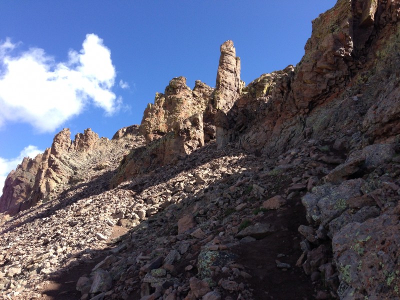
The beginning of the crux of the route. As you circle clockwise around to the back, stay to the right. This picture shows two trails. The one on the right (and possibly the one on the left) leads you to the staircase. Take note of the tallest pinnacle in the picture, and then just under it in the shadow is a shorter, uh, mushroom-like object. I think you swing around the mushroom to the right to find the staircase. Alternatively, I believe you can take the trough that appears on the left of the picture, but that may be a tougher scramble. Not hard to find, and all trails lead you up.
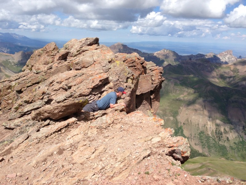
At the bottom of the staircase.
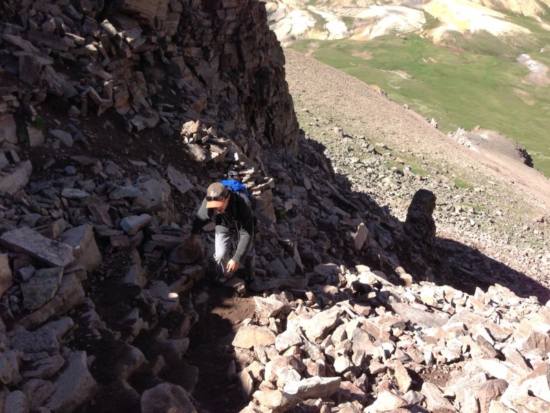
My son climbing the stairs. Hands recommended in spots, but not dangerous as long as you pick your way carefully. And in spite of what the 2D picture might suggest, if you slip, you won't go rolling down the mountain side to the grassy area about a mile below, you'll just bust your butt on a nearby rock and get banged up a bit. You would have to faint or throw yourself backwards for serious damage. Just lean into the rock and you're fine.
Similar picture as previous, but on the way down with sun higher in sky.
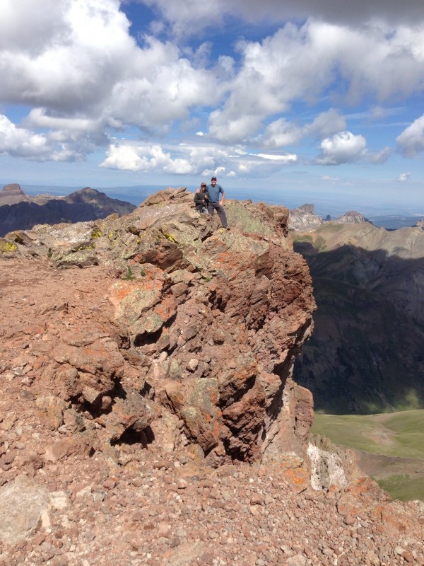
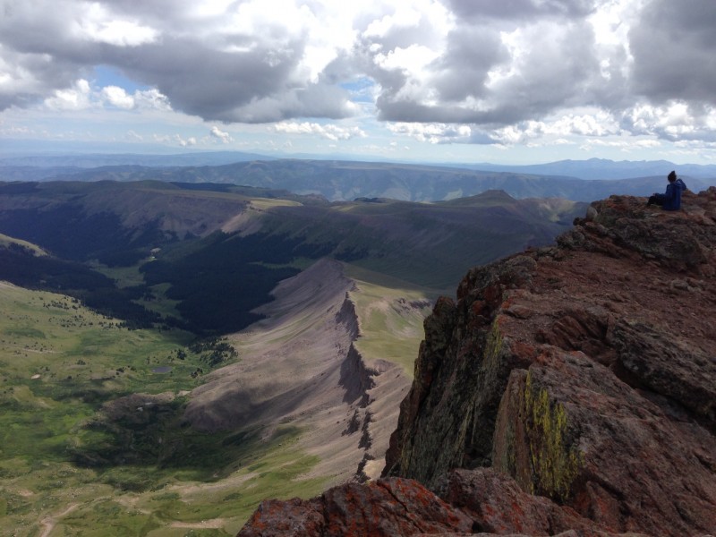
Ah, the peak! My new friends kind enough to snap pictures. Shows the dramatic cliff face that we did *not* ascend ... We're only standing this close because there is very little wind ...
Another cliff shot in the other direction looking northwest. I think Matterhorn 13'er to the far left.
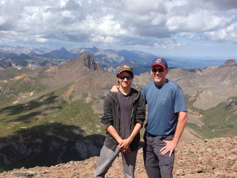
Two cool dudes. Photographer looking west. Sneffels in distant middle. Wetterhorn 14'er near middle. Coxcomb far right.
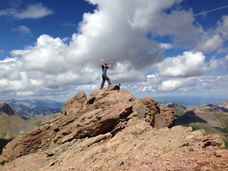
Look at me! Head seemingly in the gathering clouds, I'm at the highest point of the entire San Juan mountain range! (thanks Kate!) This also makes me an effective lightning rod. (clouds not a problem yet - but it won't be long).
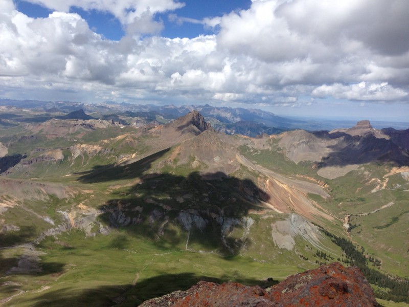
View again west, unobstructed by posers, of Wetterhorn (center), Matterhorn lower and closer, and Coxcomb wedding cake.
...and more northwest.
...and north? I'm losing track now.
...and probably easterly. Trail I think is to the right, obscured by the cliff.
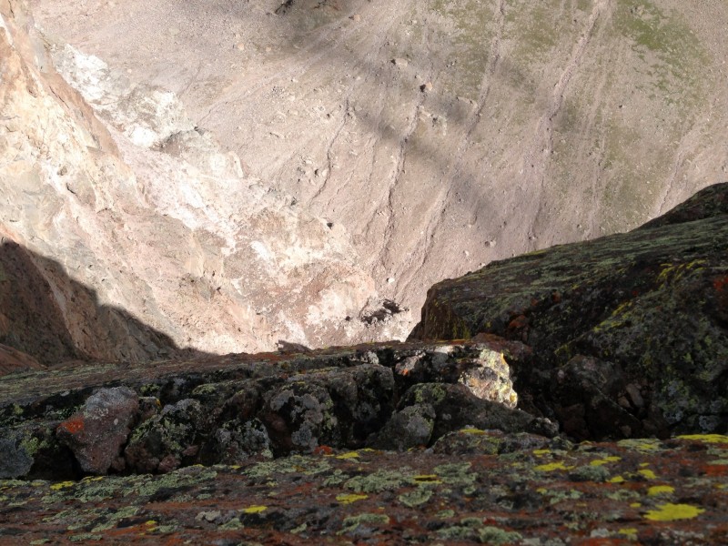
...and if you have the nerve to do this ...
... you'll see this. Hard to tell w/ camera limitations, but that's about a 1,000 ft vertical drop. These rocks have been here for 30 million years give or take, and I'm hoping it will be a few more thousand before the edge of this cliff inevitably reunites with its brethren already in the valley. So my position is not yet worrisome.
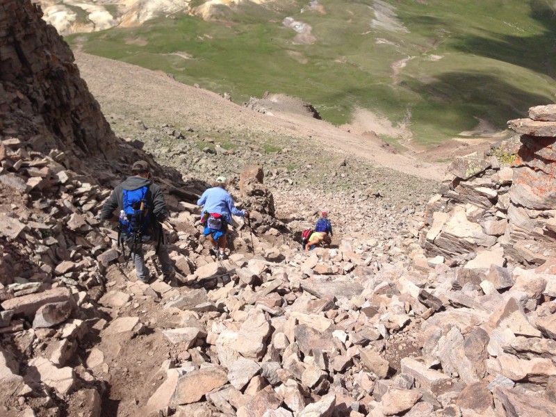
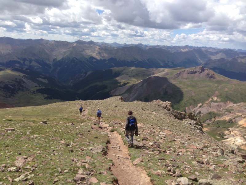
The trip back down. I show this picture because I can't stress enough how delighted I was that the "path" was so "path-like" for much of the journey. I'm more used to hikes where even the simplest Class 1's still require you to carefully step down endlessly from rock to rock where each step risks a twisted ankle - and it ends up taking me as long to get down as it did to get up. Not so on this mountain - until the last couple of legs. Which comes in handy on the way back down if you decide that you might like to "run" along the path - which we did for most of the final 10-15 minutes under hard rain and some hail (note gathering noon clouds). Hmm, well, evidently maybe some folks still prefer the soft, tender, and fragile tundra. But we fixed that. Really proud of my son for doing his first two 'teeners w/ me over the last month as I prep for Longs. Hard to find kids out on the trail these days. Way to go buddy!
Thumbnails for uploaded photos (click to open slideshow):
I was up there that day and must have met you but was so involved in what I was doing that I don't remember you specifically, LOL. It was me and my girlfriend and would have passed you on our way down since we started at 4AM from the green tent to the right of the trail about half a mile up from the TH.
I will say that where the path splits and you go right to the staircase ...DO NOT go left!!! I went left 3 years ago and it was fine, but there seems to have been a great deal of movement since then and instead of a path similar to the one you took, it's now mostly loose rock of unknown depth and questionable stability. Hands were absolutely required and descending was a butt-dragging crab-crawl, and we ended up turning around and going back to the Y in the trail. I'll definitely be going right in the future!
Ha - I do remember you! I detained you guys on your way down to pick your brain a bit on what was above and we talked a coupla mins. My son may have been a bit behind me and you probably past him next. I was the guy who said I helped myself to a few snacks out of your bear bag hanging from the tree near your tent!
Ok, that was us alright! I guess it didn't register that you had your son with you. We stopped and talked to everybody we passed so I knew you had to be one of them.
Glad you had a good time, and your photos are great!
Awesome report - I am psyched to go there this weekend! Is it possible to camp at the Nellie Creek TH, or anywhere else in the wilderness area near the trail?
Thanks! Wonderful mtn. I'm no expert on the legalities, but I think it's fine to pitch a tent up there and I saw a couple tents while we were there and I think I've seen postings about it being a popular idea, so I'd say go for it!
Great report. I enjoyed reading it, especially the scale model and baby duck bits. And thanks for the tip on finding the staircase. I'm climbing tomorrow and I'll stay to the right.
Great report! I enjoyed your pictures and insight. I climbed Longs this past Summer with my three kids & son-in-law, and you will never forget it! We are thinking now of diverting away from the Front Range and heading to the San Juan mountains for something different. Your TR convinces me to take our group and scale Uncompahgre next year. It looks like a beautiful hike. Climb on!
Caution: The information contained in this report may not be accurate and should not be the only resource used in preparation for your climb. Failure to have the necessary experience, physical conditioning, supplies or equipment can result in injury or death. 14ers.com and the author(s) of this report provide no warranties, either express or implied, that the information provided is accurate or reliable. By using the information provided, you agree to indemnify and hold harmless 14ers.com and the report author(s) with respect to any claims and demands against them, including any attorney fees and expenses. Please read the 14ers.com Safety and Disclaimer pages for more information.
Please respect private property: 14ers.com supports the rights of private landowners to determine how and by whom their land will be used. In Colorado, it is your responsibility to determine if land is private and to obtain the appropriate permission before entering the property.