Download Agreement, Release, and Acknowledgement of Risk:
You (the person requesting this file download) fully understand mountain climbing ("Activity") involves risks and dangers of serious bodily injury, including permanent disability, paralysis, and death ("Risks") and you fully accept and assume all such risks and all responsibility for losses, costs, and damages you incur as a result of your participation in this Activity.
You acknowledge that information in the file you have chosen to download may not be accurate and may contain errors. You agree to assume all risks when using this information and agree to release and discharge 14ers.com, 14ers Inc. and the author(s) of such information (collectively, the "Released Parties").
You hereby discharge the Released Parties from all damages, actions, claims and liabilities of any nature, specifically including, but not limited to, damages, actions, claims and liabilities arising from or related to the negligence of the Released Parties. You further agree to indemnify, hold harmless and defend 14ers.com, 14ers Inc. and each of the other Released Parties from and against any loss, damage, liability and expense, including costs and attorney fees, incurred by 14ers.com, 14ers Inc. or any of the other Released Parties as a result of you using information provided on the 14ers.com or 14ers Inc. websites.
You have read this agreement, fully understand its terms and intend it to be a complete and unconditional release of all liability to the greatest extent allowed by law and agree that if any portion of this agreement is held to be invalid the balance, notwithstanding, shall continue in full force and effect.
By clicking "OK" you agree to these terms. If you DO NOT agree, click "Cancel"...
Trail head for all three peaks: Engineer Pass. We went up the west side of the pass and down the east side. The west side was fine in our stock Xterra. The east side isn't very bad at all, but I'd still recommend 4WD. There is plenty of parking at the top of the pass.
Engineer Mountain
Evening of August 4, 2013
Round trip: 0.6 miles. 400 feet gained and lost.
Matt, Kate, and I spent Sunday hiking near Silverton and after some beer and pizza at Avalanche Brewing Company (they start serving pizza after 3 pm), we concocted a plan where Matt could get in 1 more 13er for the day and then go tackle his last Colorado county highpoint.
Note: Hiking on a stomach full of pizza is not advised, but we made it work.
We drove up to Engineer Pass, hiked Engineer Mountain in about 30 minutes round trip and then Matt departed and Kate and I headed down the east side of Engineer Pass to find some flat ground for the night.
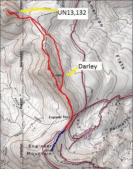
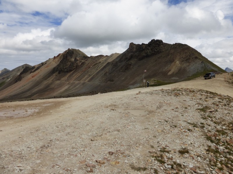
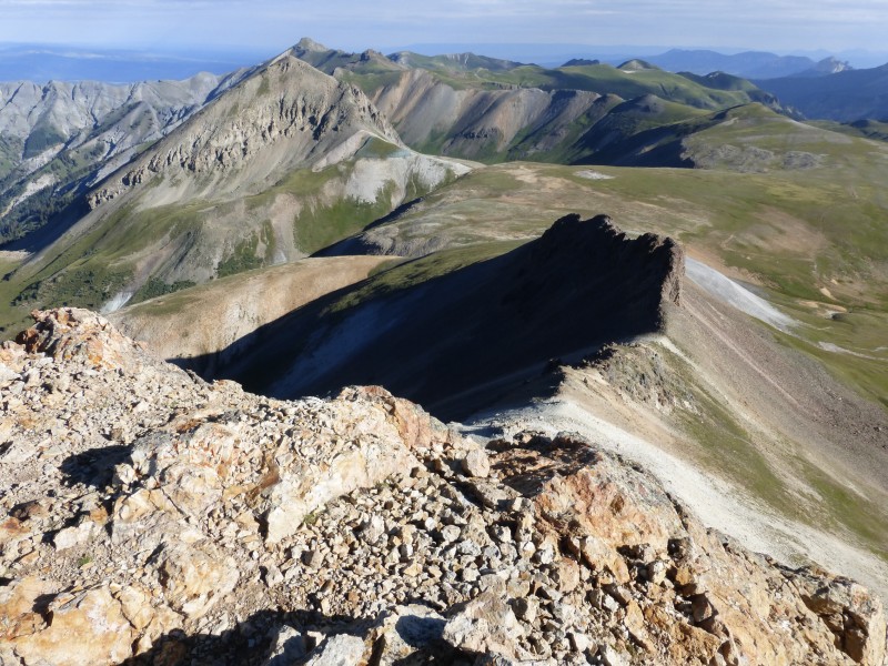
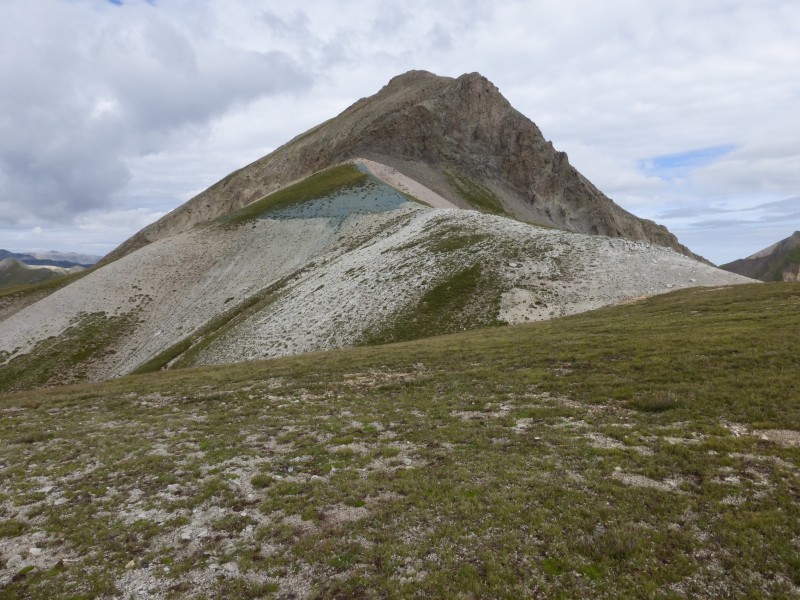
Route: From the pass, look south. Then go up the ridge. Then go back down the ridge.
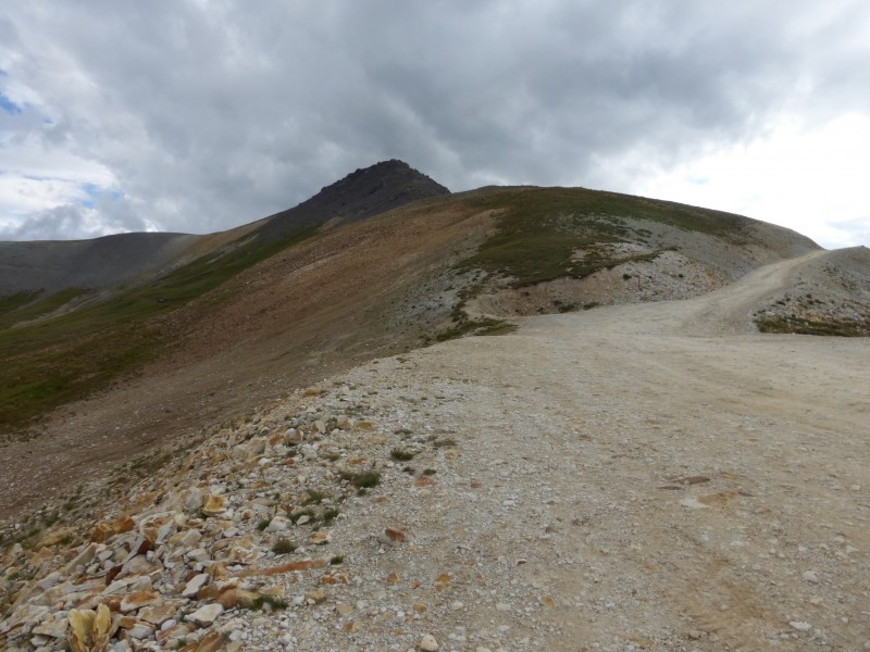
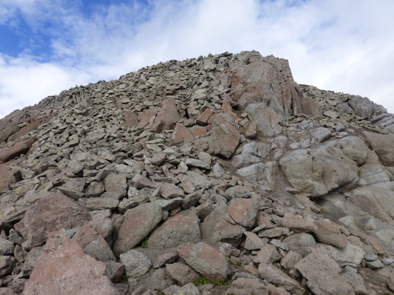
The ridge to Engineer Mountain. Engineer Mountain from the pass. Go up.
A closer look.
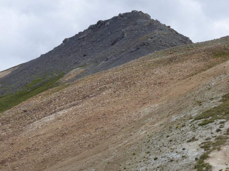
A local.
Darley Mountain & UN 13,132
August 5, 2013
Round trip: 3.8 miles. 1,410 feet gained and lost.
The next morning, Kate and I woke up to the alarm at 5:20 am. But it was dark and cloudy so we figured a snooze until 7 am would be better to see if the clouds were going to develop into something malevolent early. The early morning sky was putting on a show. Kate's new camera takes good pics! Another from Kate's camera.
We got up and drove back to the top of the pass. Darley Mountain looked pretty straightforward from there.
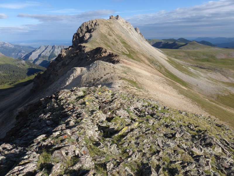
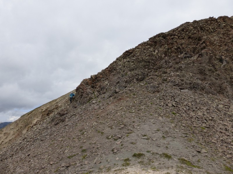
There's actually an old road/trail that crosses under the face (visible above) and then switchbacks up toward the top. We chose to go with the ridge instead of this road since the ridge looked more solid - and it was pretty solid. The summit is not visible from here.
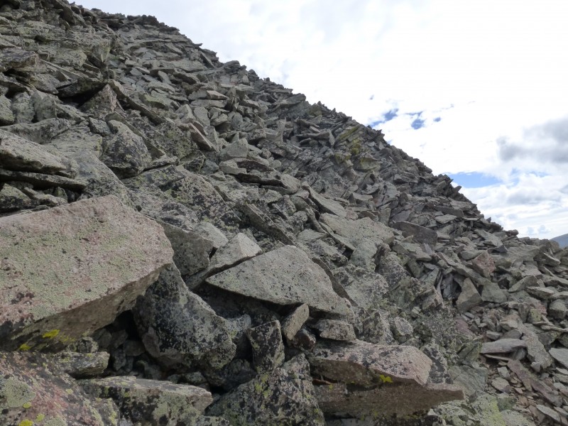
That ridge looked pretty good, but we weren't sure what was behind those big, rocky towers on the right side of the ridge, as viewed from the pass. A closer view of the towers on the ridge.
We were glad to see that the back of the ridge was actually grassy, at least it was for a while.
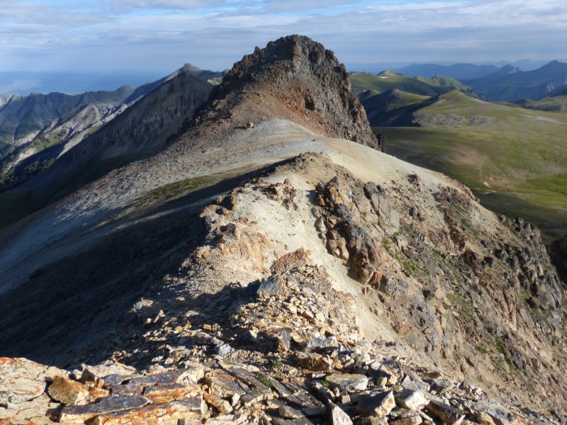
The view toward the summit after those towers.
The view over yonder. Kate's camera.
Farther along, looking toward the summit.
Looking back at the start of the ridge.
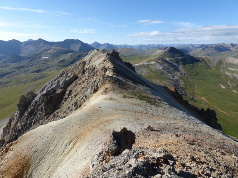
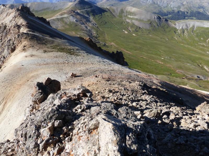
Engineer Pass Road/Alpine Loop Road and Engineer Mountain (Right side, just above the road. It's a puny thing, isn't it?) can be seen in the distance.
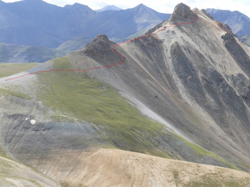
From the summit, we could see our next goal for the day. UN13,132 is the next peak out there, past the fin and just past and left of the flat-ish spot out there. The fin is in the way along the ridge.
The route up UN13,132 looked a little interesting from this distance.
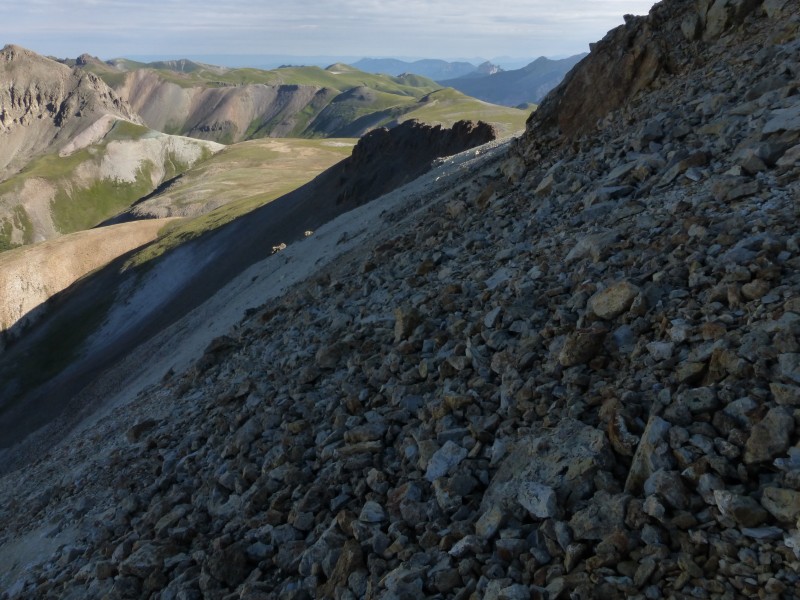
We scouted a way down that would lead us directly off the summit to the ridge heading to UN13,132, but we quickly decided that a different route would be safer. We backtracked a little and headed down the west face (right side as you're heading back to Engineer Pass). We descended this for a bit until we were below the cliffs under the summit and then we traversed on some not-so-nice scree and talus below the summit to make our way north. We ended up on the ridge between that fin and Darley. We turned right and went down the west face right about here.
On the left/west of the fin, we thought we spied something that looked a little like a beaten path but that ended very shortly. At that point, we traversed on loose talus and scree. Not pleasant. I recommend boots over runners/low-tops if you go the way we did, unless you enjoy rocks rolling onto your ankles and feet. I also recommend not going the way we did. We would try a different route around/over the fin if we go back. We traversed this terrain.
The west side of the fin was loose and not fun. We went about parallel to the saddle with Darley for a while until we got to a gully. We descended a bit to get under the gully and then we continued our traverse to the other side of the fin.
On our way back to the car, we caught sight of the east side of the fin. I think there might be two better options than what we did for staying high on the ridge: 1) Traverse on the east/right side of the fin or 2) head higher on the left side of the fin, scramble over the top and then go through the weakness apparent in the next picture. We didn't do either of these, so good luck with whatever you do... A third option is to descend to the right/east just before the fin and avoid it completely. There is a grassy face that will take you down to the flats below the fin. It's an easy walk from there toward the blue-green area described below. The fin as seen from our hike back to the car.
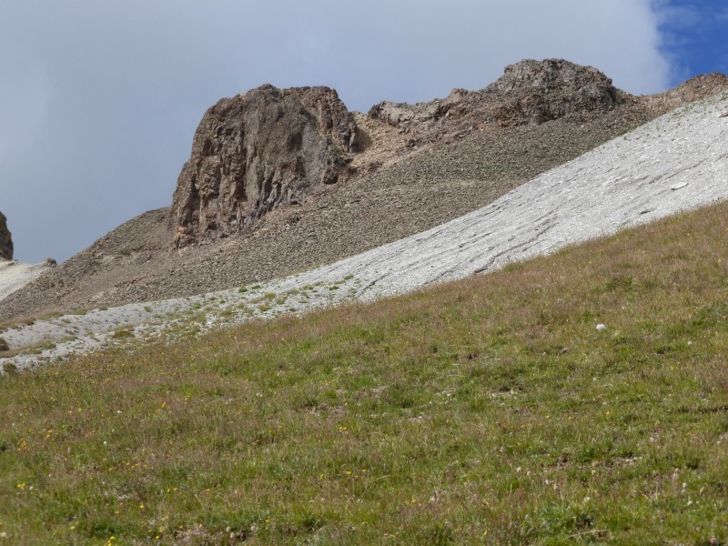
Anyway, once on the other side of the fin, UN13,132 continues to look interesting... I was thinking that if that face is anything like the loose 'stuff' we just traversed, then we'd end up not being able to hike it. Luckily, it's actually pretty solid!
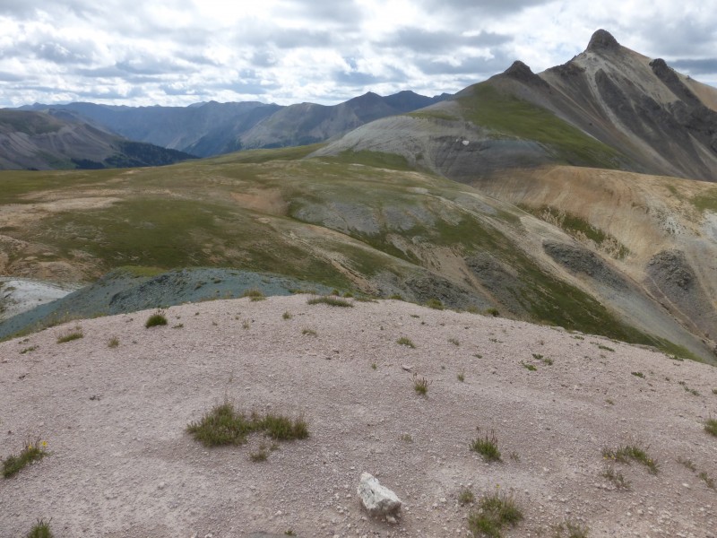
We walked along the grass, then up the white-ish dirt/rock, then up the blue-green dirt/rock, and then we got to the base of our ascent. Head for the blue-green rock/dirt.
Taken on the descent, the next pic shows the corner we went around to start out ascent. Kate is coming back from where we started our ascent - behind that corner.
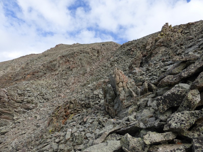
The rock behind that corner looked very loose, but there was a faint path zig-zagging up the first 50 or 75 feet or so and the rock was less loose than it first looked. There's actually a faint trail in there...
Above the first steep part, the route mellows and it's easy to pick a good line to the summit. We ascended the mostly-stable rock for a bit here and then headed to the gully maybe 50 feet below the summit ridge, but staying ridge proper or doing something else would likely also work.
The stability of the rock increased as we ascended. Near the summit.
From the top, we could see our route across the fin. Approximate route in red.
We descended our UN13,132 ascent route and then headed east of the fin and Darley on the grassy flats. We stayed close to the ridge and had a few gullies to cross.
Wildhorse Peak looked close and tempting, but the clouds were building and it was time to call it a day.
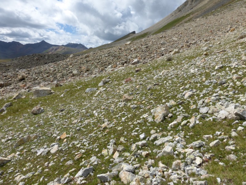
From the east, we regained the south part of Darley's ridge on the way back to the car. We could have stayed low in the grass east of Darley until we got back to the road, but regaining the ridge seemed like a good idea at the time... I'm not sure it was the most efficient way back to the pass, but it worked for us. The terrain we encountered varied between grass, rock, and scree as we did our ascending traverse back to the ridge. None of it was too bad.
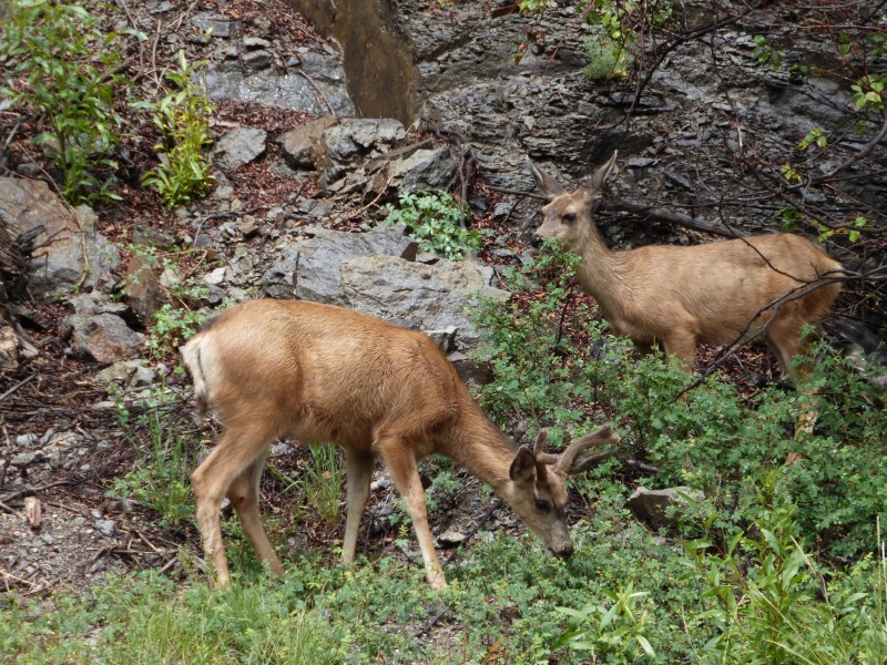
We saw some more locals on our drive out.
This was another fun and short day. Obviously, these 3 peaks could be combined into 1 slightly longer day.
We had fun and we hope you enjoyed the report.
Bob & Kate
Thumbnails for uploaded photos (click to open slideshow):
Interesting landscape down there! Almost looked like you were walking on back of a prehistoric creature, especially in images 6, 7, & 8. Have only been down to the San Juans once, but it is fascinating stuff there! Thanks for your post! :D
I don't think anyone could top your route description for Engineer: ”From the pass, look south. Then go up the ridge. Then go back down the ridge.”
You definitely won the sunrise sweepstakes. Those pics are stunning.
If you ever go back for Whitehorse, please let me know.
It was a pleasure hiking with you all on Sunday, from Sultan/GT to the epic on Engineer.
Darley --> 13132 is interesting. The right side of the fin wasn't great either but probably better than the side you took. In early June, we could see a cornice at the start of the summit ridge on 13132 and we thought it might stop us cold, almost to the point where we were gonna bail.
This corniced to the left and to the right of wooderson was all steeps. It was a little spicy coming back, rumbly tummy kind of stuff. I figured I'd throw this out there because early season might give people some trouble.
Sweet sunrise pics and congrats on a safe day out.
I think you wrote this TR just to use the word 'fin' a bunch, which you were successful in doing :D Looking forward to the report with a prominent 'cutter' along the route, whatever that is!
Congrats on what sounds like a great weekend down in the San Juan's! Engineer from the top of the pass seems like something I could scoot up on my knee scooter and then crawl back down! Not sure that's something my surgeon would approve of however.
Fin, I mean fun, trip report and I agree about Kate's new camera, wonderful sunrise pictures. :)
Caution: The information contained in this report may not be accurate and should not be the only resource used in preparation for your climb. Failure to have the necessary experience, physical conditioning, supplies or equipment can result in injury or death. 14ers.com and the author(s) of this report provide no warranties, either express or implied, that the information provided is accurate or reliable. By using the information provided, you agree to indemnify and hold harmless 14ers.com and the report author(s) with respect to any claims and demands against them, including any attorney fees and expenses. Please read the 14ers.com Safety and Disclaimer pages for more information.
Please respect private property: 14ers.com supports the rights of private landowners to determine how and by whom their land will be used. In Colorado, it is your responsibility to determine if land is private and to obtain the appropriate permission before entering the property.