| Report Type | Full |
| Peak(s) |
Crestone Peak - 14,299 feet |
| Date Posted | 08/07/2013 |
| Modified | 08/08/2013 |
| Date Climbed | 08/04/2013 |
| Author | TheOtherIndian |
| A Satisfying Quest |
|---|
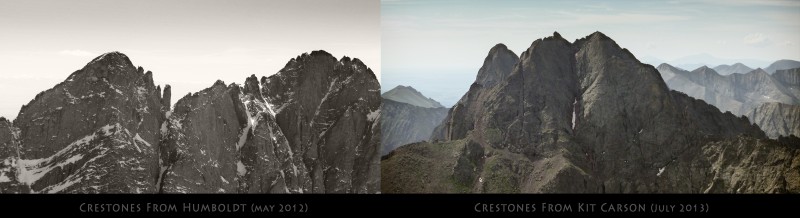 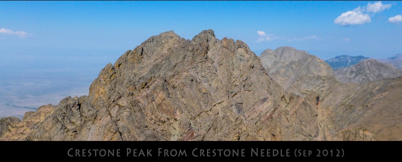 Note: This TR doesn't have any new info. 14ers' route description is perfect and navigation on the standard route is easy. Mountain and Route: Crestone Peak via the South Face/Red Gully Standard Date: 08/04/13 RT Mileage: 18.6 mi car to car, parked about 2 miles before the upper TH Vertical Gain: ~ 6400 ft Party: Me, myself and I Wildlife: Marmots and pika Crestone Peak, in all it's and it's sub summits glory is still a considerable slog from the trailhead. Add to it an overnight pack and a few miles of 4WD road and you've got yourself a 'memorable' peak. Crestone peak was on my list for a few weeks now. Due to weather conditions and other 14ers getting in the way, this did not happen for the past couple of weeks. As it turned out, I couldn't find any partners to do it this weekend and decided to go solo. I was hoping that with this being a popular area with three fourteeners, I might run into somebody on the trail. Last year when I did the Needle, I could take my Subaru to the upper trailhead. I was hoping for a similar miracle or foolishness this year but could make it only about a mile and half above the lower trailhead - a good 1.8 - 2 miles below the upper trailhead. After a short nap to wait out the evening showers, I began trudging up the road around 4:30pm. There were several vehicles heading down but none going up. I made it to the upper trailhead in about 40 minutes and continued on. The rest of the hike to the S. Colony lakes was mostly done in the evening rain and took me about 3 hours from my car. After setting up camp and a rendezvous with Mr. Brian Thomas and his friend Denise who were camped nearby to hike up Columbia point the next day, I decided to call it a day and tried to get some sleep. 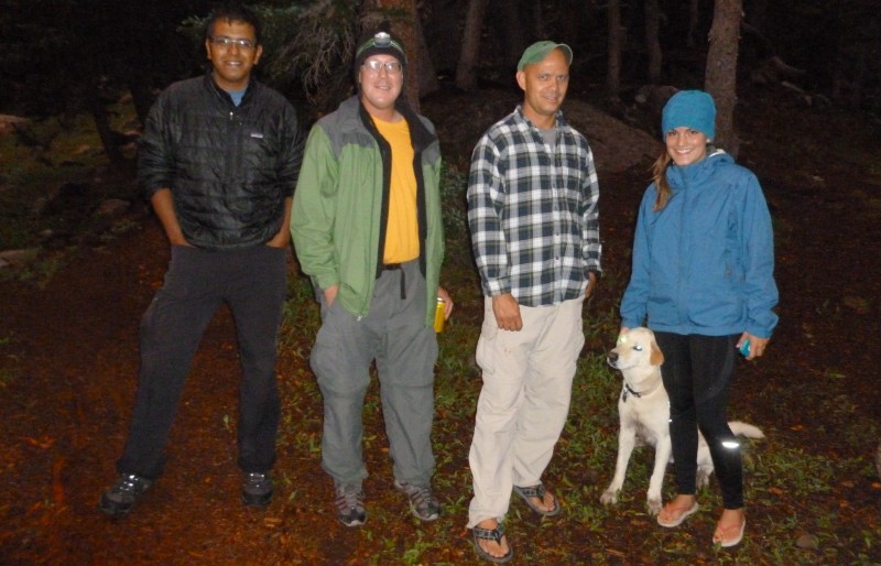 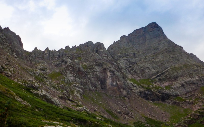 The winds picked up around 3am and kept howling for the next few hours. Not really an inviting weather for starting out the hike, but I figured if I could get out and make slow progress in the general direction of Crestone Peak, I would have a head start when the weather and my mood finally gets better. I got ready reluctantly and started out from the camp at 5:30am. Route finding up to Broken hand pass was not an issue even in the early morning twilight with large cairns helping throughout. The nasty upper portions of Broken hand pass held true to my memory although the previous night's rains helped hold down the scree pretty good. Continuing on the great trail to Cottonwood lake, I found myself at the base of the Red Gully an hour and forty minutes after I set out of camp. I took a long break here for breakfast, water and to prepare myself for the gully climb ahead of me. 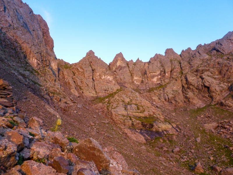 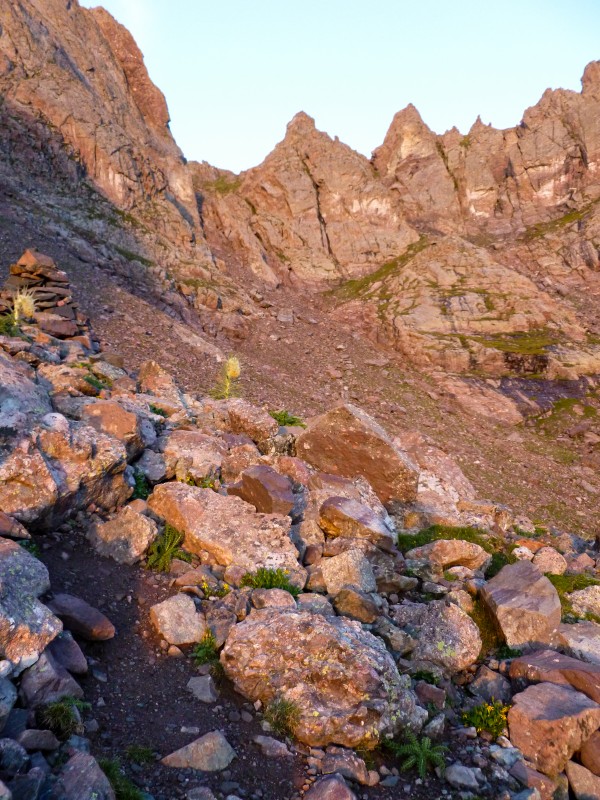 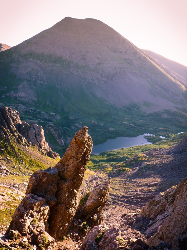 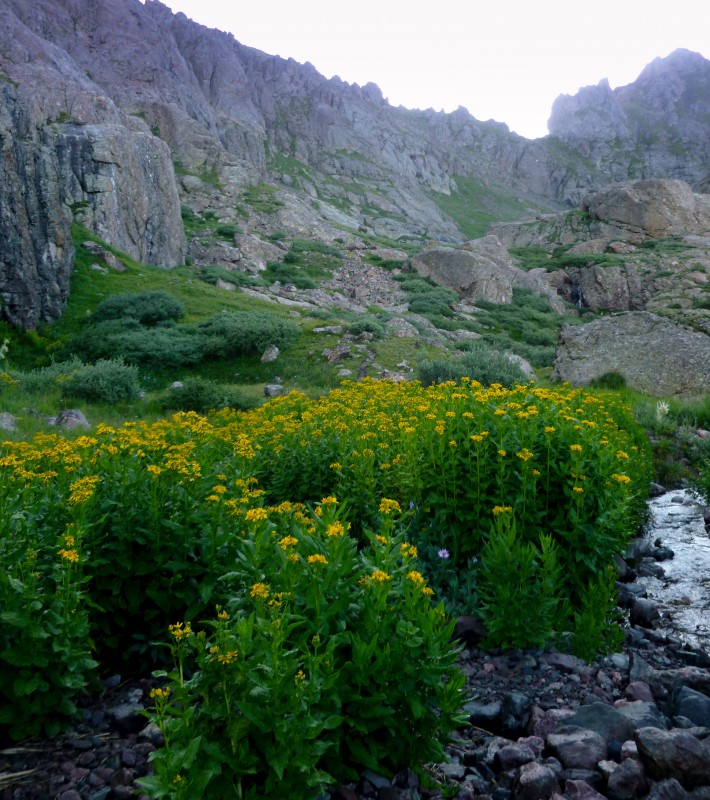 As Bill mentions in the route description, there is a trail almost all the way to 12900 ft. Although faint in some places, its pretty hard to miss going up with numerous cairns in the area. After some hiking up this trail, I found myself at the entrance to the red gully. The gully was not steep except for a couple of pitches. The flowing water, the wet rocks and the abundance of marmot (or pika?) poop on perfect handholds made some sections tricky. In my experience on Class 3 peaks, there is quite a bit of route finding to find the easiest line or keep the climbing at Class 3. However, in the Red Gully, any sensible line you pick is the easiest line and the entirety of the gully did not exceed Class 3. The gully felt exceedingly long and the scrambling was sustained enough to tire me out.  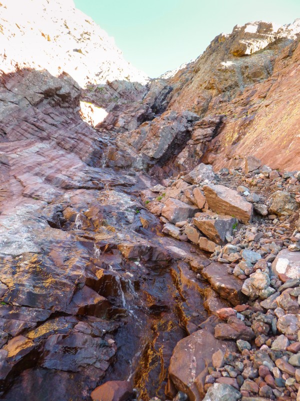 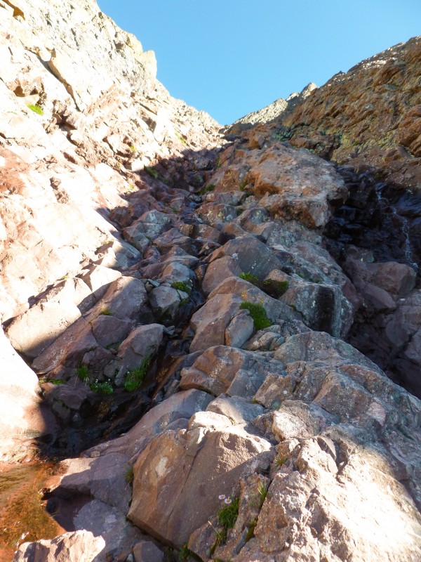 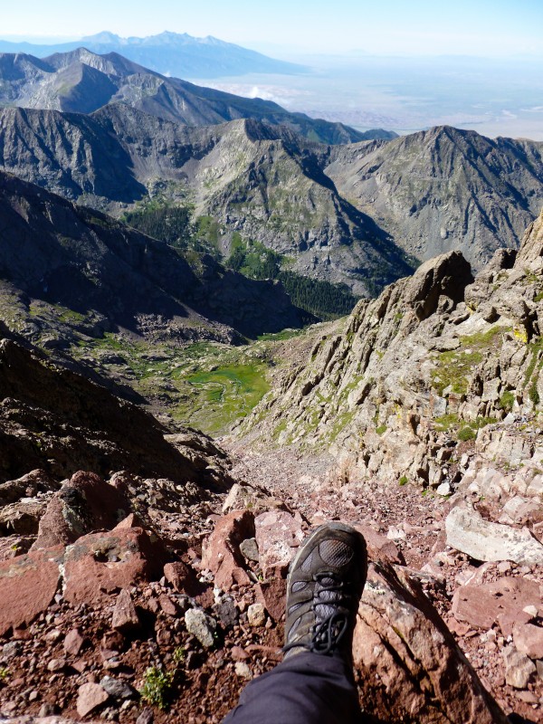 I topped out at the gully and saw two guys coming up on the north side of the mountain via the north buttress route. These were the first humans I'd seen all day, so much for my impression of Crestones as a popular area. The scramble from the top of the gully to the summit was a tad longer than expected but I eventually hit the summit just before 10am, a good 4.5 hours away from my sleeping bag. This was my first attempt to drive out the chickens inside me and do a Class 3 route solo and it looked like I was the first one to summit that day. Although another party had told me the previous night of their plans to do the peak to needle traverse, I couldn't find any signs of other hikers before me, considering much of the trail was wet and footprints were unavoidable. I waited up for the other guys who went for East Crestone first. A few minutes later, they summitted Crestone peak. I chatted with them for some time, we took summit shots of each other and I decided to head down while they were contemplating whether to get down the standard route or do the traverse. 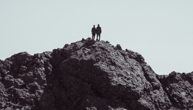 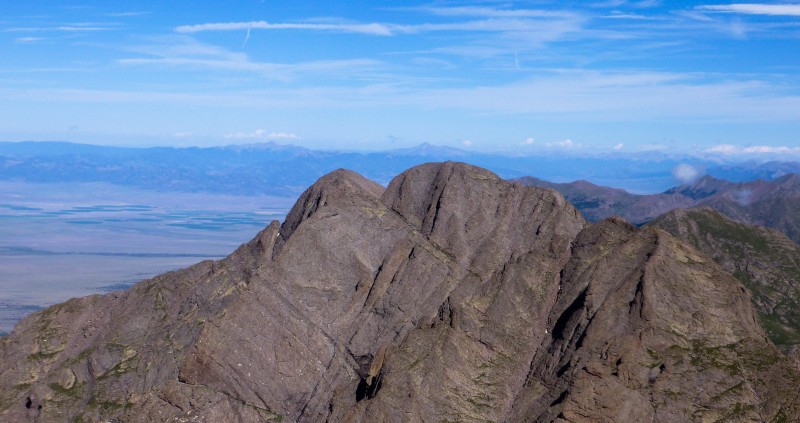 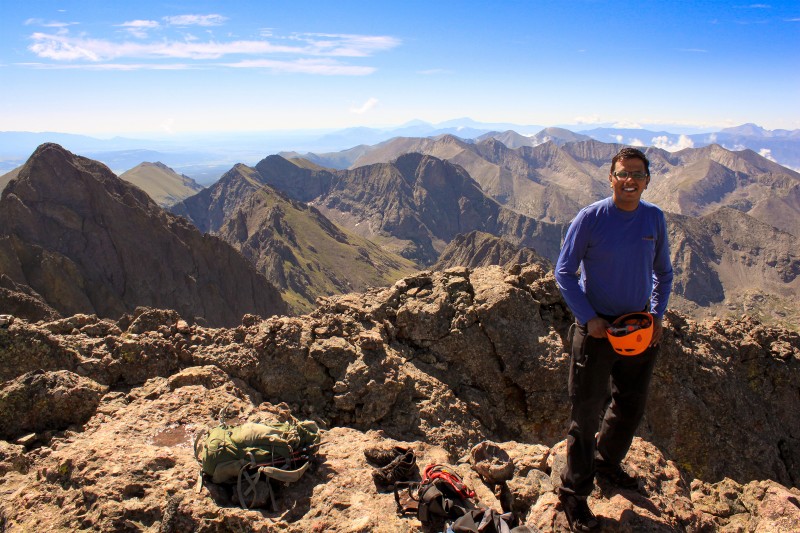 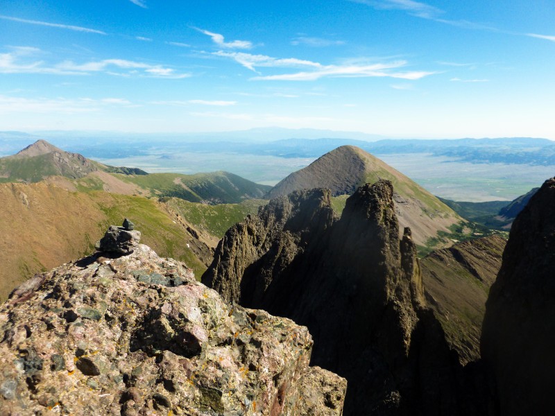 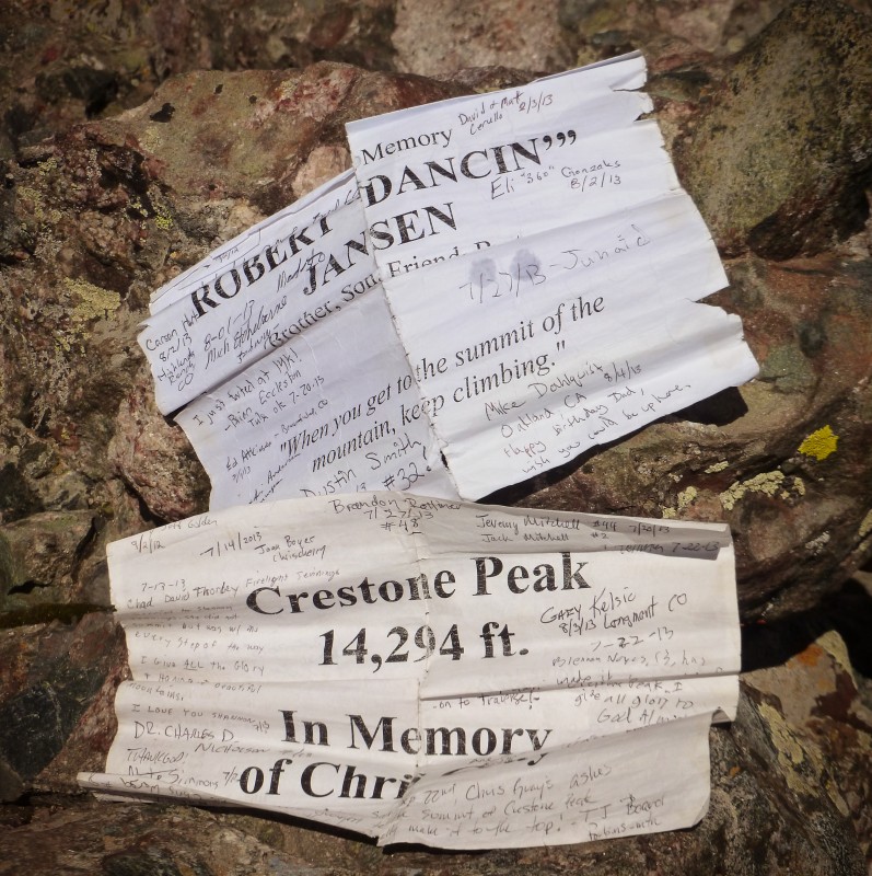 The descent was not what I had expected at all, only much more pleasant! The rocks were exceptionally stable, even the smooth ones were grippy and hardly any loose scree. A couple of sections of wet rock that seemed hard going up were easier to butt scoot down with good footholds. The descent was much shorter than the ascent and I was soon at the exit of the gully. A group of four were donning helmets and preparing to start up the gully. I exited the gully and took a sharp left to find the trail I came up in the morning. After evading some pesky marmots and some loose rocks, I eventually found the trail and made it back to the lake in no time. The two hikers who came up the north buttress had decided to go down the standard route and made it back to Cottonwood lake while I was taking a break. The hike back to broken hand pass was brutal and I nearly hit a wall. It took me more than an hour to make it back to the pass. 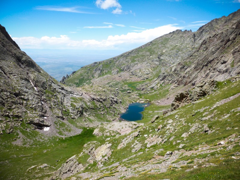 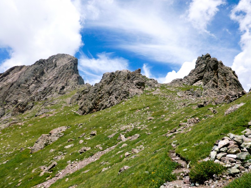 The descent was loose and nasty. At one point in the descent, I made the exact same mistake I did last year on the Crestone Needle hike. I went on the wrong side of a rock and found myself staring into 10-15 feet drop through an angled chimney with not many holds. For some foolish reason I thought I could make it but realized the magnitude of the drop once I threw my trekking poles down. I hastily went back up through some loose scree to find a much easier alternative on the right side of the rock. After this pitch the hike down was mostly loose scree and boulder hopping. There appeared to be much more loose boulders and rocky sections than I remembered from the way up. I got back to camp a bit after 2pm, filtered water, packed up and started the hike down around 3pm. 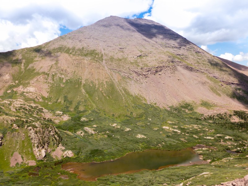 The hike down after a long day and with a heavy pack was brutal and made me take a break every mile or so. I made it to the trailhead by 5pm. Since I had seen so many cars go down around the same time the previous day, I was hoping I could get a ride down to my car and salvage what was left of my sore shoulders and blistered legs. But Murphy and his damn law ensured it wouldn't happen. After hanging around for 10-15 minutes in hopes of getting a ride, I eventually realized the futility of it and decided to hoof down the remaining 1.5 miles or so slowly. I finally reached my car to the elixir branded as Vita Coco! The drive home was another story. I had little idea that I am directly headed towards the storm and lightning I saw happening in the east. I could see snow (or hailstones?) covered peaks when I was driving closer to Westcliffe. SH 96 between Westcliffe and Wetmore had severe rain and thunderstorms. Parts of the highway had running water from the hills along with rocks, dirt and various plastic equipment from nearby ranches. Visibility was very poor and parts of the highway were covered white in hailstones. I kept driving at a slow pace feeling that it was better to keep moving than to just stay and wait out that long downpour. In many ways, the feeling was similar to what I experienced getting down the last 2-3 miles of the hike an hour before .... PS: This is my only solo trip report. After writing it I noticed that there is far too many 'I's than I would've liked. Lest people consider me narcissistic, I wanted to state that I possess just a healthy dose of narcissism and anything excess in this report is just poor writing Thumbnails for uploaded photos (click to open slideshow):
|
| Comments or Questions | |||||||||||||||||||||
|---|---|---|---|---|---|---|---|---|---|---|---|---|---|---|---|---|---|---|---|---|---|
|
Caution: The information contained in this report may not be accurate and should not be the only resource used in preparation for your climb. Failure to have the necessary experience, physical conditioning, supplies or equipment can result in injury or death. 14ers.com and the author(s) of this report provide no warranties, either express or implied, that the information provided is accurate or reliable. By using the information provided, you agree to indemnify and hold harmless 14ers.com and the report author(s) with respect to any claims and demands against them, including any attorney fees and expenses. Please read the 14ers.com Safety and Disclaimer pages for more information.
Please respect private property: 14ers.com supports the rights of private landowners to determine how and by whom their land will be used. In Colorado, it is your responsibility to determine if land is private and to obtain the appropriate permission before entering the property.