Download Agreement, Release, and Acknowledgement of Risk:
You (the person requesting this file download) fully understand mountain climbing ("Activity") involves risks and dangers of serious bodily injury, including permanent disability, paralysis, and death ("Risks") and you fully accept and assume all such risks and all responsibility for losses, costs, and damages you incur as a result of your participation in this Activity.
You acknowledge that information in the file you have chosen to download may not be accurate and may contain errors. You agree to assume all risks when using this information and agree to release and discharge 14ers.com, 14ers Inc. and the author(s) of such information (collectively, the "Released Parties").
You hereby discharge the Released Parties from all damages, actions, claims and liabilities of any nature, specifically including, but not limited to, damages, actions, claims and liabilities arising from or related to the negligence of the Released Parties. You further agree to indemnify, hold harmless and defend 14ers.com, 14ers Inc. and each of the other Released Parties from and against any loss, damage, liability and expense, including costs and attorney fees, incurred by 14ers.com, 14ers Inc. or any of the other Released Parties as a result of you using information provided on the 14ers.com or 14ers Inc. websites.
You have read this agreement, fully understand its terms and intend it to be a complete and unconditional release of all liability to the greatest extent allowed by law and agree that if any portion of this agreement is held to be invalid the balance, notwithstanding, shall continue in full force and effect.
By clicking "OK" you agree to these terms. If you DO NOT agree, click "Cancel"...
After a successful summit attempt on Mount Wilson the day before to tackle #47, Wilson Peak was our attempt at #48. We were still camped at our excellent location about .1 miles away from the trailhead and were ready to finish off the two Wilson's. At this point, I must say that the common house flies were the worst I have ever seen them camping before a 14er. During the daytime hours, these flies would buzz and bite you until you were run into the tent or vehicle. They would not go away until later in the evening when it got cold enough to scare them off. I'm not sure what caused this but 2013 must be the year of the fly and they were a pain at the Rock of Ages trailhead.
Once again, we were up around 3:00 AM and on the trail by 3:25. We knew that the hike up the Rock of Ages trail was going to be a long haul because we did it the day before. Thus, our early start was to ensure we hiked most of it in the dark (goes faster right?) and to make sure we had good weather for the next day.
The day before, we noticed a large white sign leaning up against the circular white rock shelter built right in front of the stone house on the private property, 3/4 of the way up Rock of Ages trailhead. The sign clearly said, "No trespassing, private property." Well, on this day we noticed that the sign was gone and there was a tent perched right in the middle of the rock shelter. I can only make some guesses and assess that someone removed the sign in order to enjoy the camping spot and violated private property. However, I don't know all the facts to say for sure.
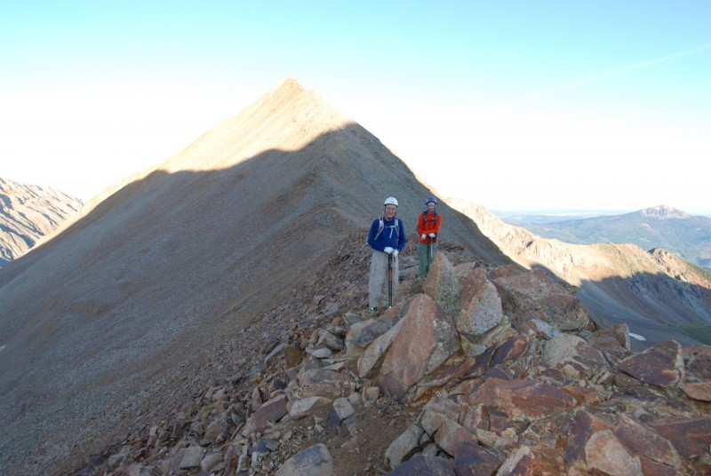
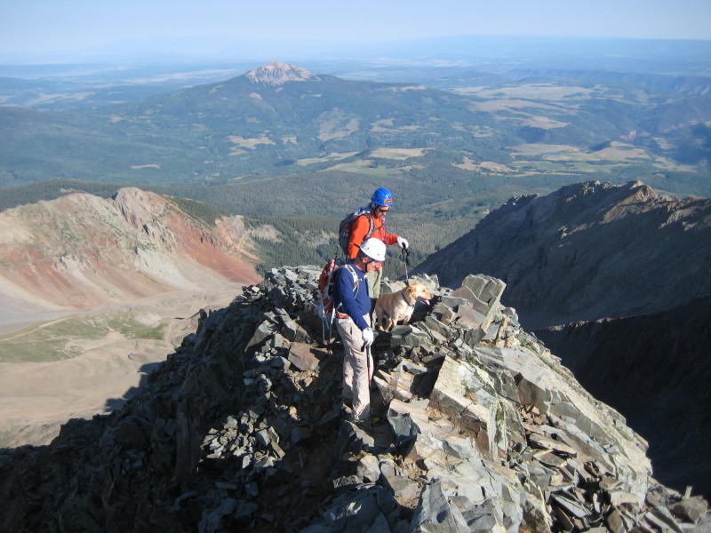
Anyway, we reached the Rock of Ages saddle and immediately took a left turn to begin the ridge that leads over to the Wilson Peak/Gladstone saddle. This is a quick 15-20 minute hike and on trail that is marked and pretty easy to navigate. Here is a shot of the guys on the trail:
Once you reach the Wilson Peak/Gladstone saddle, you have a nice view of the face of Wilson Peak and what you will have to negotiate for much of the rest of the climb. Here is a shot of the guys looking back at the Rock of Ages saddle with Wilson Peak in the background.
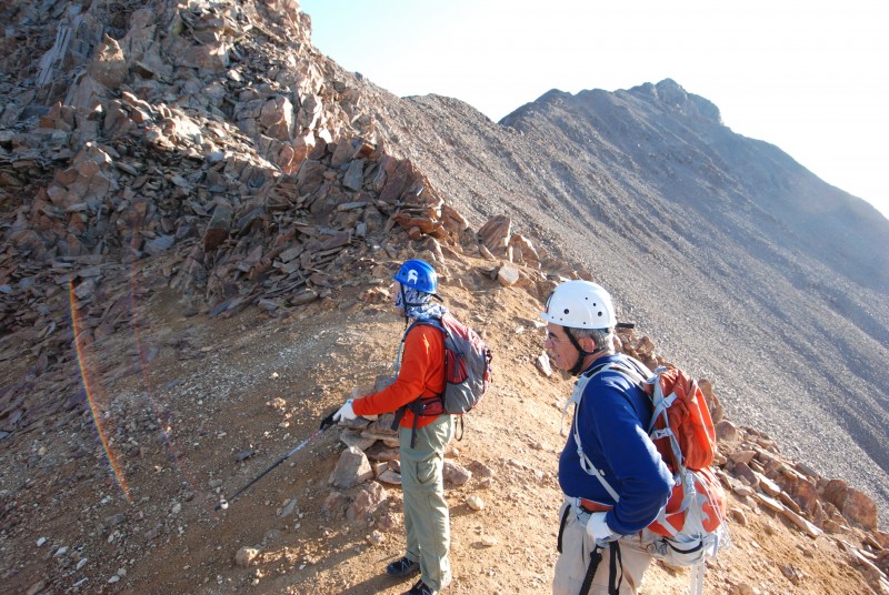
From the saddle, you have a choice to make. There are some class 3 ledges immediately to the left coming around the saddle that last for about .2 miles. Additionally, there is a scree and steep loose rock slope in front of you that many people have taken that will take you down (about 50 feet) and around the class 3. You can either go immediately down:
And then back up to the side of the ridge to regain the trail:
Or, you can take the class 3 ledges going across. This traverse really does not loose or gain any elevation and is actually quite fun. We took the steep scree slope going up Wilson Peak where we had to regain the trail after dropping down below the class 3. Going back down, we decided as a group to take on the class 3 traverse back to the Wilson Peak/Gladstone saddle. If I had to do it all again, I'd do the class 3 traverse both ways. There is really only one clear route across the traverse and it's on pretty good rock. It's got some exposure but nothing that ever worried me sick. It seemed to be quicker and a lot easier on the legs than descending and ascending scree.
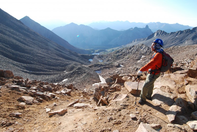
Once you finish this portion of the mountain, you actually have very good trail all the way until the false summit. Here is a video from one of the saddles along the Wilson Peak ridge before the false summit:
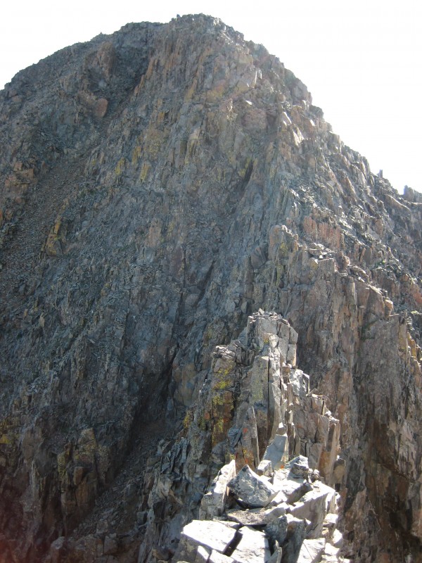
Next, you are heading for the false summit. Standing on top of the false summit may very well be the most de-moralizing part of the climb because you are looking at the last summit pitch and it looks rather gnarly. Here is a photo of the other two on the false summit:
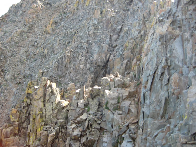
What you will be looking at from the false summit is this:
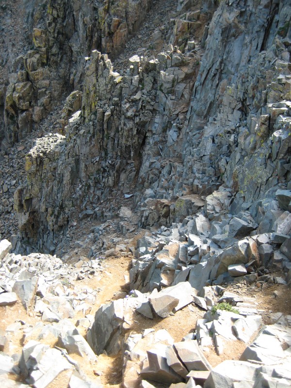
It almost looks impossible but have no fear, it is completely possible. From the false summit, you must descend briefly and traverse across a rib that is marked with a cairn. Here is the descent off of the false summit:
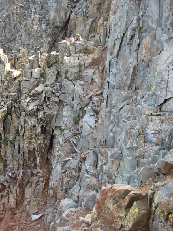
Aim directly for this cairn when descending the false summit and continue past it over into the next gully area. This is what it looks like. Notice the cairn at the top of the photo:
I actually built that cairn because when we got there, there was nothing and we descended down the first gully right off of the false summit and went around the rib. We lost maybe 50 feet in elevation and came back up the other side of the second gully. This was completely doable but unnecessary. It looks like 1000s of other people have gone this way but the traverse across where the cairn is proved to be way easier and quicker. There are just a few small moves traversing with some exposure but it's all pretty easy. We took this traverse coming down and it was worth it. Thus, I didn't want people to miss it coming from the false summit in the future and so I built the cairn. Here is a closeup of the cairn you are looking for:
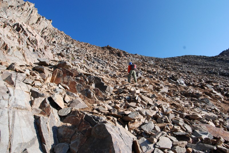
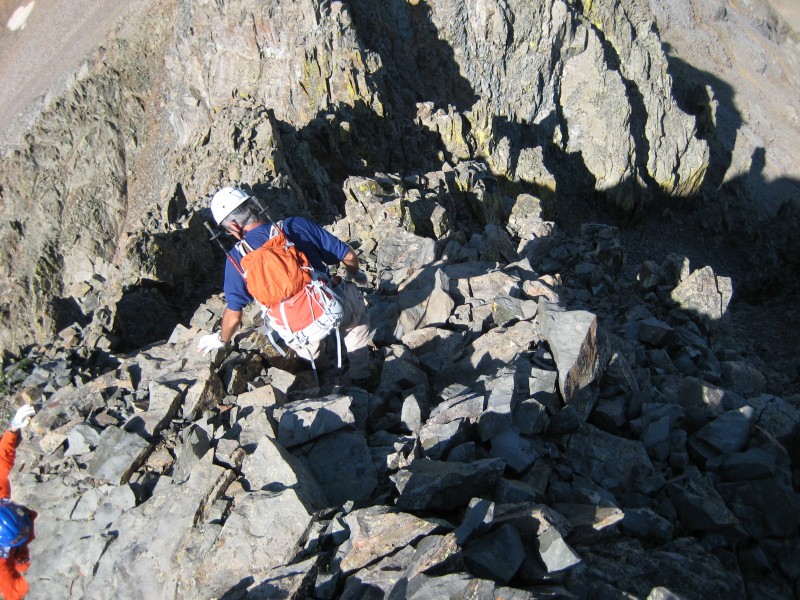
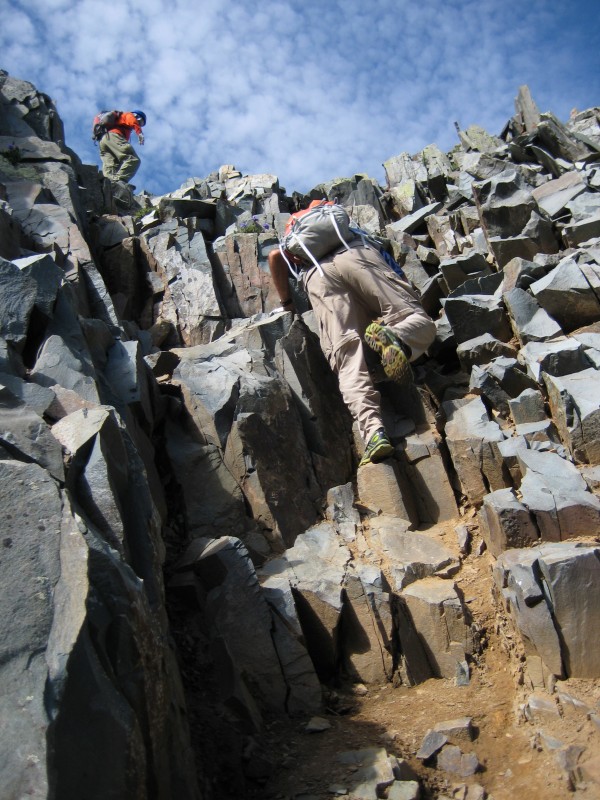
Once you get across the first rib where the cairn is, you are now getting into the crux of Wilson Peak which is a steep ascent up to the summit. Here is a video showing just a little of what you will face. There is really only a few class 3 moves that you have to make and the video shows a couple.
Once you get past this move, you are on the summit. Enjoy the panorama!
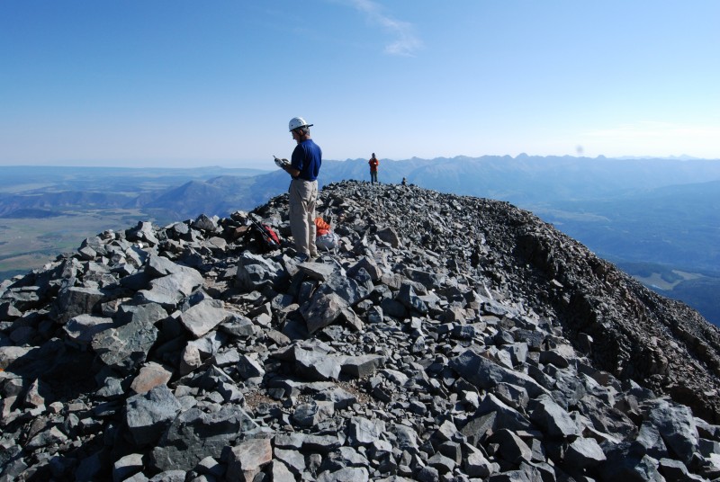
The summit of Wilson Peak is much bigger than Mount Wilson:
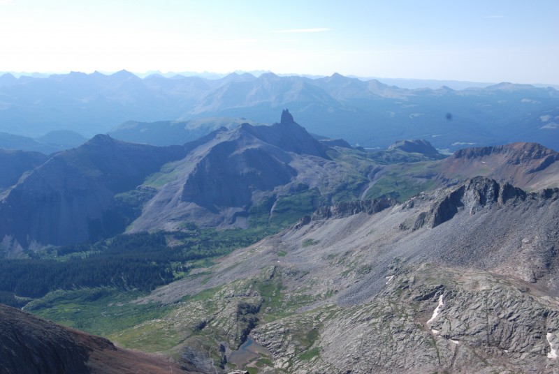
There is a good shot of Lizard Head from the summit:
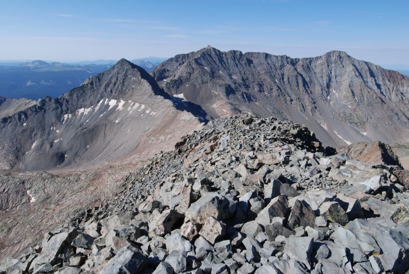
Here is a view from left to right from the summit of Wilson Peak: Gladstone, Mount Wilson, El Diente
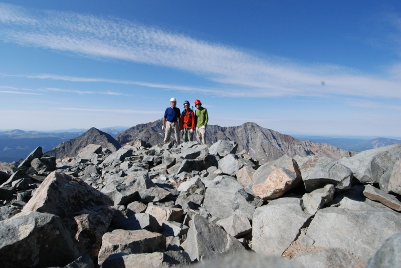
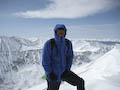
Summit photo of the three of us:
After enjoying a much longer and more relaxed time on the summit compared to Mount Wilson, we started the trek down. Here is a video showing the descent right after leaving the summit:
Here is a picture showing the initial descent moves:
Here is a video beginning the top of the steep portion of the descent:
Here is a longer look at the descent through the steep gully below the summit:
Here is a video of the class 3 crux of Wilson Peak:
Once you get down the steep gully's of the summit face, you are back to where you traverse across to get to the point where you have to climb back UP to the false summit. This is what the climb back up looks like to reach the false summit:
Again, after the false summit on the descent, there is fairly good trail the entire way back to the saddle between Gladstone and Wilson Peak. Enjoy the hike!
Overall, Wilson Peak is much less work than Mount Wilson simply because of distance. There is not nearly as much exposure either. However, there are a few class 3 moves to get up the steep summit gully's during the last pitch after the false summit. This was an enjoyable hike and #48 checked off our list!
Chaplain (CPT) Witte
U.S. Army
My GPS Tracks on Google Maps (made from a .GPX file upload):
No, the dog belonged to a couple of guys in front of us. He was hanging out at the false summit whining the whole time they summited. He never made it past there. He wasn't quite up for the class 3.
Your reporting (video clips and photos) has taken the mystery out of the final pitch - This report will be my guid for next year when I go back to the San Juan region again! Last week the weather was not kind and I had to turn around from the Saddle!
Weather got you at the Rock of Ages Saddle? Yeah, Wilson Peak is not one that you want to get tangled in after the false summit if it is raining. It's not quite as scary as Mount Wilson but still some interesting parts. Thanks for the comments and I'm glad it will help you next year.
This was a great TR and it really helped us during our climb. We had the ”oh crap” moment on the false summit looking up, but you prepared us for that and it was an easy climb. Also, we used your cairn to guide us. Thanks!!! Richard
I'm glad everything worked out well for you and the report helped calm some fears. Enjoy the hiking!
Caution: The information contained in this report may not be accurate and should not be the only resource used in preparation for your climb. Failure to have the necessary experience, physical conditioning, supplies or equipment can result in injury or death. 14ers.com and the author(s) of this report provide no warranties, either express or implied, that the information provided is accurate or reliable. By using the information provided, you agree to indemnify and hold harmless 14ers.com and the report author(s) with respect to any claims and demands against them, including any attorney fees and expenses. Please read the 14ers.com Safety and Disclaimer pages for more information.
Please respect private property: 14ers.com supports the rights of private landowners to determine how and by whom their land will be used. In Colorado, it is your responsibility to determine if land is private and to obtain the appropriate permission before entering the property.