| Report Type | Full |
| Peak(s) |
Ervin Peak - 13,538 feet |
| Date Posted | 08/05/2013 |
| Modified | 08/30/2013 |
| Date Climbed | 07/12/2013 |
| Author | Jessie_s Dad |
| Additional Members | robertsmith427 |
| Ervin Peak from Winfield |
|---|
|
Trip report: Ervin Peak from Winfield Ervin Peak: 13,531 feet Date Climbed: July 12, 2013 Members of party: Jessie_s Dad, Bob S. As a flatlander from New Jersey, I don't get to make many trips to Colorado to hike. I usually aim my attention on the 14ers when I do come west. On this trip, I wanted to try something that was off the beaten track, away from the crowds, and I decided that Mt Blaurock and Ervin Peak looked like suitable candidates for a nice day hike. Being close to Leadville was another advantage, as I got a chance to hook-up with a good friend, Bob S., to join me on the hike. I also learned a little history about Carl Blaurock and William Ervin. 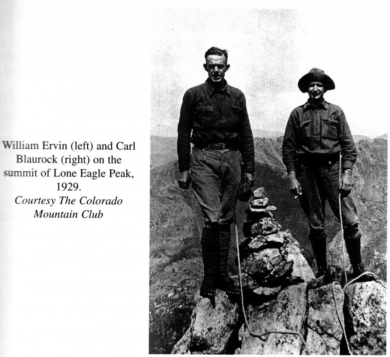 Check out these two links for some history, mostly about Blaurock. Ervin was a frequent climbing companion of Blaurock. Carl Blaurock - Wikipedia Naming Mountains for Two Climbers I had read a couple of trip reports prior to this hike, neither one being extremely specific as to the trailhead, or starting point for the hike. Bob S. & I decided to make an advance scouting trip on Wednesday to Winfield to check out the roads and see if we could find a spot that matched what we saw in the trip report from piper14er. The scouting helped us save time when we returned on Friday, as we knew we could navigate the 4WD road to a parking spot and we had a plan of where to start. Directions to the Winfield Trailhead (courtesy 14ers.com) From Leadville: Drive 20 miles south on U.S. 24 and turn right on the Chaffee County 390 road. From Buena Vista: Drive 14.5 miles north on U.S. 24 and turn left on the Chaffee County 390 road. On the 390 road (dirt), drive 11.3 miles to Winfield. There are a bunch of log buildings here. From Winfield, continue north for a short distance (less than 100 yards) to a fork. Go right up a road bordered by a fence that may present a challenge for some passenger cars. After about 0.4 miles, the road passes the Winfield Cemetery, which is marked by an explanatory sign. Shortly thereafter, there is a sign that warns cars without high clearance not to continue, and a loop that allows for some good parking places. We left Leadville at 6am for the drive to Winfield. We were treated to a nice early view of Mt Elbert on our drive, and reached Winfield at 7am. In Winfield, bear right on the 4WD road  and continue to the cemetery. We parked just past the cemetery in the loop described above, and walked further up the 4WD road  until we reached the trail to Mt Hope Pass (also part of the CDT and the Colorado Trail).  We started up the trail and then made our way through a clearing to the left 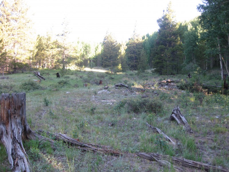 looking for a place to start our bushwack through the aspens. Our plan was to head towards the Blaurock/Ervin saddle, then work our way to Ervin, return back to the saddle and hike to Blaurock, and then descend, via one of the gullies. 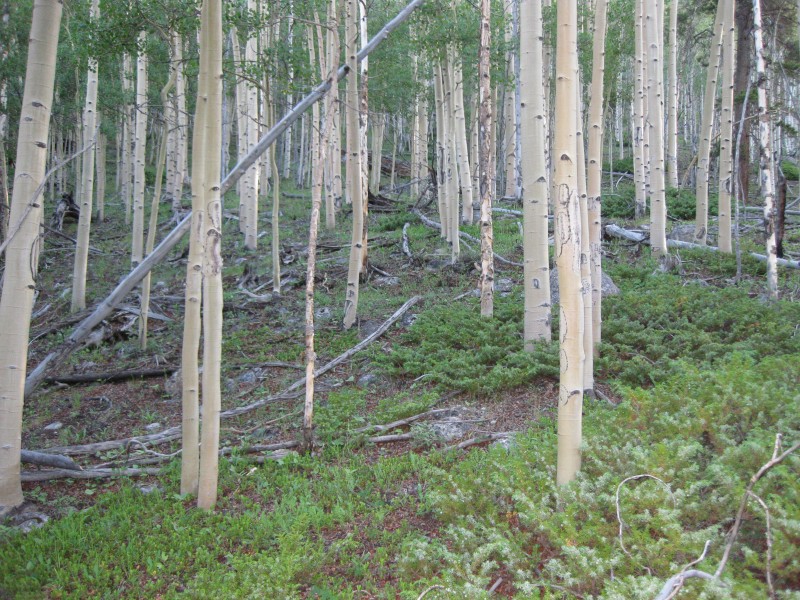  It took us a good hour to work our way up through the aspens until we reached treeline.  We passed a house along the way, realizing that there was a road leading in to the house, and remembered that for our return to the car. Our route took us east of the line we thought we should be using, so we paused often to review our plan, revising it as we went. Although we could not see much of the route ahead, we had great views across the valley behind us. The path was steep, but rewarding, as we knew that each step gained us a couple of feet of elevation gain. At some points, when we looked up, we saw a row of pines towering above us on what looked like an escarpment. We felt as though we had to go around that group of trees. As we got closer, it did not seem to present the problem we had anticipated. 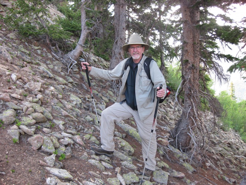 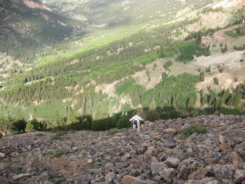 Once above tree line, we were climbing in loose Talus. This led us to an age-old discussion of the difference between Talus and Scree. Our conclusion (without aid of i-phone technology to access the internet) was that Scree was generally smaller, and looser than the jumble of rocks/boulders we were hiking through, so we considered this to be Talus. We were careful not to climb one above the other on the Talus, so in the event we started a small slide, the other was not put in harm's way, we ascended the slope, stopping frequently to consult our topo maps. 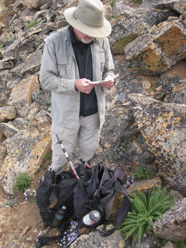 The Blaurock/Ervin saddle was well to our left, and beyond that, Mt Balurock. 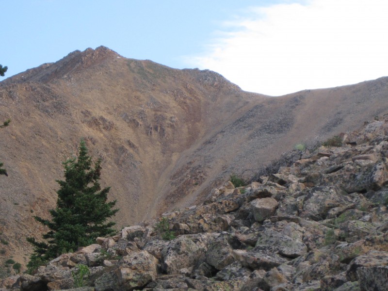 Bob S. & I decided to keep heading vertical (north) and see where that led us. Afterwards, when I look at the GPS maps downloaded in other trip reports, it turns out this is the same route most others have taken. We were enjoying beautiful weather, the forecast called for the possibility of T-storms starting around 3-4 pm.  There were wildflowers of all types surrounding us in the rocks, columbine, indian paintbrush, plus many others whose names I don't know. Anyplace that offered a semblence of dirt seemed to have a flower growing from it.  There was no view of the summit from our location, but we were aiming at a point that appeared to be a small saddle of a ridge. I was anxious to get off the Talus onto the ridge. When we were about 20 feet from reaching the saddle, I saw a dark shape above us. As I looked up, a Golden Eagle soared over the ridge directly above us, heading south. By the time I got my camera out, he was a good 1/4 to 1/2 mile away, but I was able to snap a quick shot of him (or her).  We reached the ridge at the extreme southern end. We could now see the route ahead of us if we followed the ridge north. 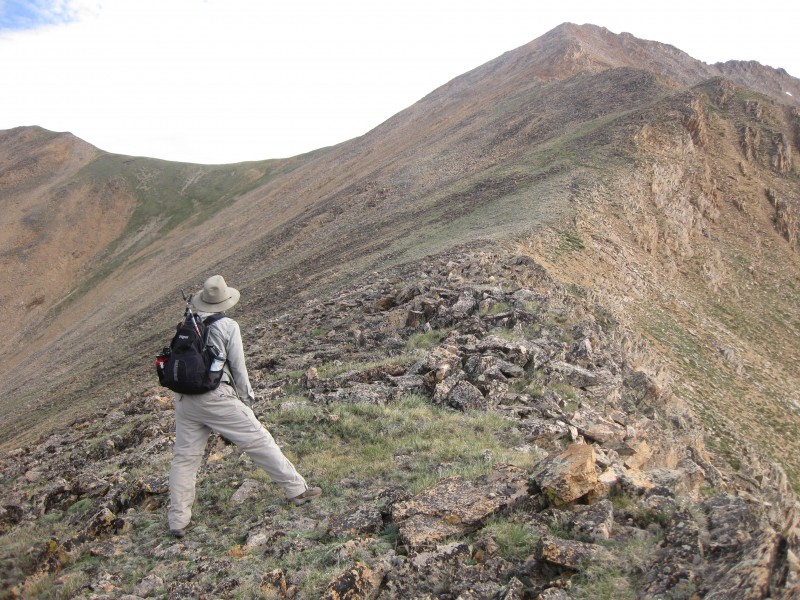  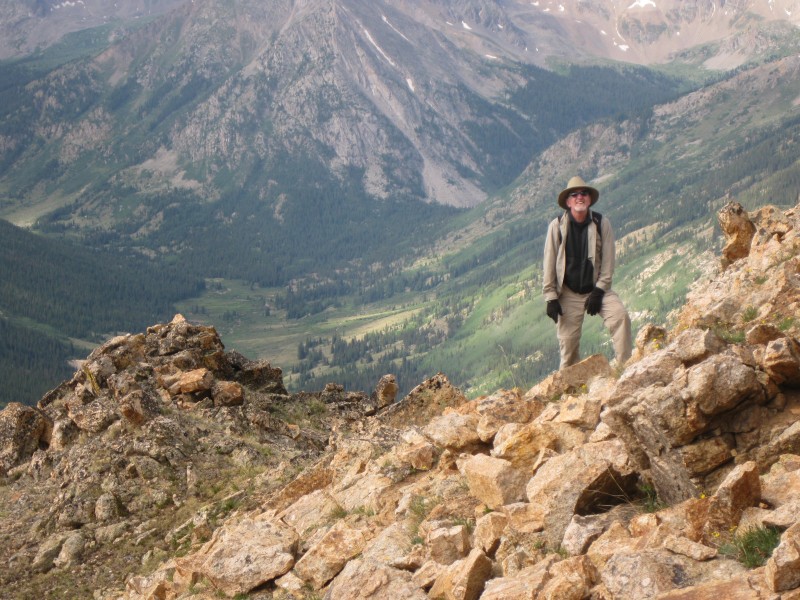 And the view to the south, the Huron massive.  Finally reaching the summit ridge at its Western end. (For our purposes, and for the purposes of this report, I am referring to this point as 'West' Ervin.) It was now 11 am. It had taken us longer than we had thought, so now we had to decide if we should continue to Ervin Peak, or head over to Mt. Blaurock. We didn't have time for both. The weather was still holding, but we didn't know how our descent would work out as we did not want to return by the same route we ascended.  We opted to continue to Ervin, 1/4 mile distant. Bob S. decided to stay at 'West' Ervin while I made my way to the summit. The towers looked daunting, 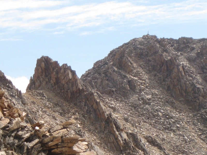 but I found that the easiest way over them was straight over the top, finding suitable class 3 scrambling as I went. A lot of fun running along the spine. On one tower, either the 4th or 5th (I don't remember which), I did not find an easy way over the top, so I moved a little to the South side, down-climbed to a gully and made my way back up. Some of this was loose dirt, but I took my time and did not have any trouble. From piper14er's report I had learned that some of the rock was loose, so I was careful in checking my handholds and footholds before committing. (Piper, thanks for the heads up). I reached the summit stick, 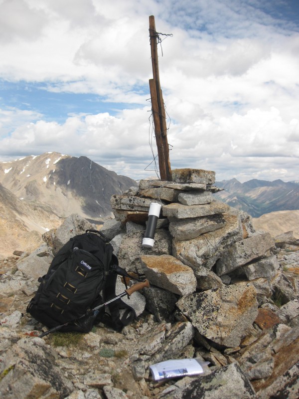 found the register, logged in (using and leaving my pen as there was no pen or pencil to be found), took some pics and a movie pan from the summit, and had a snack. I was only the 2nd person to register in 2013, the last being on 5/26, however the lack of a pencil may have something to do with that. Before returning I looked further northeast at the ridge heading over to Mt. Hope. 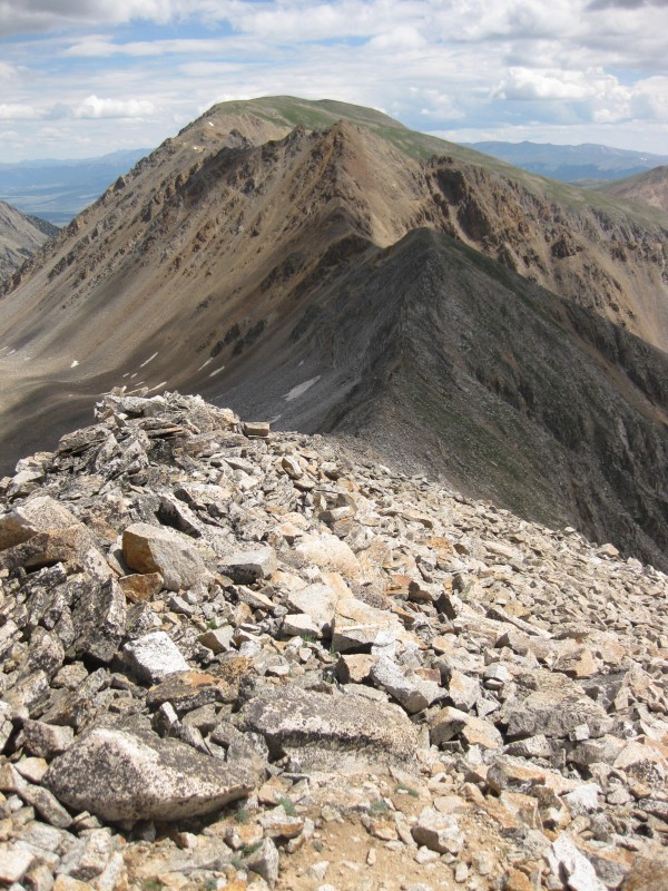 It looked to be similar to the ridge I was on, very knarly, probably a fun climb. I headed back towards 'West' Ervin and  re-joined Bob S. We ate lunch, finding shelter from the wind on the north side of the ridge, and planned for our descent. My round trip over to the summit had taken an hour. We started our descent at noon. The other trip reports I read all had descents that followed a different route from the ascents, but they also had included ascents of Blaurock. As Bob S. and I only dealt with Ervin Peak, the question will arise: "Why not descend back via the same route?" In our case, I think we felt that our route up may not have been the easiest. Another way down might prove to be better. At least we would not be dealing with all of the Talus again. For whatever reason, we started down the steep western ridge from Ervin towards the Blaurock/Ervin saddle  until we reached the gully leading down to Gray Copper Creek. From piper14er's trip report, we were on the lookout for some game trails once we got down to the creek. We had seen, and used, several on our ascent through the aspens. If we followed the creek down, it would eventually intercept the 4WD road that leads to the West Winfield trailhead (La Plata). Or the access road to the cabin we passed on our way up. That road would also lead us back to the 4WD road. We started heading down the center of this gully.  It was steep going, some of the footing was loose, but not bad. After some time, Bob S.and I reached the stream, or streams, and followed it as best we could. The small games trails we found did not follow down the stream in the direction we wanted to go so we did not use them for the most part. 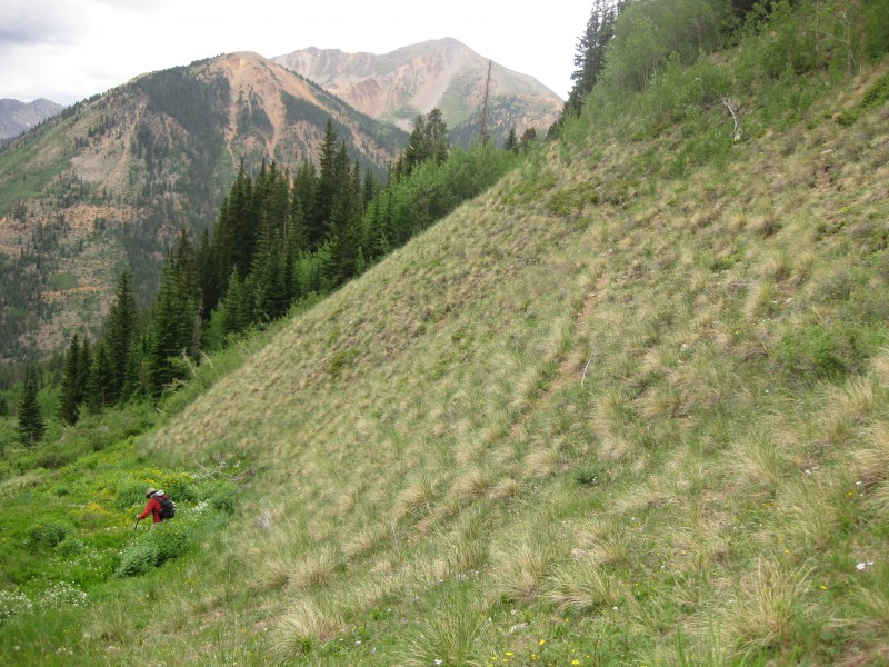 Bob S. spotted a ruffed grouse along the stream during our descent and the bones of some elk. There were some marshy areas that we had to slosh through. And now the weather was threatening with some distant thunder and some raindrops. We had just made it back into the aspens and pines when a good thunderstorm came along. 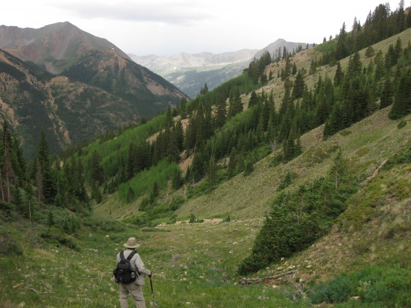 These afforded us with shelter for about 10 minutes to let the storm pass. We then continued, staying to the left side of the stream, until we reached the access road to the cabin, turning right (west), and following it back to the 4WD road. From there we turned left and headed back to our car, about a 1/2 mile walk. A couple of other cars were now parked next to ours, but we had not seen a soul all day. It was now about 3:30 pm. What a great day. Got to spend some time with a good friend, and enjoy the beauty of Colorado too. The hike met my expectations as being remote, less crowded, and a lot of fun. Just wish there had been enough time to go over to Mt. Blaurock. Guess I'll just have to come back and do that next time.  This is our approximate route for the hike. 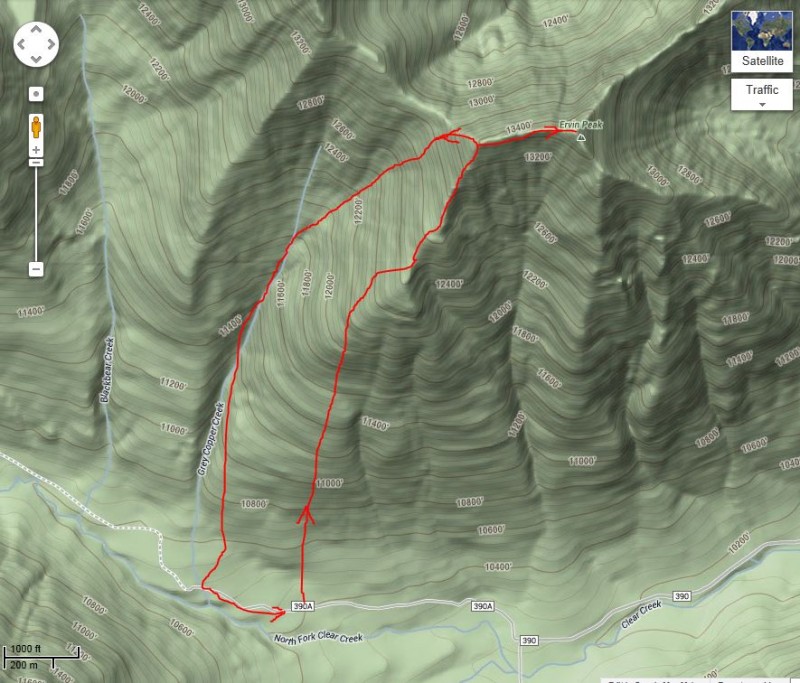 Thumbnails for uploaded photos (click to open slideshow):  In Downtown Winfield, bear right on 4WD road")
 4WD Road from cemetery")
 Mt Hope Pass Trail")
 Clearing to the left of trail")
 Bushwacking through aspens")
 My good pal, Bob S. and Jessie_s Dad")
 View of Ervin summit from West Ervin")
 aspens")
 Bob S. showing steepness of terrain")
 From summit towards West Ervin")
 Bob S. climbing through the Talus")
 Wildflowers in Talus")
 checking our bearings")
 View over towards Blaurock to our west")
 Golden Eagle")
 Looking up the ridge towards West Ervin")
 Southern ridge to Ervin")
 Bob S. looking ahead")
 View towards Belford & Oxford")
 Bob S. scrambling")
 Ervin summit with detail of Tower on ridge")
 Summit stick, register, backpack")
 Mt Hope from Ervin summit")
 Bob S. descending towards Blaurock/Ervin saddle")
 View across the valley to southwest")
 Descending the gully")
 Reaching treeline again before the rain")
 William Ervin with Carl Blaurock")
 In the gully, typical terrain, stream, gametrails")
 Our approximate route from Winfield to Ervin Peak and return")
|
| Comments or Questions | |||
|---|---|---|---|
|
Caution: The information contained in this report may not be accurate and should not be the only resource used in preparation for your climb. Failure to have the necessary experience, physical conditioning, supplies or equipment can result in injury or death. 14ers.com and the author(s) of this report provide no warranties, either express or implied, that the information provided is accurate or reliable. By using the information provided, you agree to indemnify and hold harmless 14ers.com and the report author(s) with respect to any claims and demands against them, including any attorney fees and expenses. Please read the 14ers.com Safety and Disclaimer pages for more information.
Please respect private property: 14ers.com supports the rights of private landowners to determine how and by whom their land will be used. In Colorado, it is your responsibility to determine if land is private and to obtain the appropriate permission before entering the property.


