Download Agreement, Release, and Acknowledgement of Risk:
You (the person requesting this file download) fully understand mountain climbing ("Activity") involves risks and dangers of serious bodily injury, including permanent disability, paralysis, and death ("Risks") and you fully accept and assume all such risks and all responsibility for losses, costs, and damages you incur as a result of your participation in this Activity.
You acknowledge that information in the file you have chosen to download may not be accurate and may contain errors. You agree to assume all risks when using this information and agree to release and discharge 14ers.com, 14ers Inc. and the author(s) of such information (collectively, the "Released Parties").
You hereby discharge the Released Parties from all damages, actions, claims and liabilities of any nature, specifically including, but not limited to, damages, actions, claims and liabilities arising from or related to the negligence of the Released Parties. You further agree to indemnify, hold harmless and defend 14ers.com, 14ers Inc. and each of the other Released Parties from and against any loss, damage, liability and expense, including costs and attorney fees, incurred by 14ers.com, 14ers Inc. or any of the other Released Parties as a result of you using information provided on the 14ers.com or 14ers Inc. websites.
You have read this agreement, fully understand its terms and intend it to be a complete and unconditional release of all liability to the greatest extent allowed by law and agree that if any portion of this agreement is held to be invalid the balance, notwithstanding, shall continue in full force and effect.
By clicking "OK" you agree to these terms. If you DO NOT agree, click "Cancel"...
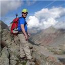
Mount Wilson has been a peak that has been sitting on our "to do list" for a while now but has never surfaced to the top until this summer. The class 4 near the summit has always given us an uneasy feeling about attempting this peak but we knew if we wanted to knock off the 54, this one had to be accomplished. And so we did it on Monday, July 21. When I say we, I mean my dad, brother and I. We have been climbing 14ers for 22 years now as a trio and our ability to negotiate obstacles and assess the terrain has only improved with time. Mount Wilson was our 47th 14er and a thrill it was!
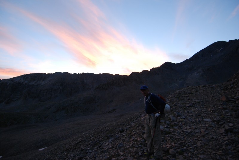
We camped near the Rock of Ages trailhead in the last car camping pull off before you get to the forbidden area of the trailhead for camping. We followed the rules but still had a close enough spot to just walk to the trailhead. The ground was anything but level and I think I was rolling down a hill half the night. However, the spot was near the trailhead and worked well. We set our alarms for 3:00 AM! I know it's early, but worth it to make sure we had good weather. We were on the trail by 3:25 AM after a quick stop at the fine porta-potty at the trailhead. We were about half way up the Rock of Ages trail to the saddle when the sun began to rise. It was absolutely beautiful!
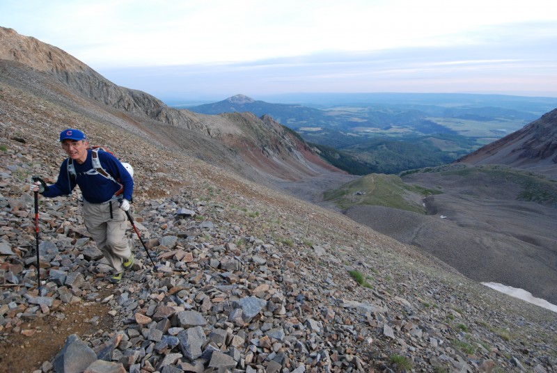
The trail is mostly just a 4 wheel drive road all the way up until the upper basin where the Colorado Mountain Club in 2009 rerouted the trail away from the stone mining structure (house) that is still present, due to the fact that it is on private property. The trail takes a steep right turn with a sign to mark it's departure from the road. There are many signs marking private property and for you to stay on the trail. It is my understanding that the agreement is fragile between the owners of the mining property and the hikers in order to keep the Rock of Ages trail open so abide by the rules! In the following picture, you can see the stone house below and the rest of the excellent trail that heads up the side of the ridge to the saddle.
Once you reach the saddle, you are really just getting started on Mount Wilson because you now have to hike down 800 feet into Navajo Lake Basin and then actually start up Wilson Peak another 800 feet. You will be looking at Mount Wilson (center) when you reach the saddle.
Here is a view from the Rock of Ages Saddle:
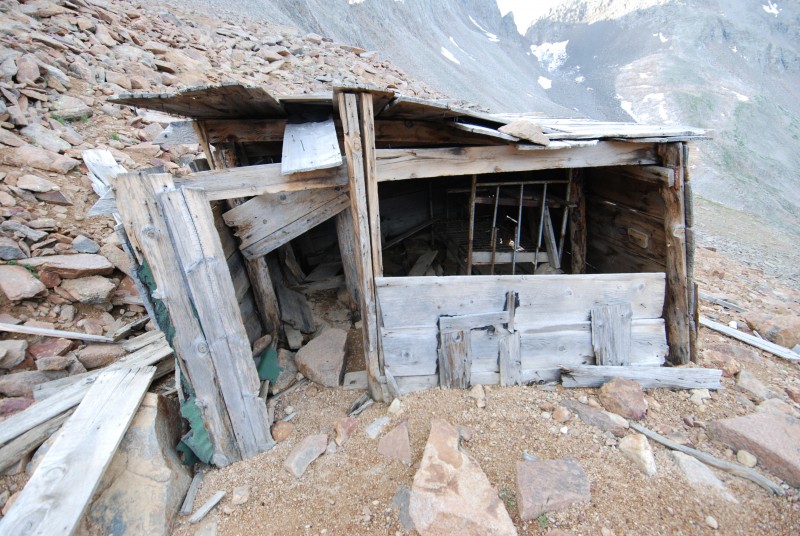
The hike down into Navajo Basin is actually quite good with excellent trail. No problems at all! You can even enjoy some old mining remnants along the way that are close to the saddle:
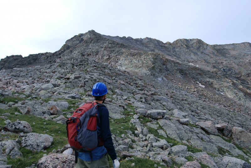
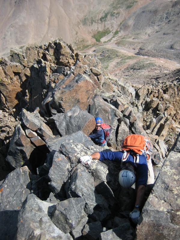
Once you reach the bottom, don't head too far to the right as you need to head mostly left and center to attack the face of Mount Wilson. There really is no trail going up Mount Wilson from the basin so you must follow what little cairns there are and route find yourself. Follow what manageable terrain you can find and it's not too bad when you get going. However, this changes about half way up. The face turns to loose talus and steep slopes. Here is a picture of the bottom of the slope:
My brother (markwise) took this next video which shows the upper half of Mount Wilson coming from Rock of Ages before you get to the summit ridge. It gives you a pretty good idea of the talus slope you face.
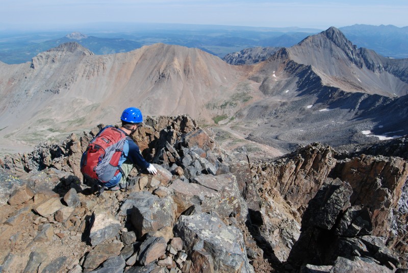
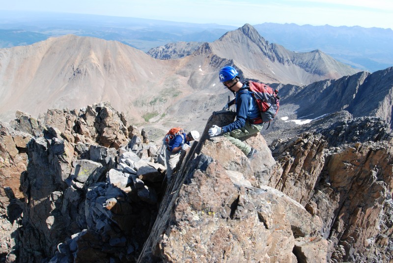
Once you are able to navigate through the loose talus and steep slopes to reach the summit ridge, you are now entering the crux of the climb. It's a beautiful and magnificent summit ridge that deserves respect. Here is a video showing our arrival on the summit ridge:
The view is absolutely spectacular and something that no words can describe. It's time to get your game face on and pucker up! In my opinion, there are two class 4 moves on the summit ridge with the "pre-crux" move coming first. All it really turns out to be is a brief knife edge with exposure on both sides. We went directly over the rock. There truly is a breathtaking drop on either side of the ridge at this point so you don't want to screw up here. This particular video I took is my favorite because I was able to show both sides of the ridge while I was watching my footsteps so I didn't fall. Check it out. Here is our video:
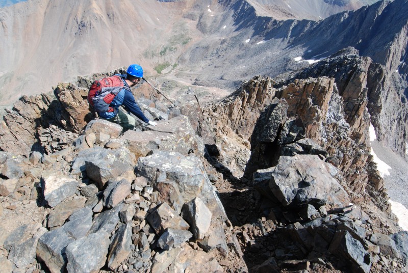
Once you are over this steep and narrow portion of the ridge, you come to what is most commonly referred to as "the crux" The crux is a class 4 maneuver up a steep 10 foot pitch with steep exposure on the left side. We chose to stay left of the actual ridge instead of going straight over as this was a very manageable move with exposure. Check out this video to see "the crux" move on Mount Wilson.
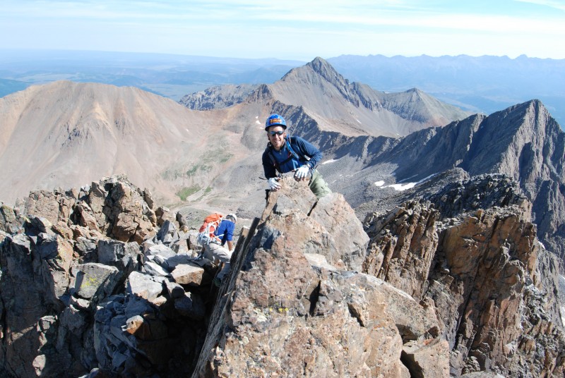
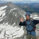
It is important to check your hand holds on Mount Wilson as some prove to be loose and not worth your life. The crux move thankfully has some good holds and steps to maneuver through. Take your time and it's not too bad. The crux move is literally right below the summit. You finish this move and you are there! Mount Wilson has the absolute smallest summit I have ever been on in accordance with 14ers. The three of us filled the summit and then some. Here is a summit panorama video:
We spent approximately 60 seconds on the summit (the length of the video) and my dad and brother were already heading down the mountain. They clearly had the down climb of the crux on their mind and before I could turn the camera off, they were at the top of it again. Here is my brother checking it out:
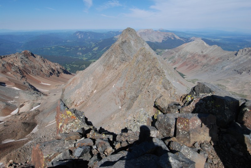
This next photo is a great shot from the summit of Mount Wilson, looking at Gladstone Peak and Wilson Peak. Gladstone is the one on the right and Wilson Peak is in the background on the left. You can now see the great distance you have to go to get back to the Rock of Ages Saddle which is the saddle just off Wilson Peak to the left. It's a long and grueling climb.
This next photo shows "the crux" a little better from the top looking down because it shows the elevation change from the top level to the bottom level on the narrow summit ridge:
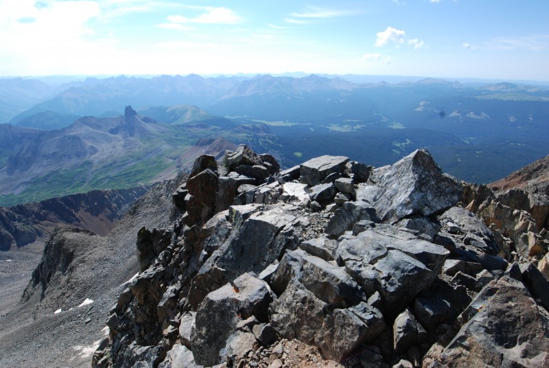
Here is a shot off the summit looking at El Diente:
Here is another shot from just below the summit with Lizard Head in the distance:
This is a great shot of the exposure coming down the "pre-crux."
This is my brother (markwise) giving one last look at the camera before heading down the last portion of the summit ridge through the narrows.
This is me coming down the pre-crux move.
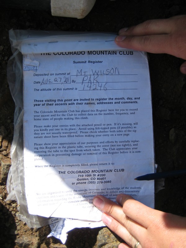
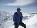
And of course, I can't forget the obligatory summit register photo to prove our accomplishment:
One last photo showing "the crux" from above:
As you can imagine, once you hike down the crux and pre-crux, there is a sense of relief. I think our entire group felt good that we had that out of the way and now the long haul down the steep talus and loose rock began. We finally made it back down into Navajo Basin and I started to feel my body shut down. Did I mention that I came from sea level (Little Rock, Arkansas) less than 24 hours before hitting Mount Wilson? This was not the smartest move I've ever made but it's how the schedule worked out for our group. I made the long and slow trek back up to the Rock of Ages Saddle and we hiked back out to our camp site from there. This was a long and grueling day that surely takes a lot of energy and will power to keep going. However, we accomplished Mount Wilson safely and completed the mission for that day. What a wonderful victory our Lord granted us! Wilson Peak was yet to come...
Overall, we were meticulous in our route finding and planning and took our time through the tough parts of the summit ridge. Don't under estimate the climb up Mount Wilson to get to the summit ridge either. It will suck the energy out of you route finding and talus hopping on the steep slopes. The view is magnificent! We did not encounter any snow at all on the trail, other than some small patches on the side of Mount Wilson that did not interfere with the best route up the face. Enjoy the hike and the climb!
Chaplain (CPT) Witte
U.S. Army
My GPS Tracks on Google Maps (made from a .GPX file upload):
Great job! Impressive, coming from sea level! The videos really helped put this in perspective. A couple of us are attempting El Diente to Mt. Wilson across the traverse this coming weekend. I would imagine that the crux is equally challenging coming from El D.
It is nice to see there is a way around the crux. I just went up and over when I climbed it. Then downclimbed it on my way down. My climbing partner was too short to reach the next foot hold on the way down, so I had to give her my shoulders because she was just hanging on the rock. :lol: Nice route finding!
Yeah, the pre-crux you can easily climb straight over the top but the actual crux after that we found the left side to be easier than the over the top route. Very fun :!:
Do you think it would have been helpful to backpack into Navajo Lake Basin for a shorter trip to the top if you had a bit more time? Thanks! And great job, BTW!
Otis, I was up there with CHWitte. If you wanted to shorten your summit day hike, and you had an extra day, doing Mt. Wilson from a camp high up in Navajo Basin would be the way to go. For a single day hike of Mt. Wilson Silver Pick/Rock of Ages is the way to go.
The Rock of Ages trail all the way up to the saddle is excellent. You really can't beat it because it is an old mining road. As a matter of fact, the trail down from Rock of Ages into Navajo Basin is also excellent and easy to follow. The only difficult route finding begins when you hit the face of Mount Wilson but this would be nearly the same conditions as if hiking from Navajo Lake Basin.
Caution: The information contained in this report may not be accurate and should not be the only resource used in preparation for your climb. Failure to have the necessary experience, physical conditioning, supplies or equipment can result in injury or death. 14ers.com and the author(s) of this report provide no warranties, either express or implied, that the information provided is accurate or reliable. By using the information provided, you agree to indemnify and hold harmless 14ers.com and the report author(s) with respect to any claims and demands against them, including any attorney fees and expenses. Please read the 14ers.com Safety and Disclaimer pages for more information.
Please respect private property: 14ers.com supports the rights of private landowners to determine how and by whom their land will be used. In Colorado, it is your responsibility to determine if land is private and to obtain the appropriate permission before entering the property.