Download Agreement, Release, and Acknowledgement of Risk:
You (the person requesting this file download) fully understand mountain climbing ("Activity") involves risks and dangers of serious bodily injury, including permanent disability, paralysis, and death ("Risks") and you fully accept and assume all such risks and all responsibility for losses, costs, and damages you incur as a result of your participation in this Activity.
You acknowledge that information in the file you have chosen to download may not be accurate and may contain errors. You agree to assume all risks when using this information and agree to release and discharge 14ers.com, 14ers Inc. and the author(s) of such information (collectively, the "Released Parties").
You hereby discharge the Released Parties from all damages, actions, claims and liabilities of any nature, specifically including, but not limited to, damages, actions, claims and liabilities arising from or related to the negligence of the Released Parties. You further agree to indemnify, hold harmless and defend 14ers.com, 14ers Inc. and each of the other Released Parties from and against any loss, damage, liability and expense, including costs and attorney fees, incurred by 14ers.com, 14ers Inc. or any of the other Released Parties as a result of you using information provided on the 14ers.com or 14ers Inc. websites.
You have read this agreement, fully understand its terms and intend it to be a complete and unconditional release of all liability to the greatest extent allowed by law and agree that if any portion of this agreement is held to be invalid the balance, notwithstanding, shall continue in full force and effect.
By clicking "OK" you agree to these terms. If you DO NOT agree, click "Cancel"...
Mileage: 5.22
Elevation Gain: 3,652'
Max Difficulty: mostly class 2+, some class 3 on ridge proper, with options for class 4
With Bob "missing", it was up to us ladies to tackle some 13ers without our token male. Ah, poor Kate, Bob-less for the weekend. Kate had originally suggested Hunts, but with the recent Ox-Cart fire, I wasn't sure we would escape that hike not covered in soot. So onto the next plan. Kate wanted short but sweet, so I dug into the list, and found Ervin and Blaurock. These would do!
So Friday evening we all drive up to our campsite/trailhead for the night. Special note - the outdated quad maps and TOPO! software show the end of the road at our trail start, but in fact the road continues. So don't be lulled into that. We started from where a mining road goes up Winfield's east slope.
We start before the ass-crack of dawn. The forecast is for 50% storms, so we're not going to take any chances. It's a bushwack from the start, but eventually the trees thin and the rocky ridge ascent starts. Steep from the very beginning, and continues until the upper summit ridge.
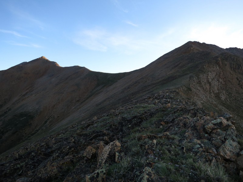
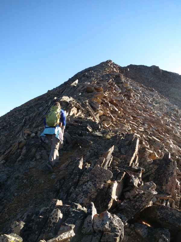
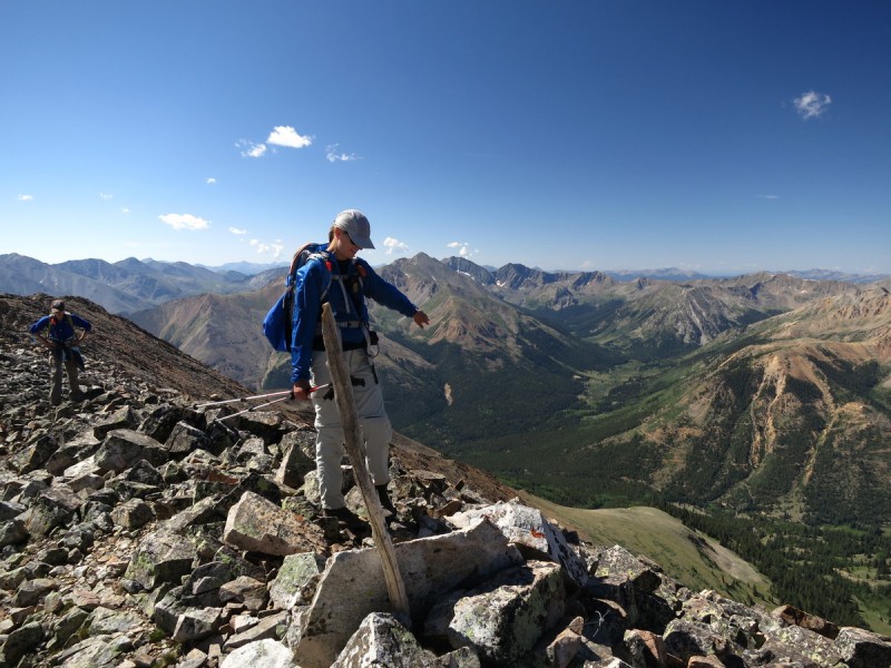
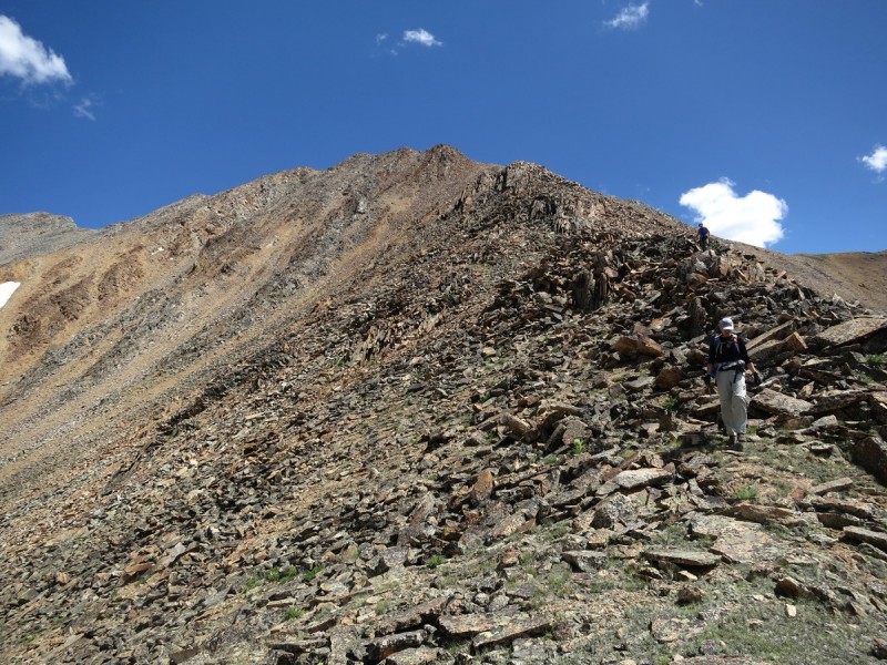
A pink sky behind Winfield Peak Looks like a nice ridge up Ervin Staying ridge proper leads to some class 2+ Upper ridge gets rockier
I vaguely remembered from previous TR's that the ridge is a bit scrambly, but I was surprised to see how much there actually was. Lots of practice route finding and having fun on the rocks. With the early start, there was no rush, and we all had fun. Where's Bob during all this excitement?!
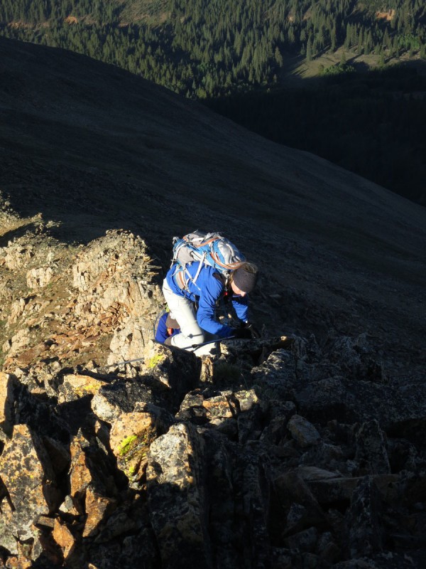
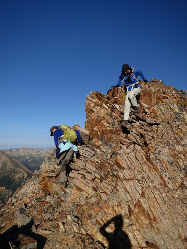
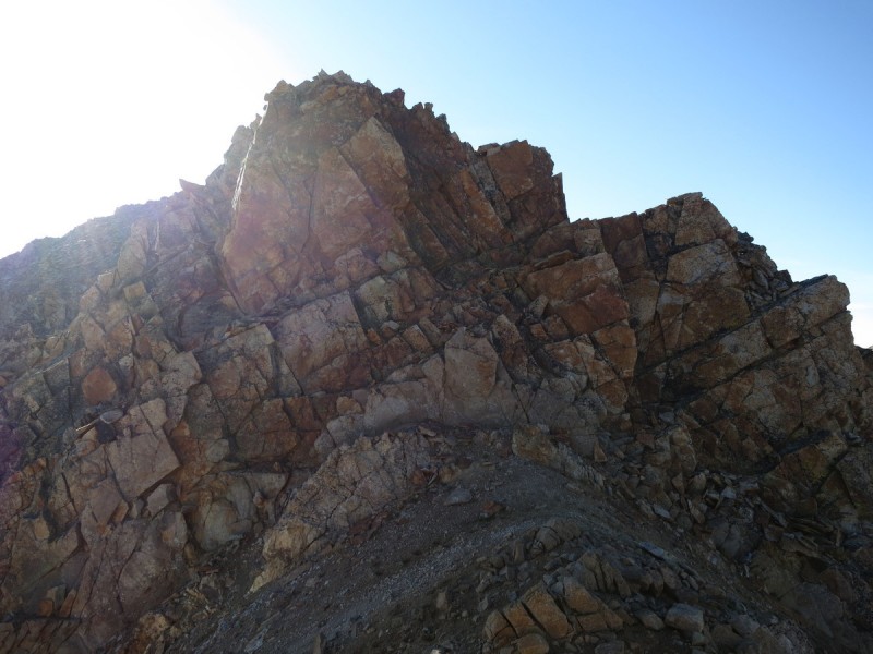
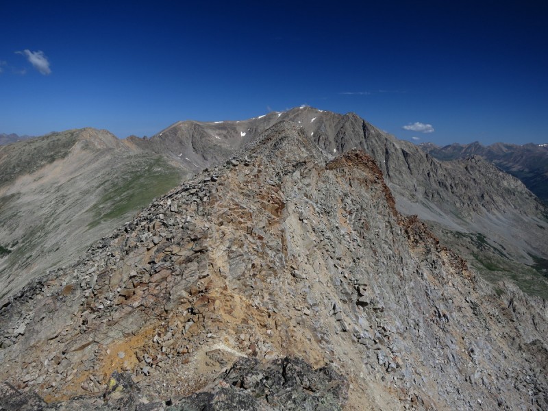
The start of the scramble to Ervin on summit ridgeLooking at the remaining ridge to Ervin Choose your scramble. Class 3 notch on right, or up the gut class 4 The backside scramble
We arrive on the summit of Ervin after a very satisfactory ridge scramble. I guess you could avoid much of it and have class 2+, but why? The work-arounds looked much less pleasant and more scree loose like.
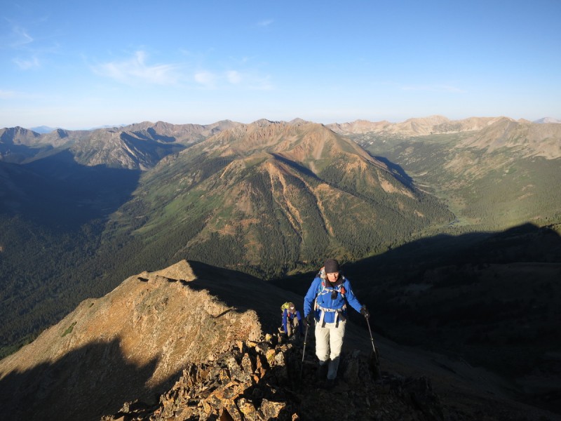
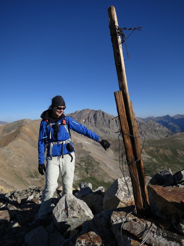
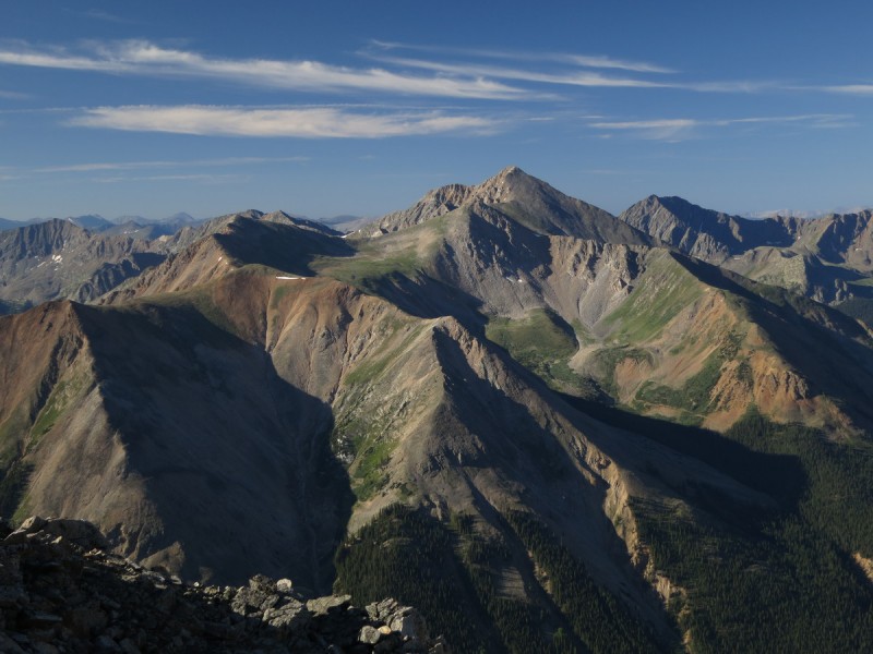
Kate and "Bob" on summit of Ervin Looking back at the summit ridge to Ervin Peak The Huron massif
We spent some time on the summit chatting, but soon it was time to head back along the ridge over to Blaurock. Maybe Bob is over there? So back down the scrambly ridge we go!
Valerie following me down the class 4 option from pic #8 (Kate: I think I see Bob over there!) Fun ridge!
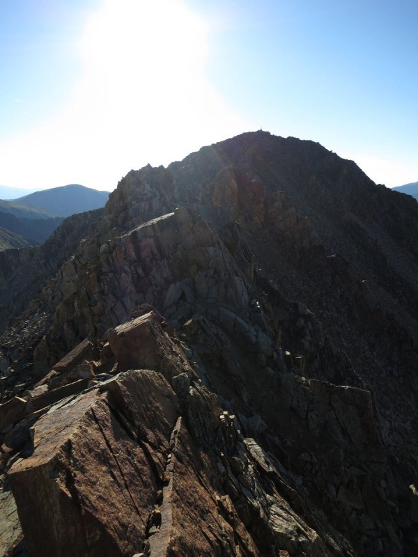
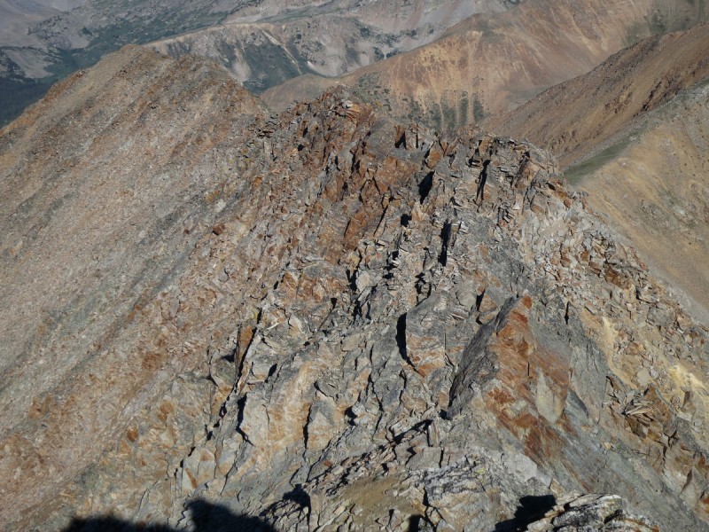
The majority of the ridge over to Blaurock (once past the Ervin side) is easy tundra walking. That is, until you get up to the false summit. Then it's a blocky rocky undulating ridgeline to follow or skirt. Is Bob hiding in the rocks? At times we stuck ridge proper, when the slope below looked less than pleasant. While at other times, a skirt of a ridge prominence was an easier choice.
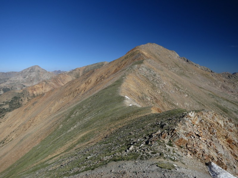
Ahh, looks like a simple ridge over to Blaurock. Hmmm, looking towards the summit of Blaurock from the false summit along the ridge.
On the summit of Blaurock, the puffy clouds started forming, but nothing threatening at all. Nor did they develop into anything all day long. So we were able to hang out for a little while before heading back down to the cars, and heading our separate ways. Kate would eventually find Bob at the airport, so don't worry!
Kate and "Bob" on Blaurock Huron and 2 Apostles peaking out scrambling down the ridge from Blaurock Last bit of rockiness down ridge, before tundra and trees
My GPS Tracks on Google Maps (made from a .GPX file upload):
Nice report with beautiful pics. My friend, Bob (.. for real) and I were on Ervin on July 19. I hope you found my pen with the register. As we didn't go to Blaurock, we descended down the gully from the saddle. On our ascent up the same route you followed, just as we reached the first ridge (your 2nd photo), a golden eagle flew over, only 20 feet above us... cool. We also saw a ruffed grouse on our descent. We stayed with class 3, your class 4 looked nice. I guess Bob didn't want to climb Ervin 2 days in a row. ha.
Mis-spoke about the date. We were actually there 1 week prior to you, on July 12th. Short term memory problem.
Caution: The information contained in this report may not be accurate and should not be the only resource used in preparation for your climb. Failure to have the necessary experience, physical conditioning, supplies or equipment can result in injury or death. 14ers.com and the author(s) of this report provide no warranties, either express or implied, that the information provided is accurate or reliable. By using the information provided, you agree to indemnify and hold harmless 14ers.com and the report author(s) with respect to any claims and demands against them, including any attorney fees and expenses. Please read the 14ers.com Safety and Disclaimer pages for more information.
Please respect private property: 14ers.com supports the rights of private landowners to determine how and by whom their land will be used. In Colorado, it is your responsibility to determine if land is private and to obtain the appropriate permission before entering the property.
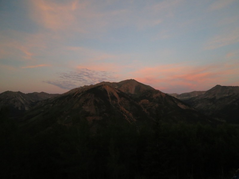


 A pink sky behind Winfield Peak")
 Looks like a nice ridge up Ervin")
 Staying ridge proper leads to some class 2+")
")
 Upper ridge gets rockier")
 The start of the scramble to Ervin on summit ridge")
 Looking at the remaining ridge to Ervin")
 Choose your scramble. Class 3 notch on right, or up the gut class 4")
 The backside scramble")
 Kate and")
 Looking back at the summit ridge to Ervin Peak")
 The Huron massif")
 Valerie following me down the class 4 option from pic #8 (Kate: I think I see Bob over there!)")
 Fun ridge!")
 Ahh, looks like a simple ridge over to Blaurock.")
 Hmmm, looking towards the summit of Blaurock from the false summit along the ridge.")
 Kate and")
 Huron and 2 Apostles peaking out")
 scrambling down the ridge from Blaurock")
 Last bit of rockiness down ridge, before tundra and trees")


