Download Agreement, Release, and Acknowledgement of Risk:
You (the person requesting this file download) fully understand mountain climbing ("Activity") involves risks and dangers of serious bodily injury, including permanent disability, paralysis, and death ("Risks") and you fully accept and assume all such risks and all responsibility for losses, costs, and damages you incur as a result of your participation in this Activity.
You acknowledge that information in the file you have chosen to download may not be accurate and may contain errors. You agree to assume all risks when using this information and agree to release and discharge 14ers.com, 14ers Inc. and the author(s) of such information (collectively, the "Released Parties").
You hereby discharge the Released Parties from all damages, actions, claims and liabilities of any nature, specifically including, but not limited to, damages, actions, claims and liabilities arising from or related to the negligence of the Released Parties. You further agree to indemnify, hold harmless and defend 14ers.com, 14ers Inc. and each of the other Released Parties from and against any loss, damage, liability and expense, including costs and attorney fees, incurred by 14ers.com, 14ers Inc. or any of the other Released Parties as a result of you using information provided on the 14ers.com or 14ers Inc. websites.
You have read this agreement, fully understand its terms and intend it to be a complete and unconditional release of all liability to the greatest extent allowed by law and agree that if any portion of this agreement is held to be invalid the balance, notwithstanding, shall continue in full force and effect.
By clicking "OK" you agree to these terms. If you DO NOT agree, click "Cancel"...
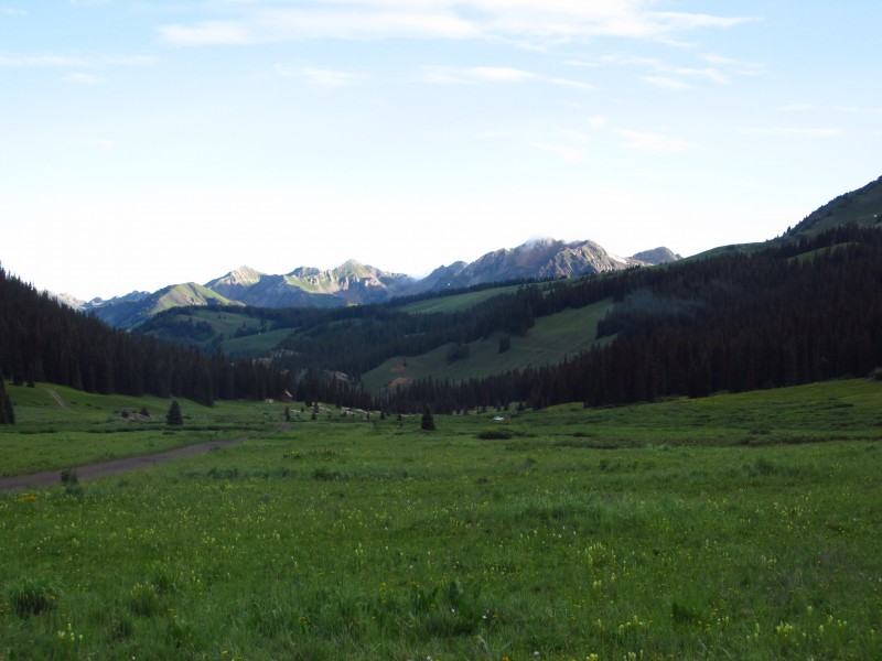
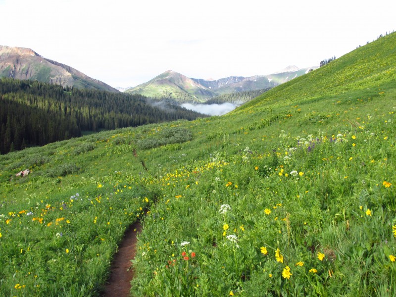
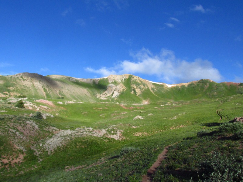
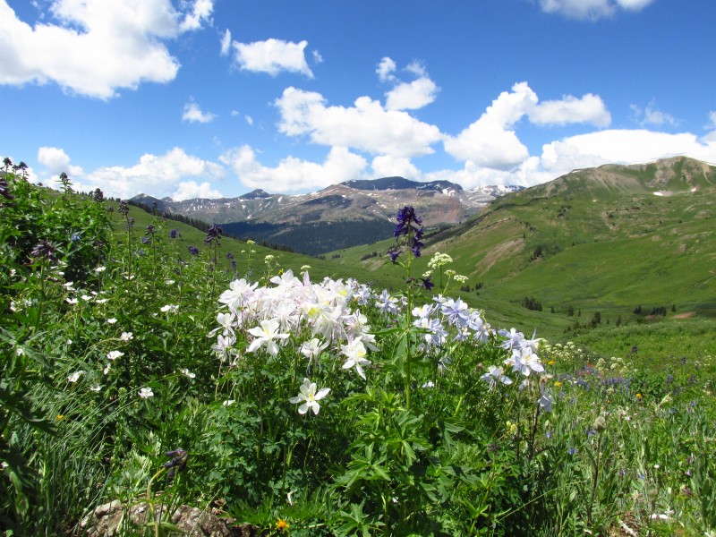
We found a good campsite next to the Schofield Pass Snotel station. It rained most of the night so we knew we would get soaked going through the alpine meadows. Some lingering clouds accompanied us on our journey up the West Maroon Pass trail. Less than half a mile up the trail the view opens up over never ending fields of flowers. It was breathtaking.
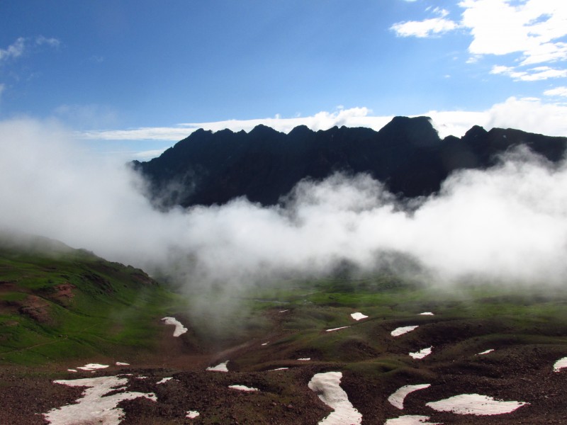
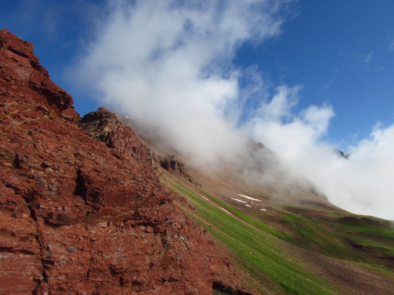
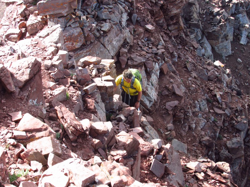
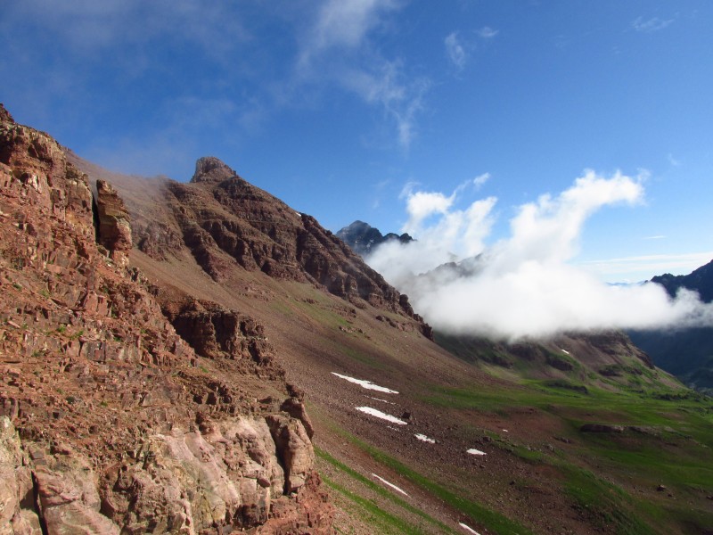
Roach suggests climbing Belleview from the west ridge, up grassy slopes to scree, I thought it looked unpleasant to ascend. So we opted for the more interesting route from West Maroon Pass. Clouds hung low on the Bells when we reached the pass. There is a strong climbers trail which weaves up the ridge. The difficulty never exceeds class 2+ on rather solid blocks for the Elks. We were glad for the moisture as it softened some of what would have been hardpan.
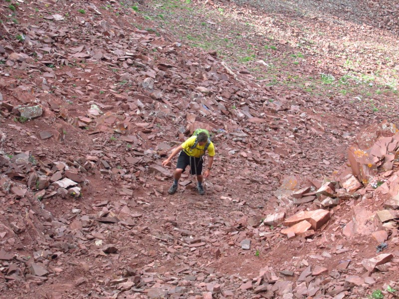
oh scree how I love thee typical terrain above West Maroon Pass
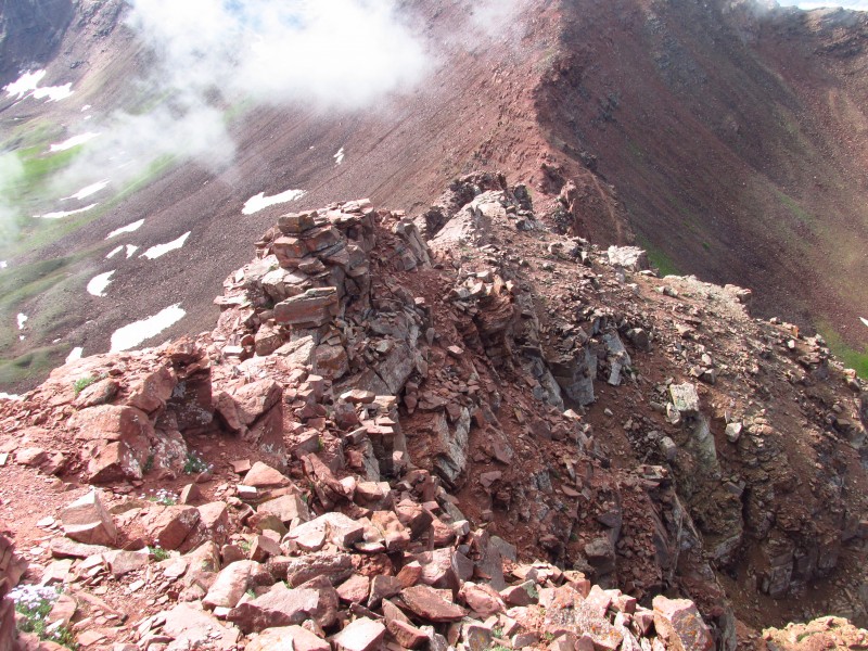
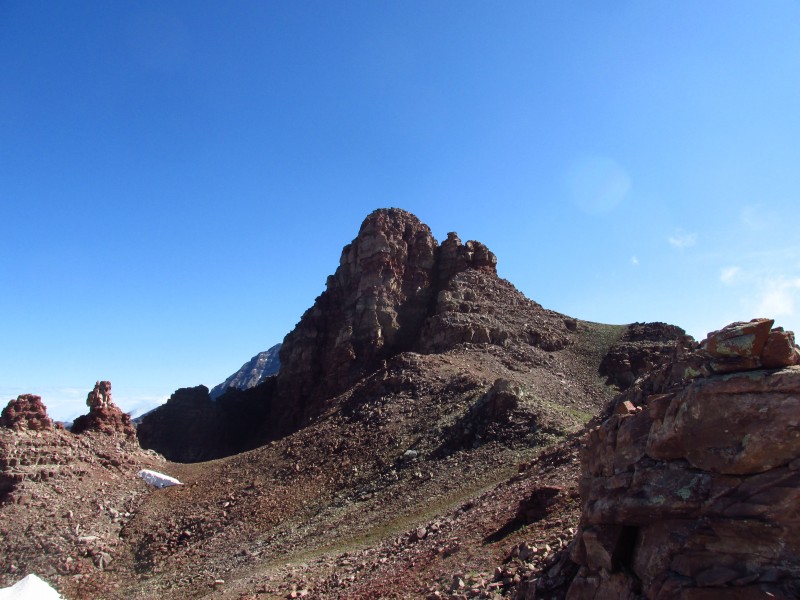
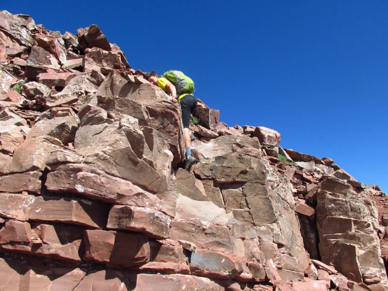
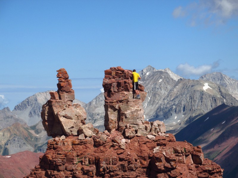
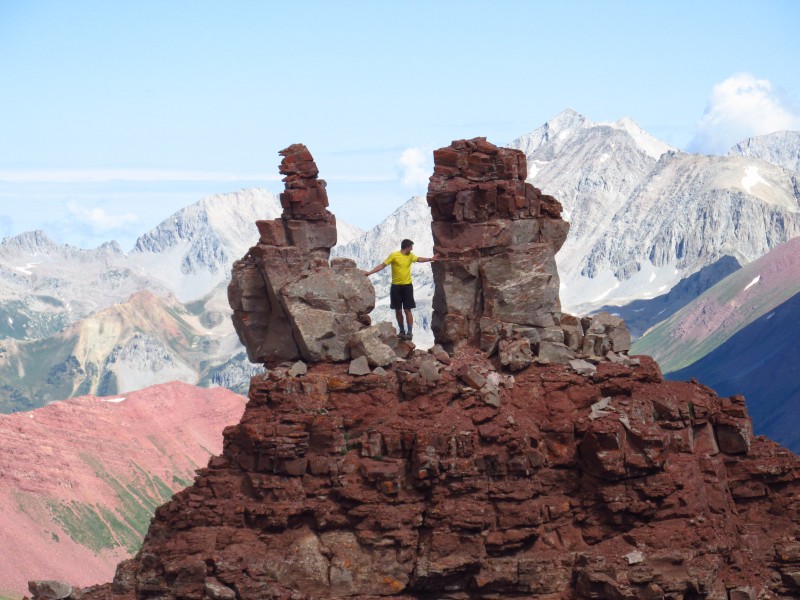
All too soon the scampering ended and we were on the false summit. The summit tower looks impressive. The easiest route wraps around to the north ridge and climbs 2+ blocks to the summit. I followed the path of least resistance up the east face to just below the summit and made a couple of class 3 moves to reach this amazing perch. Ben followed a more direct line up the face.
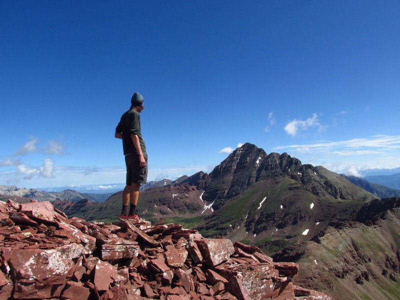
eating a tomato and studying the bells Summit area terrain extra credit
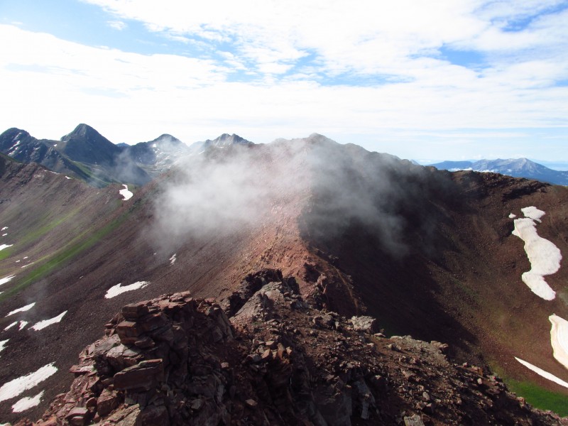
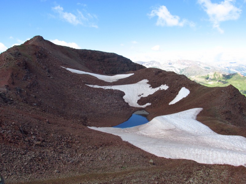
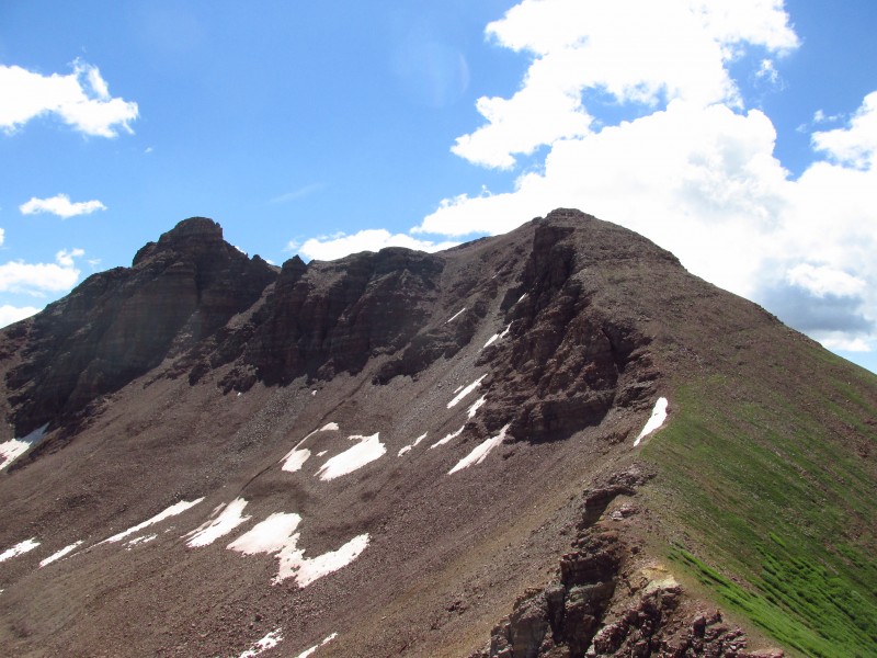
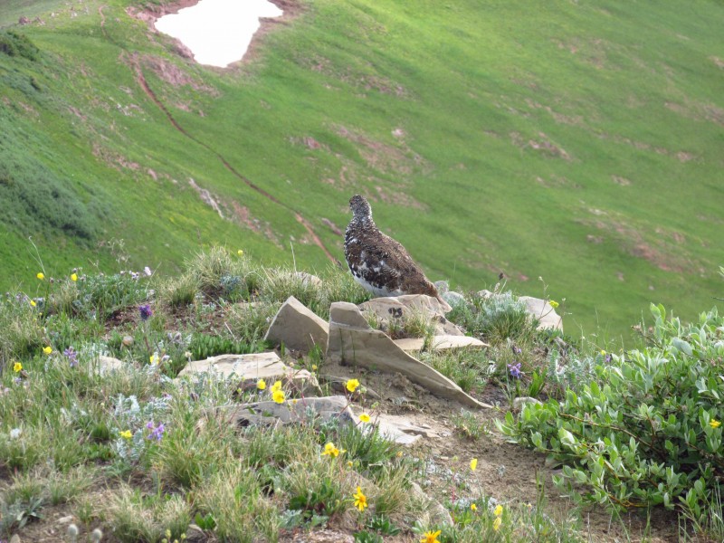
For a change of scenery we headed down the southwest ridge towards Frigid Air Pass. I can't say I would recommend ascending Belleview from this side, as a descent route it was quick. Unnamed 12489 beckoned us but impressive storm clouds chased us down. So we returned later to climb it. The route from Frigid Pass would go like this, follow the trail west to an unmarked juncture at 12200, follow this trail around a ridge bump and meet up with the Hasley Basin trail. The ridge up 12489 starts out as a rough class 2 hike and mellows out near the summit. A Ptarmigan decided to race me to the summit, I just barely won. The descent goes down the Hasley Basin trail towards trail 1970.
looking back at the ridge 12489 I beat you to the top
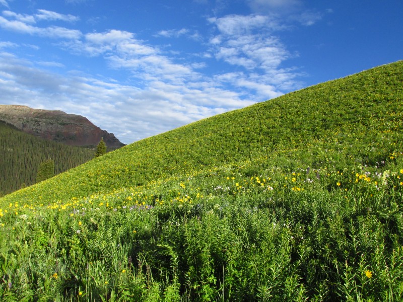
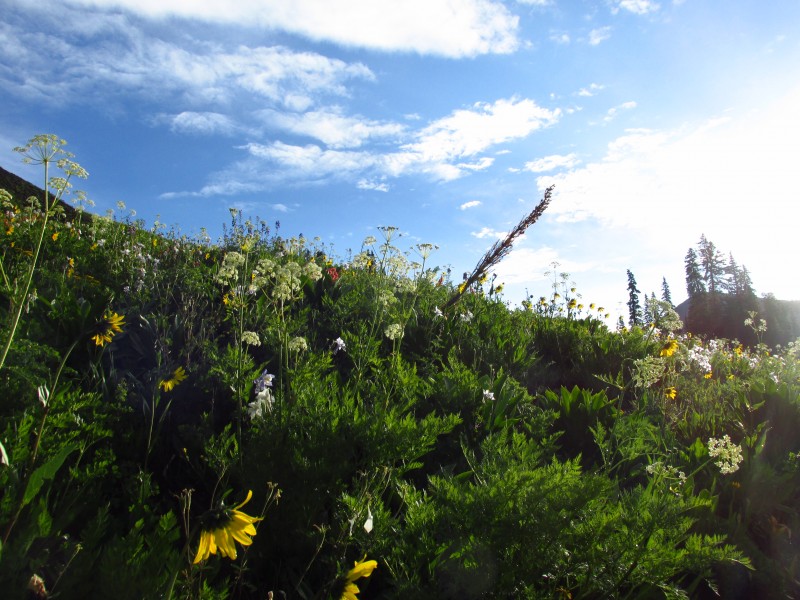
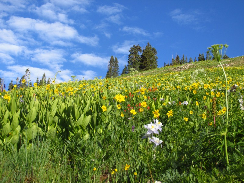
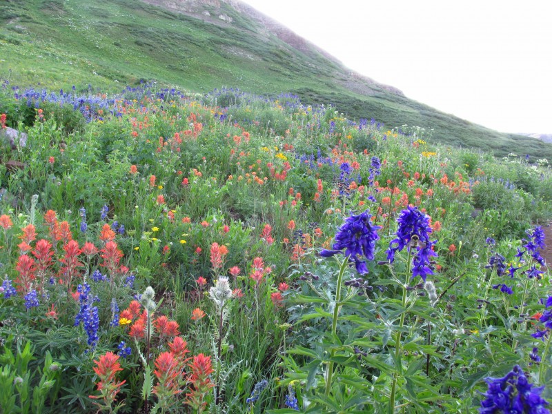
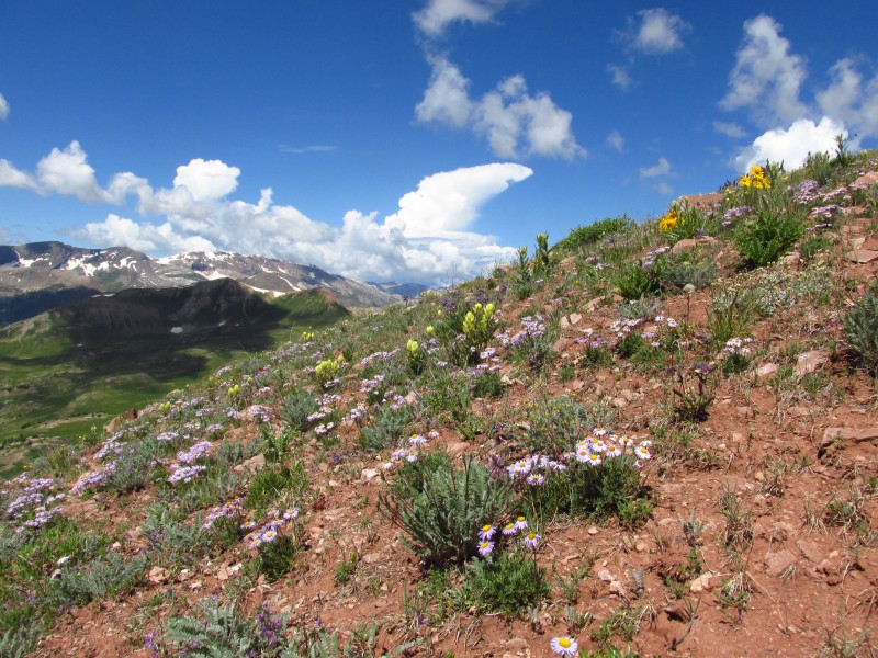
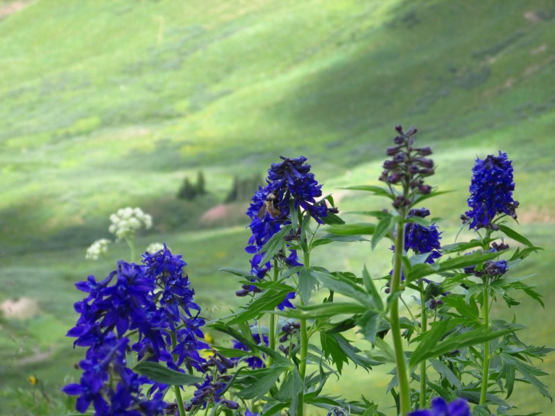
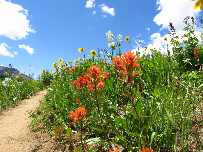
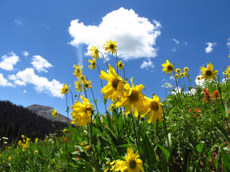
Because the wildflowers were so amazing I'll just leave you with some of the images I captured.
a storms a brewing
Thumbnails for uploaded photos (click to open slideshow):
Stop posting these amazing trip reports that only remind me that I am not in the mountains hiking and won't have opportunity to do so again until next spring.
Great photos btw.
Caution: The information contained in this report may not be accurate and should not be the only resource used in preparation for your climb. Failure to have the necessary experience, physical conditioning, supplies or equipment can result in injury or death. 14ers.com and the author(s) of this report provide no warranties, either express or implied, that the information provided is accurate or reliable. By using the information provided, you agree to indemnify and hold harmless 14ers.com and the report author(s) with respect to any claims and demands against them, including any attorney fees and expenses. Please read the 14ers.com Safety and Disclaimer pages for more information.
Please respect private property: 14ers.com supports the rights of private landowners to determine how and by whom their land will be used. In Colorado, it is your responsibility to determine if land is private and to obtain the appropriate permission before entering the property.