| Report Type | Full |
| Peak(s) |
North Star Mountain - 13,614 feet |
| Date Posted | 07/19/2013 |
| Date Climbed | 07/14/2013 |
| Author | JimR |
| North Star--In Summer!! |
|---|
|
North Star Mountain Date Climbed: 7/14/13 Beginning Elevation: 11,542' Peak Elevation: 13,614' The Group: Solo Distance: 8.2 miles Total Elevation Gain: 2480' I felt the need to get out and up last weekend, but there were a few constraints on where I could go. My wife had our 4Runner, so the trailhead had to be accessible to a rather low street sedan; also, the weather forecast seemed to indicate that I wouldn't have all day in the clear. I wanted to get up a 13er that I hadn't previously done, and I'd be solo, so I didn't want anything technically difficult (even by my rather modest standards). Finally, I didn't want to have to get up too early; 5 AM was my earliest acceptable alarm time (a person has to have some standards). Taking that all into account, I decided to head up North Star, from Hoosier Pass. There are some good trip reports on this site, and a good route description on SummitPost by Scott. It seems to be a popular winter route (that's when most of the trip reports are from), probably because of the relative lack of avy danger, the accessible trailhead, and the reasonable mileage. I got out of the house (in Boulder) a little before 6, and I got to the trailhead a little before 8, about as planned. There is plenty of parking at the TH, and there are several good campsites, either right at the TH or a little up the dirt road running west from the pass. There aren't any facilities, and I didn't notice a water source. The route starts up the obvious dirt road heading west from the pass. The road is easily drivable up to the gate in a high-clearance vehicle, and many people would probably do it in a Subaru. The pass is nearly at treeline, so you're soon out of the trees. You follow County Road 2 (do not go right on the fork to 849) as it winds gently upward, affording your first view of Lincoln, which will dominate views to south throughout the hike. 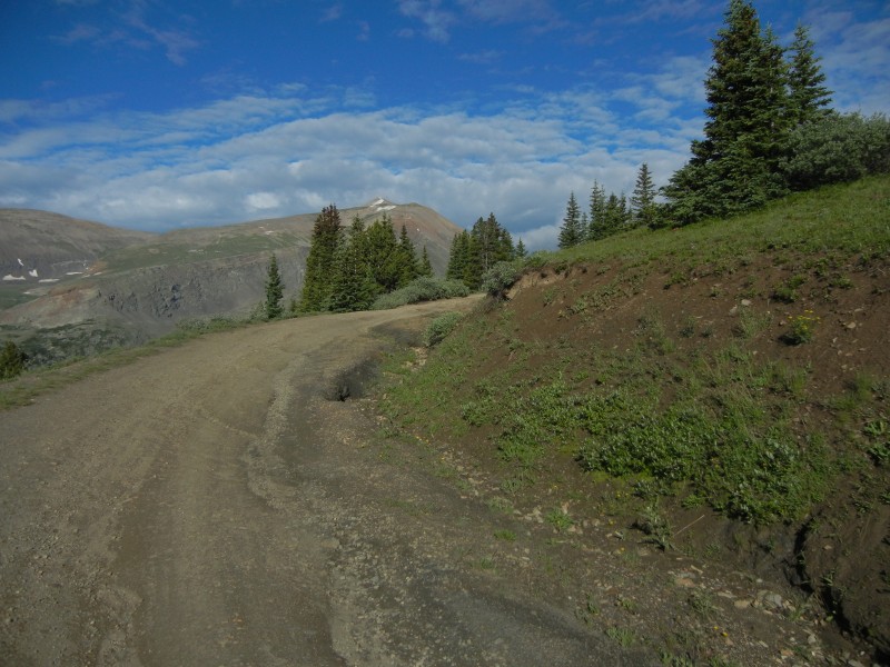 After about 1½ miles (I'm guessing), the road loops to the south and is blocked by a closed gate. The other fork of the road goes SE up a hill. At this point, I just headed uphill, NW and/or W, to the left of some old mining ruins. (The hillside is strewn with mining ruins.) 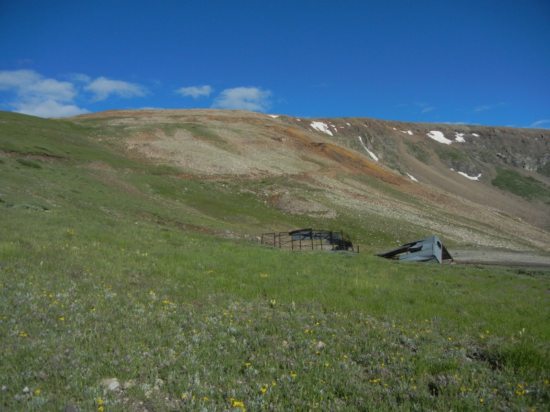 I went straight uphill, but after crossing a mining road a couple times, I caught on and just followed the road. It gave way to a decent trail, complete with cairns. When you reach the ridge in the photo above, you get a nice view of Clinton, McNamee, and Traver Peaks, up Platte Gulch (the origin of the Middle Fork of the S. Platte River, who knew?). 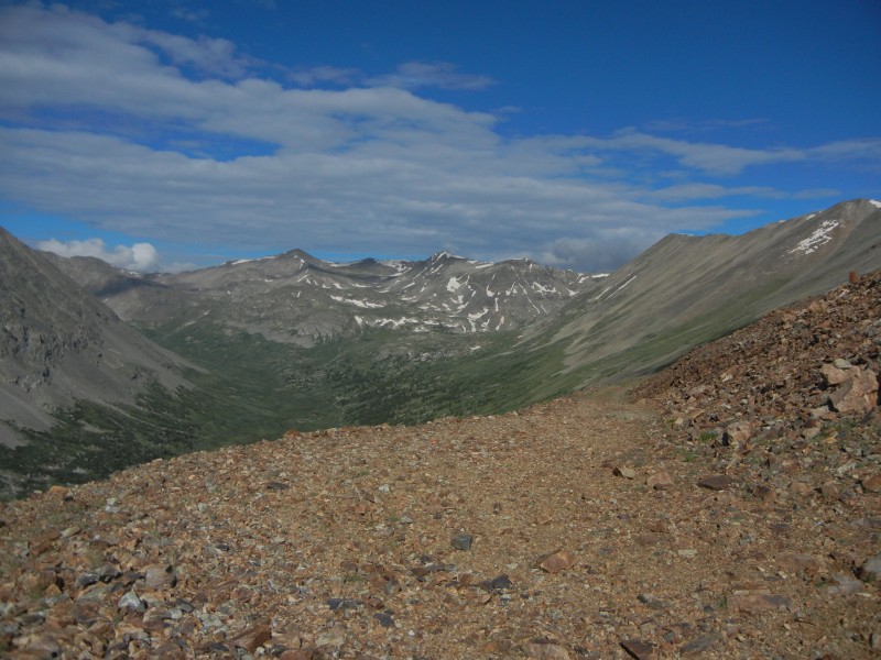 You also get a view of the remainder of the hike, three bumps along a long ridge. 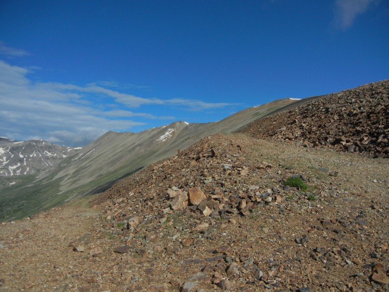 And, of course, Lincoln is watching over your left shoulder. 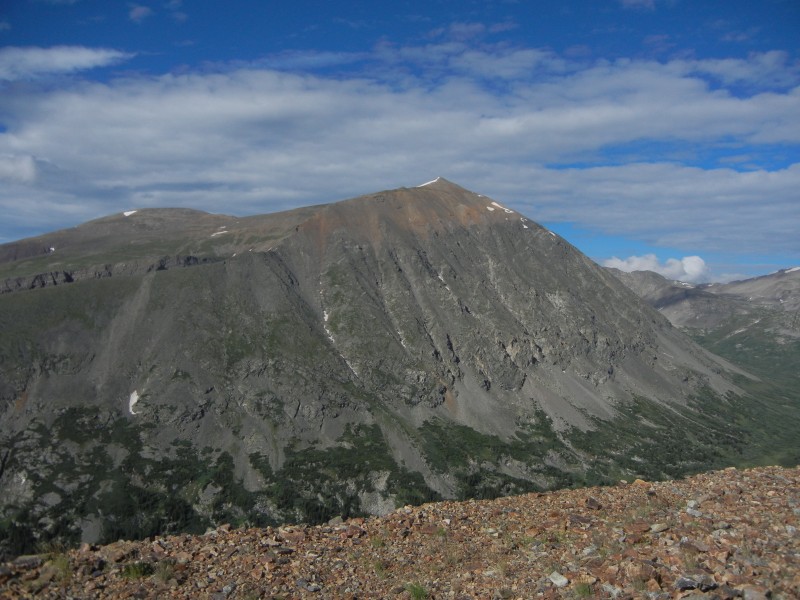 A low cloud or two made things a bit misty for a while, but generally the weather was holding, and there was little or no wind.  The trail leads around the first bump and hits the North Star ridge at the saddle between first and second bumps, just above the ruins of an old mine.  As you approach the second bump, the ridge narrows and you start having to pick your way over rocks. I stayed at the top of the ridge most of the time, in part because I like ridges and in part because there didn't seem to be any better options. There are nice views of Lincoln & Democrat to the south, and Quandary and Fletcher to the north.  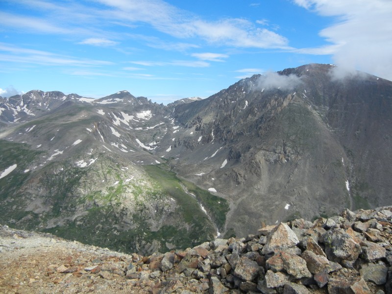 The view from the top of the second bump is a bit discouraging; the summit is still some distance away.  The ridge was long and slow, or maybe the ridge was long and I was slow. The narrow part, from a little before the second bump to the summit, is a bit over a mile of picking your way over the rocks, and then you have to go back. There were a number of nice little flower clusters to lighten things up on the way. 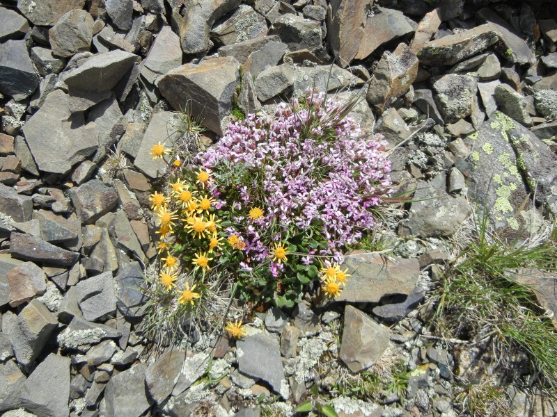 I got to the summit at about 11:30, rather slow considering the distance and elevation gain, but I'll use the rough terrain and stopping for pictures as an excuse. The weather was starting to look more ominous, so I didn't dawdle on the summit. I did, however, sign the summit register, where a couple of the recent names looked rather familiar from 14ers.com: Susan Joy Paul was the most recent signee, and two lines above her was some guy named Bill from Breckenridge. 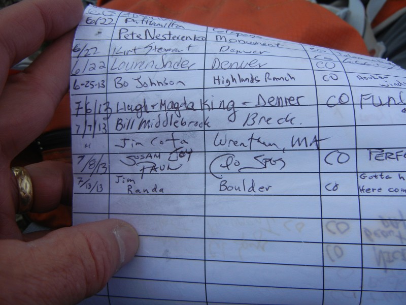 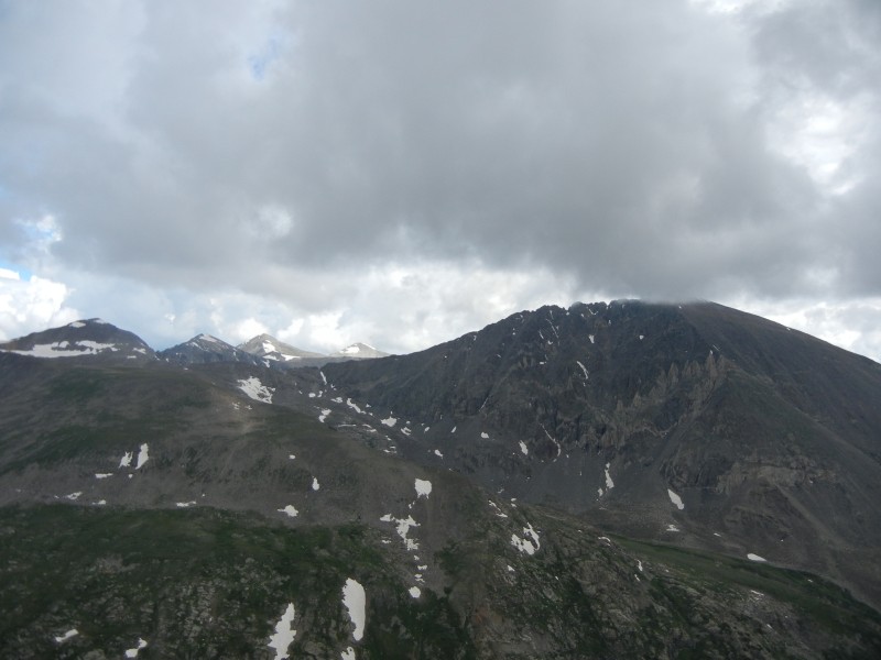 After a quick bite to eat, I started down, leaving the summit at about noon. I wanted to be off the ridge before any storm caught up to me. When I got over the second (middle) bump, I stopped for the rest of my lunch, since I figured that I was now close enough to the saddle where you leave the ridge. About that time, I got a bit of a surprise, when I saw lightening in front of me (to the east, north of Silverheels) rather than behind me. I was walking toward the storm. In retrospect, I should have anticipated this (but of course didn't) since the forecast said the wind would shift, so that it was from the east in the afternoon. That would mean the rain & t-storms would be moving in from the east. Oh well, live and learn (ideally). 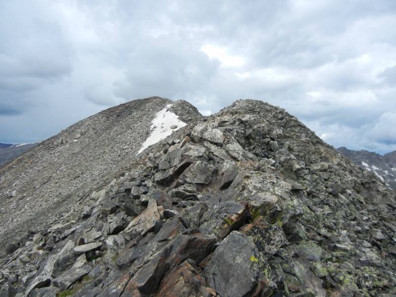 The lightening gave me a little extra motivation, and I hustled to the saddle between first and second bumps, where I picked up the trail down from the ridge. 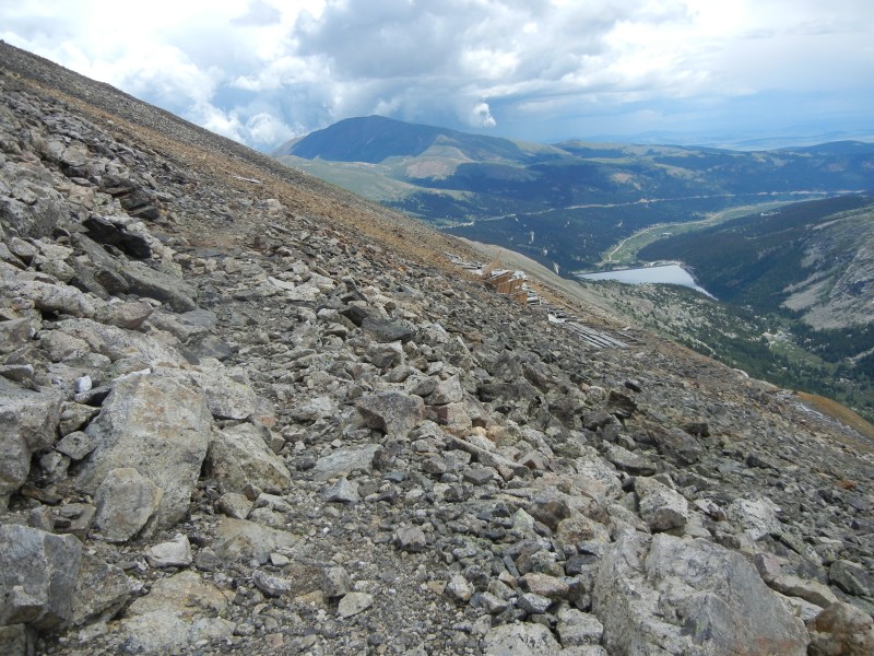  I followed the trail and an old mining road most of the way back down to the dirt road, hitting it just about at the closure gate. From there it was just a matter of racing the rain to the parking lot. There were a few drops falling as I approached the parking lot, and an absolute downpour commenced as I was opening the trunk of my car. Not perfect timing, but pretty close. I got back to the car at about 2:30.  Thumbnails for uploaded photos (click to open slideshow):
|
| Comments or Questions | ||||||
|---|---|---|---|---|---|---|
|
Caution: The information contained in this report may not be accurate and should not be the only resource used in preparation for your climb. Failure to have the necessary experience, physical conditioning, supplies or equipment can result in injury or death. 14ers.com and the author(s) of this report provide no warranties, either express or implied, that the information provided is accurate or reliable. By using the information provided, you agree to indemnify and hold harmless 14ers.com and the report author(s) with respect to any claims and demands against them, including any attorney fees and expenses. Please read the 14ers.com Safety and Disclaimer pages for more information.
Please respect private property: 14ers.com supports the rights of private landowners to determine how and by whom their land will be used. In Colorado, it is your responsibility to determine if land is private and to obtain the appropriate permission before entering the property.


